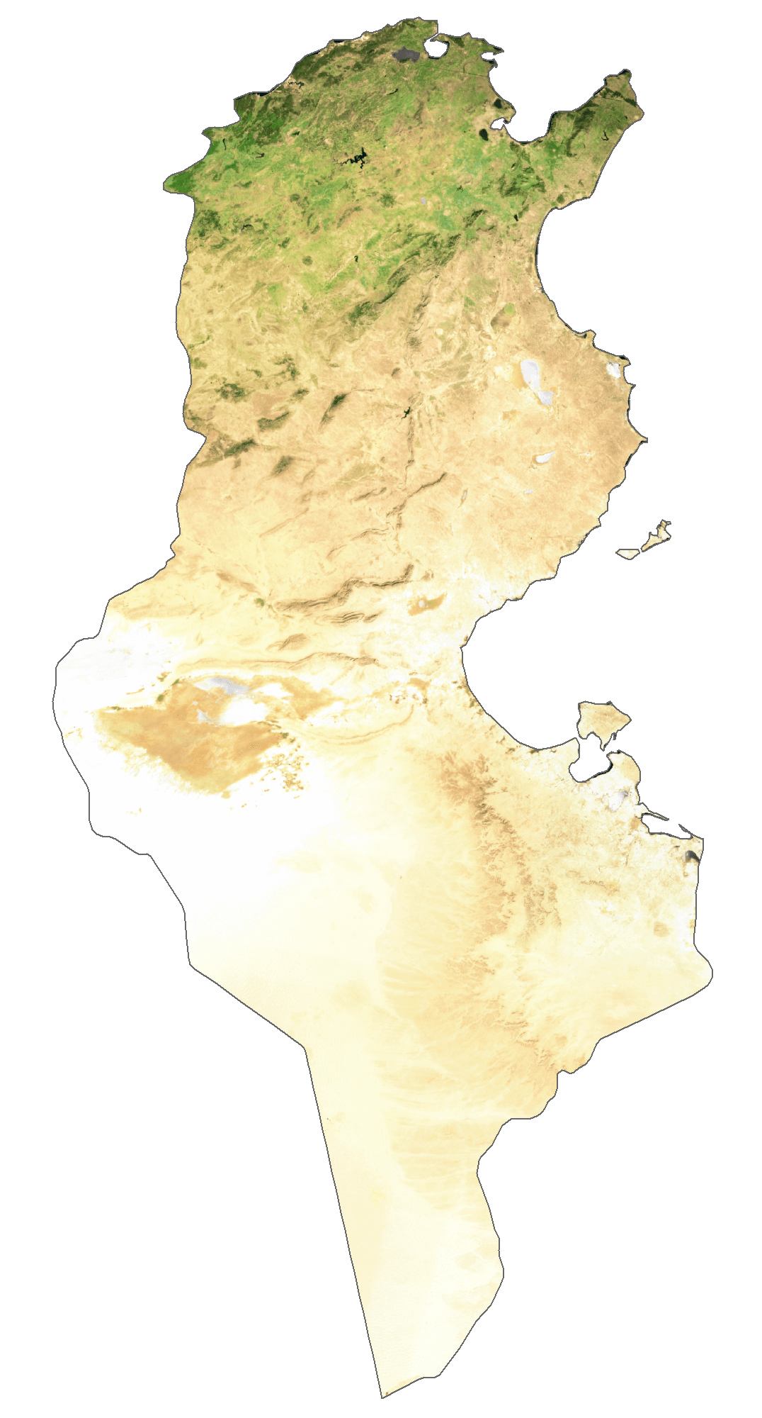
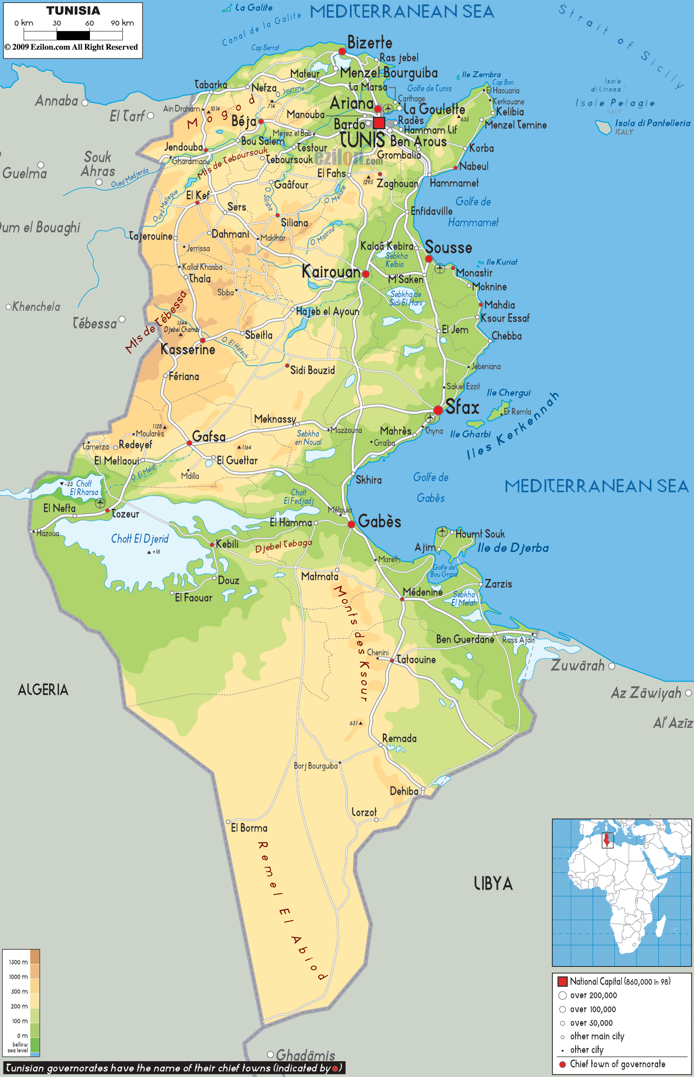
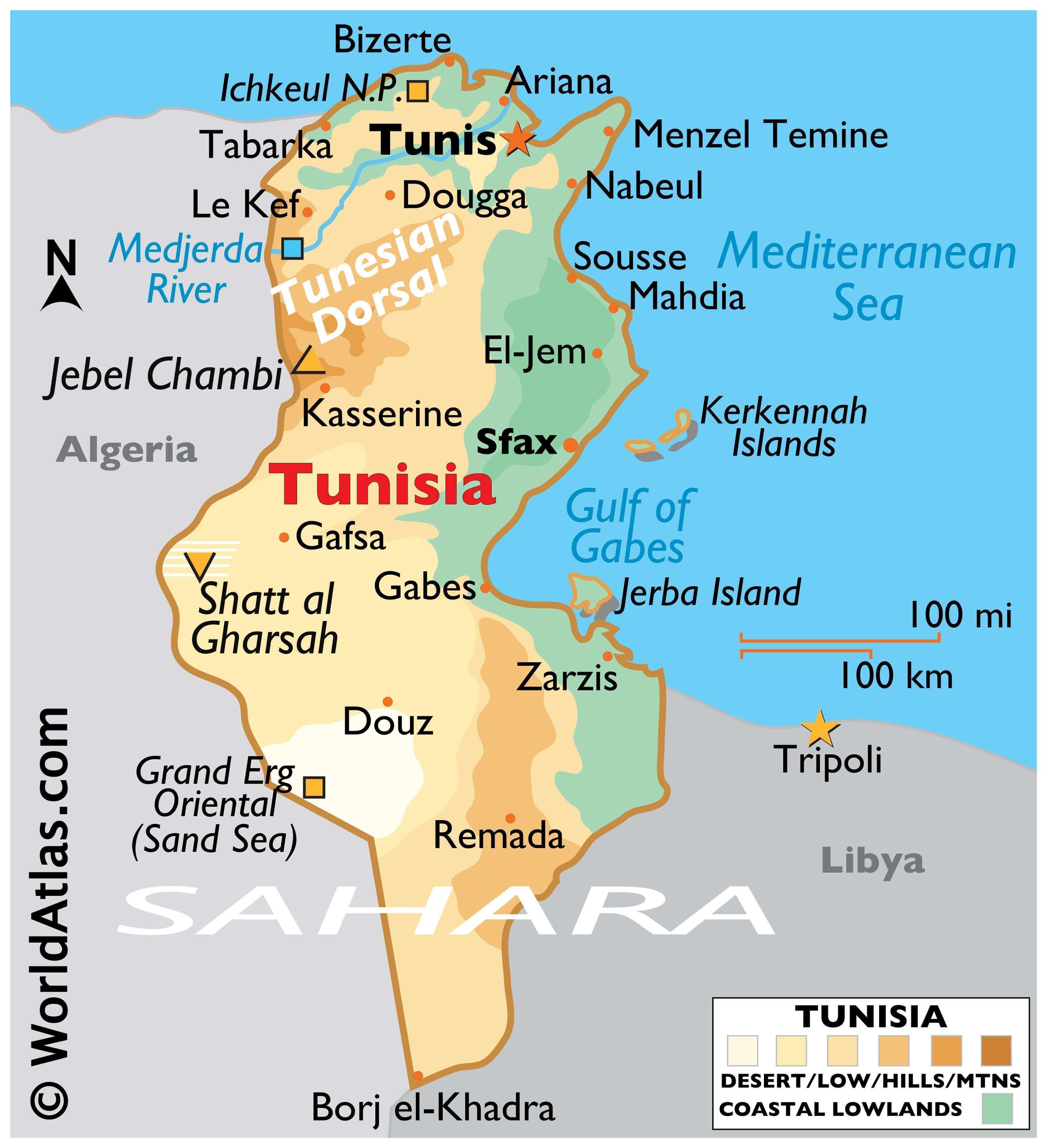
Tunisia is a North African country with a total area of 163,610 sq. km and a coastline of 1,148 km on the Mediterranean Sea to the north. Despite its relatively small size that is about the size of the US state of Wisconsin, Tunisia’s north-south extent lends it great environmental diversity. The country has a moderate relief.
As observed on the physical map above, the Tunisian Dorsal is a mountain range that runs in a southwest-northeast direction from Tunisia’s border with Algeria in the west to the Cape Bon peninsula in the east. This mountain is an extension of the Saharan Atlas Mountains. Further north from the Tunisian Dorsal, the mountains of the Northern Tell (that include the Kroumirie Mountains in the northwest and the Mogods running along the northern coastline) can be found.
In between the Tunisian Dorsal and Northern Tell Mountains lies the Medjerda River valley (shown on the map above). This valley features a series of ancient lake basins and is the country’s most fertile grain-producing land. The Medjerda River is the only perennial river in Tunisia and its drains into the Gulf of Tunis.
The High Steppes (in the west) and Low Steppes (in the east) lie to the south of the Tunisian Dorsale. They are cut by mountains running north to south.
As we go further south, there is a series of depressions called chott. Many intermittent rivers flowing through the country end up in these chotts.
Extending inwards from the eastern coastline are large plains called Al-Sāḥil and Al-Jifāra.
Most of the southern part of the country is a sandy desert and much of it is part of the Sahara Desert’s Sand Sea, also called the Grand Erg Oriental. Most of the wadis here remain dry all year round and hence, access to water is a major concern here.
Tunisia also has several islands. The Djerba Island marked on the map above is North Africa’s largest island. It is located in the Gulf of Gabès.
Mount Chambi (1,544 M) is the highest point in the country. At 17 m below sea level, Chott el Djerid is Tunisia’s lowest point.
| Flag: |  |
|---|---|
| Legal Name: | Republic of Tunisia |
| Capital Value: | Tunis |
| Official languages: | Arabic |
| Demonym(s): | Tunisian |
| Government: | Unitary presidential republic under an authoritarian dictatorship |
| Legislature: | Assembly of the Representatives of the People |
| Total Area: | 163,610 km² |
| Land Area: | 155,360 km² |
| Water Area: | 8,250 km² |
| Population: | 11,694,719 |
| Density: | 71.65/km (185.6/sq mi) (144th) |
| GDP: | $38.80 Billion |
| GDP Per Capita: | $3,317.54 |
| Currency Value: | Tunisian dinars (TND) |
| Driving side: | right |
| Calling code: | +216 |
| Internet TLD: |
|
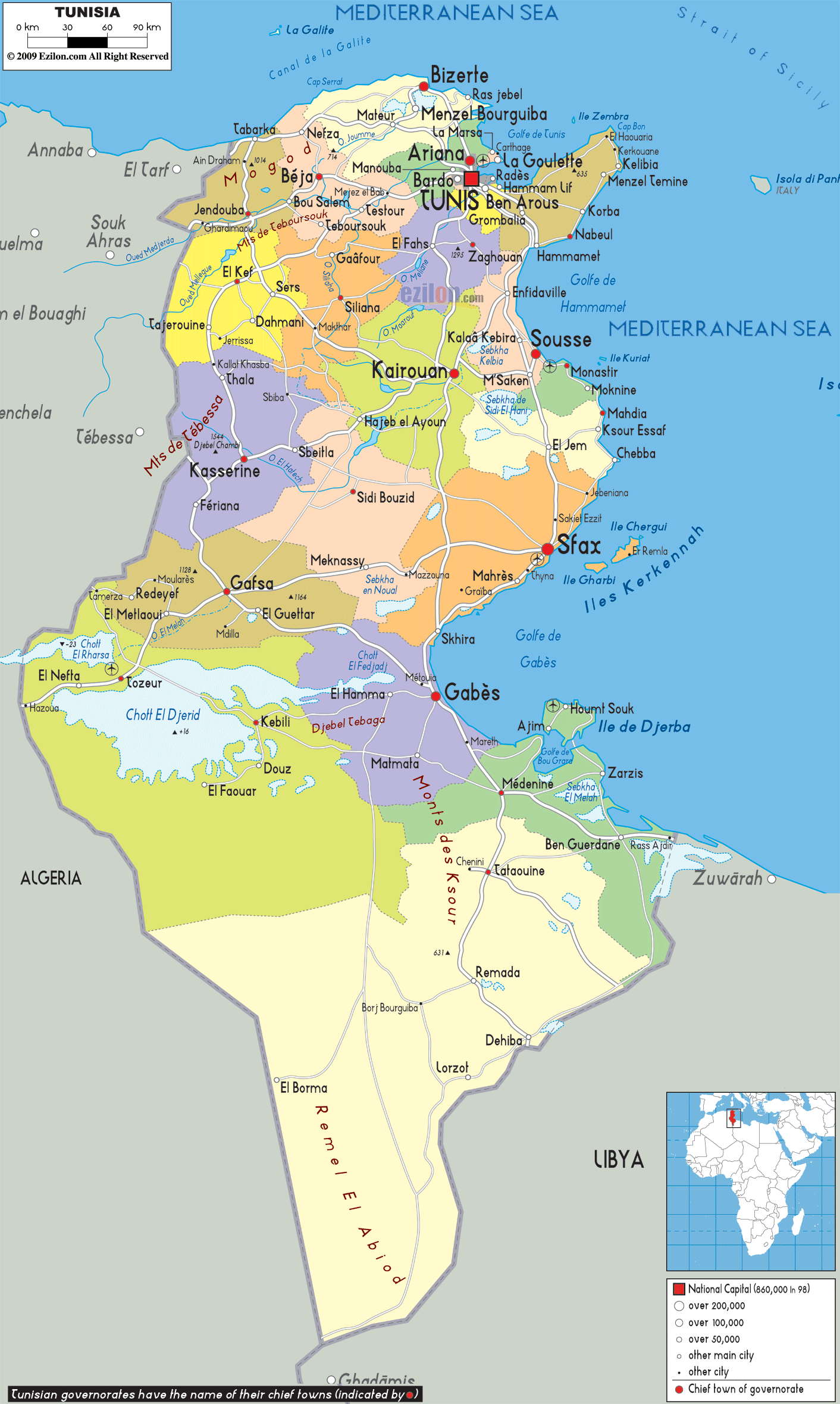
Tunisia is a stunning country steeped in history and culture. From its beautiful Mediterranean coastline to its expansive Sahara Desert, this North African country has something to offer everyone. To help you explore all that Tunisia has to offer, take a look at this map guide.
This comprehensive map of Tunisia includes all of the key features of the country. You’ll find the Sahara Desert, the Atlas Mountains, and the Mediterranean coastline clearly marked. Major cities, towns, roads, and rivers are also included, making it easy to plan your journey through this fascinating country.
Whether you’re planning a vacation or simply want to learn more about Tunisia, this map is an excellent resource. It provides an overview of the country’s geography and highlights its most important features. With this map, you can explore Tunisia in an easy and convenient way.
Online Interactive Political Map
Click on ![]() to view map in "full screen" mode.
to view map in "full screen" mode.
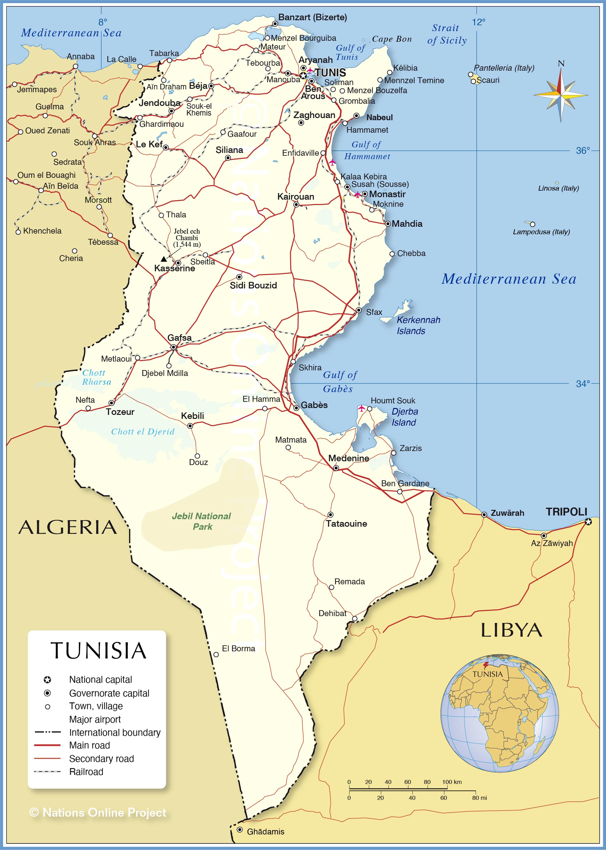
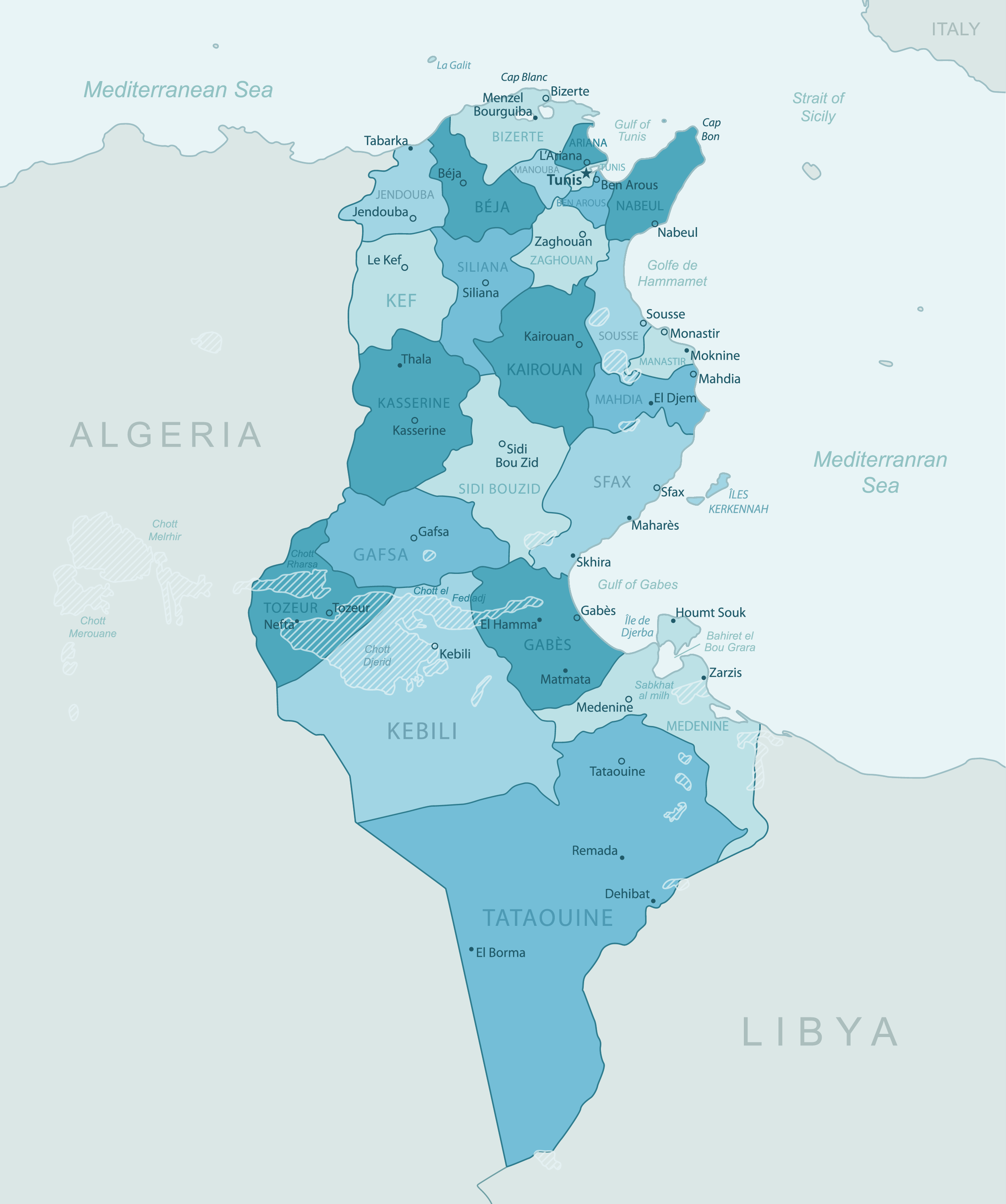
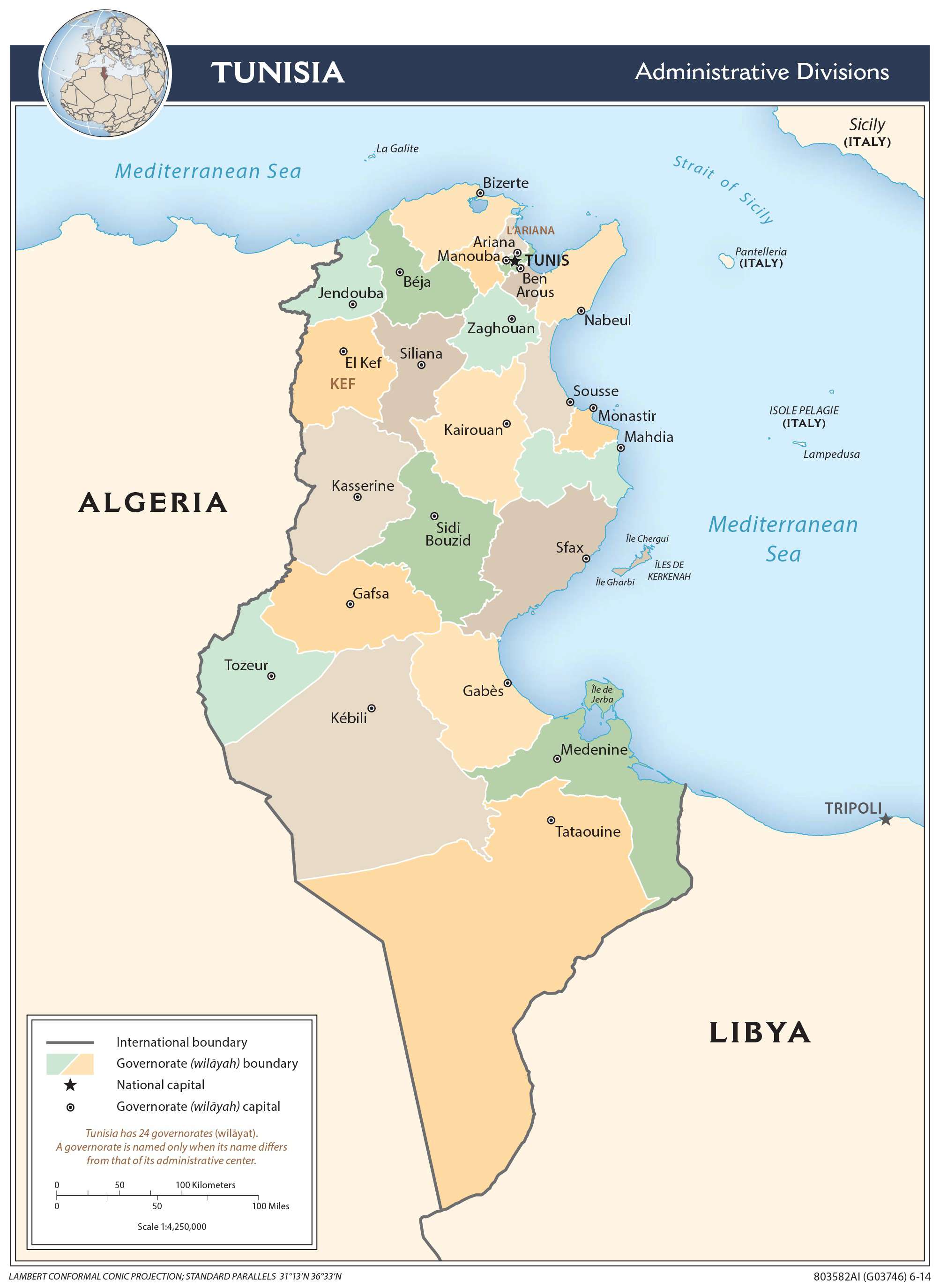
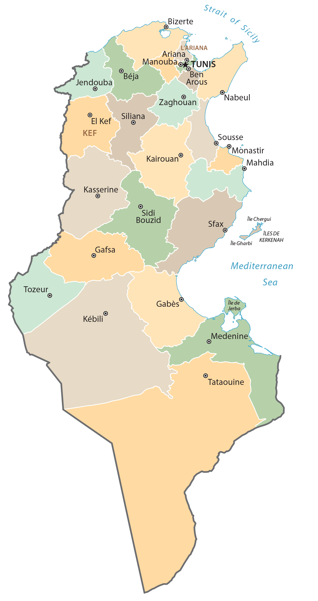
Tunisia has 24 major administrative divisions called governorates. In alphabetical order, they are as follows: Ariana, Beja (Bajah), Ben Arous (Bin ‘Arus), Bizerte (Banzart), Gabes (Qabis), Gafsa (Qafsah), Jendouba (Jundubah), Kairouan (Al Qayrawan), Kasserine (Al Qasrayn), Kebili (Qibili), Kef (Al Kaf), L’Ariana (Aryanah), Mahdia (Al Mahdiyah), Manouba (Manubah), Medenine (Madanin), Monastir (Al Munastir), Nabeul (Nabul), Sfax (Safaqis), Sidi Bouzid (Sidi Bu Zayd), Siliana (Silyanah), Sousse (Susah), Tataouine (Tatawin), Tozeur (Tawzar), Tunis, Zaghouan (Zaghwan).
The governorates are further subdivided into 264 districts called mutamadiyat which are further divided into smaller administrative divisions called shaykhats or municipalities and imadats or sectors.
Tataouine is Tunisia’s largest governorate by area and Tunis is the largest one by population but the smallest by area. The capital of this governorate, Tunis, is also the national capital.
Location Maps
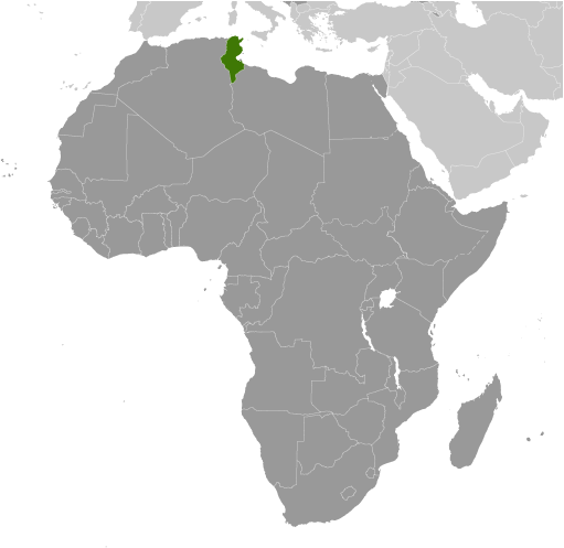
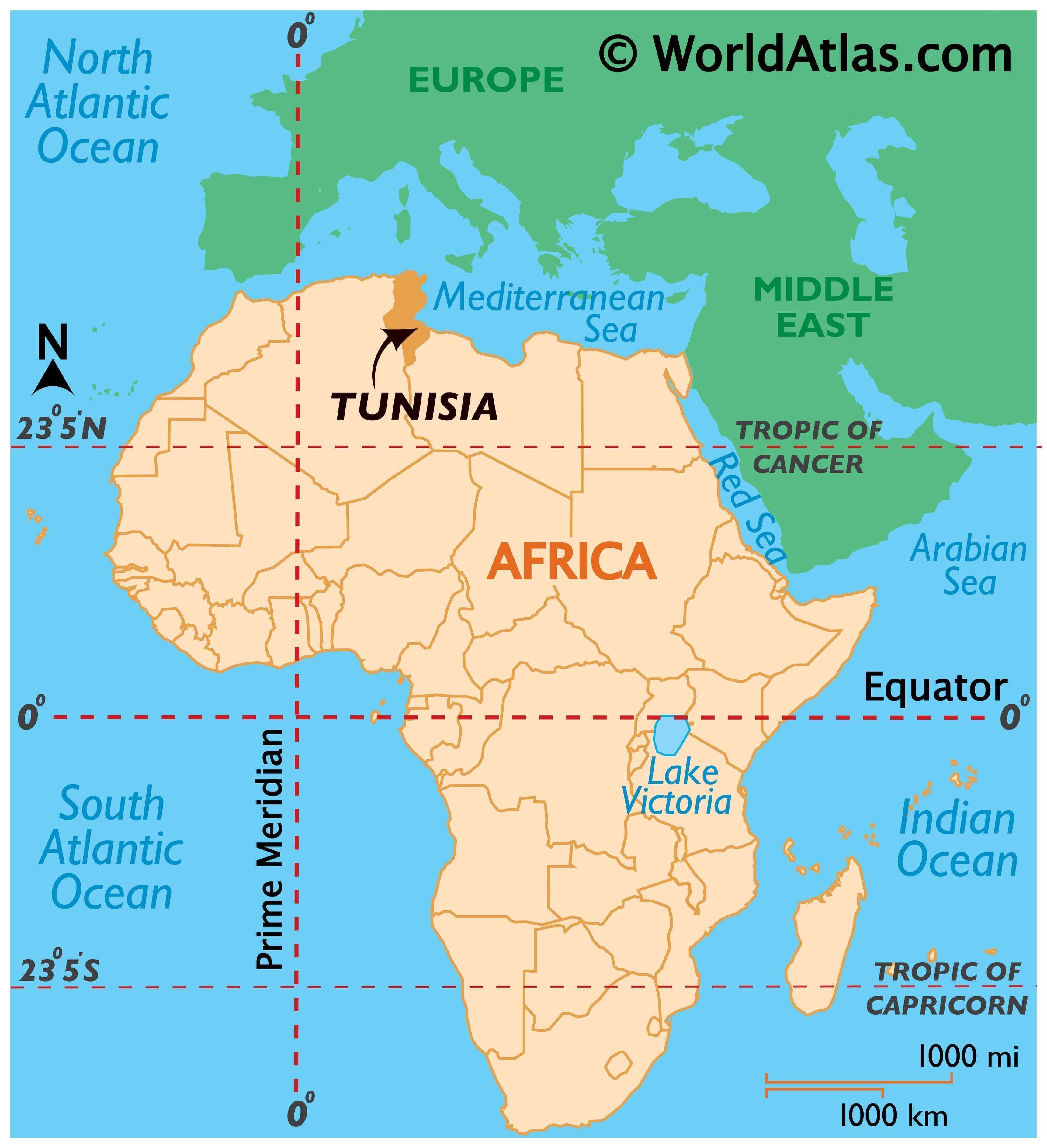
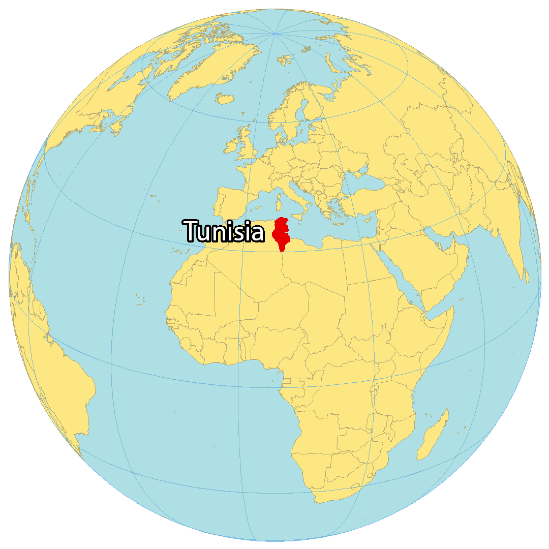
Where is Tunisia?
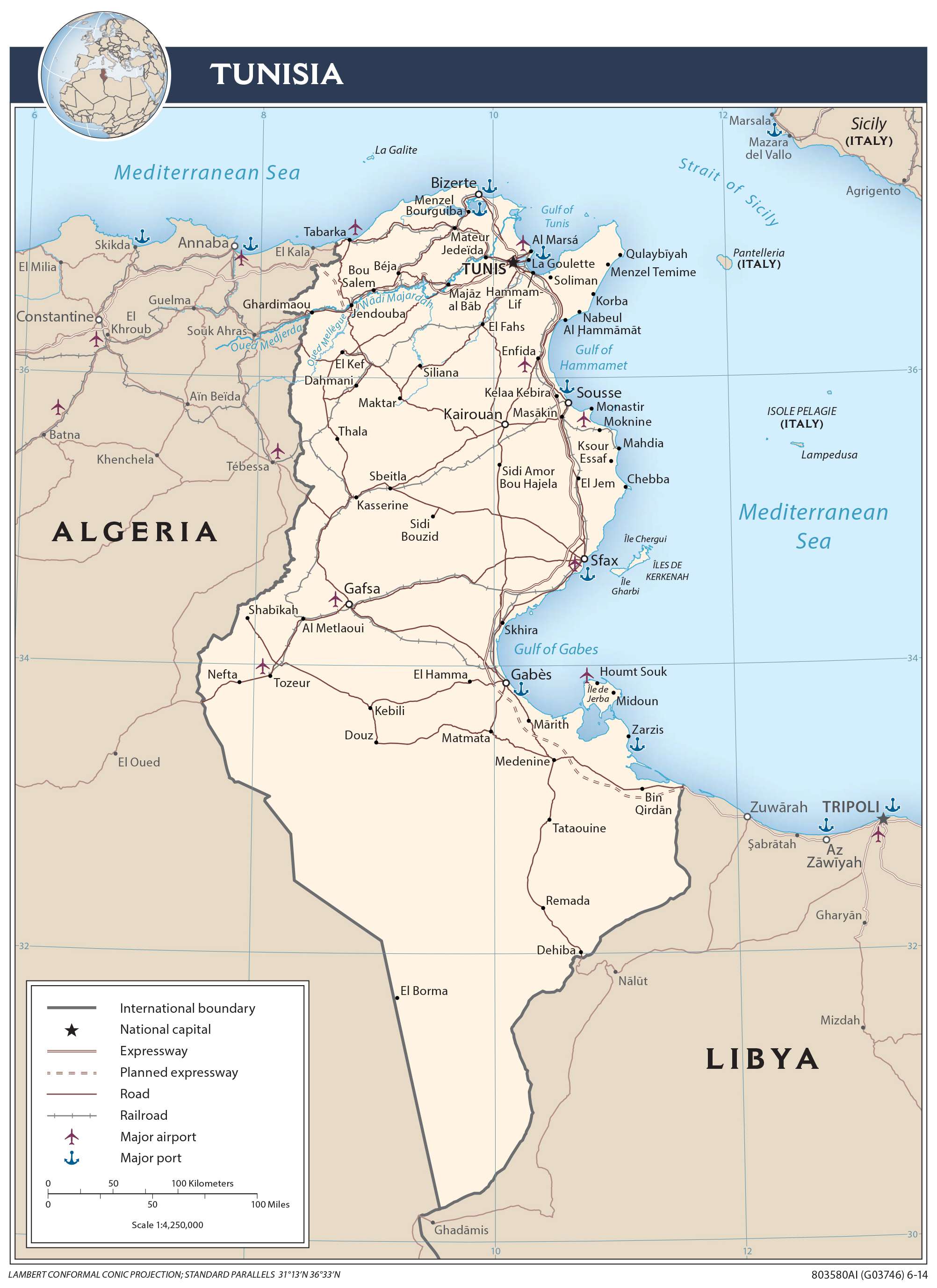
Tunisia is a country in Northern Africa, next to the Mediterranean Sea. Additionally, it contains Africa’s northernmost point at Cape Angela. Tunis is the capital and largest city of Tunisia. Other major cities include Sfax, Sousse, and Kairouan.
Tunisia borders two countries: Algeria to the west and Libya to the east. It is renowned for its historical ruins, mosques, Mediterranean coastline beaches, Atlas Mountains, and the Sahara Desert.
High Definition Political Map of Tunisia
Tunisia Administrative Map
Physical Map of Tunisia

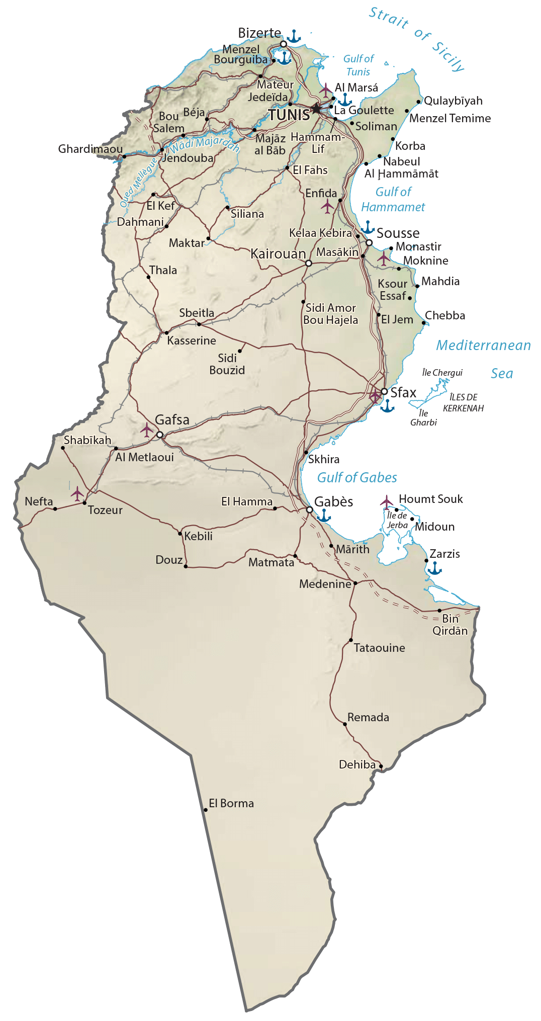
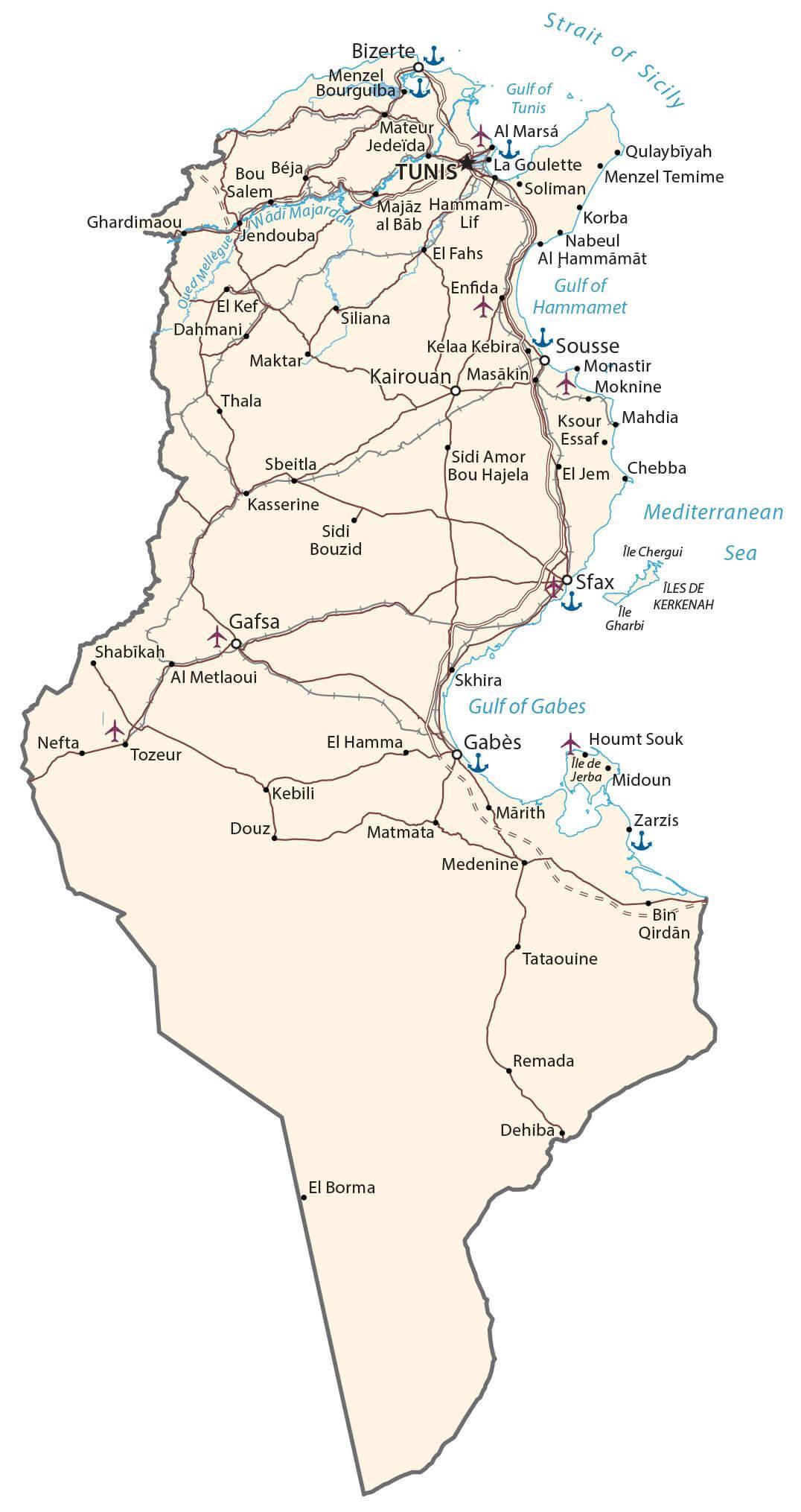
Transportation Map of Tunisia
Tunisia Satellite Map