Serbia, a landlocked country located in the Balkan Peninsula’s central region. Including the disputed territory of Kosovo, Serbia’s area is 88,361 km2(34,116 sq mi). However, excluding Kosovo, Serbia has an area of 77,474 km2(29,913 sq mi).
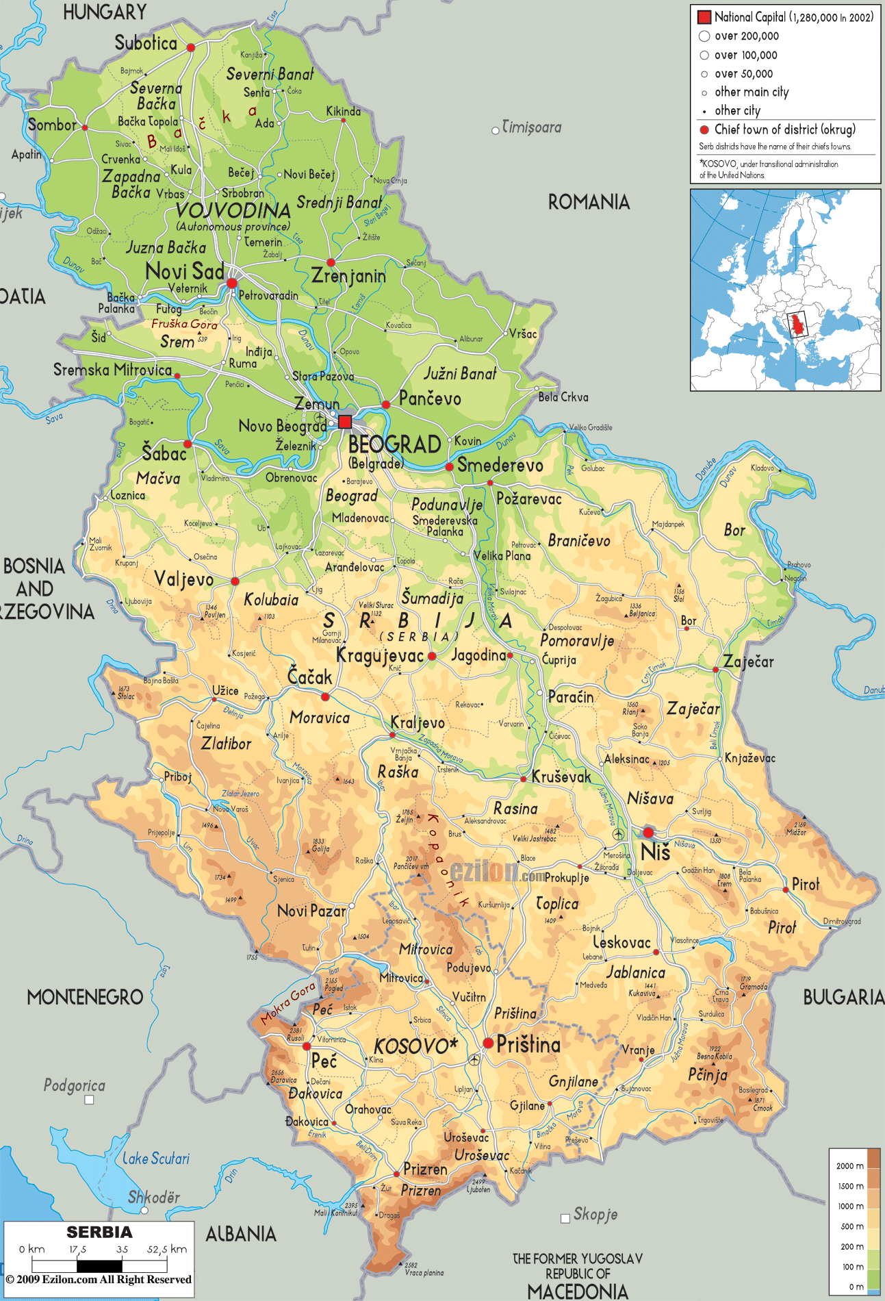
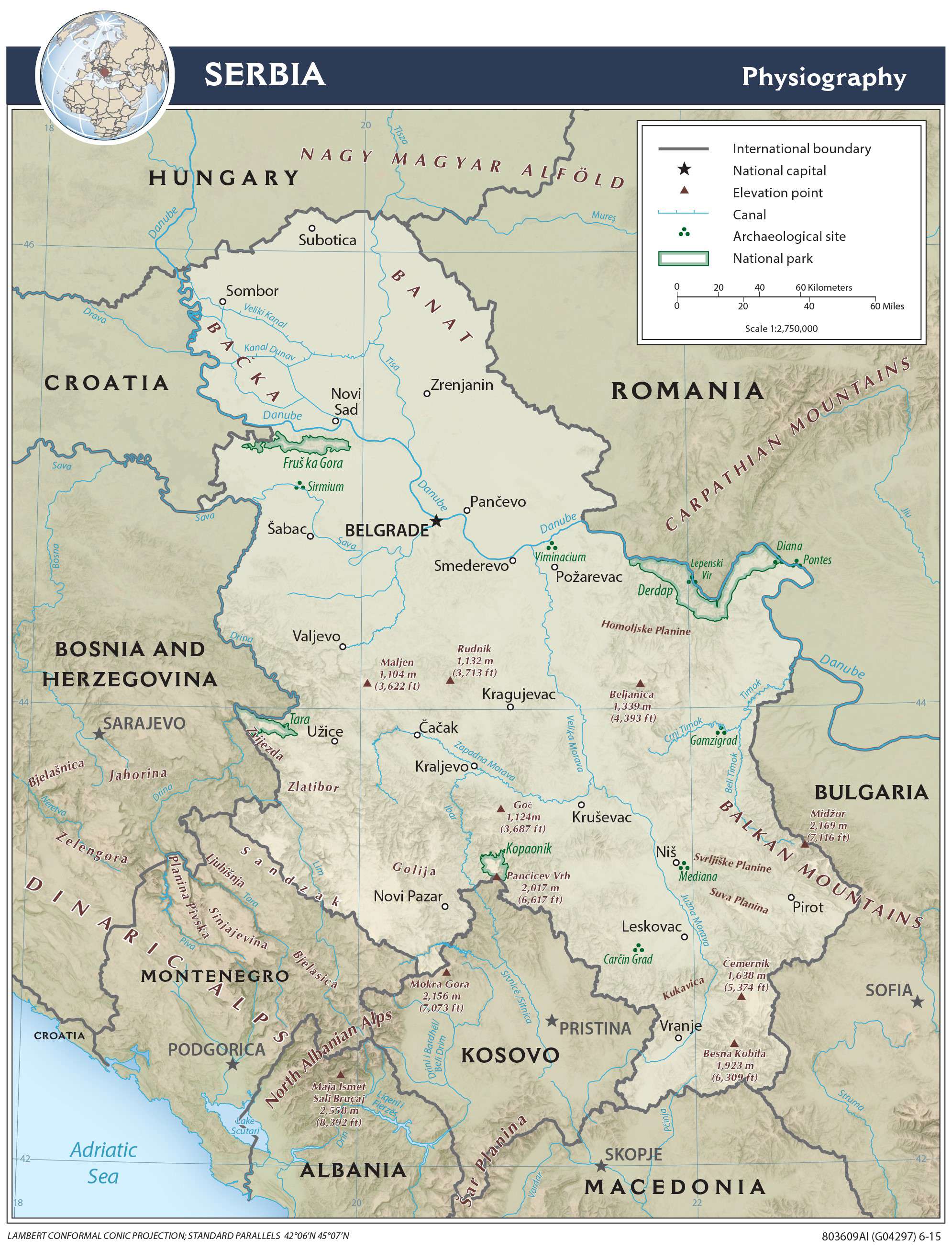
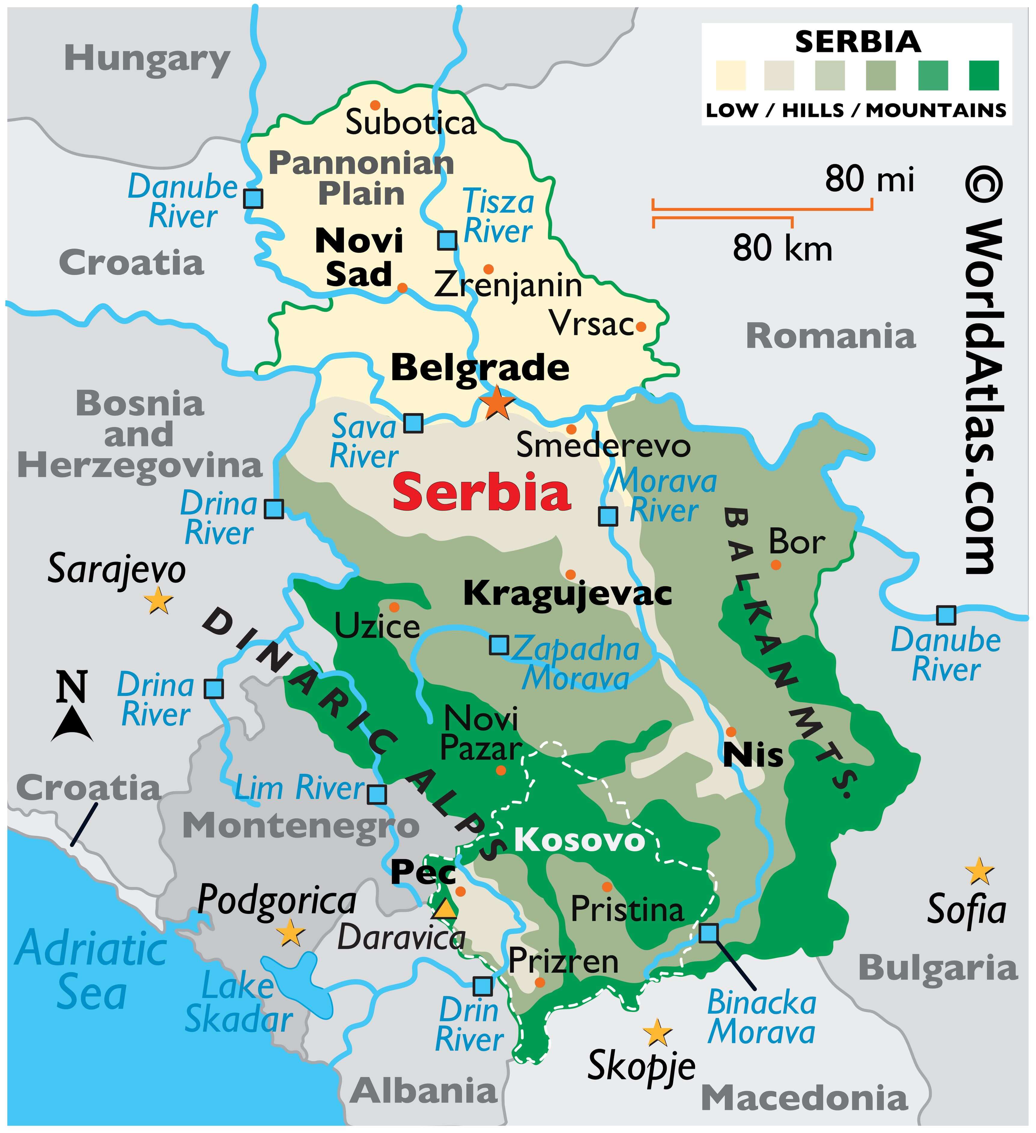
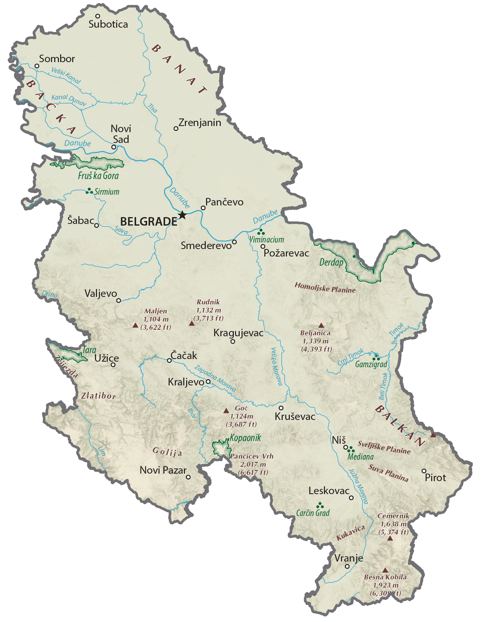
As observed on the physical map of Serbia, the rugged mountains, hills and valleys of the Dinaric Alps slice through Serbia west of the Morava River, while the toothy-edged Balkan Mountains form its natural borders with Bulgaria and Romania.
The highest point in Serbia is Deravica on Prokletije rising to 8,713 ft. (2,656 m) in the region of Kosovo. A yellow triangle marks its position on the map.
A fertile river floodplain (the Pannonian) stretches from Belgrade north to the borders with Croatia, Hungary, and Romania.
Natural lakes in Serbia are rare as a result of the rugged terrain, and the ones that do exist -such as the glacial lake Palic- are mostly located in Vojvodina.
Serbia’s largest artificial lake, resulting from a hydroelectric dam, is Derdap located on the Danube.
Significant rivers include the Danube, Drina, Lim, Morava, Sava and Tara. The lowest point in the country is at the Timok River mouth at 28 m.
| Flag: | 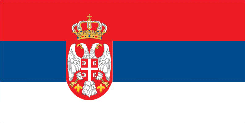 |
|---|---|
| Legal Name: | Republic of Serbia |
| Capital Value: | Belgrade (Beograd) |
| Largest City: |
Beograd (Belgrade) (1,397,939) |
| Official languages: | Serbian |
| Demonym(s): | Serbian |
| Government: | Unitary parliamentary republic |
| Legislature: | National Assembly |
| Total Area: | 77,474 km² |
| Land Area: | 77,474 km² |
| Population: | 6,944,975 |
| Density: | 86/km (222.7/sq mi) (130th) |
| GDP: | $51.41 Billion |
| GDP Per Capita: | $7,402.35 |
| Currency Value: | Serbian dinars (RSD) |
| Driving side: | right |
| Calling code: | +381 |
| Internet TLD: |
|
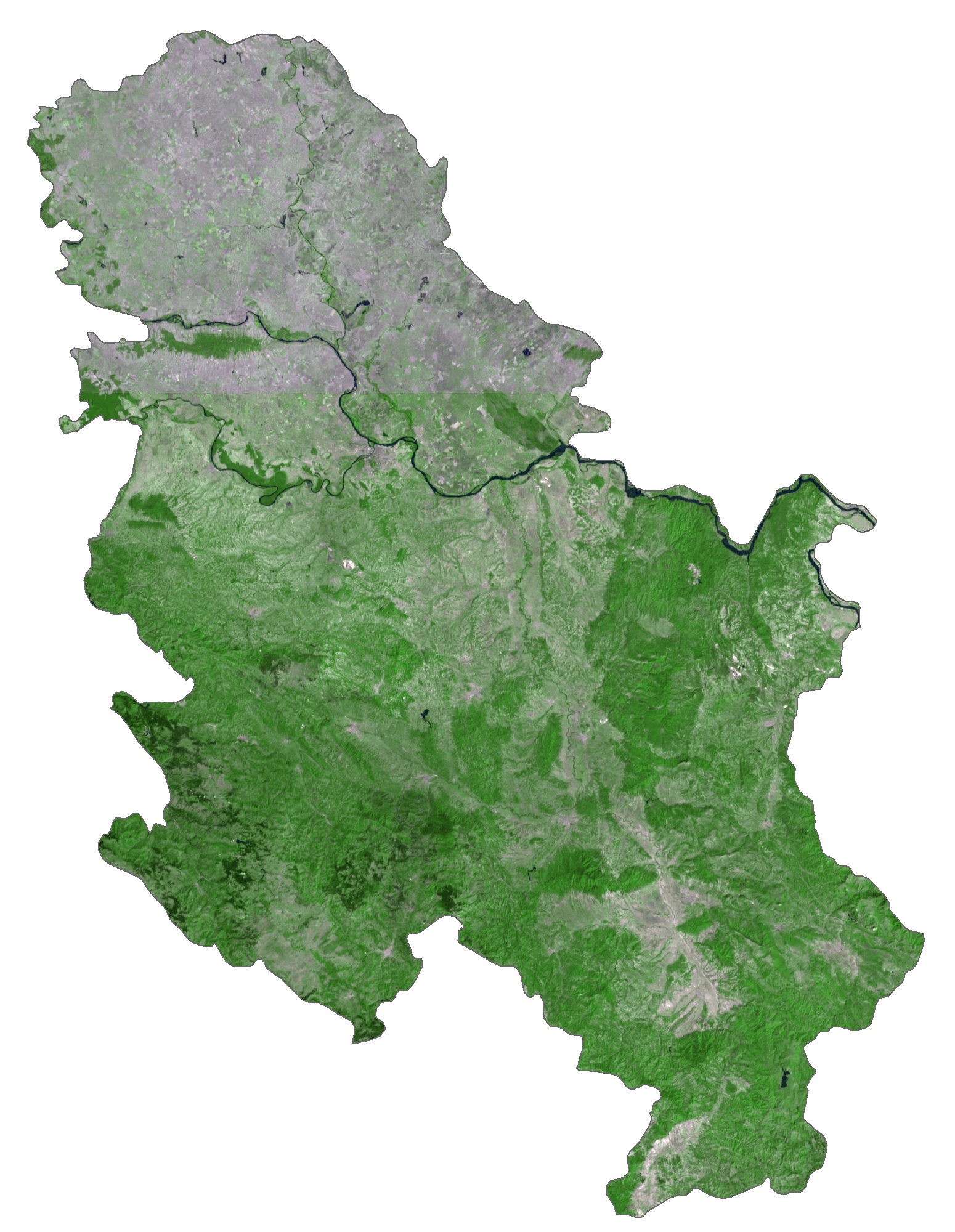
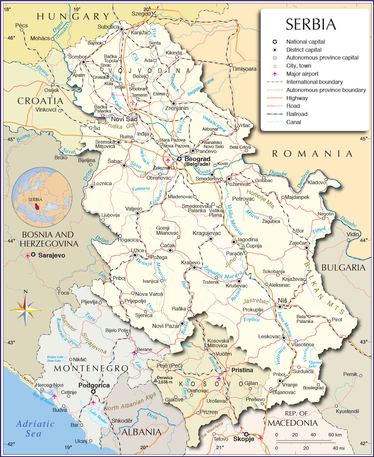
Serbia is a country located in the Balkan region of Europe. It has a rugged topography, with the Carpathian Mountains dominating much of the terrain. For travelers and adventurers, Serbia offers a wealth of natural beauty and cultural attractions. To help visitors explore the country, we’ve created a detailed map of Serbia that includes cities, towns, highways, roads, rivers, and districts. The map also includes satellite imagery, allowing visitors to get a better understanding of the terrain. With this map, visitors can explore and discover the many wonders of Serbia.
Online Interactive Political Map
Click on ![]() to view map in "full screen" mode.
to view map in "full screen" mode.
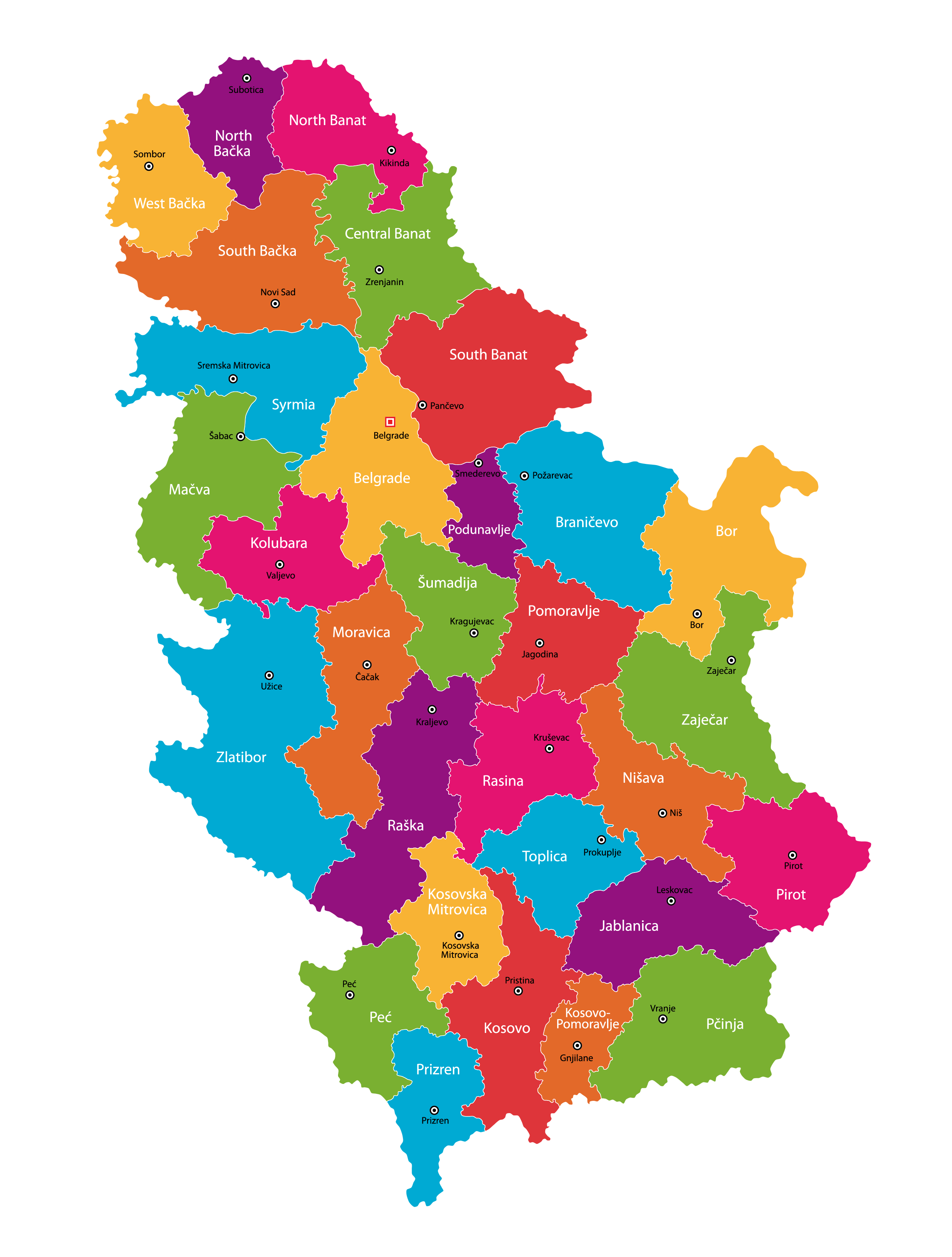
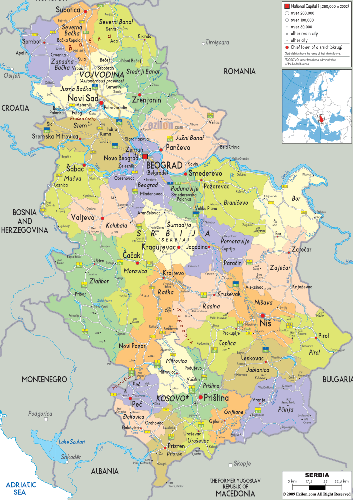
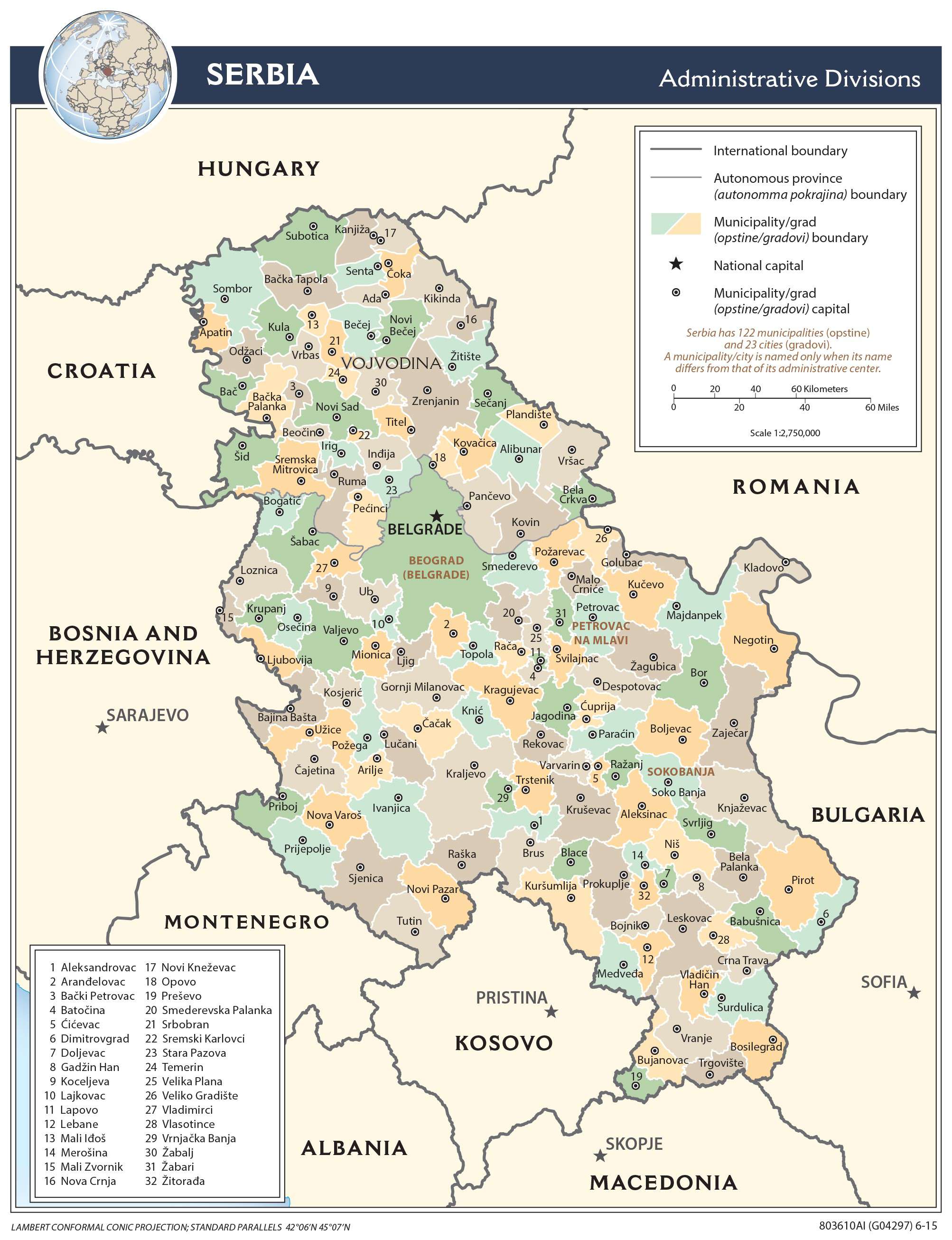
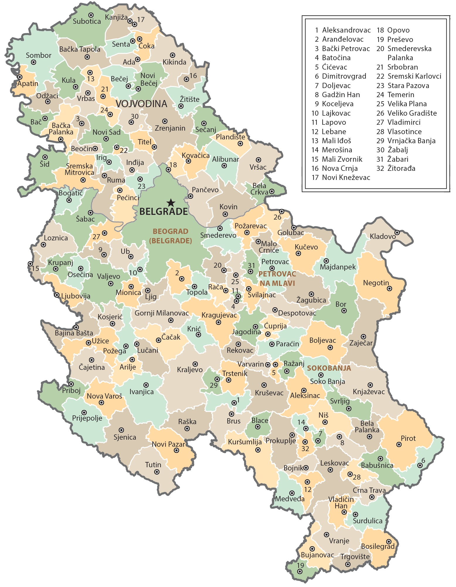
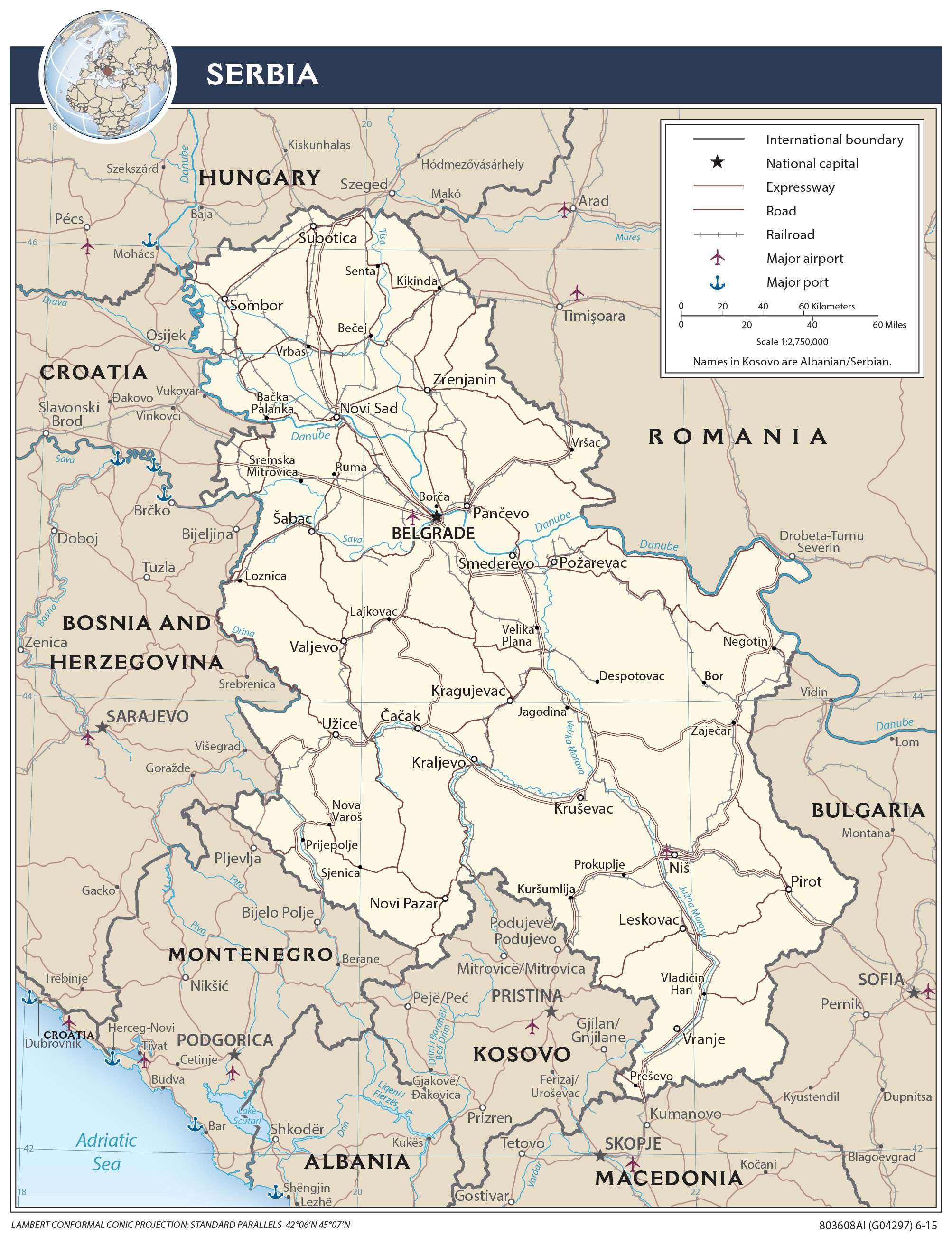
Serbia (officially, Republic of Serbia) is divided into 29 districts. In alphabetical order, the districts are: Bor, Braniceva, Central Banat, Jablanica, Kolubara, Kosovo, Kosovska Mitrovica, Kosovo-Pomoravlje, Macva, Moravica, North Backa, North Banat, Nisava, Pcinja, Pec, Pirot, Podunavlje, Pomoravlje, Prizren, Rasina, Raska, South Backa, South Banat, Srem, Sumadija, Toplica, West Backa, Zajecar and Zlatibor. The capital city of Belgrade constitutes an additional district. Serbia is also divided into 145 municipalities (opstine, singular – opstina) and 29 cities (gradovi, singular – grad).
Located in north-central part of the county, at the confluence of Danube and Sava Rivers is, Belgrade – the capital and the largest city of Serbia. Belgrade is the administrative, cultural, industrial and commercial center of the country. It is also the economical, communications and transportation hub of Serbia.
Location Maps
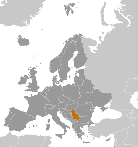
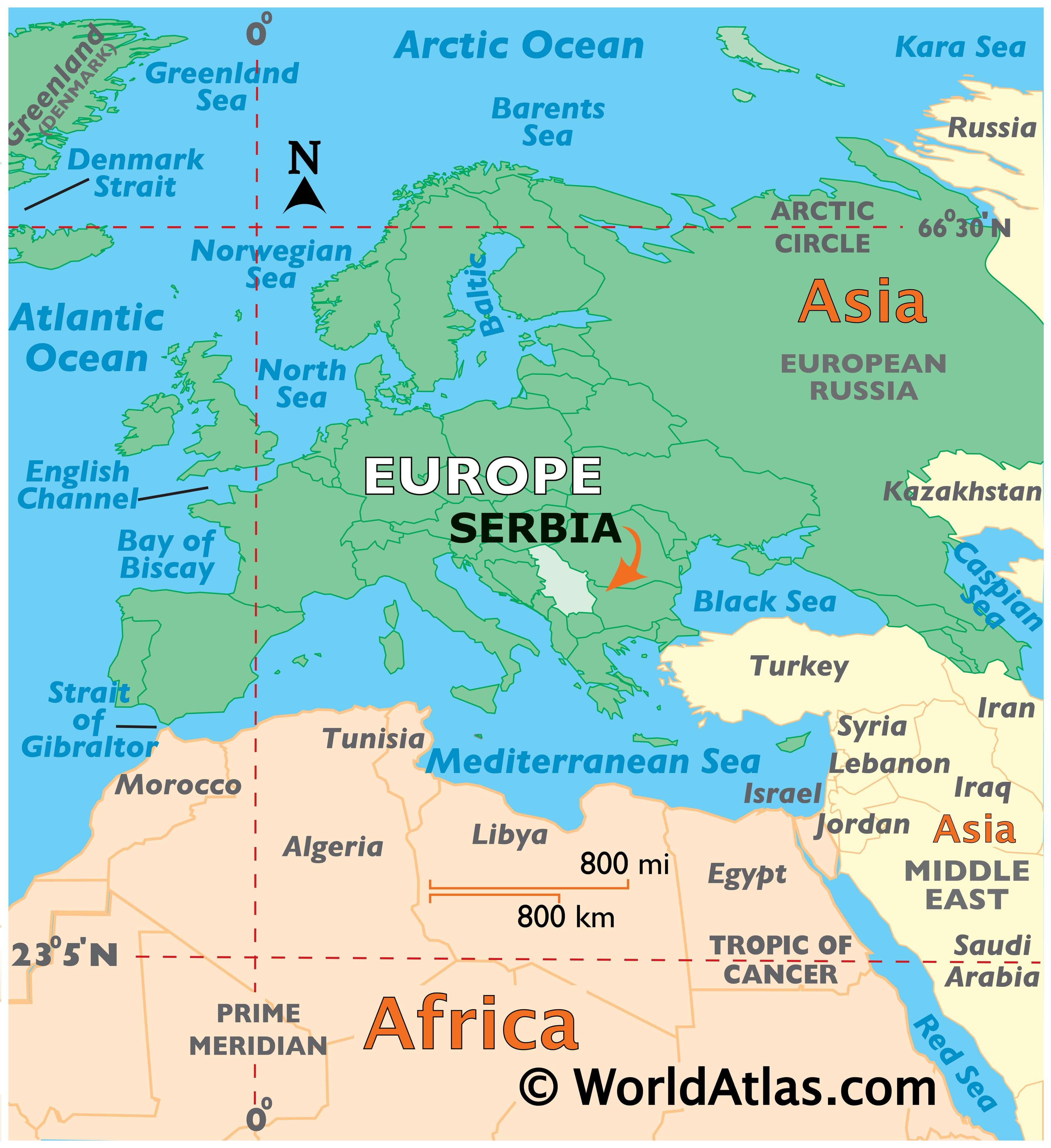
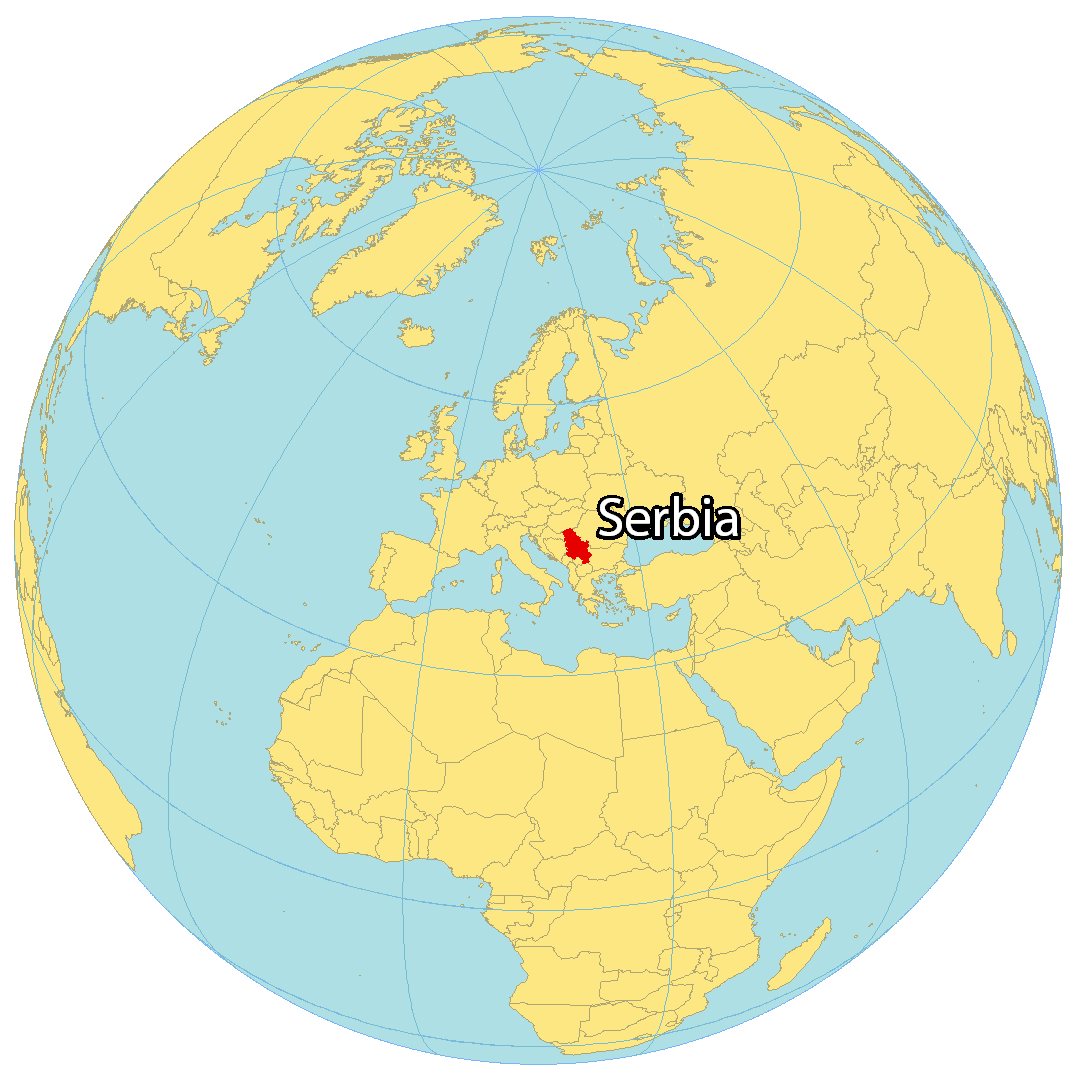
Where is Serbia?
Serbia is a landlocked country located in southeastern Europe. It borders several European countries, including Bosnia and Herzegovina, Croatia, Hungary, Romania, Bulgaria, Kosovo, North Macedonia and Montenegro. In the 20th century, Serbia was a part of Yugoslavia, but after World War II, the country was subdivided and it wasn’t until 2006 that Montenegro voted to secede from Serbia. This makes Serbia one of the youngest countries in the world, finally gaining its independence as early as 2006. Currently, Belgrade is its capital and largest city.
High Definition Political Map of Serbia
Serbia Administrative Map
Physical Map of Serbia
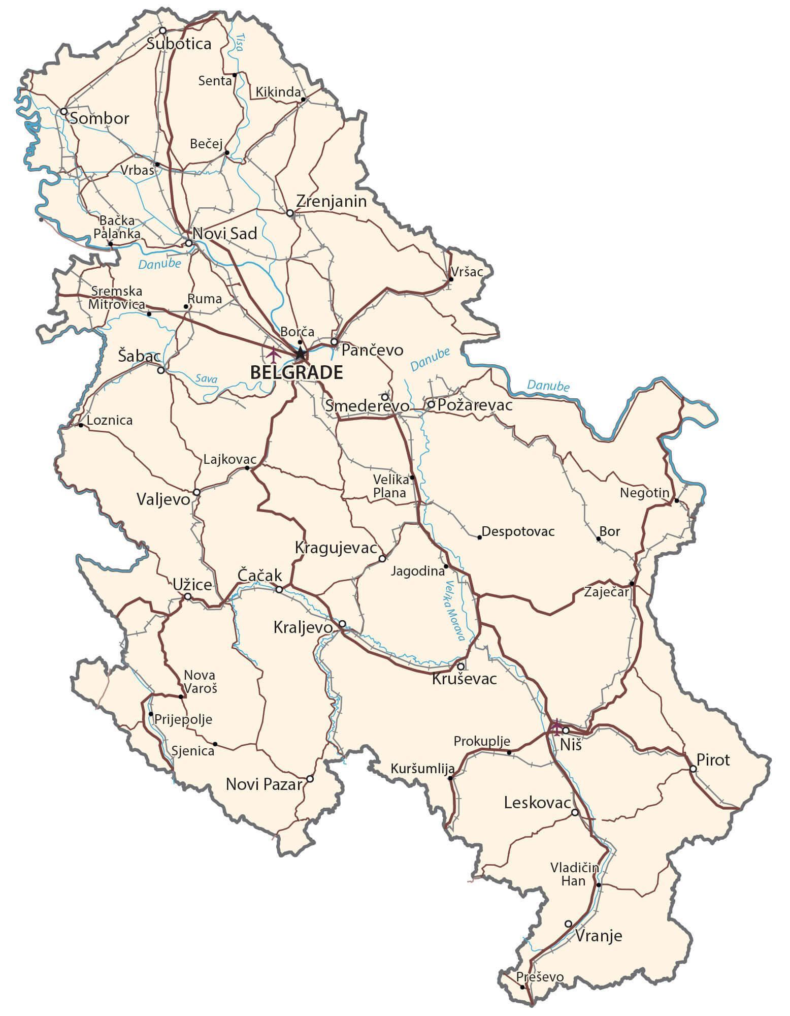
Transportation Map of Serbia
Serbia Satellite Map