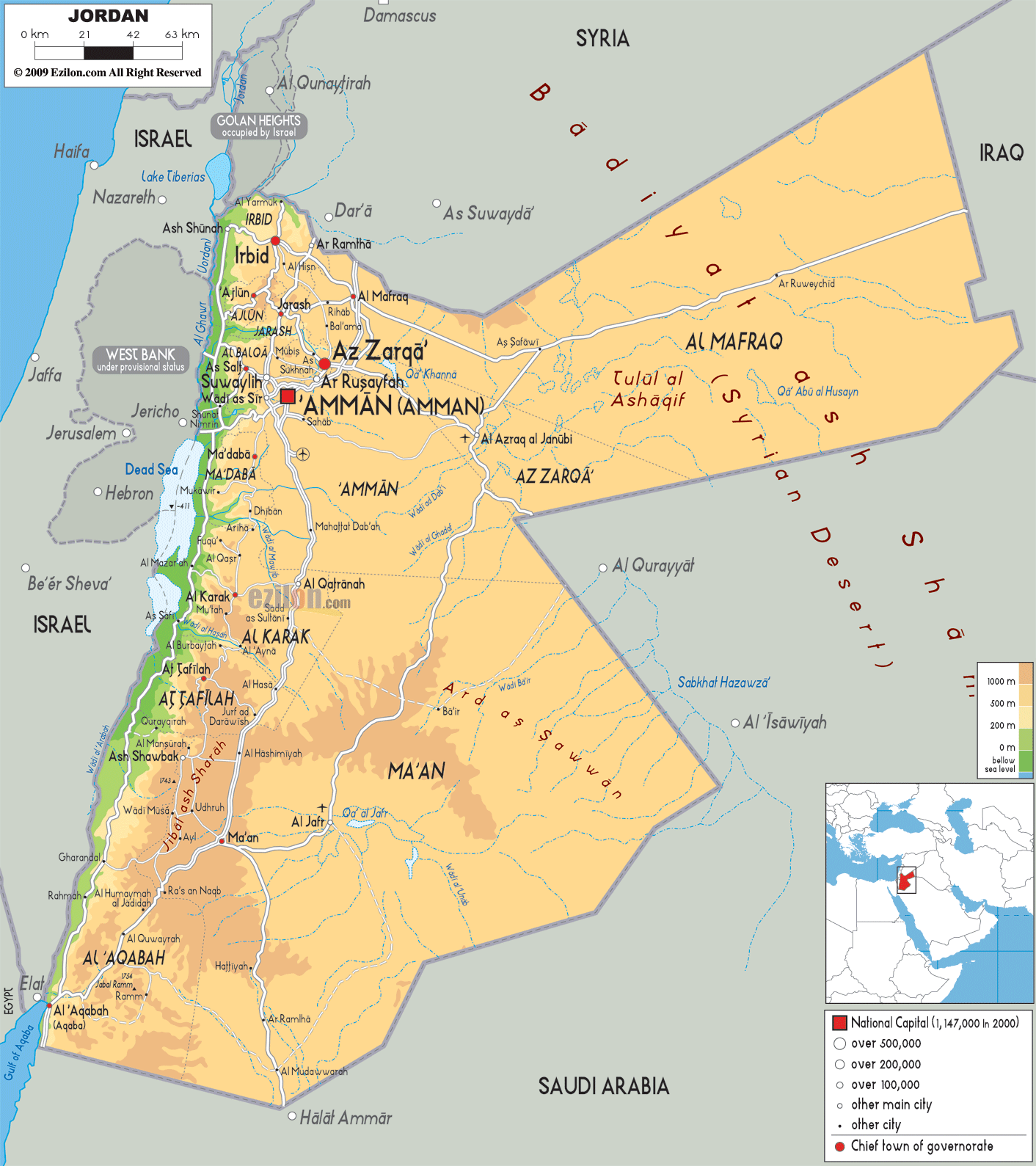
Jordan occupies an area of around 91,880 sq. km in Southwest Asia.
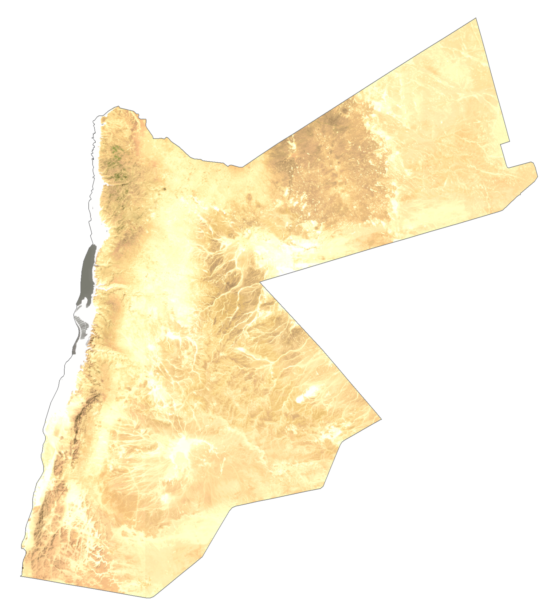
As observed on the physical map above, the country can be divided into three main physiographic regions.
The desert region includes the eastward extensions of the Syrian and the Ard As Sawwan Deserts and covers over four-fifths of the country.
To the west of the desert is the upland region that features an escarpment overlooking the rift valley to the west. Here the average elevation of land is 600 to 900 m. Jordan’s highest point marked on the map by a yellow upright triangle is located at the southern edge of this upland region. It is the 5,755 feet (1,754 m) tall Mount Ramm.
Further west is the Great Rift Valley’s mountains and hills that cut through the Jordan River’s East and West Banks.
Significant bordering bodies of water include the Dead Sea, the Gulf of Aqaba and the Sea of Galilee.
The Jordan River runs for about 5,755 feet (1,754 m) and drains into the Dead Sea.
| Flag: |  |
|---|---|
| Legal Name: | Hashemite Kingdom of Jordan |
| Capital Value: | Amman |
| Official languages: | Arabic |
| Demonym(s): | Jordanian |
| Government: | Unitary parliamentary constitutional monarchy |
| Legislature: | Parliament |
| Total Area: | 89,342 km² |
| Land Area: | 88,802 km² |
| Water Area: | 540 km² |
| Population: | 10,101,694 |
| Density: | 114/km (295.3/sq mi) (70th) |
| GDP: | $43.74 Billion |
| GDP Per Capita: | $4,330.33 |
| Currency Value: | Jordanian dinars (JOD) |
| Driving side: | right |
| Calling code: | +962 |
| Internet TLD: | .jo .الاردن |
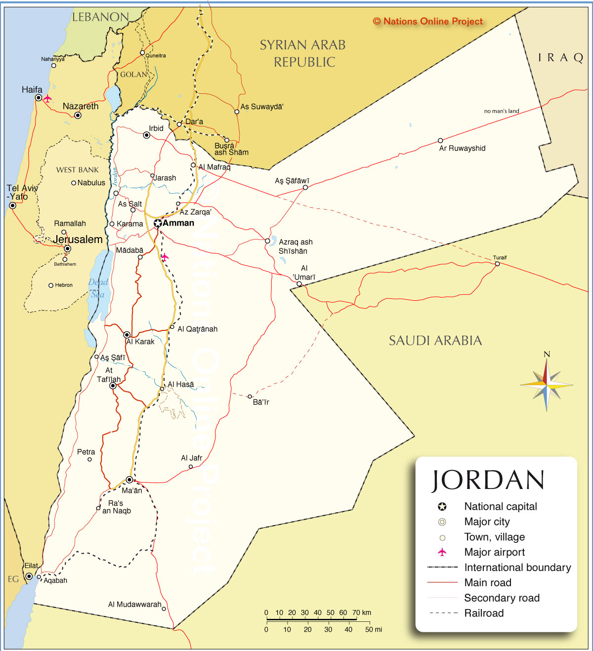
Discover the beauty and diversity of Jordan with this detailed map. From the Syrian Desert to the Dead Sea to the Jordanian Highlands, this map shows major cities, towns, roads, lakes, and rivers. Get a closer look with satellite imagery and a terrain map. Explore Jordan now!
Online Interactive Political Map
Click on ![]() to view map in "full screen" mode.
to view map in "full screen" mode.
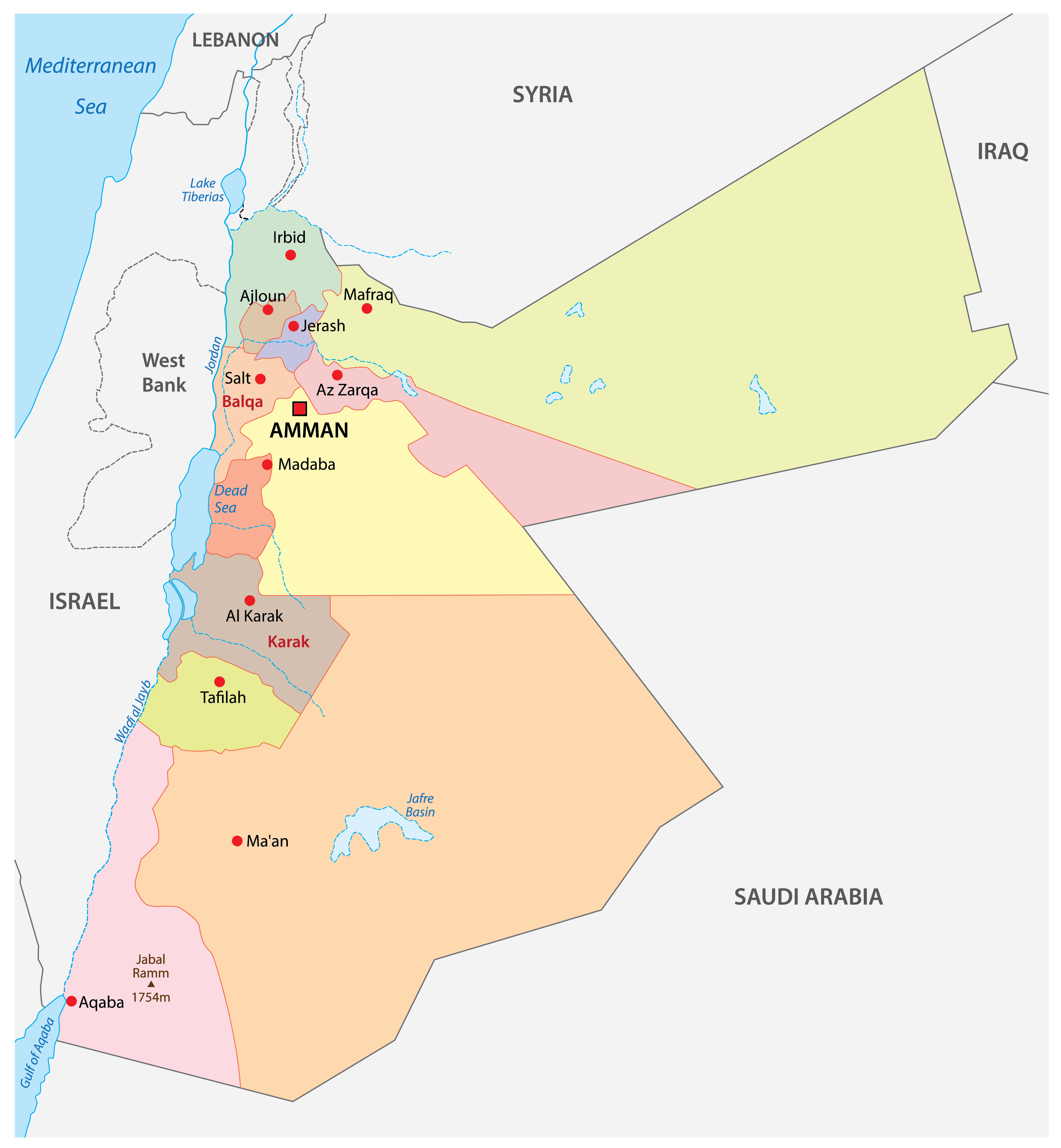
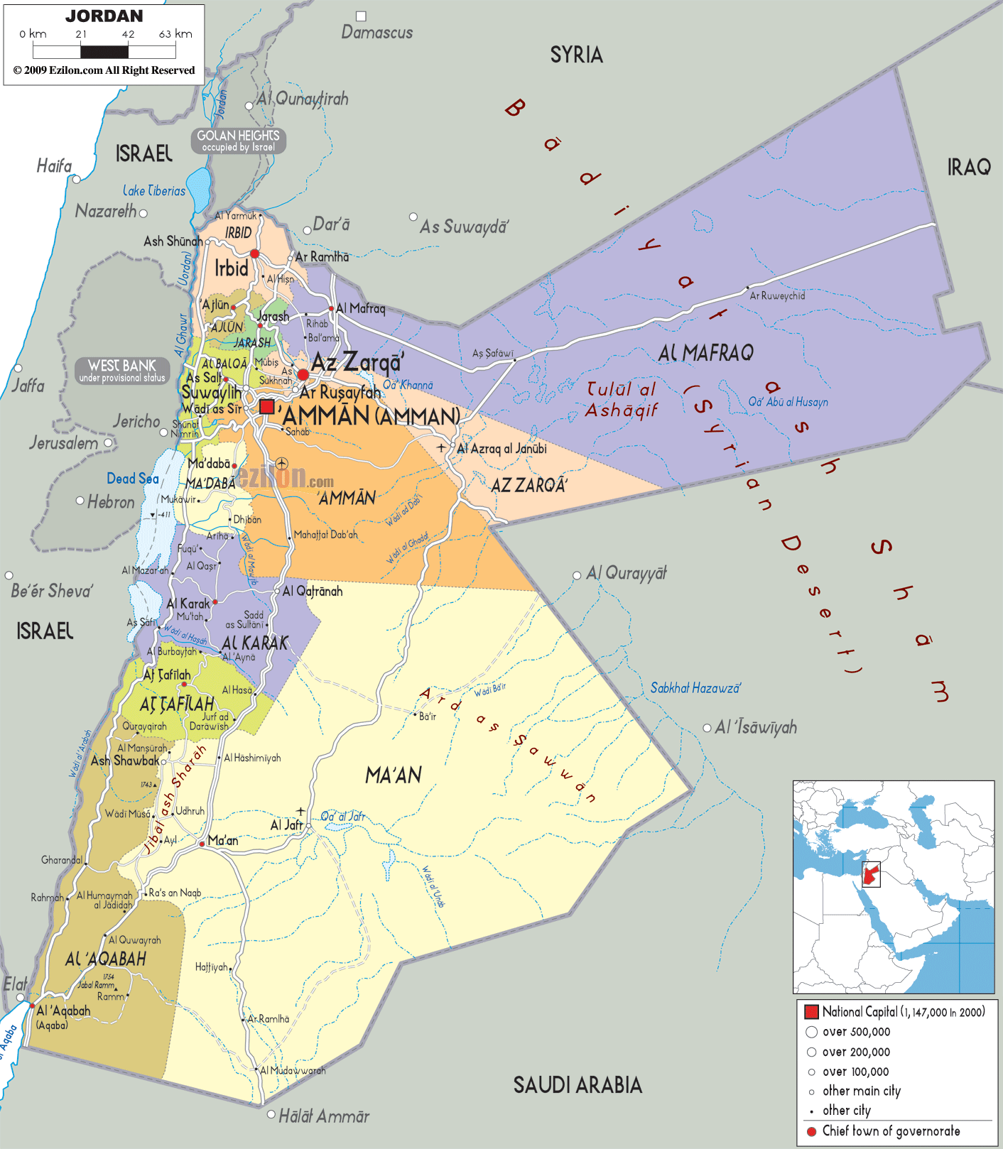
Jordan (officially, the Hashemite Kingdom of Jordan) is divided into three administrative regions. These regions are divided into 12 governorates (muhafazat, sing. muhafazah). In alphabetical order, these governorates are: Al ‘Asimah (Amman), ‘Ajlun, Al ‘Aqabah, Al Balqa’, Irbid, Jarash, Al Karak, Madaba, Al Mafraq, Ma’an, At Tafilah, and Az Zarqa’. These governorates are divided into districts (liwa), which are further subdivided into smaller subdivisions (qda).
With an area of 89, 342sq. km, and a population of over 10 million people, Jordan is the 11th most populous Arab country. Amman – the capital and largest city of Jordan is located on the east Bank Plateau and serves as the country’s economic, political and commercial centers, as well as one of the Arab world’s major cultural capitals.
Location Maps
Where is Jordan?
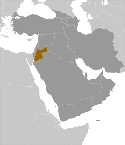
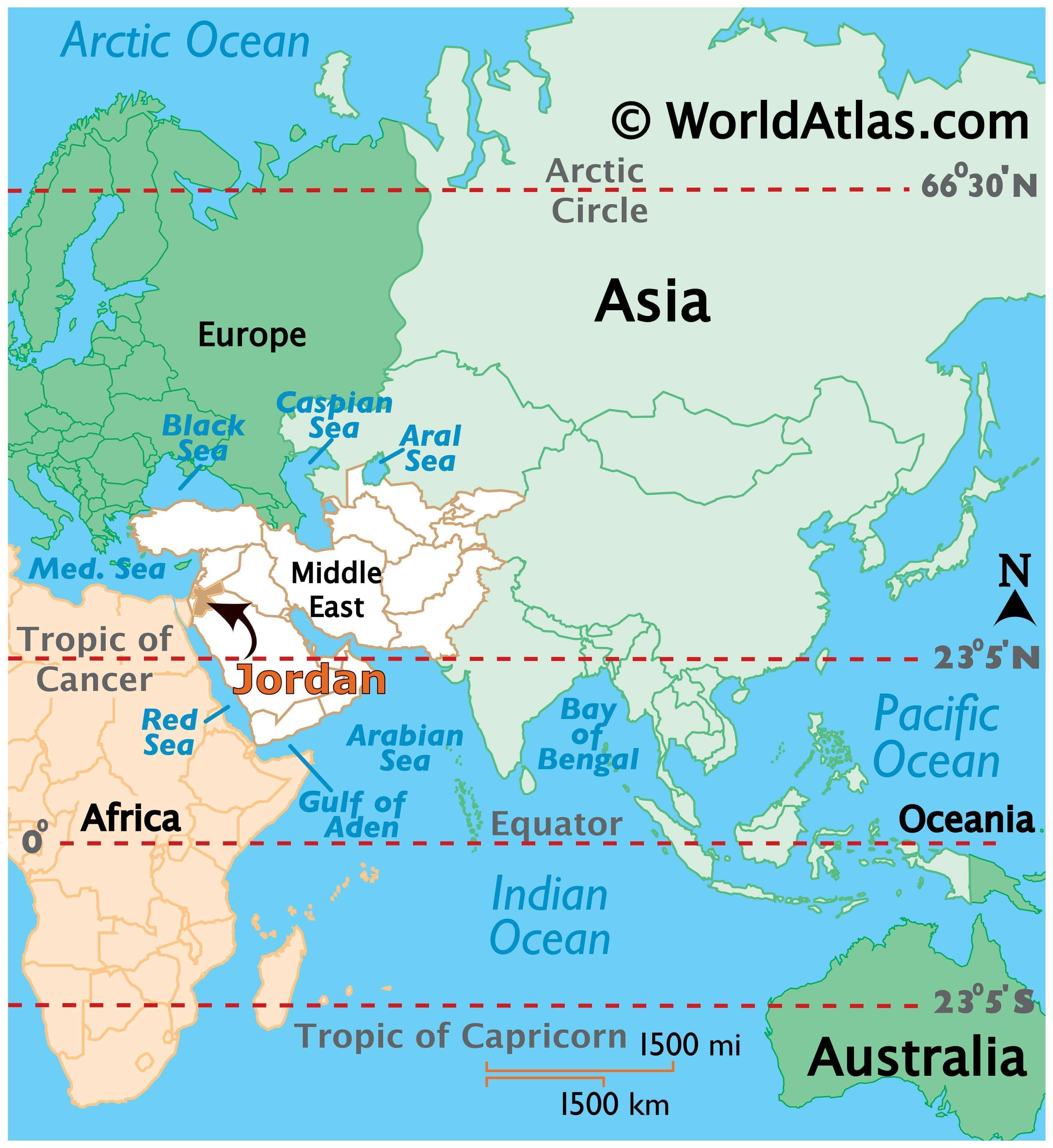
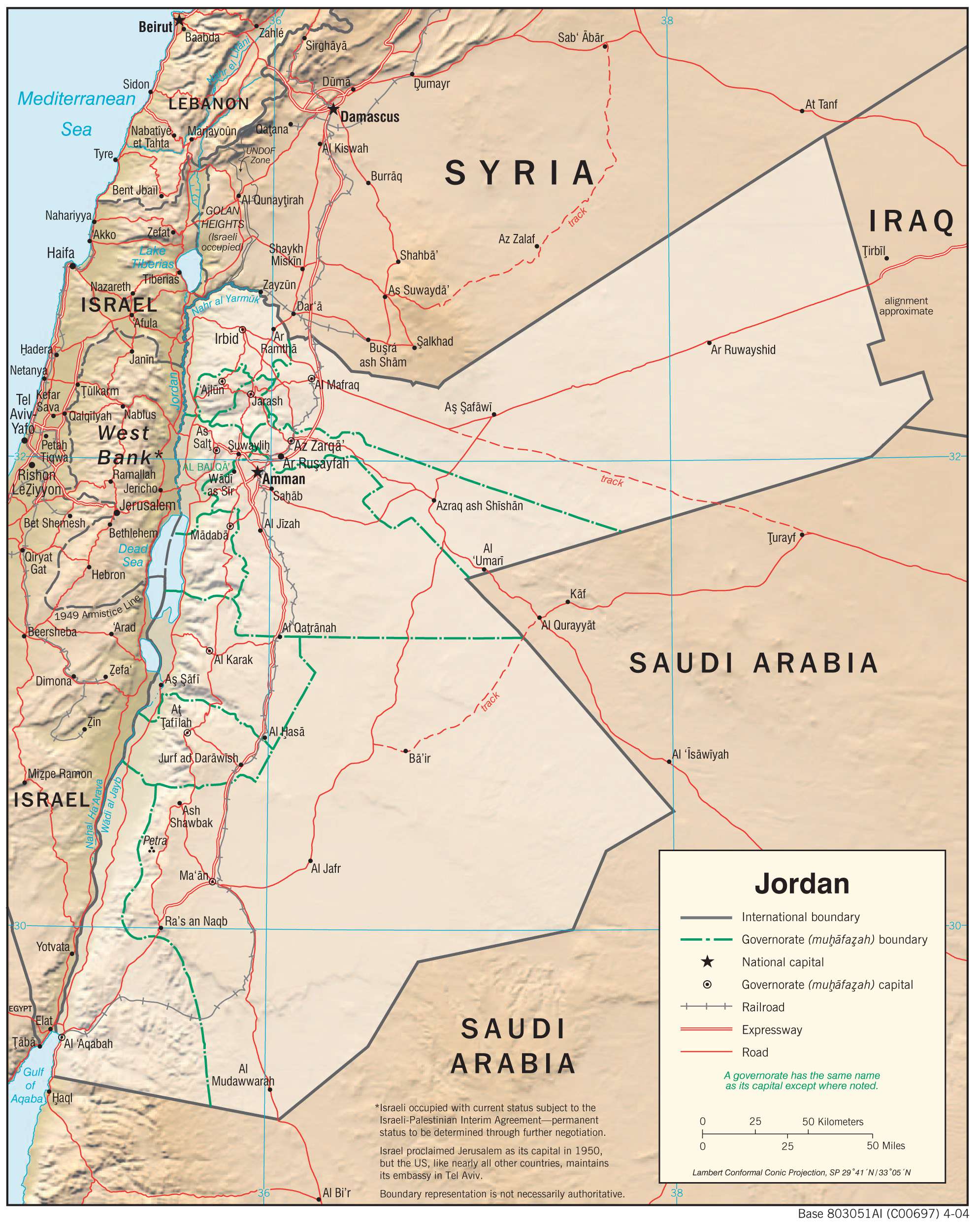
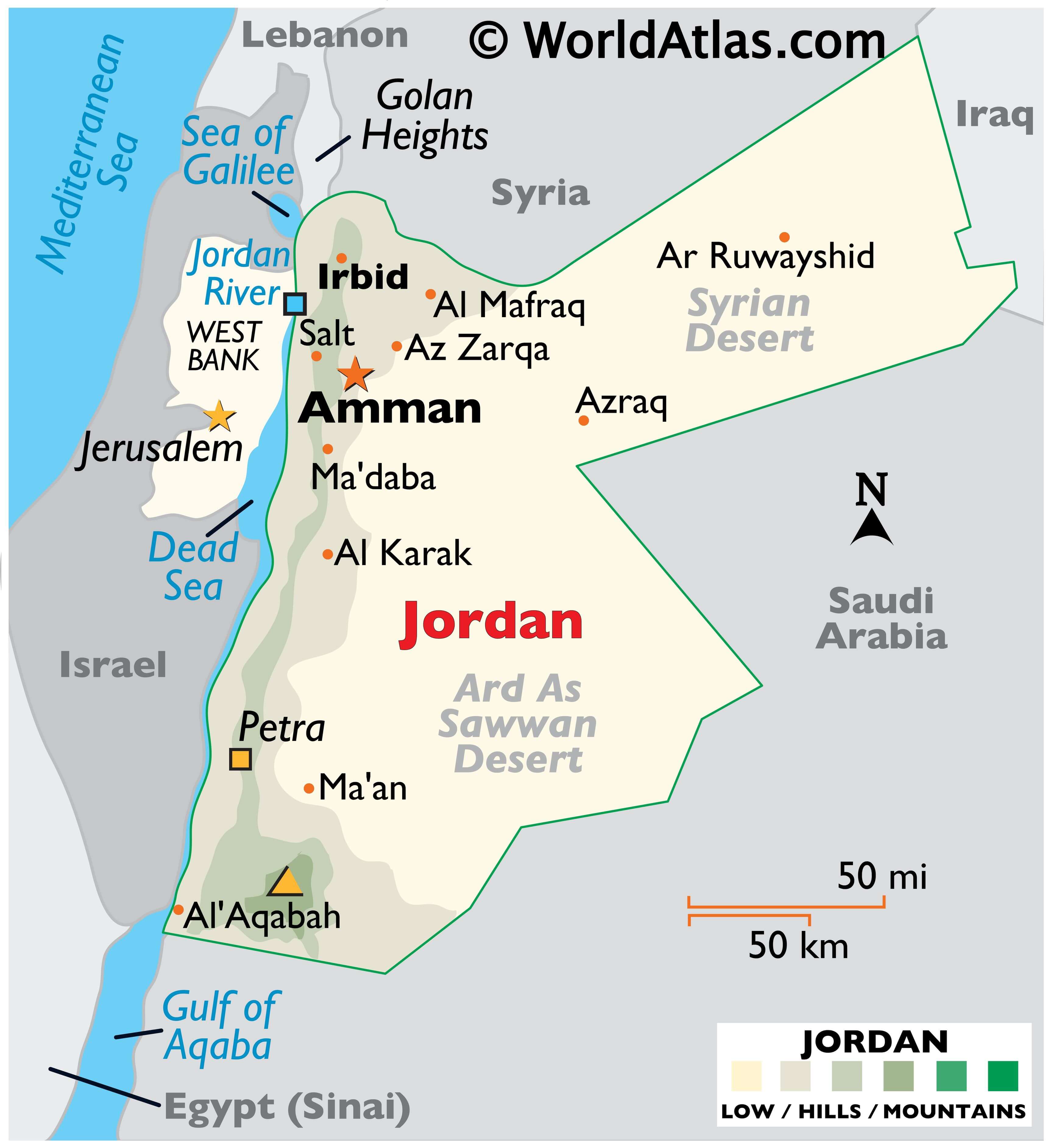
Jordan is located at the crossroads of Asia, Africa, and Europe in the Middle East. It is bordered by Israel and the West Bank (State of Palestine) to the west, Saudi Arabia and Iraq to the east, and Syria to the north. The country has a 26-kilometer (16 mi) coastline along the Gulf of Aqaba and the Red Sea. Amman is the capital and largest city of Jordan.
Jordan has a diverse geography, with several different landscapes. The east of the country is mostly desert, while the west is more mountainous. Central Jordan is home to the Jordan Rift Valley, a large valley that runs from north to south.
High Definition Political Map of Jordan
Physical Map of Jordan
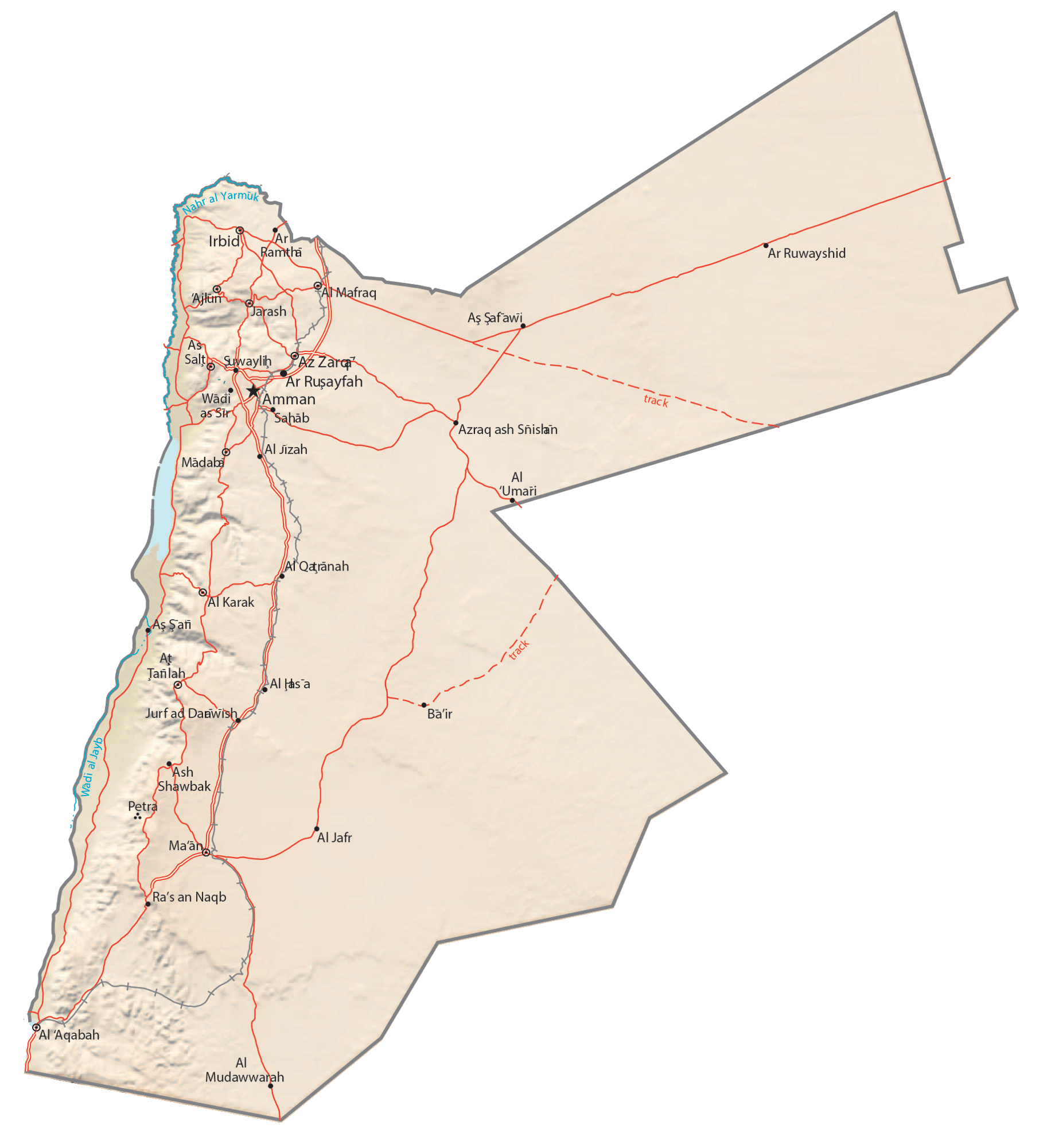
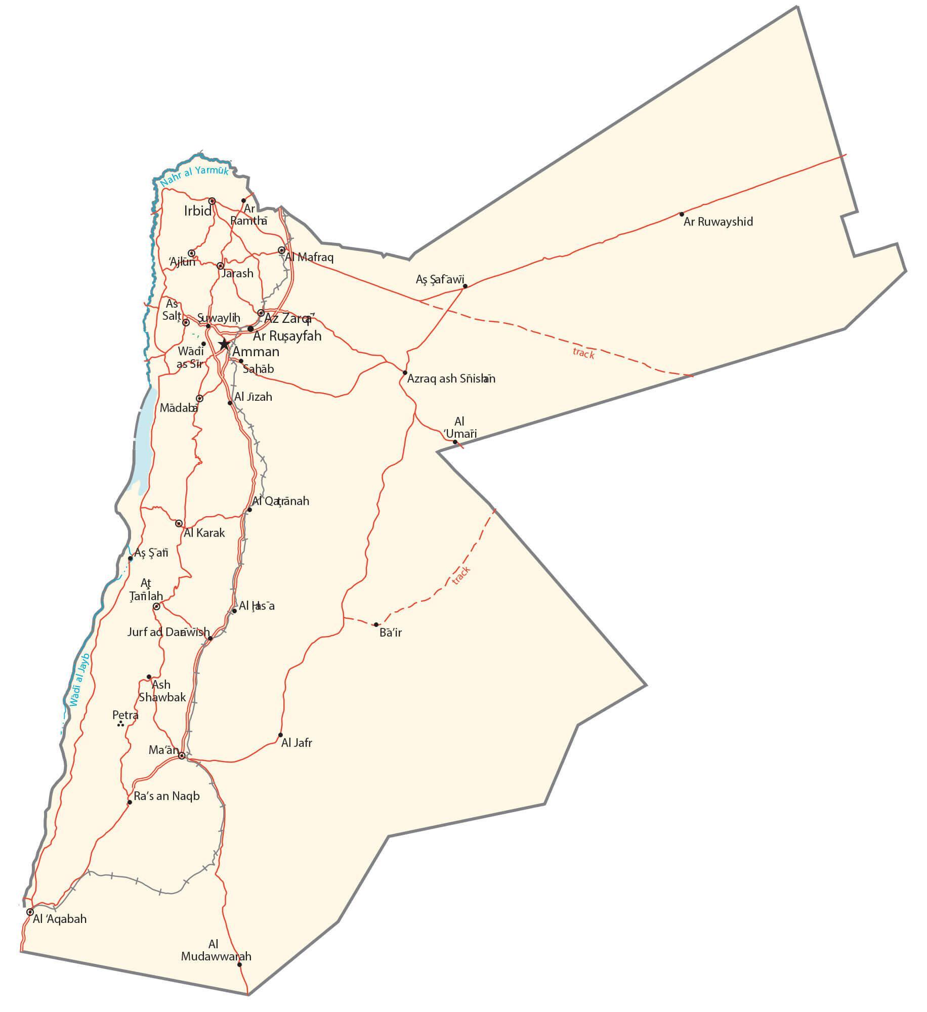
Transportation Map of Jordan

Jordan Satellite Map