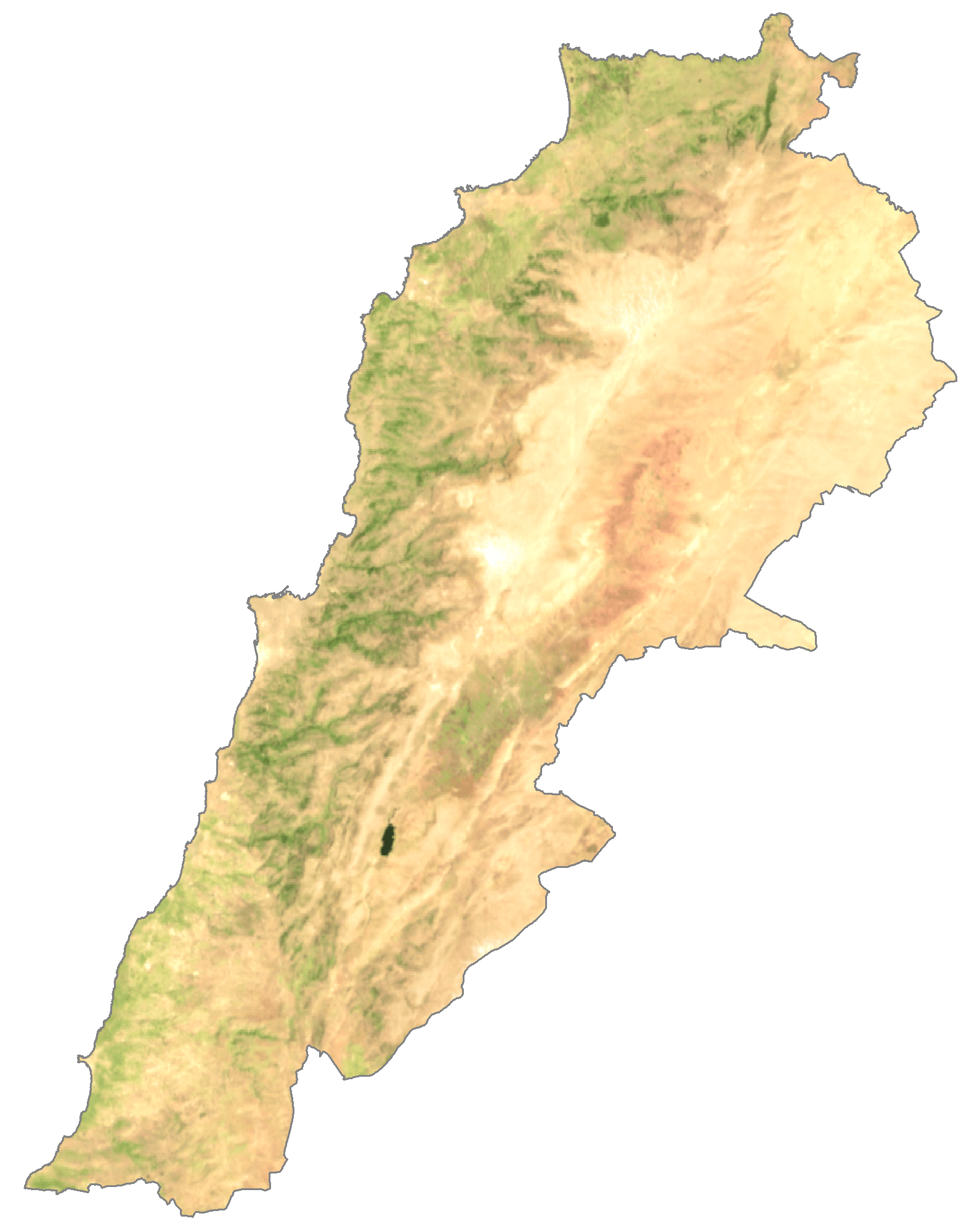
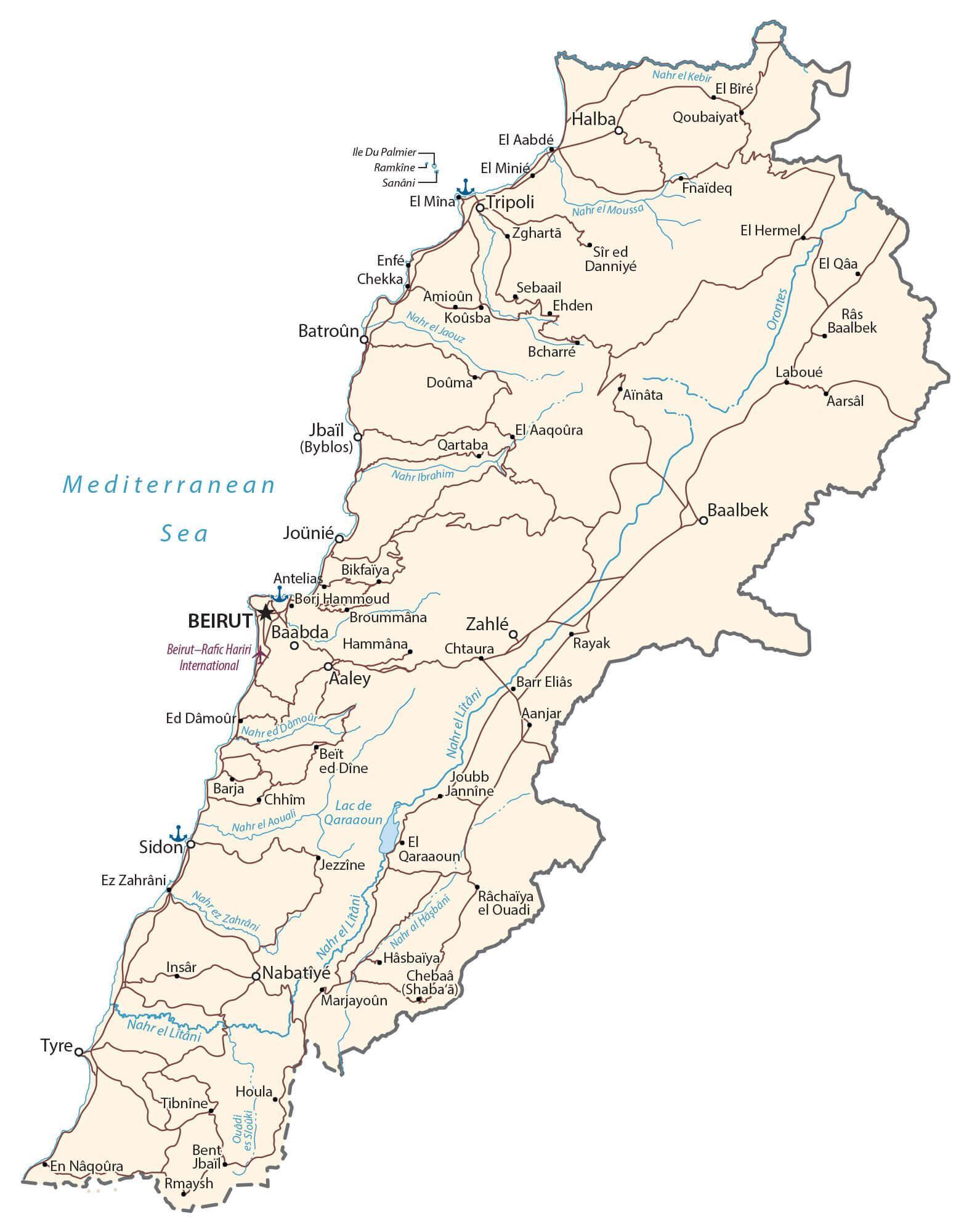
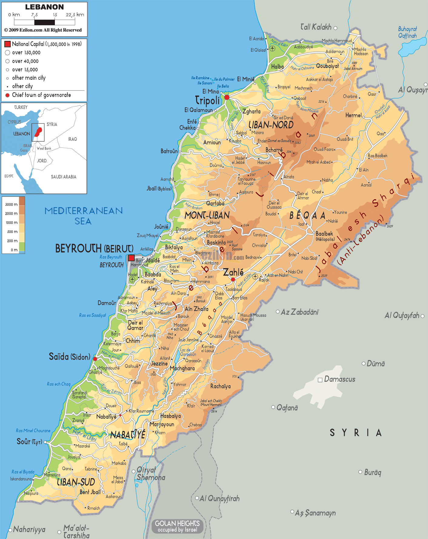
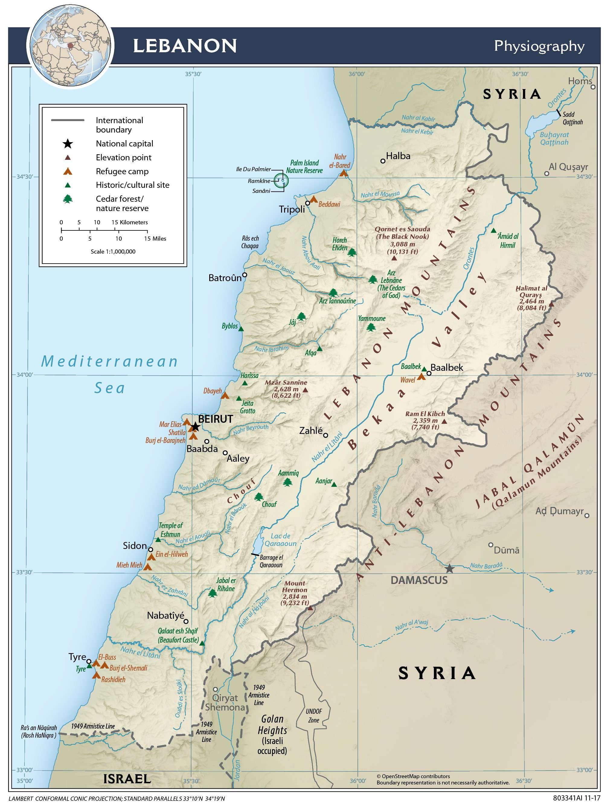
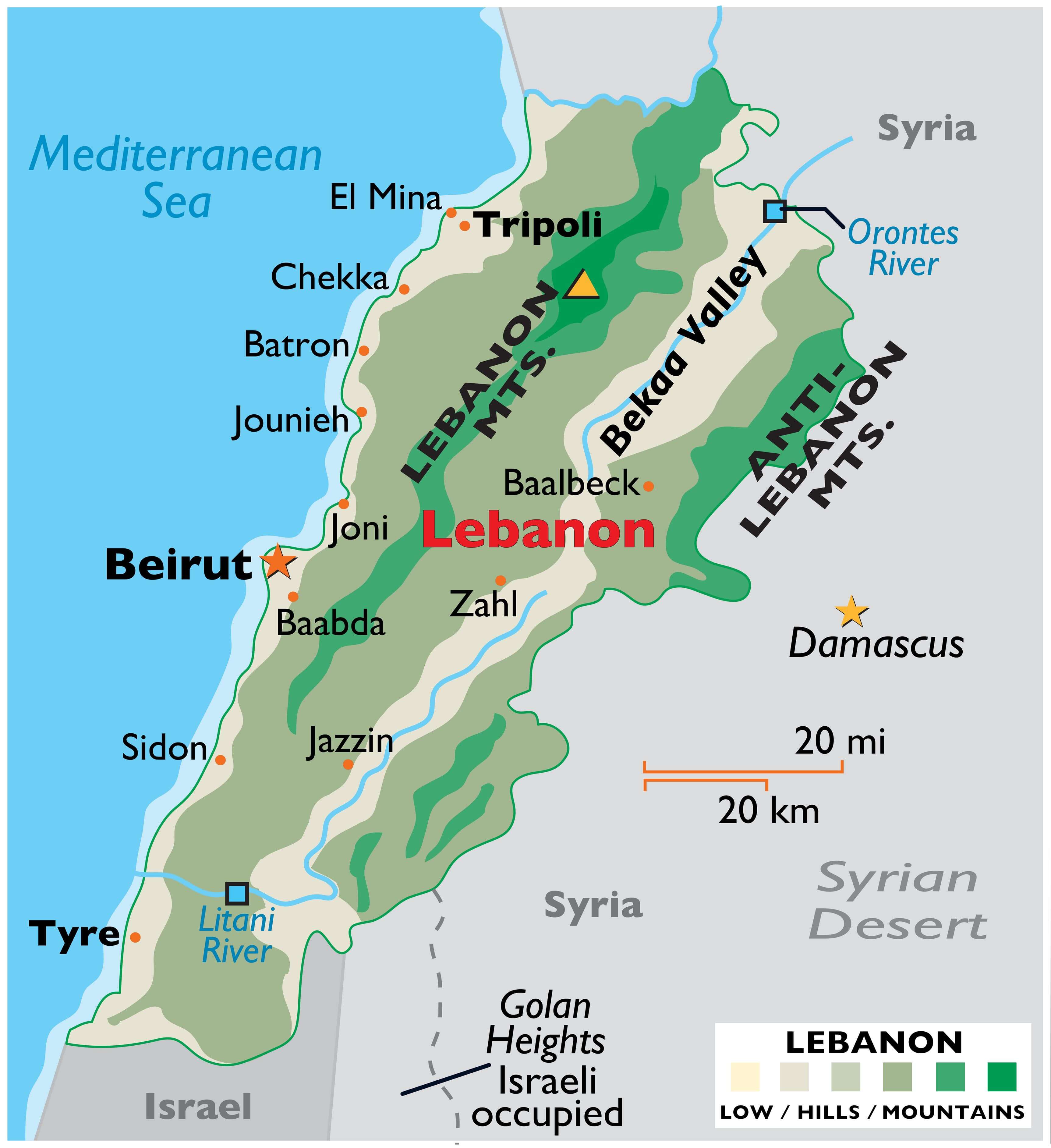
The topography of Lebanon can be distinguished into four distinct physiographic regions as observed on the physical map of the country above.
The narrow and discontinuous coastal plain along the Mediterranean Sea features both sandy bays and rocky beaches.
Further inland and rising from the coast is the Lebanon Mountain range that is around 100 miles (160 km) long and has many snow-capped peaks.Deep gorges cut through this mountain region. The highest point of Lebanon is Qurnat as Sawda’ which peaks at 10,128 ft. (3,087 m) in the Lebanon Mountains. Its position has been marked on the map by a yellow upright triangle.
Between the Lebanon Mountains to the west and the parallel running Anti-Lebanon Mountains in the east is the Al-Biqāʿ valley. This valley is part of the East African Rift System and features fertile soils.
Over a dozen minor rivers flow from the mountains, with the Litani the most significant, as it irrigates the heart of the fertile Bekaa Valley.
| Flag: |  |
|---|---|
| Legal Name: | Lebanese Republic |
| Capital Value: | Beirut |
| Largest City: |
Bayrut (Beirut) (2,424,425) |
| Official languages: | Arabic |
| Demonym(s): | Lebanese |
| Government: | Unitary confessionalist parliamentary republic |
| Legislature: | Parliament |
| Total Area: | 10,400 km² |
| Land Area: | 10,230 km² |
| Water Area: | 170 km² |
| Population: | 6,855,713 |
| Density: | 560/km (1,450.4/sq mi) |
| GDP: | $53.37 Billion |
| GDP Per Capita: | $7,784.32 |
| Currency Value: | Lebanese pounds (LBP) |
| Driving side: | right |
| Calling code: | +961 |
| Internet TLD: | .lb |
Explore Lebanon’s stunning landscape with this interactive map of the country. From the rugged mountain peaks of the Lebanon Mountains to the lush, fertile Beqaa Valley, this map reveals the geographical features that make Lebanon so unique. View satellite imagery, major cities, towns, roads, lakes, and rivers, and get a better understanding of the country’s topography and terrain.
Online Interactive Political Map
Click on ![]() to view map in "full screen" mode.
to view map in "full screen" mode.
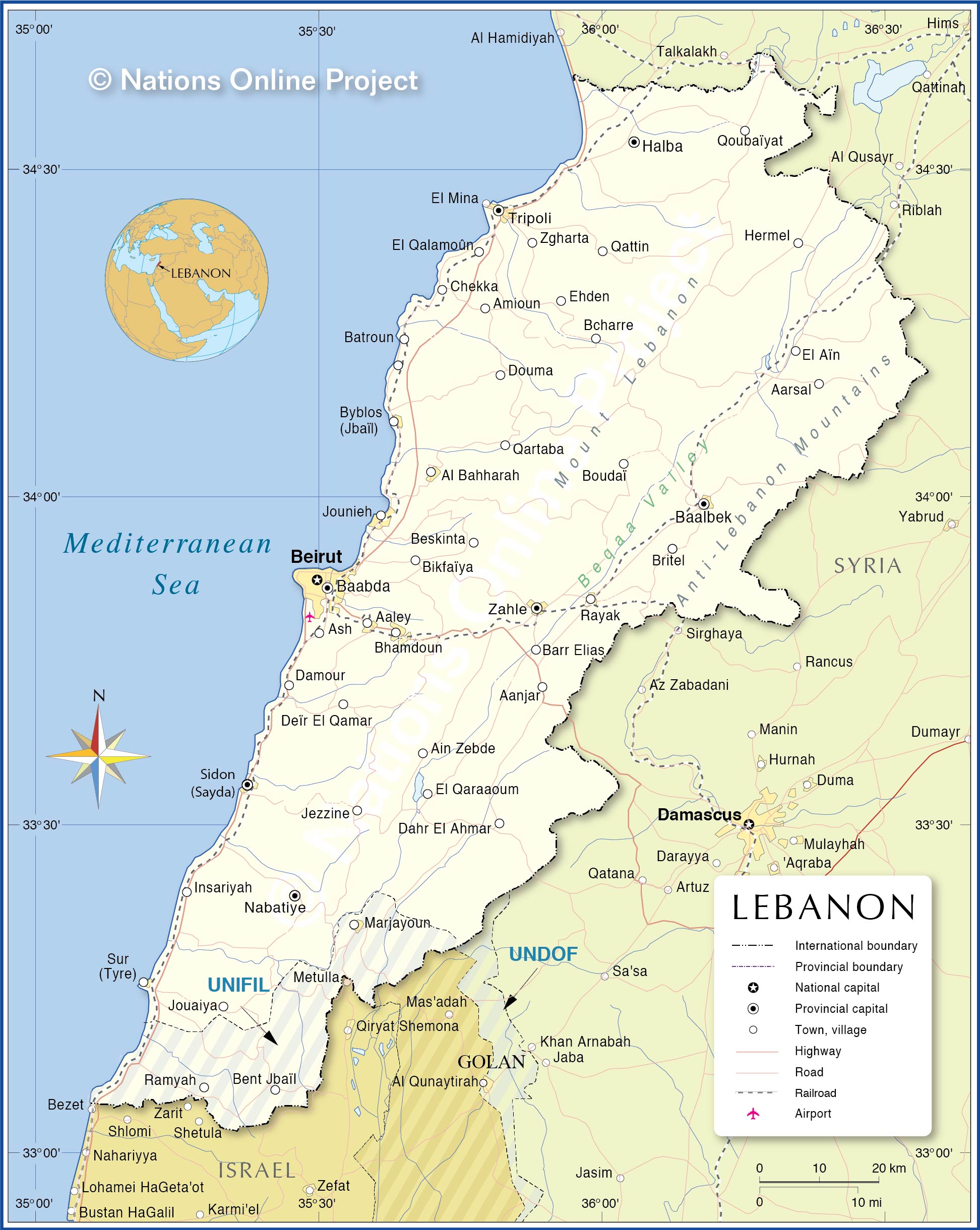
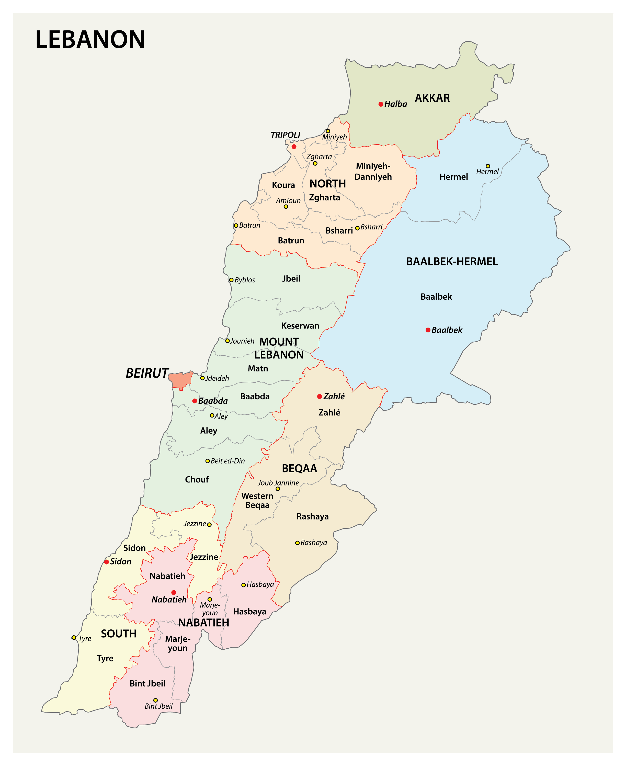
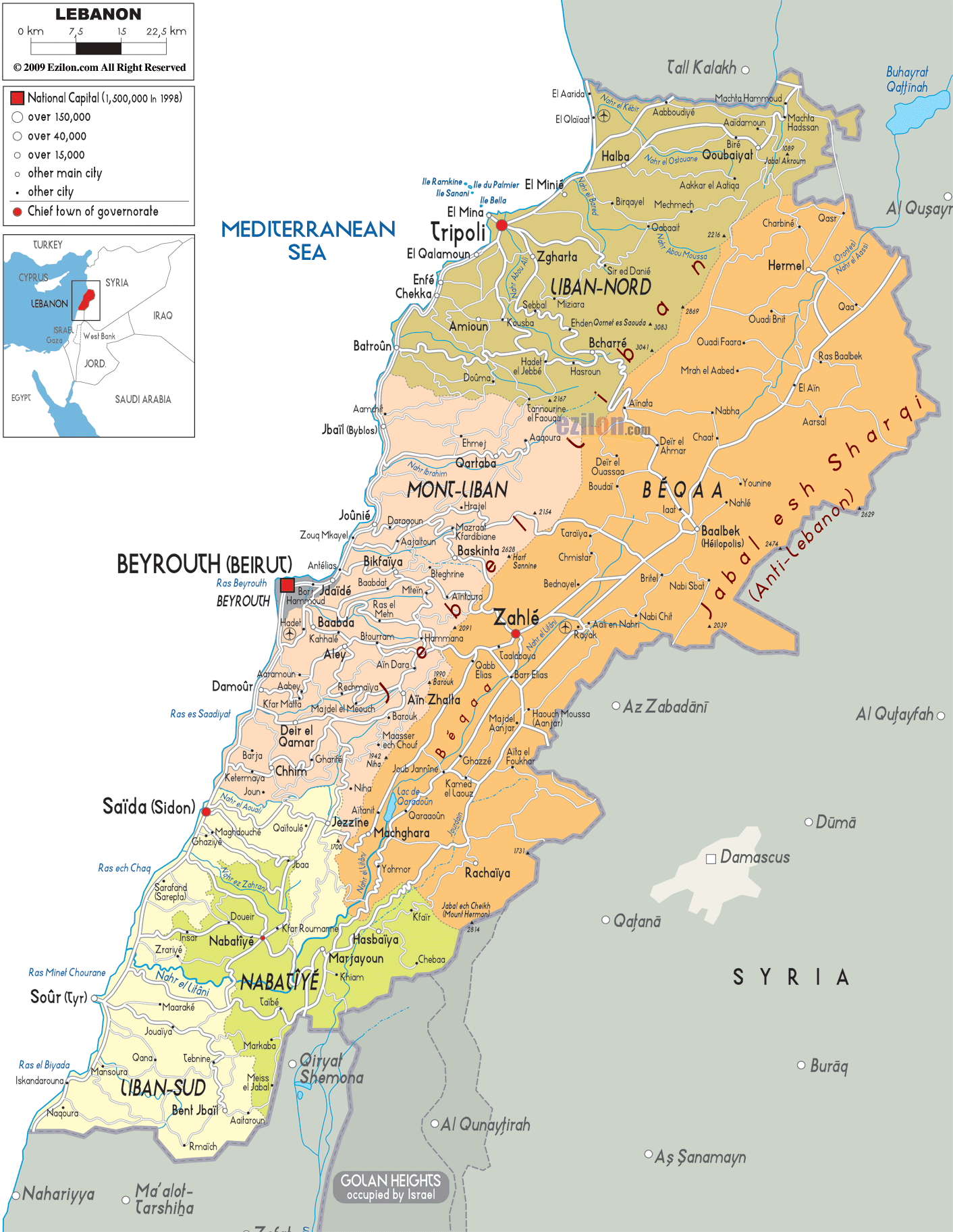
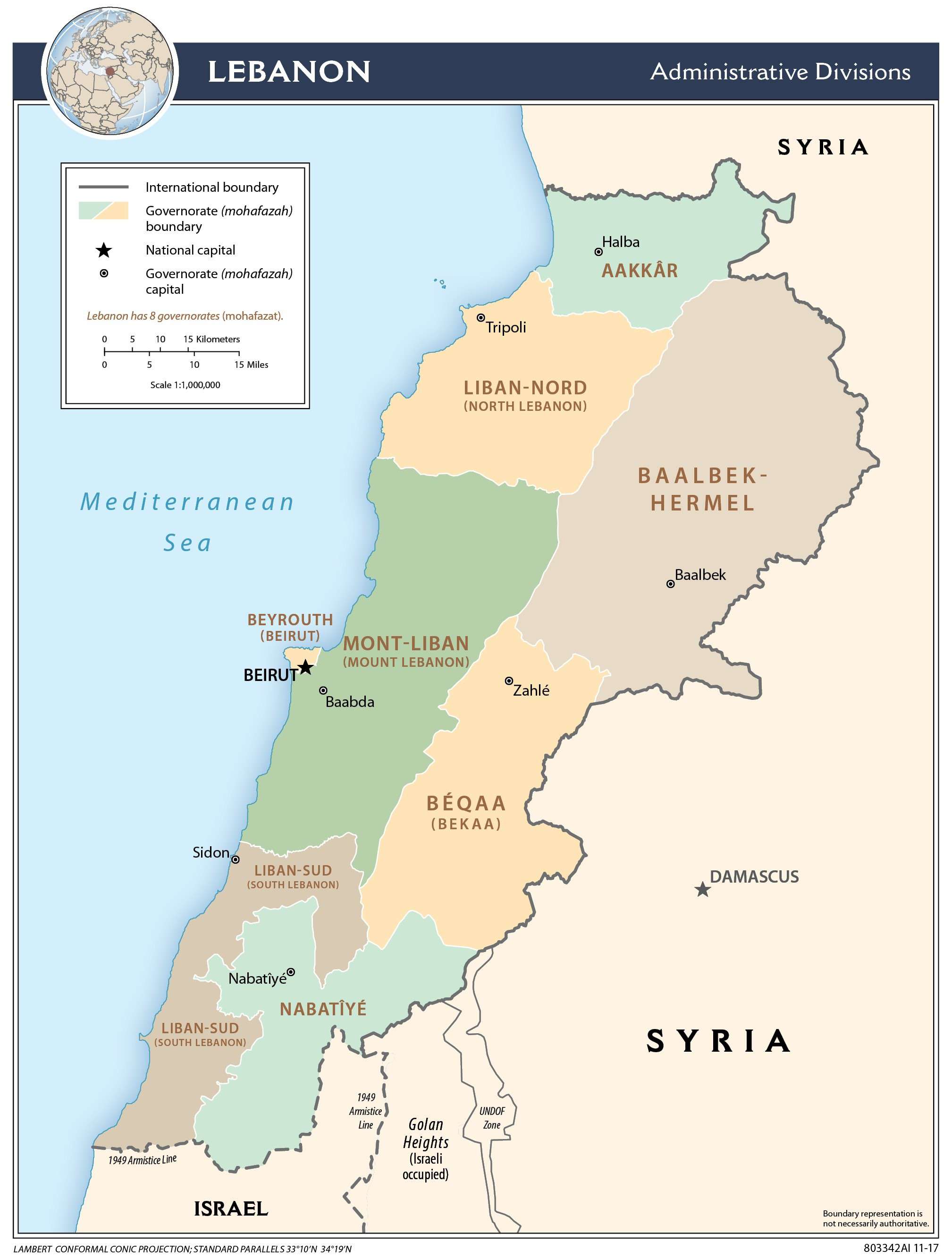
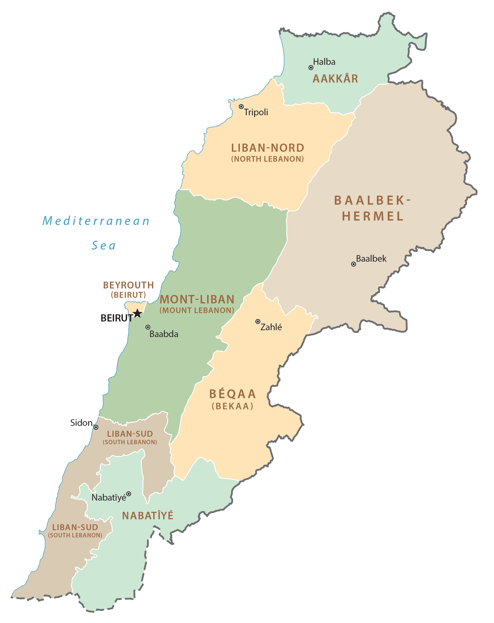
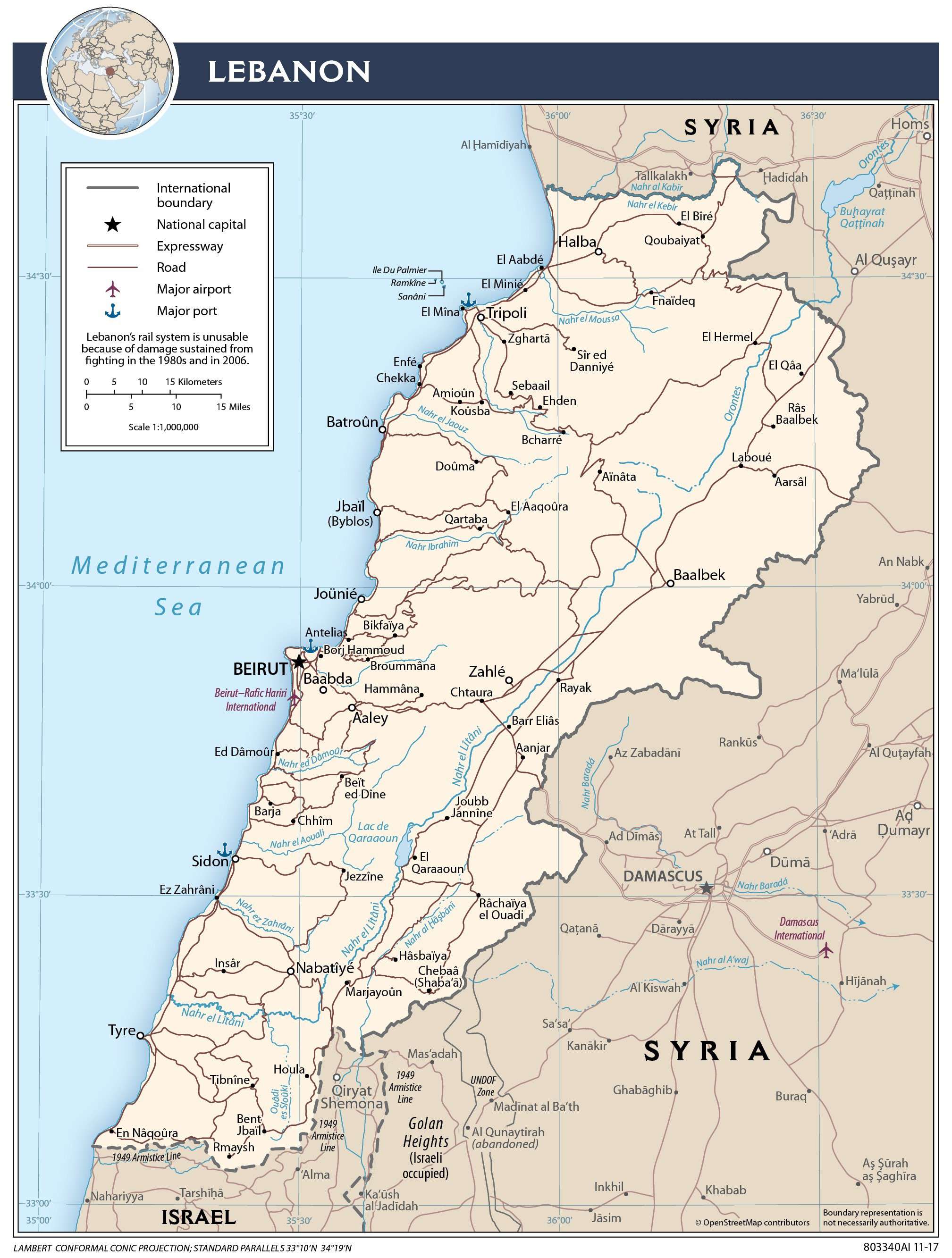
Lebanon (officially, Lebanese Republic) is divided into 8 governorates (mohafazat sing. mohafazah). In alphabetical order, these governorates are: Aakkar, Baalbek-Hermel, Beyrouth (Beirut), Beqaa (Bekaa), Mont-Liban (Mount Lebanon), Nabatiye, Liban-Nord (North Lebanon) and Liban-Sud (South Lebanon). Except the governorates of Beirut and Akkar, the rest 6 governorates are subdivided into districts (Aqdya sing. qadaa) and further smaller subdivisions.
Located on a peninsula in the Mediterranean Sea coast is Beirut – the capital and largest city of Lebanon. It is also Lebanon’s most populous city as well as the country’s important commercial hub. The Port of Beirut is Lebanon’s main seaport and also the busiest and largest port in the Mediterranean region.
Location Maps
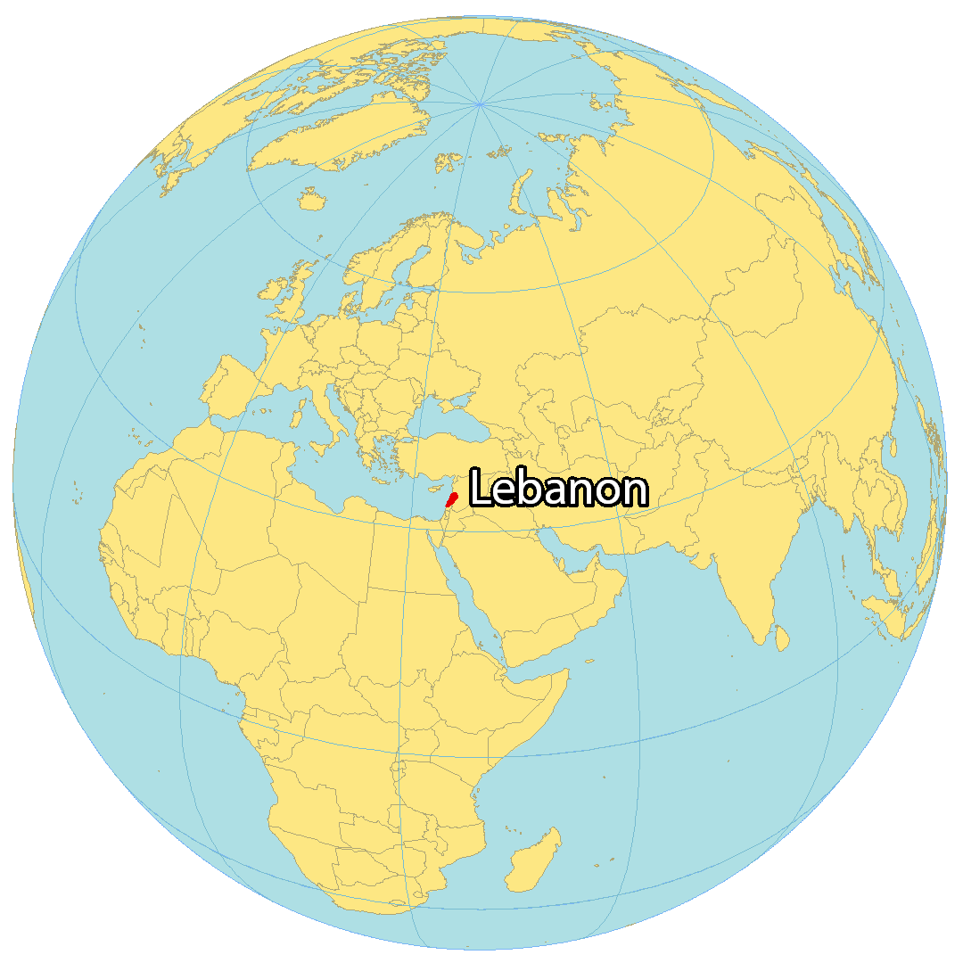
Where is Lebanon?
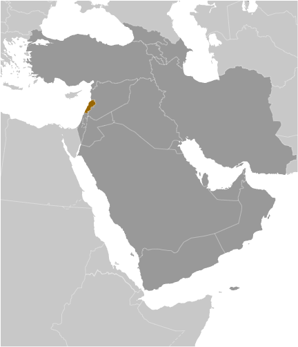
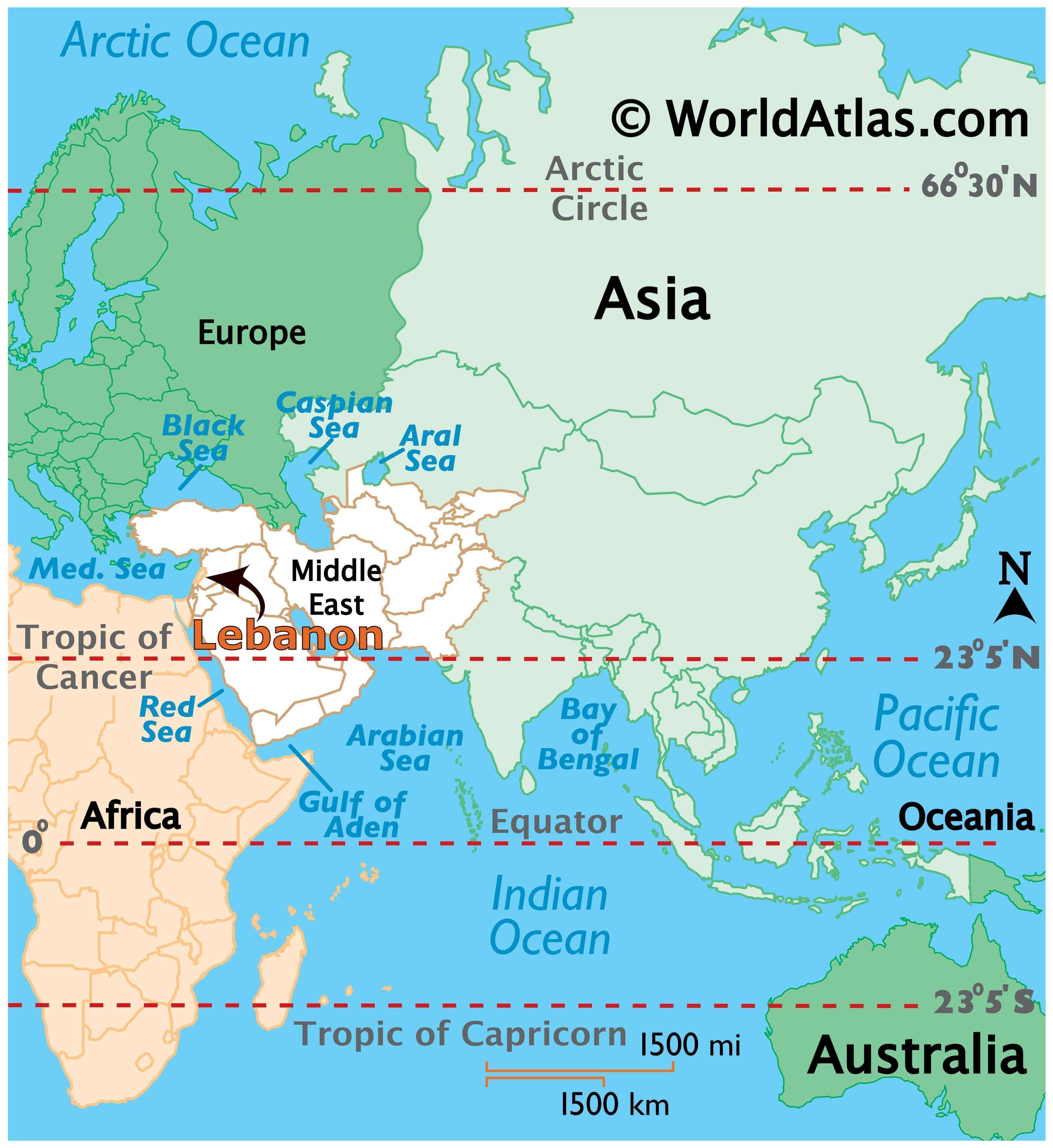
Lebanon is situated in the Middle East on the Mediterranean Sea. It is the smallest country in continental Asia, and has just two countries bordering it; Israel to the south and Syria to the northeast. Its coastline spans 225 kilometers (140 mi) with Cyprus situated directly across. Lebanon’s strategic location in the Mediterranean Sea places it at a crossroads between the Arab Orient.
Beirut is the capital and largest city in Lebanon. Other major cities include Zahle, Tripoli, and Sidon. It has a diverse landscape, encompassing snow-capped mountains, green valleys, and sandy beaches. Its climate is also diverse, ranging from temperate in the mountains to Mediterranean along the coast.
High Definition Political Map of Lebanon
Lebanon Administrative Map
Physical Map of Lebanon

Transportation Map of Lebanon
Lebanon Satellite Map