Delaware County is a county in the east central portion of the U.S. state of Indiana. As of 2020, the population was 111,903. The county seat is Muncie.
Delaware County is part of the Muncie, IN metropolitan statistical area, which is part of the larger Indianapolis-Carmel-Muncie CSA.
| Name: | Delaware County |
|---|---|
| FIPS code: | 18-035 |
| State: | Indiana |
| Founded: | 1820 (created) 1827 (organized) |
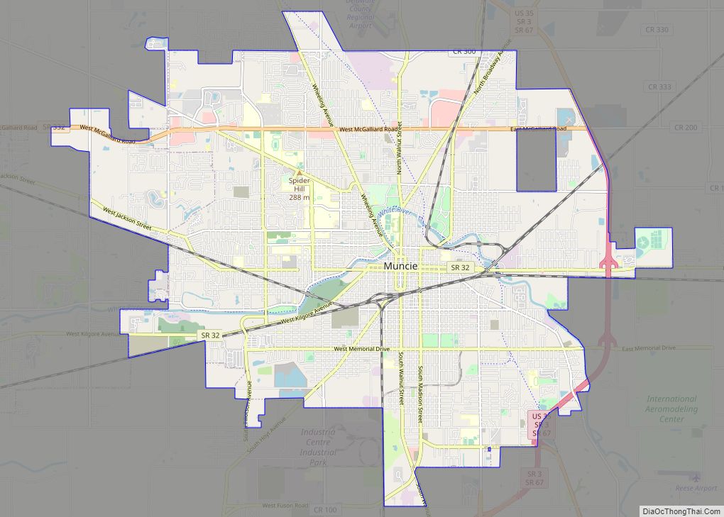
| Seat: | Muncie |
| Largest city: | Muncie |
| Total Area: | 395.91 sq mi (1,025.4 km²) |
| Land Area: | 392.12 sq mi (1,015.6 km²) |
| Population Density: | 300.1/sq mi (115.9/km²) |
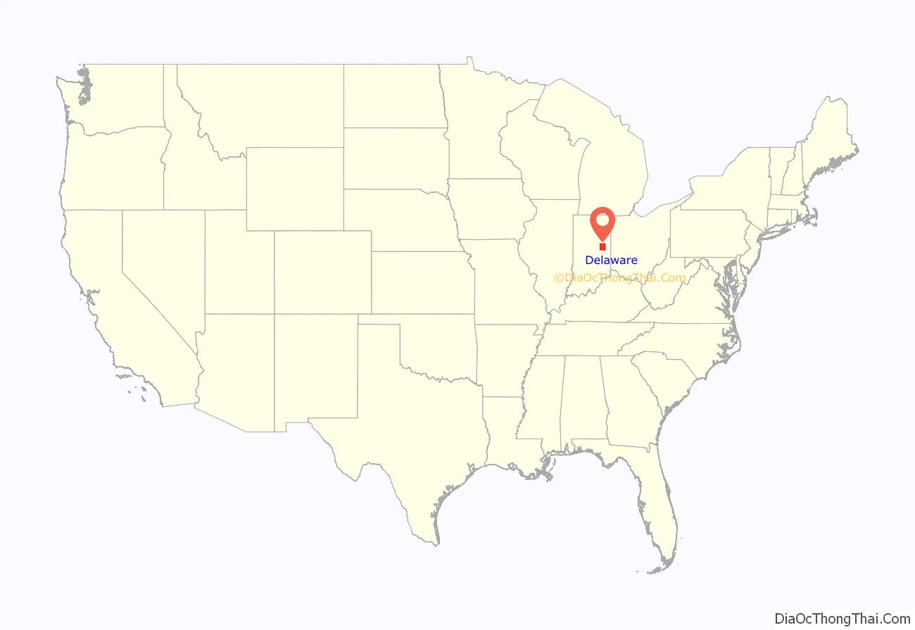
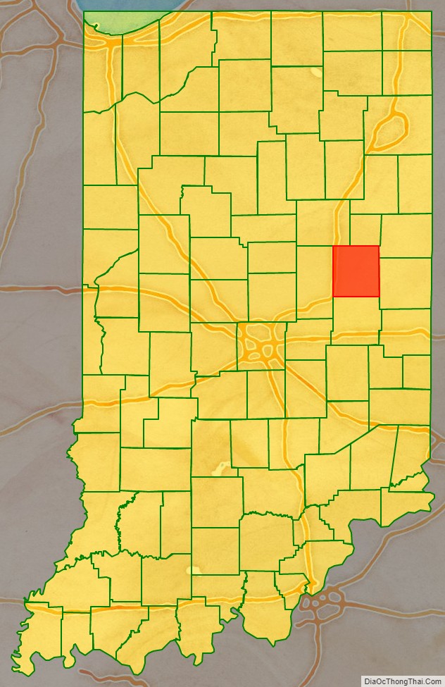
Delaware County location map. Where is Delaware County?
History
Delaware County was authorized in Jan. 1820 on New Purchase lands south of the Wabash River gained with the 1818 Treaty of St. Mary’s. It encompassed the drainage basin of the White River, along which the Delaware, a Native American people had settled, and from which the County takes its name. The Delaware people were moved to lands west of the Mississippi River in the 1840s. The county was once home to Tenskwatawa (“The Prophet”), a brother of Tecumseh who instigated a major Indian uprising in 1811 culminating in the Battle of Tippecanoe. David Conner, a trader, was the first white settler, arriving in the early 1810s. After formation, numerous counties were carved from the original, and a remnant retaining the original name was organized in 1827.
Following the American Civil War the county experienced an economic boom caused by the discovery of natural gas, which spurred rapid industrial growth in the surrounding area.
The first discovery of natural gas in Indiana occurred in 1876 near Eaton. A company was drilling in search of coal, and when they had reaching a depth of six-hundred feet, there was a loud noise and foul-smelling fumes came from the well. After a brief investigation, it was decided they had breached the ceiling of Hell, and the hole was quickly filled in. In 1884, when natural gas was discovered in nearby Ohio, people recalled the incident. They returned to the spot and opened Indiana’s first natural gas well. The gas was so abundant and strong that when the well was lit, the flames could be seen from Muncie.
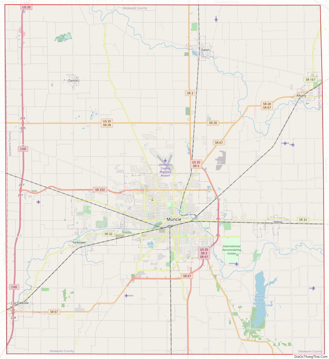
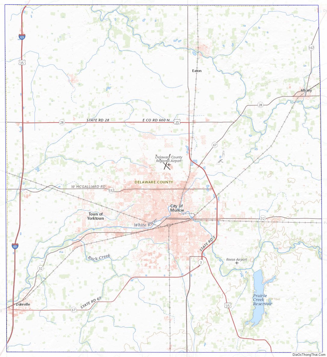
Delaware County Road Map
Geography
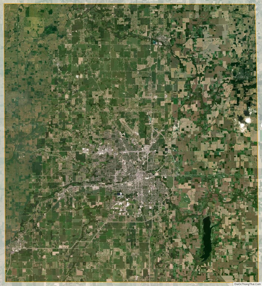
Delaware County consists of low rolling prairie, accented by waterways. The Mississinewa River flows westward through the northern part of the county while the White River runs westward through the central part of the county, through Muncie. A large reservoir, Prairie Creek Reservoir, SE of Muncie is managed by the city. The soil is fertile. The county’s high point is a hilly area in its SE corner, 4 miles (6 km) ESE from Prairie Creek Reservoir.
According to the 2010 census, the county has a total area of 395.91 square miles (1,025.4 km), of which 392.12 square miles (1,015.6 km) (or 99.04%) is land and 3.78 square miles (9.8 km) (or 0.95%) is water.
Major highways
- Interstate 69
- U.S. Route 35
- State Road 3
- State Road 28
- State Road 32
- State Road 67
- State Road 167
- State Road 332
Adjacent counties
- Blackford County – north
- Jay County – northeast
- Randolph County – east
- Henry County – south
- Madison County – west
- Grant County – northwest
Cities and towns
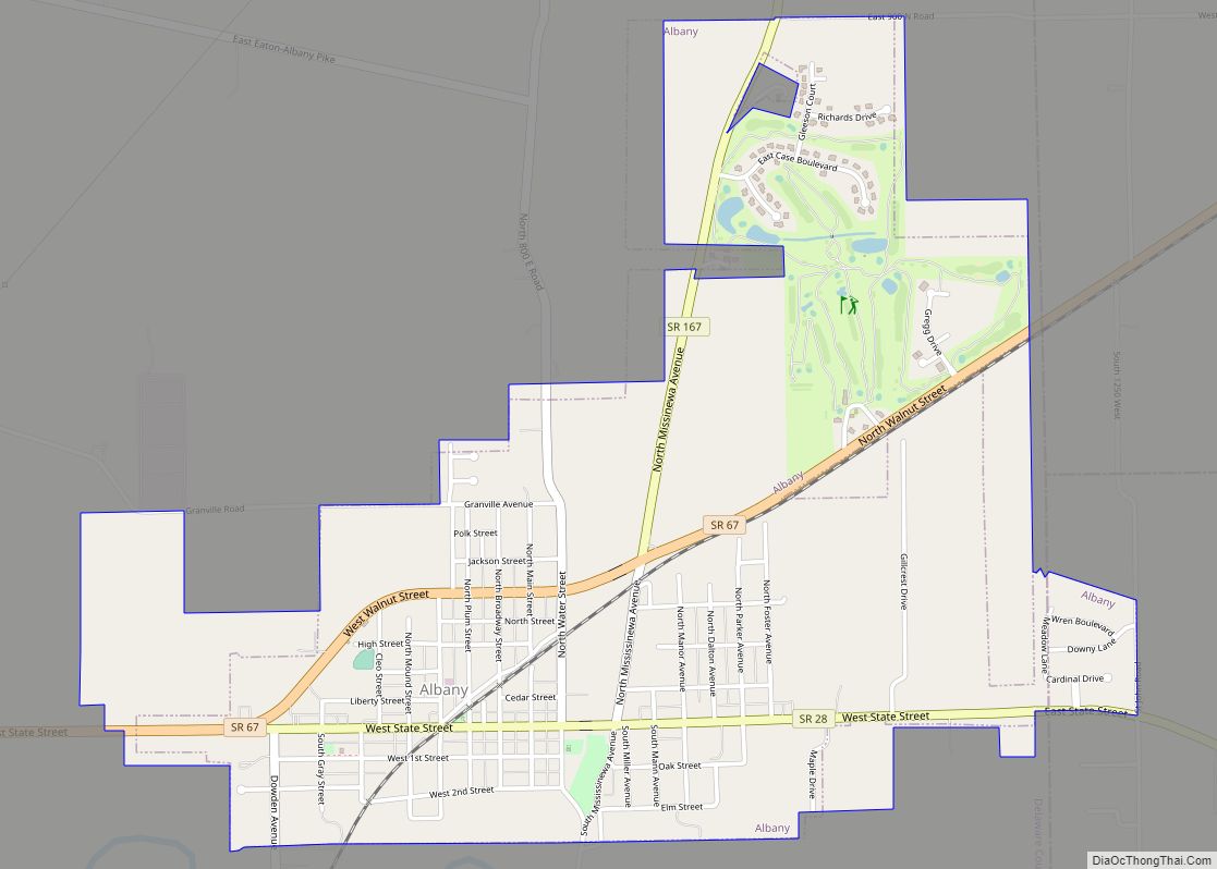
- Albany – town
- Chesterfield – town
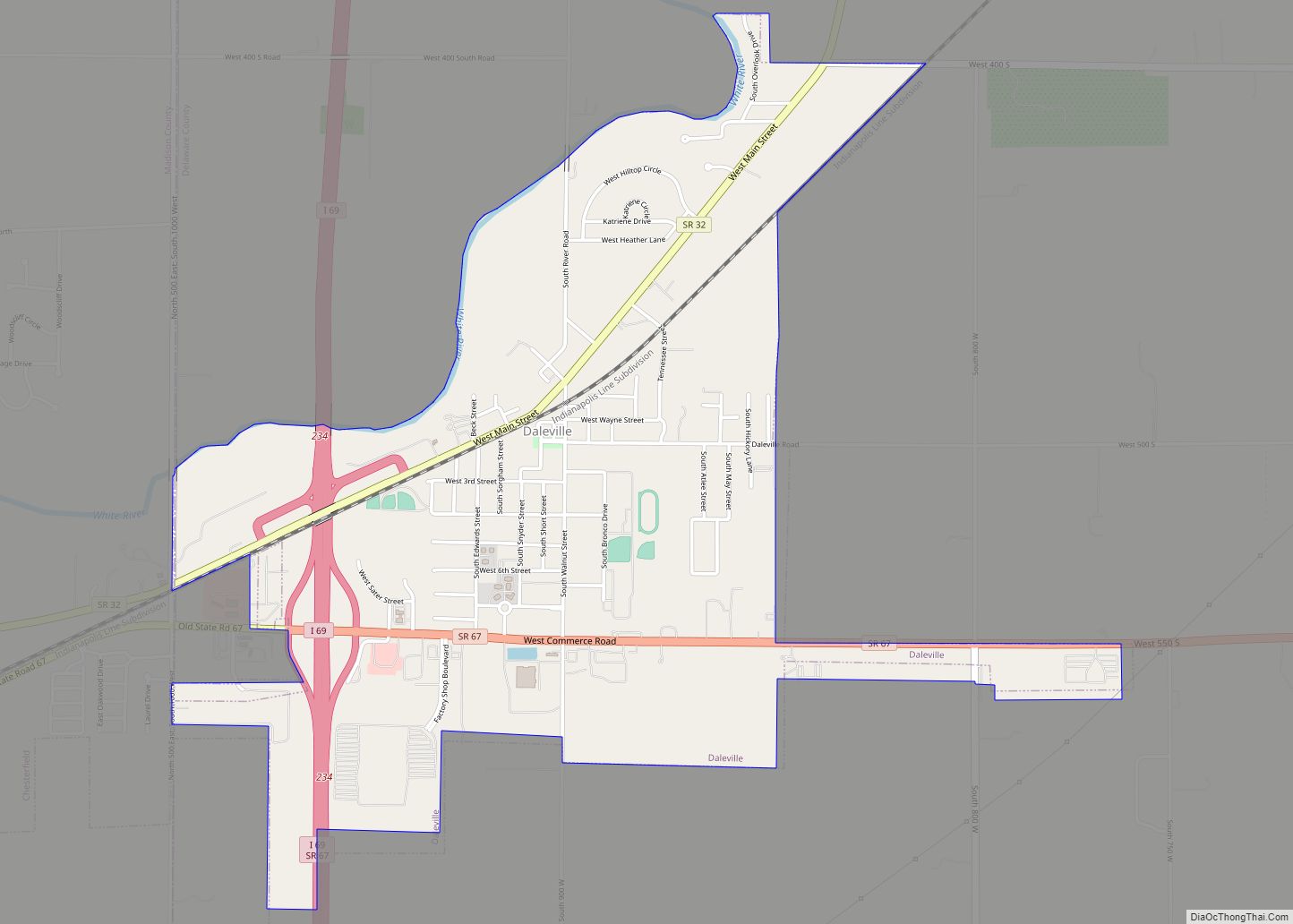
- Daleville – town
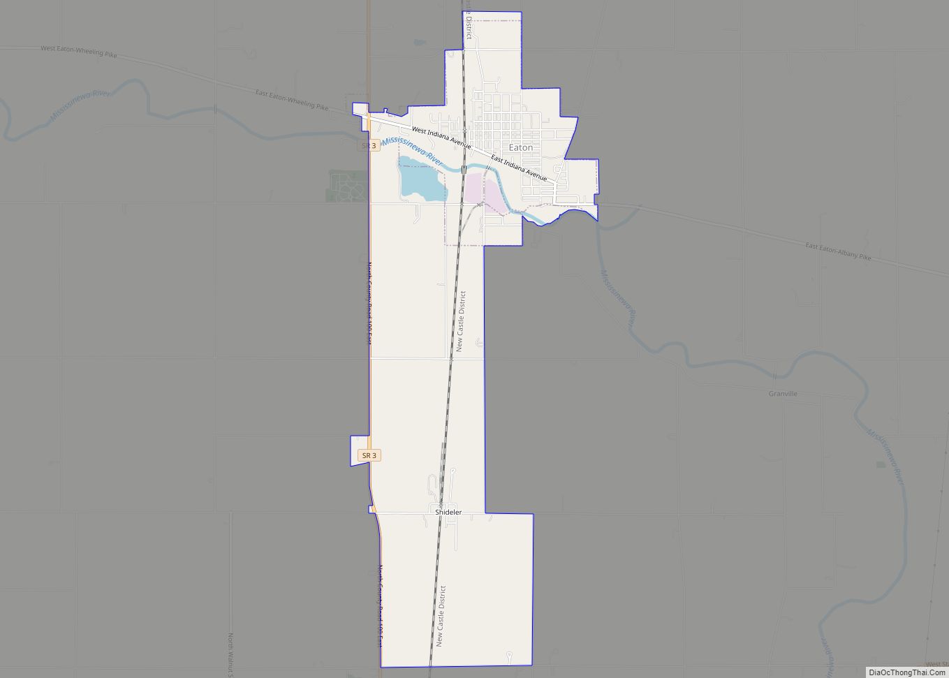
- Eaton – town
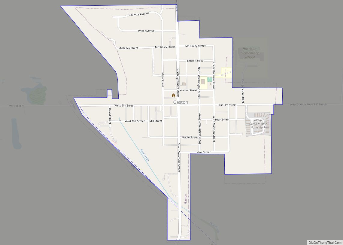
- Gaston – town
- Muncie – city
- Selma – town
- Yorktown – town
Unincorporated communities
- Anthony
- Bethel
- Cammack
- Cowan
- Cross Roads
- DeSoto
- Gates Corner
- Granville
- Janney
- Medford
- Middletown Park
- Mt Pleasant
- New Burlington
- Oakville
- Progress
- Reed Station
- Royerton
- Smithfield
- Stockport
- West Muncie
- Wheeling
Townships
- Center
- Delaware
- Hamilton
- Harrison
- Liberty
- Monroe
- Mount Pleasant
- Niles
- Perry
- Salem
- Union
- Washington
Delaware County Topographic Map
Delaware County Satellite Map
Delaware County Outline Map