Selma is a town in Liberty Township, Delaware County, Indiana, United States. As of the 2020 census, the town had a total population of 747. It is part of the Muncie, IN Metropolitan Statistical Area.
| Name: | Selma town |
|---|---|
| LSAD Code: | 43 |
| LSAD Description: | town (suffix) |
| State: | Indiana |
| County: | Delaware County |
| Elevation: | 1,010 ft (308 m) |
| Total Area: | 0.90 sq mi (2.33 km²) |
| Land Area: | 0.90 sq mi (2.32 km²) |
| Water Area: | 0.00 sq mi (0.01 km²) |
| Total Population: | 747 |
| Population Density: | 834.64/sq mi (322.17/km²) |
| ZIP code: | 47383 |
| Area code: | 765 |
| FIPS code: | 1868706 |
| GNISfeature ID: | 0443212 |
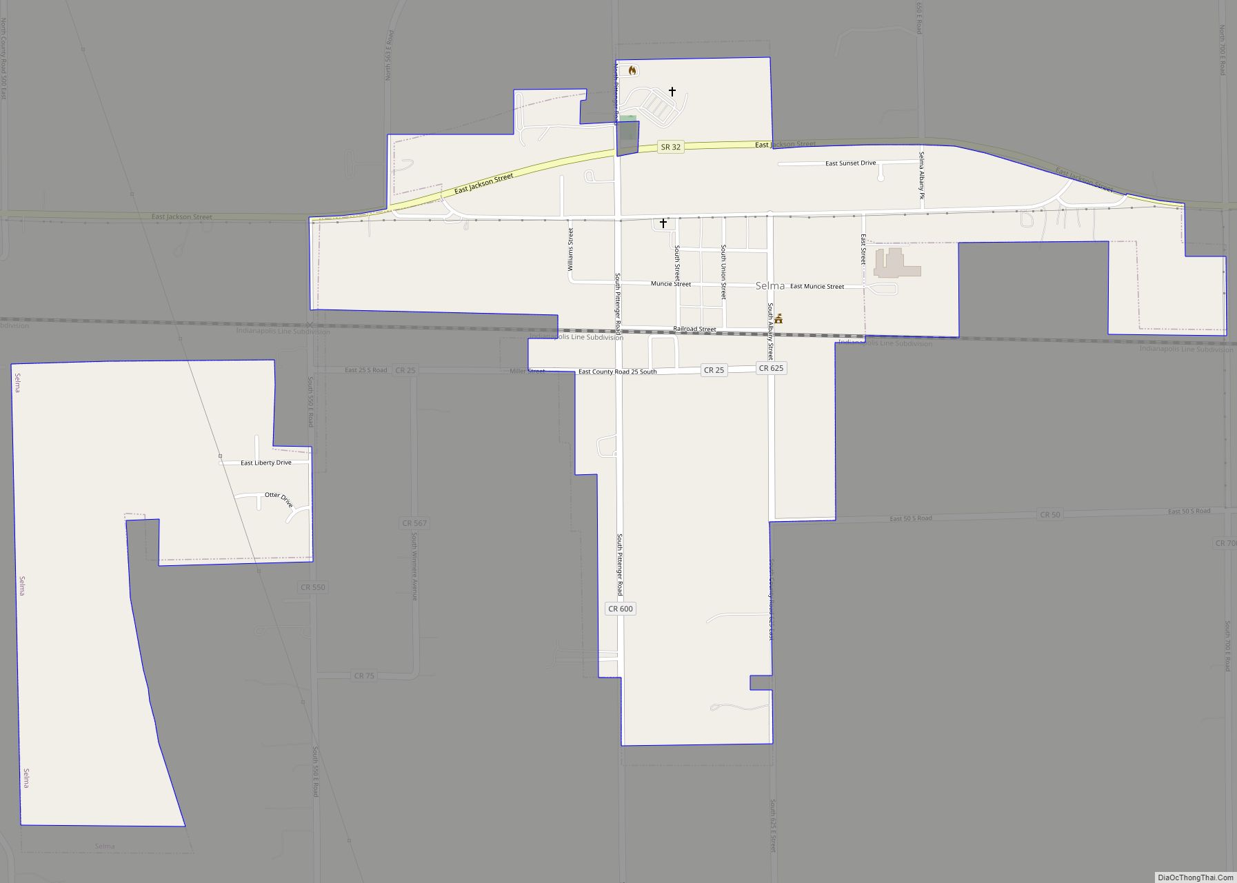
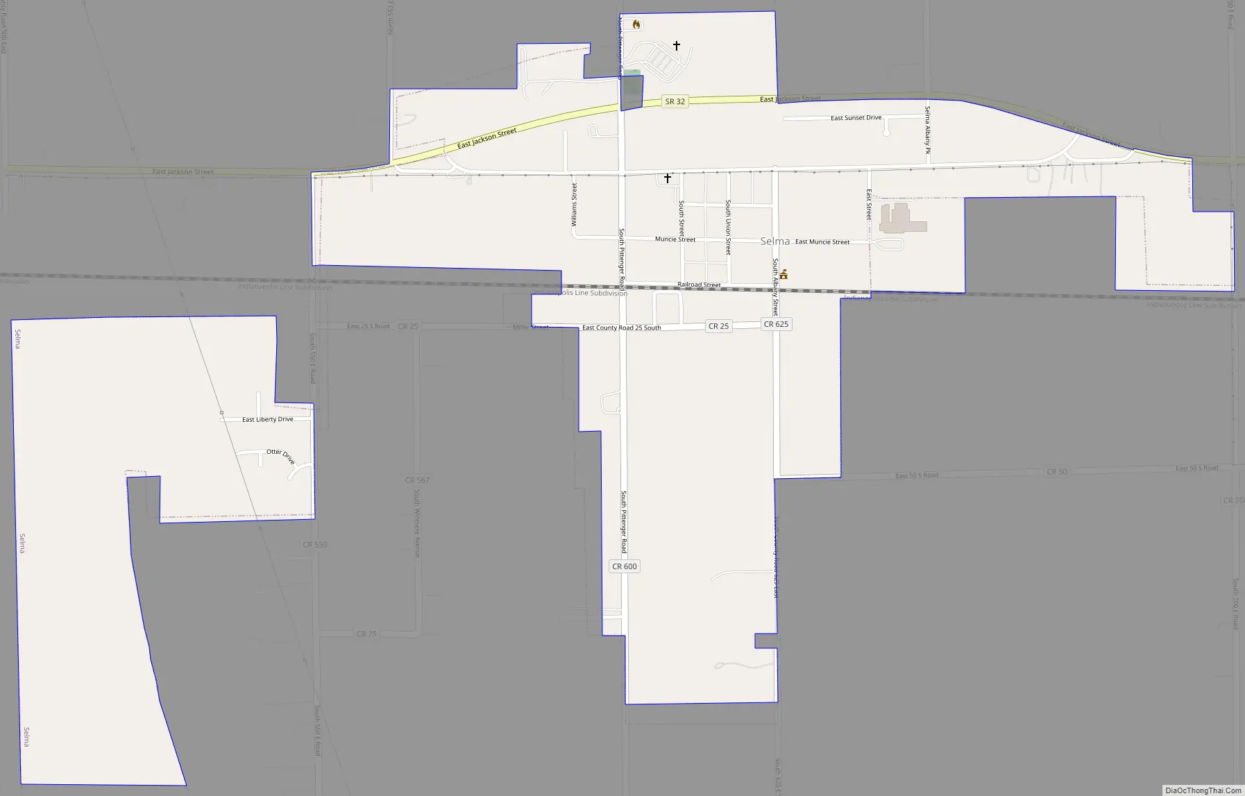
Online Interactive Map
Click on ![]() to view map in "full screen" mode.
to view map in "full screen" mode.
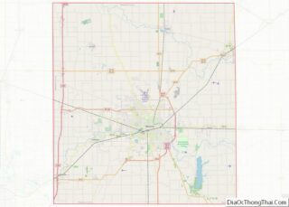
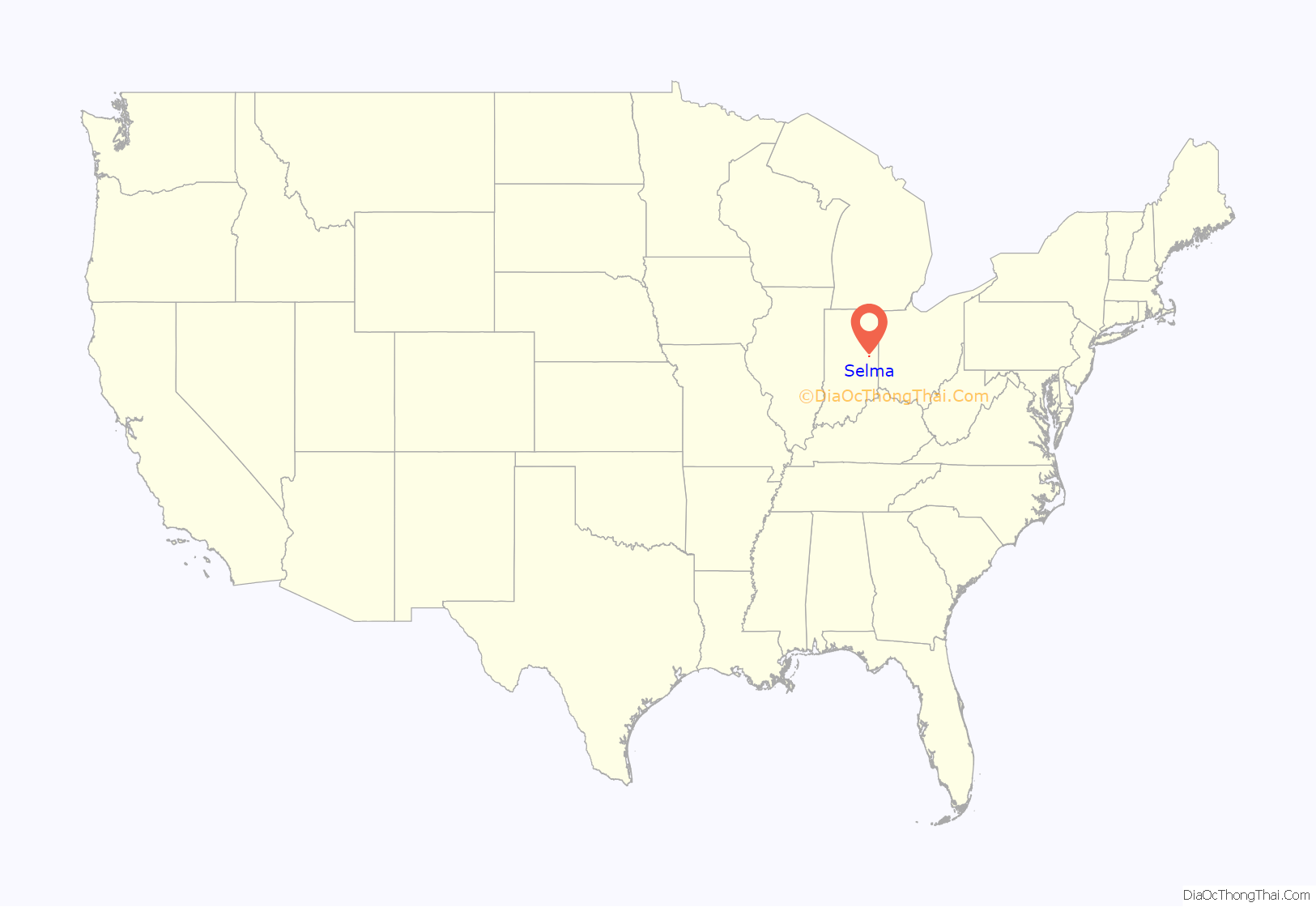
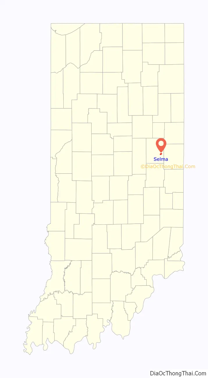
Selma location map. Where is Selma town?
History
Selma was platted in 1852 when the railroad was extended to that point. The Selma post office was established in 1853.
Affected by the Indiana Gas Boom, gas and oil were the primary industries of Selma in the late 19th and early 20th centuries. Selma was incorporated as a town in 1907.
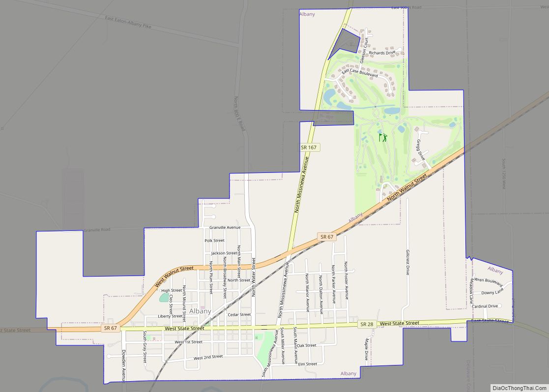
Selma Road Map
Selma city Satellite Map

Geography
Selma is located at 40°11′28″N 85°16′21″W / 40.19111°N 85.27250°W / 40.19111; -85.27250 (40.191147, -85.272440). Indiana State Road 32 runs along the northern edge of the town.
According to the 2010 census, Selma has a total area of 0.912 square miles (2.36 km), of which 0.91 square miles (2.36 km) (or 99.78%) is land and 0.002 square miles (0.01 km) (or 0.22%) is water.
See also
Map of Indiana State and its subdivision:- Adams
- Allen
- Bartholomew
- Benton
- Blackford
- Boone
- Brown
- Carroll
- Cass
- Clark
- Clay
- Clinton
- Crawford
- Daviess
- De Kalb
- Dearborn
- Decatur
- Delaware
- Dubois
- Elkhart
- Fayette
- Floyd
- Fountain
- Franklin
- Fulton
- Gibson
- Grant
- Greene
- Hamilton
- Hancock
- Harrison
- Hendricks
- Henry
- Howard
- Huntington
- Jackson
- Jasper
- Jay
- Jefferson
- Jennings
- Johnson
- Knox
- Kosciusko
- LaGrange
- Lake
- Lake Michigan
- LaPorte
- Lawrence
- Madison
- Marion
- Marshall
- Martin
- Miami
- Monroe
- Montgomery
- Morgan
- Newton
- Noble
- Ohio
- Orange
- Owen
- Parke
- Perry
- Pike
- Porter
- Posey
- Pulaski
- Putnam
- Randolph
- Ripley
- Rush
- Saint Joseph
- Scott
- Shelby
- Spencer
- Starke
- Steuben
- Sullivan
- Switzerland
- Tippecanoe
- Tipton
- Union
- Vanderburgh
- Vermillion
- Vigo
- Wabash
- Warren
- Warrick
- Washington
- Wayne
- Wells
- White
- Whitley
- Alabama
- Alaska
- Arizona
- Arkansas
- California
- Colorado
- Connecticut
- Delaware
- District of Columbia
- Florida
- Georgia
- Hawaii
- Idaho
- Illinois
- Indiana
- Iowa
- Kansas
- Kentucky
- Louisiana
- Maine
- Maryland
- Massachusetts
- Michigan
- Minnesota
- Mississippi
- Missouri
- Montana
- Nebraska
- Nevada
- New Hampshire
- New Jersey
- New Mexico
- New York
- North Carolina
- North Dakota
- Ohio
- Oklahoma
- Oregon
- Pennsylvania
- Rhode Island
- South Carolina
- South Dakota
- Tennessee
- Texas
- Utah
- Vermont
- Virginia
- Washington
- West Virginia
- Wisconsin
- Wyoming