Eaton is a town in Union Township, Delaware County, Indiana, along the Mississinewa River. The population was 1,595 at the 2020 census. It is part of the Muncie, IN Metropolitan Statistical Area.
| Name: | Eaton town |
|---|---|
| LSAD Code: | 43 |
| LSAD Description: | town (suffix) |
| State: | Indiana |
| County: | Delaware County |
| Elevation: | 886 ft (270 m) |
| Total Area: | 3.79 sq mi (9.82 km²) |
| Land Area: | 3.73 sq mi (9.65 km²) |
| Water Area: | 0.06 sq mi (0.16 km²) |
| Total Population: | 1,595 |
| Population Density: | 427.96/sq mi (165.25/km²) |
| ZIP code: | 47338 |
| Area code: | 765 |
| FIPS code: | 1820080 |
| GNISfeature ID: | 0433963 |
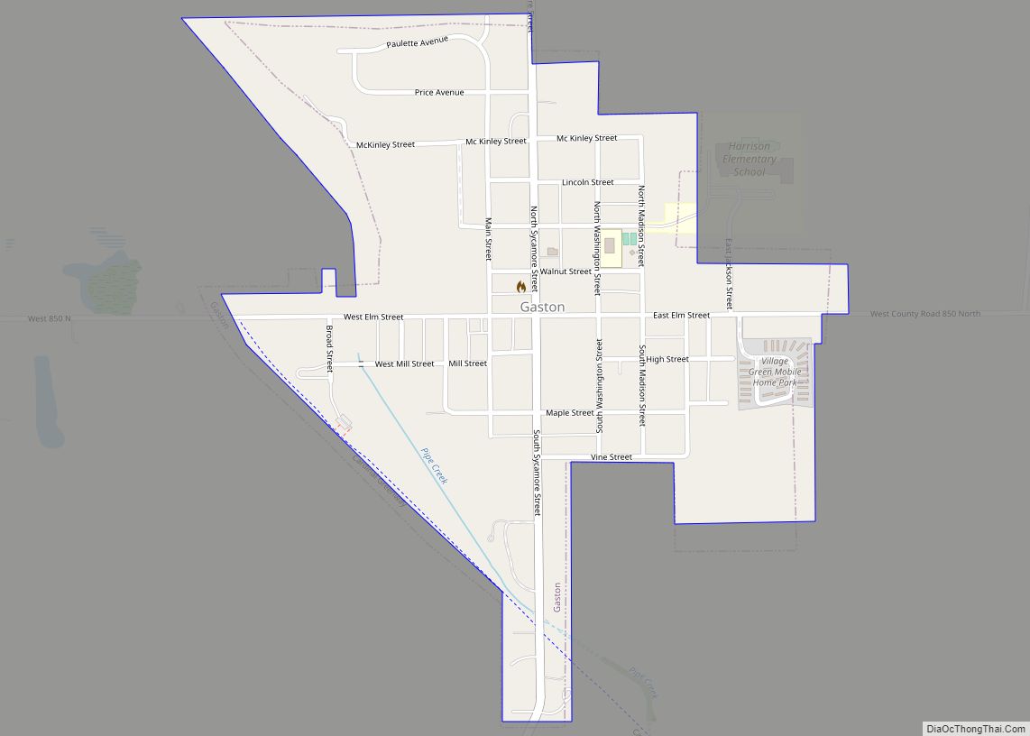
Online Interactive Map
Click on ![]() to view map in "full screen" mode.
to view map in "full screen" mode.
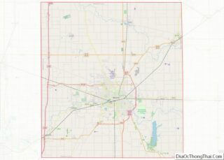
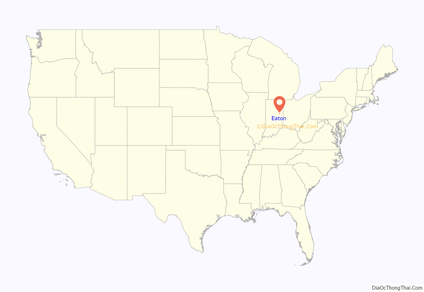
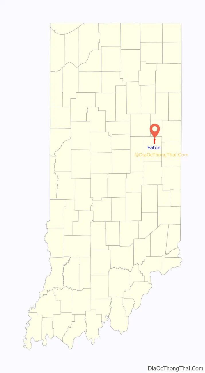
Eaton location map. Where is Eaton town?
History
Eaton was laid out and platted in 1854. The town incorporated as a village in 1873, soon after the railroad had been built through the neighborhood.
The first discovery of natural gas in Indiana occurred in the town of Eaton in 1876. The discovery set off the Indiana Gas Boom, leading to two decades of rapid regional growth.
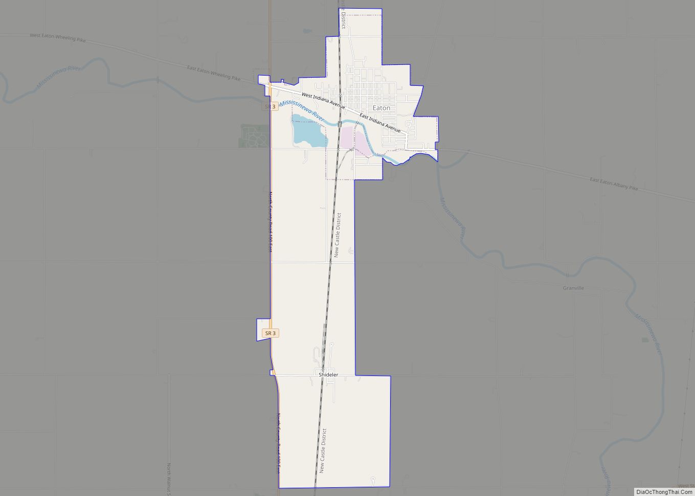
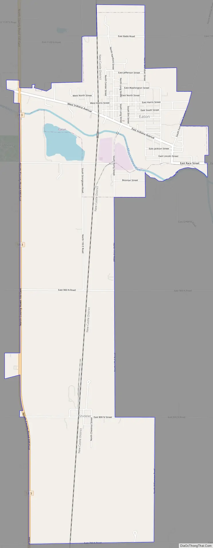
Eaton Road Map
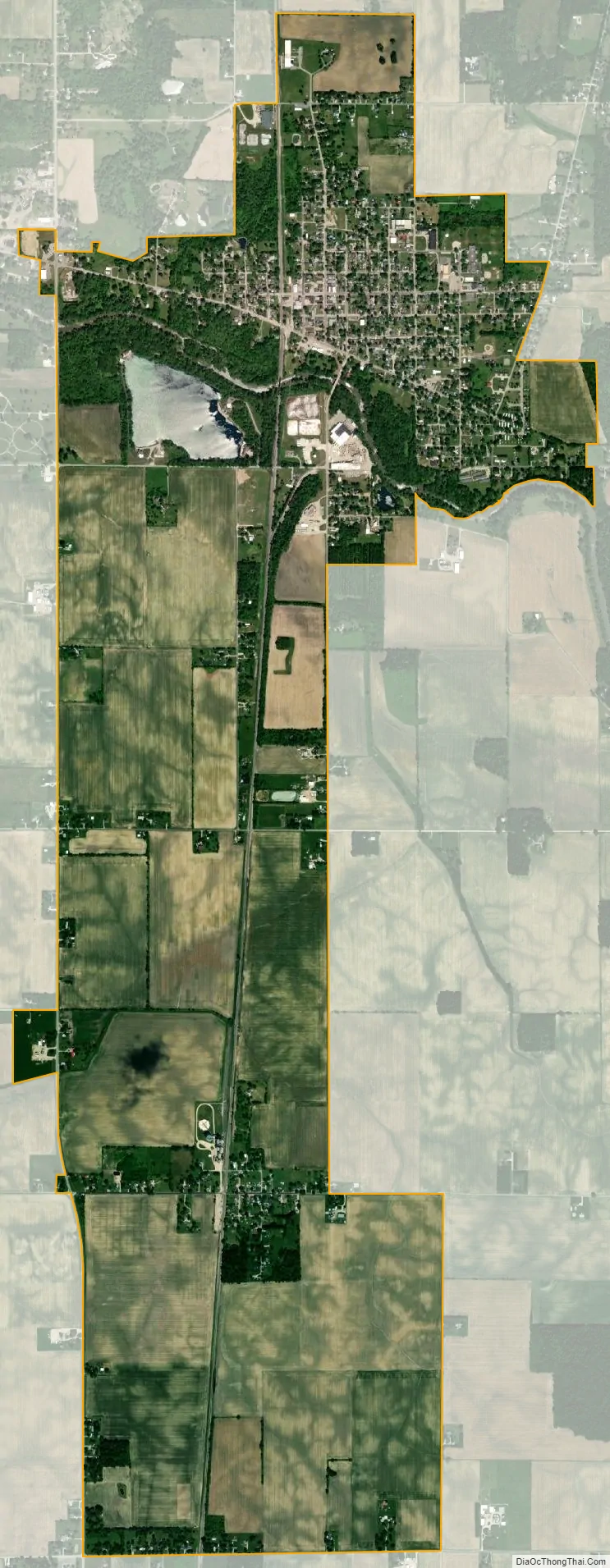
Eaton city Satellite Map
Geography
Eaton is located at 40°20′23″N 85°21′13″W / 40.33972°N 85.35361°W / 40.33972; -85.35361 (40.339675, -85.353746).
According to the 2010 census, Eaton has a total area of 3.76 square miles (9.74 km), of which 3.7 square miles (9.58 km) (or 98.4%) is land and 0.06 square miles (0.16 km) (or 1.6%) is water.
See also
Map of Indiana State and its subdivision:- Adams
- Allen
- Bartholomew
- Benton
- Blackford
- Boone
- Brown
- Carroll
- Cass
- Clark
- Clay
- Clinton
- Crawford
- Daviess
- De Kalb
- Dearborn
- Decatur
- Delaware
- Dubois
- Elkhart
- Fayette
- Floyd
- Fountain
- Franklin
- Fulton
- Gibson
- Grant
- Greene
- Hamilton
- Hancock
- Harrison
- Hendricks
- Henry
- Howard
- Huntington
- Jackson
- Jasper
- Jay
- Jefferson
- Jennings
- Johnson
- Knox
- Kosciusko
- LaGrange
- Lake
- Lake Michigan
- LaPorte
- Lawrence
- Madison
- Marion
- Marshall
- Martin
- Miami
- Monroe
- Montgomery
- Morgan
- Newton
- Noble
- Ohio
- Orange
- Owen
- Parke
- Perry
- Pike
- Porter
- Posey
- Pulaski
- Putnam
- Randolph
- Ripley
- Rush
- Saint Joseph
- Scott
- Shelby
- Spencer
- Starke
- Steuben
- Sullivan
- Switzerland
- Tippecanoe
- Tipton
- Union
- Vanderburgh
- Vermillion
- Vigo
- Wabash
- Warren
- Warrick
- Washington
- Wayne
- Wells
- White
- Whitley
- Alabama
- Alaska
- Arizona
- Arkansas
- California
- Colorado
- Connecticut
- Delaware
- District of Columbia
- Florida
- Georgia
- Hawaii
- Idaho
- Illinois
- Indiana
- Iowa
- Kansas
- Kentucky
- Louisiana
- Maine
- Maryland
- Massachusetts
- Michigan
- Minnesota
- Mississippi
- Missouri
- Montana
- Nebraska
- Nevada
- New Hampshire
- New Jersey
- New Mexico
- New York
- North Carolina
- North Dakota
- Ohio
- Oklahoma
- Oregon
- Pennsylvania
- Rhode Island
- South Carolina
- South Dakota
- Tennessee
- Texas
- Utah
- Vermont
- Virginia
- Washington
- West Virginia
- Wisconsin
- Wyoming