New Castle is a city in and the county seat of Lawrence County, Pennsylvania, United States. It is 50 miles (80 km) northwest of Pittsburgh near the Pennsylvania–Ohio border, approximately 18 miles (29 km) southeast of Youngstown, Ohio. As of the 2020 U.S. census, the city had a population of 21,926.
New Castle is the commercial center of a fertile agricultural region, officially the New Castle micropolitan area, which had a population of 86,070 in 2020. The city also anchors the northwestern part of the Pittsburgh–New Castle–Weirton combined statistical area.
| Name: | New Castle city |
|---|---|
| LSAD Code: | 25 |
| LSAD Description: | city (suffix) |
| State: | Pennsylvania |
| County: | Lawrence County |
| Incorporated: | 1869 (city) |
| Land Area: | 8.31 sq mi (21.52 km²) |
| Water Area: | 0.24 sq mi (0.62 km²) |
| Population Density: | 2,639.46/sq mi (1,019.09/km²) |
| ZIP code: | 16101, 16102, 16103, 16105, 16107, 16108 |
| FIPS code: | 4253368 |
| Website: | www.newcastlepa.org |
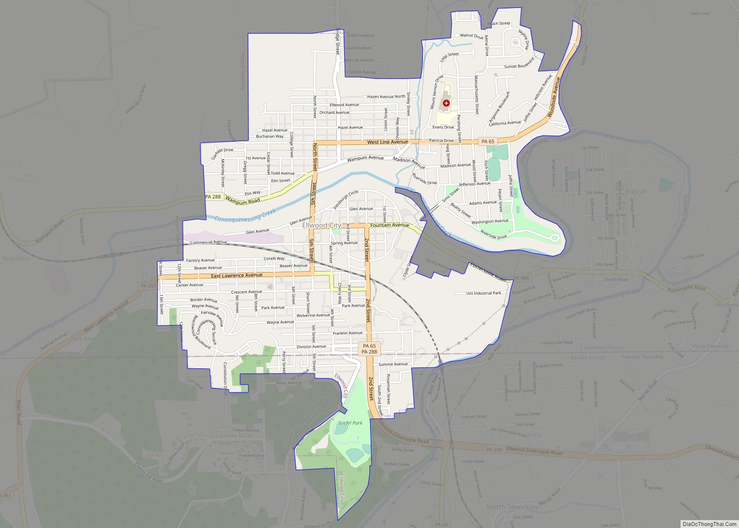
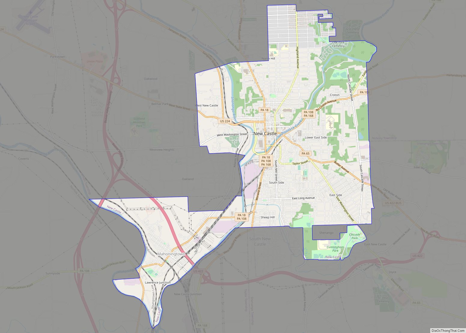
Online Interactive Map
Click on ![]() to view map in "full screen" mode.
to view map in "full screen" mode.
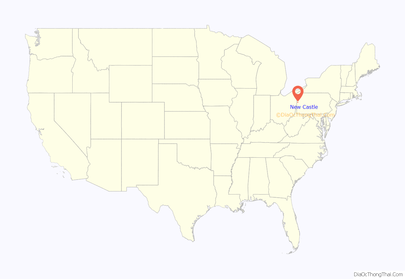
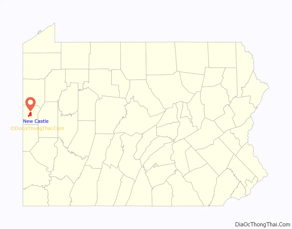
New Castle location map. Where is New Castle city?
History
18th century
In 1798, John Carlysle Stewart, a civil engineer, traveled to western Pennsylvania to resurvey the “donation lands”, which had been reserved for veterans of the Revolutionary War. He discovered that the original survey had neglected to stake out approximately 50 acres (20 ha) at the confluence of the Shenango River and Neshannock Creek, at that time a part of Allegheny County. The Indian town of Kuskusky was listed on early maps in this location. Claiming the land for himself, he laid out in April 1798 what was to become the town of New Castle. It comprised approximately that same 50 acres (20 ha), in what was then part of Allegheny County.
19th century
In 1825, New Castle became a borough, having a population of about 300. The city later became a part of Mercer County. On April 5, 1849, the governor of Pennsylvania signed an act creating Lawrence County, named in honor of U.S. Navy Captain James Lawrence. New Castle became a city in 1869 and was headed by its first mayor, Thomas B. Morgan. At that time, the population had increased to about 6,000.
In 1849, a group of Old Order Amish families from Mifflin County, Pennsylvania, settled just north of New Castle in New Wilmington. Later migrations from Holmes County, Ohio, would make this Amish community one of the largest in Pennsylvania. Approximately 2,000 Amish live and work presently in the townships north of New Castle.
Business in New Castle began to flourish in the early 19th century with the construction of the Beaver and Erie Canal system, which made its way through the city. Numerous manufacturing plants became located in New Castle because of the availability of transportation facilities and ready access to raw material markets. The canal system was later supplemented and then replaced by railroads which offered greater speed and capacity for freight, as well as year-round service.
In the 1870s, the city became a major hub of the Pittsburgh and Lake Erie Railroad. New Castle’s population swelled from 11,600 in 1890 to 28,339 in 1900, and to 38,280 in 1910, as immigrants, particularly from Italy, flocked to the city to work in the mills and nearby limestone quarries. Italian laborers of the era were frequent victims of the Black Hand society, which employed blackmail and extortion to rob the workers of their pay. In 1907 the headquarters of the Black Hand for the entire region was discovered in the village of Hillsville a few miles west of New Castle. By this time New Castle was one of the fastest-growing cities in the country, and with the construction of the largest tin plate mill in America, the city became the tin plate capital of the world. The tin plate industry marked a new increase in the city’s prosperity.
20th century
In 1908, New Castle was linked to Pittsburgh by the Pittsburgh, Harmony, Butler and New Castle Railway, an interurban trolley line. Steel and paper mills, foundries, a bronze bushing factory, and car-construction plants contributed to the region’s economy. Shenango China produced commercial china and created the fine Castleton China line for the White House, including dinnerware for Presidents Dwight D. Eisenhower and Lyndon B. Johnson. Other ceramic factories produced bathroom fixtures and industrial refractory materials.
In the 1920s, New Castle enjoyed its greatest prosperity. The landscape of the city was transformed with the building of many beautiful structures, some of which still stand, such as the Scottish Rite Cathedral, St. Mary’s Church, and the Castleton Hotel. The city also established its identity. New Castle is known both as the “hot dog capital of the world” and the “fireworks capital of America”. Its chili dogs are the product of Greek immigrants who came to New Castle in the early 20th century and established restaurants along with their homes. The renown for fireworks is credited to two local fireworks companies of international stature, S.Vitale Pyrotechnic Industries, Inc. (Pyrotecnico) and Zambelli Internationale. The first fireworks manufacturer in New Castle was Leopold Fazzoni, who owned and operated the Fazzoni Brothers Fireworks Company. Fazzoni came to New Castle from Italy in 1886 and worked in the tin mills to earn enough money to start his own business. He was issued the first certificate for fireworks manufacturing in the state. Of the people who worked with the Fazzoni family, many founded their own businesses, such as Paul Rozzi, Jacob Conti, Constantino Vitale, and Joseph Zambelli.
Despite recent economic challenges, the city continues to serve as the headquarters of Pyrotecnico Fireworks, the winner of the 2008 Gold Jupiter, awarded at the world’s most prestigious fireworks venue: LaRonde in Montreal, Canada. The company was started by Constantino Vitale in Italy in 1889, who immigrated to New Castle in the 1920s, continuing his business there. Five generations of the Vitale family have transformed the company. In the 1990s the company’s name was changed to Pyrotecnico and has grown to be a world leader in the industry. Also located in New Castle is Zambelli Fireworks, which was founded in New Castle. Zambelli Fireworks is one of the world’s leading fireworks and pyrotechnics companies. These fireworks companies have been featured in venues such as presidential celebrations and Super Bowls. Pyrotecnico and Zambelli Fireworks have changed the face of the fireworks industry. This has gained the city the nickname of “Fireworks Capital of America”. New Castle has recently opened Zambelli Plaza near the Cascade Center in 2007 in honor of the Zambelli family’s accomplishments.
In the 1930s, the city, along with most cities of America, suffered during the Great Depression. During this time, the federal government established the Works Progress Administration (WPA) and the Civilian Conservation Corps (CCC). These programs offered jobs to many displaced workers. Many of the stone walls built by the WPA and the CCC still stand as a reminder of the historic demise of the economy. In the 1940s, industry temporarily surged during wartime.
In 1950, the population peaked at 48,834, but became part of the Rust Belt, with population dwindling to 28,334 by 1990. New Castle is the county seat of Lawrence County which has a population of approximately 91,000.
In 1998, New Castle was a host city for the History Channel Great Race. Over 15,000 spectators gathered downtown for the festivities. The city celebrated its 200th birthday in 1998 with a downtown fireworks festival that attracted over 30,000 people.
The Lawrence County Courthouse, North Hill Historic District, and Scottish Rite Cathedral are listed on the National Register of Historic Places.
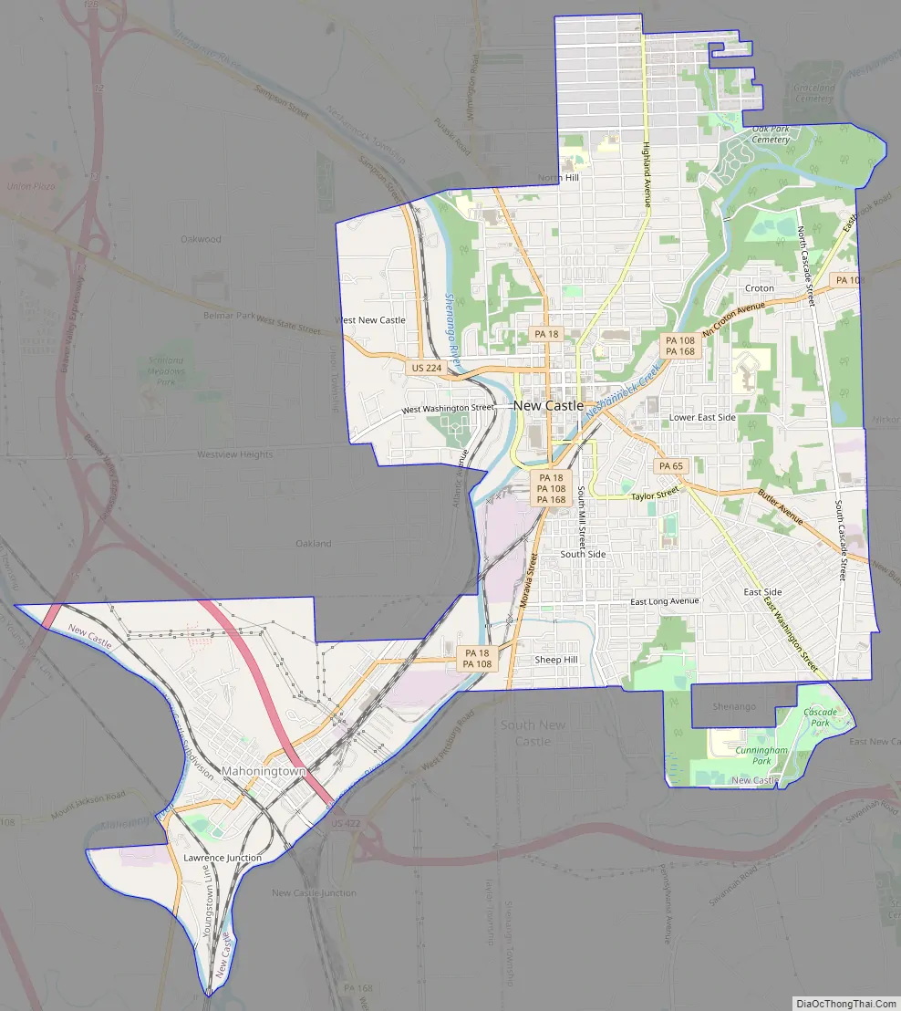
New Castle Road Map
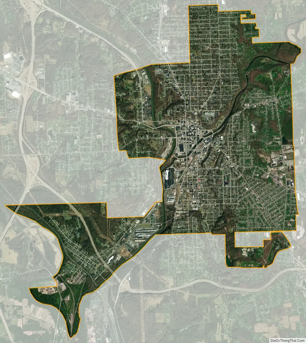
New Castle city Satellite Map
Geography
New Castle is located in the center of Lawrence County at 40°58′50″N 80°20′40″W / 40.98056°N 80.34444°W / 40.98056; -80.34444 (40.997325, −80.344556), along the Shenango River at the mouth of Neshannock Creek.
According to the U.S. Census Bureau, the city has a total area of 8.5 square miles (22.1 km), of which 8.3 square miles (21.5 km) are land and 0.2 square miles (0.6 km), or 2.78%, are water. Via the Shenango River, the city is part of the Beaver River watershed, flowing south to the Ohio River.
Surrounding and adjacent neighborhoods
New Castle has six land borders with townships: Neshannock Township to the north, Hickory Township to the northeast, Shenango Township to the southeast, Taylor Township to the south-southwest, North Beaver Township to the southwest, and Union Township to the west. Also to the south is the border with South New Castle.
See also
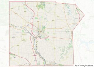
Map of Pennsylvania State and its subdivision:- Adams
- Allegheny
- Armstrong
- Beaver
- Bedford
- Berks
- Blair
- Bradford
- Bucks
- Butler
- Cambria
- Cameron
- Carbon
- Centre
- Chester
- Clarion
- Clearfield
- Clinton
- Columbia
- Crawford
- Cumberland
- Dauphin
- Delaware
- Elk
- Erie
- Fayette
- Forest
- Franklin
- Fulton
- Greene
- Huntingdon
- Indiana
- Jefferson
- Juniata
- Lackawanna
- Lancaster
- Lawrence
- Lebanon
- Lehigh
- Luzerne
- Lycoming
- Mc Kean
- Mercer
- Mifflin
- Monroe
- Montgomery
- Montour
- Northampton
- Northumberland
- Perry
- Philadelphia
- Pike
- Potter
- Schuylkill
- Snyder
- Somerset
- Sullivan
- Susquehanna
- Tioga
- Union
- Venango
- Warren
- Washington
- Wayne
- Westmoreland
- Wyoming
- York
- Alabama
- Alaska
- Arizona
- Arkansas
- California
- Colorado
- Connecticut
- Delaware
- District of Columbia
- Florida
- Georgia
- Hawaii
- Idaho
- Illinois
- Indiana
- Iowa
- Kansas
- Kentucky
- Louisiana
- Maine
- Maryland
- Massachusetts
- Michigan
- Minnesota
- Mississippi
- Missouri
- Montana
- Nebraska
- Nevada
- New Hampshire
- New Jersey
- New Mexico
- New York
- North Carolina
- North Dakota
- Ohio
- Oklahoma
- Oregon
- Pennsylvania
- Rhode Island
- South Carolina
- South Dakota
- Tennessee
- Texas
- Utah
- Vermont
- Virginia
- Washington
- West Virginia
- Wisconsin
- Wyoming