Salem is the county seat of Dent County, Missouri, United States. The population was 4,608 at the 2020 census, which allows Salem to become a Class 3 city in Missouri; however, the city has chosen to remain a Class 4 city under Missouri Revised Statutes. Salem is located a few miles north of the Ozark Scenic Riverways and close to Montauk State Park, which contains the headwaters of the Current River.
The name Salem is derived from the Hebrew word Shalom, meaning “peace”.
| Name: | Salem city |
|---|---|
| LSAD Code: | 25 |
| LSAD Description: | city (suffix) |
| State: | Missouri |
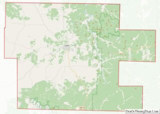
| County: | Dent County |
| Elevation: | 1,168 ft (356 m) |
| Total Area: | 3.48 sq mi (9.01 km²) |
| Land Area: | 3.48 sq mi (9.01 km²) |
| Water Area: | 0.00 sq mi (0.00 km²) |
| Total Population: | 4,608 |
| Population Density: | 1,324.52/sq mi (511.41/km²) |
| ZIP code: | 65560 |
| Area code: | 573 |
| FIPS code: | 2965234 |
| GNISfeature ID: | 2396528 |
| Website: | www.salemmo.com |
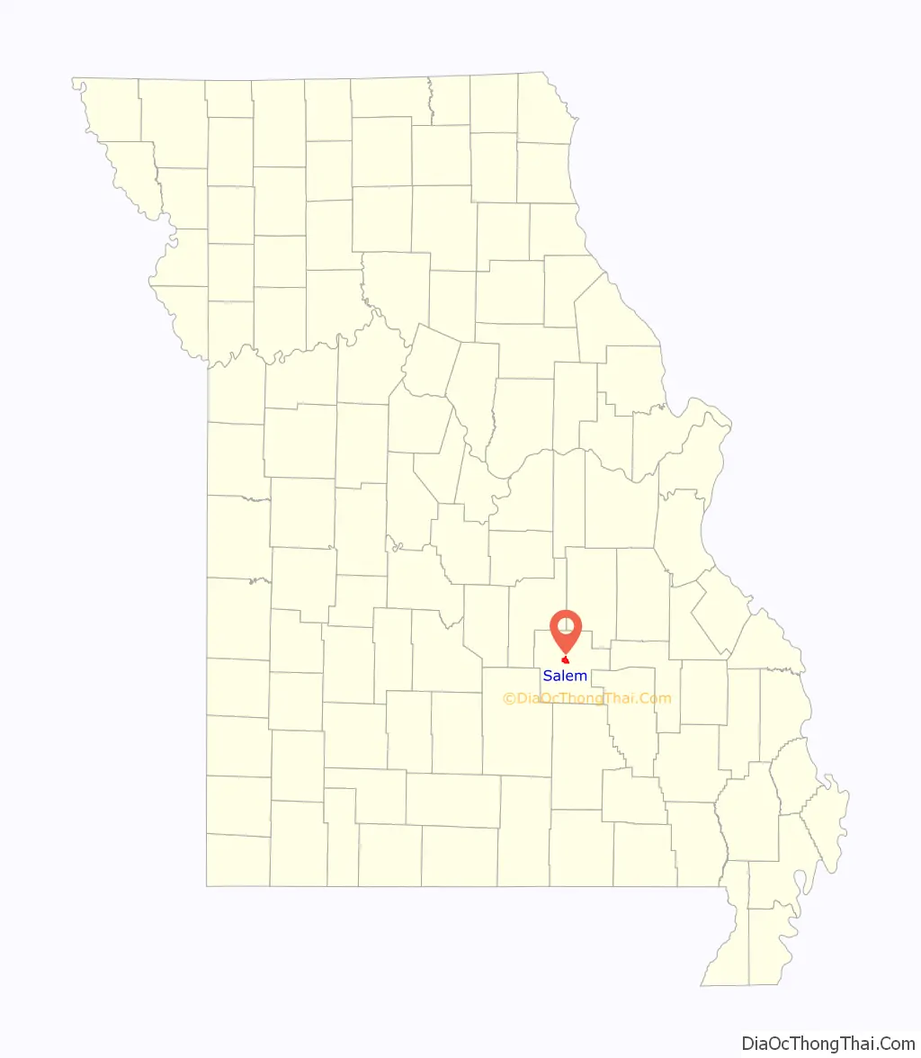
Online Interactive Map
Click on ![]() to view map in "full screen" mode.
to view map in "full screen" mode.
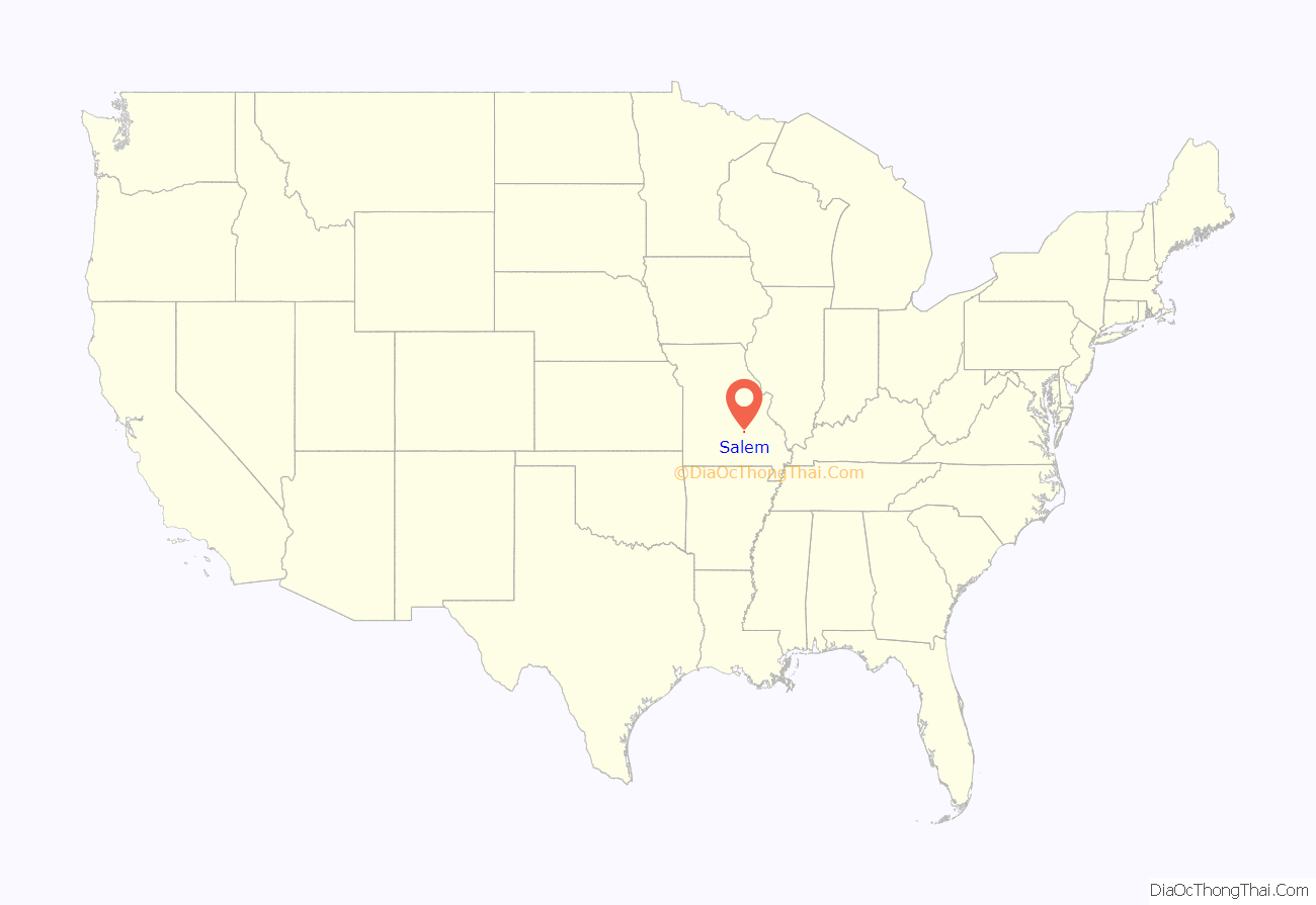
Salem location map. Where is Salem city?
History
Dent County was first explored by Dustin Counts and settled between 1818 and 1829. In 1851, the Missouri Assembly created Dent County from portions of Crawford and Shannon counties. It was named for early settler Lewis Dent, who served as the first representative. A log courthouse, built circa 1851–1852, was Dent County’s first and was located on the Wingfield farm northeast of Salem. W. P. Williams became the first mayor of Salem in 1860, just after the Missouri State Legislature passed laws regarding the administration of village government. During the American Civil War, units of the 5th Missouri State Militia would sometimes garrison in Salem. Village governments were suspended during the Civil War. In 1881, Salem was incorporated as a town. The town’s museums include the Dent County Museum, the Ozark Natural & Cultural Resource Center, the Bonebrake Center of Nature and History, and a historic Downtown Walking Tour.
The Dam and Spillway in the Hatchery Area at Montauk State Park, Dent County Courthouse, Lower Parker School, Montauk State Park Open Shelter, Nova Scotia Ironworks Historic District, Old Mill at Montauk State Park, and W.A. Young House are listed on the National Register of Historic Places.
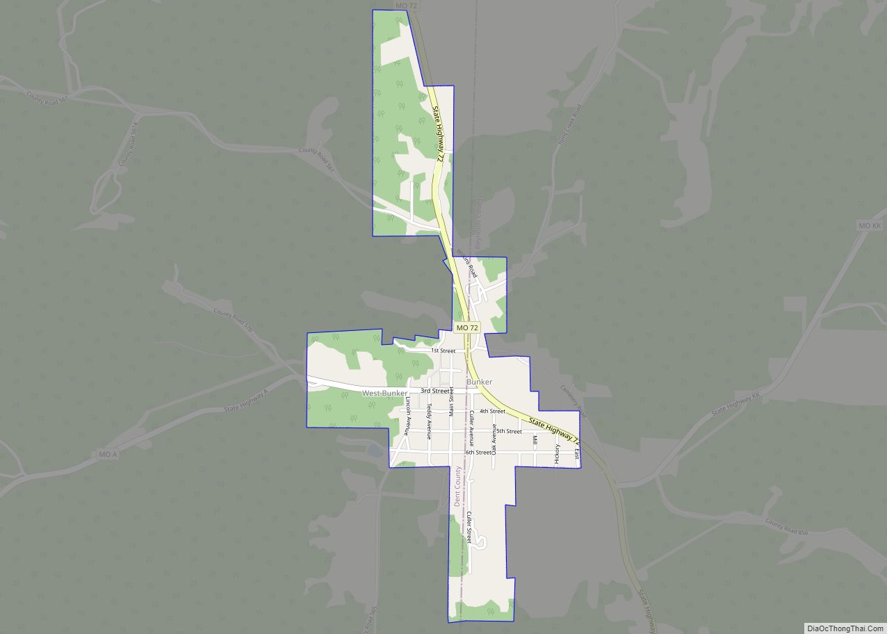
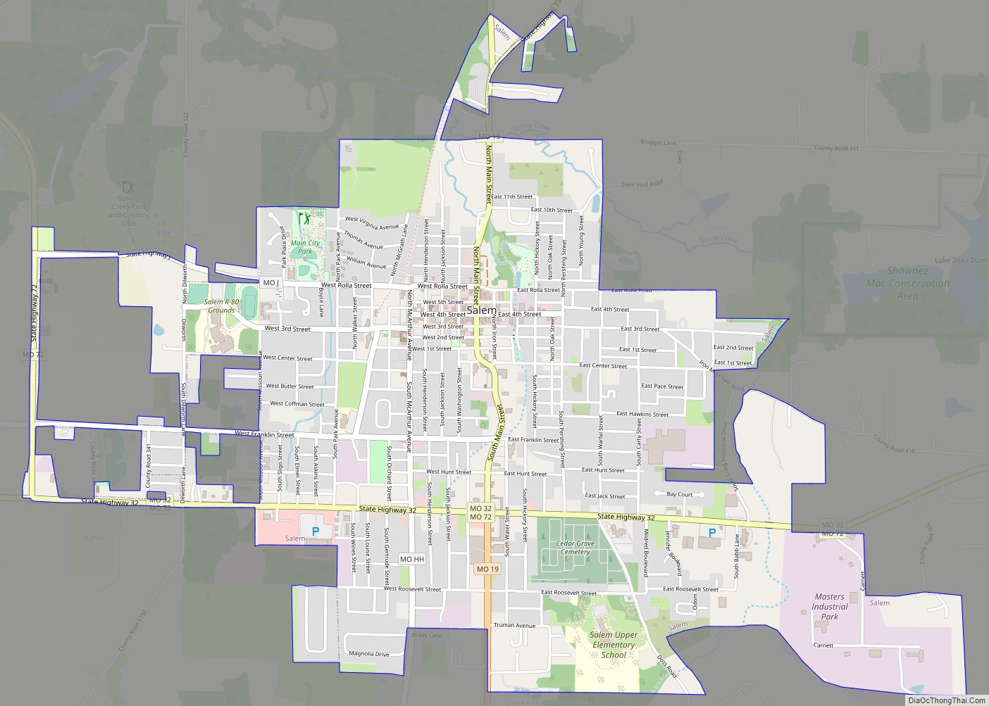
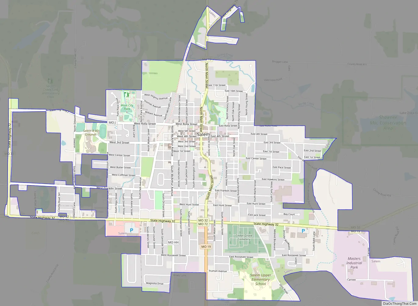
Salem Road Map
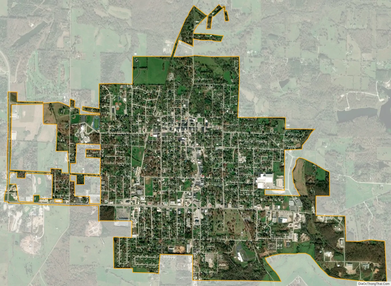
Salem city Satellite Map
Geography
According to the United States Census Bureau, the city has a total area of 3.18 square miles (8.24 km), all land.
Climate
Salem has a humid subtropical climate (Köppen climate classification Cfa). It has cool winters and warm summers with consistent rainfall year-round.
See also
Map of Missouri State and its subdivision:- Adair
- Andrew
- Atchison
- Audrain
- Barry
- Barton
- Bates
- Benton
- Bollinger
- Boone
- Buchanan
- Butler
- Caldwell
- Callaway
- Camden
- Cape Girardeau
- Carroll
- Carter
- Cass
- Cedar
- Chariton
- Christian
- Clark
- Clay
- Clinton
- Cole
- Cooper
- Crawford
- Dade
- Dallas
- Daviess
- De Kalb
- Dent
- Douglas
- Dunklin
- Franklin
- Gasconade
- Gentry
- Greene
- Grundy
- Harrison
- Henry
- Hickory
- Holt
- Howard
- Howell
- Iron
- Jackson
- Jasper
- Jefferson
- Johnson
- Knox
- Laclede
- Lafayette
- Lawrence
- Lewis
- Lincoln
- Linn
- Livingston
- Macon
- Madison
- Maries
- Marion
- McDonald
- Mercer
- Miller
- Mississippi
- Moniteau
- Monroe
- Montgomery
- Morgan
- New Madrid
- Newton
- Nodaway
- Oregon
- Osage
- Ozark
- Pemiscot
- Perry
- Pettis
- Phelps
- Pike
- Platte
- Polk
- Pulaski
- Putnam
- Ralls
- Randolph
- Ray
- Reynolds
- Ripley
- Saint Charles
- Saint Clair
- Saint Francois
- Saint Louis
- Sainte Genevieve
- Saline
- Schuyler
- Scotland
- Scott
- Shannon
- Shelby
- Stoddard
- Stone
- Sullivan
- Taney
- Texas
- Vernon
- Warren
- Washington
- Wayne
- Webster
- Worth
- Wright
- Alabama
- Alaska
- Arizona
- Arkansas
- California
- Colorado
- Connecticut
- Delaware
- District of Columbia
- Florida
- Georgia
- Hawaii
- Idaho
- Illinois
- Indiana
- Iowa
- Kansas
- Kentucky
- Louisiana
- Maine
- Maryland
- Massachusetts
- Michigan
- Minnesota
- Mississippi
- Missouri
- Montana
- Nebraska
- Nevada
- New Hampshire
- New Jersey
- New Mexico
- New York
- North Carolina
- North Dakota
- Ohio
- Oklahoma
- Oregon
- Pennsylvania
- Rhode Island
- South Carolina
- South Dakota
- Tennessee
- Texas
- Utah
- Vermont
- Virginia
- Washington
- West Virginia
- Wisconsin
- Wyoming