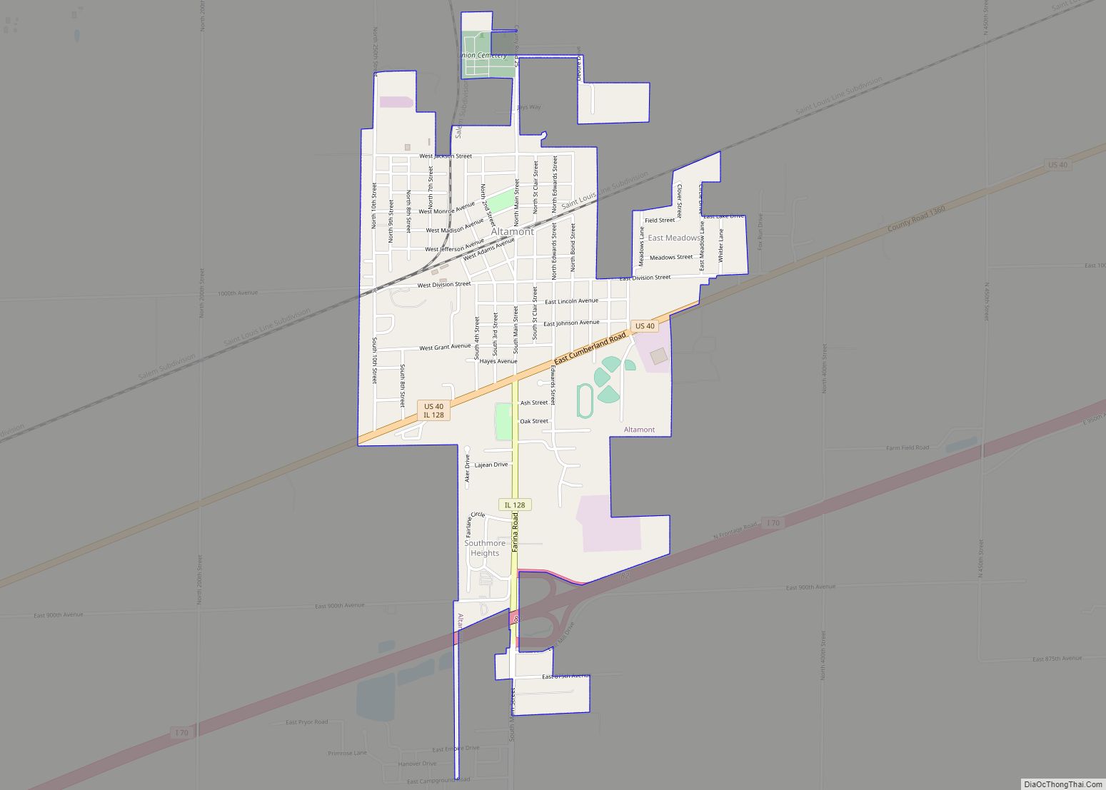
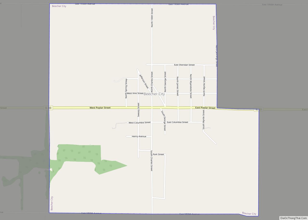
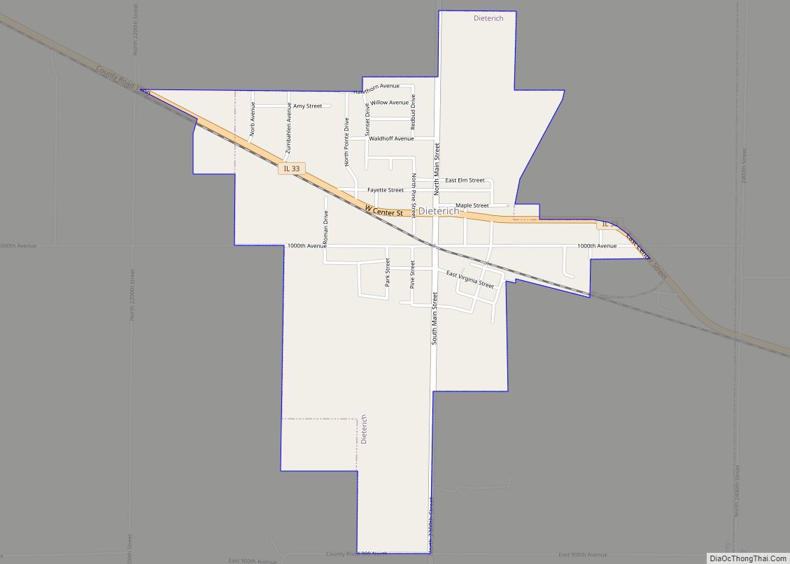
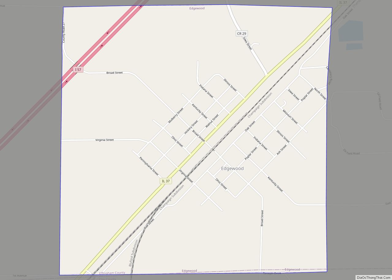
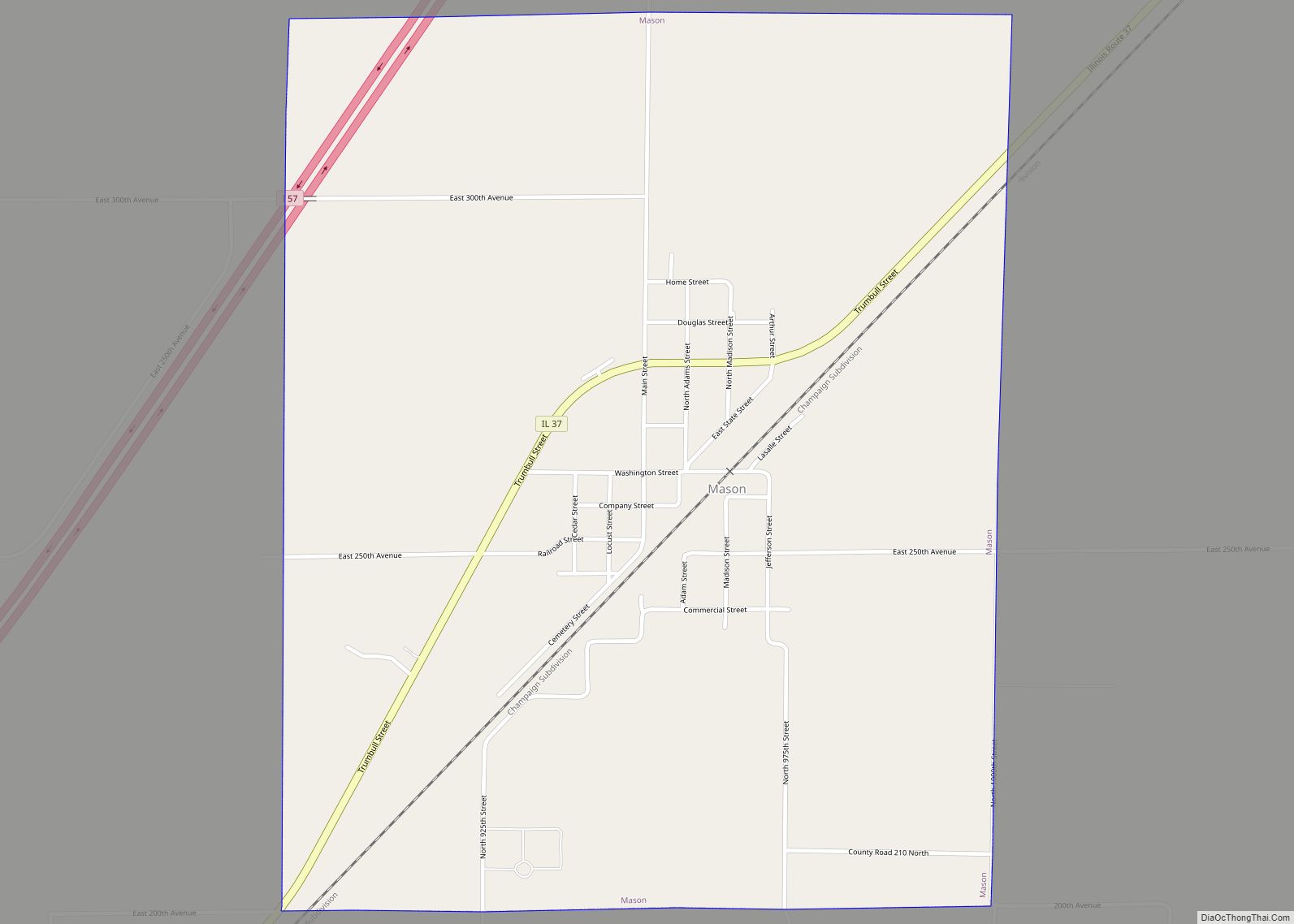
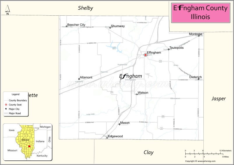
Effingham County is located in the south central part of the U.S. state Illinois. As of the 2020 census, the population was 34,668. Its county seat and largest city is Effingham. Some other cities in Effingham County, Illinois include Altamont, Teutopolis, Beecher City, Montrose, Dieterich, Shumway, Watson, Mason, and Edgewood. Effingham County comprises the Effingham, IL Micropolitan Statistical Area.
| Name: | Effingham County |
|---|---|
| FIPS code: | 17-049 |
| State: | Illinois |
| Founded: | 1831 |
| Named for: | Thomas Howard, 3rd Earl of Effingham |
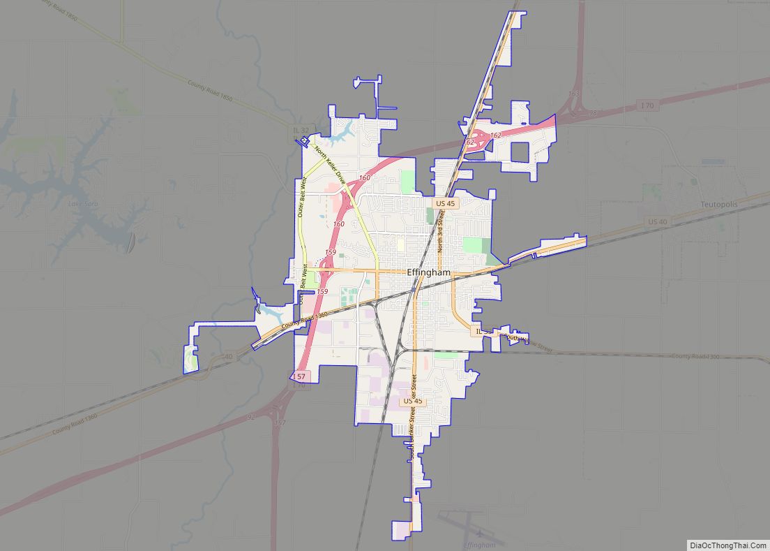
| Seat: | Effingham |
| Largest city: | Effingham |
| Total Area: | 480 sq mi (1,200 km²) |
| Land Area: | 479 sq mi (1,240 km²) |
| Total Population: | 34,668 |
| Population Density: | 72/sq mi (28/km²) |
| Time zone: | UTC−6 (Central) |
| Summer Time Zone (DST): | UTC−5 (CDT) |
| Website: | www.co.effingham.il.us |
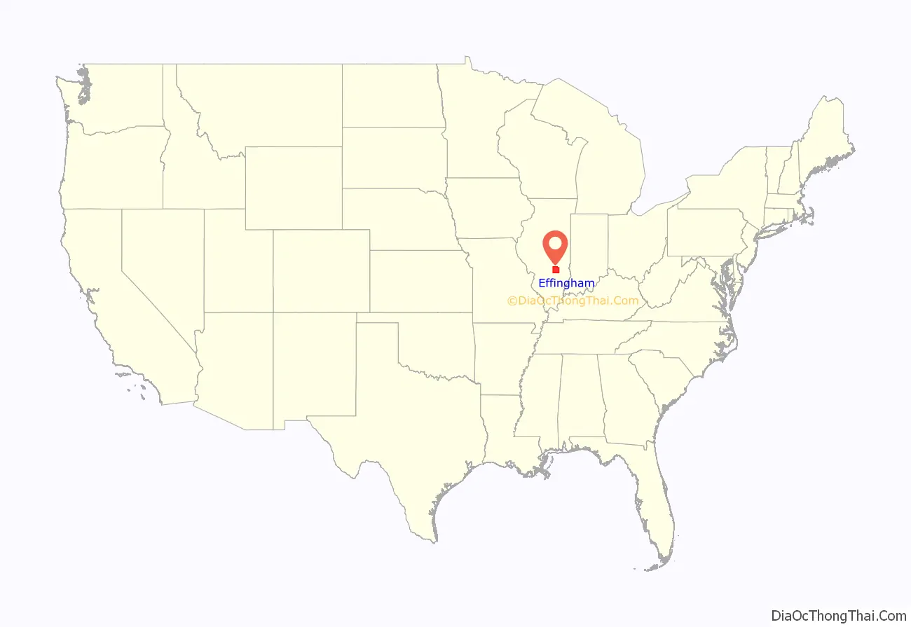
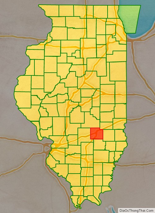
Effingham County location map. Where is Effingham County?
History
Effingham County was formed in 1831 out of Fayette and Crawford counties. It may have been named after Thomas Howard, 3rd Earl of Effingham, who resigned his commission as general in the British army in 1775, refusing to serve in the war against the Colonies. The name is Anglo-Saxon for “Effa’s house”. New information suggests that the county was named after a surveyor who surveyed the area whose last name was Effingham. There is no written proof that the county was named after Lord Effingham.
Effingham County at the time of its creation in 1831
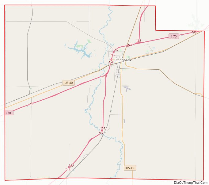
Effingham County Road Map
Geography
According to the U.S. Census Bureau, the county has a total area of 480 square miles (1,200 km), of which 479 square miles (1,240 km) is land and 1.2 square miles (3.1 km) (0.3%) is water.
Just west of Effingham on Interstate 70 there is a 198-foot (60 m) white cross; 35,000 vehicles are estimated to pass the site each day. It is one of the world’s tallest crosses, and took over 200 short tons (180 t) of steel to erect.
Climate and weather
In recent years, average temperatures in the county seat of Effingham have ranged from a low of 18 °F (−8 °C) in January to a high of 87 °F (31 °C) in July, although a record low of −29 °F (−34 °C) was recorded in January 1915 and a record high of 111 °F (44 °C) was recorded in July 1954. Average monthly precipitation ranged from 2.38 inches (60 mm) in January to 4.51 inches (115 mm) in July.
Adjacent counties
- Cumberland County – northeast
- Jasper County – east
- Clay County – south
- Fayette County – west
- Shelby County – northwest
Major highways
- Interstate 57
- Interstate 70
- U.S. Route 40
- U.S. Route 45
- Illinois Route 32
- Illinois Route 33
- Illinois Route 37
- Illinois Route 128
Transit
- Effingham station
- List of intercity bus stops in Illinois
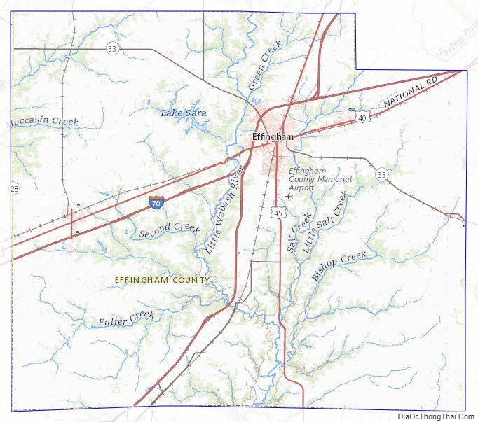
Effingham County Topographic Map
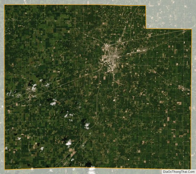
Effingham County Satellite Map
Effingham County Outline Map