Greenville is an incorporated town in Floyd County, Indiana. The population was 595 at the 2010 census. Greenville is located in the greater Louisville metropolitan area.
| Name: | Greenville town |
|---|---|
| LSAD Code: | 43 |
| LSAD Description: | town (suffix) |
| State: | Indiana |
| County: | Floyd County |
| Elevation: | 827 ft (252 m) |
| Total Area: | 0.90 sq mi (2.34 km²) |
| Land Area: | 0.90 sq mi (2.34 km²) |
| Water Area: | 0.00 sq mi (0.00 km²) |
| Total Population: | 1,365 |
| Population Density: | 1,509.96/sq mi (582.88/km²) |
| ZIP code: | 47124 |
| Area code: | 812 & 930 |
| FIPS code: | 1829844 |
| GNISfeature ID: | 0435458 |
| Website: | http://www.visitgreenvillein.com |
Online Interactive Map
Click on ![]() to view map in "full screen" mode.
to view map in "full screen" mode.
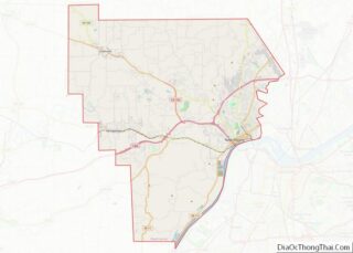
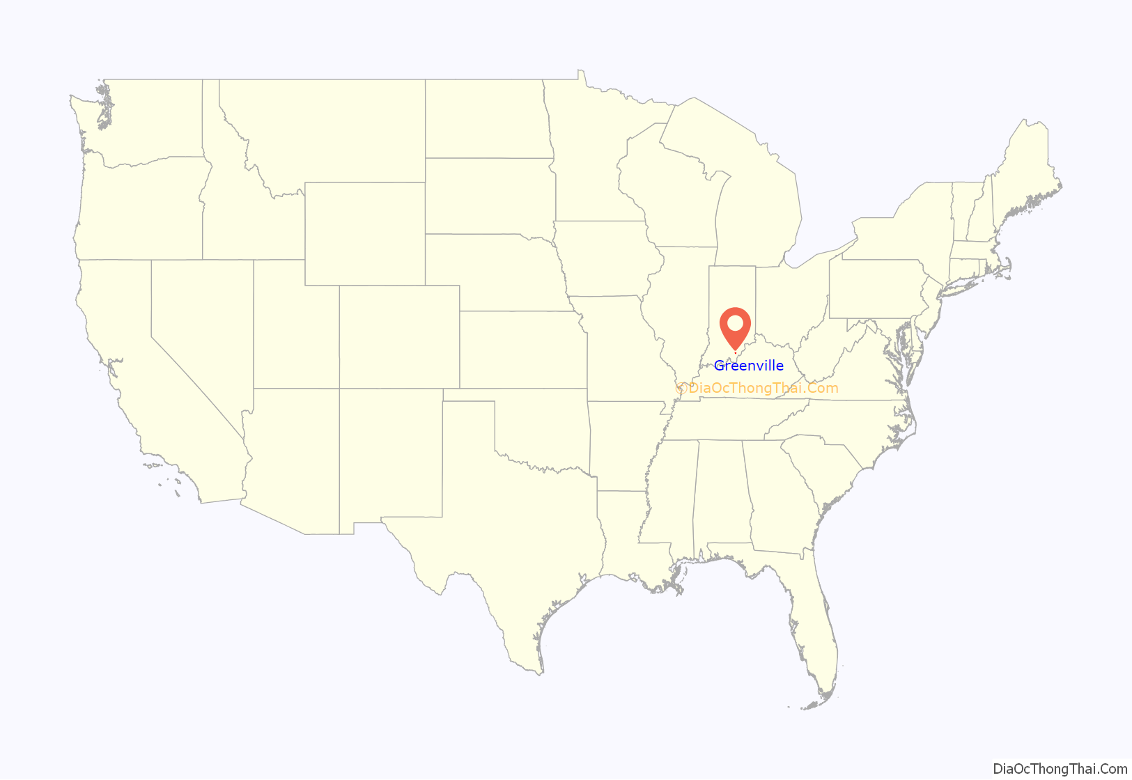
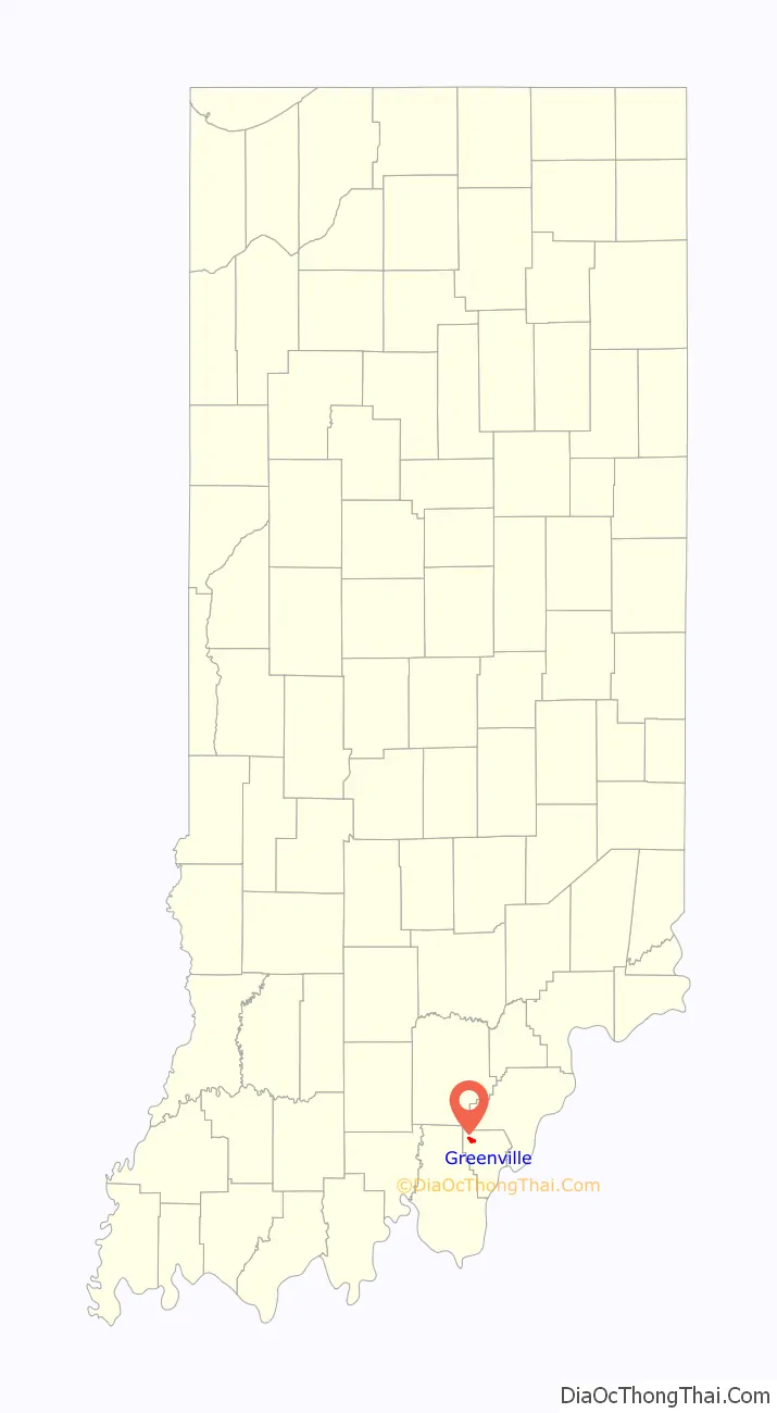
Greenville location map. Where is Greenville town?
History
Founding
Greenville was platted in 1816 by Andrew Mundell and Benjamin Haines some three years before Floyd County was established. During the first three years of Greenville’s development, the village was a part of Clark County.
Notable people
Captain John Baptiste Ford found his way to Greenville as a 14-year-old runaway from Danville, Kentucky. Ford began as an apprentice with his future father-in-law in the local saddle shop which led him into his first business venture. Ford purchased the Old Mill and saddle shop from its owner, added a grocery and began making tin pie safes which he sold throughout the country. Later, Ford moved to New Albany and established several businesses, and became the first man to succeed in making plate glass in the United States. That success was the precursor to several glass companies, most notably the Pittsburgh Plate Glass Company now known as PPG. Ford became the father of American plate glass.
That original building that housed the mill, saddle shop and grocery still stands today. Historically referred to as the Old Mill and Ford’s Flour Mill, the Greenville Station is believed to be the oldest commercial building in Greenville. Construction on the original wooden structure began in 1810 and finished in 1812. In 1840, Ford helped to erect the present brick structure. Besides housing Ford’s grocery and the saddle shop, the Old Mill was the Greenville Post Office from 1823 until the early 1940s when it was relocated to H. Miller’s house at the corner of East First Street and Hwy 150. The Station was a stop for the 104-mile stagecoach route that ran from Falls Cities to the Wabash River. The building also served as a stop along the Pony Express route from 1861 to 1867. The Greenville Station served as lodge hall for two civil organizations: the fraternal order of the Free and Accepted Masons and the International Order of Oddfellows. Through a majority of the early 20th century, the Greenville Station was referred to by the townspeople as the “lodge building” or the “lodge.”
Ford was on the board for the Floyd County Seminary from 1850 – 1852. Ford was a philanthropist and always gave back to the community even after he left Greenville. He paid for the construction of the Simpson Memorial United Methodist Church in 1899. In 2017, the Greenville Town Council named a road “John Baptiste Ford Drive” to honor Ford’s history and significant contributions to both the community and industrialism. The Greenville Historic Preservation Commission had a historic marker approved by the Indiana Historic Bureau in 2019. The historic marker is the only John B. Ford specific historic marker in the country and the first IHB approved marker in Floyd County outside of New Albany.
Civil War
Morgan’s Raid came through Greenville on July 10, 1863 led by Confederate General John Hunt Morgan. After the Battle of Corydon, Morgan sent a column of troops through Greenville. Confederate troops were reported east of Greenville, at eight o’clock, and some of the scouts burned the railroad bridge at Farrabee Station, fifteen miles further north, at ten o’clock.
Greenville resident Ephraim L. Girdner enlisted with the Union Army in 1861. He was captured by the Confederates during the Battle of Richmond in 1862, he was promoted to Captain of his regiment in 1864, and was also part of Sherman’s March to the Sea engaging is several battles along the way. Much of Girdner’s communications and military documents during the Civil War were preserved by his family and donated as the “Girdner Papers” to the library at Emory University in Atlanta.
County Seat
Early in Floyd County‘s history, Greenville was initially to be the county seat. It was proposed that either New Albany or Greenville would become the county seat. The contest was left up to who could make the largest donation. The contest was animated but New Albany added the donation of a bell for the court house. The offer of the bell was irresistible and vanquished Greenville from the contest.
Incorporation
Greenville was surveyed by George Smith, county surveyor, and incorporated October 28, 1879.
Fire of 1908
On March 26, 1908 a fire destroyed most of the town’s original buildings. Today, the Station stands just two doors from one of the city’s oldest home (rebuilt in 1908), which still boasts some of John B. Ford’s original plate glass works.
The Town Flag
The Greenville Town Flag was designed by Glenn Burkhart in 1969, then just a 5th grader at Greenville Elementary School. The design was part of a contest held by the Greenville Town Council and the Greenville Park Board. Glenn received a $25 bond as a prize for winning the contest. His original drawing and the original flag from 1969 have been preserved. The Greenville Historic Preservation Commission held a flag re-dedication ceremony in January 2019 for the Flag’s 50 year anniversary.
Churches
The Simpson Memorial United Methodist Church was listed on the National Register of Historic Places in 2004.
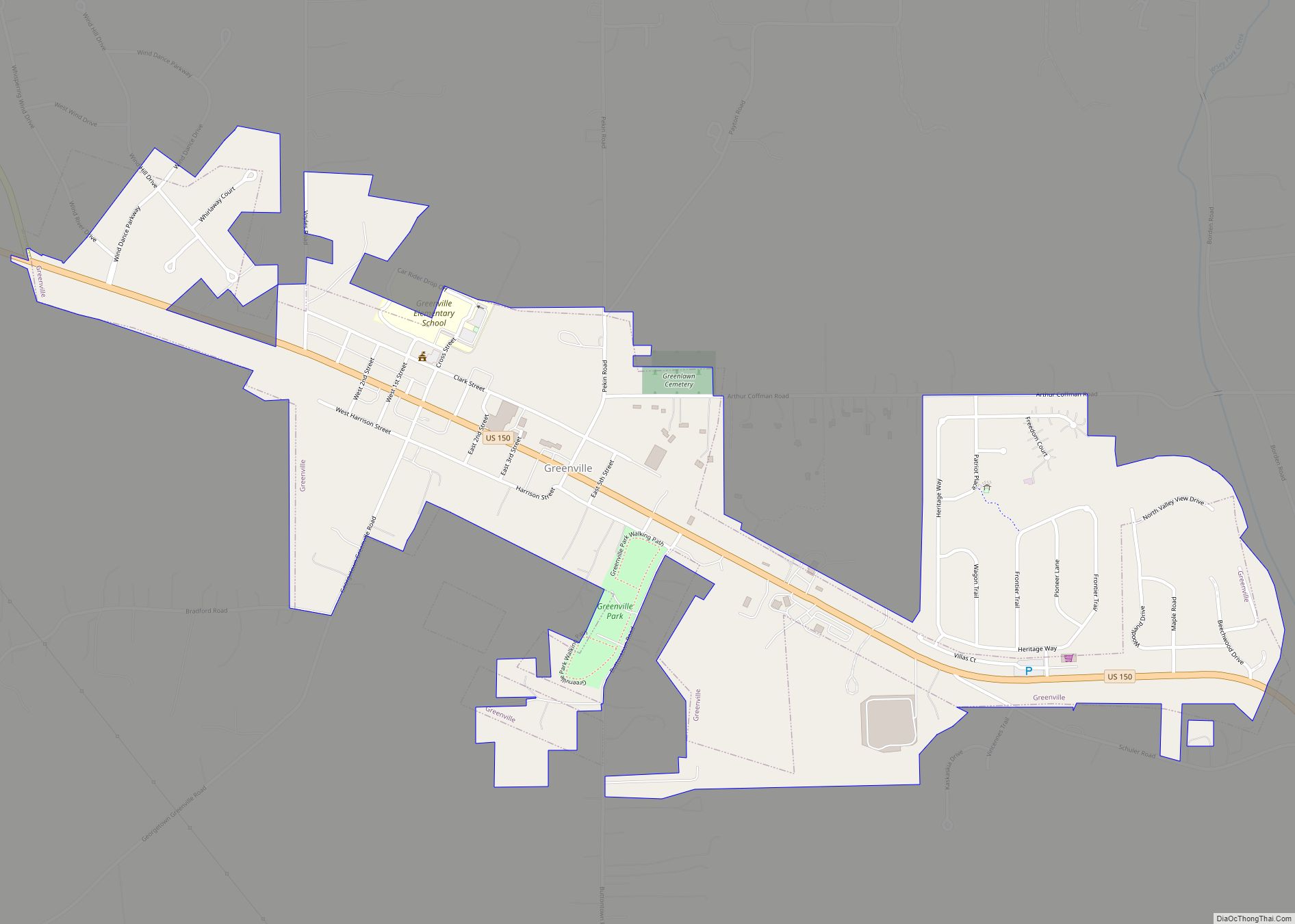
Greenville Road Map
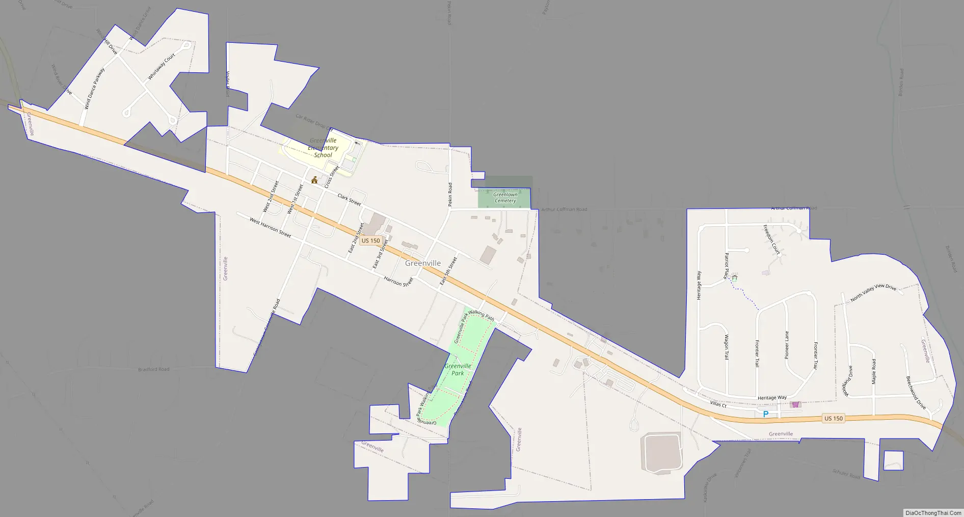
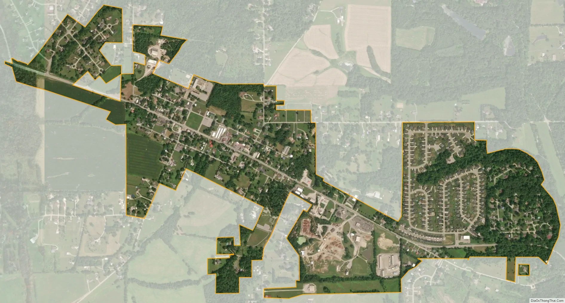
Greenville city Satellite Map
Geography
Greenville is located at 38°22′22″N 85°59′19″W / 38.37278°N 85.98861°W / 38.37278; -85.98861 (38.372768, -85.988685).
According to the 2010 census, Greenville has a total area of 0.78 square miles (2.02 km), all land.
The township is situated such that, clockwise, it borders the township of Jackson Township, Washington County to the northwest, Wood Township, Clark County to the northeast, Laffayette Township in Floyd County to the east, Georgetown Township to the south, Jackson Township, Harrison County to the southwest, and Morgan Township, Harrison County to the west.
Big and Little Indian Creeks meander through the township, which are tributaries in the Ohio River watershed.
See also
Map of Indiana State and its subdivision:- Adams
- Allen
- Bartholomew
- Benton
- Blackford
- Boone
- Brown
- Carroll
- Cass
- Clark
- Clay
- Clinton
- Crawford
- Daviess
- De Kalb
- Dearborn
- Decatur
- Delaware
- Dubois
- Elkhart
- Fayette
- Floyd
- Fountain
- Franklin
- Fulton
- Gibson
- Grant
- Greene
- Hamilton
- Hancock
- Harrison
- Hendricks
- Henry
- Howard
- Huntington
- Jackson
- Jasper
- Jay
- Jefferson
- Jennings
- Johnson
- Knox
- Kosciusko
- LaGrange
- Lake
- Lake Michigan
- LaPorte
- Lawrence
- Madison
- Marion
- Marshall
- Martin
- Miami
- Monroe
- Montgomery
- Morgan
- Newton
- Noble
- Ohio
- Orange
- Owen
- Parke
- Perry
- Pike
- Porter
- Posey
- Pulaski
- Putnam
- Randolph
- Ripley
- Rush
- Saint Joseph
- Scott
- Shelby
- Spencer
- Starke
- Steuben
- Sullivan
- Switzerland
- Tippecanoe
- Tipton
- Union
- Vanderburgh
- Vermillion
- Vigo
- Wabash
- Warren
- Warrick
- Washington
- Wayne
- Wells
- White
- Whitley
- Alabama
- Alaska
- Arizona
- Arkansas
- California
- Colorado
- Connecticut
- Delaware
- District of Columbia
- Florida
- Georgia
- Hawaii
- Idaho
- Illinois
- Indiana
- Iowa
- Kansas
- Kentucky
- Louisiana
- Maine
- Maryland
- Massachusetts
- Michigan
- Minnesota
- Mississippi
- Missouri
- Montana
- Nebraska
- Nevada
- New Hampshire
- New Jersey
- New Mexico
- New York
- North Carolina
- North Dakota
- Ohio
- Oklahoma
- Oregon
- Pennsylvania
- Rhode Island
- South Carolina
- South Dakota
- Tennessee
- Texas
- Utah
- Vermont
- Virginia
- Washington
- West Virginia
- Wisconsin
- Wyoming