Hamilton County is a county in the U.S. state of New York. As of the 2020 census, the population was 5,107, making it the least populous county in New York. With an area nearly the size of Delaware, it is the least densely populated county east of the Mississippi River. Its county seat is Lake Pleasant. The county was created in 1816 and organized in 1847.
Hamilton County is one of only two counties that lie entirely within the Adirondack Park (Essex being the other). Because of its location in the park, any development in the county is restricted by the New York State Constitution, which designates the park as “forever wild.” There are no permanent traffic lights in the county, and much of the county has no cell phone service.
| Name: | Hamilton County |
|---|---|
| FIPS code: | 36-041 |
| State: | New York |
| Founded: | 1816 |
| Named for: | Alexander Hamilton |
| Seat: | Lake Pleasant |
| Total Area: | 1,808 sq mi (4,680 km²) |
| Land Area: | 1,717 sq mi (4,450 km²) |
| Total Population: | 5,107 |
| Population Density: | 3.0/sq mi (1.2/km²) |
| Time zone: | UTC−5 (Eastern) |
| Summer Time Zone (DST): | UTC−4 (EDT) |
| Website: | www.hamiltoncounty.com |
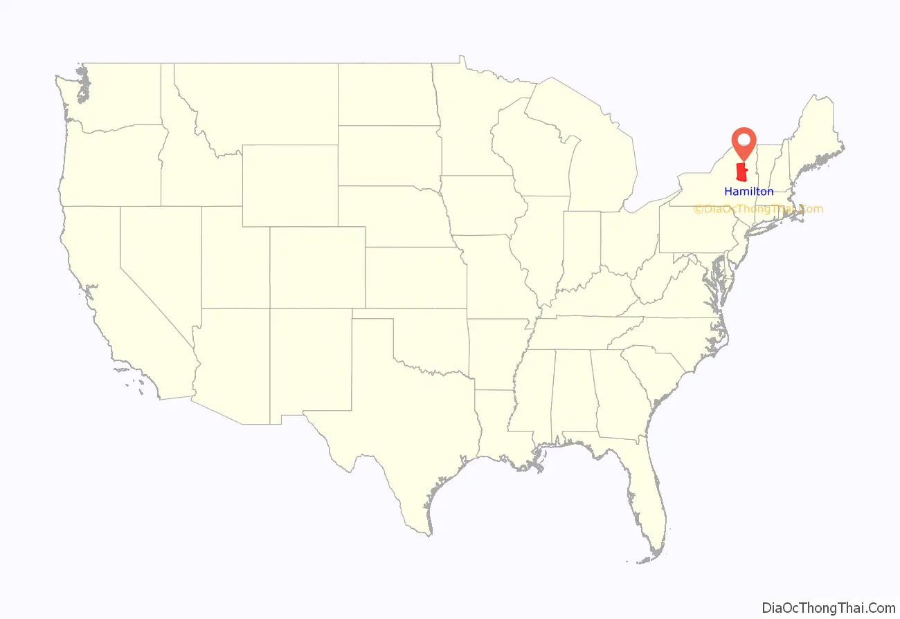
Hamilton County location map. Where is Hamilton County?
History
On April 12, 1816, Hamilton County was created by partitioning 1,800 square miles (4,700 km) from Montgomery County, but due to low population it remained unorganized and administered from Montgomery County, N.Y. until it was recognized as sufficiently prepared for self-government on January 1, 1838. The organization process was completed by summer 1847.
On April 6, 1860, Fulton County was partitioned, with 10 square miles (26 km) of land in Sacandaga Park transferred to Hamilton County. On May 24, 1915, land was swapped between Hamilton and Essex counties, with Hamilton ceding Fishing Brook Mountain for Indian Lake. Hamilton gained an additional 20 square miles (52 km), whereas Essex County lost 30 square miles (78 km). This left Hamilton with its present size of 1,830 square miles (4,700 km).
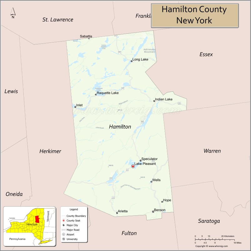
The former town of Gilman was dissolved in 1860. The original county seat was Sageville, now part of Lake Pleasant.
Hamilton County Road Map
Geography
According to the U.S. Census Bureau, the county has a total area of 1,808 square miles (4,680 km), of which 1,717 square miles (4,450 km) is land and 90 square miles (230 km) (5.0%) is water. It is New York’s third-largest county by land area and fifth-largest by total area.
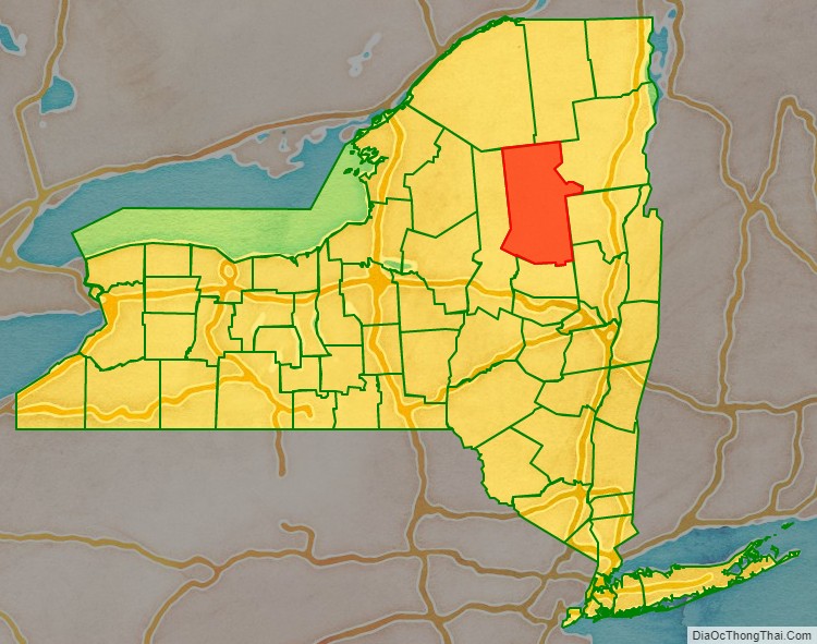
Hamilton County is in the state’s north central section, northwest of Albany. It lies entirely within Adirondack Park and consists mostly of publicly owned parkland.
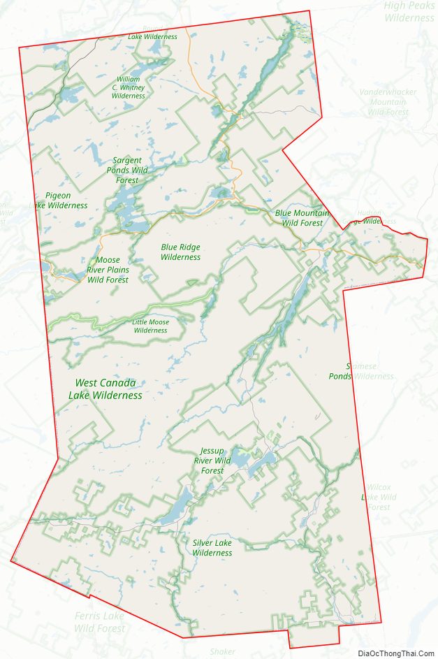
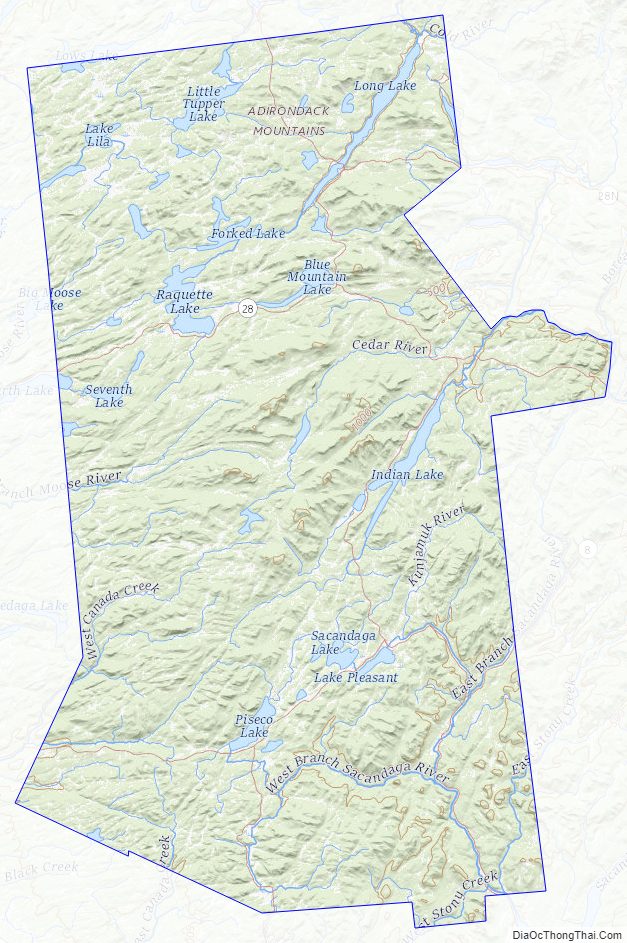
The county is very mountainous, broken up by rivers and lakes. The county is famous for its lakes. Indian Lake, and Long Lake are both famous for their long length, small width, and erratic shape, similar to the Finger Lakes. Other notable lakes include Piseco Lake, Lewey Lake, Raquette Lake, Sacandaga Lake, and Lake Pleasant. While notable mountains include: Snowy Mountain, Panther Mountain, and Buell Mountain.
Adjacent counties
- Franklin County – north
- Essex County – northeast
- Warren County – east
- Saratoga County – southeast
- Fulton County – south
- Herkimer County – west
- St. Lawrence County – northwest
Hamilton County Topographic Map
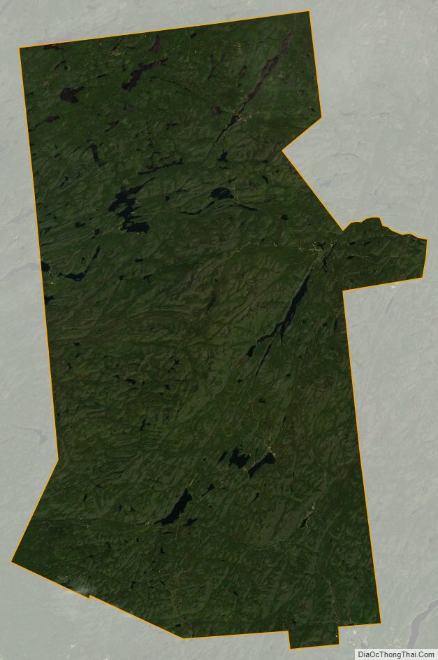
Hamilton County Satellite Map
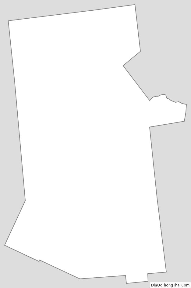
Hamilton County Outline Map