Fulton County is a county in the U.S. state of New York. It forms part of the state’s Mohawk Valley region. Its county seat is Johnstown. At the 2020 U.S. census, the county had a population of 53,324. The county is named in honor of Robert Fulton, who is widely credited with developing the first commercially successful steamboat. Fulton County comprises the Gloversville micropolitan statistical area, which is included in the Capital District.
| Name: | Fulton County |
|---|---|
| FIPS code: | 36-035 |
| State: | New York |
| Founded: | 1838 |
| Named for: | Robert Fulton |
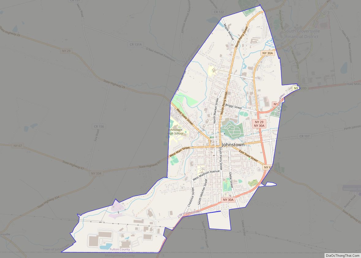
| Seat: | Johnstown |
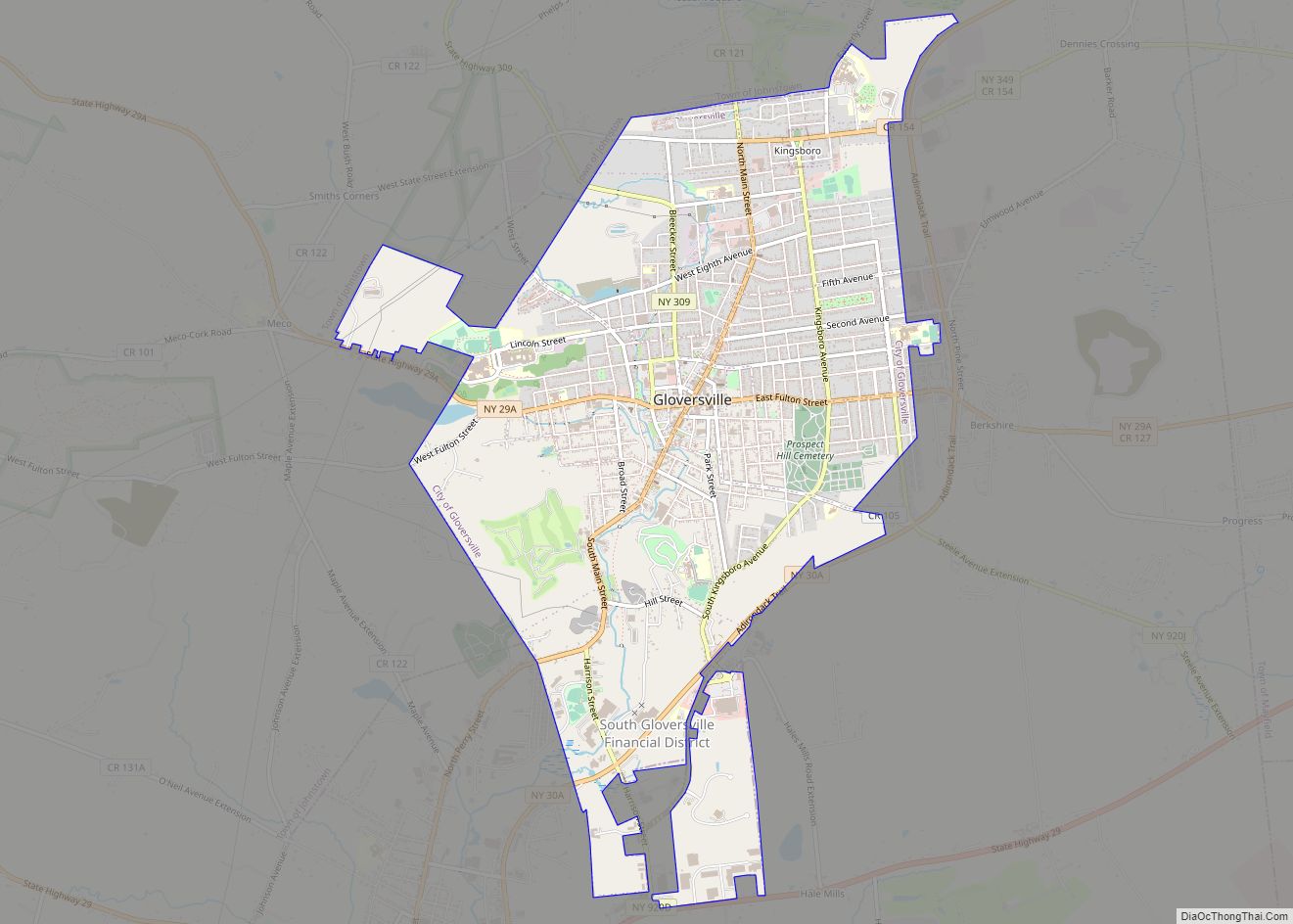
| Largest city: | Gloversville |
| Total Area: | 533 sq mi (1,380 km²) |
| Land Area: | 495 sq mi (1,280 km²) |
| Total Population: | 53,324 |
| Population Density: | 107.6/sq mi (41.5/km²) |
| Time zone: | UTC−5 (Eastern) |
| Summer Time Zone (DST): | UTC−4 (EDT) |
| Website: | www.fultoncountyny.gov |
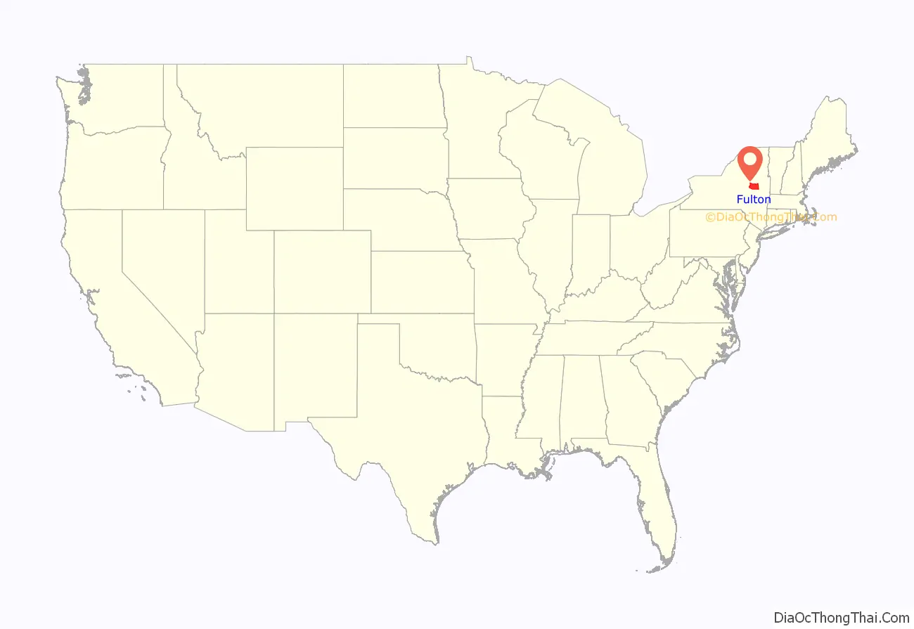
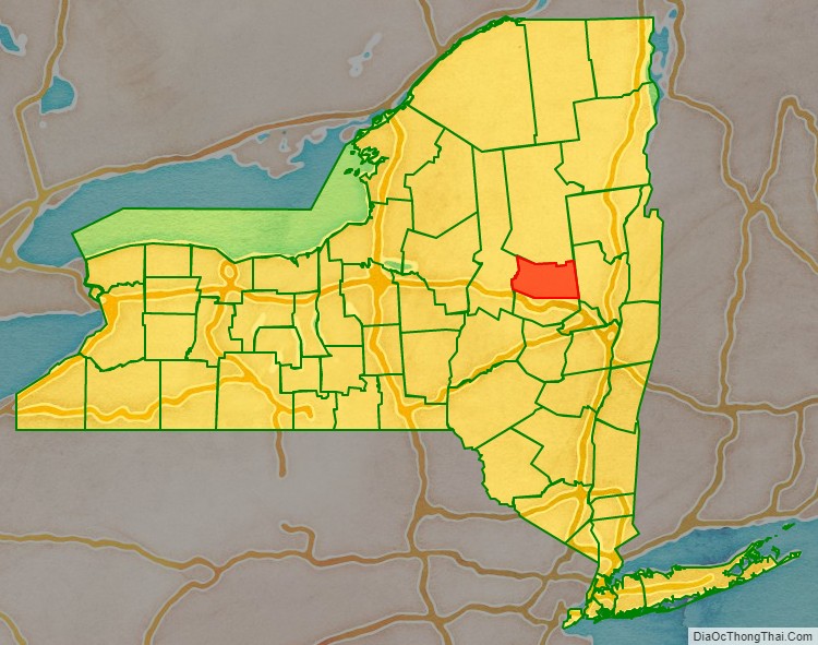
Fulton County location map. Where is Fulton County?
History
In 1838, Fulton County was split off from Montgomery, shortly after the Montgomery county seat was moved to Fonda, New York. The creation of Fulton County was engineered by Johnstown lawyer Daniel Cady, whose wife was a cousin of Robert Fulton.
Fulton County was created on April 18, 1838, by a partition of Montgomery County, resulting in a county with an area of 550 square miles (1,400 km).
The old Tryon County courthouse, built in 1772, later the Montgomery County courthouse, became the Fulton County Courthouse, where it is New York’s oldest operating courthouse.
One adjustment has been made to the area of Fulton County. On April 6, 1860, 10 square miles (26 km) on the northern border was transferred to Hamilton in the vicinity of Sacandaga Park. This resulted in the Fulton County that exists today.
In the mid-18th century, Sir William Johnson, founder of Fort Johnson in Montgomery County and of Johnstown, arrived in what would become Fulton County. Sir William Johnson, 1st Baronet, was an Irish pioneer and army officer in colonial New York, and the British Superintendent of Indian Affairs from 1755 to 1774. His homes, Fort Johnson and Johnson Hall are current New York State Historic Sites.
Fulton County was also home to Elizabeth Cady Stanton, a central pioneer in America’s women’s rights movement.
Shortly after the American Revolutionary War, the manufacture of gloves and leather became the area’s primary industry. At one point, Johnstown and Gloversville were known as the world’s Glove and Leather capital. The largest rise in population and growth came as a result of the fruits of these businesses.
Many residents of Fulton County can trace their ancestry to the glove and leather trades. Today few glovers, tanners and leather dressers remain in the area, although some companies have adapted to the changes in the market to remain competitive.
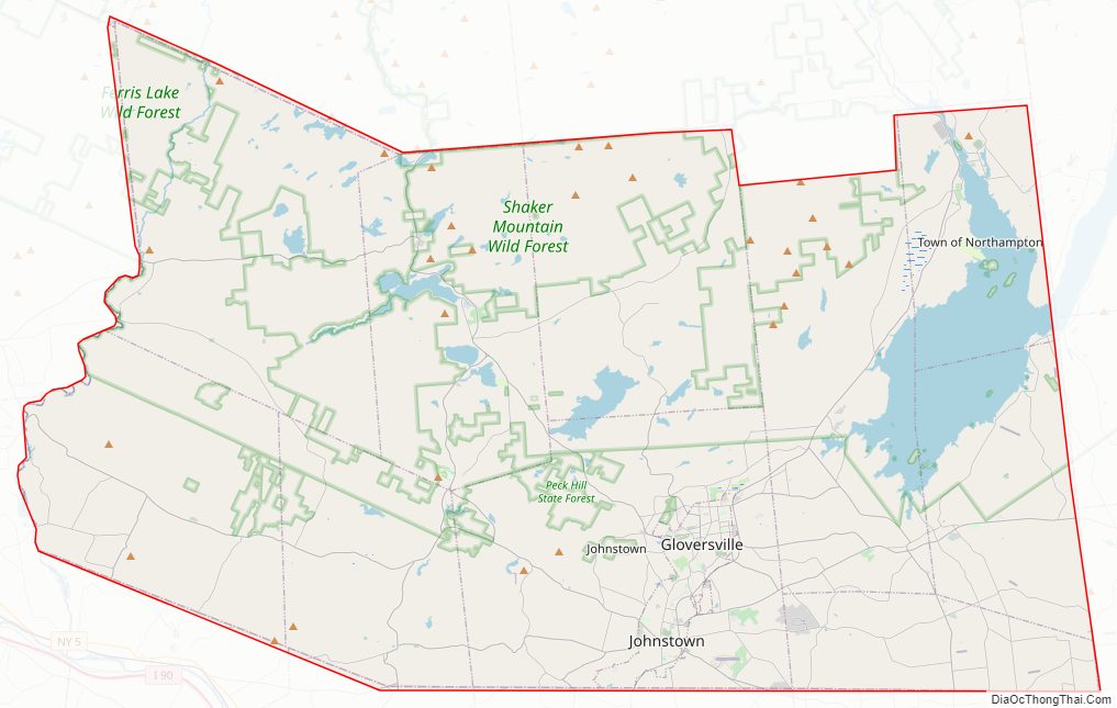
Fulton County Road Map
Geography
According to the U.S. Census Bureau, the county has a total area of 533 square miles (1,380 km), of which 495 square miles (1,280 km) is land and 37 square miles (96 km) (7.0%) is water. Fulton County is in the central part of the state, northwest of Albany, lying in the southern Adirondack Mountains. Approximately 58% of the county is within the boundaries of Adirondack Park.
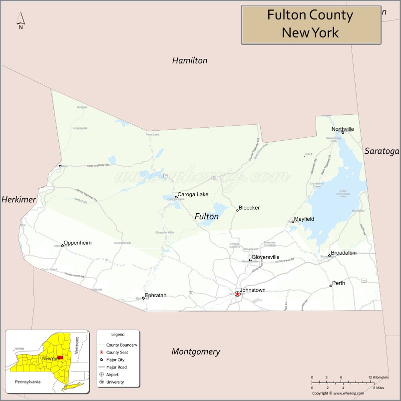
Adjacent counties
- Hamilton County – north
- Saratoga County – east
- Montgomery County – south
- Herkimer County – west
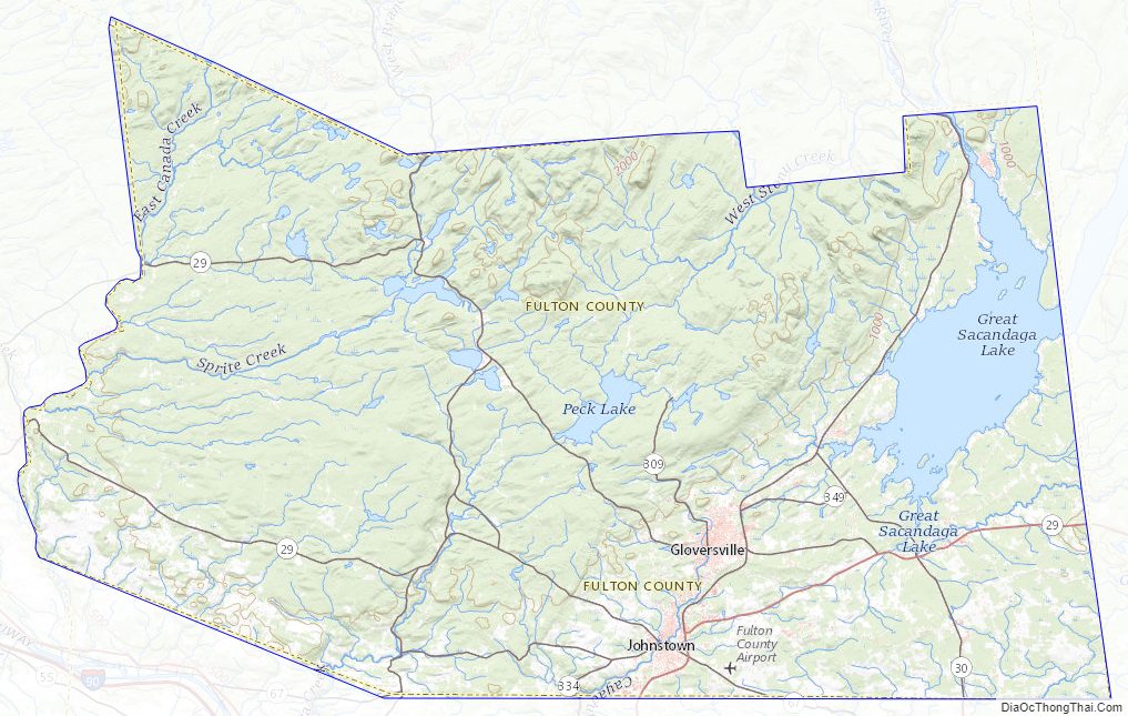
Fulton County Topographic Map
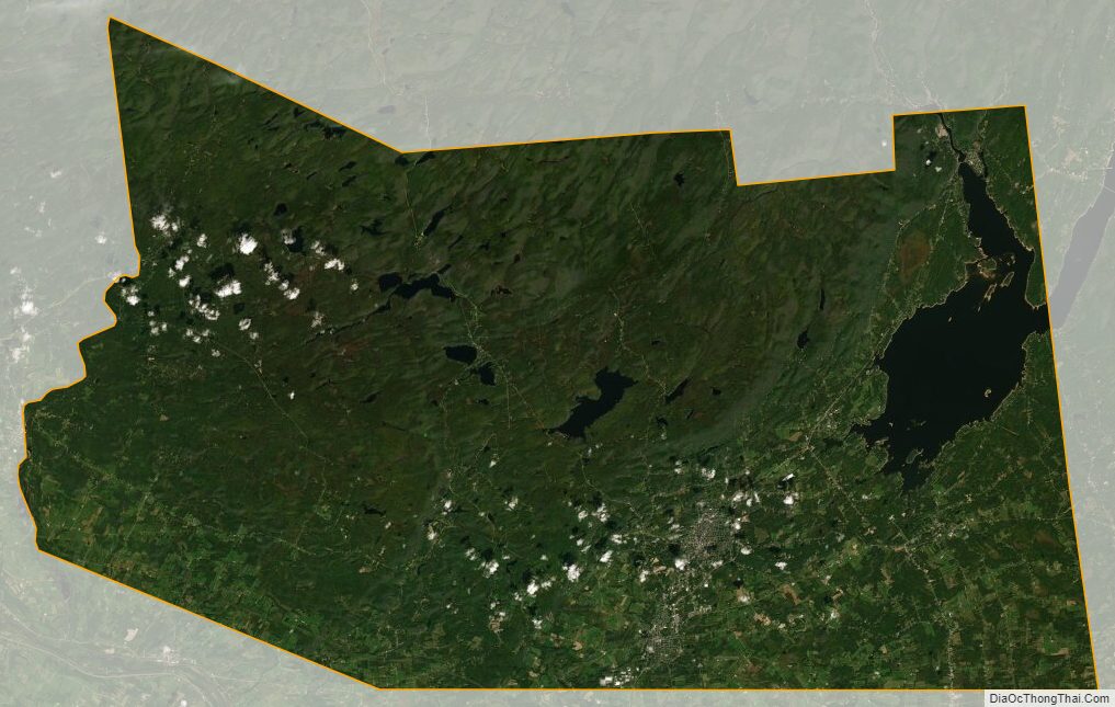
Fulton County Satellite Map
Fulton County Outline Map