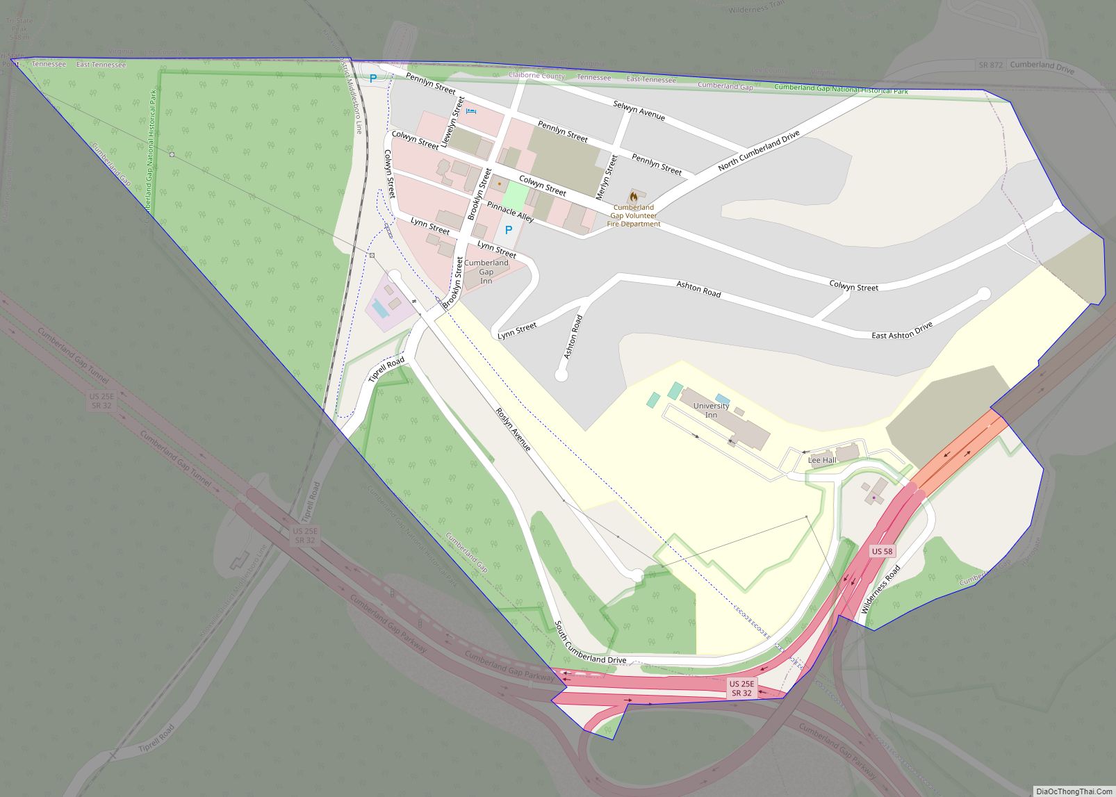
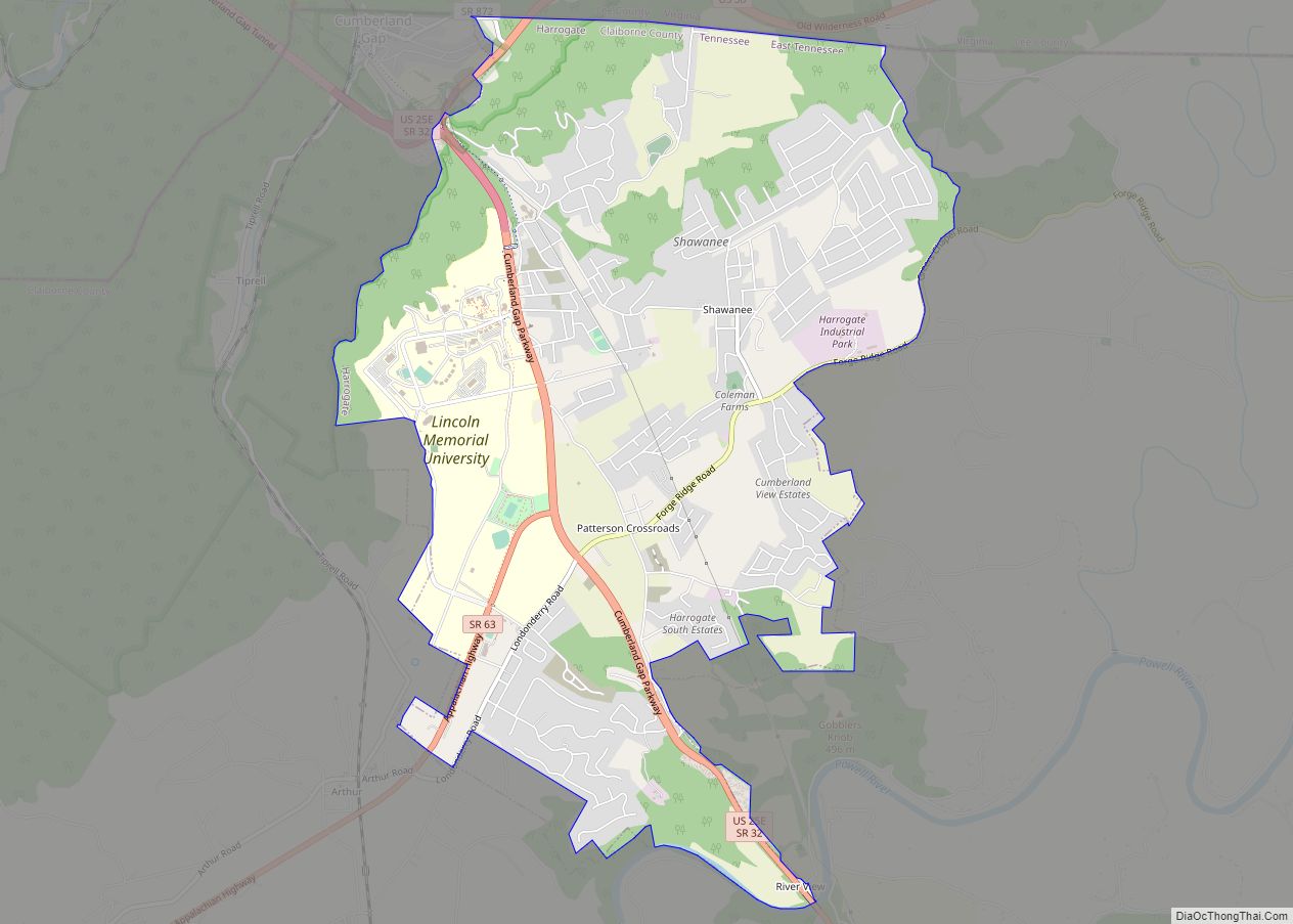
Harrogate is the largest city in Claiborne County, Tennessee, United States. It is adjacent to Cumberland Gap National Historical Park.
The community has been known as “Harrogate” since the 19th century, but did not incorporate by that name until 1993. As of the 2010 census, its population was 4,389. It is considered a college town with Lincoln Memorial University’s main campus located entirely within Harrogate.
Before incorporation, the United States Census Bureau treated Harrogate as a census-designated place (CDP) called Harrogate-Shawanee. At the time of the 2000 census the CDP had a population of 2,865.
| Name: | Harrogate city |
|---|---|
| LSAD Code: | 25 |
| LSAD Description: | city (suffix) |
| State: | Tennessee |
| County: | Claiborne County |
| Founded: | 1888 |
| Incorporated: | 1993 |
| Elevation: | 1,253 ft (382 m) |
| Total Area: | 7.26 sq mi (18.82 km²) |
| Land Area: | 7.26 sq mi (18.82 km²) |
| Water Area: | 0.00 sq mi (0.00 km²) 0.0% |
| Total Population: | 4,400 |
| Population Density: | 605.64/sq mi (233.85/km²) |
| ZIP code: | 37724, 37752 |
| Area code: | 423 |
| FIPS code: | 4732640 |
| GNISfeature ID: | 2403807 |
| Website: | www.harrogate-tn.com |
Online Interactive Map
Click on ![]() to view map in "full screen" mode.
to view map in "full screen" mode.
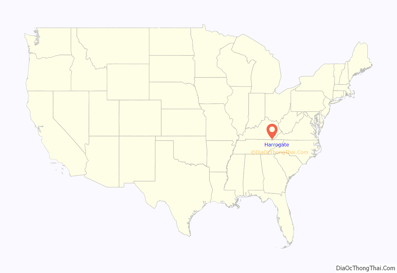
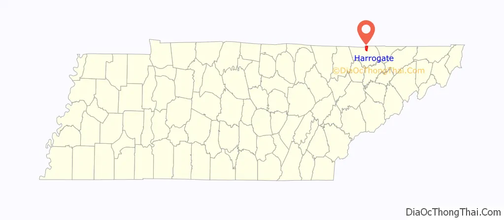
Harrogate location map. Where is Harrogate city?
History
In 1974, the population of Harrogate continued to grow at a fast pace, leading to the construction of a new middle school serving both students of Harrogate and the adjacent town of Cumberland Gap. In 1993, Harrogate was incorporated into a city, and continued to see the fastest population growth of all in Claiborne County. Lincoln Memorial University saw growth as new dorms, an athletic arena, new classrooms, a medical program, and a partnership with Japan‘s Kanto International Senior High School enhanced the Harrogate campus.
By the late 2000s, the city would construct a sewage treatment system following increased contaminations of groundwater and instances of human waste surfacing from failing septic tank systems.
Harrogate Road Map
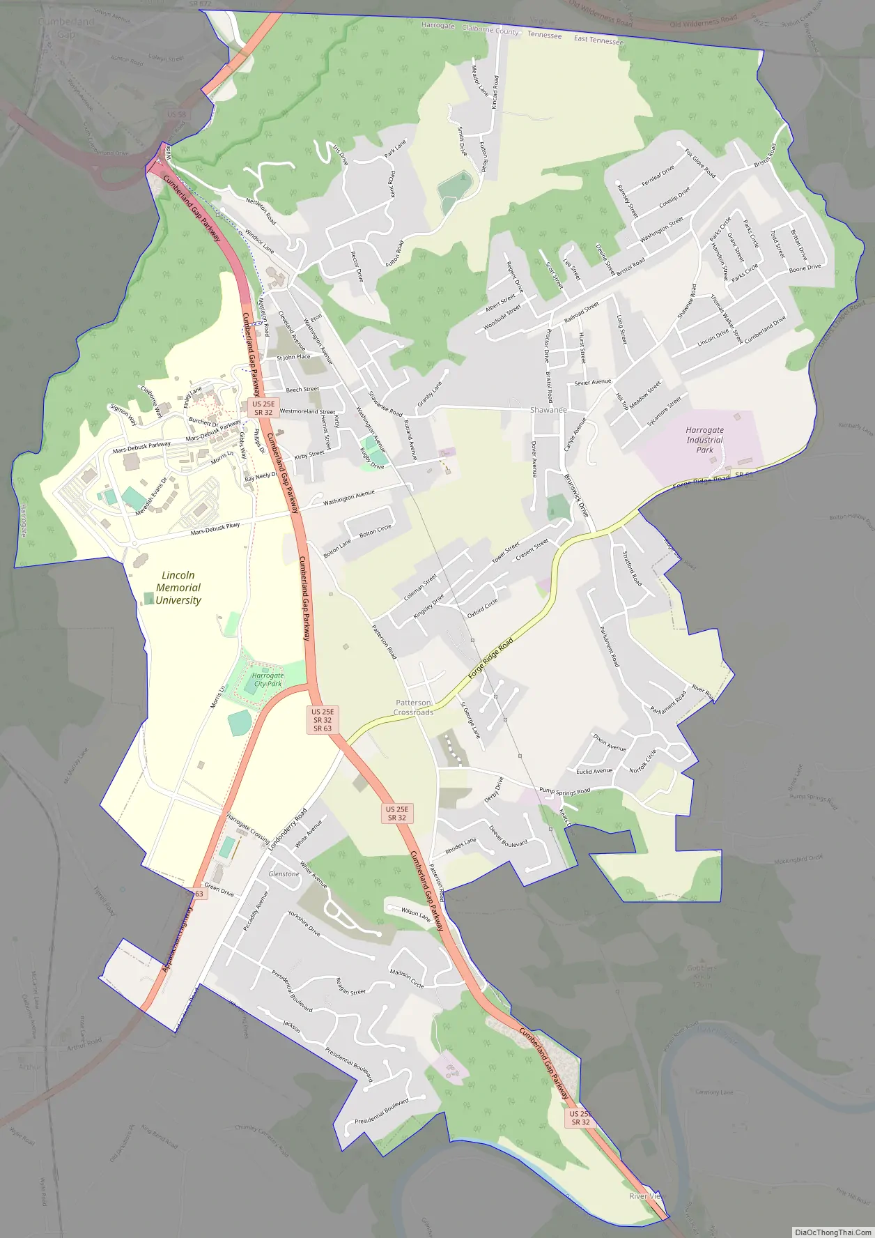
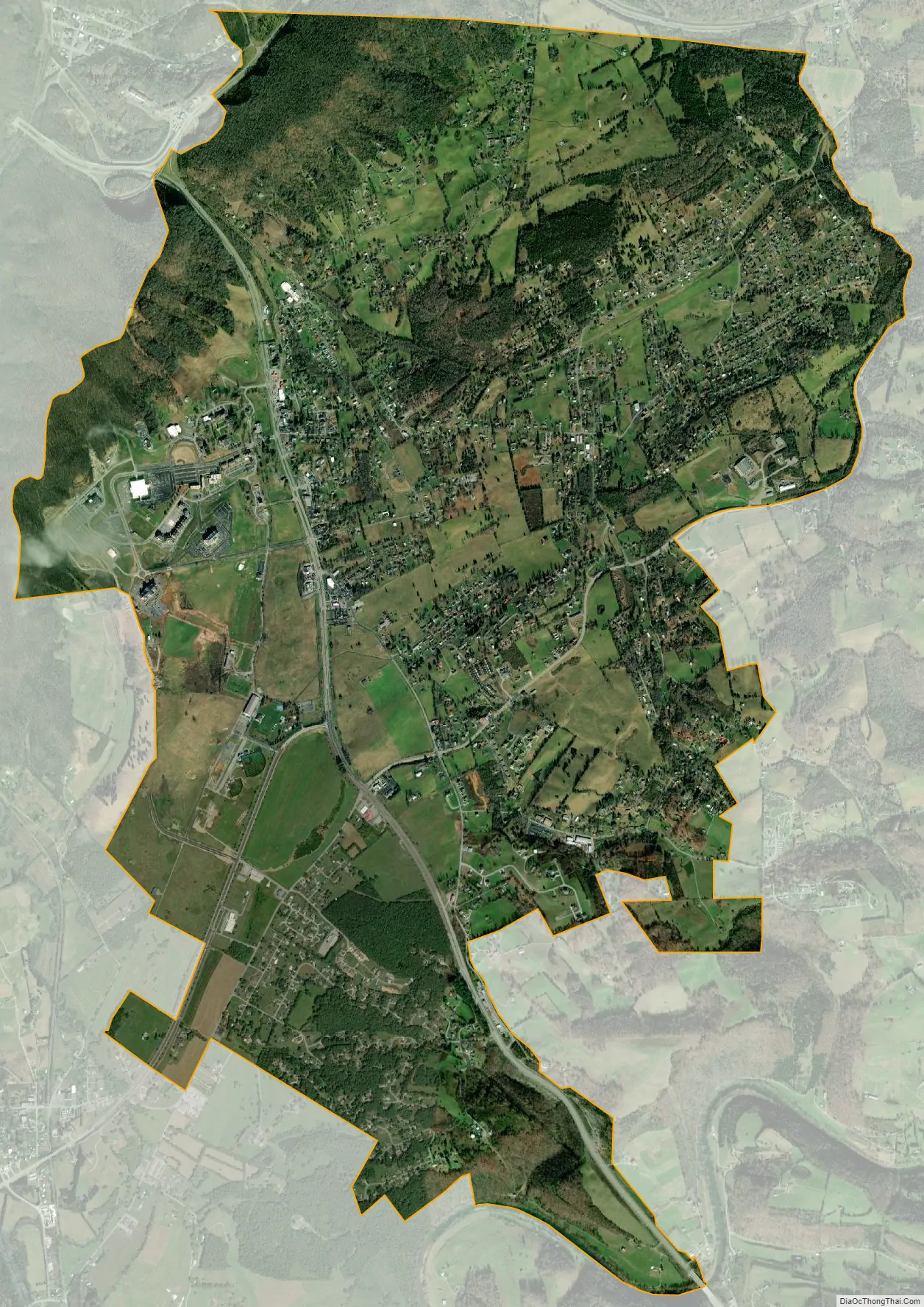
Harrogate city Satellite Map
Geography
Harrogate is located at 36°34′56″N 83°39′25″W / 36.58222°N 83.65694°W / 36.58222; -83.65694 (37.811324, -82.806780). According to the United States Census Bureau, the city has a total area of 7.26 square miles (18.8 km), all land.
The unincorporated community of Shawanee, is located east inside of the city limits of Harrogate.
See also
Map of Tennessee State and its subdivision:- Anderson
- Bedford
- Benton
- Bledsoe
- Blount
- Bradley
- Campbell
- Cannon
- Carroll
- Carter
- Cheatham
- Chester
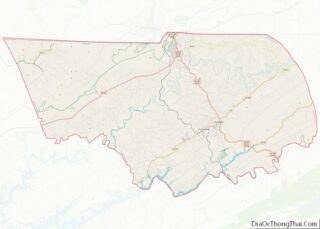
- Claiborne
- Clay
- Cocke
- Coffee
- Crockett
- Cumberland
- Davidson
- Decatur
- DeKalb
- Dickson
- Dyer
- Fayette
- Fentress
- Franklin
- Gibson
- Giles
- Grainger
- Greene
- Grundy
- Hamblen
- Hamilton
- Hancock
- Hardeman
- Hardin
- Hawkins
- Haywood
- Henderson
- Henry
- Hickman
- Houston
- Humphreys
- Jackson
- Jefferson
- Johnson
- Knox
- Lake
- Lauderdale
- Lawrence
- Lewis
- Lincoln
- Loudon
- Macon
- Madison
- Marion
- Marshall
- Maury
- McMinn
- McNairy
- Meigs
- Monroe
- Montgomery
- Moore
- Morgan
- Obion
- Overton
- Perry
- Pickett
- Polk
- Putnam
- Rhea
- Roane
- Robertson
- Rutherford
- Scott
- Sequatchie
- Sevier
- Shelby
- Smith
- Stewart
- Sullivan
- Sumner
- Tipton
- Trousdale
- Unicoi
- Union
- Van Buren
- Warren
- Washington
- Wayne
- Weakley
- White
- Williamson
- Wilson
- Alabama
- Alaska
- Arizona
- Arkansas
- California
- Colorado
- Connecticut
- Delaware
- District of Columbia
- Florida
- Georgia
- Hawaii
- Idaho
- Illinois
- Indiana
- Iowa
- Kansas
- Kentucky
- Louisiana
- Maine
- Maryland
- Massachusetts
- Michigan
- Minnesota
- Mississippi
- Missouri
- Montana
- Nebraska
- Nevada
- New Hampshire
- New Jersey
- New Mexico
- New York
- North Carolina
- North Dakota
- Ohio
- Oklahoma
- Oregon
- Pennsylvania
- Rhode Island
- South Carolina
- South Dakota
- Tennessee
- Texas
- Utah
- Vermont
- Virginia
- Washington
- West Virginia
- Wisconsin
- Wyoming