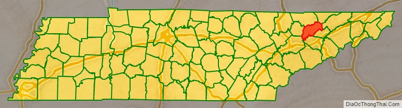
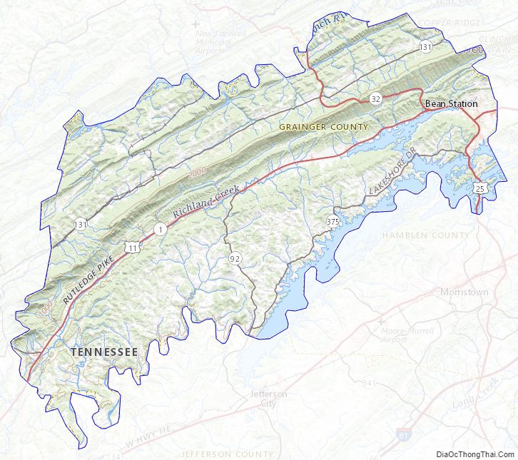
Grainger County is a county located in the U.S. state of Tennessee. As of the 2020 census, the population was 23,527. Its county seat is Rutledge. Grainger County is a part of both the Knoxville Metropolitan Statistical Area and Morristown Metropolitan Statistical Area.
| Name: | Grainger County |
|---|---|
| FIPS code: | 47-057 |
| State: | Tennessee |
| Founded: | 1796 |
| Named for: | Mary Grainger Blount |
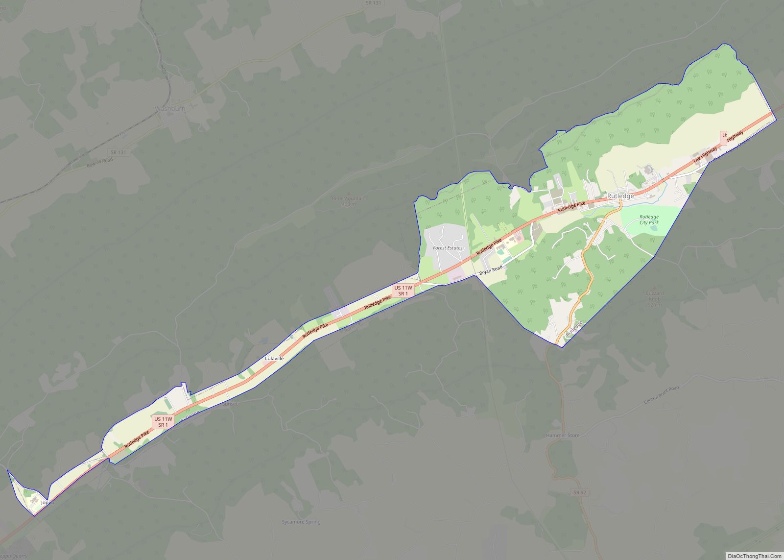
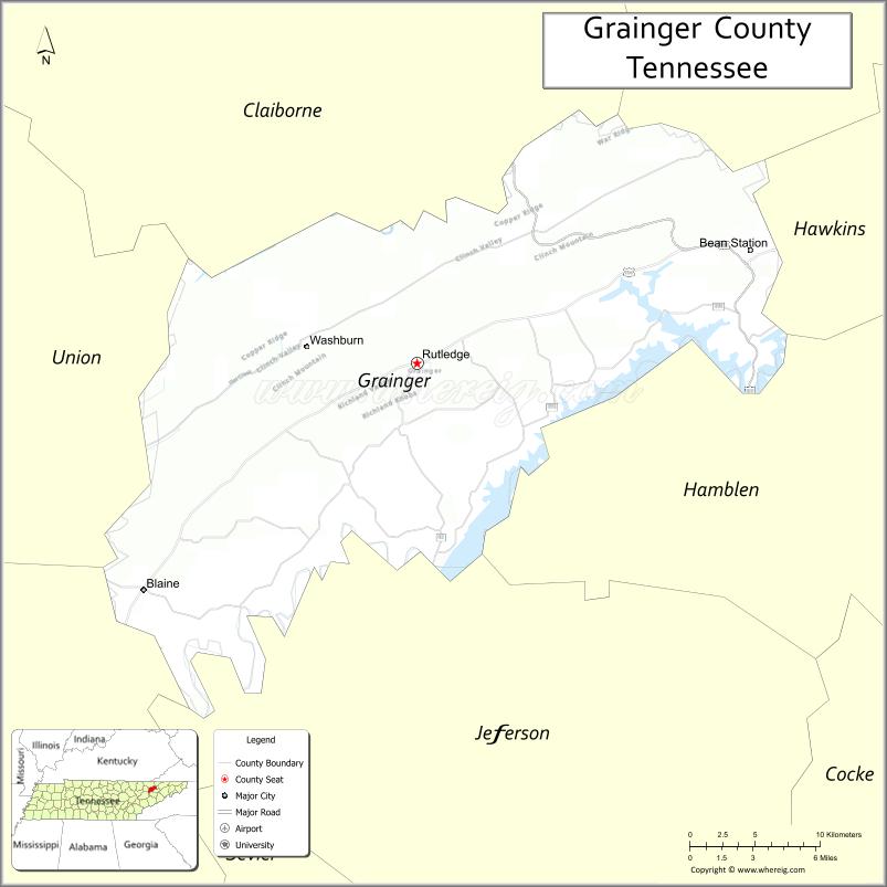
| Seat: | Rutledge |
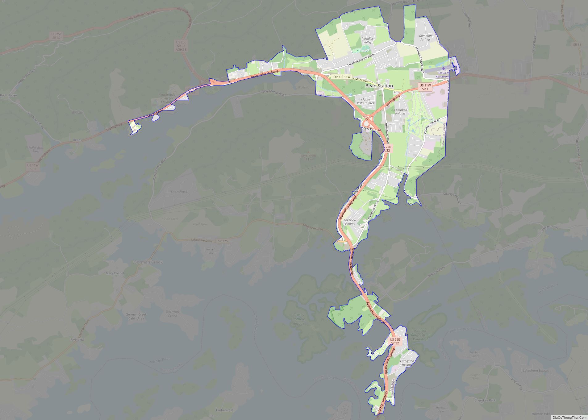
| Largest town: | Bean Station |
| Total Area: | 302 sq mi (780 km²) |
| Land Area: | 281 sq mi (730 km²) |
| Total Population: | 23,527 |
| Population Density: | 81/sq mi (31/km²) |
| Time zone: | UTC−5 (Eastern) |
| Summer Time Zone (DST): | UTC−4 (EDT) |
| Website: | www.graingercountytn.com |
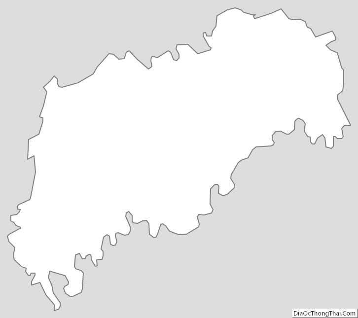
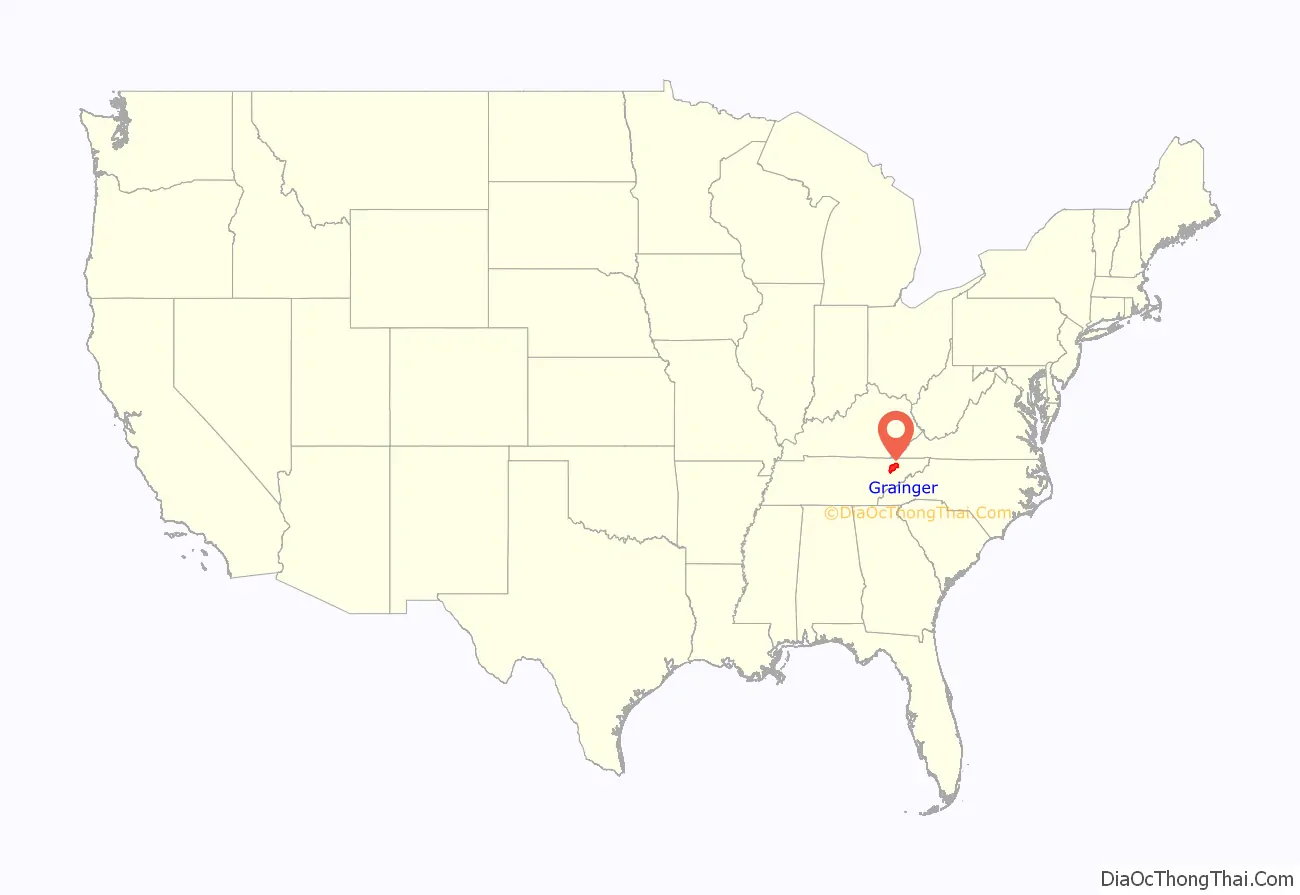
Grainger County location map. Where is Grainger County?
History
Early years
In 1775, pioneers Daniel Boone and William Bean had first observed the Holston River valley in Grainger County after crossing the gap at Clinch Mountain during a long hunting excursion. After fighting in the American Revolutionary War one year later, Bean was awarded 3,000 acres (12 km) in the area he previously surveyed for settlement during his excursion with Boone. Bean would later construct a four-room cabin at this site, which served as his family’s home, and as an inn for prospective settlers, fur traders, and longhunters.
Grainger County would be established into a county from Knox and Hawkins counties by the North Carolina state legislature on April 22, 1796, the year Tennessee became the sixteenth state of the United States. It is named for Mary Grainger Blount, the wife of William Blount, making it the only county in Tennessee named for a woman. In 1801, Rutledge was selected as the county seat. Anderson, Claiborne, Campbell, Hamblen, Hancock, Scott and Union counties were formed from portions of the original Grainger County following its reduction in land size between 1801 and 1870.
Civil War
Like its surrounding East Tennessee counties, Grainger County was generally opposed to secession from the Union. In Tennessee’s Ordinance of Secession referendum on June 8, 1861, sparsely populated Grainger County voters rejected secession by 1,756 to 495.
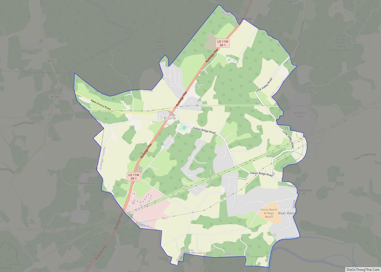
During the American Civil War, a state of near-guerrilla warfare brought economic, political, and social chaos to Grainger County, notably during the Knoxville campaign. Two arguments occurred within the county during the Civil War, with the first as a skirmish in Blaine around Christmas of 1862. In the year ahead, the Battle of Bean’s Station pitted the forces of Confederate General James Longstreet against a Union forces under General James Shackelford in a planned surprise attack that failed for Confederate forces through the critically poor decision-making of Longstreet’s staff. While the Battle of Bean’s Station proved victorious for Longstreet in the end, he later failed to capture Knoxville westward through Blaine, and went into hiding in Russellville in nearby Hamblen County.
1900s to present day
In the post-Civil War era, a businessman named Samuel Tate constructed a large Victorian-style luxury hotel just west of Bean Station that became the main focus of a resort known as Tate Springs. Around the late 1870s, the hotel was purchased by Captain Thomas Tomlinson, who would transform the property into a vast resort that advertised the supposed healing powers of its mineral spring’s water. During its heyday, the resort complex included over three-dozen buildings, a 100-acre (40 ha) park, and an 18-hole golf course. The resort had attracted some of the wealthiest people in America during this time. The resort declined during the Great Depression, and the hotel and most of its outbuildings have since been demolished after a major fire damaged the main hotel structure. The Tate Springs Springhouse still stands just off U.S. Route 11W near Bean Station Elementary School.
In 1901, in the northern area of the county near Thorn Hill, a four-year conflict between two families, known locally as “The Battle of Thorn Hill,” began following the murder of a prominent resident. The feud fueled acts of violence such as assassinations of prominent citizens and racially-motivated murders against African Americans in public places and businesses.
During the early and mid 20th century, moonshining became popular and spread throughout many communities in the county.
After the creation of the Tennessee Valley Authority in the 1930s, many Grainger County residents had to be relocated for the construction of both Cherokee and Norris Dam in the southern and northern parts of the county. Bean Station experienced most of this loss, as the original site the town now resides in the Cherokee Lake basin. Of the 875 families relocated for the Cherokee Project, 434 or 49.6% were from Grainger County.
In 1946, Grainger County suffered the loss of its third courthouse in Rutledge to a massive fire. However, most records, including those dating back to the county’s establishment in 1796 were safe inside steel fireproof safes.
In the 1970s through the 1980s, plans for a 75-mile-long hiking trail system known as the Trail of the Lonesome Pine were proposed to run along the ridgeline of Clinch Mountain from the Tennessee-Virginia state line in Hancock County to its terminus in the city of Blaine in Grainger County. The plans were met with extreme opposition from unwilling property owners, particularly those from Grainger County, as the project would be nearly complete in the Hawkins and Hancock portions of the trail system. With the unwillingness from Grainger County property owners, the trail system would be abandoned all-together in 1981 despite the completion of construction outside of Grainger County.
On May 13, 1972, 14 people were killed in a head-on collision between a Greyhound double-decker bus and a tractor-trailer hauling carpet on U.S. Route 11W in the Bean Station area of the county, making it the deadliest automobile accident of its time in Tennessee. This infamous crash, along with several other fatal crashes along the narrow two-lane stretch of U.S. Route 11W in Grainger County, gave it the nickname “Bloody Highway 11W.”
On July 4, 2012, Grainger County received national attention when 10-year-old Noah Winstead and his friend, 11-year old Nate Lynam, were electrocuted due to frayed wiring being in contact with the water the boys were swimming near a Cherokee Lake marina in the German Creek area of the county. In the aftermath of the tragedy, Tennessee legislators passed the Noah and Nate Act, which required marinas to be routinely inspected safety hazards such as faulty wiring and dangerous equipment operations.
On April 5, 2018, Southeastern Provisions, a cattle slaughterhouse in the county, was raided by U.S. Immigration and Customs Enforcement (ICE); 11 workers were arrested and 86 more were detained, all of whom were suspected of residing in the United States unlawfully. At the time, the raid was reportedly the largest workplace raid in United States history. In September 2018, the owner of the meatpacking facility was found guilty of multiple state and federal crimes, including tax evasion, wire fraud, contamination of local water supply, employing undocumented immigrants not authorized to work in the US, and other numerous workplace violations.
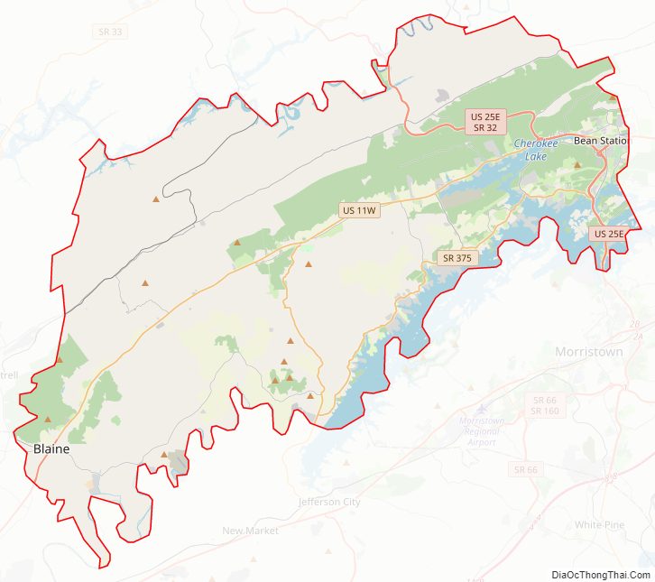
Grainger County Road Map
Geography
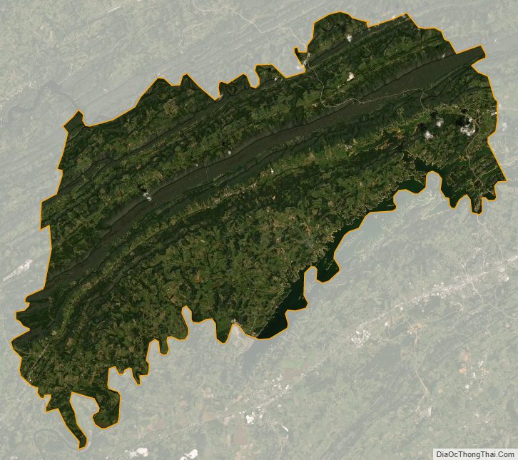
According to the U.S. Census Bureau, the county has a total area of 302 square miles (780 km), of which 281 square miles (730 km) is land and 22 square miles (57 km) (7.2%) is water. Grainger County is bounded on the northwest by the Clinch River (impounded by Norris Dam to form Norris Lake) and on the southeast by the Holston River and Cherokee Lake.
Clinch Mountain is a major geographic feature that effectively separates the county into a southern section (including Bean Station, Blaine, Joppa, and Rutledge) and a northern section (including the communities of Washburn, Powder Springs, and Thorn Hill).
Indian Cave
Indian Cave is a historic site located on the Holston River near present-day Blaine. The cave was used for centuries before Europeans entered the area, as indigenous peoples settled in the area about 1000 CE. Remains of cane torches and other artifacts located in the cave indicate use by prehistoric indigenous peoples. The Iroquoian-speaking Cherokee migrated into the area from the northeast, making the eastern Ohio River valley and Appalachians down into South Carolina their historic territory.
In the 1700s, a Cherokee village was located just west of the main cave entrance, before the people were pushed out by encroaching Anglo-American settlers. The Donelson Party passed the Indian Cave entrance on their way down the Holston River in 1779 to settle present-day Nashville, Tennessee. In the years after the American Revolutionary War, the number of settlers continued to increase. Under the Indian Removal Act of 1830, Congress authorized the president to remove the Indians from the Southeast to territory west of the Mississippi River.
Robert Hoke, a former Confederate general from North Carolina, purchased the cave on July 21, 1869, as one of his business enterprises after the American Civil War. He had it mined for bat guano, a valuable natural fertilizer.
Area businessmen formed the Indian Cave Park Association on January 4, 1916, to develop the cave as a commercial attraction, as was being done for other caves throughout the Great Smoky Mountains. The Association did not open the cave officially to the public until May 30, 1924.
On November 18, 2000, over 800 people from all over the United States attended an all-night dance party known as the “Rave in a Cave” in Indian Cave. The party lured many of its attendees via Internet advertisements. 22 arrests on drug charges were made and one party-goer died of a drug overdose. On the day of the party, nearby residents attempted to block access into the cave, leading to physical action by the attendees with baseball bats. Officials from the Grainger County sheriff’s department had set up a road block to prevent further confrontations between county residents and the party attendees. Over 150 traffic citations were also filed as well.
The cave is not open to visitors and is closed to the public as of 2005.
Joppa Mountain
Joppa Mountain is located along the Clinch Mountain ridge in central Grainger County in the unincorporated community of Joppa. Buzzard Rock is the summit of the mountain at an elevation of 2,530 feet (770 m) above sea level, making it one of the highest points in Grainger County. At this summit, the neighboring U.S. states of Georgia, Kentucky, North Carolina, and Virginia can be seen, along with the Cumberland Gap and the Great Smoky Mountains range, on a clear day.
Hang gliding from Joppa Mountain was a pastime of many hang gliding enthusiasts around the United States and the world. Hang gliding on Joppa Mountain gained momentum in the mid-1970s and enjoyed considerable popularity until the late 1980s.
As of the present day, Buzzard Rock is inaccessible to hang gliders and hikers alike due to the property being closed to the public since the 1990s.
Waterways
The main source of water in Grainger County is man-made Cherokee Lake. Cherokee Lake was created during the 1940s as part of the Tennessee Valley Authority’s hydroelectric revitalization project. The lake is fed by multiple sources, including a series of natural creeks and runoff waters. The lake begins with its first source at Poor Valley Creek in Hawkins County, extends through Grainger County and neighboring Hamblen and Jefferson counties. Cherokee Lake ends at Cherokee Dam where the water is drained into the Holston River along the Grainger/Jefferson border. In total, Cherokee Lake has 28,780 acres of surface area and extends for 400 miles of shoreline.
The Holston River below Cherokee Dam continues southwestward along the Grainger/Jefferson border passing the communities of New Corinth, Richland, and Blaine, then crossing into Knox County, with the confluence with the French Broad River in Knoxville, forming the Tennessee River.
In the northern part of the county, the Clinch River passes through Thorn Hill near the tri-border of Claiborne, Hancock and Grainger counties. The river then traverses northwestward along the Grainger/Claiborne border, flowing into the basin of Norris Lake north of Washburn and Liberty Hill. In total, Norris Lake has 33,840 acres of surface area and extends for 809 miles of shoreline that Grainger shares with Union, Claiborne, Campbell, and Anderson counties.
Adjacent counties
- Claiborne County (north)
- Hancock County (northeast)
- Hawkins County (northeast)
- Hamblen County (east)
- Jefferson County (south)
- Knox County (southwest)
- Union County (west)
State protected areas
- Buffalo Springs Wildlife Management Area
- Johnson Ridge Small Wildlife Area
- TVA Noeton Resource Management Area
Grainger County Topographic Map
Grainger County Satellite Map
Grainger County Outline Map