Tazewell is a town in and the county seat of Claiborne County, Tennessee, United States. The population was 2,165 at the 2000 census and 2,218 at the 2010 census, and 2,348 at the 2020 census. The town is named for Tazewell, Virginia, which itself was named for Henry Tazewell (1753–1799), a U.S. senator from Virginia.
| Name: | Tazewell town |
|---|---|
| LSAD Code: | 43 |
| LSAD Description: | town (suffix) |
| State: | Tennessee |
| County: | Claiborne County |
| Incorporated: | 1801 |
| Elevation: | 1,365 ft (416 m) |
| Total Area: | 4.34 sq mi (11.24 km²) |
| Land Area: | 4.34 sq mi (11.24 km²) |
| Water Area: | 0.00 sq mi (0.00 km²) |
| Total Population: | 2,348 |
| Population Density: | 540.89/sq mi (208.85/km²) |
| ZIP code: | 37879 |
| Area code: | 423 |
| FIPS code: | 4773120 |
| GNISfeature ID: | 1272257 |
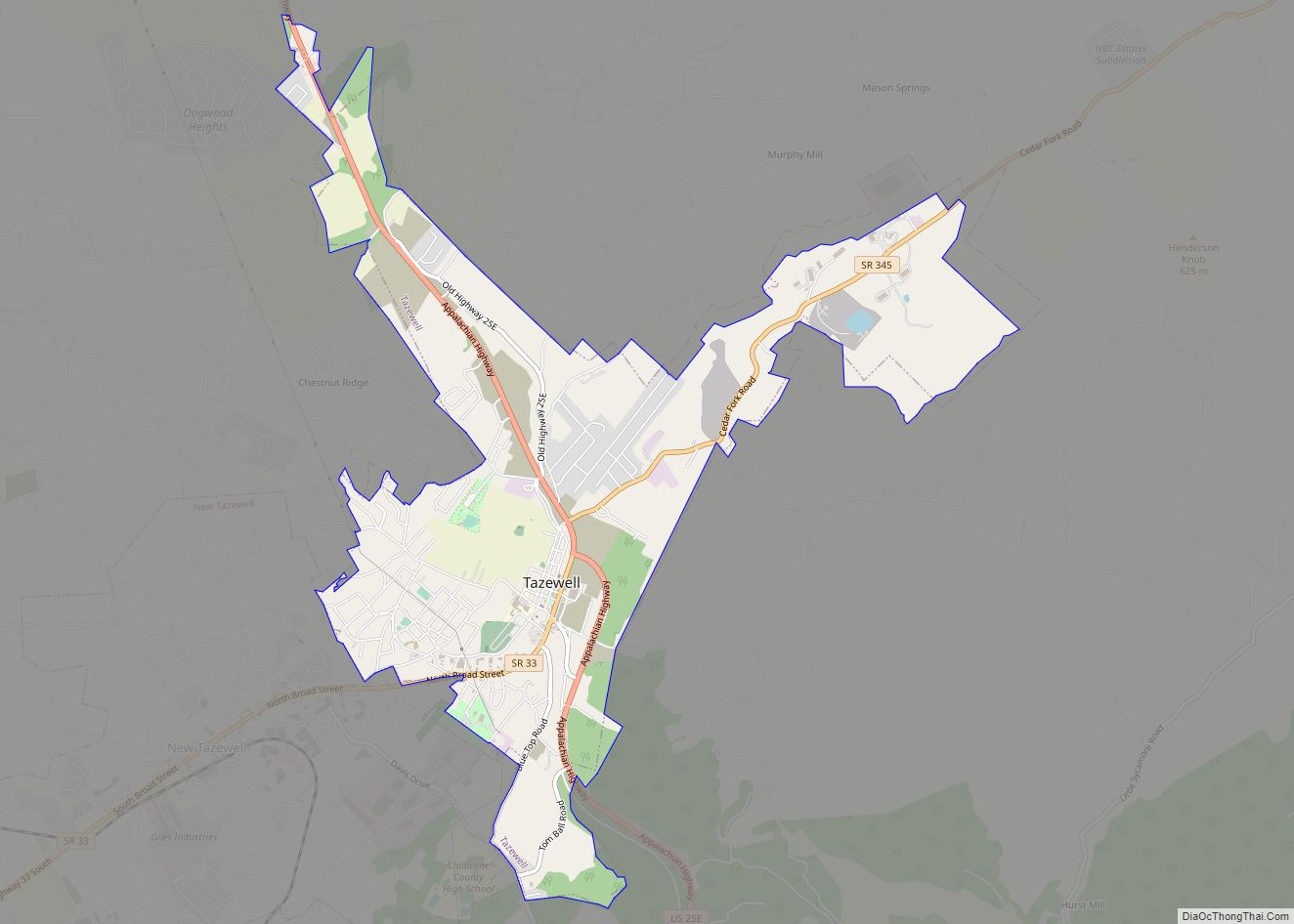
Online Interactive Map
Click on ![]() to view map in "full screen" mode.
to view map in "full screen" mode.
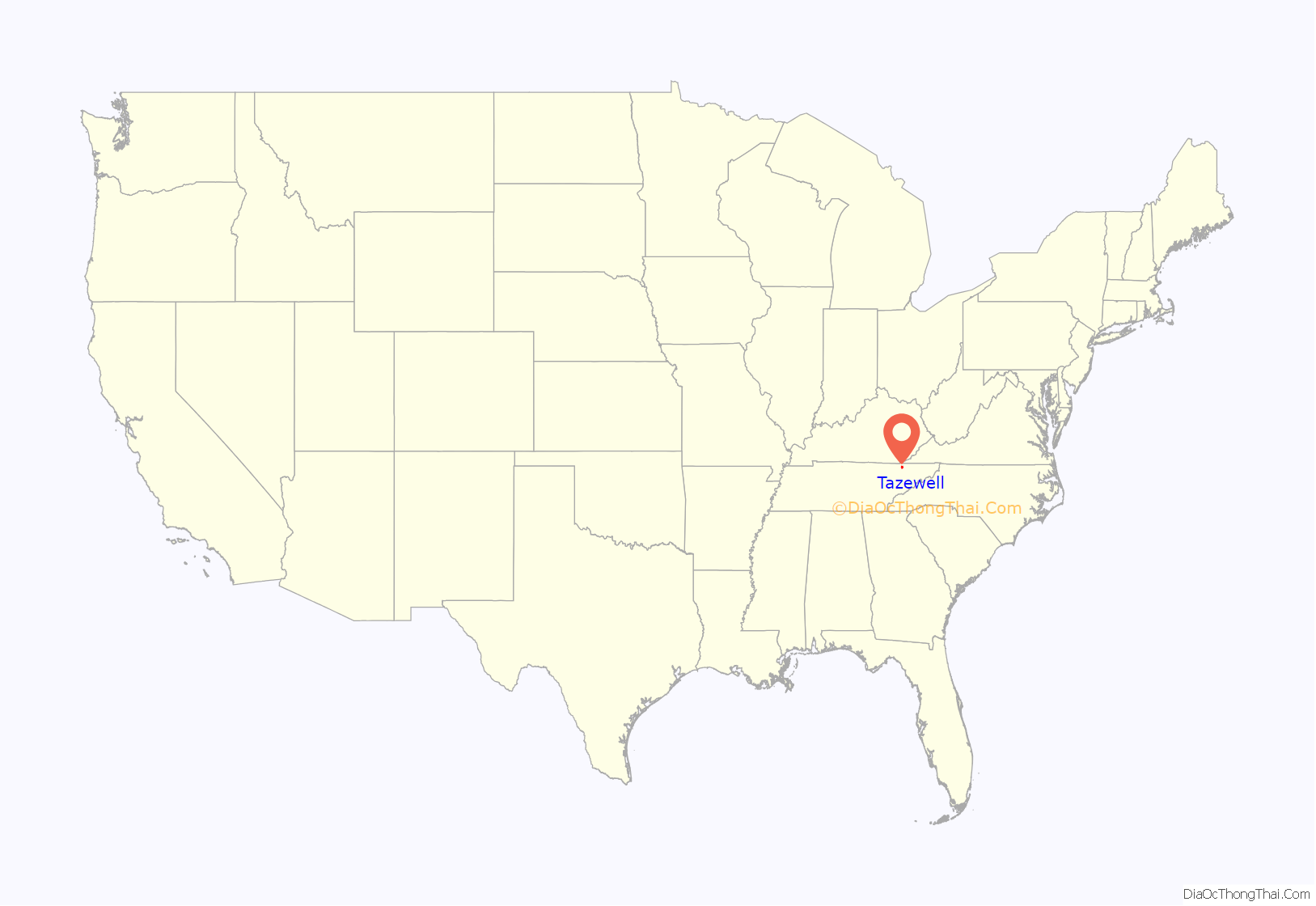
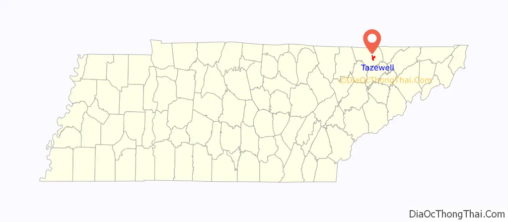
Tazewell location map. Where is Tazewell town?
History
In 1750, Dr. Thomas Walker of Virginia publicized the location of Cumberland Gap, which brought a stream of long hunters down the Clinch and Powell valleys into what is now Claiborne County. The land at the time was part of Cherokee and Shawnee hunting grounds, and hostile attacks by members of these two tribes were not uncommon. To protect themselves, hunters, fur traders and early settlers erected a series of small forts and stations along the Powell and Clinch valleys. One such station, known as Fort Butler, was located just west of modern Tazewell.
Among the earliest settlers in the Tazewell area was John Hunt (1750–1822), a militia captain who would later be instrumental in the founding of Huntsville, Alabama. In 1804, three years after the creation of Claiborne County, Tazewell was chosen as the county seat due in part to Hunt’s influence (although a local legend states that the residents of Tazewell’s rival for the seat, Springdale, were too intoxicated to vote on the day of selection). Hunt was named the county’s first sheriff, and the government met at his house until a courthouse was constructed. The original courthouse was a wooden structure which had hitching posts for horses in front.
In 1862, at the height of the Civil War, Confederate troops occupied Tazewell as part of the greater struggle for the strategic Cumberland Gap. When the Confederates evacuated the town in November of that year, a fire followed, destroying much of Tazewell. The town retains a number of historical structures, mostly from the Victorian era, including a historic jail, built in 1819.
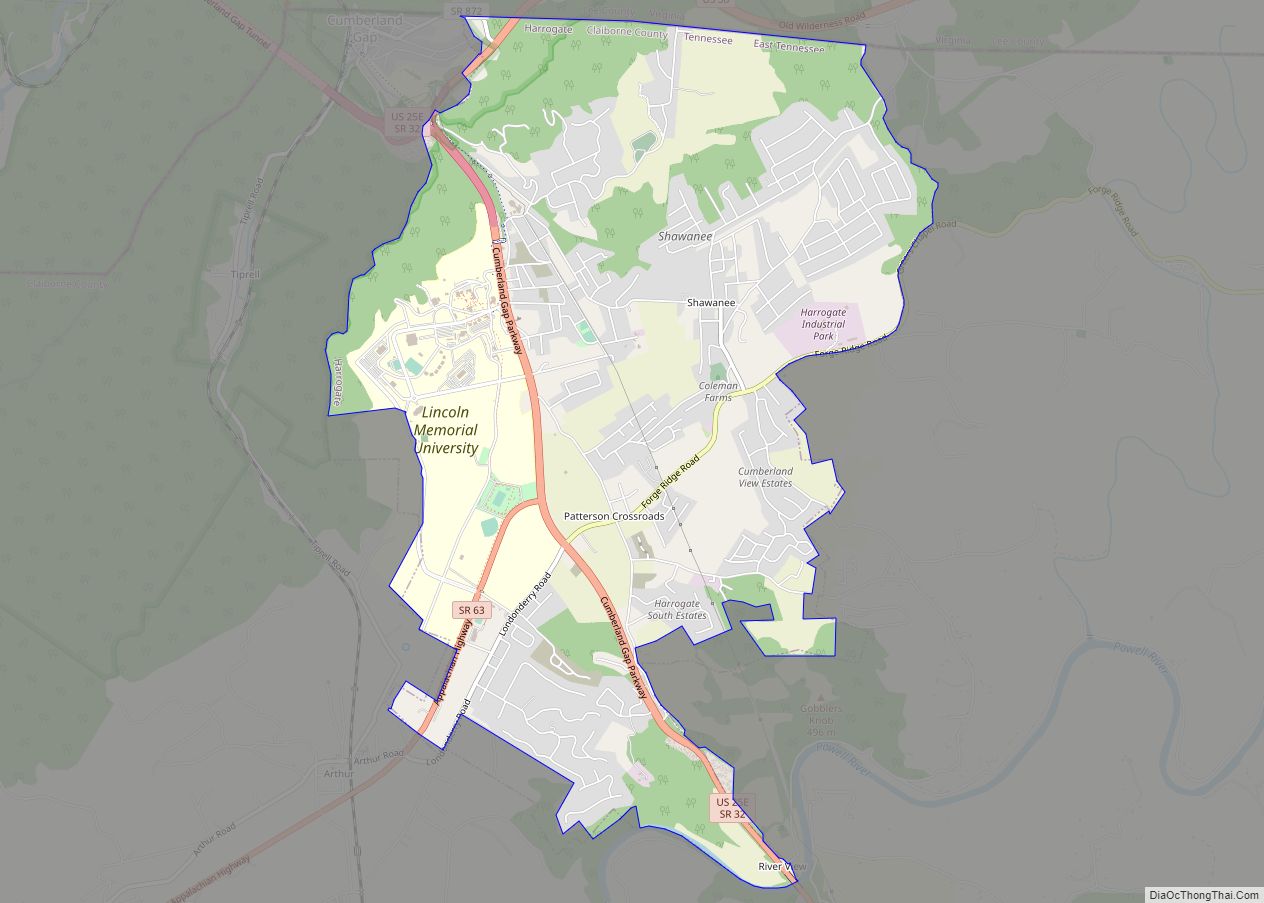
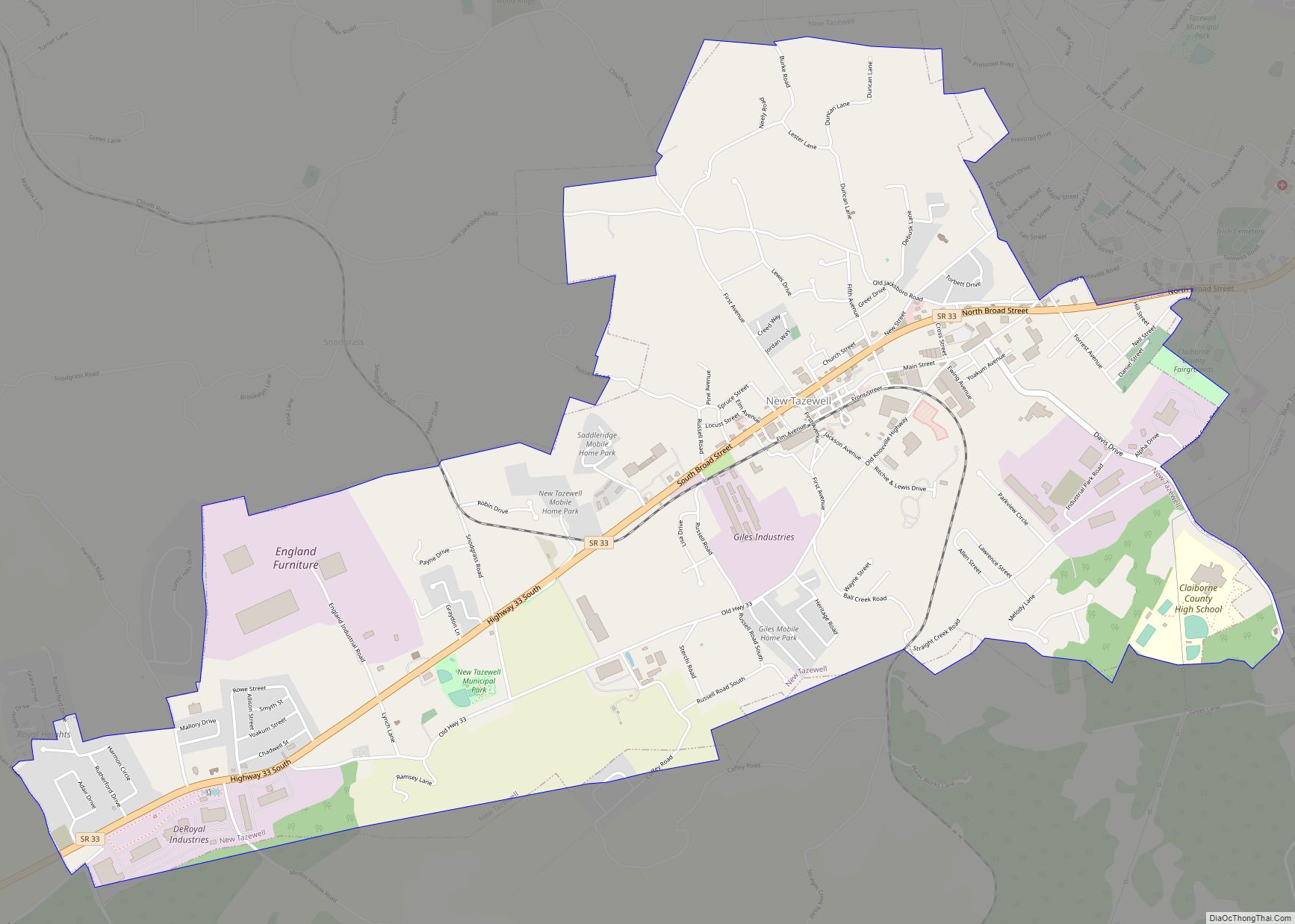
In 1890, plans developed for a railroad through the town, connecting nearby Cumberland Gap to Knoxville Residents protested the construction of a train depot, which led to the re-routing of the railroad and establishment of a depot several miles west, still bearing the name of the town. The area around the depot saw the birth of a new town, with businesses and homes propping in its vicinity. This town would later incorporate into what is now the city of New Tazewell.
In the early years of its incorporation, a rivalry began between the two communities, often over development projects choosing to start up in the area. In the 2000s, the rivalry subsided, and efforts to merge the two communities into one municipality were proposed, but were rejected.
Tazewell Road Map
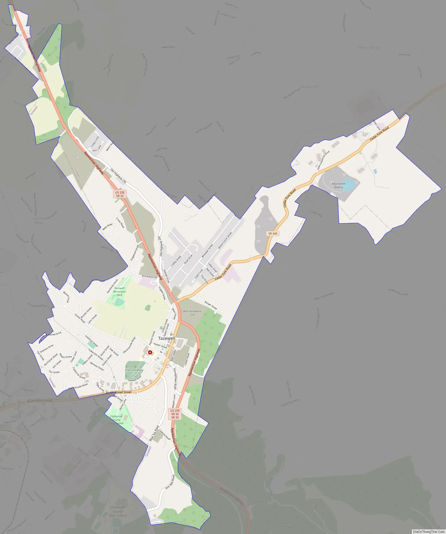
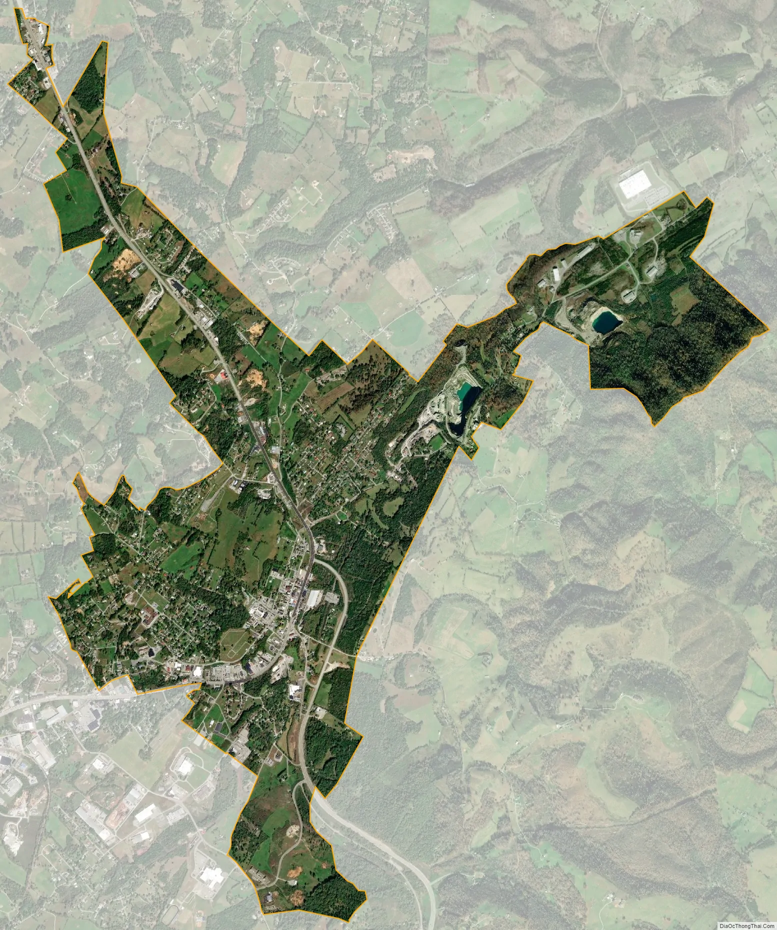
Tazewell city Satellite Map
Geography
Tazewell is located at 36°27′16″N 83°34′16″W / 36.45444°N 83.57111°W / 36.45444; -83.57111 (36.454408, -83.571074). The town is situated on the northern slope of Wallen Ridge, the northernmost of a series of long, narrow ridges that comprise the Ridge and Valley Province of the Appalachian Mountains. Big Barren Creek rises in the western section of Tazewell and flows southwestward for approximately 10 miles (16 km) before emptying into the Norris Lake impoundment of the Clinch River. The streams in the eastern section of Tazewell are part of the watershed of the Powell River, a Clinch tributary that flows westward a few miles north of Tazewell.
Tazewell is centered just east of the junction of US 25E, which connects the town to Morristown to the southeast and Middlesboro, Kentucky to the north, and SR 33, which connects the town to Maynardville to the southwest and Sneedville and the upper Clinch Valley to the northeast.
According to the United States Census Bureau, the town has a total area of 4.4 square miles (11 km), all land.
Climate
See also
Map of Tennessee State and its subdivision:- Anderson
- Bedford
- Benton
- Bledsoe
- Blount
- Bradley
- Campbell
- Cannon
- Carroll
- Carter
- Cheatham
- Chester
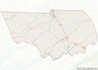
- Claiborne
- Clay
- Cocke
- Coffee
- Crockett
- Cumberland
- Davidson
- Decatur
- DeKalb
- Dickson
- Dyer
- Fayette
- Fentress
- Franklin
- Gibson
- Giles
- Grainger
- Greene
- Grundy
- Hamblen
- Hamilton
- Hancock
- Hardeman
- Hardin
- Hawkins
- Haywood
- Henderson
- Henry
- Hickman
- Houston
- Humphreys
- Jackson
- Jefferson
- Johnson
- Knox
- Lake
- Lauderdale
- Lawrence
- Lewis
- Lincoln
- Loudon
- Macon
- Madison
- Marion
- Marshall
- Maury
- McMinn
- McNairy
- Meigs
- Monroe
- Montgomery
- Moore
- Morgan
- Obion
- Overton
- Perry
- Pickett
- Polk
- Putnam
- Rhea
- Roane
- Robertson
- Rutherford
- Scott
- Sequatchie
- Sevier
- Shelby
- Smith
- Stewart
- Sullivan
- Sumner
- Tipton
- Trousdale
- Unicoi
- Union
- Van Buren
- Warren
- Washington
- Wayne
- Weakley
- White
- Williamson
- Wilson
- Alabama
- Alaska
- Arizona
- Arkansas
- California
- Colorado
- Connecticut
- Delaware
- District of Columbia
- Florida
- Georgia
- Hawaii
- Idaho
- Illinois
- Indiana
- Iowa
- Kansas
- Kentucky
- Louisiana
- Maine
- Maryland
- Massachusetts
- Michigan
- Minnesota
- Mississippi
- Missouri
- Montana
- Nebraska
- Nevada
- New Hampshire
- New Jersey
- New Mexico
- New York
- North Carolina
- North Dakota
- Ohio
- Oklahoma
- Oregon
- Pennsylvania
- Rhode Island
- South Carolina
- South Dakota
- Tennessee
- Texas
- Utah
- Vermont
- Virginia
- Washington
- West Virginia
- Wisconsin
- Wyoming