Mountain City is a town in and the county seat of Johnson County, Tennessee, United States. The population was 2,383 at the 2000 census and 2,531 at the 2010 census. It is the northeasternmost county seat in Tennessee. In addition, at an elevation of 2,418 feet (737 m), it has the distinction of being the highest incorporated city in the state.
| Name: | Mountain City town |
|---|---|
| LSAD Code: | 43 |
| LSAD Description: | town (suffix) |
| State: | Tennessee |
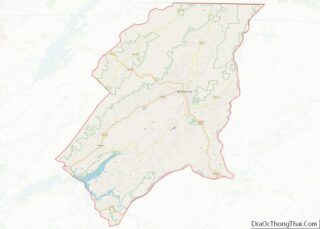
| County: | Johnson County |
| Founded: | 1836 |
| Incorporated: | 1905 |
| Elevation: | 2,418 ft (737 m) |
| Total Area: | 3.37 sq mi (8.73 km²) |
| Land Area: | 3.37 sq mi (8.73 km²) |
| Water Area: | 0.00 sq mi (0.00 km²) |
| Total Population: | 2,415 |
| Population Density: | 716.62/sq mi (276.66/km²) |
| ZIP code: | 37683 |
| Area code: | 423 |
| FIPS code: | 4750400 |
| GNISfeature ID: | 1328969 |
| Website: | www.johnsoncountytn.org |
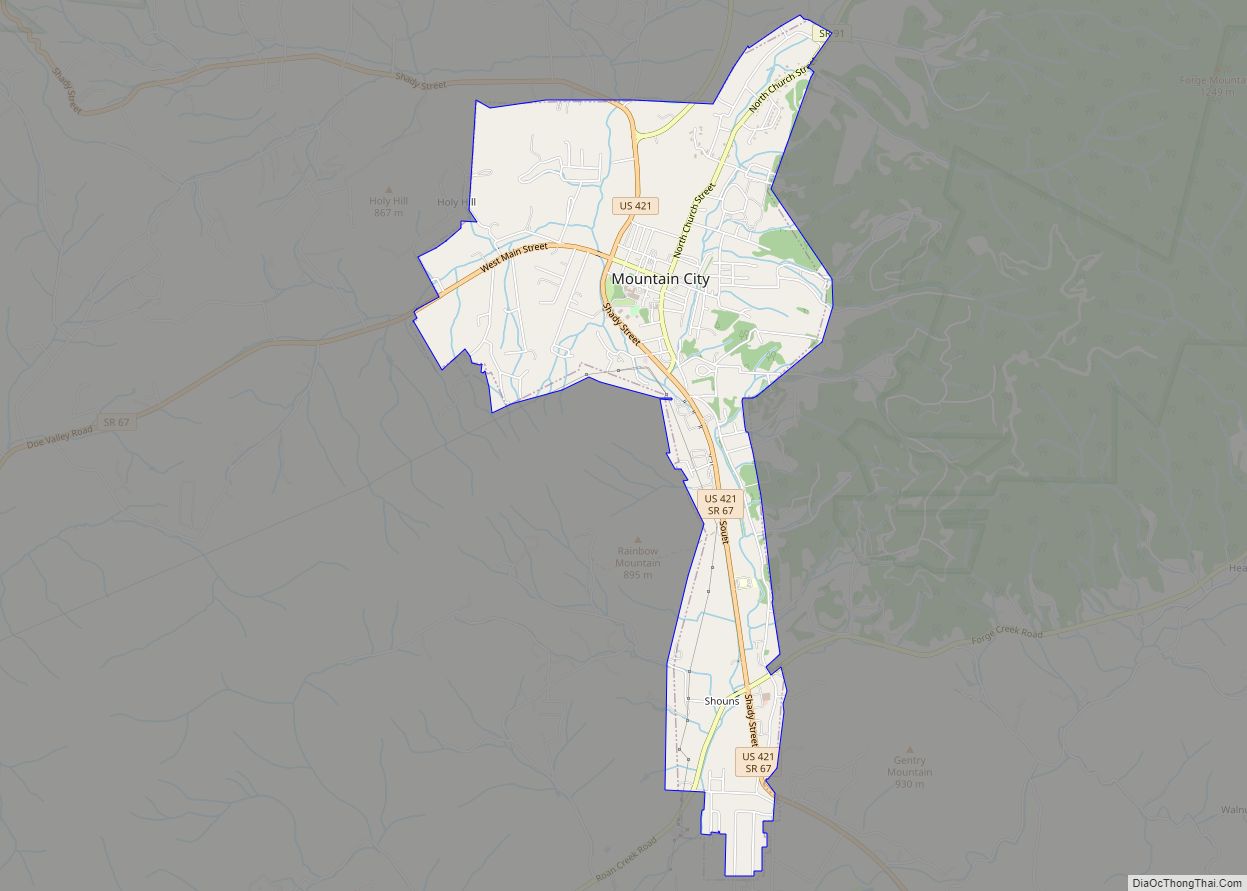
Online Interactive Map
Click on ![]() to view map in "full screen" mode.
to view map in "full screen" mode.
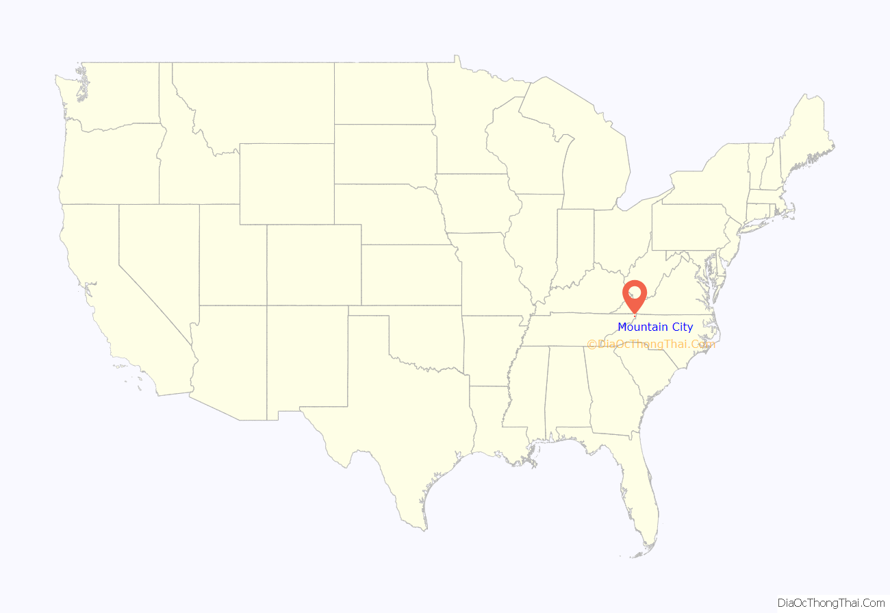
Mountain City location map. Where is Mountain City town?
History
When the first Euro-American explorers arrived in what is now the Mountain City area in the late 17th century, well-worn Native American trails passed through the area. In 1949, workers at the Maymead quarry (just south of Mountain City) discovered a cave with several early Mississippian-era (ca. 1000 A.D.) burials inside. The Needham and Arthur expedition of 1673 is believed to have passed through the area, making use of the gap at Trade to the south. Explorer Daniel Boone made use of the same gap on an expedition to what is now Kentucky in 1769, and today part of the Daniel Boone Heritage Trail— which follows Boone’s route— passes through Mountain City.
The first permanent Euro-American settlers arrived in the Mountain City area in the late 18th century, among them Leonard Shoun and Revolutionary War veteran Alexander Doran. The area was initially part of Carter County, but the difficulty of reaching Elizabethton (the county seat) led to the creation of Johnson County in 1836. That year, a county seat for the new county was platted on land purchased from William Vaught, and named Taylorsville after Colonel James P. Taylor. The name of the town was changed to “Mountain City” in 1885, presumably at the urging of Roderick R. Butler (1827–1902), a prominent citizen and U.S. Congressman, who wanted the town’s name to reflect its situation amidst one of the highest valleys in Tennessee. Butler’s mansion, now listed on the National Register of Historic Places, still stands near the center of the town.
Music
In May 1925, Mountain City was the site of a musical gathering, the first Mountain City Fiddlers Convention, that is considered a landmark event in the modern history of Appalachian traditional music. The gathering contributed significantly to the development of country music, and is commemorated every summer, at the Old Time Fiddler’s Convention in nearby Laurel Bloomery.
RedTail Mountain Resort
Since 1982, Mountain City has been home to a luxury inn and country club, now known as the RedTail Mountain Resort. It is the northeasternmost gated community in Tennessee.
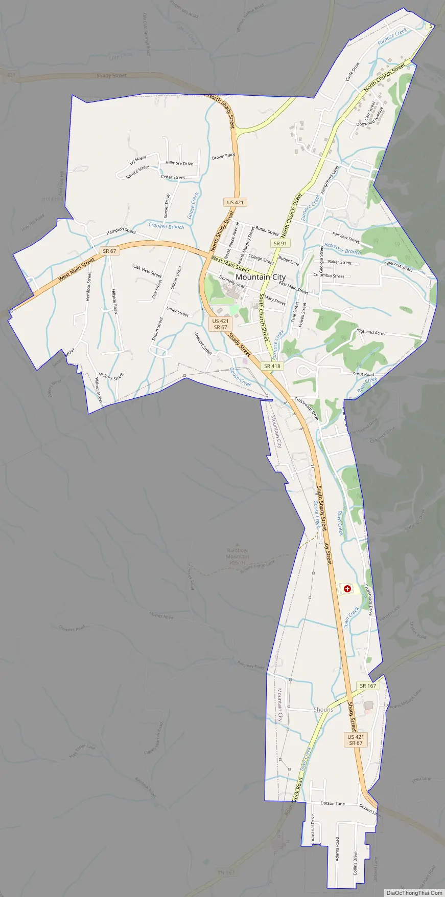
Mountain City Road Map
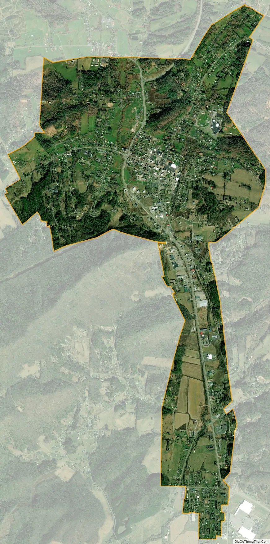
Mountain City city Satellite Map
Geography
Mountain City is located at 36°28′6″N 81°48′14″W / 36.46833°N 81.80389°W / 36.46833; -81.80389 (36.468444, -81.803856). According to the United States Census Bureau, the town has a total area of 3.3 square miles (8.6 km), all land. At just over 2,400 feet (730 m), Mountain City is situated in one of the highest valleys in the state of Tennessee. Doe Mountain rises to the southwest, Forge Mountain rises to the east, and the Iron Mountains rise prominently to the north. The Tennessee-North Carolina border runs opposite Forge Mountain approximately 5 miles (8.0 km) east of Mountain City, and the Tennessee-Virginia border passes about 10 miles (16 km) to the north.
U.S. Route 421 (Shady Street) connects Mountain City with Bristol, Tennessee, to the northwest and Boone, North Carolina, to the southeast. Tennessee State Route 67 traverses the Doe Creek Valley on the north side of Doe Mountain, and connects Mountain City with Carter County and the Watauga Lake areas to the west. A spur of S.R. 67, S.R. 167, follows the Roan Creek Valley on the south side of Doe Mountain, rejoining S.R. 67 at Shouns in the southern part of Mountain City. Tennessee State Route 91 connects Mountain City to Laurel Bloomery, Tennessee, and Damascus, Virginia, to the north (the road becomes Virginia State Route 91 at the state line).
See also
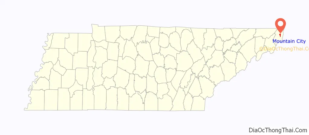
Map of Tennessee State and its subdivision:- Anderson
- Bedford
- Benton
- Bledsoe
- Blount
- Bradley
- Campbell
- Cannon
- Carroll
- Carter
- Cheatham
- Chester
- Claiborne
- Clay
- Cocke
- Coffee
- Crockett
- Cumberland
- Davidson
- Decatur
- DeKalb
- Dickson
- Dyer
- Fayette
- Fentress
- Franklin
- Gibson
- Giles
- Grainger
- Greene
- Grundy
- Hamblen
- Hamilton
- Hancock
- Hardeman
- Hardin
- Hawkins
- Haywood
- Henderson
- Henry
- Hickman
- Houston
- Humphreys
- Jackson
- Jefferson
- Johnson
- Knox
- Lake
- Lauderdale
- Lawrence
- Lewis
- Lincoln
- Loudon
- Macon
- Madison
- Marion
- Marshall
- Maury
- McMinn
- McNairy
- Meigs
- Monroe
- Montgomery
- Moore
- Morgan
- Obion
- Overton
- Perry
- Pickett
- Polk
- Putnam
- Rhea
- Roane
- Robertson
- Rutherford
- Scott
- Sequatchie
- Sevier
- Shelby
- Smith
- Stewart
- Sullivan
- Sumner
- Tipton
- Trousdale
- Unicoi
- Union
- Van Buren
- Warren
- Washington
- Wayne
- Weakley
- White
- Williamson
- Wilson
- Alabama
- Alaska
- Arizona
- Arkansas
- California
- Colorado
- Connecticut
- Delaware
- District of Columbia
- Florida
- Georgia
- Hawaii
- Idaho
- Illinois
- Indiana
- Iowa
- Kansas
- Kentucky
- Louisiana
- Maine
- Maryland
- Massachusetts
- Michigan
- Minnesota
- Mississippi
- Missouri
- Montana
- Nebraska
- Nevada
- New Hampshire
- New Jersey
- New Mexico
- New York
- North Carolina
- North Dakota
- Ohio
- Oklahoma
- Oregon
- Pennsylvania
- Rhode Island
- South Carolina
- South Dakota
- Tennessee
- Texas
- Utah
- Vermont
- Virginia
- Washington
- West Virginia
- Wisconsin
- Wyoming