Loretto is a city in Lawrence County, Tennessee, United States. The population was 1,714 at the 2010 census, and 1,739 at the 2020 census.
| Name: | Loretto city |
|---|---|
| LSAD Code: | 25 |
| LSAD Description: | city (suffix) |
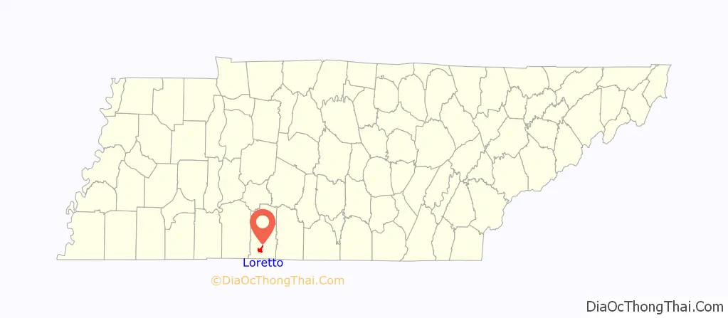
| State: | Tennessee |
| County: | Lawrence County |
| Elevation: | 825 ft (251 m) |
| Total Area: | 3.79 sq mi (9.81 km²) |
| Land Area: | 3.78 sq mi (9.80 km²) |
| Water Area: | 0.01 sq mi (0.02 km²) |
| Total Population: | 1,739 |
| Population Density: | 459.81/sq mi (177.51/km²) |
| ZIP code: | 38469 |
| Area code: | 931 |
| FIPS code: | 4743700 |
| GNISfeature ID: | 1292062 |
| Website: | cityoflorettotn.com |
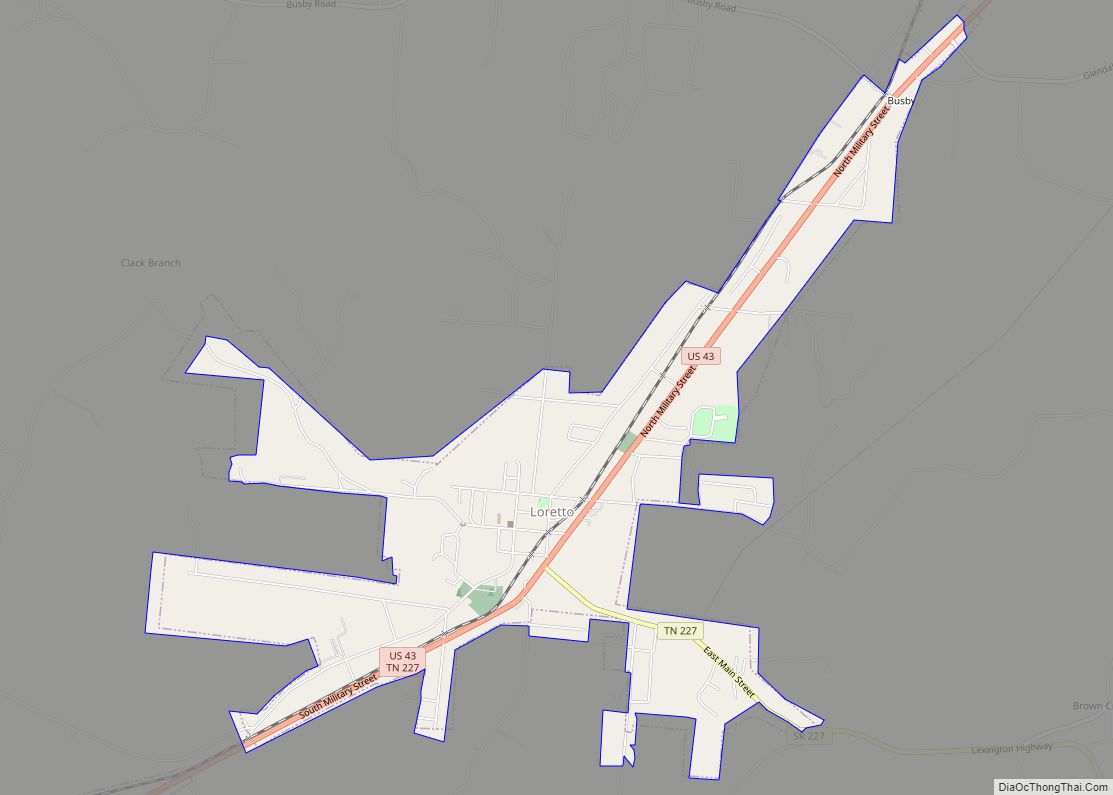
Online Interactive Map
Click on ![]() to view map in "full screen" mode.
to view map in "full screen" mode.
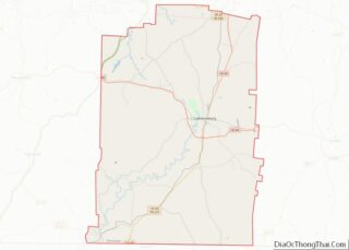
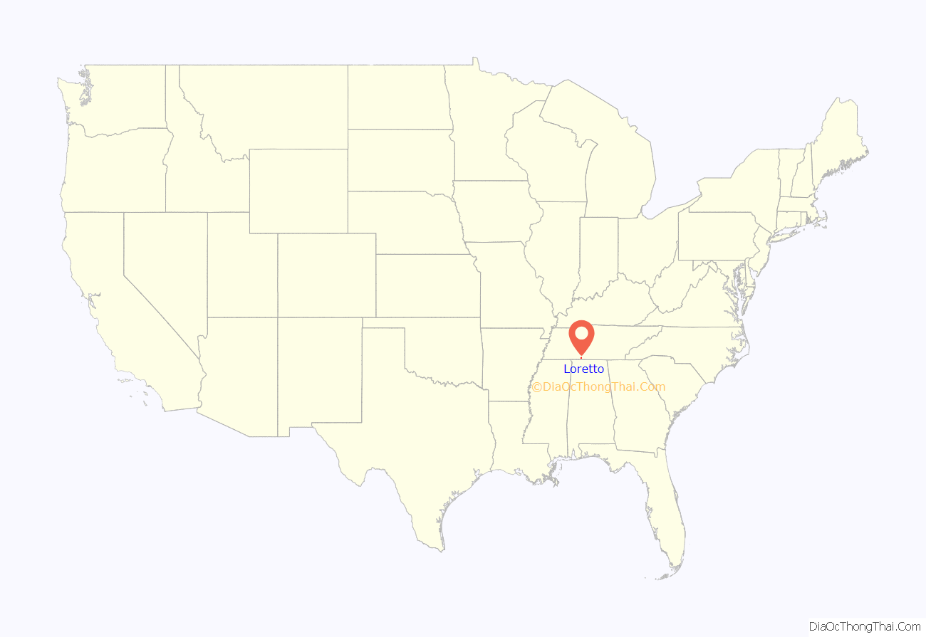
Loretto location map. Where is Loretto city?
History
Loretto began as a stagecoach station known as “Glen Rock” in the early 19th century. In 1870, a number of German Catholic immigrants settled in the Loretto area, and a new city was established shortly afterward. Some sources suggest the name “Loretto” was inspired by the Loreto region in Italy, while others say the city was named for a sainted nun. The congregation the immigrants formed, the Sacred Heart Church of Jesus, still exists, and their church (built in 1912) is listed on the National Register of Historic Places. With the arrival of the railroad in the 1880s, Loretto thrived as a lumber town.
Other historic buildings include the Bank of Loretto building, which was built in the 1920s. The Bank of Loretto building was renovated in 2013 and housed Nana’s Pizzeria, which closed in late 2020. The building now houses The Noble Fox restaurant. Next door to the old Loretto bank building was Weathers Store and Myers Store. They sold general merchandise to generations of families. Steps down the street lies the Loretto Milling Company, established in 1895 and still open for business, making it one of the oldest family-run businesses in the city. Other businesses located in this district included a doctor’s office, cobbler’s shop, cafes, hotels, and a funeral home. There was also a stage coach stop, and then later on a bus depot. The historic downtown area began to decline following the construction of U.S. Route 43 to the east of the district in the 1940s, when its commercial activity shifted to the new highway. Like many Southern towns, Loretto is applying for grants to help revive the older historic district.
Loretto is the home of the Loretto High School Mustangs.
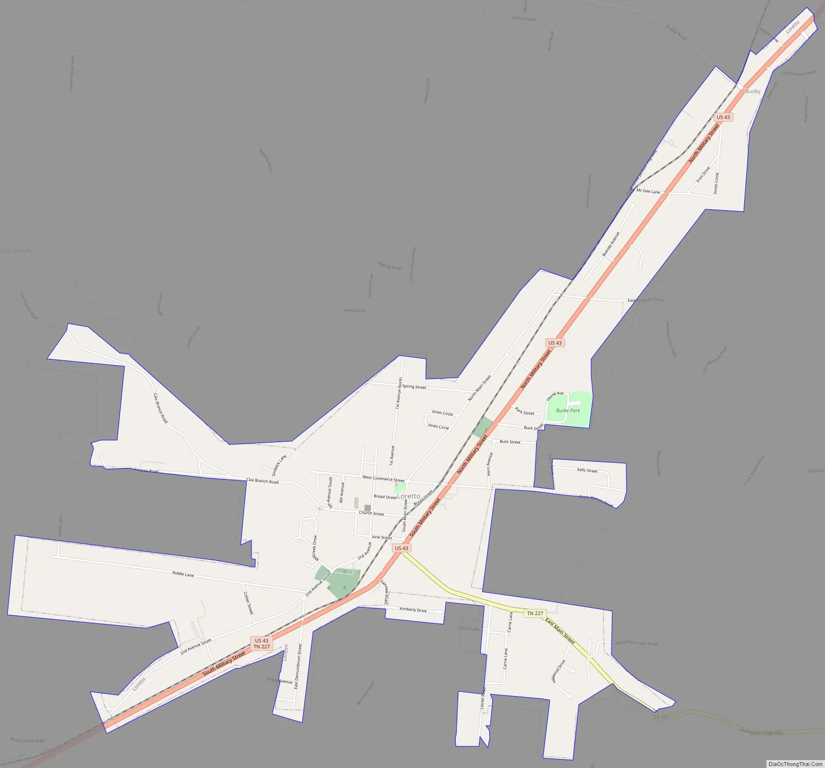
Loretto Road Map
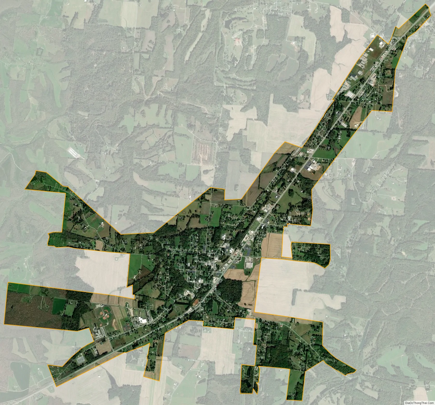
Loretto city Satellite Map
Geography
Loretto is located at 35°4′42″N 87°26′20″W / 35.07833°N 87.43889°W / 35.07833; -87.43889 (35.078401, -87.439023). The city is situated on a relatively broad ridgetop between the Shoal Creek Valley to the west and Bluewater Creek to the east. U.S. Route 43 connects Loretto with Lawrenceburg to the northeast and the Muscle Shoals area in Alabama to the southwest. Tennessee State Route 227 connects Loretto with rural Lawrence County and Lexington, Alabama, to the southeast (the road becomes Alabama State Route 101 at the state line).
According to the United States Census Bureau, the city has a total area of 3.8 square miles (9.8 km), of which 3.8 square miles (9.8 km) is land and 0.27% is water.
See also
Map of Tennessee State and its subdivision:- Anderson
- Bedford
- Benton
- Bledsoe
- Blount
- Bradley
- Campbell
- Cannon
- Carroll
- Carter
- Cheatham
- Chester
- Claiborne
- Clay
- Cocke
- Coffee
- Crockett
- Cumberland
- Davidson
- Decatur
- DeKalb
- Dickson
- Dyer
- Fayette
- Fentress
- Franklin
- Gibson
- Giles
- Grainger
- Greene
- Grundy
- Hamblen
- Hamilton
- Hancock
- Hardeman
- Hardin
- Hawkins
- Haywood
- Henderson
- Henry
- Hickman
- Houston
- Humphreys
- Jackson
- Jefferson
- Johnson
- Knox
- Lake
- Lauderdale
- Lawrence
- Lewis
- Lincoln
- Loudon
- Macon
- Madison
- Marion
- Marshall
- Maury
- McMinn
- McNairy
- Meigs
- Monroe
- Montgomery
- Moore
- Morgan
- Obion
- Overton
- Perry
- Pickett
- Polk
- Putnam
- Rhea
- Roane
- Robertson
- Rutherford
- Scott
- Sequatchie
- Sevier
- Shelby
- Smith
- Stewart
- Sullivan
- Sumner
- Tipton
- Trousdale
- Unicoi
- Union
- Van Buren
- Warren
- Washington
- Wayne
- Weakley
- White
- Williamson
- Wilson
- Alabama
- Alaska
- Arizona
- Arkansas
- California
- Colorado
- Connecticut
- Delaware
- District of Columbia
- Florida
- Georgia
- Hawaii
- Idaho
- Illinois
- Indiana
- Iowa
- Kansas
- Kentucky
- Louisiana
- Maine
- Maryland
- Massachusetts
- Michigan
- Minnesota
- Mississippi
- Missouri
- Montana
- Nebraska
- Nevada
- New Hampshire
- New Jersey
- New Mexico
- New York
- North Carolina
- North Dakota
- Ohio
- Oklahoma
- Oregon
- Pennsylvania
- Rhode Island
- South Carolina
- South Dakota
- Tennessee
- Texas
- Utah
- Vermont
- Virginia
- Washington
- West Virginia
- Wisconsin
- Wyoming