Marin County /məˈrɪn/ (listen) (Spanish: Condado de Marín) is a county located in the northwestern part of the San Francisco Bay Area of the U.S. state of California. As of the 2020 census, the population was 262,231. Its county seat and largest city is San Rafael. Marin County is across the Golden Gate Bridge from San Francisco, and is included in the San Francisco–Oakland–Berkeley, CA Metropolitan Statistical Area.
Marin County’s natural sites include the Muir Woods redwood forest, the Marin Headlands, Stinson Beach, the Point Reyes National Seashore, and Mount Tamalpais. As of 2019, Marin County had the sixth highest income per capita of all U.S. counties, at $141,735. The county is governed by the Marin County Board of Supervisors.
The Marin County Civic Center was designed by Frank Lloyd Wright and draws thousands of visitors a year to guided tours of its arch and atrium design. In 1994, a new county jail facility was embedded into the hillside nearby.
The United States’ oldest cross country running event, the Dipsea Race, takes place annually in Marin County, attracting thousands of athletes. Modern Mountain biking has many early origins on the slopes of Mount Tamalpais in Marin. San Quentin State Prison is located in the county.
| Name: | Marin County |
|---|---|
| FIPS code: | 06-041 |
| State: | California |
| Founded: | 1850 |
| Named for: | Chief Marin, “great chief of the tribe Licatiut” |
| Seat: | San Rafael |
| Largest city: | San Rafael (population) Novato (area) |
| Total Area: | 828 sq mi (2,140 km²) |
| Land Area: | 520 sq mi (1,300 km²) |
| Total Population: | 262,231 |
| Population Density: | 504/sq mi (195/km²) |
| Time zone: | UTC−8 (Pacific) |
| Summer Time Zone (DST): | UTC−7 (PDT) |
| Website: | www.co.marin.ca.us |
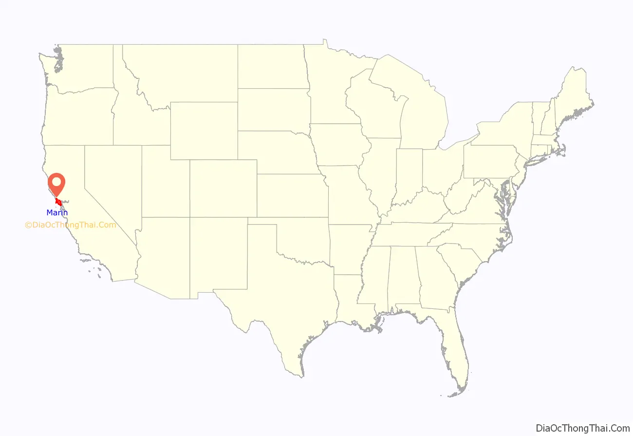
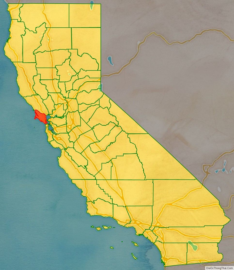
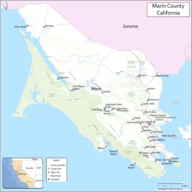
Marin County location map. Where is Marin County?
History
Native American settlement
Thousands of years ago, Coast Miwok people first populated the area today known as Marin County.
In 1770, Coast Miwok population ranged from 1,500 to 2,000, with about 600 village sites throughout the county.
In 1967, the Marin Museum of the American Indian was established, with exhibits focusing on Coast Miwok artifacts, crafts, and artwork. As of 2021, Indigenous-led events include healing drumming, dogbane cordage demonstrations, trade feasts, and traditional dancing.
American colonization
During the Mexican-American war, areas of Marin County were seized by Americans as part of the invasion of California (1846–1847). Marin County is one of the original 27 counties of California, created February 18, 1850, following adoption of the California Constitution of 1849 and just months before the state was admitted to the Union.
According to General Mariano Vallejo, who headed an 1850 committee to name California’s counties, the county was named for “Marin,” great chief of the tribe Licatiut.” Marin had been named “Huicmuse” until he was baptized as “Marino” at about age 20. Marin / Marino was born into the Huimen people, a Coast Miwok tribe of Native Americans who inhabited the San Rafael area. Vallejo believed that “Chief Marin” had waged several fierce battles against the Spanish. Marino definitely did reside at Mission Dolores (in modern San Francisco) much of the time from his 1801 baptism and marriage until 1817, frequently serving as a baptism witness and godfather; he may have escaped and been recaptured at some point during that time. Starting in 1817, he served as an alcalde (in effect, an overseer) at the San Rafael Mission, where he lived from 1817 off and on until his death. In 1821, Marino served as an expedition guide for the Spanish for a couple of years before escaping and hiding out for some months in the tiny Marin Islands (also named after him); his recapture resulted in a yearlong incarceration at the Presidio before his return to the Mission San Rafael area for about 15 years until his death in 1839. In 2009, a plaque commemorating Chief Marin was placed in Mill Valley.
Another version of the origin of the county name is that the bay between San Pedro Point and San Quentin Point was named Bahía de Nuestra Señora del Rosario la Marinera in 1775, and that Marin is simply an abbreviation of this name.
Francis Drake and the crew of the Golden Hind was thought to have landed on the Marin coast in 1579 claiming the land as Nova Albion. A bronze plaque inscribed with Drake’s claim to the new lands, fitting the description in Drake’s own account, was discovered in 1933. This so-called Drake’s Plate of Brass was revealed as a hoax in 2003.
In 1595, Sebastian Cermeno lost his ship, the San Agustin, while exploring the Marin Coast. The Spanish explorer Vizcaíno landed about twenty years after Drake in what is now called Drakes Bay. However the first Spanish settlement in Marin was not established until 1817 when Mission San Rafael Arcángel was founded partly in response to the Russian-built Fort Ross to the north in what is now Sonoma County. Mission San Rafael Arcángel was founded in what is now downtown San Rafael as the 20th Spanish mission in the colonial Mexican province of Alta California by four priests, Father Narciso Duran from Mission San Jose, Father Abella from Mission San Francisco de Asís, Father Gil y Taboada and Father Mariano Payeras, the President of the Missions, on December 14, 1817, four years before Mexico gained independence from Spain.
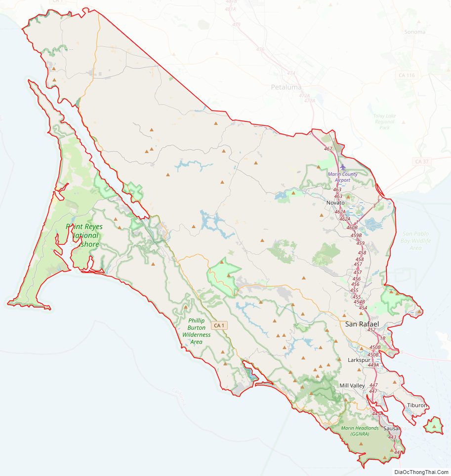
Marin County Road Map
Geography
According to the U.S. Census Bureau, the county has a total area of 828 square miles (2,140 km), of which 520 square miles (1,300 km) is land and 308 square miles (800 km) (37.2%) is water. It is the fourth-smallest county in California by land area. According to the records at the County Assessor-Recorder’s Office, as of June 2006, Marin had 91,065 acres (369 km) of taxable land, consisting of 79,086 parcels with a total tax basis of $39.8 billion. These parcels are divided into the following classifications:
Geographically, the county forms a large, southward-facing peninsula, with the Pacific Ocean to the west, San Pablo Bay, and San Francisco Bay to the east, and – across the Golden Gate – the city of San Francisco to the south. Marin County’s northern border is with Sonoma County.
Most of the county’s population resides on the eastern side, with a string of communities running along U.S. Route 101 and the San Francisco Bay, from Sausalito to Tiburon to Corte Madera to San Rafael and Novato. The interior contains large areas of agricultural and open space; West Marin, through which State Route 1 runs alongside the California coast, contains many small unincorporated communities whose economies depend on agriculture and tourism. West Marin has beaches which are popular destinations for surfers and tourists year-round.
Notable features of the shoreline along the San Francisco Bay include the Sausalito shoreline, Richardson Bay, the Tiburon Peninsula, Ring Mountain, and Triangle Marsh at Corte Madera. Further north lies San Quentin State Prison along the San Rafael shoreline.
Adjacent counties
- Sonoma County – north
- San Francisco – south
National protected areas
- Golden Gate National Recreation Area (part)
- Marin Islands National Wildlife Refuge
- Muir Woods National Monument
- Point Reyes National Seashore
- San Pablo Bay National Wildlife Refuge (part)
- Gulf of the Farallones National Marine Sanctuary (part)
State and local protected areas
The Marin County Department of Parks and Open Space manages numerous county parks and open spaces, including Stafford Lake County Park. The Marin Municipal Water District has 130 mi (209 km) of trails.
- Angel Island State Park
- China Camp State Park
- Mount Tamalpais State Park
- Olompali State Historic Park
- Samuel P. Taylor State Park
- Tomales Bay State Park
Marine Protected Areas of Marin County
Like underwater parks, these marine-protected areas help conserve ocean wildlife and marine ecosystems:
- Estero Americano State Marine Recreational Management Area
- Estero de San Antonio State Marine Recreational Management Area
- Point Reyes State Marine Reserve & Point Reyes State Marine Conservation Area
- Estero de Limantour State Marine Reserve & Drakes Estero State Marine Conservation Area
- Duxbury Reef State Marine Conservation Area
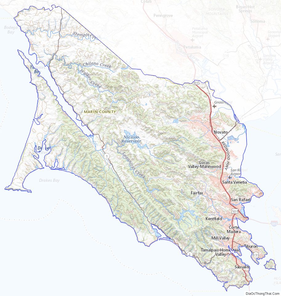
Marin County Topographic Map
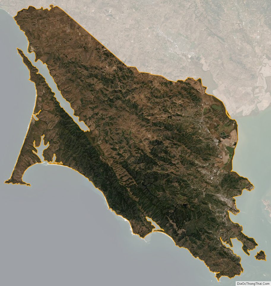
Marin County Satellite Map
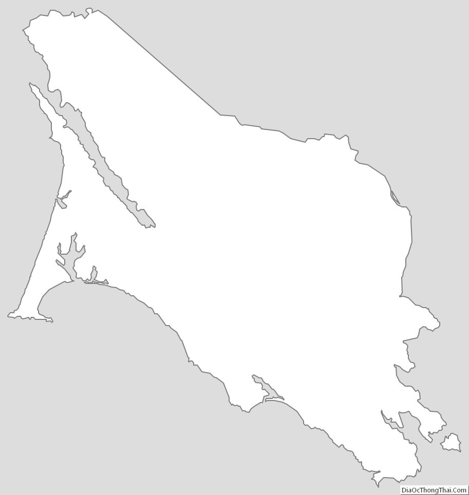
Marin County Outline Map