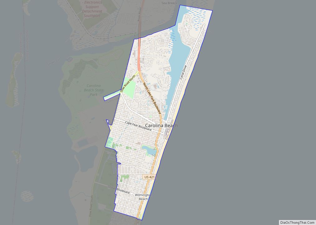
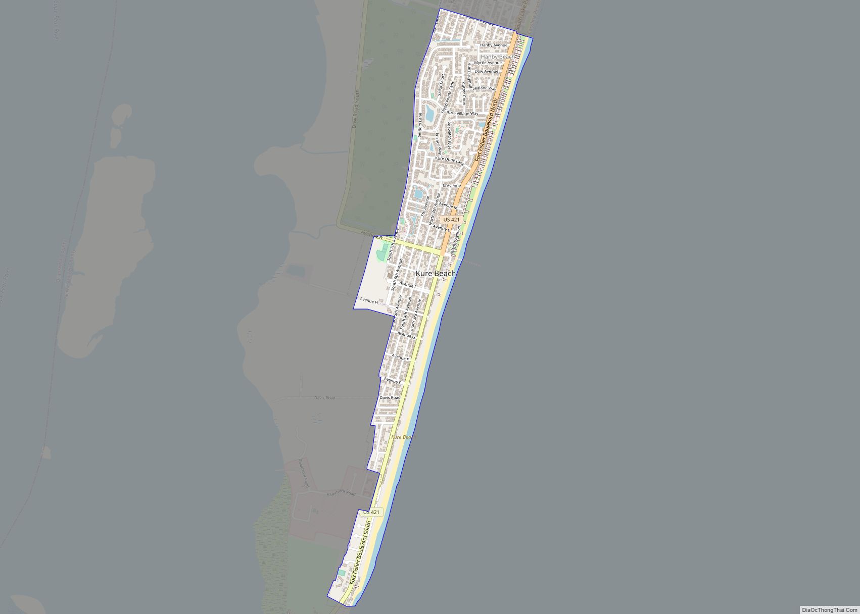
Carolina Beach is a beach town in New Hanover County, North Carolina, United States, situated about 12 miles (19 km) south of Wilmington International Airport in southeastern coastal North Carolina. As of the 2020 census, the city population was 6,564. It is part of the Wilmington metropolitan area. The community of Wilmington Beach was annexed by the town in 2000.
Carolina Beach lies at the northern end of Pleasure Island, which it shares with the community of Kure Beach, south of the inlet that separates the island from the unincorporated community of Sea Breeze. The town has a land area of 2.45 square miles (6.3 km), extending along the island from Freeman Park in the north to Alabama Avenue in the south. The town borders Kure Beach, which is directly to the south of Carolina Beach. During the summer months, the town of Carolina Beach has live Beach music every Friday night on the boardwalk right near town center. Some of the favorite restaurants include Kates Pancakes, Hang 10 Grill, and Shuckin’ Shack Oyster Bar and Grill.
| Name: | Carolina Beach town |
|---|---|
| LSAD Code: | 43 |
| LSAD Description: | town (suffix) |
| State: | North Carolina |
| County: | New Hanover County |
| Elevation: | 3 ft (1 m) |
| Total Area: | 2.74 sq mi (7.09 km²) |
| Land Area: | 2.45 sq mi (6.35 km²) |
| Water Area: | 0.29 sq mi (0.74 km²) |
| Total Population: | 6,564 |
| Population Density: | 2,677.00/sq mi (1,033.61/km²) |
| ZIP code: | 28428 |
| FIPS code: | 3710500 |
| GNISfeature ID: | 0982655 |
| Website: | carolinabeach.org |
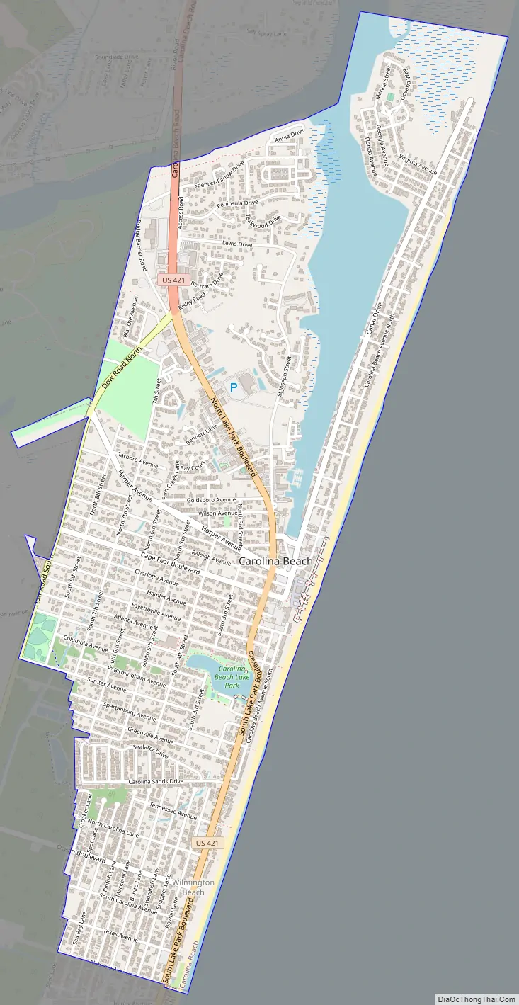
Online Interactive Map
Click on ![]() to view map in "full screen" mode.
to view map in "full screen" mode.
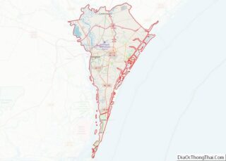
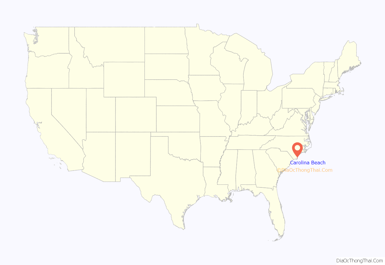
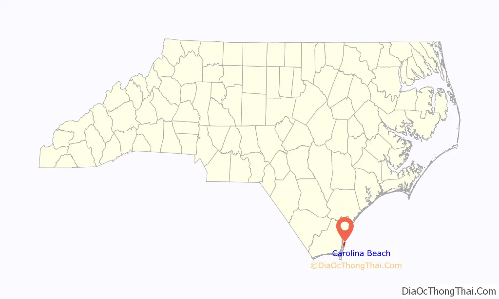
Carolina Beach location map. Where is Carolina Beach town?
History
The town was “wiped off the map” by Hurricane Hazel in 1954. Reportedly, 362 buildings were destroyed in the town.
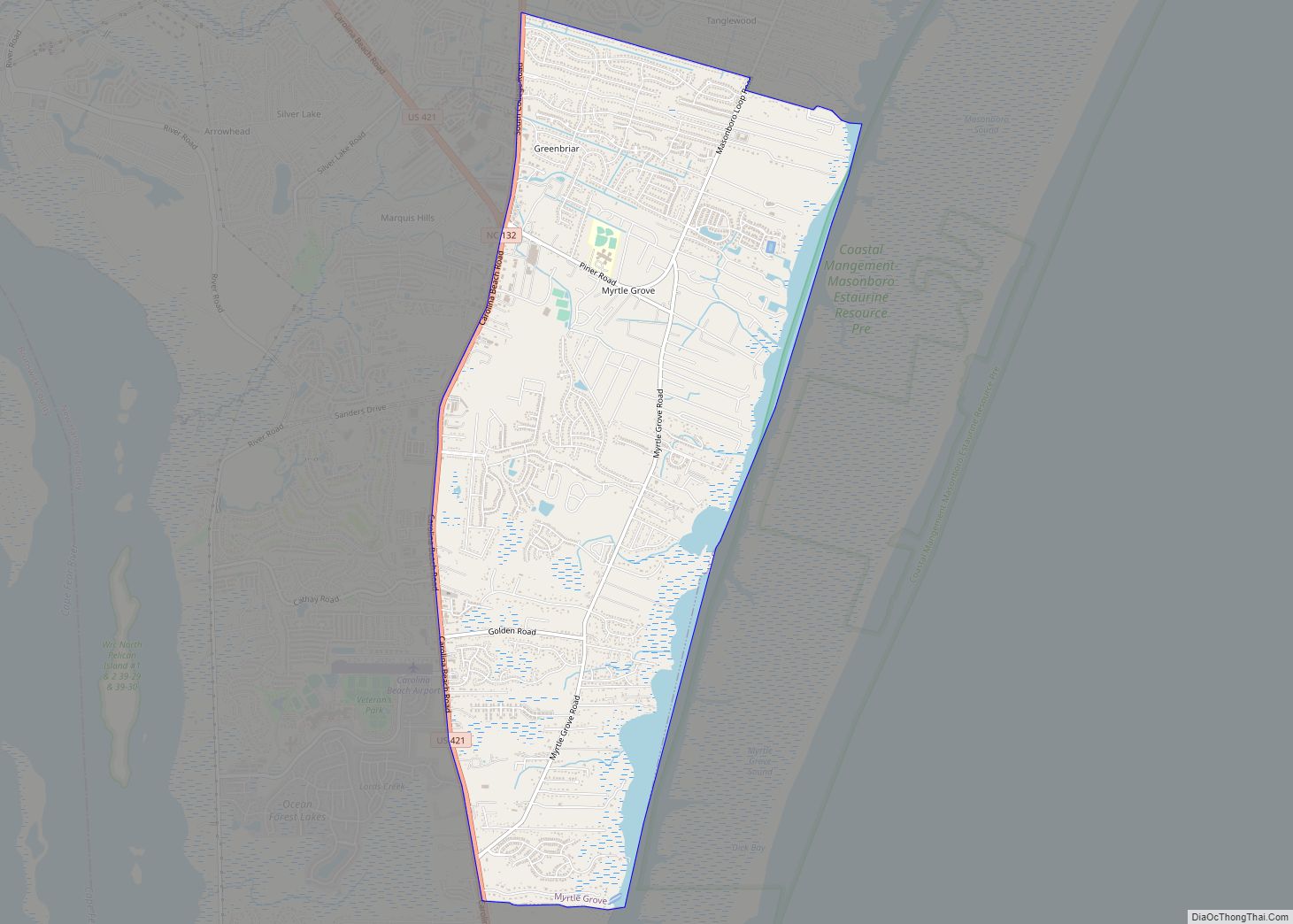
Carolina Beach Road Map
Carolina Beach city Satellite Map

Geography
Carolina Beach is located at 34°2′12″N 77°53′49″W / 34.03667°N 77.89694°W / 34.03667; -77.89694 (34.036796, -77.896939).
According to the United States Census Bureau, the town has a total area of 2.5 square miles (6.5 km).2.2 square miles (5.7 km) of it is land and 0.2 square miles (0.52 km) of it (8.13%) is water.
See also
Map of North Carolina State and its subdivision:- Alamance
- Alexander
- Alleghany
- Anson
- Ashe
- Avery
- Beaufort
- Bertie
- Bladen
- Brunswick
- Buncombe
- Burke
- Cabarrus
- Caldwell
- Camden
- Carteret
- Caswell
- Catawba
- Chatham
- Cherokee
- Chowan
- Clay
- Cleveland
- Columbus
- Craven
- Cumberland
- Currituck
- Dare
- Davidson
- Davie
- Duplin
- Durham
- Edgecombe
- Forsyth
- Franklin
- Gaston
- Gates
- Graham
- Granville
- Greene
- Guilford
- Halifax
- Harnett
- Haywood
- Henderson
- Hertford
- Hoke
- Hyde
- Iredell
- Jackson
- Johnston
- Jones
- Lee
- Lenoir
- Lincoln
- Macon
- Madison
- Martin
- McDowell
- Mecklenburg
- Mitchell
- Montgomery
- Moore
- Nash
- New Hanover
- Northampton
- Onslow
- Orange
- Pamlico
- Pasquotank
- Pender
- Perquimans
- Person
- Pitt
- Polk
- Randolph
- Richmond
- Robeson
- Rockingham
- Rowan
- Rutherford
- Sampson
- Scotland
- Stanly
- Stokes
- Surry
- Swain
- Transylvania
- Tyrrell
- Union
- Vance
- Wake
- Warren
- Washington
- Watauga
- Wayne
- Wilkes
- Wilson
- Yadkin
- Yancey
- Alabama
- Alaska
- Arizona
- Arkansas
- California
- Colorado
- Connecticut
- Delaware
- District of Columbia
- Florida
- Georgia
- Hawaii
- Idaho
- Illinois
- Indiana
- Iowa
- Kansas
- Kentucky
- Louisiana
- Maine
- Maryland
- Massachusetts
- Michigan
- Minnesota
- Mississippi
- Missouri
- Montana
- Nebraska
- Nevada
- New Hampshire
- New Jersey
- New Mexico
- New York
- North Carolina
- North Dakota
- Ohio
- Oklahoma
- Oregon
- Pennsylvania
- Rhode Island
- South Carolina
- South Dakota
- Tennessee
- Texas
- Utah
- Vermont
- Virginia
- Washington
- West Virginia
- Wisconsin
- Wyoming