Perry County is a county located in the U.S. state of Tennessee. As of the 2020 census, the population was 8,366, with an average population density of 18.6 persons per square mile (7.2 persons per square km) it is the least densely populated county in Tennessee. Its county seat and largest town is Linden. It is named after American naval commander and War of 1812 hero Oliver Hazard Perry.
In 1806, the Cherokee ceded to the United States the land that would later become Perry County in the Treaty of Washington. The county was established by the Tennessee General Assembly in 1819 from parts of Wayne County, Hickman County, and Humphreys County. In 1846, the portions of Perry County located west of the Tennessee River were split off to form Decatur County.
Agriculture and forestry are the largest components of the local economy, supplemented by light industry and tourism. Perry County is one of the most economically disadvantaged counties in the state. It was severely impacted by the Great Recession of 2008, at one point having the second highest unemployment rate in the United States, and as of 2020 continues to lag behind the rest of the state in various economic indicators, including income inequality and poverty rates. Transportation infrastructure in the county is limited, with no access to railroads, commercial airports or riverports, or freeways.
Over 80% of the county is forested. The county’s terrain is largely defined by its two major rivers, the Buffalo and the Tennessee, and features ridges and valleys that form tributaries to the rivers. Agriculture and outdoor recreation benefit from plentiful fresh water sources, fertile crop land, and abundant wildlife. Mousetail Landing State Park is the largest protected area in the county and a significant driver of nature tourism in the area.
| Name: | Perry County |
|---|---|
| FIPS code: | 47-135 |
| State: | Tennessee |
| Founded: | November 14, 1819 |
| Named for: | Oliver Hazard Perry |
| Seat: | Linden |
| Largest town: | Linden |
| Total Area: | 423 sq mi (1,100 km²) |
| Land Area: | 415 sq mi (1,070 km²) |
| Total Population: | 8,366 |
| Population Density: | 18.6/sq mi (7.2/km²) |
| Time zone: | UTC−6 (Central) |
| Summer Time Zone (DST): | UTC−5 (CDT) |
| Website: | www.perrycountygov.com |
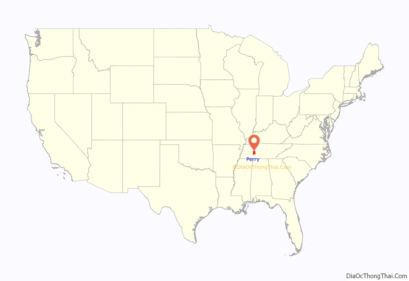
Perry County location map. Where is Perry County?
History
Prehistory and early settlement
There is paleontological evidence of the presence of prehistoric megafauna in the county. In September 1820, the skeletal remains of a large animal, possibly a giant ground sloth (Megalonyx), were excavated in an unidentified cave in the county. The remains were reportedly recovered by a Nashville museum operator and collector, but have since been lost. Archaeological evidence suggests a significant population of mound building Native Americans in the county, with a number of mounds located near the Tennessee River at Lady’s Bluff. Archaeological surveys conducted in the 1970s and 1980s discovered evidence of early Archaic through late Woodland settlement concentrated in bottomland (low-lying alluvial land) in the Tennessee River basin near Mousetail Landing, with evidence of Paleoindian occupation in one site. Arrowheads and spear tips associated the Mississippian, Woodland, and Copena cultures have been found along the Tennessee River tributaries in the western half of the county.
On January 7, 1806, with the signing of the Treaty of Washington, the Cherokee ceded to the United States a large tract of territory in the south-central portion of Tennessee that included the area that would become Perry County. Permanent settlement by people of European descent along with enslaved people of African descent began shortly after this treaty was ratified. The area was found to have very productive bottomland with an abundance of water, timber, and wild game. The earliest settlers likely arrived from nearby counties in Middle Tennessee, although some did immigrate to the area from North Carolina, Alabama, and Kentucky.
Between 1810 and 1812, the first gristmill in the area was established on Cane Creek. The first known birth of a person of European descent in the area occurred in 1818 along Toms Creek. Some of the early settlers were veterans of the War of 1812, and some had probably received land grants in the area from the state of North Carolina for service in the American Revolution.
Formation and early history
In 1819, the Tennessee General Assembly passed an act providing “that a new county be established north of Wayne, west of Hickman, and south of Humphreys, by the name of Perry County, beginning at the southeast corner of Humphreys, running west, thence south, thence east, thence north to place of beginning, and to include all the territory lying between Humphreys, Hardin, Wayne and Hickman Counties.” The county, named in honor of Oliver Hazard Perry, was officially organized that same year in the home of James Dixon near Lick Creek, which still stands today.
In 1820, the first court in the county was held in the same house under a Judge Humphreys, and the first school was established by Ferney Stanley on Toms Creek. In 1821, the county seat was established in Perryville, a river port located on the west bank of the Tennessee River. A log courthouse was constructed in Perryville, but was later replaced with a brick structure. In 1830, the settlement of Beardstown was established on a high bluff overlooking the Buffalo River.
By the early 1830s, significant deposits of iron ore had been discovered in the county. Sufficient quantities were being extracted to justify the construction of a large iron ore furnace on Cedar Creek near the Tennessee River between 1832 and 1834. At its peak, it processed 1,400 tons of pig iron annually, using both free and enslaved labor, and taking advantage of the most advanced “hot blast” smelting techniques available at the time. The furnace shut down in 1862, during the Civil War, and was never brought back in to service. The Cedar Grove Iron Furnace is the only twin-stack iron furnace remaining in Tennessee. In addition to iron ore, some marble mining was conducted in the county in the middle of the 19th century.
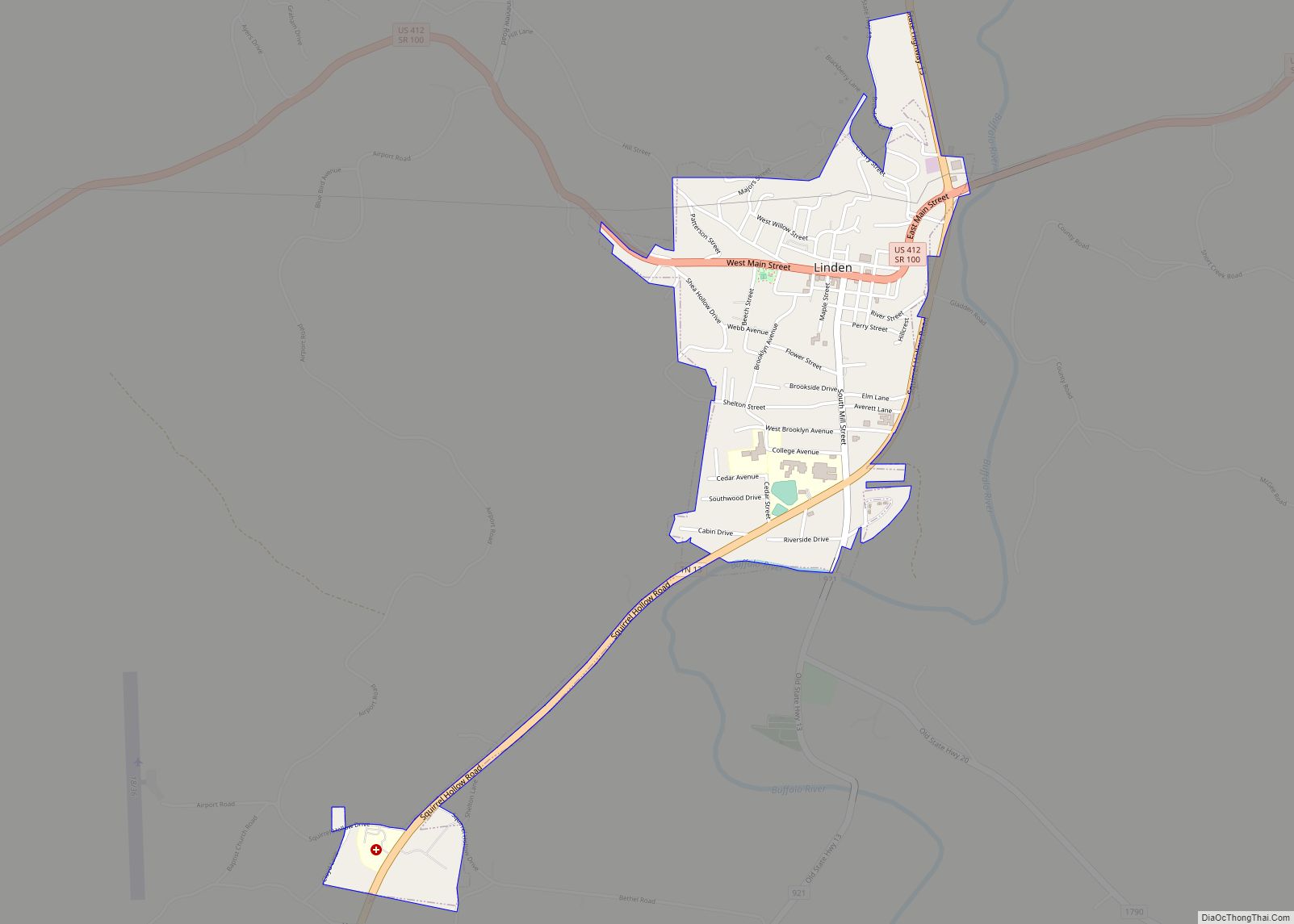
In 1846, Decatur County was formed from the portions of Perry County west of the Tennessee River. The seat of government and courts were then temporarily relocated to a small town known as Harrisburg, located near the geographic center of the county. Around 1844, the community of Flatwoods, originally known as Whitaker’s Bluff, was established along the Buffalo River in the southern part of the county by a group of settlers from Halifax, North Carolina. In 1847, forty acres located approximately 3 miles (4.8 km) north of Harrisburg on the west bank of the Buffalo River were donated to the county by David B. Harris for the building of a new county seat named Linden. The land was divided into plots and a public square, and the plots were sold off to provide funds for the construction of public buildings. Linden was established as the county seat in 1848, where it remains today, and is the largest municipality in the county. A temporary structure to house the court was built in 1848, and was replaced by a wooden frame building in 1849. Harrisburg no longer exists as an organized entity or recognized location.
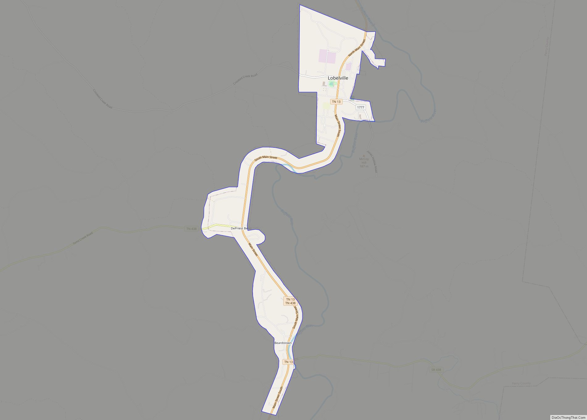
In 1850, it was reported that there were 10 grist mills, a saw mill, a furnace, and two tanneries in operation within the county. Additionally, 21 churches were organized, as well as 23 schools enrolling 685 students. Corn was the primary agricultural product at the time, though oats, sweet potatoes, and tobacco were also grown in smaller quantities. In 1854, Lobelville was established as a trading-post village on the west bank of the Buffalo River about 5 miles (8.0 km) north of Beardstown by a French trader named Henri de Lobel.
By the late 1850s, allegations and rumors of an impending slave insurrection began to spread throughout the southern United States. In 1856, the panic reached Perry County, when multiple enslaved persons were murdered over rumors of the plotting of a revolt. The total number of people killed by so-called vigilance committees is unclear, with contemporary reports citing as many as 15 being hanged, and later historical research noting between 10 and 12.
Civil War
In 1861, Perry County voted in favor of secession by a margin of 780 to 168. Even though the vote was overwhelmingly in favor of secession, the Unionist sentiment was strong and pervasive throughout the war, with men from the county volunteering for both sides in the conflict. About 300 men joined the Confederate Army, with about 200 joining the Union Army. One particularly notable Confederate unit formed in the county was Harder’s Company of the 23rd Tennessee Infantry Regiment, raised in 1861 and composed of about 100 men from the Cedar Creek area. This unit fought throughout the war, seeing action at Fort Donelson, Shiloh, Stones River, Chickamagua, and the Siege of Petersburg, after which they surrendered with the Army of Northern Virginia in 1865.
Both pro-Union and pro-Confederate irregular and guerrilla forces were organized in Perry County, and were known to have conducted raids on neighboring counties. Of note were the Perry County Jayhawkers, a group of Union-aligned partisans known to have engaged in fighting against opposing partisans in Hickman County and who burned the county seat of Centerville. Due to the rural, isolated nature of the region, away from the major railway lines and with only limited access to large landings on the Tennessee River, there were no large-scale engagements in the county. In February 1862, the Cedar Grove Iron Furnace was partially destroyed when it was shelled by Union gunboats USS Conestoga, USS Tyler, and USS Lexington. On April 27, 1862, a body was found by a group of children playing near Britt’s Landing on the Tennessee River in Perry County. Investigation of papers found on the body revealed it to be that of Governor Louis P. Harvey of Wisconsin. Gov. Harvey had been conducting an inspection of hospitals where wounded soldiers were being treated after the Battle of Shiloh, and had drowned in the river on April 19 while returning to Wisconsin.
Before dawn on May 12, 1863, a flotilla under the command of Lt. Cmdr. Ledyard Phelps composed of the USS Champion, USS Covington, USS Argosy, and the USS Silver Cloud landed elements of the Union Army’s 6th Tennessee Cavalry Regiment on the Tennessee River 12 miles (19 km) west of Linden. The small force of 55 men led by Lt. Col William Breckenridge, a native of Perry County, approached Linden at daybreak. The Confederate forces, totaling about 100 men under Lt. Col. William Frierson, were preparing to depart Linden to join General Van Dorn’s force at Spring Hill and were taken completely by surprise. After a short skirmish against pickets, the Union cavalry captured Lt. Col Frierson and 46 of his officers and men and killed three more before reinforcements could arrive. During this engagement, the county courthouse, which was being held by the Confederate forces, was burned, destroying most records from the early history of the county. The only Union loss during the engagement was one horse. Breckenridge then returned to the Tennessee River and transferred his prisoners to the awaiting riverboats for transportation to Cairo, Missouri. Intelligence gathered from the Confederates captured in the engagement provided significant details to Union leadership on the size, location, and intentions of Confederate forces in the Middle Tennessee, including plans to re-capture Fort Henry and attack Union forces under General Rosecrans. The amphibious landing and battle was recounted on the front page of the Sunday, May 17, 1863, edition of the New York Times. No further action took place in the county until September 27, 1864, when a detachment of Confederate cavalry conducted a raid on the county, skirmishing with Federal forces near Lobelville and Beardstown.
Reconstruction and the late 19th century
Martial law was lifted in the county in April 1865, when the civil court held its first session since Tennessee’s secession and the beginning of the Civil War. In 1868, a new two-story brick courthouse was built to replace the one burned during the war. Perry County was not immune to Reconstruction era racial violence against Black citizens. In 1869, two Black men who had been arrested for unknown crimes were removed from the county jail by a mob and shot.
In the late 19th century, the county was largely known for its tanneries and peanut cultivation, producing over 500,000 bushels of peanuts per year by 1886. The first known Black-owned farm in the county was established in 1871 on the north fork of Lick Creek. Tapp Craig and his wife, Amy Guthrie, both former slaves, purchased the farm with a down payment of a yoke of oxen, and paid off the farm over the next two years. The farm, still owned by the Craig family, is listed in the National Register of Historic Places due to its significance in the history of Black farmers in Tennessee.
From about 1880 to 1884, the first regular newspaper in the county, the Linden Times, was published weekly. By the mid-1880s, the continued lack of railroad connections was reported as a cause for the lack of investment in the county. An 1886 editorial in the Nashville Daily American noted that many in the county were awaiting the construction of the proposed Nashville, Memphis, and Jackson Railroad, and viewed it as an essential step in the modernization and industrialization of the area. In 1887, Congress authorized the construction of a railroad bridge across the Tennessee River connecting Perry and Decatur counties. The Tennessee Midland Railroad laid tracks from Lexington, Tennessee to Perryville. While a terminus allowing the transfer of goods from rail to river shipping was constructed in Perryville, the bridge was never built and the railroad was never extended into Perry County. A second attempt to bring a railroad to Perry County was started around 1890 with construction beginning on the Florence Northern Railroad. Plans for the line’s extension meant for it to eventually pass through Linden on its way from Florence, Alabama to Paducah, Kentucky. In 1894 the railroad was purchased by a Chattanooga company after about 30 miles (48 km) had been graded, and construction was never completed.
20th century
Briefly, in the summer of 1903, Perry County was without a county government. That year the state legislature passed an act consolidating the civil districts in the county, and providing for a new special election to be held that would elect new officers. Due to an oversight in the writing of the act, the new county officers could not be seated until 30 days after the election.
By 1910, the population of the county peaked at 8,815. It then proceeded to decline to a low of 5,238 individuals in 1970, a number not seen since the census of 1830. During the First World War, a Selective Service Board was established in Linden. Over 1,500 men registered for the draft, and 254 individuals from Perry County served in the United States military from 1917 to 1919. Out of those who served, 10 were wounded and 27 were killed, a nearly 15% casualty rate.
In 1927, the county decided to renovate and expand the courthouse. In January 1928, the building burned as it was undergoing restoration. The county government decided to demolish the remains of the old courthouse and construct new, larger building in the Colonial Revival style which was completed that same year. Also in 1928, construction started on the first bridge across the Tennessee River in the county, connecting Perry and Decatur counties. The bridge, named after World War I Medal of Honor recipient Alvin C. York, was opened on July 5, 1930, as part of a major road building program to provide additional links between Memphis and Nashville. This bridge was later demolished and replaced by a modern concrete bridge in 1986. The construction of the road bridge and completion of the highway reduced demand for rail service in the area, and service to the rail terminal at Perryville was discontinued in 1936.
By the 1930s, Perry County had acquired a reputation as a hotbed of illicit alcohol production. Its isolated nature on the eastern edge of a Federal law enforcement district meant that prohibition officers rarely operated in the area, allowing moonshine operations to run unimpeded. Liquor would be distributed to dealers in neighboring Hickman County for sale. Recovery from the Great Depression was slow in the county. By the late 1940s, wages had improved from their nadir in the 1930s, although unemployment was high among the predominant industries of farming and forestry. In 1958, Interstate 40 was completed in Tennessee, crossing the length of the state but passing 4 miles (6.4 km) north of the county. Following this, businesses began to leave the county for locations nearer urban areas and adjacent to the highway; and when two garment factories and an automobile parts plant ceased operations, the conditions were set for long-term economic stagnation.
In 1971, an Old Order Mennonite community was established along Cane Creek near Lobelville. Both English as well as Plattdeutsch and Pennsylvania German speaking families settled in the area from other areas of Tennessee, from nearby states such as Arkansas, and internationally from Belize. This community generally avoids motor vehicles, except in certain limited situations sanctioned by their church, and most families are not connected to the electric grid.
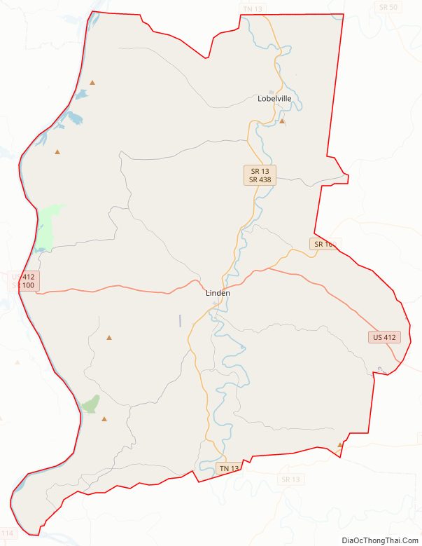
Perry County Road Map
Geography
Perry County is located on the western edge of Middle Tennessee. The topography of Perry County is characterized by high ridges separating creeks flowing into the county’s two rivers and is typical of the Western Highland Rim region of Tennessee. The highest point in Perry County is approximately 980 feet (300 m) above sea level, located on an unnamed ridge in the far southeastern portion of the county near the borders of Lewis County and Wayne County.
Rivers
Three rivers are found within Perry County: the Tennessee River, Buffalo River, and Duck River. The Tennessee River runs along the western boundary of the county, Buffalo River bisects the county, and a bend of the Duck River crosses into the county very briefly in its far northeastern corner.
The Tennessee River forms the western border of Perry County, dividing it from Decatur County and Benton County. It flows south to north and is navigable through the entire length of the county. In 1944, with the construction of Kentucky Dam, portions of low-lying land adjacent to the river were inundated, although the societal and environmental impact was substantially lower than areas farther downstream. While the presence of the dam allows for some level of control against regular, catastrophic flooding along the basin, some areas of the western portion of the county do become inundated after some flood events. At the National Weather Service designated flood stage of the river, portions of the county near Crooked Creek are inundated. At moderate and major flood stages, bottomland near Mousetail Landing State Park, Deer Creek, and Cedar Creek are inundated.
Lady’s Bluff, located approximately 11 miles (18 km) west of Linden, is the tallest bluff on the lower Tennessee River, and overlooks the section of the river known as The Narrows. The river is narrow enough at this point that barges cannot pass side by side and must pass through individually. Lady’s Bluff Small Wild Area is a small federally protected public access park that includes the bluff and surrounding woodland. One possibly apocryphal story of the origin of the name of the bluff stems from a supposed incident where a woman was kidnapped and used as bait for an ambush by Native Americans against white settlers encroaching on their land.
The Buffalo River flows south to north through the county before entering the Duck River just north of the county line in Humphreys County, and over 25% of the river’s total watershed area is within the county. The towns of Linden and Lobelville and the unincorporated communities of Flatwoods and Beardstown are located along the river. Four river outfitters are located along the river within the county and add to its value as a recreational river.
Topography and hydrography
Most of the western half of the county forms part of the watershed for the Tennessee River, while most of the eastern half drains into the Buffalo River. A very small portion of the far northeastern corner of the county drains into the Duck River. The water table is high due to the hard substrate, creating numerous springs and shallow wells, and is charged by the Highland Rim aquifer. Typical spring and well yields range from 1 to 400 gallons per minute (4.5 to 1820 liters per minute).
Buffalo Ridge bisects the county from north to south between the Tennessee and Buffalo rivers. The ridge reaches approximately 700 feet (210 m) above sea level, with a topographic prominence of about 300 feet (91 m). Eight smaller spur ridges extend to the west from the main crest of Buffalo Ridge about 9 miles (14 km), creating the drainages for nine major creeks that flow into the Tennessee River. These creeks are, from north to south, Blue Creek, Crooked Creek, Roans Creek, Toms Creek, Lick Creek, Spring Creek, Cypress Creek, Marsh Creek, and Cedar Creek. To the east of the Buffalo River, additional ridges run east to west, similar to the terrain west of Buffalo Ridge. These ridges form the basins for the main Buffalo River tributaries within the county, Coon Creek, Brush Creek, Hurricane Creek, Short Creek, and Cane Creek.
Large tracts of natural wetlands exist within the county. One estimate based on analysis of satellite photography by the Tennessee Valley Authority estimated approximately 5,200 acres of forested wetlands and 1,200 acres of non-forested wetlands. These wetlands occur primarily along stream courses, and are some of the most productive wildlife habitat in the region.
Soil and geology
Soil deposits from the three river drainages located in the county have created fertile bottomland that are used intensively for agricultural purposes. The soil profile is generally very deep, with slopes and soil types suitable for agriculture and building construction. The ridge tops are well drained and loamy, with significant chert rock deposits. Reserves of chert, sand, gravel, limestone, and phosphate can be found in the county. Cherty limestone deposits are the most extensive geologic feature of the county, and an impermeable siltstone and shale base below the chert formations has led to the emergence of numerous fresh water springs.
Blue and gray limestone outcrops are present in most valleys of the county. These limestone formations are part of the Lobelville formation of the Silurian Brownsport Group and of the Lower Helderberg Group. Significant numbers of fossils have been found in the limestone. By the late 1830s, the fossils of various newly cataloged species of mollusks and trilobites found in the county were described in reports to the General Assembly. Iron ore is extremely abundant, with numerous deposits to the west of Buffalo Ridge.
Adjacent counties
- Humphreys County (north)
- Hickman County (northeast)
- Lewis County (southeast)
- Wayne County (south)
- Decatur County (west)
- Benton County (northwest)


