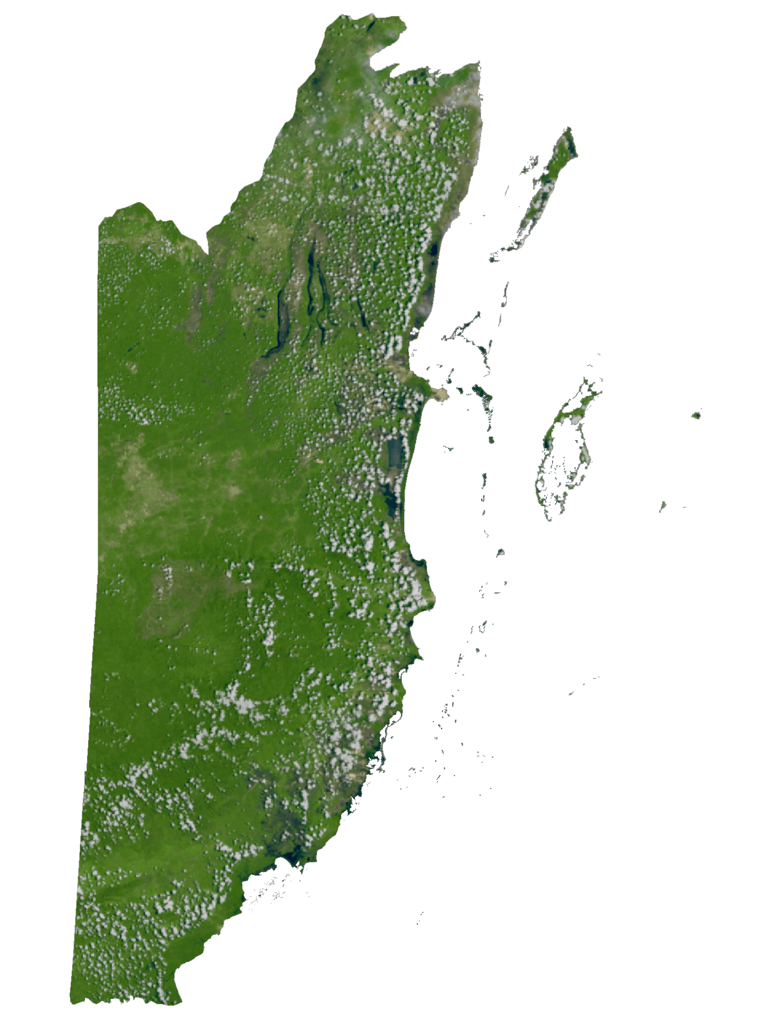
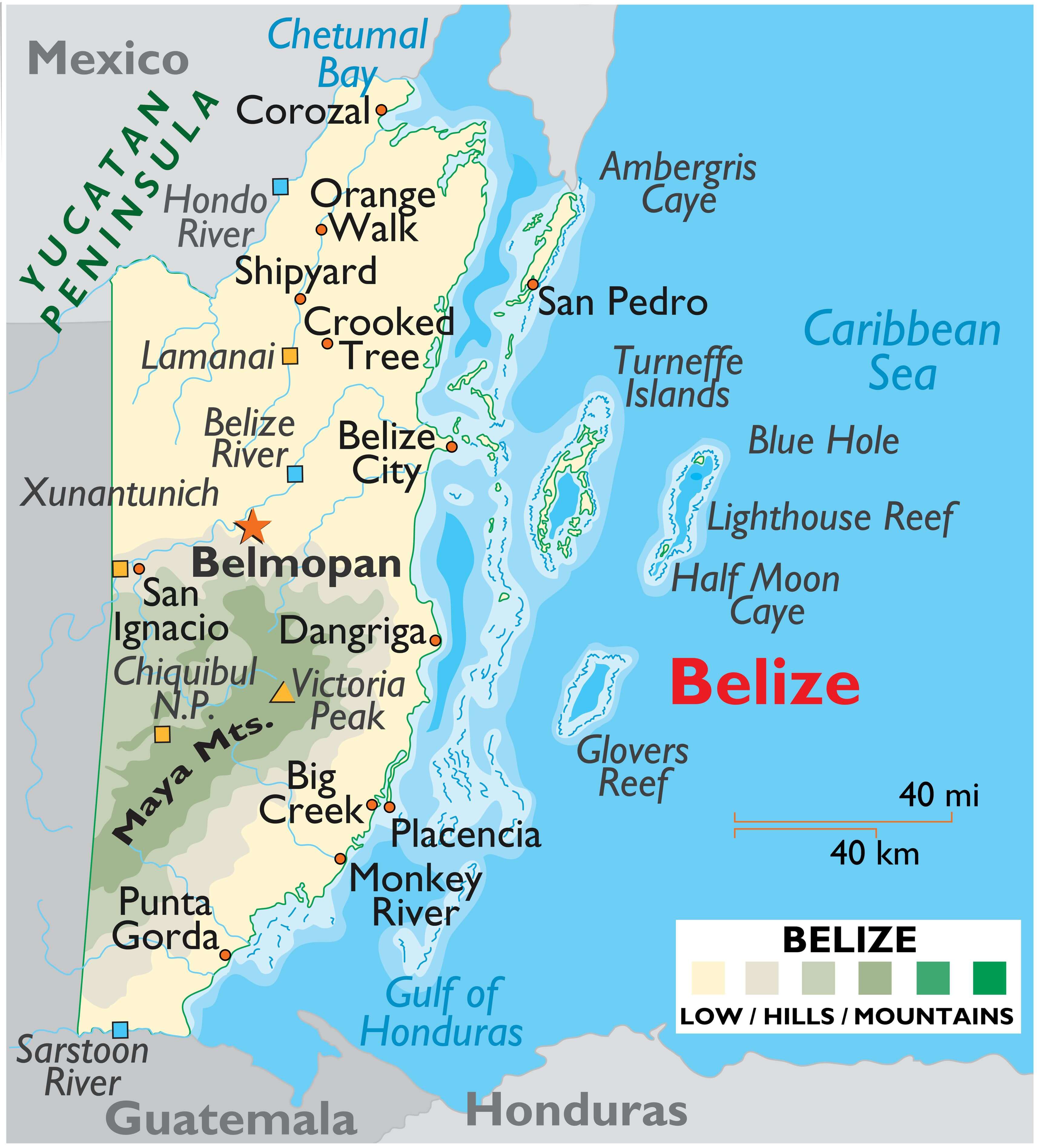
Belize, a country with an area of 22,966 sq. km (8,867 sq mi), is divided into four main geographic regions, including the relatively low Maya Mountains of the south that dominate all but the narrow coastal plain; the northern limestone lowlands and its many rivers and streams; the flat and swampy coastal plain, and the almost countless cayes, islands and lagoons that fringe it’s Caribbean coastline.
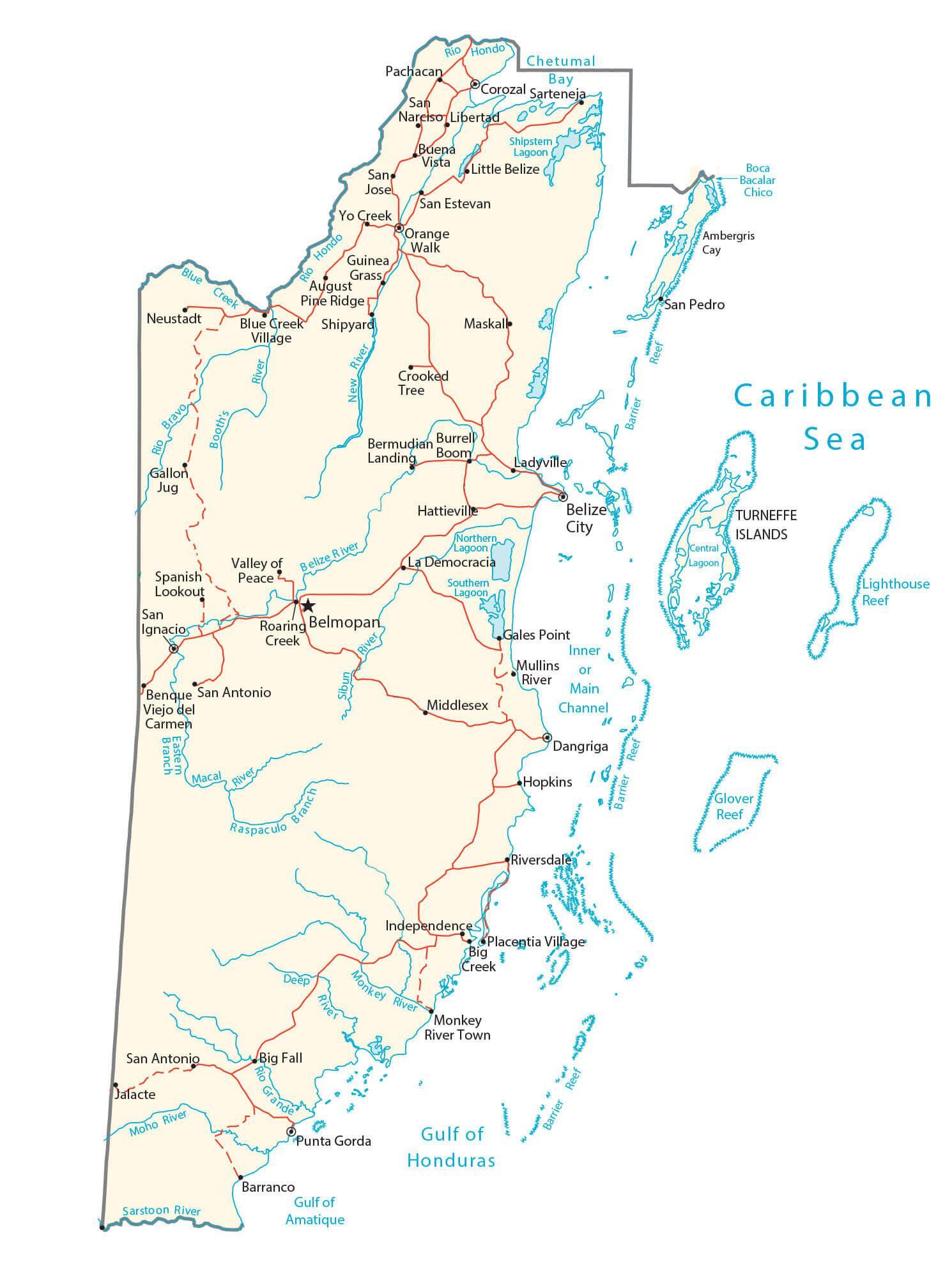
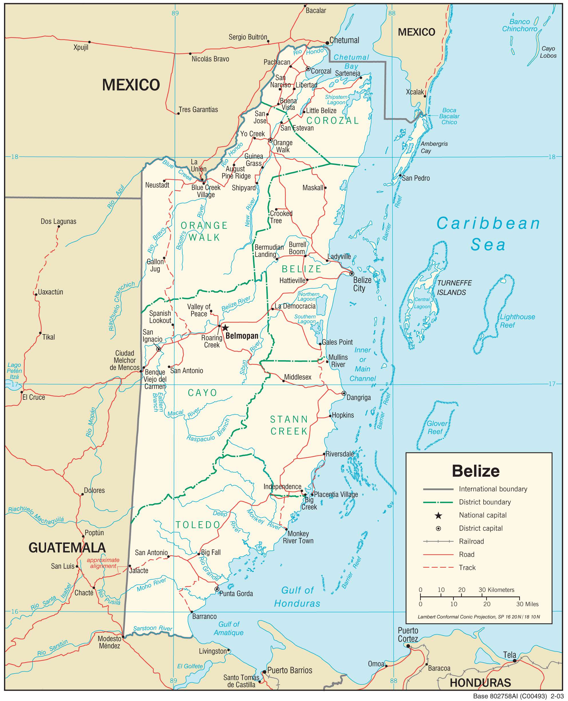
As observed on the physical map of Belize above, the Caribbean country is dissected by a network of rivers, mostly small in length. The largest and the most significant river is the navigable Belize River that stretches from the Guatemala border all the way to the Caribbean Sea.
More than 50% of the land in Belize is covered by tropical rainforest.
Located in Southern Maya Mountains at an elevation of 1124 m (3687 ft) is Belize’s highest point – Doyle’s Delight. Previously, it was thought that Victoria Peak (as marked on the map by a yellow upright triangle), located in the north of Cockscomb basin was the highest point at an elevation of 1120m (3675ft).
Second only in size to the Great Barrier Reef, off the northeast coastline of Australia, a 175 mile long Belize Barrier Reef fronts the Belize coastline, intermixed with literally hundreds of small islands and cayes. 58 miles direct east of Belize City sits the Blue Hole (marked on the map above), which is more than 1000ft across and some 400ft deep. It is the opening to a former Ice Age cave, and is today one of the world’s most popular dive sites.
| Flag: |  |
|---|---|
| Legal Name: | Belize |
| Capital Value: | Belmopan |
| Official languages: | English |
| Demonym(s): | Belizean |
| Government: | Unitary parliamentary constitutional monarchy |
| Legislature: | National Assembly |
| Total Area: | 22,966 km² |
| Land Area: | 22,806 km² |
| Water Area: | 160 km² |
| Population: | 390,353 |
| Density: | 17.79/km (46.1/sq mi) (169th) |
| GDP: | $1.88 Billion |
| GDP Per Capita: | $4,815.16 |
| Currency Value: | Belizean dollars (BZD) |
| Driving side: | right |
| Calling code: | +501 |
| Internet TLD: | .bz |
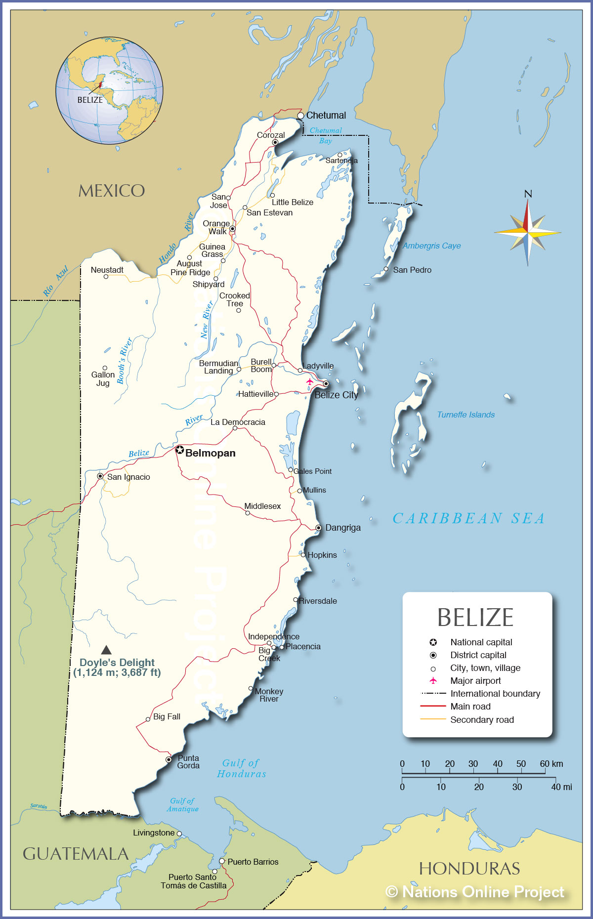
Explore Belize with this comprehensive map! Discover the country’s major cities, towns, roads, islands, reefs, and rivers. Take a closer look at the topography of Belize with its satellite and physical map. Get to know more about this beautiful Central American nation and its natural wonders!
Online Interactive Political Map
Click on ![]() to view map in "full screen" mode.
to view map in "full screen" mode.
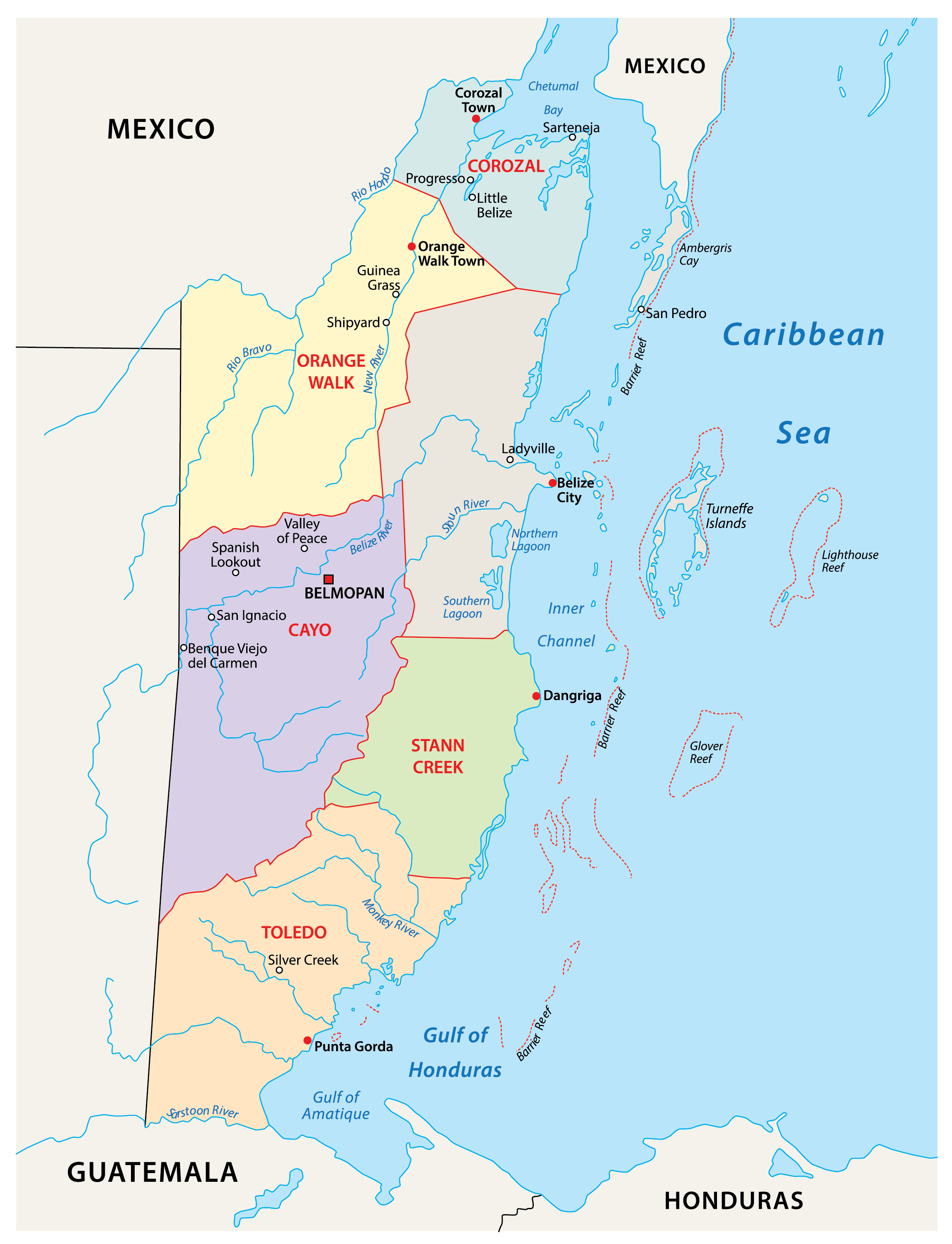
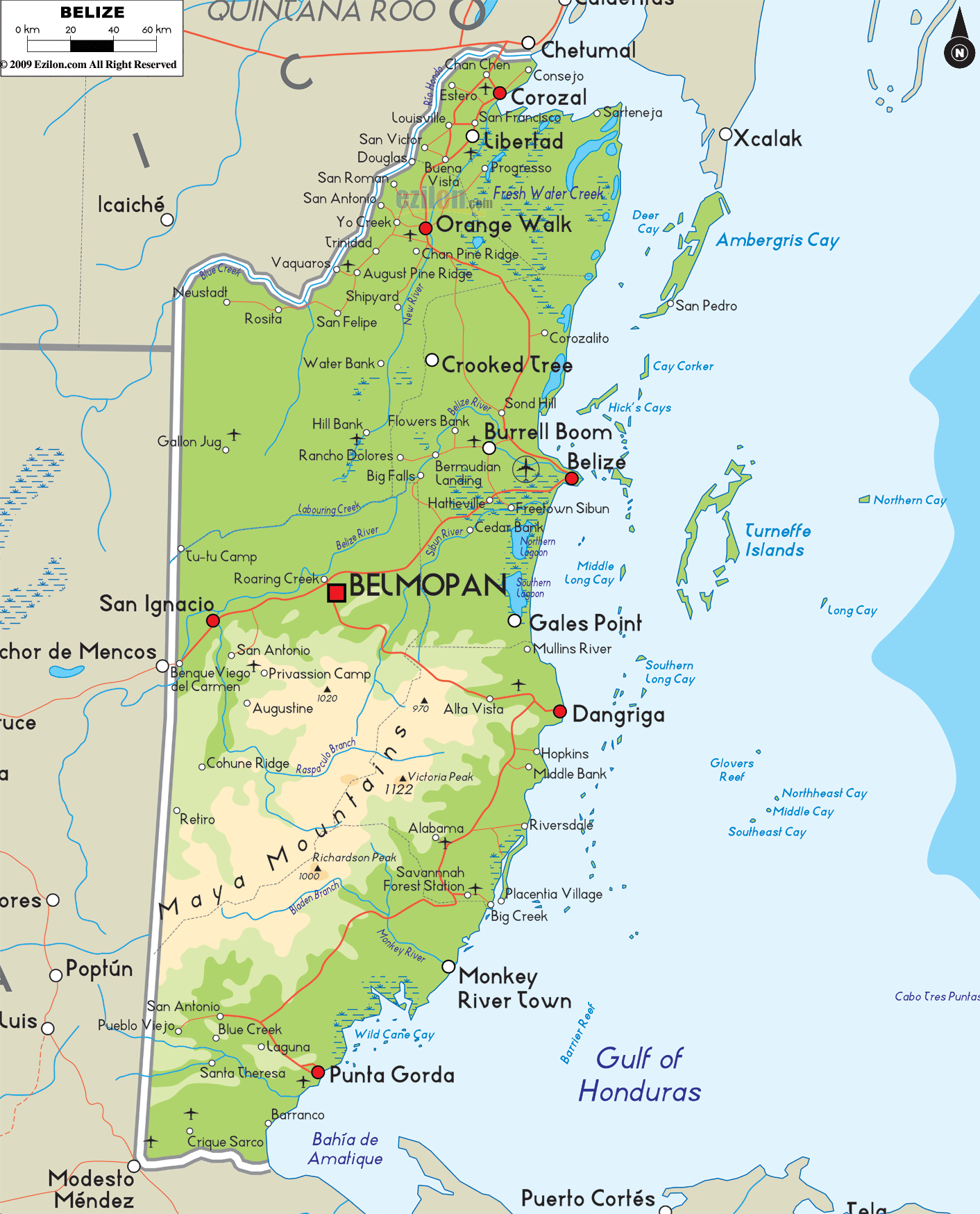
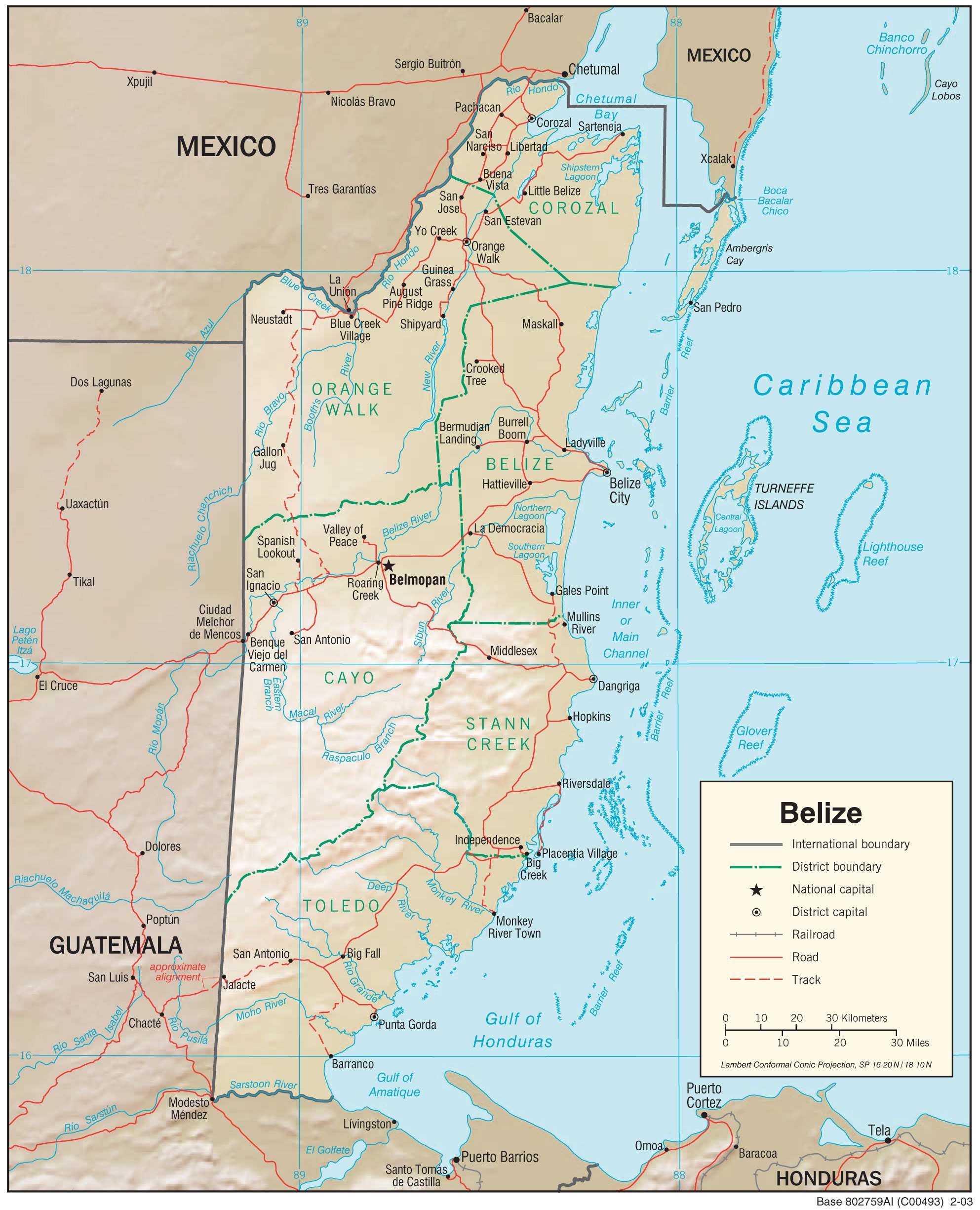
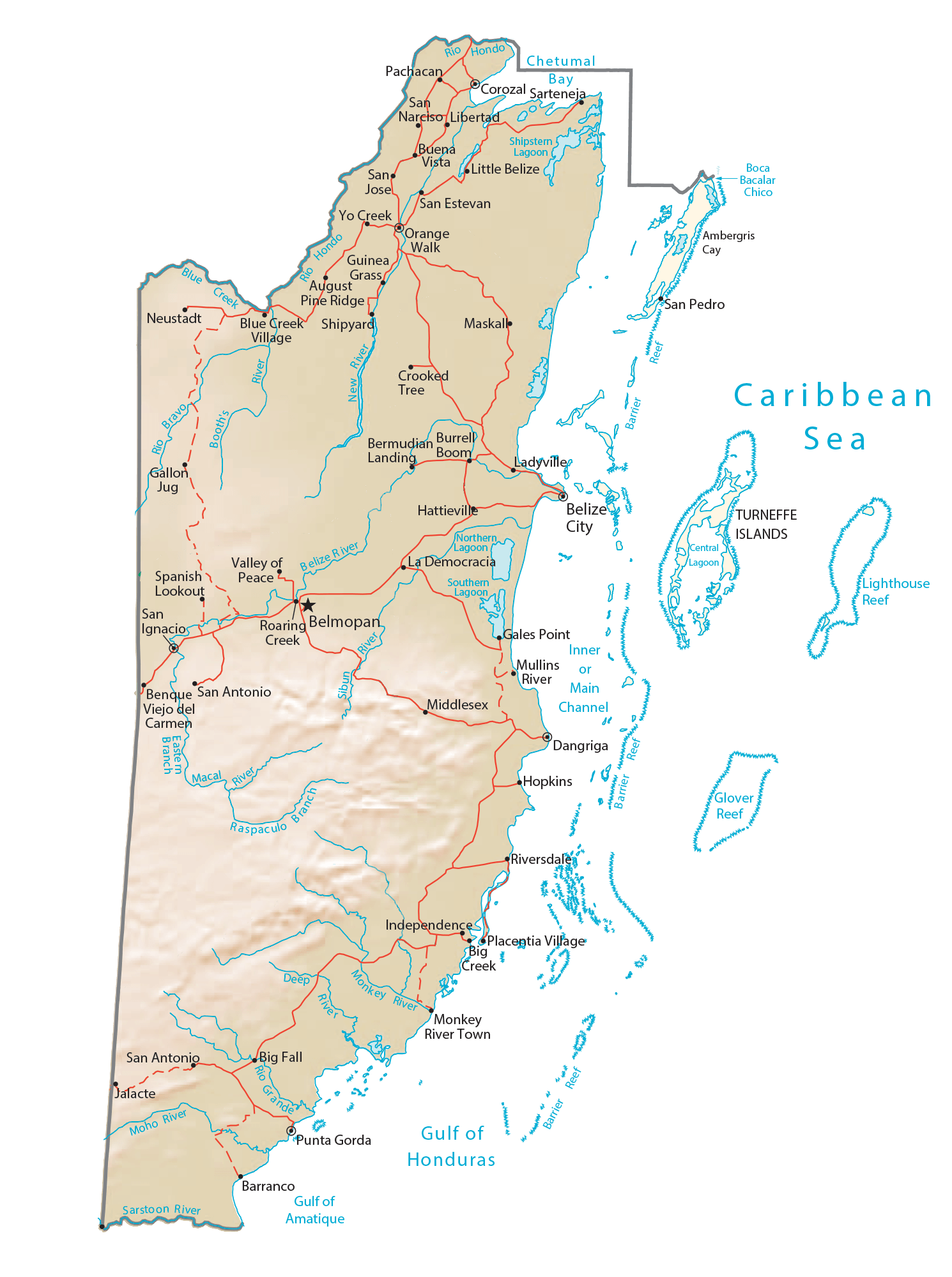
Belize is divided into 6 districts. In alphabetical order, the districts are: Belize, Cayo, Corozal, Orange Walk, Stann Creek and Toledo. These districts are further subdivided into 31 constituencies.
Covering an area of 22,970 sq. km, Belize has the lowest population density in Central America and the 2nd highest population growth rate in the region. Located near the Belize River Valley about 50 miles inland from the Caribbean coast is, Belmopan – the capital, the 3rd largest and the most populous city of Belize. It is also the administrative, cultural and commercial center of the country. Belize City is the largest city of Belize. It is also the industrial and financial center of the country as well as its principal port.
Location Maps
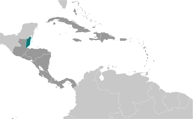
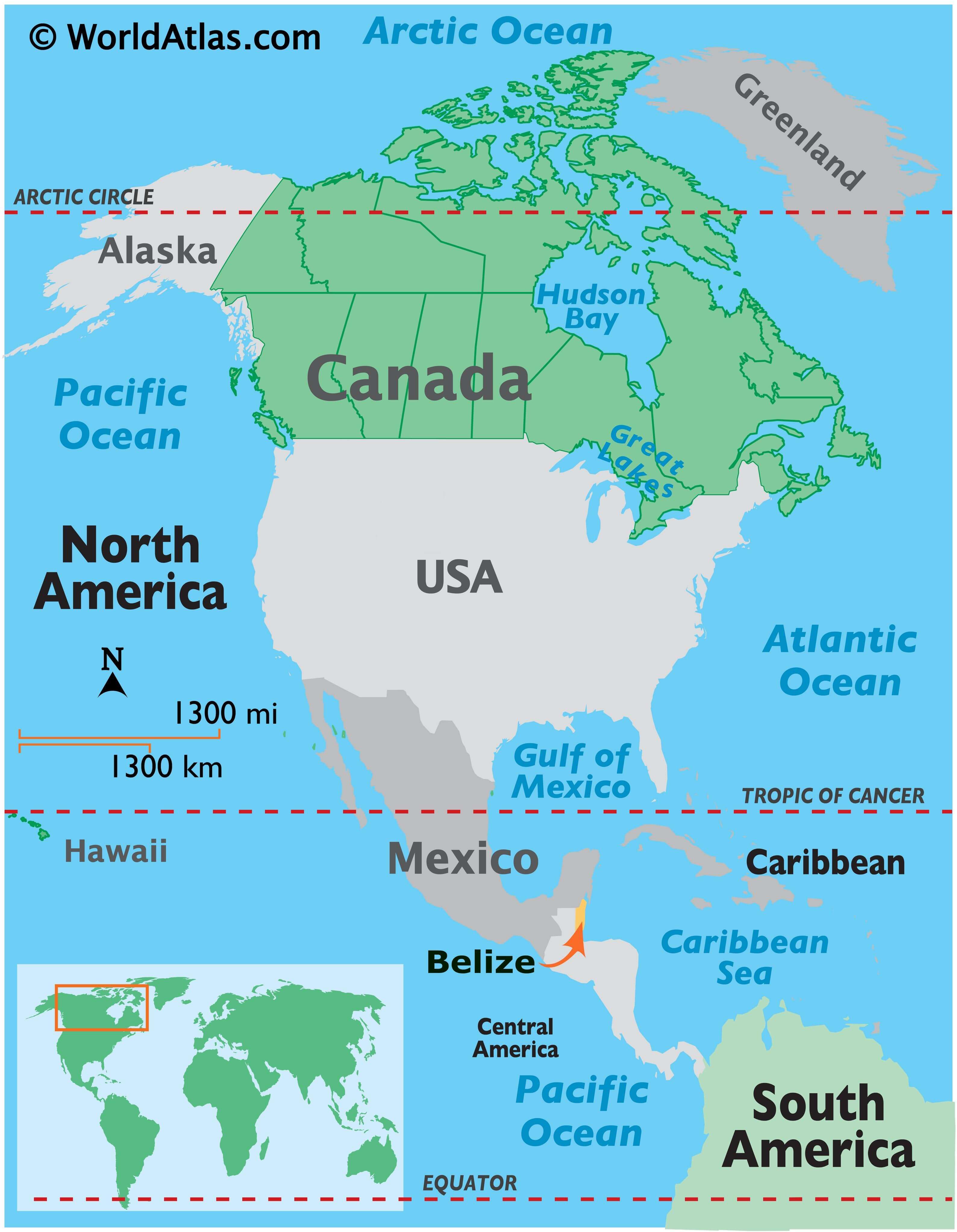
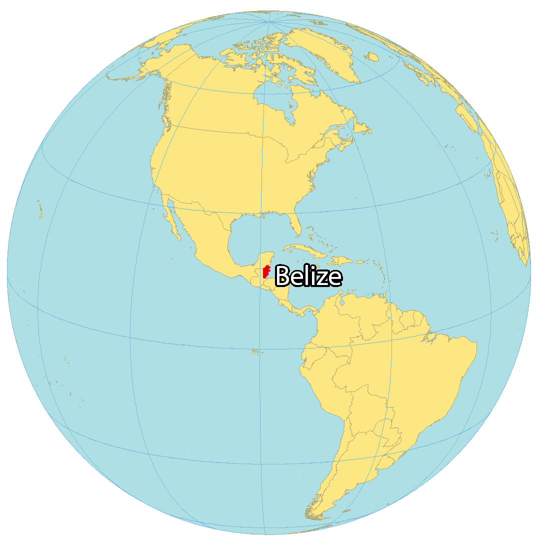
Where is Belize?
Belize is located in Central America, along the Caribbean Sea, and borders just two countries – Guatemala to the southwest and Mexico to the north. It is the only country in Central America that does not share a coastline along the North Pacific Ocean. Belize has the lowest population and population density in Central America, with its capital city Belmopan being the smallest and Belize City being the largest in the nation.
High Definition Political Map of Belize

Physical Map of Belize
Geography
Belize is on the Caribbean coast of northern Central America. It shares a border on the north with the Mexican state of Quintana Roo, on the west with the Guatemalan department of Petén, and on the south with the Guatemalan department of Izabal. To the east in the Caribbean Sea, the second-longest barrier reef in the world flanks much of the 386 kilometres (240 mi) of predominantly marshy coastline. The area of the country totals 22,960 square kilometres (8,865 sq mi), an area slightly larger than El Salvador, Israel, New Jersey, or Wales. The many lagoons along the coasts and in the northern interior reduces the actual land area to 21,400 square kilometres (8,263 sq mi). It is the only Central American country with no Pacific coastline.
Belize is shaped roughly like a rhombus that extends about 280 kilometres (174 mi) north-south and about 100 kilometres (62 mi) east-west, with a total land boundary length of 516 kilometres (321 mi). The undulating courses of two rivers, the Hondo and the Sarstoon River, define much of the course of the country’s northern and southern boundaries. The western border follows no natural features and runs north–south through lowland forest and highland plateau.
The north of Belize consists mostly of flat, swampy coastal plains, in places heavily forested. The flora is highly diverse considering the small geographical area. The south contains the low mountain range of the Maya Mountains. The highest point in Belize is Doyle’s Delight at 1,124 m (3,688 ft).
Belize’s rugged geography has also made the country’s coastline and jungle attractive to drug smugglers, who use the country as a gateway into Mexico. In 2011, the United States added Belize to the list of nations considered major drug producers or transit countries for narcotics.
Environment preservation and biodiversity
Belize has a rich variety of wildlife because of its position between North and South America and a wide range of climates and habitats for plant and animal life. Belize’s low human population and approximately 22,970 square kilometres (8,867 sq mi) of undistributed land make for an ideal home for the more than 5,000 species of plants and hundreds of species of animals, including armadillos, snakes, and monkeys.
The Cockscomb Basin Wildlife Sanctuary is a nature reserve in south-central Belize established to protect the forests, fauna, and watersheds of an approximately 400 km (150 sq mi) area of the eastern slopes of the Maya Mountains. The reserve was founded in 1990 as the first wilderness sanctuary for the jaguar and is regarded by one author as the premier site for jaguar preservation in the world.
Vegetation and flora
While over 60% of Belize’s land surface is covered by lush forest, some 20% of the country’s land is covered by cultivated land (agriculture) and human settlements. Belize had a 2018 Forest Landscape Integrity Index mean score of 6.15/10, ranking it 85th globally out of 172 countries. Savanna, scrubland and wetland constitute the remainder of Belize’s land cover. Important mangrove ecosystems are also represented across Belize’s landscape. Four terrestrial ecoregions lie within the country’s borders – the Petén–Veracruz moist forests, Belizian pine forests, Belizean Coast mangroves, and Belizean Reef mangroves. As a part of the globally significant Mesoamerican Biological Corridor that stretches from southern Mexico to Panama, Belize’s biodiversity – both marine and terrestrial – is rich, with abundant flora and fauna.
Belize is also a leader in protecting biodiversity and natural resources. According to the World Database on Protected Areas, 37% of Belize’s land territory falls under some form of official protection, giving Belize one of the most extensive systems of terrestrial protected areas in the Americas. By contrast, Costa Rica only has 27% of its land territory protected.
Around 13.6% of Belize’s territorial waters, which contain the Belize Barrier Reef, are also protected. The Belize Barrier Reef is a UNESCO-recognized World Heritage Site and is the second-largest barrier reef in the world, behind Australia’s Great Barrier Reef.
A remote sensing study conducted by the Water Center for the Humid Tropics of Latin America and the Caribbean (CATHALAC) and NASA, in collaboration with the Forest Department and the Land Information Centre (LIC) of the government of Belize’s Ministry of Natural Resources and the Environment (MNRE), and published in August 2010 revealed that Belize’s forest cover in early 2010 was approximately 62.7%, down from 75.9% in late 1980. A similar study by Belize Tropical Forest Studies and Conservation International revealed similar trends in terms of Belize’s forest cover. Both studies indicate that each year, 0.6% of Belize’s forest cover is lost, translating to the clearing of an average of 10,050 hectares (24,835 acres) each year. The USAID-supported SERVIR study by CATHALAC, NASA, and the MNRE also showed that Belize’s protected areas have been extremely effective in protecting the country’s forests. While only some 6.4% of forests inside of legally declared protected areas were cleared between 1980 and 2010, over a quarter of forests outside of protected areas were lost between 1980 and 2010.
As a country with a relatively high forest cover and a low deforestation rate, Belize has significant potential for participation in initiatives such as REDD. Significantly, the SERVIR study on Belize’s deforestation was also recognized by the Group on Earth Observations (GEO), of which Belize is a member nation.
Natural resources and energy
Belize is known to have a number of economically important minerals, but none in quantities large enough to warrant mining. These minerals include dolomite, barite (source of barium), bauxite (source of aluminium), cassiterite (source of tin), and gold. In 1990 limestone, used in road construction, was the only mineral resource exploited for domestic or export use.
In 2006, the cultivation of newly discovered crude oil in the town of Spanish Lookout has presented new prospects and problems for this developing nation.
Access to biocapacity in Belize is much higher than world average. In 2016, Belize had 3.8 global hectares of biocapacity per person within its territory, much more than the world average of 1.6 global hectares per person. In 2016 Belize used 5.4 global hectares of biocapacity per person – their ecological footprint of consumption. This means they use more biocapacity than Belize contains. As a result, Belize is running a biocapacity deficit.
Belize Barrier Reef
The Belize Barrier Reef is a series of coral reefs straddling the coast of Belize, roughly 300 metres (980 ft) offshore in the north and 40 kilometres (25 mi) in the south within the country limits. The Belize Barrier Reef is a 300-kilometre-long (190 mi) section of the 900-kilometre-long (560 mi) Mesoamerican Barrier Reef System, which is continuous from Cancún on the northeast tip of the Yucatán Peninsula through the Riviera Maya up to Honduras making it one of the largest coral reef systems in the world.
It is the top tourist destination in Belize, popular for scuba diving and snorkelling, and attracting almost half of its 260,000 visitors. It is also vital to its fishing industry. In 1842 Charles Darwin described it as “the most remarkable reef in the West Indies”.
The Belize Barrier Reef was declared a World Heritage Site by UNESCO in 1996 due to its vulnerability and the fact that it contains important natural habitats for in-situ conservation of biodiversity.
The Belize Barrier Reef is home to a large diversity of plants and animals, and is one of the most diverse ecosystems of the world:
- 70 hard coral species
- 36 soft coral species
- 500 species of fish
- hundreds of invertebrate species
With ~90% of the reef still yet to be researched, some estimate that only 10% of all species have been discovered.
Belize became the first country in the world to completely ban bottom trawling in December 2010. In December 2015, Belize banned offshore oil drilling within 1 km (0.6 mi) of the Barrier Reef and all of its seven World Heritage Sites.
Despite these protective measures, the reef remains under threat from oceanic pollution as well as uncontrolled tourism, shipping, and fishing. Other threats include hurricanes, along with global warming and the resulting increase in ocean temperatures, which causes coral bleaching. It is claimed by scientists that over 40% of Belize’s coral reef has been damaged since 1998.
Climate
Belize has a tropical climate with pronounced wet and dry seasons, although there are significant variations in weather patterns by region. Temperatures vary according to elevation, proximity to the coast, and the moderating effects of the northeast trade winds off the Caribbean. Average temperatures in the coastal regions range from 24 °C (75.2 °F) in January to 27 °C (80.6 °F) in July. Temperatures are slightly higher inland, except for the southern highland plateaus, such as the Mountain Pine Ridge, where it is noticeably cooler year round. Overall, the seasons are marked more by differences in humidity and rainfall than in temperature.
Average rainfall varies considerably, from 1,350 millimetres (53 in) in the north and west to over 4,500 millimetres (180 in) in the extreme south. Seasonal differences in rainfall are greatest in the northern and central regions of the country where, between January and April or May, less than 100 millimetres (3.9 in) of rainfall per month. The dry season is shorter in the south, normally only lasting from February to April. A shorter, less rainy period, known locally as the “little dry”, usually occurs in late July or August, after the onset of the rainy season.
Hurricanes have played key—and devastating—roles in Belizean history. In 1931, an unnamed hurricane destroyed over two-thirds of the buildings in Belize City and killed more than 1,000 people. In 1955, Hurricane Janet levelled the northern town of Corozal. Only six years later, Hurricane Hattie struck the central coastal area of the country, with winds in excess of 300 km/h (185 mph) and 4 m (13 ft) storm tides. The devastation of Belize City for the second time in thirty years prompted the relocation of the capital some 80 kilometres (50 mi) inland to the planned city of Belmopan.
In 1978, Hurricane Greta caused more than US$25 million in damage along the southern coast. In 2000, Hurricane Keith, the wettest tropical cyclone in the nation’s record, stalled, and hit the nation as a Category 4 storm on 1 October, causing 19 deaths and at least $280 million in damage. Soon after, on 9 October 2001, Hurricane Iris made landfall at Monkey River Town as a 235 km/h (145 mph) Category 4 storm. The storm demolished most of the homes in the village, and destroyed the banana crop. In 2007, Hurricane Dean made landfall as a Category 5 storm only 40 km (25 mi) north of the Belize–Mexico border. Dean caused extensive damage in northern Belize.
In 2010, Belize was directly affected by the Category 2 Hurricane Richard, which made landfall approximately 32 kilometres (20 mi) south-southeast of Belize City at around 00:45 UTC on 25 October 2010. The storm moved inland towards Belmopan, causing estimated damage of BZ$33.8 million ($17.4 million 2010 USD), primarily from damage to crops and housing. The most recent hurricane to make landfall in Belize was Hurricane Lisa in 2022.
Transportation Map of Belize
Belize Satellite Map