Paducah (/pəˈduːkə/ pə-DOO-kə) is a home rule-class city in and the county seat of McCracken County, Kentucky, United States. The largest city in the Jackson Purchase region, it is located at the confluence of the Tennessee and the Ohio rivers, halfway between St. Louis, Missouri, to the northwest and Nashville, Tennessee, to the southeast. As of the 2020 census, the population was 27,137, up from 25,024 during the 2010 U.S. Census. Twenty blocks of the city’s downtown have been designated as a historic district and listed on the National Register of Historic Places.
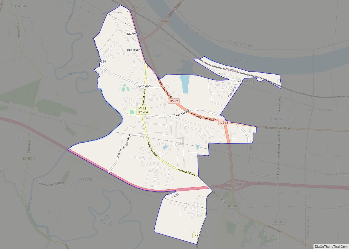
Paducah is the hub of its micropolitan area, which includes McCracken, Ballard and Livingston counties in Kentucky and Massac County in Illinois.
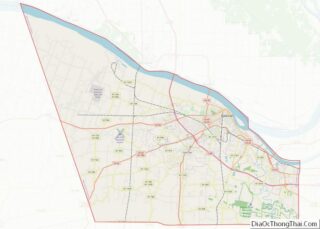
| Name: | Paducah city |
|---|---|
| LSAD Code: | 25 |
| LSAD Description: | city (suffix) |
| State: | Kentucky |
| County: | McCracken County |
| Incorporated: | 1838 |
| Elevation: | 341 ft (104 m) |
| Land Area: | 20.30 sq mi (52.59 km²) |
| Water Area: | 0.45 sq mi (1.15 km²) |
| Population Density: | 1,336.60/sq mi (516.06/km²) |
| ZIP code: | 42001-42002-42003 |
| Area code: | 270 & 364 |
| FIPS code: | 2158836 |
| GNISfeature ID: | 0500106 |
| Website: | paducahky.gov |
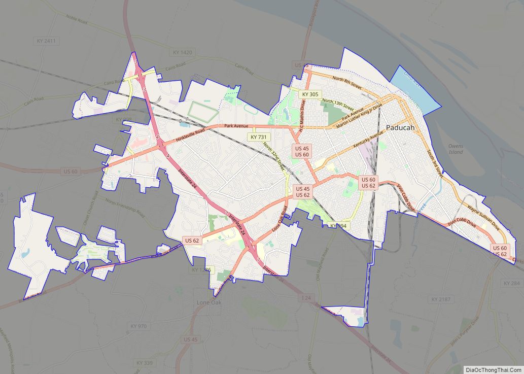
Online Interactive Map
Click on ![]() to view map in "full screen" mode.
to view map in "full screen" mode.
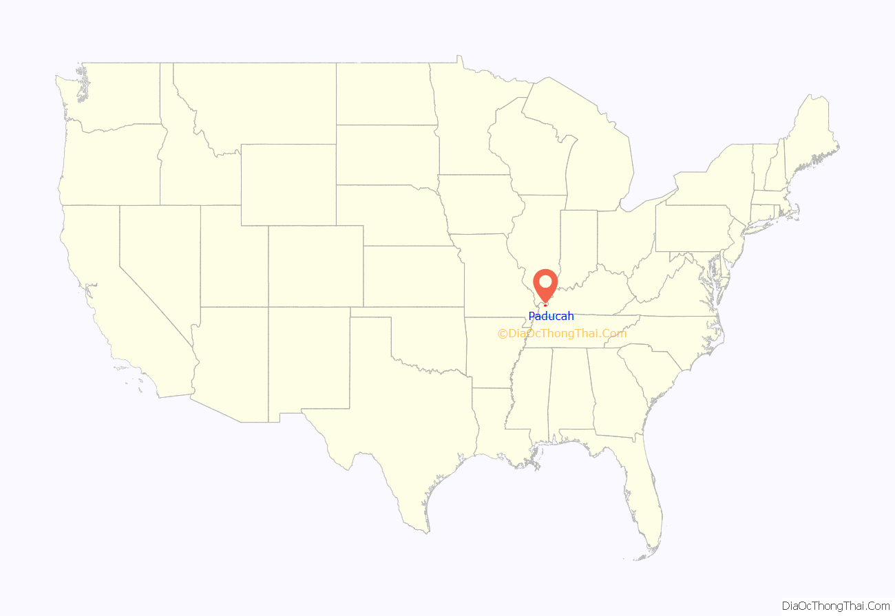
Paducah location map. Where is Paducah city?
History
Early history
Paducah was first settled as “Pekin” around 1821 by European Americans James and William Pore. The town was laid out by explorer and surveyor William Clark in 1827 and renamed Paducah.
Although local lore long connected this name to an eponymous Chickasaw chief “Paduke” and his band of “Paducahs”, authorities on the Chickasaw have since said that there was never any chief or tribe of that name, or anything like it. The Chickasaw language does not have related words. Instead, historians believe that Clark named the town for the Comanche people of the western plains. They were known by regional settlers as the Padoucas, from a Spanish transliteration of the Kaw word Pádoka or the Omaha Pádoⁿka.
Incorporation, steamboats and railroads
Paducah was formally established as a town in 1830 and incorporated as a city by the state legislature in 1838. By this time, steam boats traversed the river system, and its port facilities were important to trade and transportation. In addition, developing railroads began to enter the region. A factory for making red bricks, and a foundry for making rail and locomotive components became the nucleus of a thriving “River and Rail” economy.
Paducah became the site of dry dock facilities for steamboats and towboats, and thus headquarters for many barge companies. Because of its proximity to coalfields further to the east in Kentucky and north in Illinois, Paducah also became an important railway hub for the Illinois Central Railroad. This was the primary north-south railway connecting the industrial cities of Chicago and East St. Louis to the Gulf of Mexico at Gulfport, Mississippi, and New Orleans, Louisiana. The Illinois Central system also provided east-west links to the Burlington Northern and the Atchison, Topeka, and Santa Fe Railways (which later merged to become the BNSF Railway).
In 1924 the Illinois Central Railroad began construction at Paducah of their largest locomotive workshop in the nation. Over a period of 190 days, a large ravine between Washington and Jones streets was filled with 44,560 carloads of dirt to enlarge the site, sufficient for the construction of 23 buildings. The eleven million dollar project was completed in 1927 as the fourth-largest industrial plant in Kentucky. The railroad became the largest employer in Paducah, having 1,075 employees in 1938.
As steam locomotives were replaced through the 1940s and 1950s, the Paducah shops were converted to maintain diesel locomotives. A nationally known rebuilding program for aging diesel locomotives from Illinois Central and other railroads began in 1967. The shops became part of the Paducah and Louisville Railway in 1986. In the early 21st century, they are operated by VMV Paducahbilt.
Civil War
At the outset of the Civil War, Kentucky attempted to take a neutral position. However, when a Confederate force occupied Columbus, a Union force under General Ulysses S. Grant responded by occupying Paducah. Throughout most of the war, Col. Stephen G. Hicks was in charge of Paducah, and the town served as a massive supply depot for Federal forces along the Ohio, Mississippi, and Tennessee river systems.
On December 17, 1862, under the terms of General Order No. 11, US forces required 30 Jewish families to leave their long-established homes. Grant was trying to break up a black market in cotton, in which he assumed Jewish traders were involved due to racial stereotyping associated with anti-Semitic tropes. Cesar Kaskel, a prominent local Jewish businessman, dispatched a telegram of complaint to President Lincoln and met with him. As there were similar actions taken by other Jewish businessmen and loud complaints by Congress about the treatment of their constituents, Lincoln ordered the policy to be revoked within a few weeks.
On March 25, 1864, Confederate Gen. Nathan Bedford Forrest raided Paducah as part of his campaign northward from Mississippi into Western Tennessee and Kentucky. He intended to re-supply the Confederate forces in the region with recruits, ammunition, medical supplies, horses and mules, and especially to disrupt the Union domination of the regions south of the Ohio River. Known as the Battle of Paducah, the raid was successful in terms of the re-supply effort and in intimidating the Union, but Forrest returned south. According to his report, “I drove the enemy to their gunboats and fort; and held the city for ten hours, captured many stores and horses; burned sixty bales of cotton, one steamer, and a drydock, bringing out fifty prisoners.” Much of the fighting took place around Fort Anderson on the city’s west side, in the present-day Lower Town neighborhood; most buildings in the neighborhood postdate the war, as most of the neighborhood was demolished soon after the battle to deny any future raids the advantage of surprise that they had enjoyed during the battle. Among the few houses that were not destroyed is the David Yeiser House, a single-story Greek Revival structure.
Later having read in the newspapers that 140 fine horses had escaped the raid, Forrest sent Brigadier General Abraham Buford back to Paducah, to get the horses and to keep Union forces busy there while he attacked Fort Pillow in Tennessee. His forces were charged with a massacre of United States Colored Troops among the Union forces whom they defeated at the fort. On April 14, 1864, Buford’s men found the horses hidden in a Paducah foundry, as reported by the newspapers. Buford rejoined Forrest with the spoils, leaving the Union in control of Paducah until the end of the War.
1937 flood
In a far-reaching flood, on January 21, 1937, the Ohio River at Paducah rose above its 50-foot flood stage, cresting at 60.8 feet on February 2 and receding again to 50 feet on February 15. For nearly three weeks, 27,000 residents were forced to flee or to stay with friends and relatives in higher ground in McCracken or other counties. The American Red Cross and local churches provided some shelters. Buildings in downtown Paducah still bear historic plaques that define the high water marks.
Driven by 18 inches of rainfall in 16 days, along with sheets of swiftly moving ice, the Ohio River flood of 1937 was the worst natural disaster in Paducah’s history and elsewhere in the Ohio Valley. The earthen levee was ineffective against this flood. As a result, Congress authorized the United States Army Corps of Engineers to build the flood wall that now protects the city.
Atomic City
In 1950, the U.S. Atomic Energy Commission selected Paducah as the site for a new uranium enrichment plant. Construction began in 1951 and the plant opened for operations in 1952. Originally operated by Union Carbide, the plant has changed hands several times. Martin Marietta, its successor company Lockheed-Martin, and now the United States Enrichment Corporation have operated the plant in turn. The U.S. Department of Energy (DOE), successor to the AEC, remains the owner. The plant was closed in June 2013, and the Department of Energy began the process of decontaminating and shutting down the facilities.
Quilt City
On April 25, 1991, the National Quilt Museum opened in downtown Paducah. Paducah has been part of the UNESCO Creative Cities Network in the category of craft and folk art since November 2013.
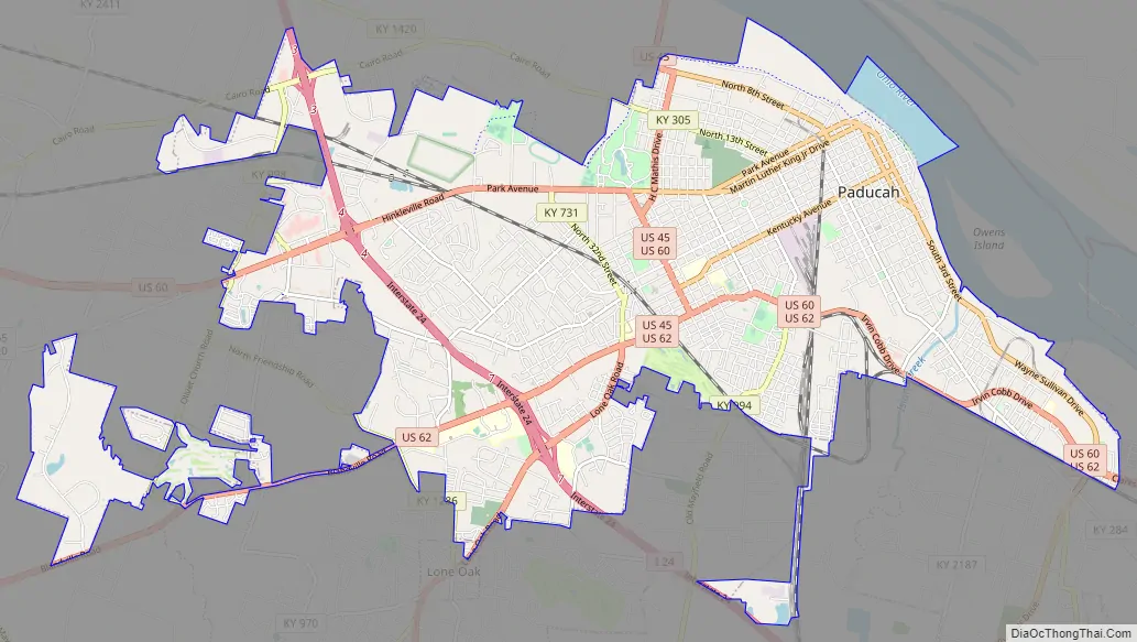
Paducah Road Map
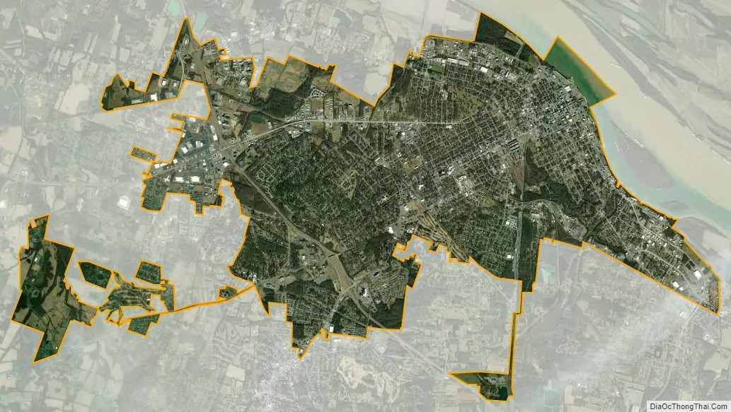
Paducah city Satellite Map
Geography
According to the United States Census Bureau, the city has a total area of 20.0 square miles (52 km), of which 19.9 square miles (52 km) is land and 0.10 square miles (0.26 km) (0.52%) is water.
Climate
Paducah has a humid subtropical climate (Köppen Cfa) with four distinct seasons and is located in USDA hardiness zone 7a. Spring-like conditions typically begin in mid-to-late March, summer from mid-to-late-May to late September, with fall in the October–November period. Seasonal extremes in both temperature and precipitation are common during early spring and late fall; severe weather is also common, with occasional tornado outbreaks in the region. Winter typically brings a mix of rain, sleet, and snow, with occasional heavy snowfall and icing. The city has a normal January mean temperature of 34.6 °F (1.4 °C) and averages 13 days annually with temperatures staying at or below freezing; the first and last freezes of the season on average fall on October 25 and April 8, respectively. Summer is typically hazy, hot, and humid with a July daily average of 78.9 °F (26.1 °C) and drought conditions at times. Paducah averages 48 days a year with high temperatures at or above 90 °F (32 °C). Snowfall averages 8.9 inches (23 cm) per season, contributing to the average annual precipitation of 50.32 inches (1,280 mm). Extremes in temperature range from 108 °F (42 °C) on July 17, 1942, and June 29, 2012, down to −15 °F (−26 °C) on January 20, 1985. Paducah is prone to river flooding from the Ohio River, which is currently ongoing as of late February 2018, with the river expected to crest at 49 feet on February 28.
See also
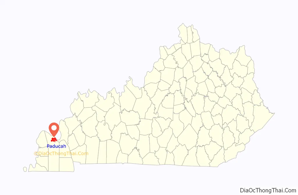
Map of Kentucky State and its subdivision:- Adair
- Allen
- Anderson
- Ballard
- Barren
- Bath
- Bell
- Boone
- Bourbon
- Boyd
- Boyle
- Bracken
- Breathitt
- Breckinridge
- Bullitt
- Butler
- Caldwell
- Calloway
- Campbell
- Carlisle
- Carroll
- Carter
- Casey
- Christian
- Clark
- Clay
- Clinton
- Crittenden
- Cumberland
- Daviess
- Edmonson
- Elliott
- Estill
- Fayette
- Fleming
- Floyd
- Franklin
- Fulton
- Gallatin
- Garrard
- Grant
- Graves
- Grayson
- Green
- Greenup
- Hancock
- Hardin
- Harlan
- Harrison
- Hart
- Henderson
- Henry
- Hickman
- Hopkins
- Jackson
- Jefferson
- Jessamine
- Johnson
- Kenton
- Knott
- Knox
- Larue
- Laurel
- Lawrence
- Lee
- Leslie
- Letcher
- Lewis
- Lincoln
- Livingston
- Logan
- Lyon
- Madison
- Magoffin
- Marion
- Marshall
- Martin
- Mason
- McCracken
- McCreary
- McLean
- Meade
- Menifee
- Mercer
- Metcalfe
- Monroe
- Montgomery
- Morgan
- Muhlenberg
- Nelson
- Nicholas
- Ohio
- Oldham
- Owen
- Owsley
- Pendleton
- Perry
- Pike
- Powell
- Pulaski
- Robertson
- Rockcastle
- Rowan
- Russell
- Scott
- Shelby
- Simpson
- Spencer
- Taylor
- Todd
- Trigg
- Trimble
- Union
- Warren
- Washington
- Wayne
- Webster
- Whitley
- Wolfe
- Woodford
- Alabama
- Alaska
- Arizona
- Arkansas
- California
- Colorado
- Connecticut
- Delaware
- District of Columbia
- Florida
- Georgia
- Hawaii
- Idaho
- Illinois
- Indiana
- Iowa
- Kansas
- Kentucky
- Louisiana
- Maine
- Maryland
- Massachusetts
- Michigan
- Minnesota
- Mississippi
- Missouri
- Montana
- Nebraska
- Nevada
- New Hampshire
- New Jersey
- New Mexico
- New York
- North Carolina
- North Dakota
- Ohio
- Oklahoma
- Oregon
- Pennsylvania
- Rhode Island
- South Carolina
- South Dakota
- Tennessee
- Texas
- Utah
- Vermont
- Virginia
- Washington
- West Virginia
- Wisconsin
- Wyoming