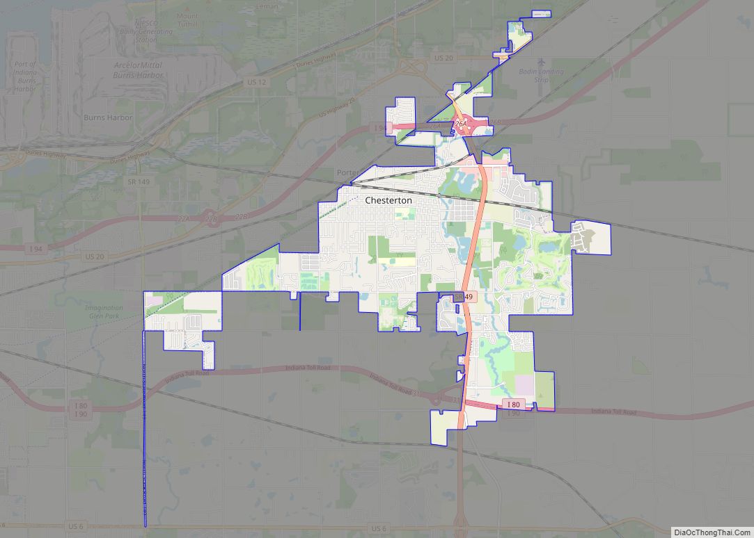
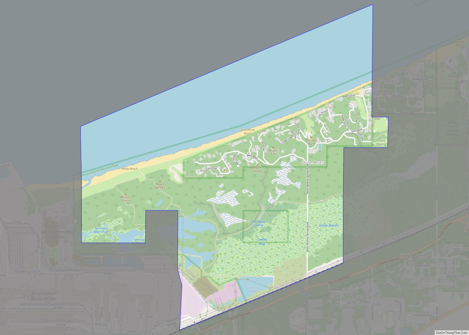
Porter County is a county in the U.S. state of Indiana. As of 2020, the population was 173,215, making it the 10th most populous county in Indiana. The county seat is Valparaiso. The county is part of Northwest Indiana, as well as the Chicago metropolitan area. Porter County is the site of much of the Indiana Dunes, an area of ecological significance. The Hour Glass Museum in Ogden Dunes documents the region’s ecological significance.
| Name: | Porter County |
|---|---|
| FIPS code: | 18-127 |
| State: | Indiana |
| Founded: | 5 February 1836 (authorized) 1837 (organized) |
| Named for: | David Porter |
| Seat: | Valparaiso |
| Largest city: | Portage |
| Total Area: | 521.8 sq mi (1,351 km²) |
| Land Area: | 418.2 sq mi (1,083 km²) |
| Population Density: | 407.4/sq mi (157.3/km²) |
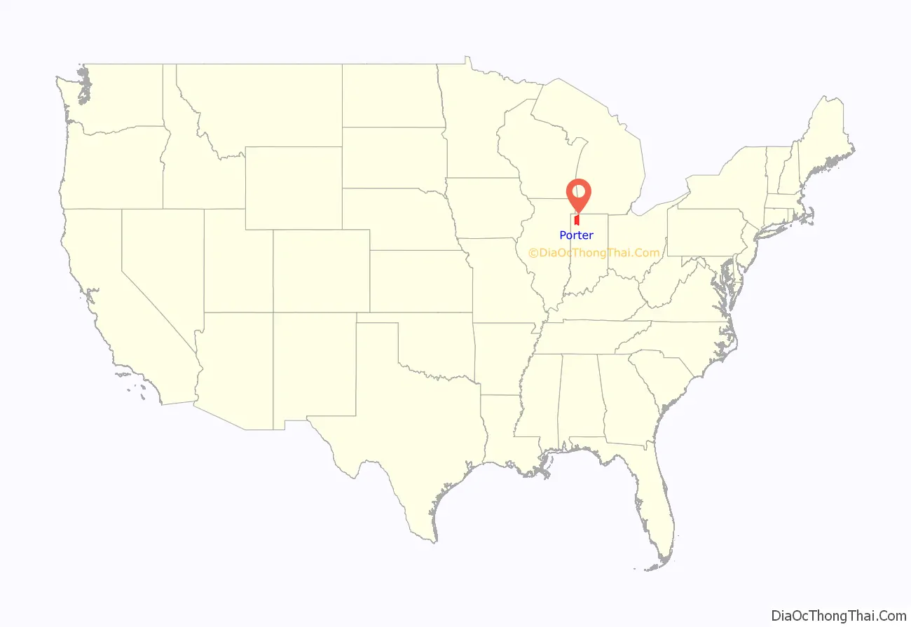
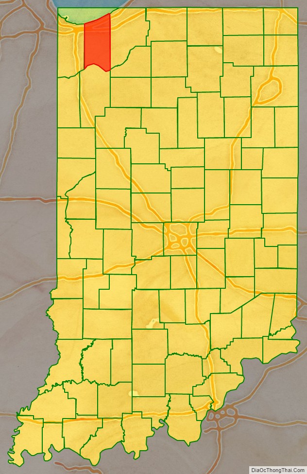
Porter County location map. Where is Porter County?
History
The Porter County area was occupied by an Algonquian people dubbed Huber-Berrien. This subsistence culture arrived after the glaciers retreated around 15,000 years ago and the rise of glacial Lake Algonquian, 4–8,000 years ago. The native people of this area were next recorded during the Iroquois Wars (1641–1701) as being Potawatomi and Miami. The trading post system used by the French and then the English encouraged native people to live in central villages along major waterways. Therefore, there are no recorded villages within Porter County’s current boundaries. It was not until 1830 when Chiqua’s town and Tassinong appear on maps and in records. Chiqua’s town is a mile east of Valparaiso on State Route 2, the old Sauk Trail. Tassinong is south of Valparaiso about 5 miles (8.0 km) on State Route 49 at Baum’s Bridge Road, the main route across the Great Kankakee Marsh.
After the American Revolutionary War established US sovereignty over the territory of the upper midwest, the new federal government defined the Northwest Territory in 1787 which included the area of present-day Indiana. In 1800, Congress separated Ohio from the Northwest Territory, designating the rest of the land as the Indiana Territory. President Thomas Jefferson chose William Henry Harrison as the governor of the territory, and Vincennes was established as the capital. After the Michigan Territory was separated and the Illinois Territory was formed, Indiana was reduced to its current size and geography. By December 1816 the Indiana Territory was admitted to the Union as a state.
The Indiana State Legislature passed an omnibus county bill on 7 February 1835 that authorized the creation of thirteen counties in northeast Indiana, including Porter. In 1837 the county was organized. It was named for Capt. David Porter, naval officer during the Barbary Wars and the War of 1812.
In 1962, Bethlehem Steel built a large integrated steel mill on the shores of Lake Michigan, which is now owned and operated by Cleveland-Cliffs. The construction of the mill, as well as the neighboring Port of Indiana, generated enormous controversy between industrial interests and locals who wanted to conserve the natural shoreline and habitat. Although the activists lost and the steel mill and port were constructed, the US Congress created the Indiana Dunes National Lakeshore in 1966 to protect the area’s unique natural habitat.
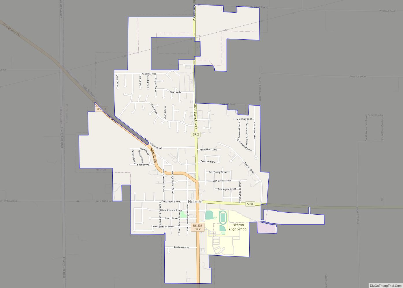
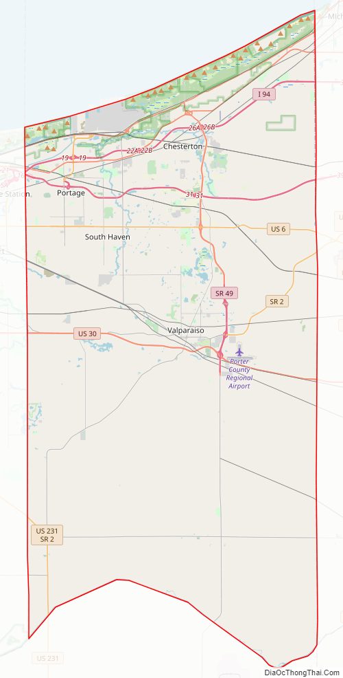
Porter County Road Map
Geography
Porter County lies on the northern edge of Indiana; its north border is formed by Lake Michigan and its south border is formed by the westward-flowing Kankakee River Its once-tree-covered low rolling hills have been cleared and devoted to agriculture; the only exceptions in Porter County are the drainages carved into the terrain, which are brush-filled. The East Arm Little Calumet River flows westward through the upper portion of Porter County. The highest point, at 870 feet (270 m), is a small hill on the county’s east border, 2.75 miles (4.4 km) NW of Westville. The lowest point, at approximately 585 feet (178 m), is along the Lake Michigan shoreline (exact elevation varies due to variation in lake level). According to the 2010 census, the county has an area of 521.78 square miles (1,351.4 km), of which 418.15 square miles (1,083.0 km) (or 80.14%) is land and 103.63 square miles (268.4 km) (or 19.9%) is water, most of it in Lake Michigan.
Adjacent counties
- LaPorte County – east
- Starke County – southeast
- Jasper County – south
- Lake County – west
- Cook County, Illinois – northwest, boundary in Lake Michigan
- Berrien County, Michigan – northeast, boundary in Lake Michigan
Protected areas
- Indiana Dunes National Park (part)
- Indiana Dunes National Park Heron Rookery
- Indiana Dunes State Park
- Moraine Nature Preserve
Major highways
- Interstate 80
- Indiana Toll Road
- Interstate 94
- U.S. Route 6
- U.S. Route 12
- U.S. Route 20
- U.S. Route 30
- U.S. Route 231
- State Road 2
- State Road 8
- State Road 49
- State Road 130
- State Road 149
- State Road 249
- State Road 520
Railroads
- Amtrak
- Canadian National
- Chesapeake and Indiana Railroad
- Chicago, Fort Wayne and Eastern Railroad
- Chicago South Shore and South Bend Railroad
- CSX Transportation
- Norfolk Southern Railway
- South Shore Line
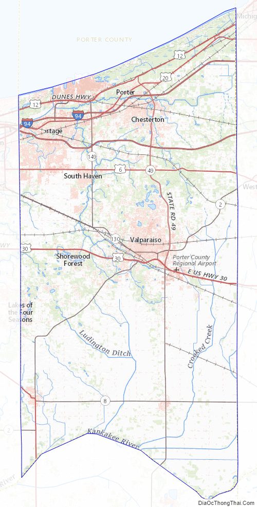
Porter County Topographic Map
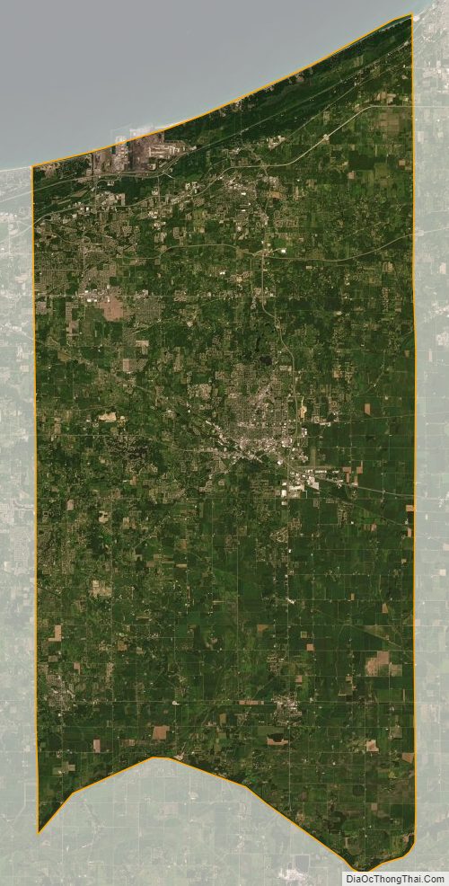
Porter County Satellite Map
Porter County Outline Map