Valparaiso (/ˌvɑːlpəˈreɪzoʊ/ vahl-pə-RAY-zoh), colloquially Valpo, is a city and the county seat of Porter County, Indiana, United States. The population was 34,151 at the 2020 census.
| Name: | Valparaiso city |
|---|---|
| LSAD Code: | 25 |
| LSAD Description: | city (suffix) |
| State: | Indiana |
| County: | Porter County |
| Incorporated: | February 29, 1835 |
| Elevation: | 794 ft (242 m) |
| Total Area: | 16.43 sq mi (42.57 km²) |
| Land Area: | 16.39 sq mi (42.44 km²) |
| Water Area: | 0.05 sq mi (0.12 km²) 0.32% |
| Total Population: | 34,151 |
| Population Density: | 2,084.16/sq mi (804.68/km²) |
| ZIP code: | 46383-46385 |
| Area code: | 219 |
| FIPS code: | 1878326 |
| GNISfeature ID: | 449849 |
| Website: | http://www.ci.valparaiso.in.us/ |
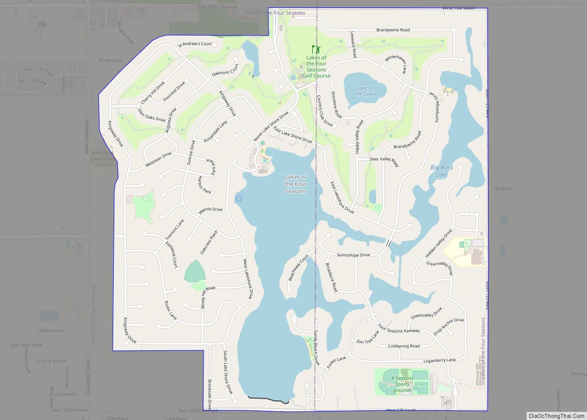
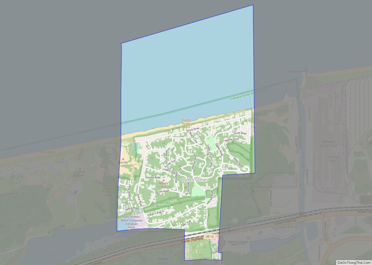
Online Interactive Map
Click on ![]() to view map in "full screen" mode.
to view map in "full screen" mode.
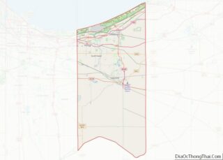
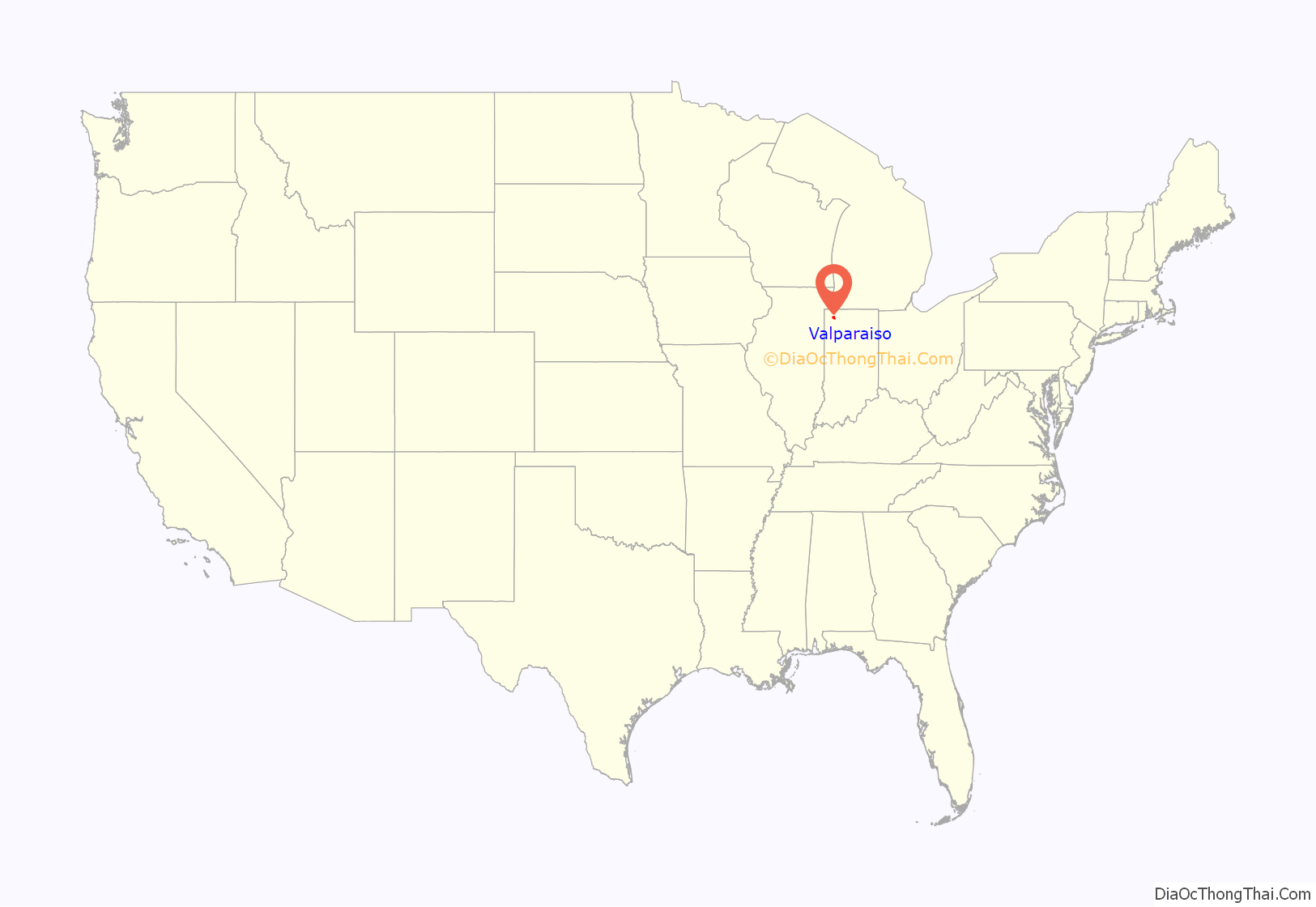
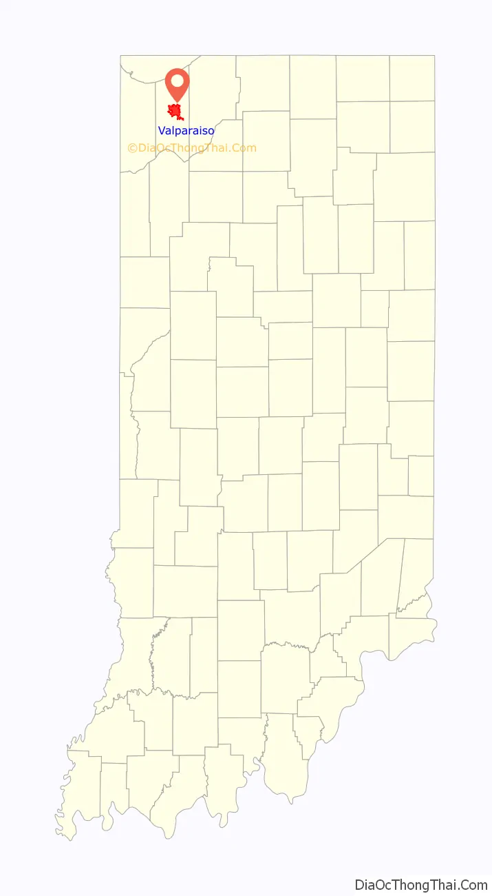
Valparaiso location map. Where is Valparaiso city?
History
The site of present-day Valparaiso was included in the purchase of land from the Potawatomi people by the U.S. Government in October 1832. Chiqua’s town or Chipuaw was located a mile east of the current Courthouse along the Sauk Trail. Chiqua’s town existed from or before 1830 until after 1832. The location is just north of the railroad crossing on State Route 2 and County Road 400 North.
Located on the ancient Native American trail from Rock Island to Detroit, the town had its first log cabin in 1834. Established in 1836 as Portersville, county seat of Porter County, it was renamed to Valparaiso (meaning “Vale of Paradise” in Old Spanish) in 1837 after Valparaíso, Chile, near which the county’s namesake David Porter battled in the Battle of Valparaiso during the War of 1812. The city was once called the “City of Churches” due to the large number of churches located there at the end of the 19th century. Valparaiso Male and Female College, one of the earliest higher education institutions admitting both men and women in the country, was founded in Valparaiso in 1859, but closed its doors in 1871 before reopening in 1873 as the Northern Indiana Normal School and Business Institute. In the early 20th century, it became Valparaiso College, then Valparaiso University. It was initially affiliated with the Methodist Church but after 1925 with the Lutheran University Association (which has relationships both with the Lutheran Church Missouri Synod, and with the Evangelical Lutheran Church in America) and expanded significantly after World War II.
From the 1890s until 1969, there were no African-American residents in Valparaiso. This has been attributed to Valparaiso being a sundown town. There was also substantial activity by the Ku Klux Klan, which negotiated to purchase Valparaiso University in 1923. The first African-American family to move to Valparaiso faced intimidation and eventually left the city when a visiting relative was murdered. In recent years, the city’s racial composition has diversified.
Valparaiso also has a long history of being a transportation hub for the region. In 1858, the Pittsburgh, Fort Wayne and Chicago Railroad reached Valparaiso, connecting the city directly to Chicago. By 1910, an interurban railway connected the city to Gary, Indiana. Today, while the city no longer has a passenger train station, it is still very much a part of the “Crossroads of America” due to its proximity to I-65, I-80, I-90, and I-94. Additionally, the Canadian National railroad still runs freight on the tracks, including through the downtown area.
Until 1991, Valparaiso was the terminal of Amtrak’s Calumet commuter service.
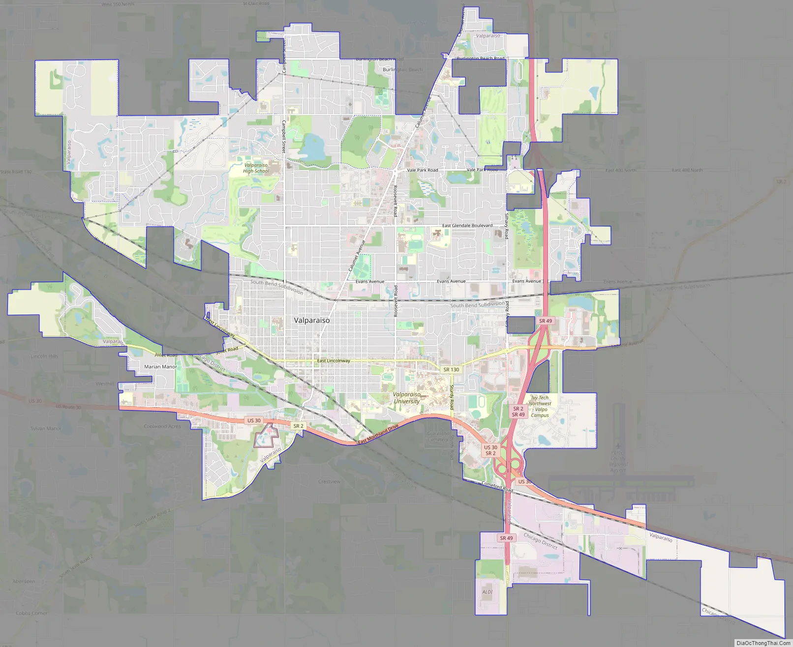
Valparaiso Road Map
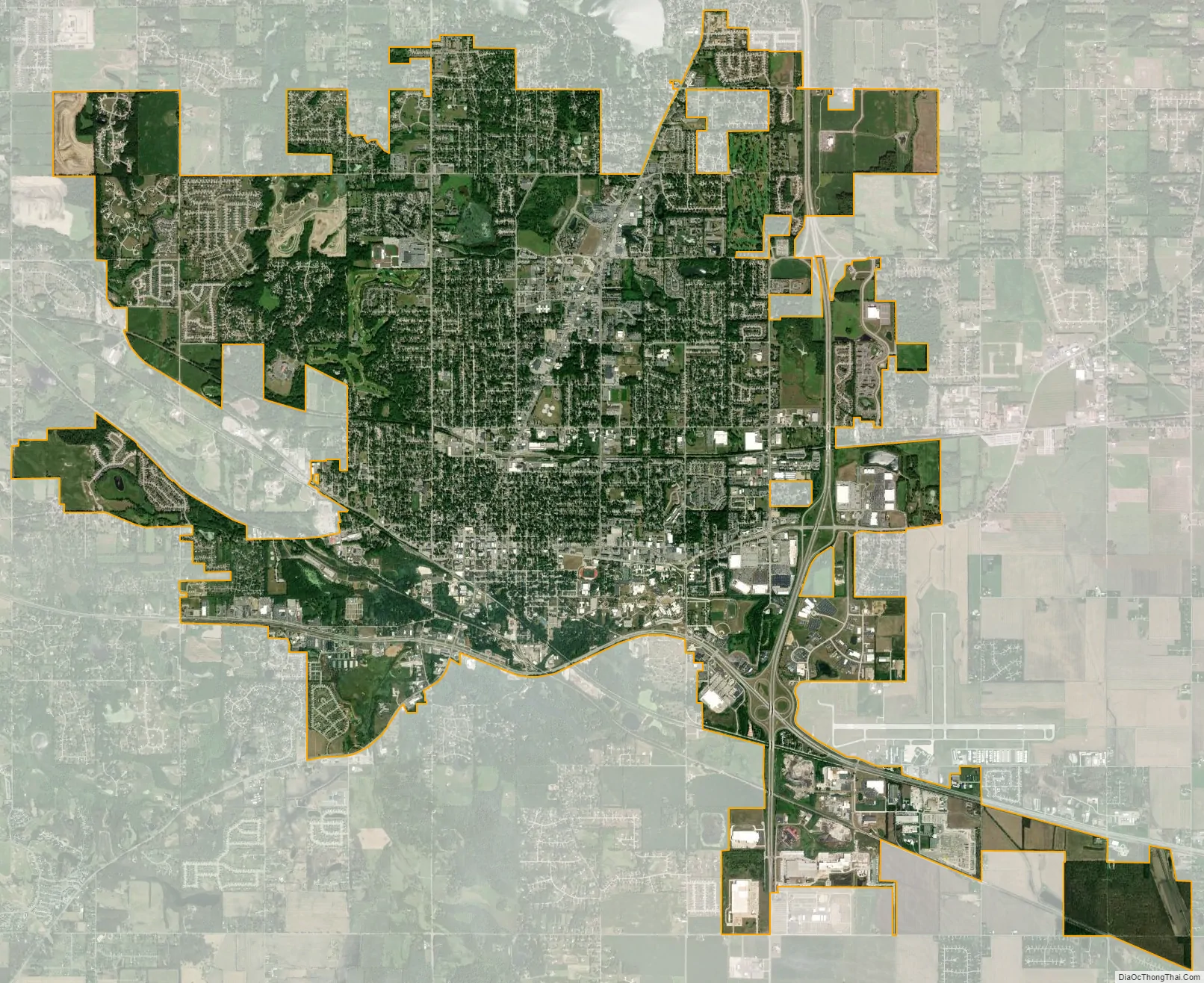
Valparaiso city Satellite Map
Geography
The city is situated at the junctions of U.S. Route 30, State Road 2, and State Road 49.
According to the 2010 census, Valparaiso has a total area of 15.578 square miles (40.35 km), of which 15.53 square miles (40.22 km) (or 99.69%) is land and 0.048 square miles (0.12 km) (or 0.31%) is water.
Topography
The city is situated on the Valparaiso Moraine.
Glaciation has left numerous features on the landscape here. Kettle lakes and knobs make up much of this hilly area of Northwest Indiana. The Pines Ski Area is the only remaining kame in the city; the other one is under the university’s Chapel of the Resurrection, however, grading of land in that area makes that particular kame almost nonexistent. Many glacial erratics can be found throughout the city. The moraine has left the city with mostly clay soil.
Climate
See also
Map of Indiana State and its subdivision:- Adams
- Allen
- Bartholomew
- Benton
- Blackford
- Boone
- Brown
- Carroll
- Cass
- Clark
- Clay
- Clinton
- Crawford
- Daviess
- De Kalb
- Dearborn
- Decatur
- Delaware
- Dubois
- Elkhart
- Fayette
- Floyd
- Fountain
- Franklin
- Fulton
- Gibson
- Grant
- Greene
- Hamilton
- Hancock
- Harrison
- Hendricks
- Henry
- Howard
- Huntington
- Jackson
- Jasper
- Jay
- Jefferson
- Jennings
- Johnson
- Knox
- Kosciusko
- LaGrange
- Lake
- Lake Michigan
- LaPorte
- Lawrence
- Madison
- Marion
- Marshall
- Martin
- Miami
- Monroe
- Montgomery
- Morgan
- Newton
- Noble
- Ohio
- Orange
- Owen
- Parke
- Perry
- Pike
- Porter
- Posey
- Pulaski
- Putnam
- Randolph
- Ripley
- Rush
- Saint Joseph
- Scott
- Shelby
- Spencer
- Starke
- Steuben
- Sullivan
- Switzerland
- Tippecanoe
- Tipton
- Union
- Vanderburgh
- Vermillion
- Vigo
- Wabash
- Warren
- Warrick
- Washington
- Wayne
- Wells
- White
- Whitley
- Alabama
- Alaska
- Arizona
- Arkansas
- California
- Colorado
- Connecticut
- Delaware
- District of Columbia
- Florida
- Georgia
- Hawaii
- Idaho
- Illinois
- Indiana
- Iowa
- Kansas
- Kentucky
- Louisiana
- Maine
- Maryland
- Massachusetts
- Michigan
- Minnesota
- Mississippi
- Missouri
- Montana
- Nebraska
- Nevada
- New Hampshire
- New Jersey
- New Mexico
- New York
- North Carolina
- North Dakota
- Ohio
- Oklahoma
- Oregon
- Pennsylvania
- Rhode Island
- South Carolina
- South Dakota
- Tennessee
- Texas
- Utah
- Vermont
- Virginia
- Washington
- West Virginia
- Wisconsin
- Wyoming