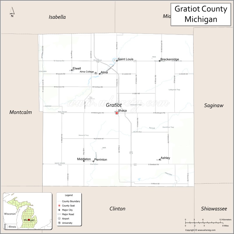
Gratiot County (/ˈɡræʃɪt/ GRASH-it) is a county in the U.S. state of Michigan. As of the 2020 Census, the population was 41,761. The county seat is Ithaca, although its most populous city is Alma.
Gratiot County comprises the Alma, MI Micropolitan Statistical Area, which is also part of the Mount Pleasant-Alma, MI Combined Statistical Area. The Gratiot County Courthouse was designed in the classical revival style by Claire Allen, a prominent southern Michigan architect. It is one of seven sites in the county listed on the National Register of Historic Places (No. 76002291 added 1976). In June 2012, the 212.8 MW Gratiot County Wind Project opened, the largest wind power installation in the state.
| Name: | Gratiot County |
|---|---|
| FIPS code: | 26-057 |
| State: | Michigan |
| Founded: | 1855 |
| Named for: | Charles Gratiot |
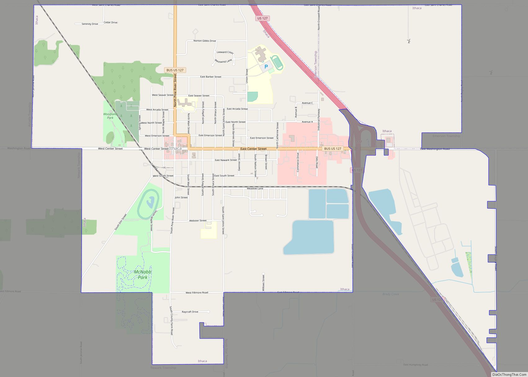
| Seat: | Ithaca |
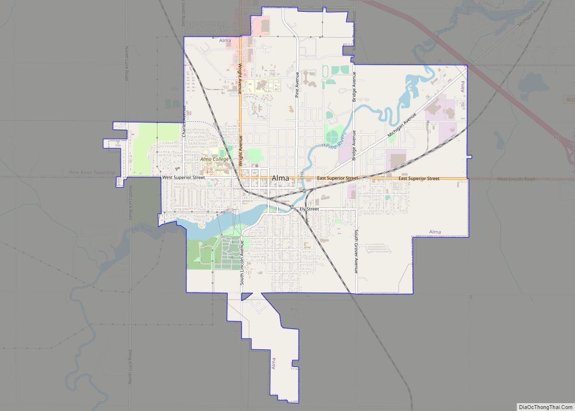
| Largest city: | Alma |
| Total Area: | 572 sq mi (1,480 km²) |
| Land Area: | 568 sq mi (1,470 km²) |
| Total Population: | 41,761 |
| Population Density: | 75/sq mi (29/km²) |
| Time zone: | UTC−5 (Eastern) |
| Summer Time Zone (DST): | UTC−4 (EDT) |
| Website: | www.gratiotmi.com |
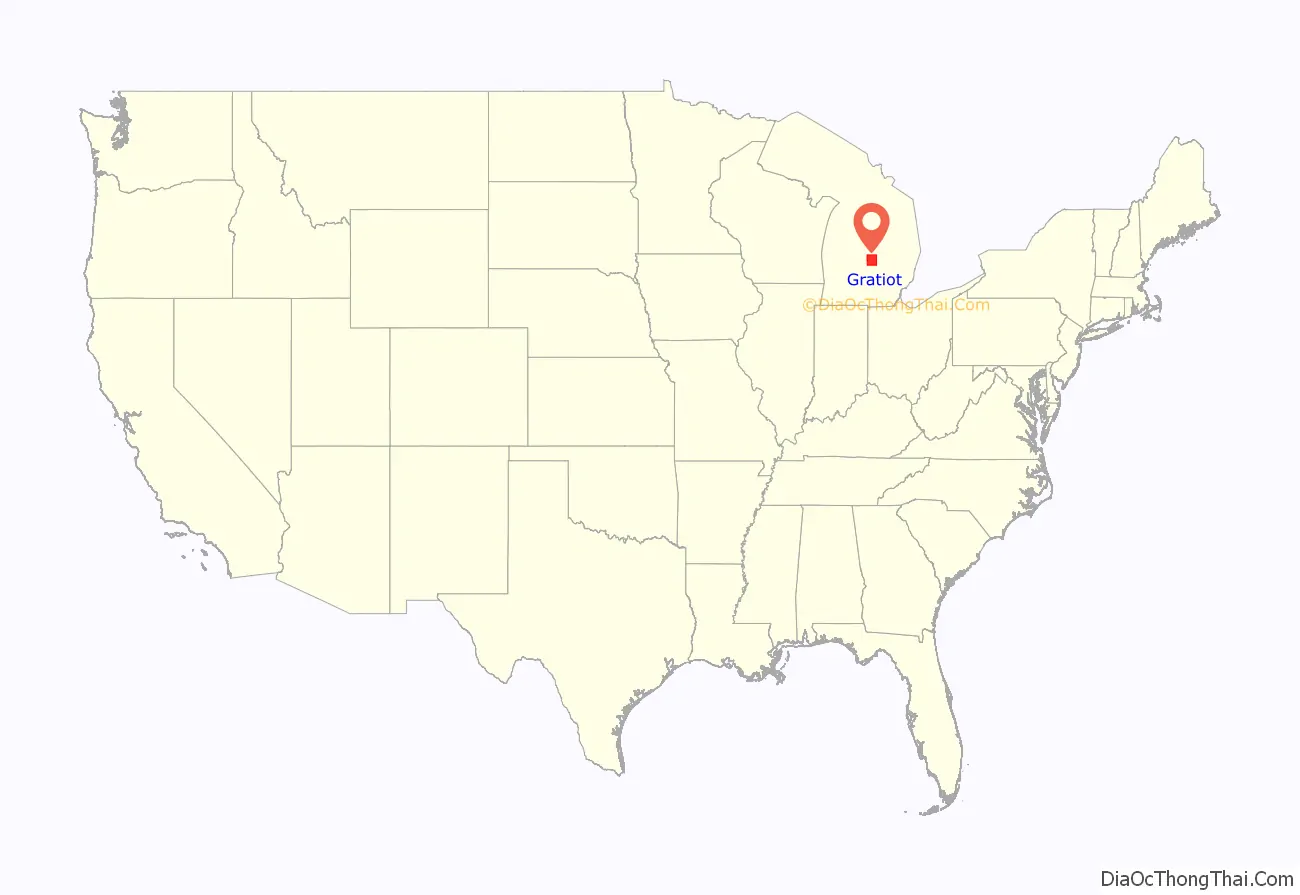
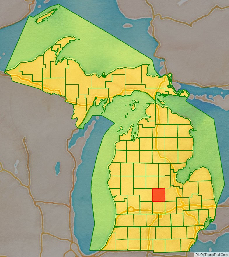
Gratiot County location map. Where is Gratiot County?
History
Gratiot County, Michigan is named for Captain Charles Gratiot, who supervised the building of Port Huron‘s Fort Gratiot. It was described by the Territorial Legislature in 1831. By 1837, the Territory had been admitted to the Union as a state; in 1855 the State Legislature authorized the organization of Gratiot County – the death year of the county’s namesake.
Gratiot County was a New England settlement. The original founders of Ithaca and of Alma were settlers from New England, “Yankees”, descended from the English Puritans who settled the northeastern coast of the new continent in the 1600s. The Gratiot County settlers were farmers who headed west into what was then the wilds of the Northwest Territory during the early 1800s. Most of them arrived as a result of the completion of the Erie Canal as well as the close of the Black Hawk War. They arrived to virgin forest and wild prairie, but laid out farms, constructed roads, erected government buildings and established post routes. They maintained their customs, such as passion for education, and abhorrence of the existing slave trade. They were members of the Congregationalist Church or the Episcopal Church.
In the 1890s, German immigrants began settling in Gratiot County. See List of Michigan county name etymologies. Emil Lockwood, a noted Michigan legislator, represented Gratiot County in the Michigan Senate from 1963 to 1970, much of the time as Senate Majority Leader.
There are six Michigan historical markers in Gratiot County:
- Alma College
- Gratiot County
- Jackson Weller House
- Lumberjack Park
- Michigan Masonic Home
- Saginaw and Gratiot County State Road / Saginaw Valley & St. Louis Railroad
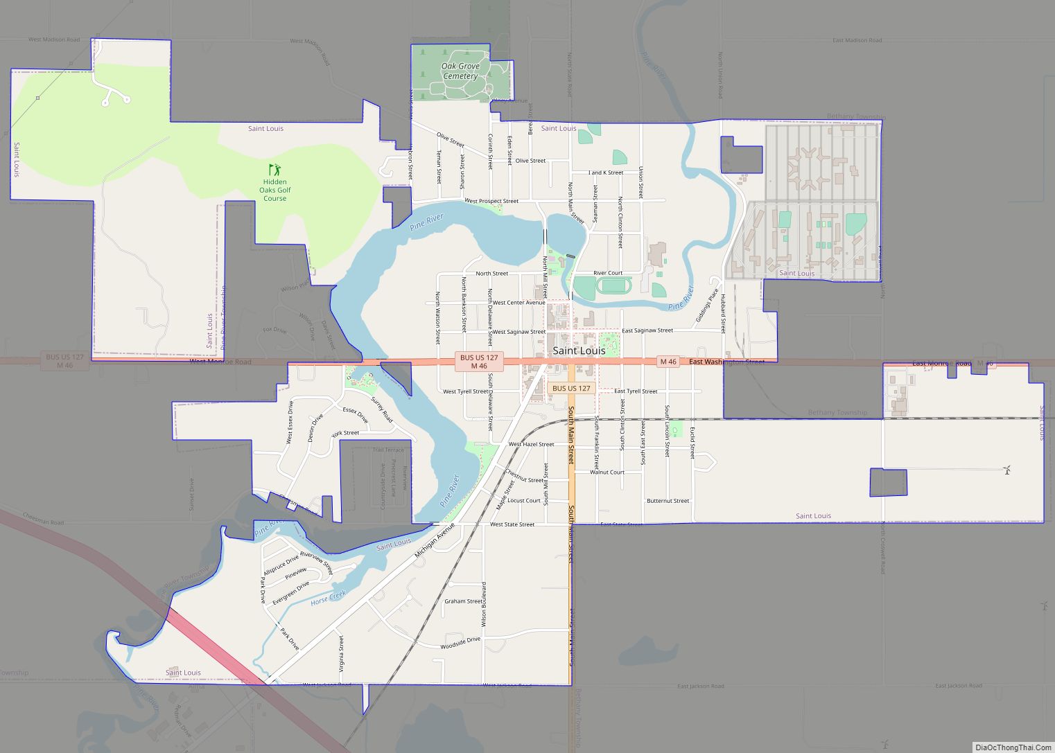
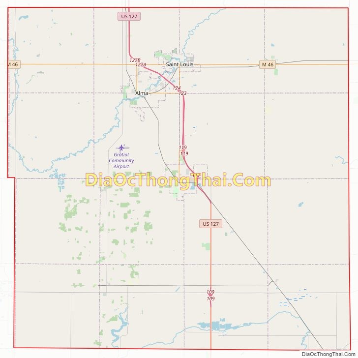
Gratiot County Road Map
Geography
According to the U.S. Census Bureau, the county has a total area of 572 square miles (1,480 km), of which 568 square miles (1,470 km) is land and 3.1 square miles (8.0 km) (0.6%) is water. It is considered to be part of Central Michigan.
Adjacent counties
- Midland County – northeast
- Isabella County – northwest
- Saginaw County – east
- Montcalm County – west
- Shiawassee County – southeast
- Clinton County – south
- Ionia County – southwest
Major highways
- US 127 – runs north to I-75 and south to Lansing.
- Bus. US 127 – business loop through downtown Alma.
- Bus. US 127 – business loop through downtown Ithaca.
- Bus. US 127 – business loop through downtown St. Louis.
- M-46 – cross-peninsular highway that runs east to Saginaw and Port Sanilac; runs west to Muskegon.
- M-57 – runs east to Flint; runs west to US 131 near Grand Rapids.
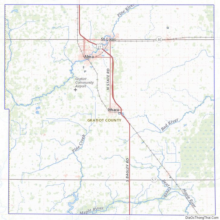
Gratiot County Topographic Map
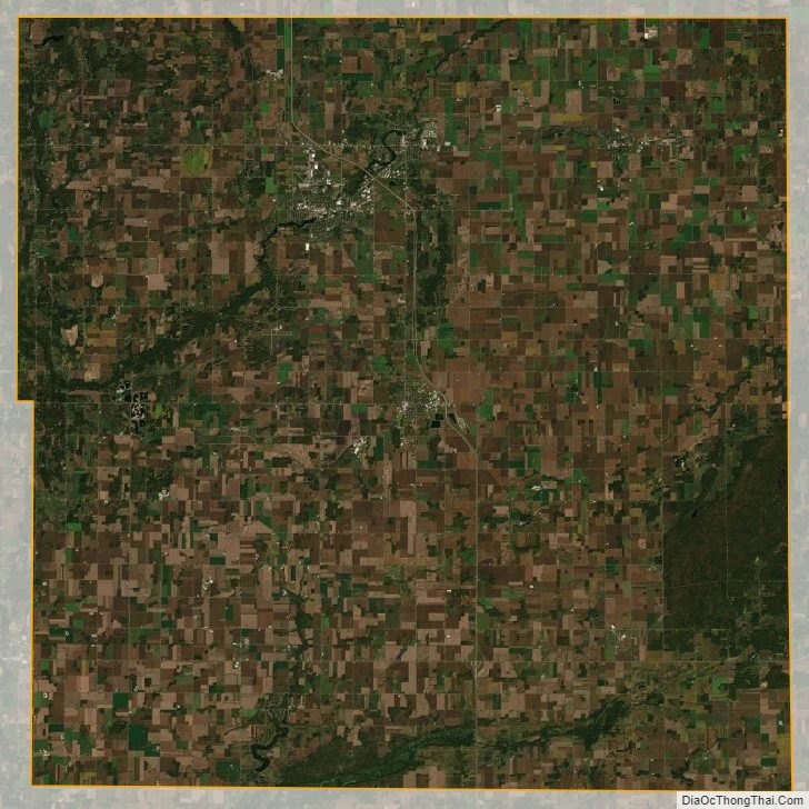
Gratiot County Satellite Map
Gratiot County Outline Map