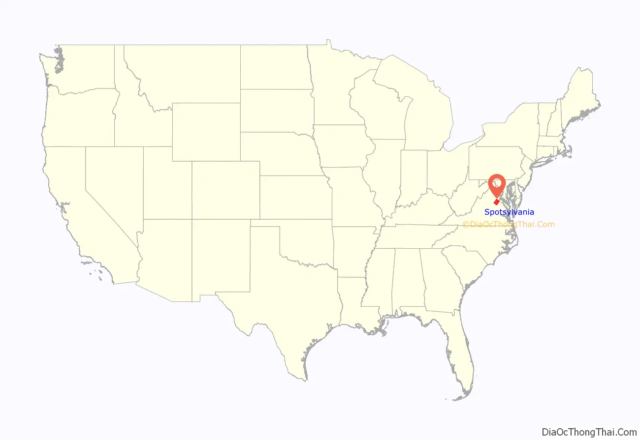
Spotsylvania County is a county in the U.S. state of Virginia. As of the July 2021 estimate, the population was 143,676. Its county seat is Spotsylvania Courthouse.
| Name: | Spotsylvania County |
|---|---|
| FIPS code: | 51-177 |
| State: | Virginia |
| Founded: | 1721 |
| Named for: | Alexander Spotswood |
| Seat: | Spotsylvania Courthouse |
| Total Area: | 414 sq mi (1,070 km²) |
| Land Area: | 401 sq mi (1,040 km²) |
| Total Population: | 140,032 |
| Population Density: | 340/sq mi (130/km²) |
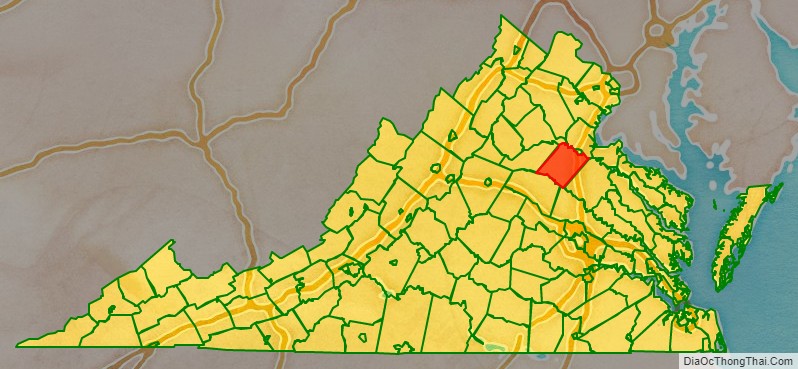
Spotsylvania County location map. Where is Spotsylvania County?
History
At the time of European encounter, the inhabitants of the area that became Spotsylvania County were a Siouan-speaking tribe called the Manahoac.
As the colonial population increased, Spotsylvania County was established in 1721 from parts of Essex, King and Queen, and King William counties. The county was named in Latin for Lieutenant Governor of Virginia Alexander Spotswood who incidentally was also the second greatgrandfather of Robert E Lee.
Many major battles were fought in this county during the Civil War, including the Battle of Chancellorsville, Battle of the Wilderness, Battle of Fredericksburg, and Battle of Spotsylvania Court House. The war resulted in widespread disruption and opportunity: some 10,000 African-American slaves left area plantations and city households to cross the Rappahannock River, reaching the Union lines and gaining freedom. This exodus is commemorated by historical markers on both sides of the river.
General Stonewall Jackson was shot and mortally wounded by friendly fire in Spotsylvania County during the Battle of Chancellorsville. A group of Confederate soldiers from North Carolina were in the woods and heard General Jackson’s party returning from reconnoitering the Union lines. They mistook them for a Federal patrol and fired on them, wounding Jackson in both arms. His left arm was amputated. General Jackson died a few days later from pneumonia at nearby Guinea Station. He and other Confederate wounded were being gathered there for evacuation to hospitals to the south and further away from enemy lines.
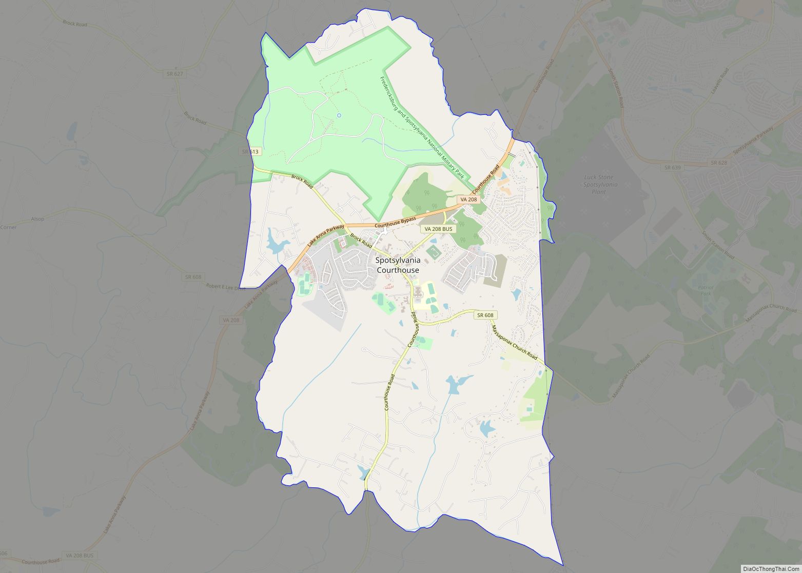
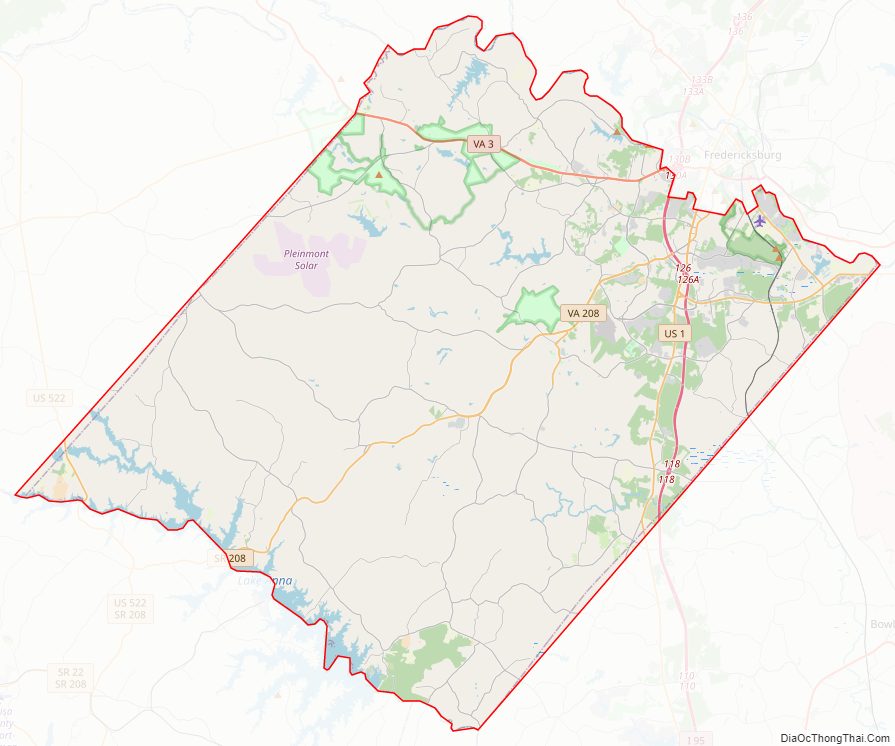
Spotsylvania County Road Map
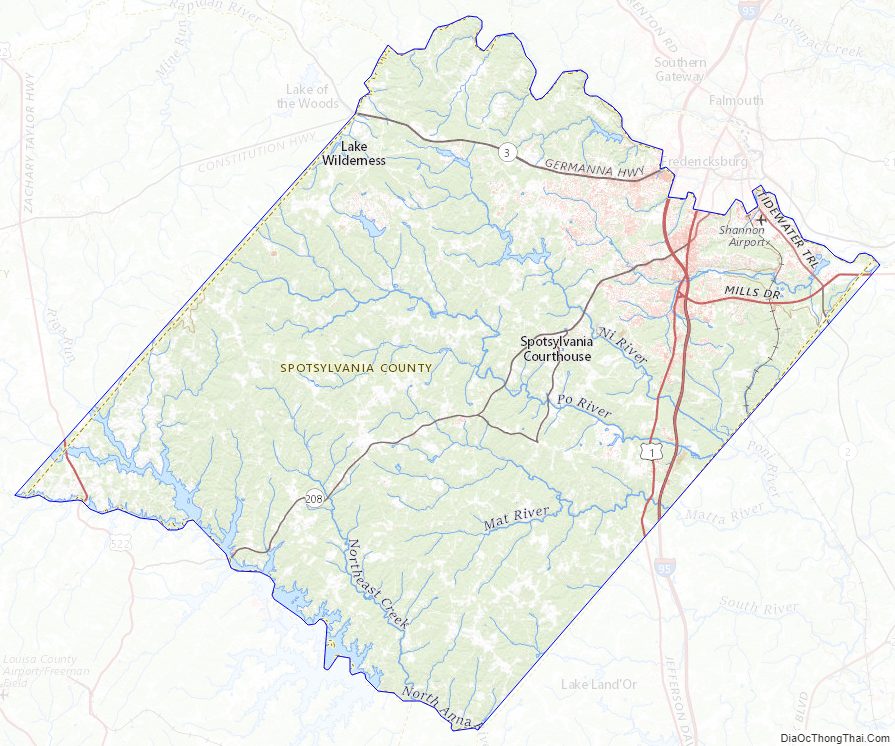
Geography
It is bounded on the north by the Rappahannock and Rapidan rivers, the independent city of Fredericksburg (all of which were part of the area’s early history), and the counties of Stafford and Culpeper; on the south by the North Anna River and its impoundment, Lake Anna, and by the counties of Hanover and Louisa; on the west by Orange County and Culpeper County; and on the east by Caroline County.
Adjacent counties and independent city
- Culpeper County, Virginia – north
- Stafford County, Virginia – northeast
- City of Fredericksburg, Virginia – northeast
- Caroline County, Virginia – southeast
- Hanover County, Virginia – south
- Louisa County, Virginia – southwest
- Orange County, Virginia – west and northwest
National protected area
- Fredericksburg and Spotsylvania National Military Park (part)
Points of interest
- Lake Anna State Park
- Spotsylvania County Public Schools
- Spotsylvania Courthouse
- Fredericksburg and Spotsylvania National Military Park
- Spotsylvania Towne Centre
- Spotsylvania County Sheriff’s Office
- Central Rappahannock Regional Library
- Dominion Raceway
Communities
There are no incorporated towns or cities in Spotsylvania County. Unincorporated communities in the county include:
- Alsop
- Arcadia
- Artillery Ridge
- Bells Crossroad
- Belmont
- Blades Corner
- Brandon
- Brockroad
- Brokenburg
- Carters Store
- Chancellor
- Chancellor Green, a local Hispanic enclave
- Chancellorsville
- Chewnings Corner
- Cookstown
- Cosner’s Corner
- Dunavant
- Five Mile Fork
- Four Mile Fork
- Granite Springs
- Lanes Corner
- Leavells
- Lewiston
- Margo
- Marye
- Massaponax
- McHenry
- Old Trap
- Olivers Corner
- Partlow
- Paytes
- Post Oak
- Shady Grove Corner
- Snell
- Stubbs
- Thornburg
- Todds Tavern
Many areas of the county have Fredericksburg addresses.
Major highways
- I-95
- US 1
- US 17
- US 522
- SR 2
- SR 3
- SR 208
Spotsylvania County Topographic Map
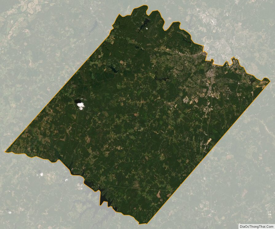
Spotsylvania County Satellite Map
Spotsylvania County Outline Map