Hanover County is a county in the Commonwealth of Virginia. As of the 2020 census, the population was 109,979. Its county seat is Hanover Courthouse.
Hanover County is a part of the Greater Richmond Region.
| Name: | Hanover County |
|---|---|
| FIPS code: | 51-085 |
| State: | Virginia |
| Founded: | 1720 |
| Named for: | Electorate of Hanover |
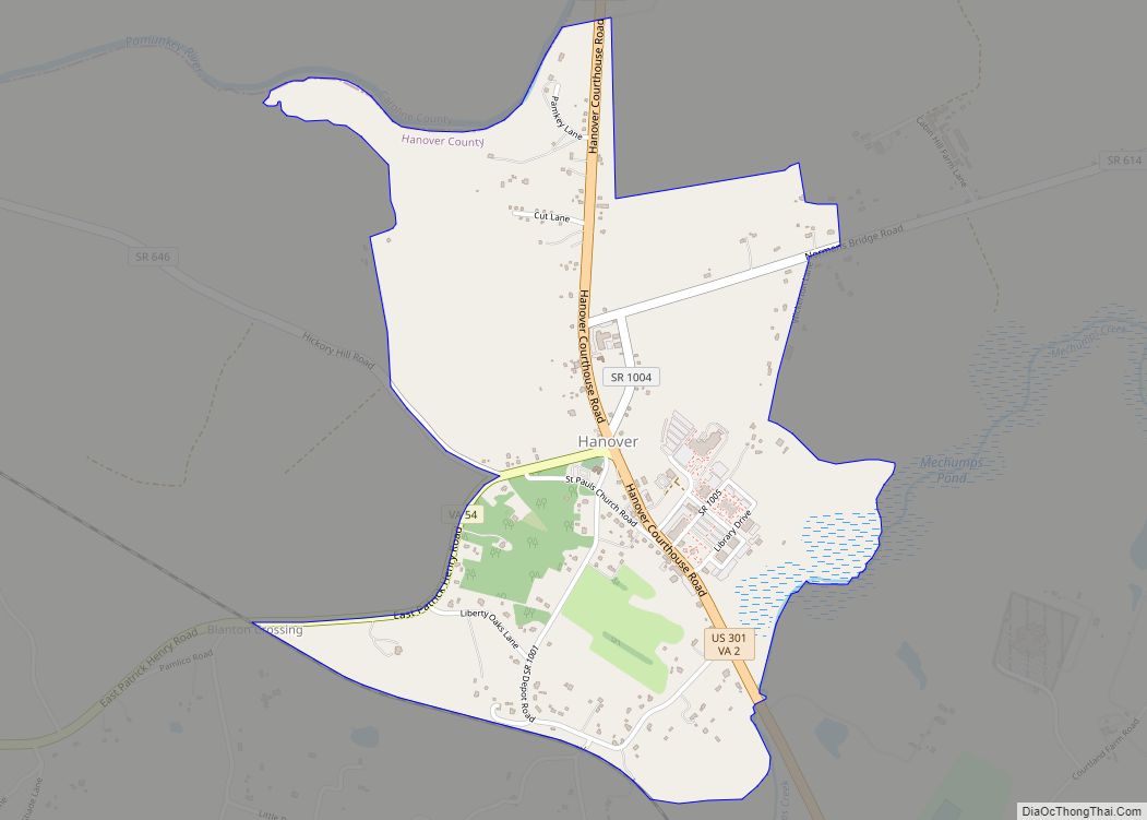
| Seat: | Hanover Courthouse |
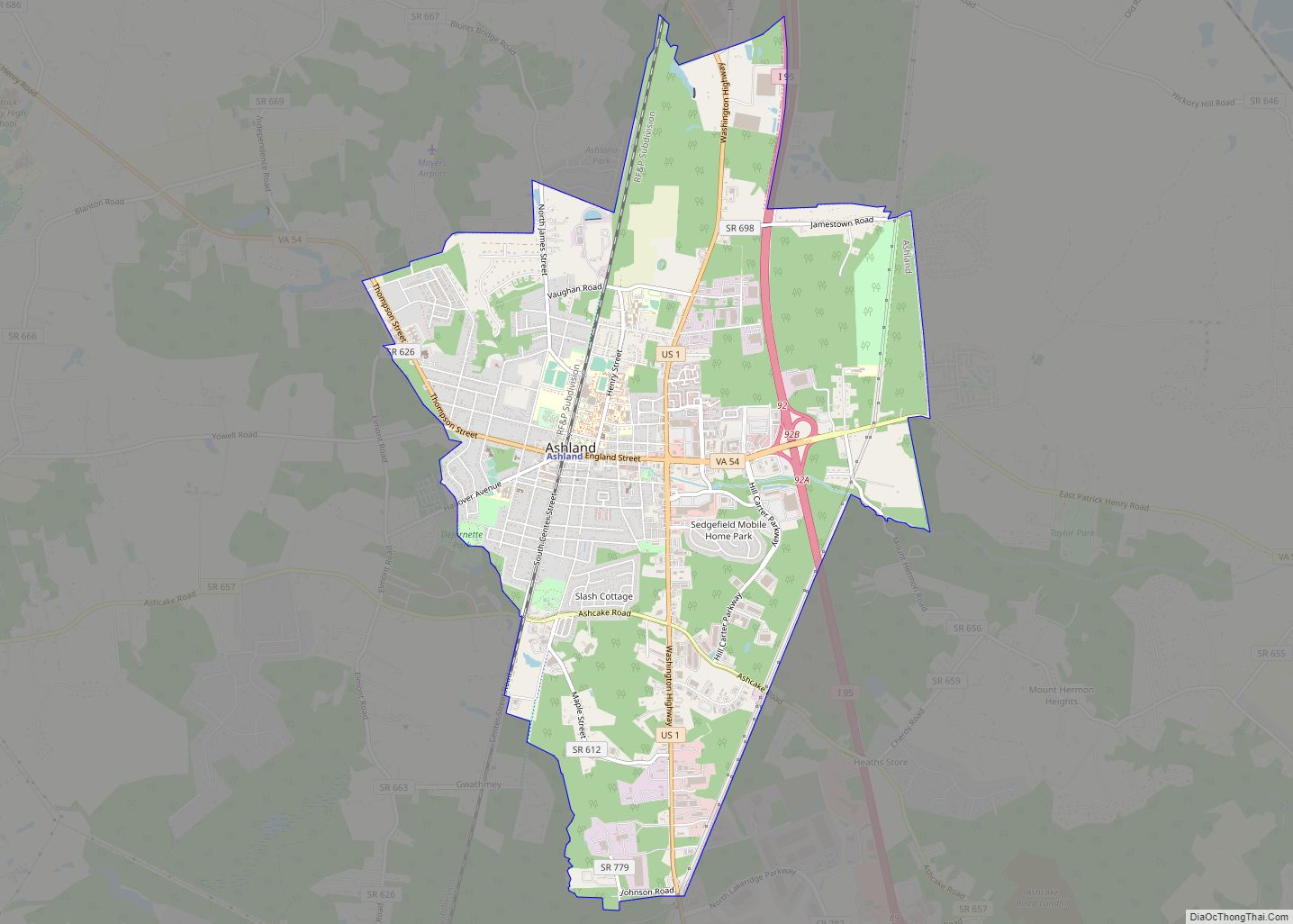
| Largest town: | Ashland |
| Total Area: | 474 sq mi (1,230 km²) |
| Land Area: | 469 sq mi (1,210 km²) |
| Total Population: | 109,979 |
| Population Density: | 230/sq mi (90/km²) |
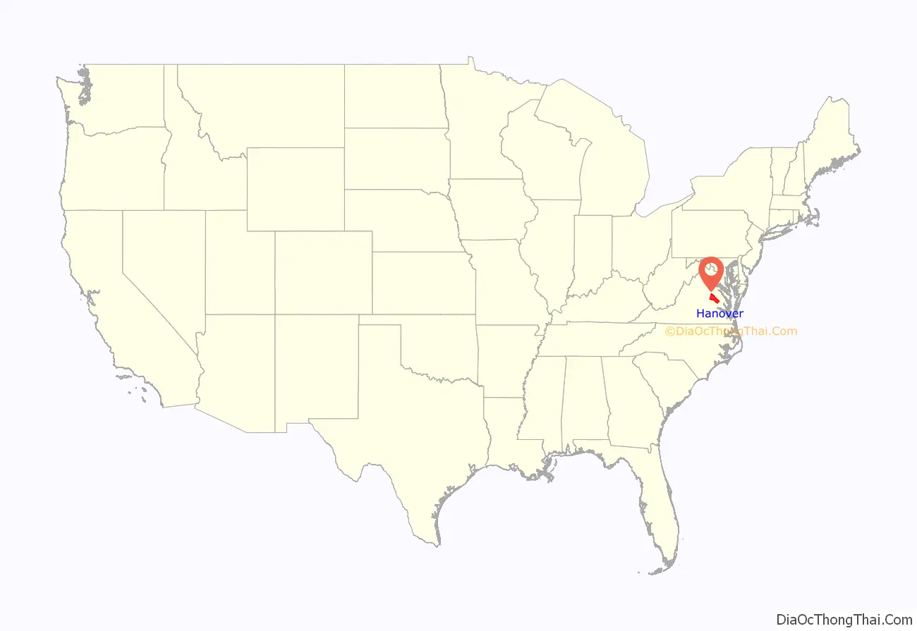
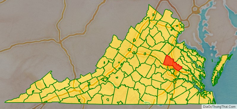
Hanover County location map. Where is Hanover County?
History
Located in the western Tidewater region of Virginia, Hanover County was created on November 26, 1719, from the area of New Kent County called St. Peter’s Parish. It was named for the Electorate of Hanover in Germany, because King George I of Great Britain was Elector of Hanover at the time. The county was developed by planters moving west from the Virginia tidewater, where soils had been exhausted by tobacco monoculture.
Hanover County was the birthplace and home of noted American statesman Patrick Henry. He reportedly married Sarah Shelton in the parlor of her family’s house, Rural Plains, also known as Shelton House. At the Hanover Courthouse, Henry argued the case of the Parson’s Cause in 1763, attacking the British Crown’s attempt to set the salaries of clergy in the colony regardless of conditions in the local economy. The historic Hanover Courthouse is pictured in the county seal. Hanover County was also the birthplace of Henry Clay, who became known as a politician in Kentucky, author of the Missouri Compromise of 1820, and Secretary of State.
The Chickahominy River forms the border of the county in the Mechanicsville area. During the American Civil War and the 1862 Peninsula Campaign, the Union Army approached the river and could hear the bells of Richmond’s churches. But they learned that the river was a major obstacle. Union General George B. McClellan failed in his attempt to get all his troops across it, intending to overwhelm the outnumbered Confederate forces defending Richmond. His failure to take Richmond has been said to have prolonged the war by almost 3 years. Hanover County was the site of Civil War battles due to its location between Richmond and northern Virginia, including the Seven Days Battles of the Peninsula Campaign and Battle of Cold Harbor in 1864.
The incorporated town of Ashland is located within Hanover County. Ashland is the second and current home of Randolph-Macon College.
In 1953, Barksdale Theatre was founded at the historic Hanover Tavern. It was the nation’s first dinner theater and central Virginia’s first professional theatre organization. The Barksdale company continues to produce live theatre at the Tavern, as well as at several locations in Richmond. It is recognized today as Central Virginia’s leading professional theatre.
Kings Dominion amusement park opened in 1975 in Doswell and added to the county’s economy. In January 2007, America’s Promise named Hanover County as one of the top 100 communities for youth.
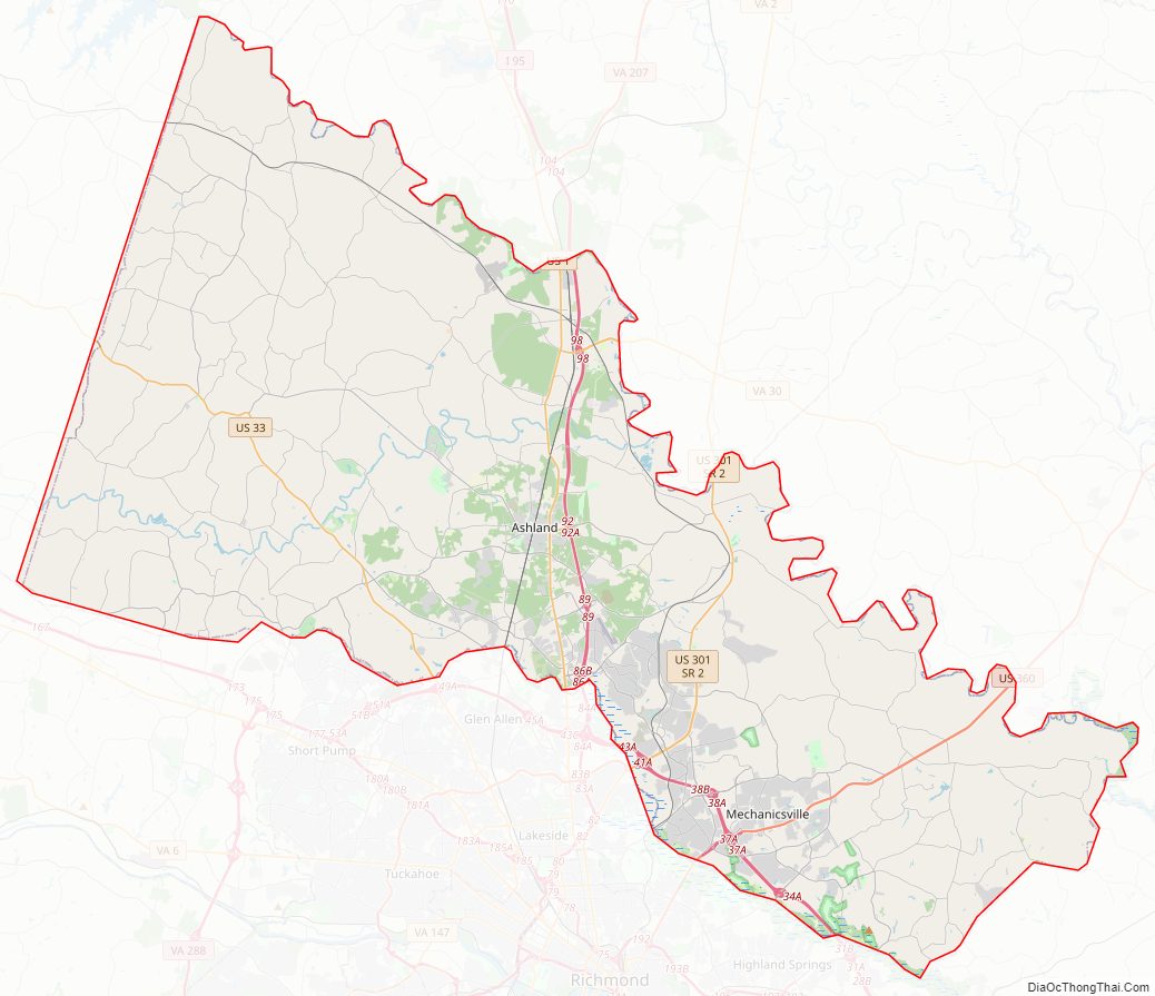
Hanover County Road Map
Geography
According to the U.S. Census Bureau, the county has a total area of 474 square miles (1,230 km), of which 469 square miles (1,210 km) is land and 5 square miles (13 km) (1.1%) is water.
Hanover County is about 90 miles (145 km) south of Washington, D.C., and about 12 miles (19 km) north of Richmond, Virginia.
Adjacent counties
- Caroline County (north)
- Goochland County (southwest)
- Henrico County (south)
- King William County (northeast)
- Louisa County (west)
- New Kent County (east)
- Spotsylvania County (northwest)
Major highways
- I-95
- I-295
- US 1
- US 33
- US 301
- US 360
- SR 2
- SR 30
- SR 54
- SR 156
- SR 326
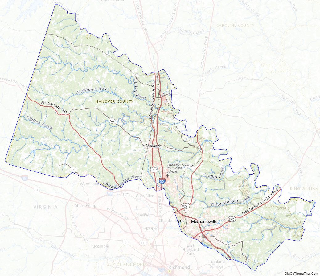
Hanover County Topographic Map
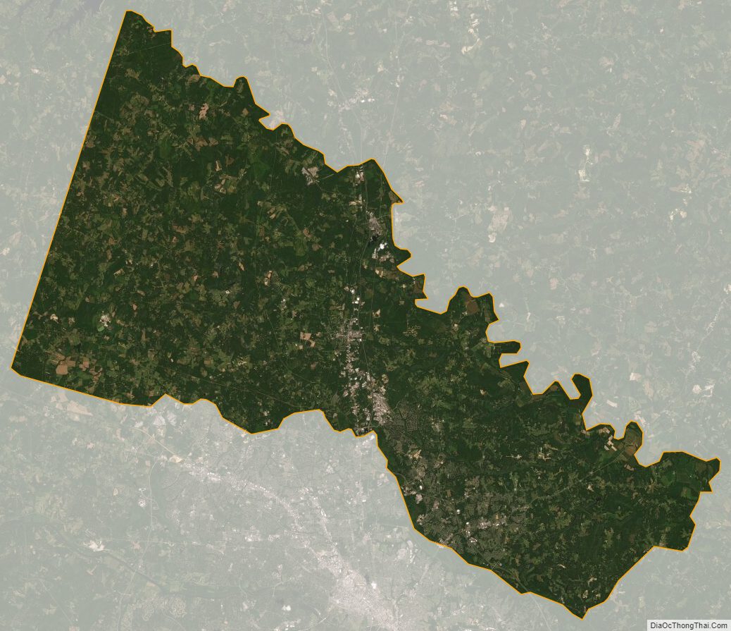
Hanover County Satellite Map
Hanover County Outline Map