Stafford County is located in the Commonwealth of Virginia. It is a suburb outside of Washington D.C. It is approximately 40 miles (64 km) south of D.C. It is part of the Northern Virginia region, and the D.C area. It is one of the fastest growing, and highest-income counties in America. As of the 2020 census, the population sits at 156,927. Its county seat is Stafford.
Located across the Rappahannock River from the City of Fredericksburg, Stafford County is part of the Washington-Arlington-Alexandria, DC-VA-MD-WV Metropolitan Statistical Area. In 2006, and again in 2009, Stafford was ranked by Forbes magazine as the 11th highest-income county in the United States. According to a Census Bureau report released in 2019, Stafford County is currently the sixth highest-income county in America.
| Name: | Stafford County |
|---|---|
| FIPS code: | 51-179 |
| State: | Virginia |
| Founded: | 1664 |
| Named for: | Staffordshire, England |
| Seat: | Stafford |
| Total Area: | 280 sq mi (700 km²) |
| Land Area: | 269 sq mi (700 km²) |
| Total Population: | 156,927 |
| Population Density: | 560/sq mi (220/km²) |
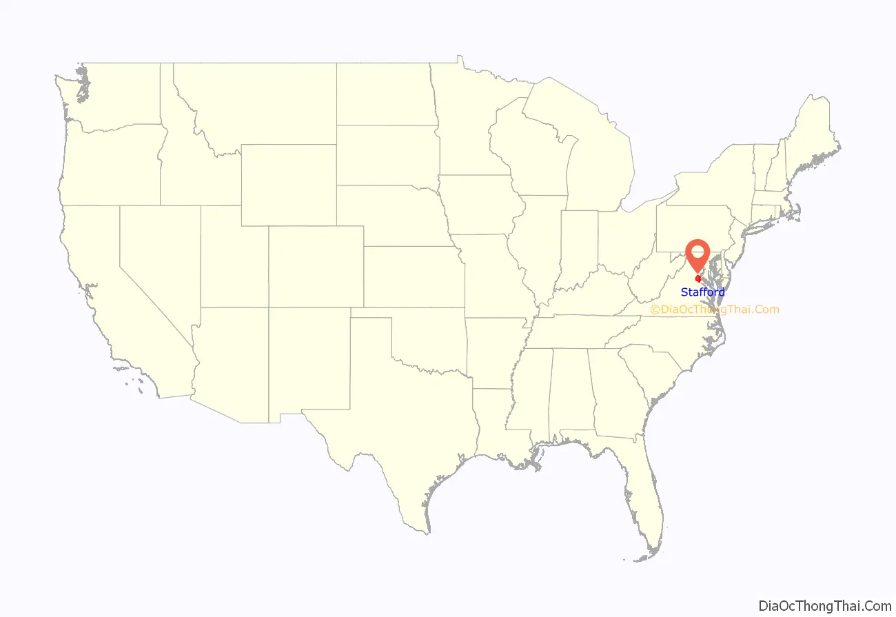
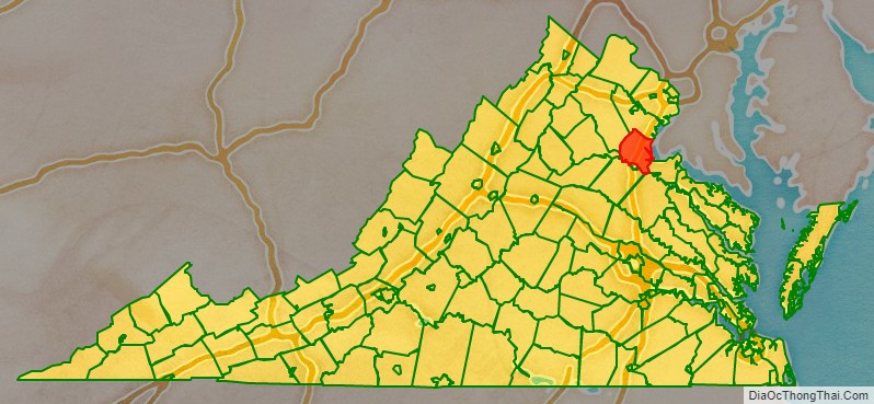
Stafford County location map. Where is Stafford County?
History
For thousands of years, various cultures of indigenous peoples succeeded each other in their territories along the Potomac River and its tributaries. By the time of English colonization, there were 32 Algonquian-speaking American Indian tribes in the present-day coastal Tidewater Virginia area, including those of the Patawomeck and numerous tribes that were part of the Powhatan Confederacy. The former small tribe, still centered in Stafford County, was recognized by the state of Virginia in 2010.
The Native Americans’ first recorded encounter with Europeans in this area was in 1608, with John Smith of the Jamestown Settlement. During a time of recurring tension between the early English colonists and local Native Americans, the colonists led by Samuel Argall captured Chief Powhatan’s daughter, Pocahontas, while she was living with her husband, Kocoum, at the Patawomeck town of Passapatanzy. The colonists took her from Passapatanzy, located in the eastern part of what is now Stafford County, to a secondary English settlement, known as Henricus (or Henrico Town). During her captivity there, Alexander Whitaker converted Pocahontas to Christianity. She took the name “Rebecca” at her baptism. Rebecca/Pocahontas married English colonist John Rolfe on April 5, 1614, in Jamestown. Their mixed-race descendants were among the First Families of Virginia.
The English colonial government of Virginia imposed its own order on the land and peoples. In 1664 it established Stafford County from territory previously part of Westmoreland County (which had been created from Northumberland County in 1653). It was named after Staffordshire, England. As originally delineated, Stafford County included a much larger area than its current borders. As population grew, the following counties and jurisdictions were created: Arlington, Fairfax, and Prince William counties, and the City of Alexandria. It is part of the area now considered Northern Virginia.
George Washington spent much of his childhood in the lower part of the county at his family’s home Ferry Farm (which at the time was part of King George County), along the Rappahannock River across from Fredericksburg. Colonial Forge High School was built on a tract of land owned in colonial times by his father Augustine Washington. George Mason, another Founding Father, also lived in Stafford during his formative years.
Aquia Church, built in 1757, is unusual among local structures for having been designed on the plan of a Greek cross rather than the more standard Roman Cross design. In addition, Aquia Church has a rare three-tiered pulpit; it has been designated as a National Historic Landmark. The Episcopal church continues to be active today.
Stafford County industry and resources were important to the colony and early nation. During the Revolutionary War, the Stafford ironworks furnished arms for the colonial rebel soldiers. Aquia Creek sandstone, quarried from Government Island, was used to build the White House and the U.S. Capitol.
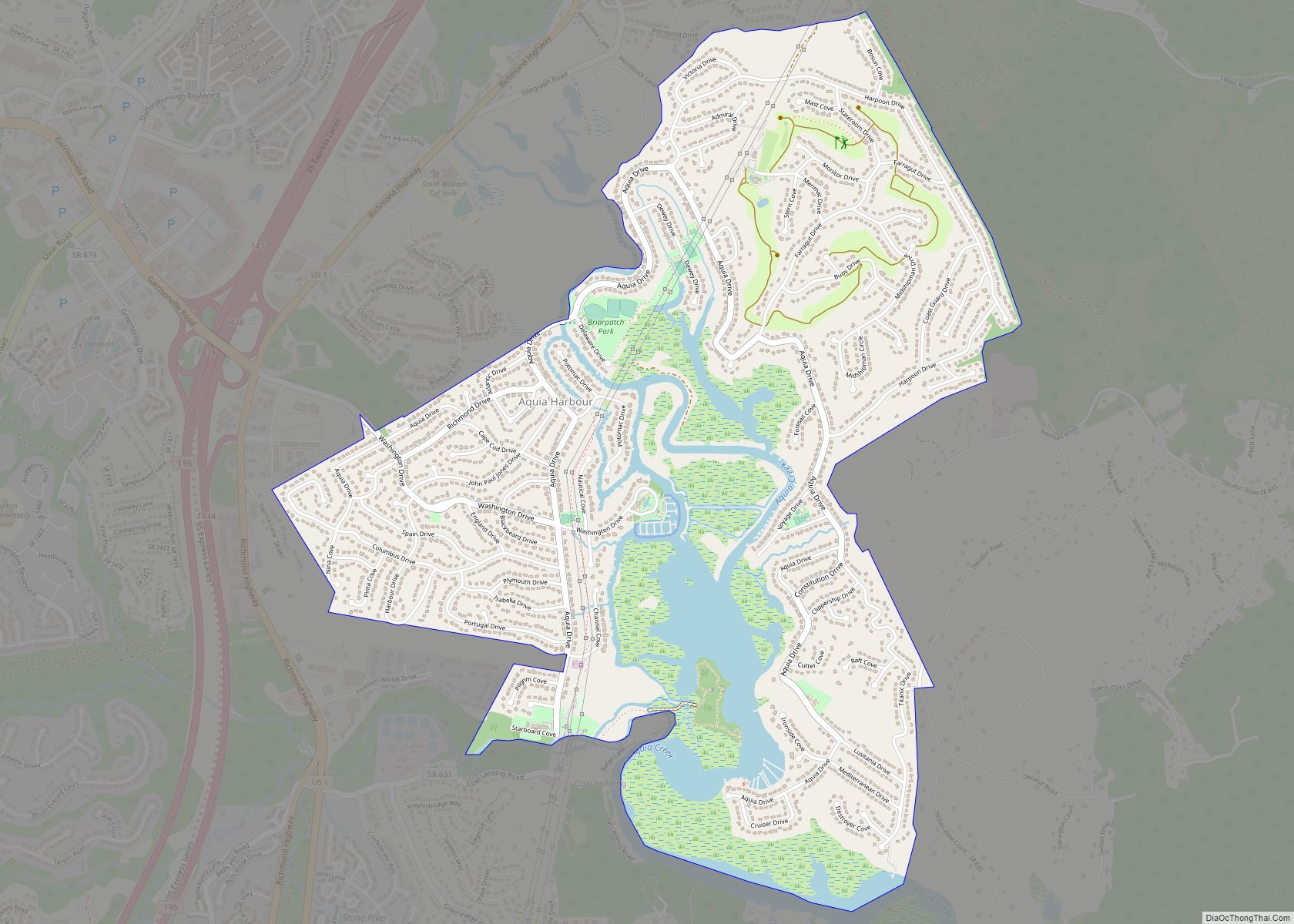
During the American Civil War, the county was part of the battlegrounds, occupied repeatedly by more than 100,000 troops for several years. In 1862, before and after the Battle of Fredericksburg, some 10,000 African-American slaves left area plantations and city households to cross the Rappahannock River, reaching the Union lines and gaining freedom. This exodus and Trail of Freedom is commemorated by historical markers on both sides of the river, in Fredericksburg and in Stafford County. The Battle of Aquia Creek took place in the Aquia Harbour area. Both the Union Army and Confederate Army struggled to control the strategic Potomac Creek Bridge at various times during the war.
Falmouth, a town bordering Fredericksburg, was the home of late-19th century American Impressionist artist Gari Melchers. His house, Belmont, still stands and is listed on the National Register of Historic Places.
20th century to present
Stafford County has developed to be one of the core counties of the Washington metropolitan area and Northern Virginia, the seat of government and numerous major defense installations. Marine Corps Base Quantico, occupies northern areas of this county. The FBI Academy, FBI National Laboratory and NCIS HQ are located on the Stafford side of MCBQ. Many residents commute north to work there and in other defense and federal facilities, as well as private companies, in Washington and its environs on Interstate Highway 95, U.S. Route 1, and by Virginia Railway Express. Stafford County is a suburban county and home to many Washington D.C commuters and workers which work for the Federal Government. It is also home to many military families due to its proximity to MCBQ. These facts contribute to the high-income of families in Stafford County, and the high amount of home-ownership, and college graduates. Stafford County is also one of the few counties in America where black households make more than white households. In recent years Stafford County has experienced major suburbanization, and growth as more and more workers move to the suburbs for their families. Thus, many developers are currently active in Stafford County in housing and retail projects.
In the early morning hours of May 9, 2008, a tornado touched down in the southern part of the county, severely damaging about 140 suburban homes.
The county was severely affected by “Snowmageddon,” the massive blizzards of December 2009 and February 2010. Stafford received some of the heaviest snow in the D.C. metropolitan area, with about 25 inches of snow in December, and 19 inches in February.
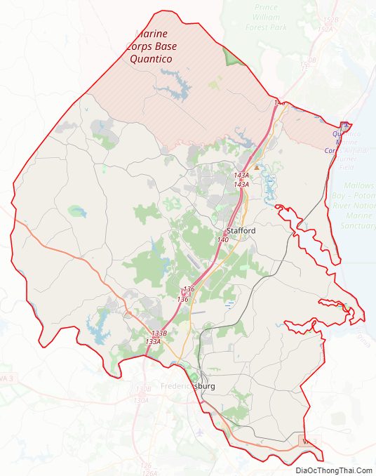
Stafford County Road Map
Geography
According to the U.S. Census Bureau, the county has a total area of 280 square miles (730 km), of which 269 square miles (700 km) is land and 11 square miles (28 km) (3.9%) is water. The Potomac River flows along part of the eastern border of the county, while the Rappahannock River runs along the extent of the county’s southern border. The independent city of Fredericksburg developed at the fall line of the river, supporting mills run by water power. To the northwest of there is the Piedmont area. Aquia Creek empties into the tidal segment of the Potomac River at Brent Point in Stafford County. It is surrounded by Prince William County to the north, Fauquier County to the West, the City of Fredericksburg, and Spotsylvania County to the south. Due to its location and proximity to Washington D.C many Federal Government workers and commuters live in Stafford County. Stafford County’s location close to D.C, is one of the major reasons of the suburbanization and growth of the county
Major bodies of water
- Rappahannock River
- Potomac River
- Aquia Creek
Adjacent counties and independent city
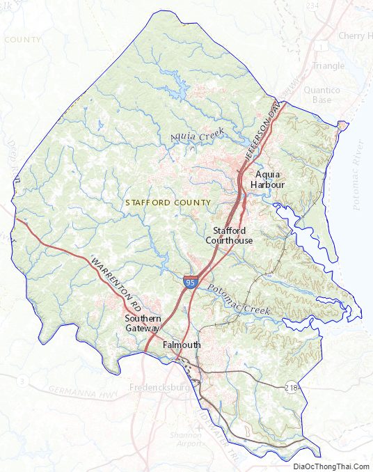
Stafford County Topographic Map
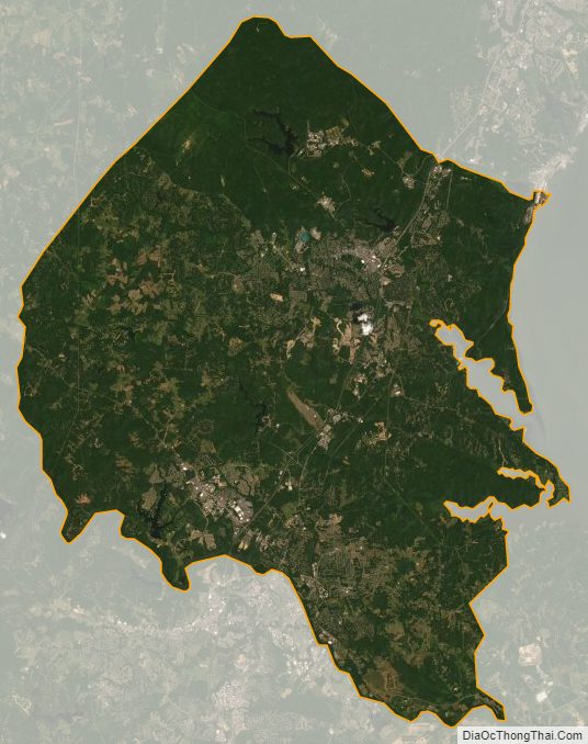
Stafford County Satellite Map
Stafford County Outline Map