Spotsylvania Courthouse is a census-designated place (CDP) and the county seat of Spotsylvania County, Virginia, United States, located 10 miles (16 km) southwest of Fredericksburg. Recognized by the U.S. Census Bureau as a census designated place (CDP), the population was 4,239 at the 2010 census.
During the American Civil War, the crossroads community became a Union objective during the Battle of Spotsylvania Courthouse, fought May 8–21, 1864. The battle, which ended in stalemate, included a brutal 20-hour struggle over a section of the Confederate defenses that became known as the “Bloody Angle”. The site of the Bloody Angle and other portions of the battlefield are preserved as part of Fredericksburg and Spotsylvania County Battlefields Memorial National Military Park and administered by the National Park Service. The Fredericksburg and Spotsylvania National Military Park includes three cemeteries. Over 15,000 Union soldiers, many unidentified, are buried in the Fredericksburg National Cemetery. The other two cemeteries are dedicated to fallen Confederate soldiers.
| Name: | Spotsylvania Courthouse CDP |
|---|---|
| LSAD Code: | 57 |
| LSAD Description: | CDP (suffix) |
| State: | Virginia |
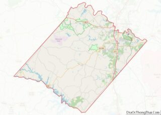
| County: | Spotsylvania County |
| Elevation: | 299 ft (91 m) |
| Total Area: | 8.7 sq mi (22.5 km²) |
| Land Area: | 8.7 sq mi (22.4 km²) |
| Water Area: | 0.0 sq mi (0.1 km²) |
| Total Population: | 4,239 |
| Population Density: | 490/sq mi (190/km²) |
| FIPS code: | 5174470 |
| GNISfeature ID: | 1867599 |
Online Interactive Map
Click on ![]() to view map in "full screen" mode.
to view map in "full screen" mode.
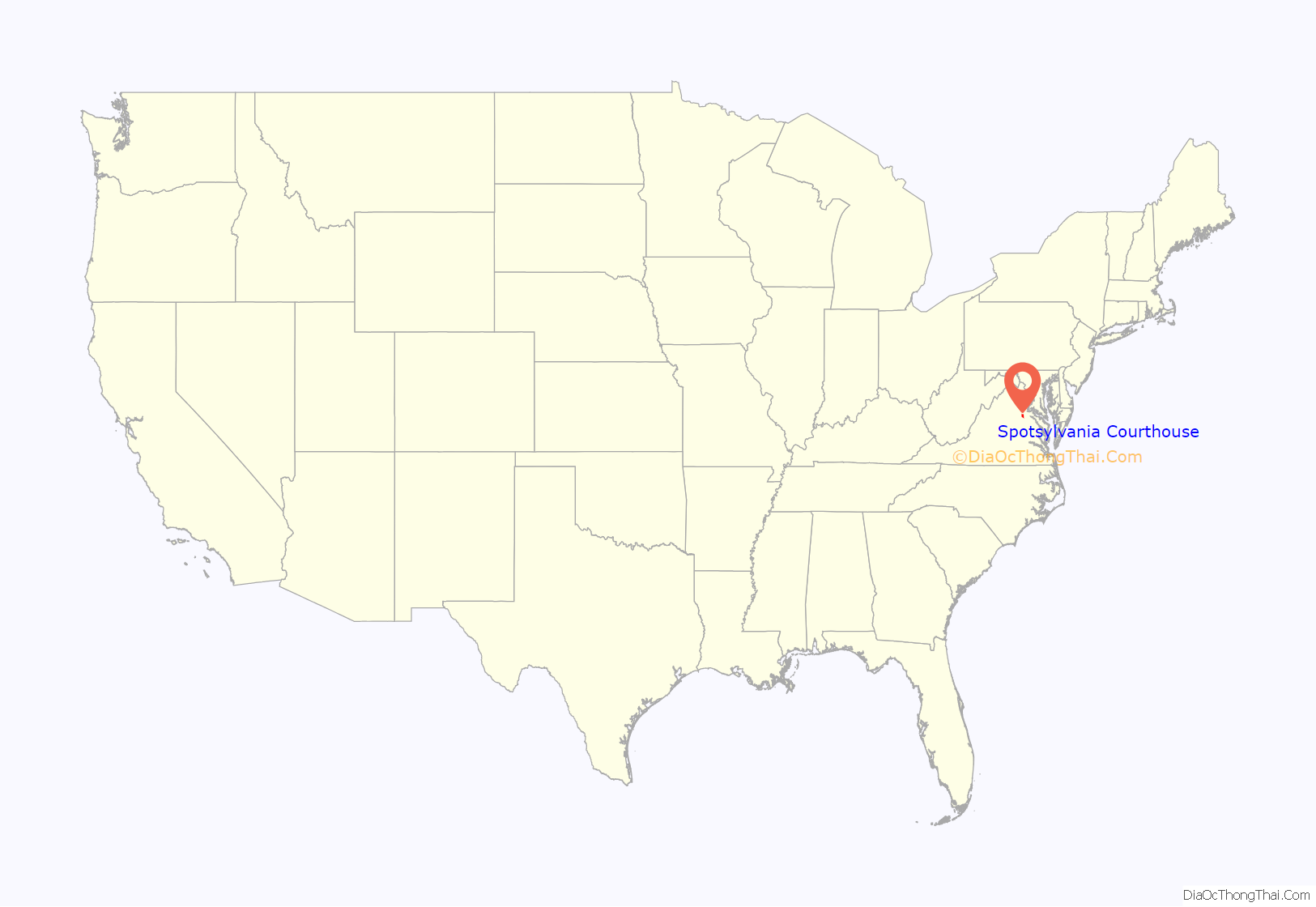
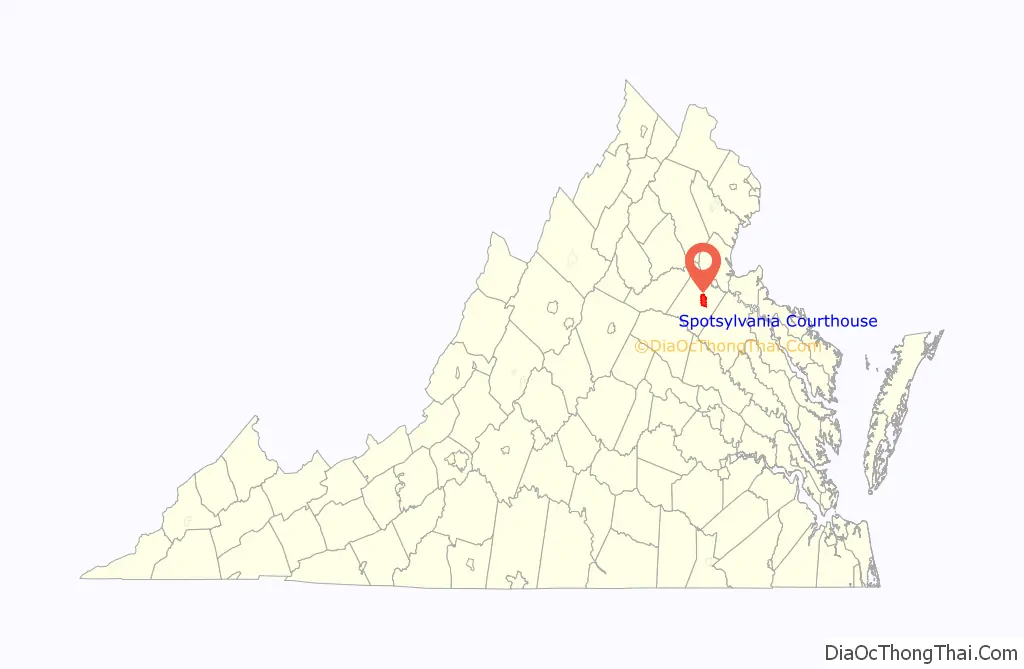
Spotsylvania Courthouse location map. Where is Spotsylvania Courthouse CDP?
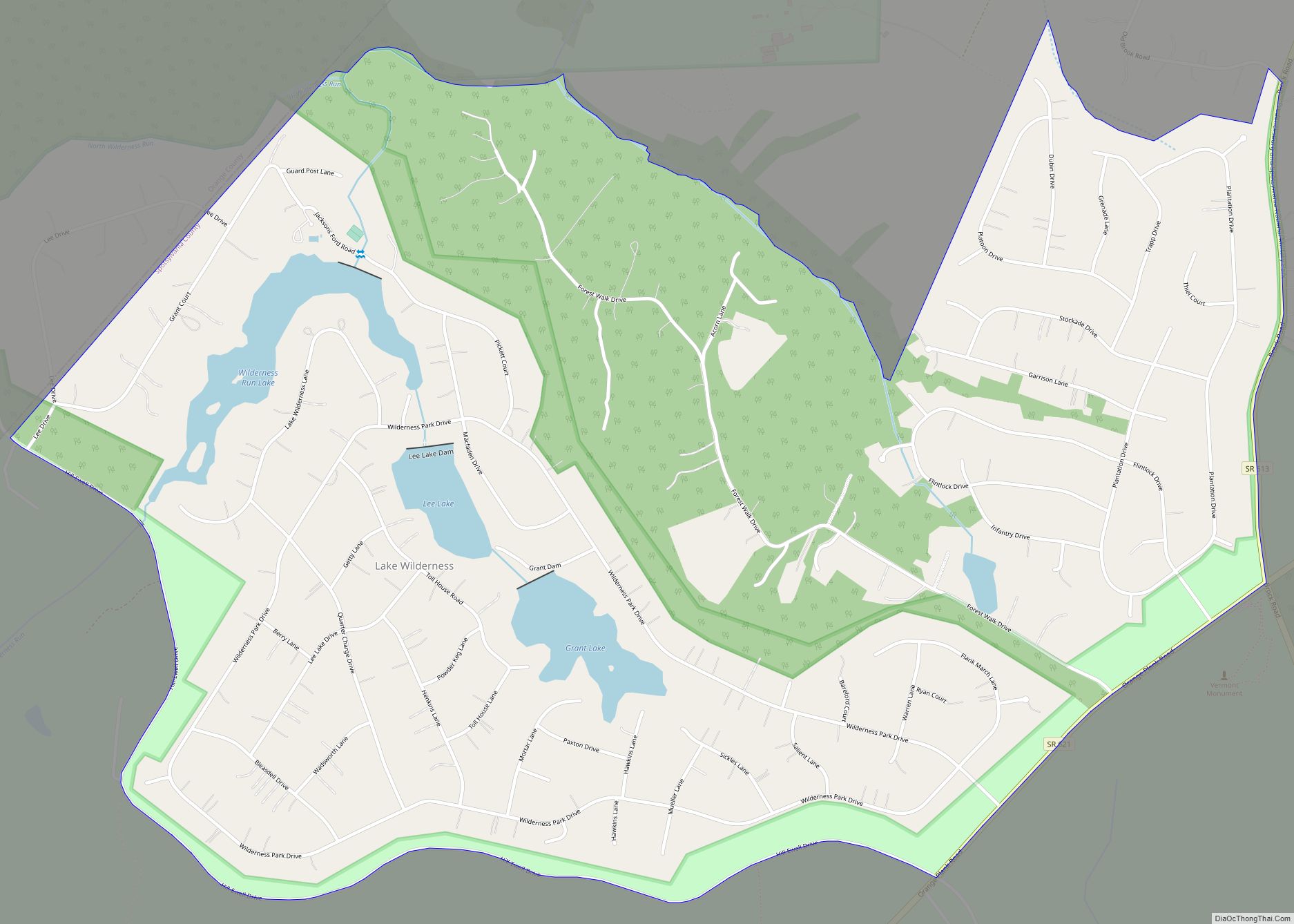
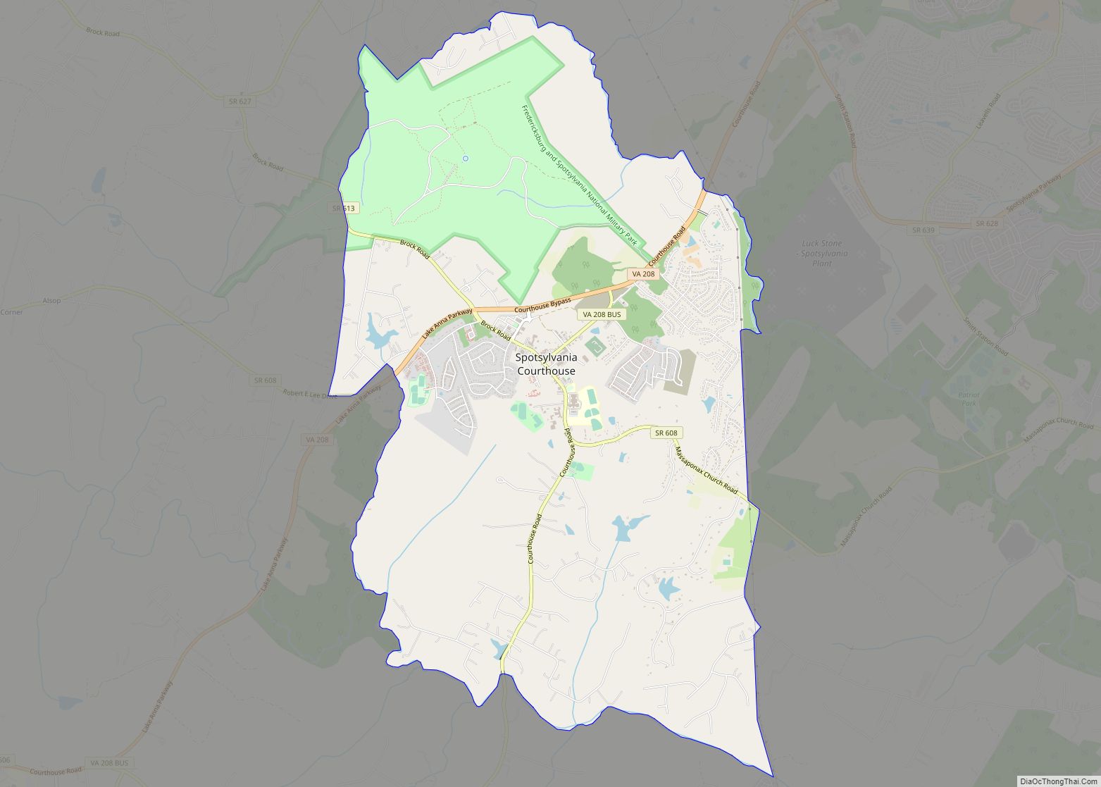
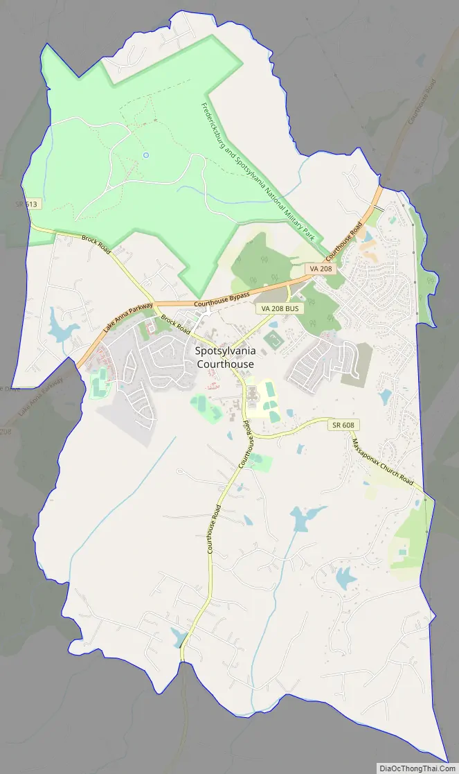
Spotsylvania Courthouse Road Map
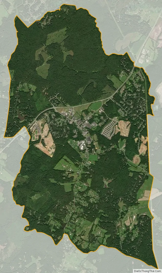
Spotsylvania Courthouse city Satellite Map
Geography
Spotsylvania Courthouse is located at 38°12′7″N 77°35′15″W / 38.20194°N 77.58750°W / 38.20194; -77.58750 (38.202080, −77.587499).
According to the United States Census Bureau, the census designated place (CDP) has a total area of 8.7 square miles (22.5 km), of which 8.6 square miles (22.4 km) is land and 0.04 square mile (0.1 km) (0.23%) is water.
See also
Map of Virginia State and its subdivision:- Accomack
- Albemarle
- Alexandria
- Alleghany
- Amelia
- Amherst
- Appomattox
- Arlington
- Augusta
- Bath
- Bedford
- Bedford City
- Bland
- Botetourt
- Bristol
- Brunswick
- Buchanan
- Buckingham
- Buena Vista
- Campbell
- Caroline
- Carroll
- Charles City
- Charlotte
- Charlottesville
- Chesapeake
- Chesterfield
- Clarke
- Clifton Forge City
- Colonial Heights
- Covington
- Craig
- Culpeper
- Cumberland
- Danville
- Dickenson
- Dinwiddie
- Emporia
- Essex
- Fairfax
- Fairfax City
- Falls Church
- Fauquier
- Floyd
- Fluvanna
- Franklin
- Frederick
- Fredericksburg
- Galax
- Giles
- Gloucester
- Goochland
- Grayson
- Greene
- Greensville
- Halifax
- Hampton
- Hanover
- Harrisonburg
- Henrico
- Henry
- Highland
- Hopewell
- Isle of Wight
- James City
- King and Queen
- King George
- King William
- Lancaster
- Lee
- Lexington
- Loudoun
- Louisa
- Lunenburg
- Lynchburg
- Madison
- Manassas
- Manassas Park
- Martinsville
- Mathews
- Mecklenburg
- Middlesex
- Montgomery
- Nelson
- New Kent
- Newport News
- Norfolk
- Northampton
- Northumberland
- Norton
- Nottoway
- Orange
- Page
- Patrick
- Petersburg
- Pittsylvania
- Poquoson
- Portsmouth
- Powhatan
- Prince Edward
- Prince George
- Prince William
- Pulaski
- Radford
- Rappahannock
- Richmond
- Roanoke
- Roanoke City
- Rockbridge
- Rockingham
- Russell
- Salem
- Scott
- Shenandoah
- Smyth
- Southampton
- Spotsylvania
- Stafford
- Staunton
- Suffolk
- Surry
- Sussex
- Tazewell
- Virginia Beach
- Warren
- Washington
- Waynesboro
- Westmoreland
- Williamsburg
- Winchester
- Wise
- Wythe
- York
- Alabama
- Alaska
- Arizona
- Arkansas
- California
- Colorado
- Connecticut
- Delaware
- District of Columbia
- Florida
- Georgia
- Hawaii
- Idaho
- Illinois
- Indiana
- Iowa
- Kansas
- Kentucky
- Louisiana
- Maine
- Maryland
- Massachusetts
- Michigan
- Minnesota
- Mississippi
- Missouri
- Montana
- Nebraska
- Nevada
- New Hampshire
- New Jersey
- New Mexico
- New York
- North Carolina
- North Dakota
- Ohio
- Oklahoma
- Oregon
- Pennsylvania
- Rhode Island
- South Carolina
- South Dakota
- Tennessee
- Texas
- Utah
- Vermont
- Virginia
- Washington
- West Virginia
- Wisconsin
- Wyoming