Tipton County is a county in the U.S. state of Indiana, located north of the state capital of Indianapolis. According to the 2010 census, it had a population of 15,936, a decrease of 3.9% from its 2000 population of 16,577. Its county seat is Tipton. The county has four incorporated towns with a total population of about 7,000, as well as many small unincorporated communities. It is divided into six townships which provide local services. Three Indiana state roads and one U.S. Route cross the county, as do two railroad lines. Before the arrival of non-indigenous settlers in the early 19th century, the area was inhabited by several Native American tribes. The county was officially established in 1844, one of the last Indiana counties to be settled. Tipton and Howard Counties were established by the same legislative action on January 15.
| Name: | Tipton County |
|---|---|
| FIPS code: | 18-159 |
| State: | Indiana |
| Founded: | January 15, 1844 |
| Named for: | John Tipton |
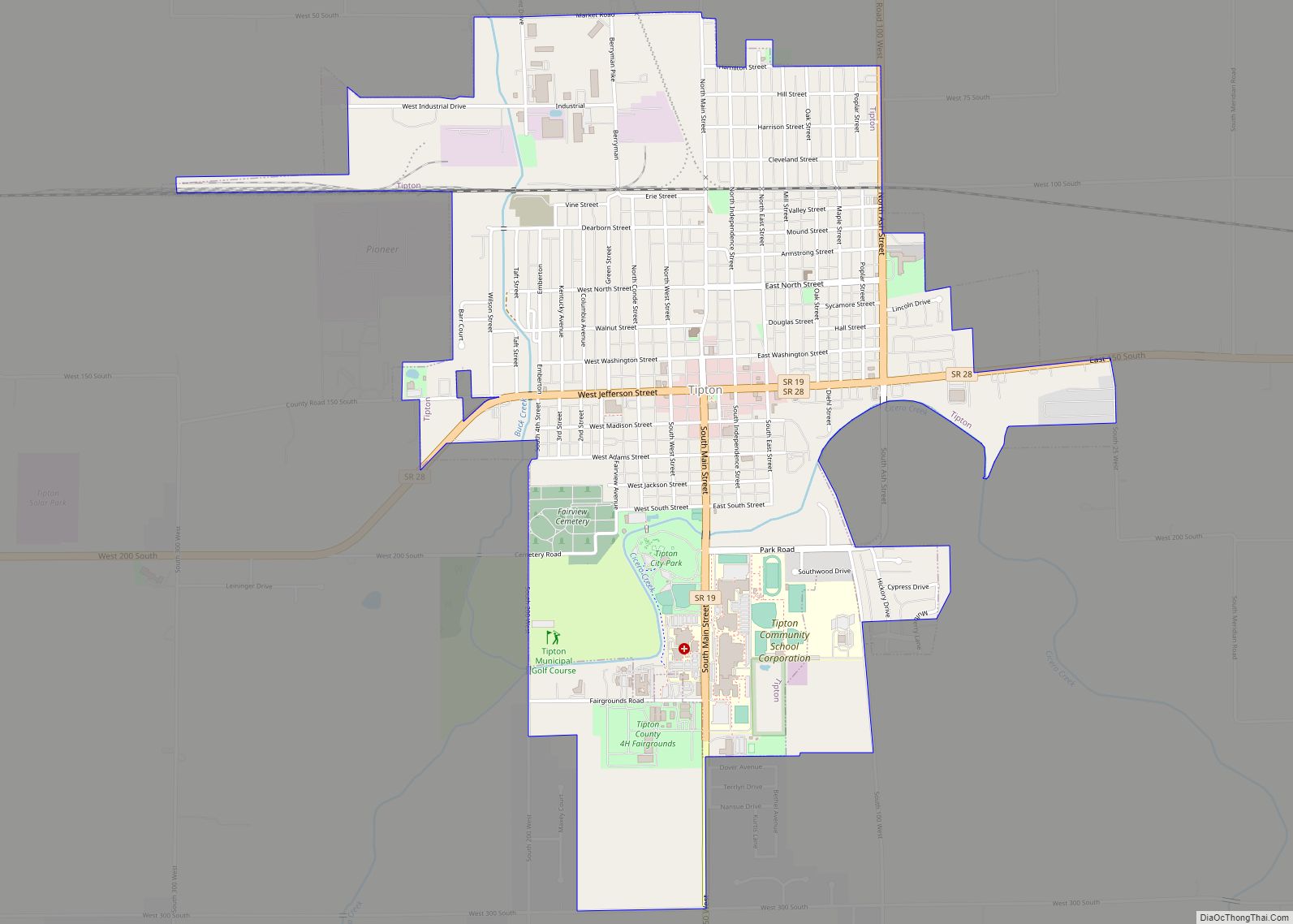
| Seat: | Tipton |
| Largest city: | Tipton |
| Total Area: | 260.57 sq mi (674.9 km²) |
| Land Area: | 260.54 sq mi (674.8 km²) |
| Population Density: | 61/sq mi (23.63/km²) |
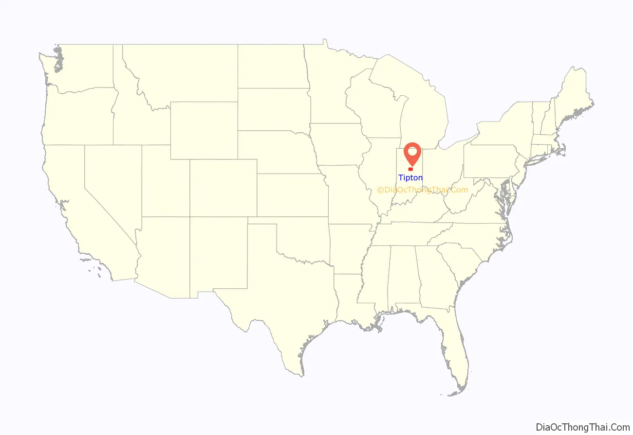
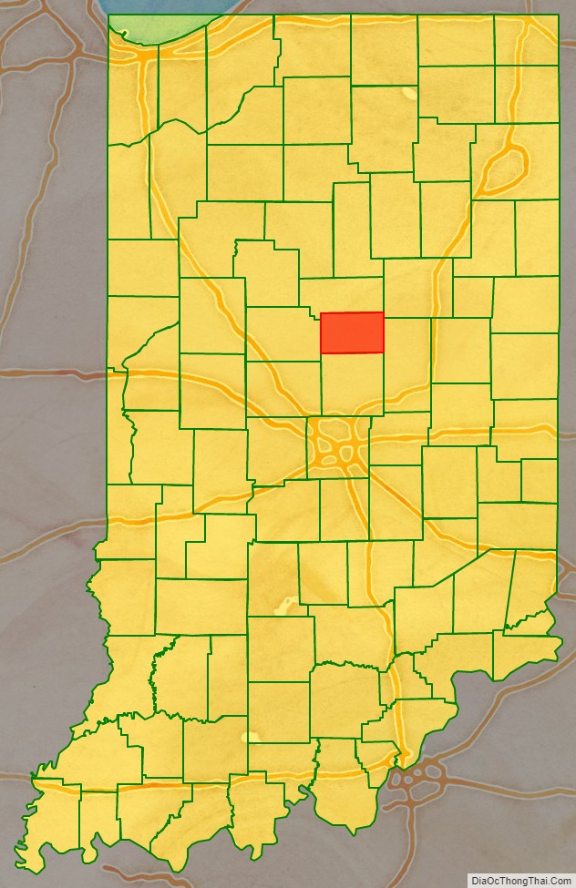
Tipton County location map. Where is Tipton County?
History
Prior to the arrival of non-indigenous settlers in the 1830s, the area of Tipton County was inhabited by the Miami and Delaware tribes. Tipton County was formed in 1844. It was named for John Tipton, a soldier of the Battle of Tippecanoe in 1811. Tipton served as United States Senator for Indiana from 1831 until shortly before his death in 1839. The first murder in the county occurred in October 1851. Harvey Moon killed Andrew Hornbeck with a knife. Moon was tried in Indianapolis, as a jury could not be empaneled in Tipton County. He was sentenced to five years in prison. He escaped prison and was not recaptured.
Courthouse
The first Tipton County Courthouse was a two-story frame building. It was planned in early 1845 and was completed by the end of the year at a cost of about $1200. It was expanded the following year. By 1858 a new courthouse was needed, and the brick building was completed by 1859 at a cost of approximately $15,000. The present courthouse was designed by Adolph Sherrer. He had taken over the Indiana Statehouse project when architect Edwin May died in 1880; five years after the completion of that project in 1888, Scherrer began work on the Tipton building, which was built of sandstone in a Romanesque style with a clock tower of 206 feet elevation including the flagstaff on top. It was built 1893-94 by Pierce and Morgan of Indianapolis at a cost of $170,988. It is one of several Romanesque courthouses dating from the 1890s that are still in use.
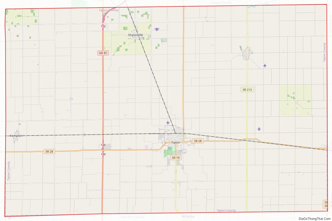
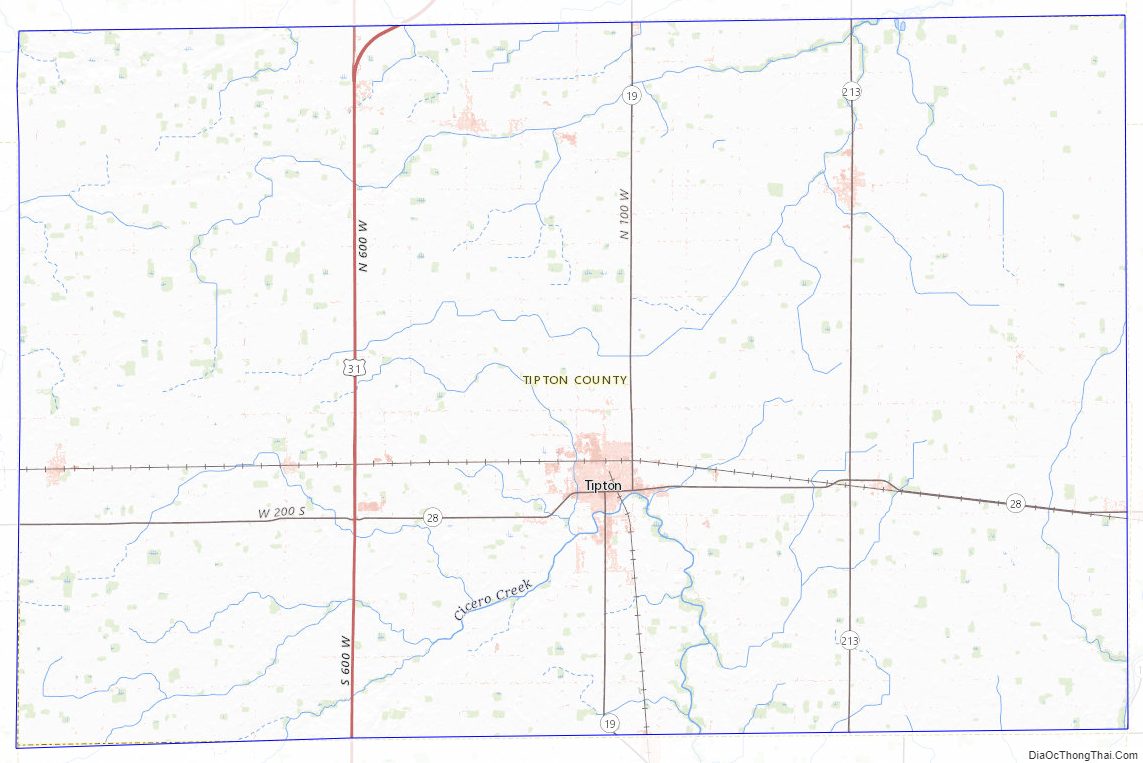
Tipton County Road Map
Geography
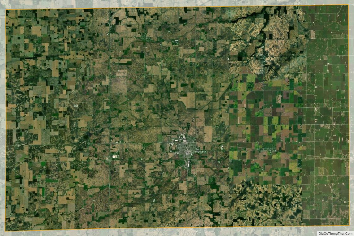
Tipton County falls near the center of Indiana. Most of the county consists of level till plain with elevations from 850 feet (260 m) to 900 feet (270 m) above sea level. Prior to settlement by non-indigenous people, it was mostly covered with dense forests consisting of oak, beech, maple, walnut, hickory, sycamore and tulip trees. The southern part of the county has better natural drainage, and this area was first cleared for agriculture. Much of the rest of the county tended to be swampy due to the level ground and lack of sufficient natural waterways, so drainage channels had to be dug to make the land suitable for farming. According to the 2010 census, the county has a total area of 260.57 square miles (674.9 km), of which 260.54 square miles (674.8 km) (or 99.99%) is land and 0.03 square miles (0.078 km) (or 0.01%) is water.
Adjacent counties
- Clinton County – west
- Grant County – northeast
- Hamilton County – south
- Howard County – north and northwest
- Madison County – east and southeast
Incorporated communities
- Tipton – the county seat, near the county center. Its 2010 population was 5,106.
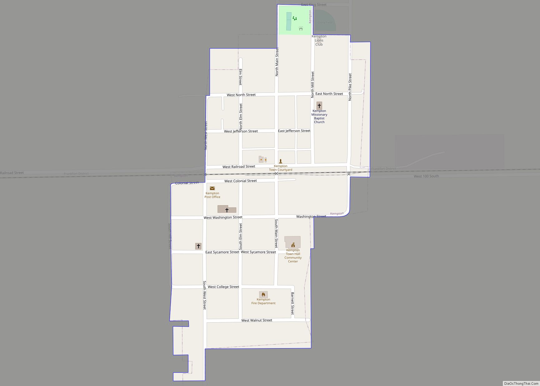
- Kempton – near the western border, in Jefferson Township. Its 2010 population was 335.
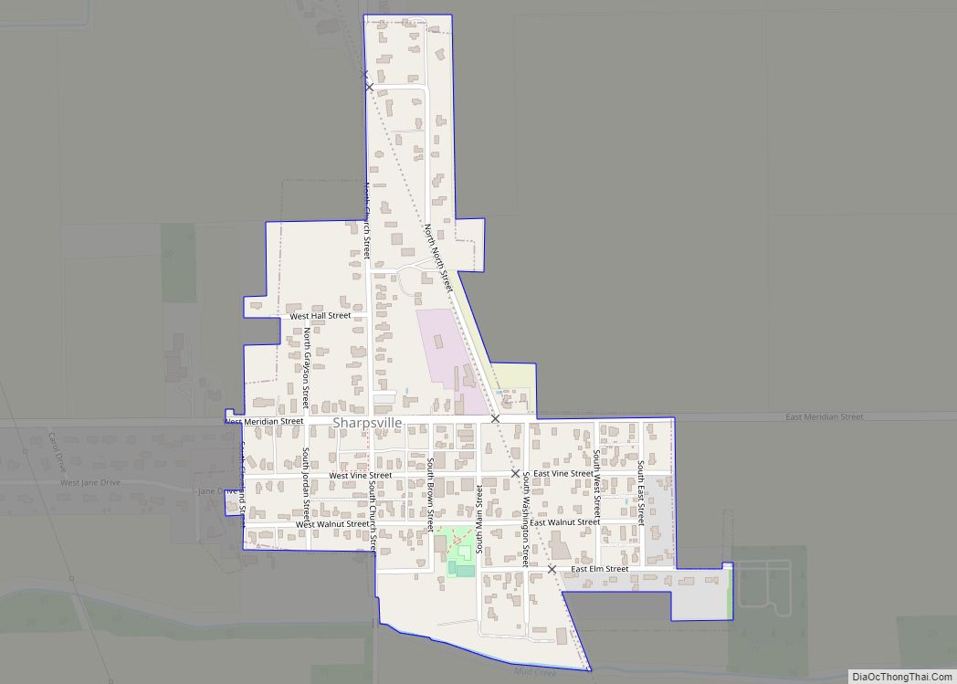
- Sharpsville – near the northern border, in Liberty Township. Its 2010 population was 607.
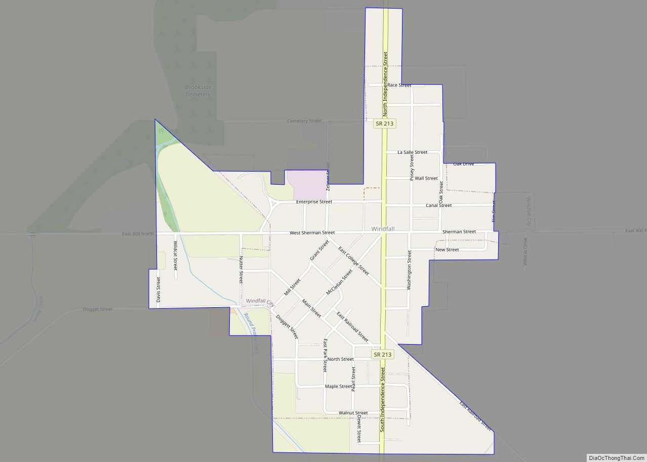
- Windfall City – in northeast corner of the county, in Wildcat Township. Its 2010 population was 708.
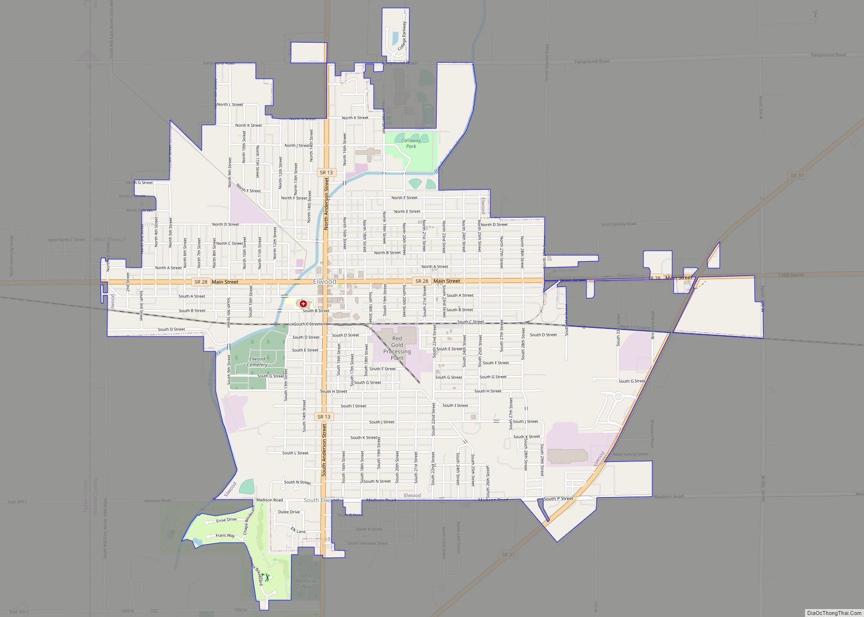
The city of Elwood lies in Madison County to the east and extends slightly over the border; as of the 2000 census, seven Elwood residents lived in Tipton County.
Unincorporated communities
- Curtisville
- East Union
- Ekin
- Goldsmith
- Groomsville
- Hobbs
- Jackson
- Nevada
- New Lancaster
- Normanda
- Tetersburg
- West Elwood
Townships
- Cicero
- Jefferson
- Liberty
- Madison
- Prairie
- Wildcat
Climate and weather
Tipton County is in the humid continental climate region of the United States along with most of Indiana. Its Köppen climate classification is Dfa, meaning that it is cold, has no dry season, and has a hot summer. In recent years, average temperatures in Tipton have ranged from a low of 15 °F (−9 °C) in January to a high of 83 °F (28 °C) in July, although a record low of −25 °F (−32 °C) was recorded in January 1994 and a record high of 98 °F (37 °C) was recorded in July 1999. Average monthly precipitation ranged from 1.67 inches (42 mm) in February to 4.24 inches (108 mm) in June. From 1950 through 2009, 13 tornadoes were reported in Tipton County, resulting in two deaths and several injuries; the total estimated property damage was over $3 million.
Tipton County Topographic Map
Tipton County Satellite Map
Tipton County Outline Map