Elwood is a city in Madison and Tipton counties in the U.S. state of Indiana. The Madison County portion, which is nearly all of the city, is part of the Indianapolis–Carmel–Anderson metropolitan statistical area. The population of Elwood was 8,410 at the 2020 census.
| Name: | Elwood city |
|---|---|
| LSAD Code: | 25 |
| LSAD Description: | city (suffix) |
| State: | Indiana |
| County: | Madison County, Tipton County |
| Elevation: | 860 ft (262 m) |
| Total Area: | 3.97 sq mi (10.28 km²) |
| Land Area: | 3.97 sq mi (10.28 km²) |
| Water Area: | 0.00 sq mi (0.00 km²) |
| Total Population: | 8,410 |
| Population Density: | 2,119.46/sq mi (818.35/km²) |
| ZIP code: | 46036 |
| Area code: | 765 |
| FIPS code: | 1821070 |
| GNISfeature ID: | 434144 |
| Website: | www.elwoodcity-in.org |
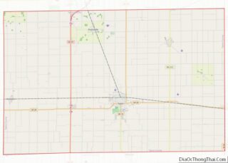
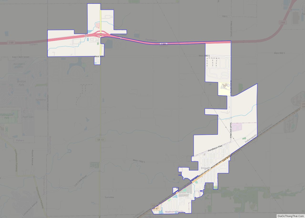
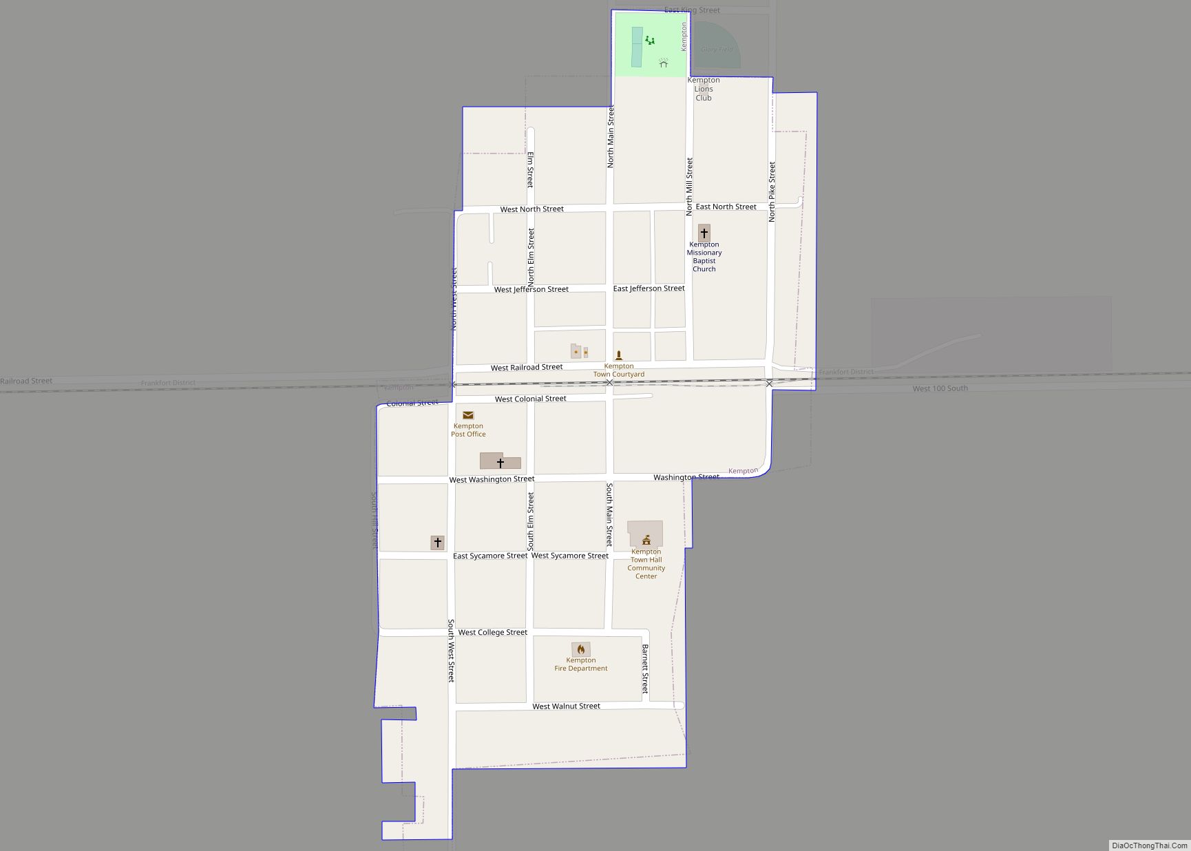
Online Interactive Map
Click on ![]() to view map in "full screen" mode.
to view map in "full screen" mode.
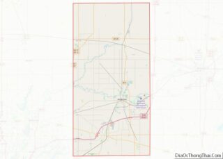
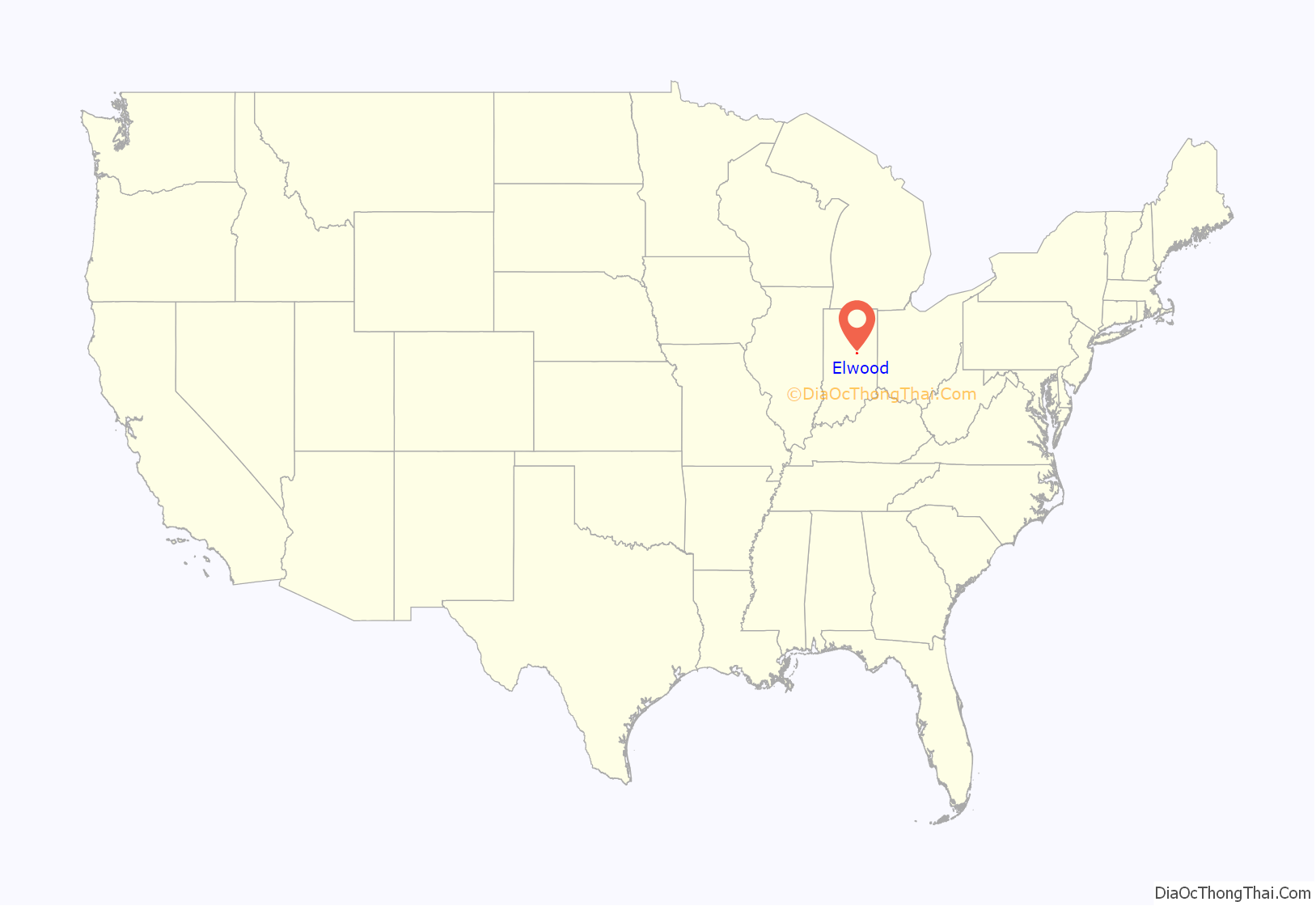
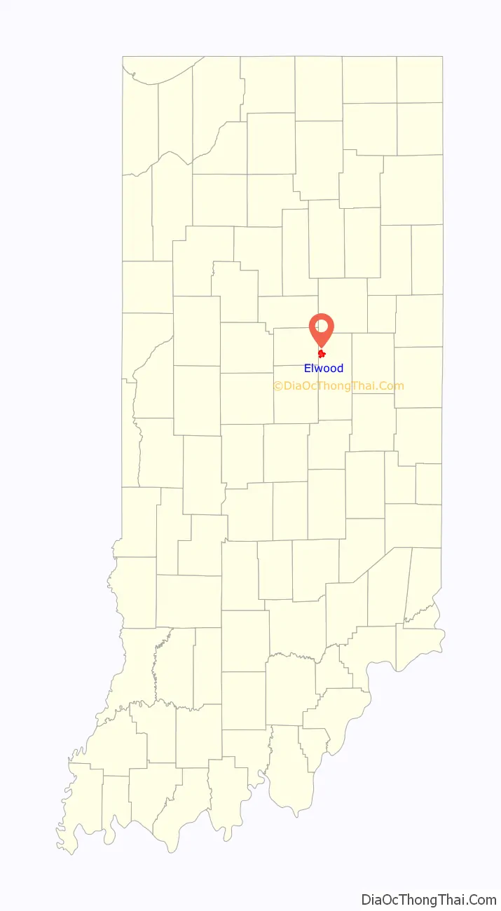
Elwood location map. Where is Elwood city?
History
Elwood was laid out in 1853 under the name “Duck Creek”. It was incorporated as a city in 1891.
A post office was established under the name “Duck Creek” in 1855, was renamed to Elwood in 1869, and has been operating since.
On August 17, 1940, the Republican National Committee held a formal notification ceremony to recognize Elwood-born Wendell Willkie as its nominee for President of the United States to run against Franklin Roosevelt. Held at Callaway Park on the outskirts of town, the ceremony drew 150,000 people for what would become the largest political rally in American history at the time. People came in 60,000 automobiles, 63 special trains, 300 Pullmans, and 1,200 buses. The Indiana University band led a parade in which 249 other bands also marched in the procession. When Willkie stepped onto the platform, the crowd cheered him for ten minutes before he could begin his speech. However, oppressive heat and Willkie’s underwhelming, flat speech left many disappointed by the end of the day.
Sundown town
By the 1880s, Elwood had become a sundown town, prohibiting Black people from residing within the town. In 1897, when a number of Black families attempted to settle in the town and were driven out, The Evening Times in Washington D.C. reported that for more than two decades Black people had not been “permitted to remain any length of time.” This prohibition remained in place for most of the 20th century.
At the rally for Wendell Wilkie, noted above, which drew around 150,000 people to the city, some prominent Black reporters, such as Marse Callaway of Baltimore, were allowed to briefly stay in a hotel downtown, but others were unable to stay the night due to the community’s sundown status. Other Black people were discouraged from attempting to attend the rally at all due to the sundown signs posted at the city limits. These signs and policies remained in place for decades afterwards.
By the late twentieth century sundown policies were less strictly enforced, although as recently as 2002 law enforcement in nearby Marion considered Elwood to still be unwelcoming of Black people. In 2015, after Goshen, Indiana, passed a resolution acknowledging its history as a sundown town, Elwood’s own past became a topic of discussion. The mayor of Elwood stated that while he had had no knowledge of the racially exclusionary policies of Elwood’s past, he would address them if they were part of Elwood’s “lingering reputation”.
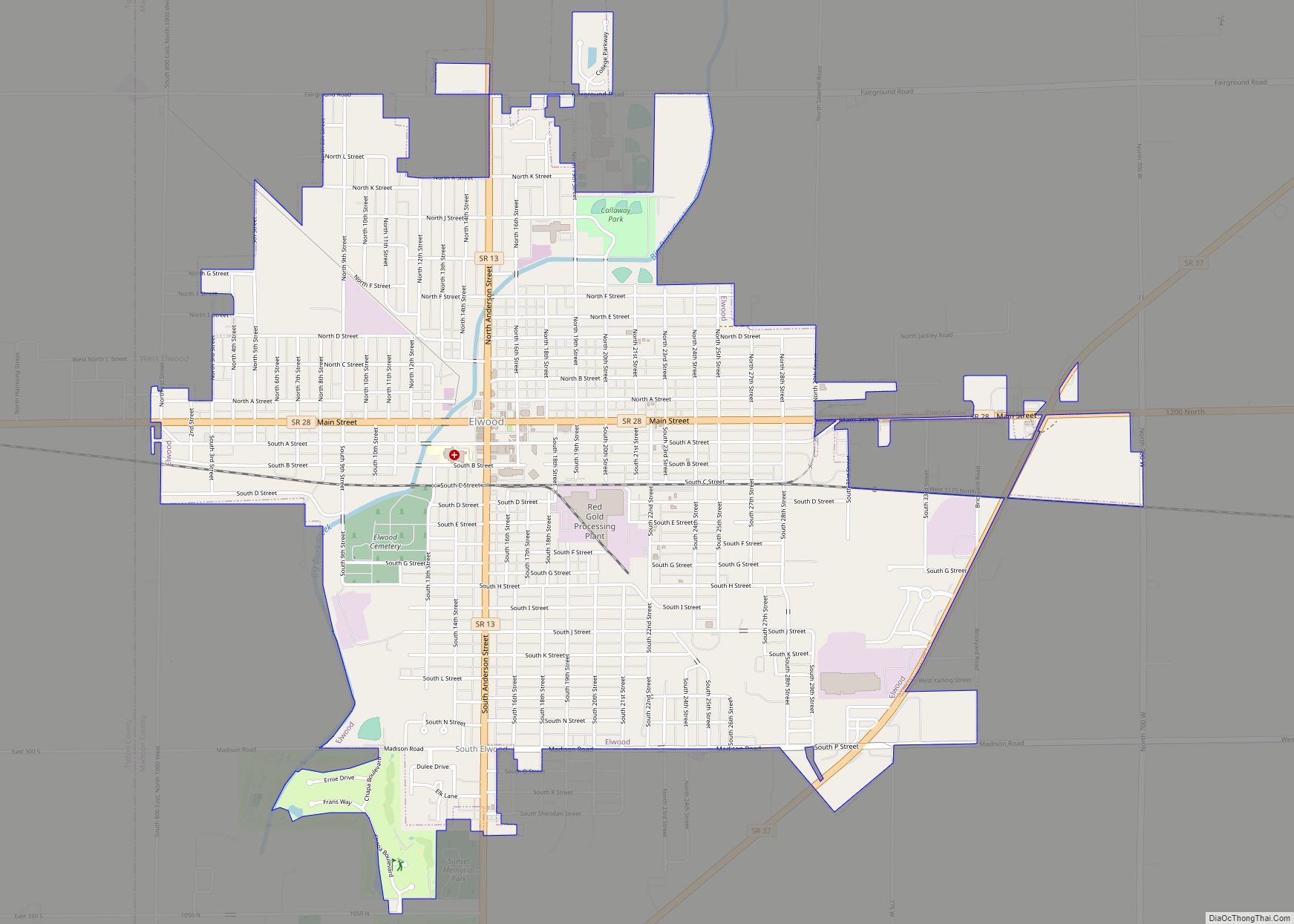
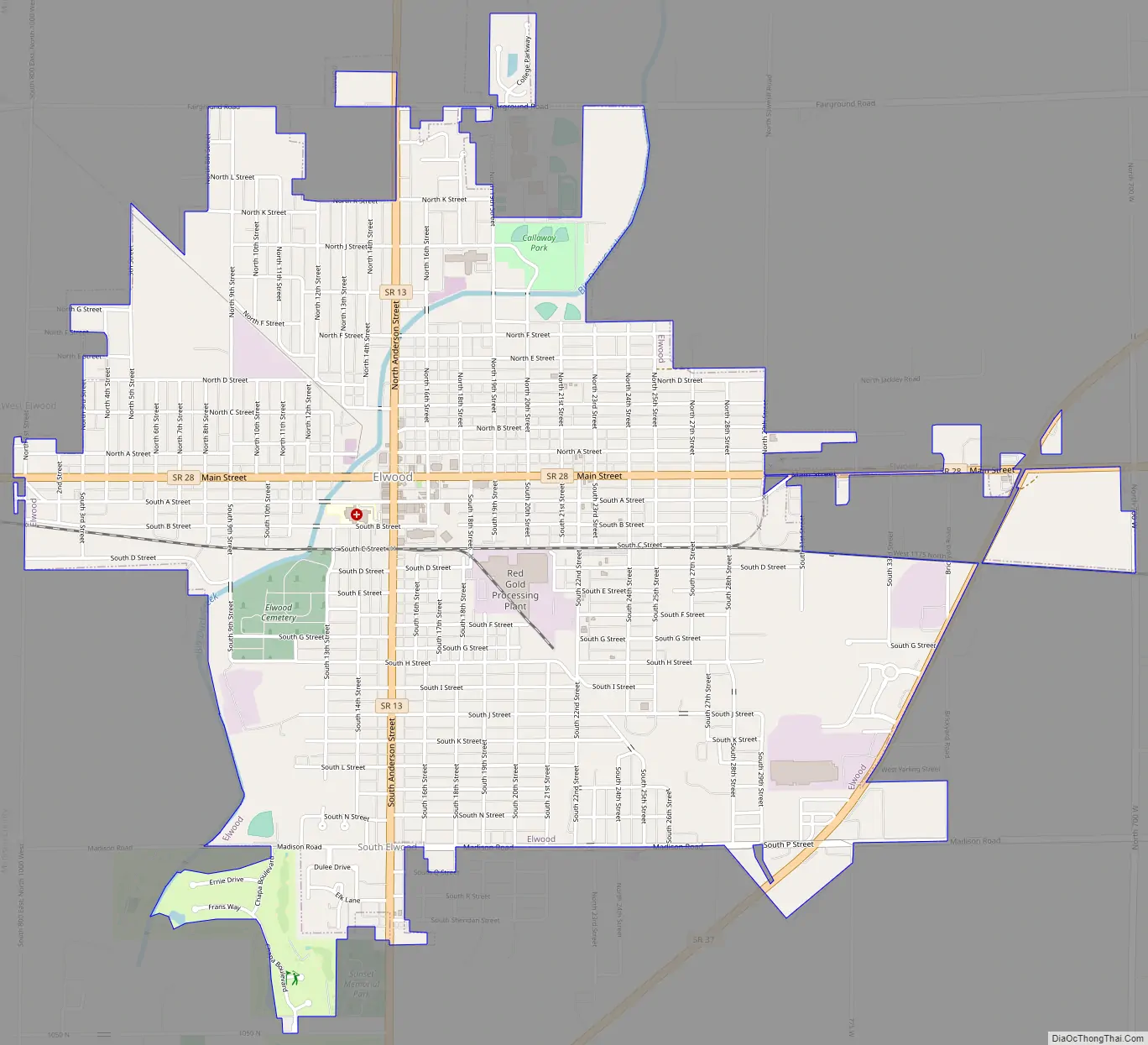
Elwood Road Map
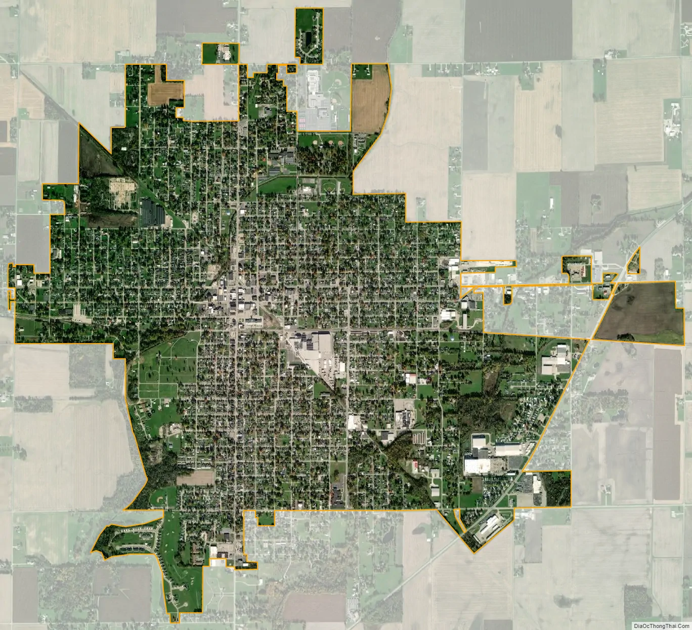
Elwood city Satellite Map
Geography
Elwood is located in northwestern Madison County at 40°16′27″N 85°50′17″W / 40.27417°N 85.83806°W / 40.27417; -85.83806 (40.274109, -85.838047). The equivalent of two half-blocks of land in Tipton County are also within the city limits.
Indiana State Road 28 passes through the city as Main Street, leading east 9 miles (14 km) to Alexandria and west 10 miles (16 km) to Tipton. State Road 13 (Anderson Street) crosses SR 28 in the center of Elwood; it leads north 10 miles (16 km) to Point Isabel and south 15 miles (24 km) to Lapel. State Road 37 crosses the southeast corner of the city limits, leading northeast 23 miles (37 km) to Marion and southwest 20 miles (32 km) to Noblesville. Anderson, the Madison county seat, is 17 miles (27 km) southeast of Elwood by local roads.
According to the U.S. Census Bureau, Elwood has a total area of 3.97 square miles (10.28 km), all land. Big Duck Creek flows through the center of town, leading southwest to the White River near Strawtown.
See also
Map of Indiana State and its subdivision:- Adams
- Allen
- Bartholomew
- Benton
- Blackford
- Boone
- Brown
- Carroll
- Cass
- Clark
- Clay
- Clinton
- Crawford
- Daviess
- De Kalb
- Dearborn
- Decatur
- Delaware
- Dubois
- Elkhart
- Fayette
- Floyd
- Fountain
- Franklin
- Fulton
- Gibson
- Grant
- Greene
- Hamilton
- Hancock
- Harrison
- Hendricks
- Henry
- Howard
- Huntington
- Jackson
- Jasper
- Jay
- Jefferson
- Jennings
- Johnson
- Knox
- Kosciusko
- LaGrange
- Lake
- Lake Michigan
- LaPorte
- Lawrence
- Madison
- Marion
- Marshall
- Martin
- Miami
- Monroe
- Montgomery
- Morgan
- Newton
- Noble
- Ohio
- Orange
- Owen
- Parke
- Perry
- Pike
- Porter
- Posey
- Pulaski
- Putnam
- Randolph
- Ripley
- Rush
- Saint Joseph
- Scott
- Shelby
- Spencer
- Starke
- Steuben
- Sullivan
- Switzerland
- Tippecanoe
- Tipton
- Union
- Vanderburgh
- Vermillion
- Vigo
- Wabash
- Warren
- Warrick
- Washington
- Wayne
- Wells
- White
- Whitley
- Alabama
- Alaska
- Arizona
- Arkansas
- California
- Colorado
- Connecticut
- Delaware
- District of Columbia
- Florida
- Georgia
- Hawaii
- Idaho
- Illinois
- Indiana
- Iowa
- Kansas
- Kentucky
- Louisiana
- Maine
- Maryland
- Massachusetts
- Michigan
- Minnesota
- Mississippi
- Missouri
- Montana
- Nebraska
- Nevada
- New Hampshire
- New Jersey
- New Mexico
- New York
- North Carolina
- North Dakota
- Ohio
- Oklahoma
- Oregon
- Pennsylvania
- Rhode Island
- South Carolina
- South Dakota
- Tennessee
- Texas
- Utah
- Vermont
- Virginia
- Washington
- West Virginia
- Wisconsin
- Wyoming