Kempton is a town in Jefferson Township, Tipton County, in the U.S. state of Indiana. The population was 335 at the 2010 census. It is part of the Kokomo, Indiana Metropolitan Statistical Area.
| Name: | Kempton town |
|---|---|
| LSAD Code: | 43 |
| LSAD Description: | town (suffix) |
| State: | Indiana |
| County: | Tipton County |
| Elevation: | 919 ft (280 m) |
| Total Area: | 0.16 sq mi (0.42 km²) |
| Land Area: | 0.16 sq mi (0.42 km²) |
| Water Area: | 0.00 sq mi (0.00 km²) |
| Total Population: | 288 |
| Population Density: | 1,777.78/sq mi (688.01/km²) |
| ZIP code: | 46049 |
| Area code: | 765 |
| FIPS code: | 1839366 |
| GNISfeature ID: | 437234 |
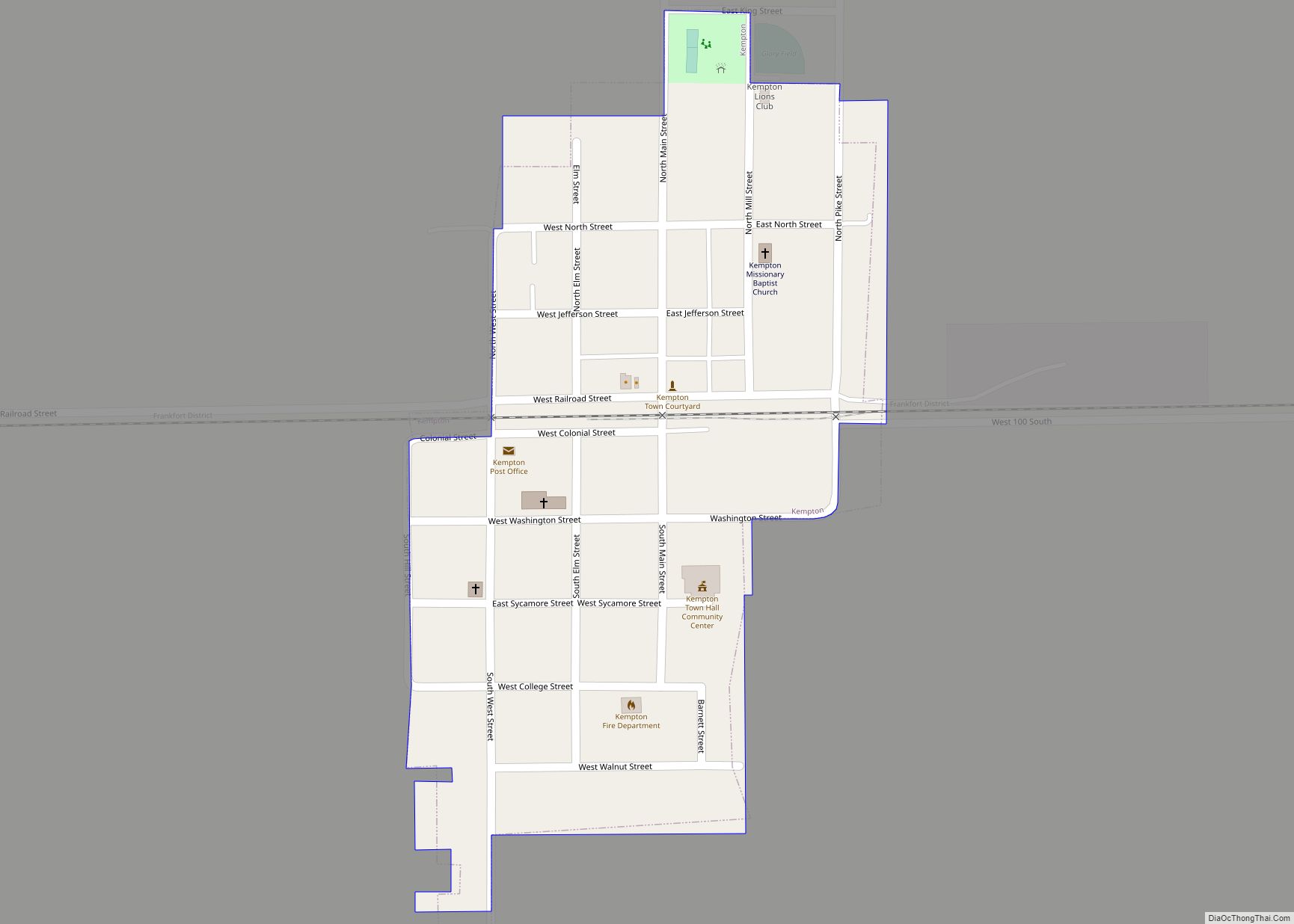
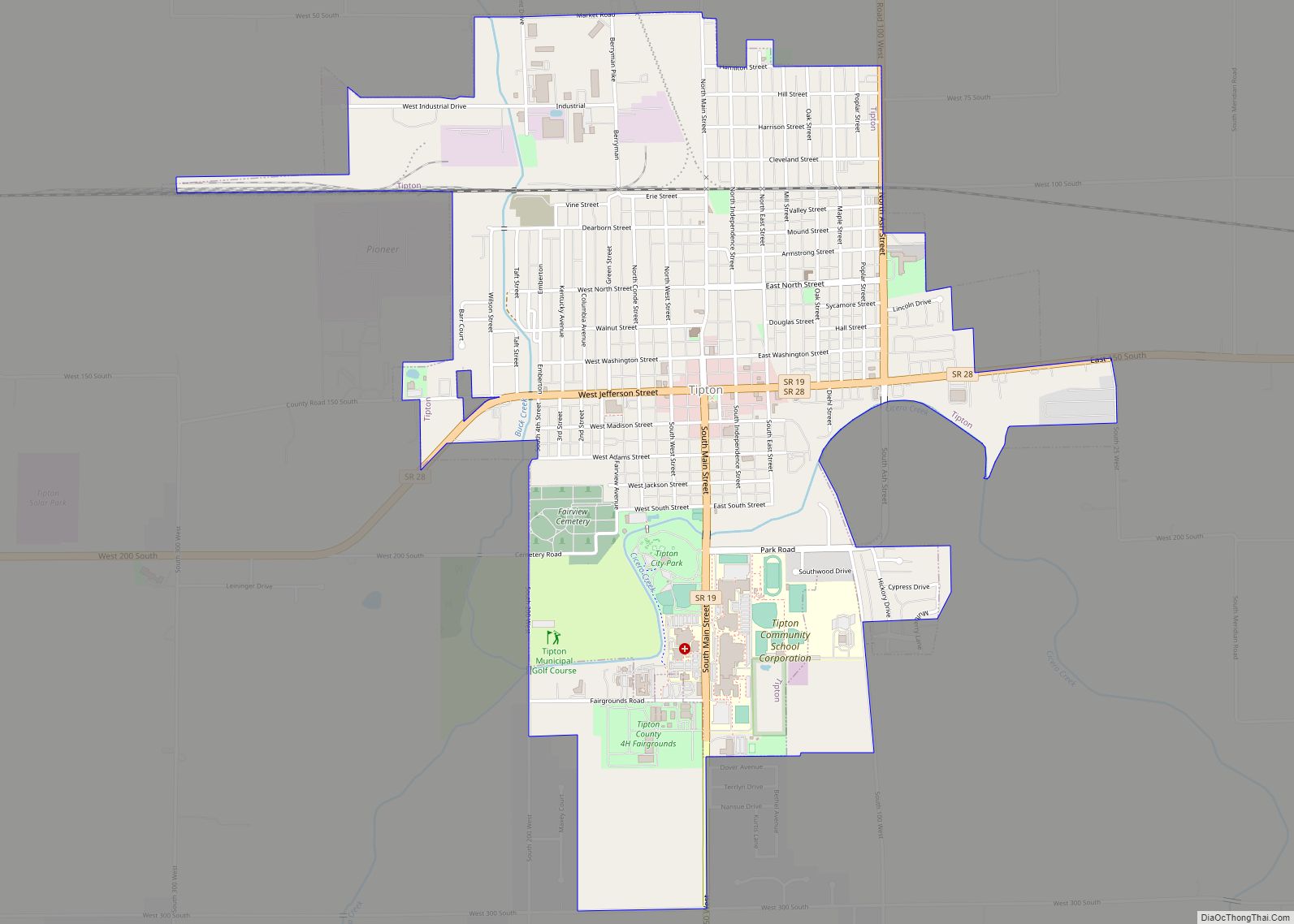
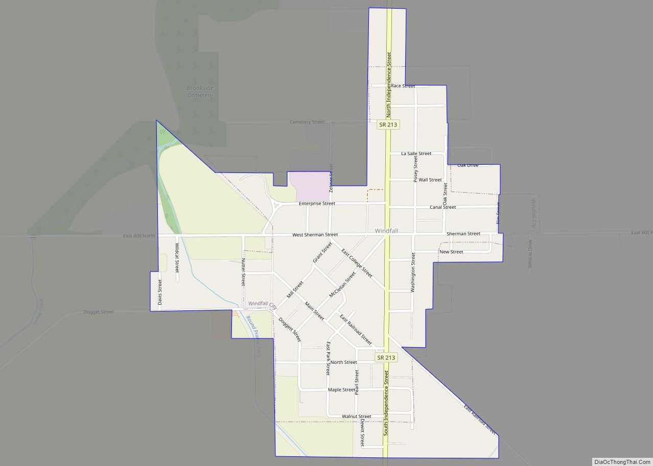
Online Interactive Map
Click on ![]() to view map in "full screen" mode.
to view map in "full screen" mode.
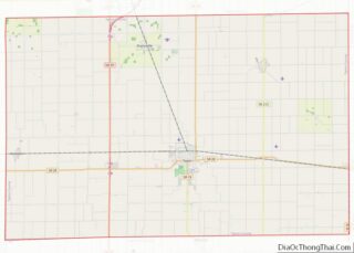
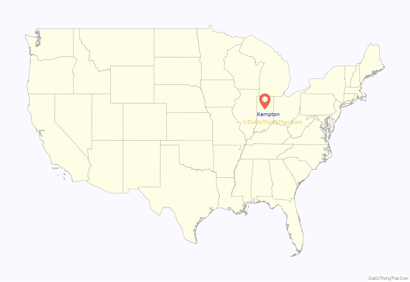
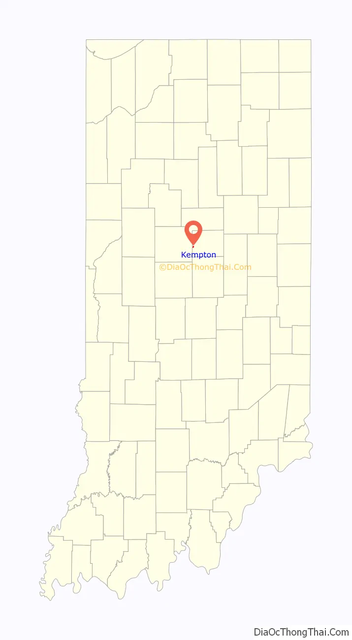
Kempton location map. Where is Kempton town?
History
Kempton was founded in 1875, upon the completion of the Lake Erie and Western Railroad, in the same year. The land was originally owned by David Kemp, the namesake of the town. The first house in Kempton was built by Henry Hays. Hays also operated a grocery out of the building. That year, there was also a post office, an additional store, a blacksmith, and a mill. A Methodist Episcopal Church was built in 1902. As of 1914, the town had a population of about 700 people and had a bank, newspaper, and three churches. Tilemaking was the most lucrative industry, with the Kempton Tile Factory being located in the town. A canning factory and milling company were also located in Kempton.
The Kempton post office has been in operation since 1876.
Kempton Road Map

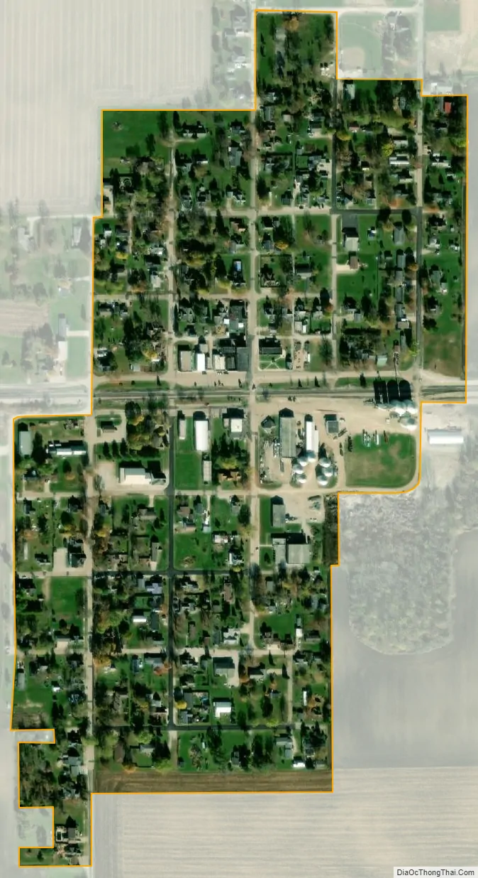
Kempton city Satellite Map
Geography
Kempton is located in the western part of Jefferson Township at 40°17′15″N 86°13′48″W / 40.28750°N 86.23000°W / 40.28750; -86.23000 (40.287545, -86.230034).
According to the 2010 census, Kempton has a total area of 0.16 square miles (0.41 km), all land.
See also
Map of Indiana State and its subdivision:- Adams
- Allen
- Bartholomew
- Benton
- Blackford
- Boone
- Brown
- Carroll
- Cass
- Clark
- Clay
- Clinton
- Crawford
- Daviess
- De Kalb
- Dearborn
- Decatur
- Delaware
- Dubois
- Elkhart
- Fayette
- Floyd
- Fountain
- Franklin
- Fulton
- Gibson
- Grant
- Greene
- Hamilton
- Hancock
- Harrison
- Hendricks
- Henry
- Howard
- Huntington
- Jackson
- Jasper
- Jay
- Jefferson
- Jennings
- Johnson
- Knox
- Kosciusko
- LaGrange
- Lake
- Lake Michigan
- LaPorte
- Lawrence
- Madison
- Marion
- Marshall
- Martin
- Miami
- Monroe
- Montgomery
- Morgan
- Newton
- Noble
- Ohio
- Orange
- Owen
- Parke
- Perry
- Pike
- Porter
- Posey
- Pulaski
- Putnam
- Randolph
- Ripley
- Rush
- Saint Joseph
- Scott
- Shelby
- Spencer
- Starke
- Steuben
- Sullivan
- Switzerland
- Tippecanoe
- Tipton
- Union
- Vanderburgh
- Vermillion
- Vigo
- Wabash
- Warren
- Warrick
- Washington
- Wayne
- Wells
- White
- Whitley
- Alabama
- Alaska
- Arizona
- Arkansas
- California
- Colorado
- Connecticut
- Delaware
- District of Columbia
- Florida
- Georgia
- Hawaii
- Idaho
- Illinois
- Indiana
- Iowa
- Kansas
- Kentucky
- Louisiana
- Maine
- Maryland
- Massachusetts
- Michigan
- Minnesota
- Mississippi
- Missouri
- Montana
- Nebraska
- Nevada
- New Hampshire
- New Jersey
- New Mexico
- New York
- North Carolina
- North Dakota
- Ohio
- Oklahoma
- Oregon
- Pennsylvania
- Rhode Island
- South Carolina
- South Dakota
- Tennessee
- Texas
- Utah
- Vermont
- Virginia
- Washington
- West Virginia
- Wisconsin
- Wyoming