Tipton is a city in and the county seat of Tipton County, Indiana, United States. The population was estimated to be 5,275 as of July 1, 2021.
| Name: | Tipton city |
|---|---|
| LSAD Code: | 25 |
| LSAD Description: | city (suffix) |
| State: | Indiana |
| County: | Tipton County |
| Elevation: | 869 ft (265 m) |
| Total Area: | 2.63 sq mi (6.80 km²) |
| Land Area: | 2.63 sq mi (6.80 km²) |
| Water Area: | 0.00 sq mi (0.00 km²) 0% |
| Total Population: | 5,275 |
| Population Density: | 2,009.52/sq mi (775.79/km²) |
| ZIP code: | 46072 |
| Area code: | 765 |
| FIPS code: | 1875986 |
| GNISfeature ID: | 444784 |
| Website: | www.tiptongov.com |
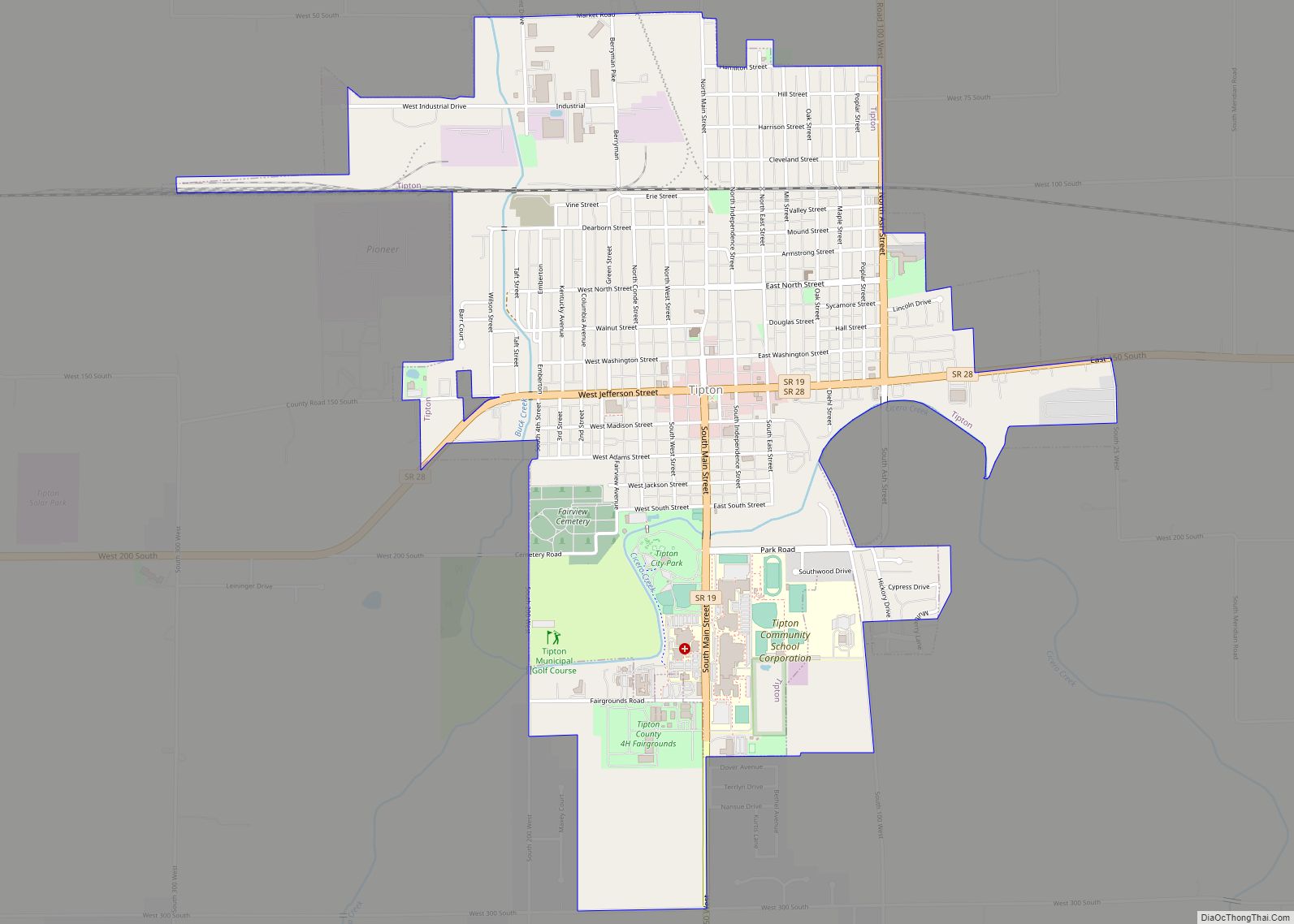
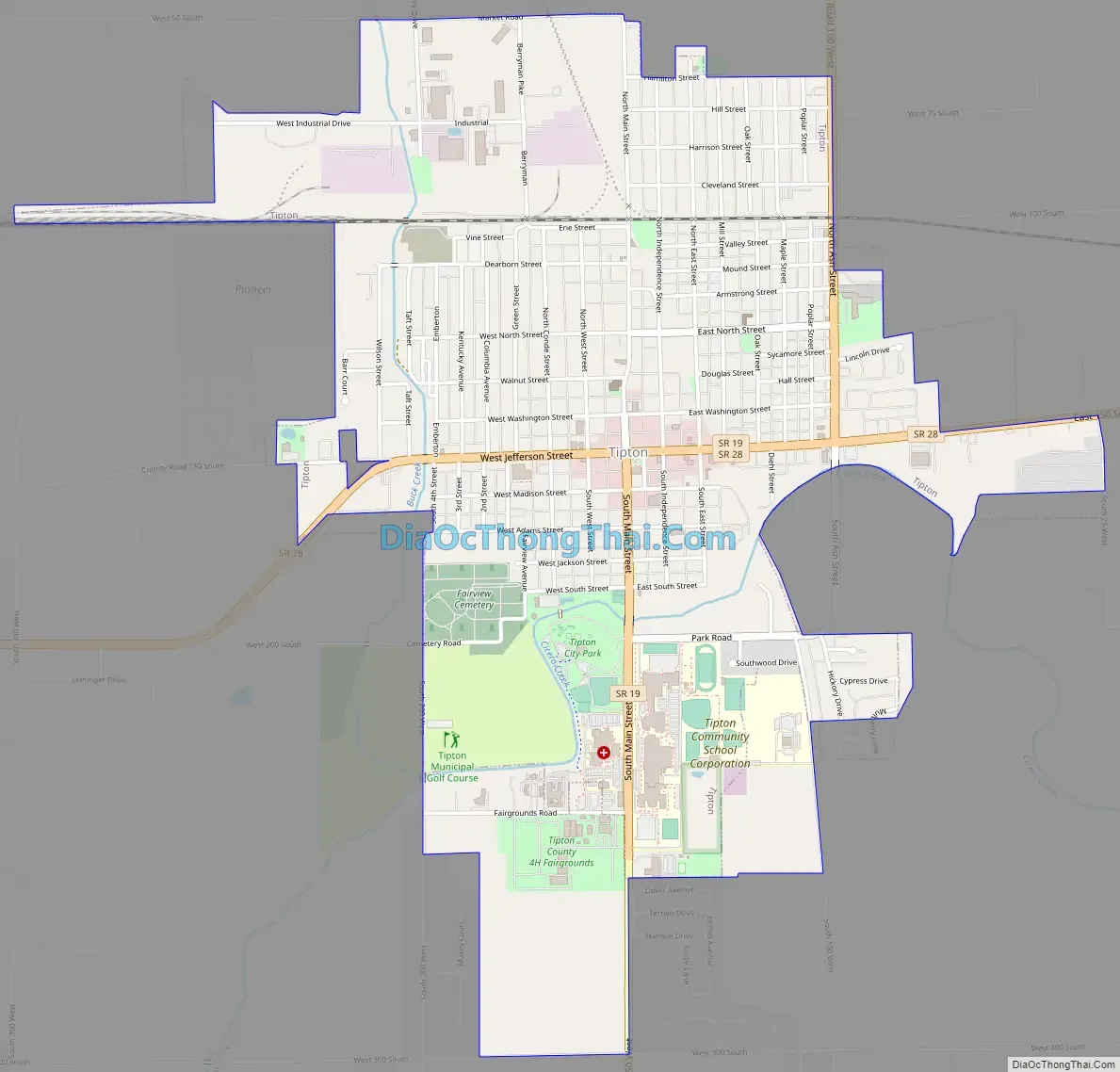
Online Interactive Map
Click on ![]() to view map in "full screen" mode.
to view map in "full screen" mode.
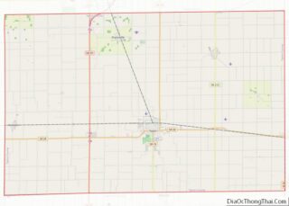
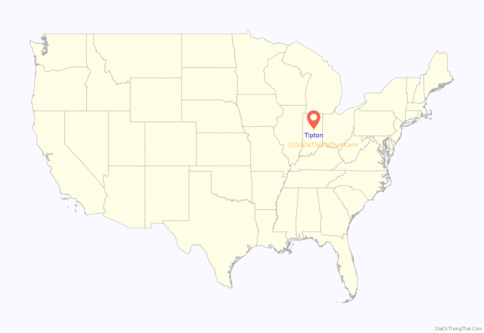
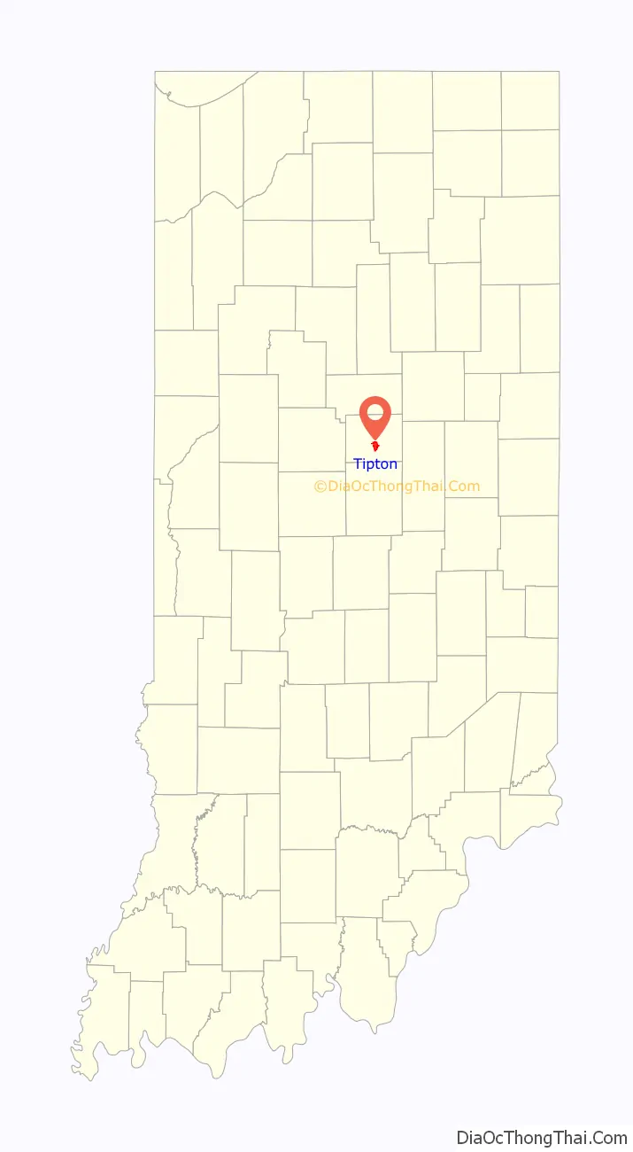
Tipton location map. Where is Tipton city?
History
The Tipton County Courthouse and Tipton County Jail and Sheriff’s Home were added to the National Register of Historic Places in 1984.
Samuel King founds Kingston
The first white person to settle in the area now known as Tipton was Samuel King, who purchased land between 1835 and 1836. The land was still a part of Hamilton County. He resided in Rush County, but visited the area frequently. Strawtown, Indiana was the closest trading post. King decided to found a town on the land he purchased and he platted the town on April 16, 1839. The town was named Kingston. Despite efforts, King failed to sell any of the plots that he platted. A few Miami Indians resided in the area still.
In January, 1844, Tipton County was founded and a county seat needed to be created. The county seat was originally going to be located in the middle area of the county, however, Miami Indians resided on the land and they were unable to create a town there. The county commissioners put out a call for landowners to propose that the county seat be placed on their land. King offered to donate 100 acres of Kingston. On October 16, 1844, the commissioners accepted his offer.
Canton
The commissioners were in charge of also naming the new town. Commissioner John D. Smith, who used to reside in Ohio, proposed to name the town Canton, after Canton, Ohio. The commission accepted the name. After October, it was decided to plat Canton. The area had to be cleared of trees and plants, and John Criswell did the surveying for $2 a day. Sales of the plots began in November. As of March 1845, 34 lots had been sold.
Canton becomes Tipton
In 1845, a post office was going to be established in Canton. However, this did not proceed because it was discovered that there was a town already named Canton in the state, which was founded in 1838. The town was renamed Tipton, after John Tipton, a veteran of the Battle of Tippecanoe and the War of 1812. He was also the leader of the Indiana Rangers. Tipton served as United States Senator for Indiana from 1831 until shortly before his death in 1839. Finally, a post office was founded and John S. Ressler became the first postmaster.
Early Tipton was a mess, with log cabins and poorly built homes riddling the streets and not following the platting. Cows wandered through town and wild game was chased by residents through the streets. It was very rural. There was no telegraph or steam train, so communication with areas outside of the area were rare during this time. Residents lived mainly on hunting. Agriculture was poorly developed. Tipton was also known for flooding and mud, with people having to frequently walk through flood waters and swamp-like areas to get from house to house during wet seasons. By 1850, the population doubled and a physician, Isaac Parker, had founded his practice in the city.
Cholera epidemic
Around August 1, 1845, the city entered into a cholera epidemic. The majority of residents fled the city. Livestock began dying of starvation and dehydration due to being left in their pens due to their owners deaths or fleeing of the city. One resident, Mason Lyons, freed all the animals that were still alive, allowing them to wander into the forest to feed. Stores and businesses closed. There were three doctors in town, including Isaac Parker. Over 20 people died. The epidemic lasted approximately one month.
Late 1800s and incorporation
In 1854, the Tipton Presbyterian Church was founded in the city, after being dissolved in Normanda. A Christian church was founded in Tipton in 1855. Its congregation met at the Methodist Episcopal church until a church was built in 1870. The congregation built a new church, the West Street Christian church, that was completed in 1908. The court house burnt down in 1857. The Methodist church served as the court house for three years until the new courthouse was finished. In 1872, the Jefferson street canal was built, which helped to drain the surface areas of the town. The canal was nonexistent by 1914. The first Catholic church was built in Tipton in 1874. By 1880, Tipton was primarily low-income and had little to no economy. Saloons were the most profitable businesses. Starting in 1880, the town began to rebuild its reputation. An incentive was offered to whoever built the first brick building. The Methodist church outgrew its building and the new church was the first brick building, starting the trend for two-story brick buildings in the town. Tipton was incorporated in 1884, becoming the “city” of Tipton. The first city election was held in 1884.
In 1888, the Sisters of St. Joseph arrived in Tipton to settle. A small church was built and they founded St. Joseph Academy, a parochial school. The school closed in 1977. A Baptist church was organized in Tipton in 1898, with a church being built in 1900.
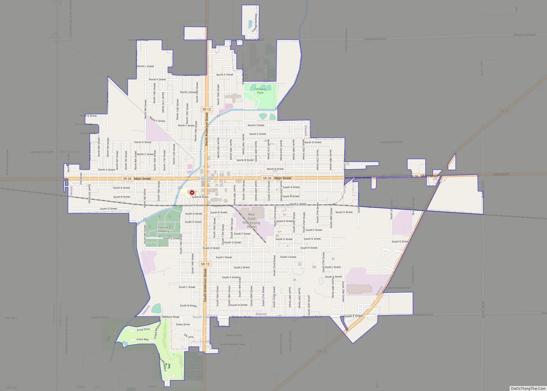
Tipton Road Map
Tipton city Satellite Map

Geography
Tipton is located at 40°17′6″N 86°2′25″W / 40.28500°N 86.04028°W / 40.28500; -86.04028 (40.284944, -86.040342). This is 36 miles (58 km.) almost due North of the state Capital, Indianapolis.
According to the 2010 census, Tipton has a total area of 2.5 square miles (6.47 km), all land.
Natural environment
In 1849, the city was covered in trees, underbrush, logs, stumps and wild vines and weeds. A large swamp was located on the southeastern part of the town square. On the north side of the square was a slough. Wolves, bull frogs, deer, mosquitos, and wild game were commonplace.
See also
Map of Indiana State and its subdivision:- Adams
- Allen
- Bartholomew
- Benton
- Blackford
- Boone
- Brown
- Carroll
- Cass
- Clark
- Clay
- Clinton
- Crawford
- Daviess
- De Kalb
- Dearborn
- Decatur
- Delaware
- Dubois
- Elkhart
- Fayette
- Floyd
- Fountain
- Franklin
- Fulton
- Gibson
- Grant
- Greene
- Hamilton
- Hancock
- Harrison
- Hendricks
- Henry
- Howard
- Huntington
- Jackson
- Jasper
- Jay
- Jefferson
- Jennings
- Johnson
- Knox
- Kosciusko
- LaGrange
- Lake
- Lake Michigan
- LaPorte
- Lawrence
- Madison
- Marion
- Marshall
- Martin
- Miami
- Monroe
- Montgomery
- Morgan
- Newton
- Noble
- Ohio
- Orange
- Owen
- Parke
- Perry
- Pike
- Porter
- Posey
- Pulaski
- Putnam
- Randolph
- Ripley
- Rush
- Saint Joseph
- Scott
- Shelby
- Spencer
- Starke
- Steuben
- Sullivan
- Switzerland
- Tippecanoe
- Tipton
- Union
- Vanderburgh
- Vermillion
- Vigo
- Wabash
- Warren
- Warrick
- Washington
- Wayne
- Wells
- White
- Whitley
- Alabama
- Alaska
- Arizona
- Arkansas
- California
- Colorado
- Connecticut
- Delaware
- District of Columbia
- Florida
- Georgia
- Hawaii
- Idaho
- Illinois
- Indiana
- Iowa
- Kansas
- Kentucky
- Louisiana
- Maine
- Maryland
- Massachusetts
- Michigan
- Minnesota
- Mississippi
- Missouri
- Montana
- Nebraska
- Nevada
- New Hampshire
- New Jersey
- New Mexico
- New York
- North Carolina
- North Dakota
- Ohio
- Oklahoma
- Oregon
- Pennsylvania
- Rhode Island
- South Carolina
- South Dakota
- Tennessee
- Texas
- Utah
- Vermont
- Virginia
- Washington
- West Virginia
- Wisconsin
- Wyoming