The City of Thornton is a home rule municipality located in Adams and Weld counties, Colorado, United States. The city population was 141,867, all in Adams County, at the 2020 United States Census, an increase of +19.44% since the 2010 United States Census. Thornton is the sixth most populous city in Colorado and the 191st most populous city in the United States. Thornton is 10 miles (16 km) north of the Colorado State Capitol in Denver and is a part of the Denver–Aurora–Lakewood, CO Metropolitan Statistical Area.
| Name: | Thornton city |
|---|---|
| LSAD Code: | 25 |
| LSAD Description: | city (suffix) |
| State: | Colorado |
| County: | Adams County, Weld County |
| Incorporated: | June 12, 1956 |
| Elevation: | 5,351 ft (1,631 m) |
| Total Area: | 37.947 sq mi (98.282 km²) |
| Land Area: | 35.924 sq mi (93.043 km²) |
| Water Area: | 2.023 sq mi (5.239 km²) |
| Total Population: | 141,867 |
| Population Density: | 3,949/sq mi (1,525/km²) |
| ZIP code: | Denver 80221, 80229, 80233, 80241, 80260 Brighton 80602 |
| Area code: | Both 303 and 720 |
| FIPS code: | 0877290 |
| GNISfeature ID: | 0181265 |
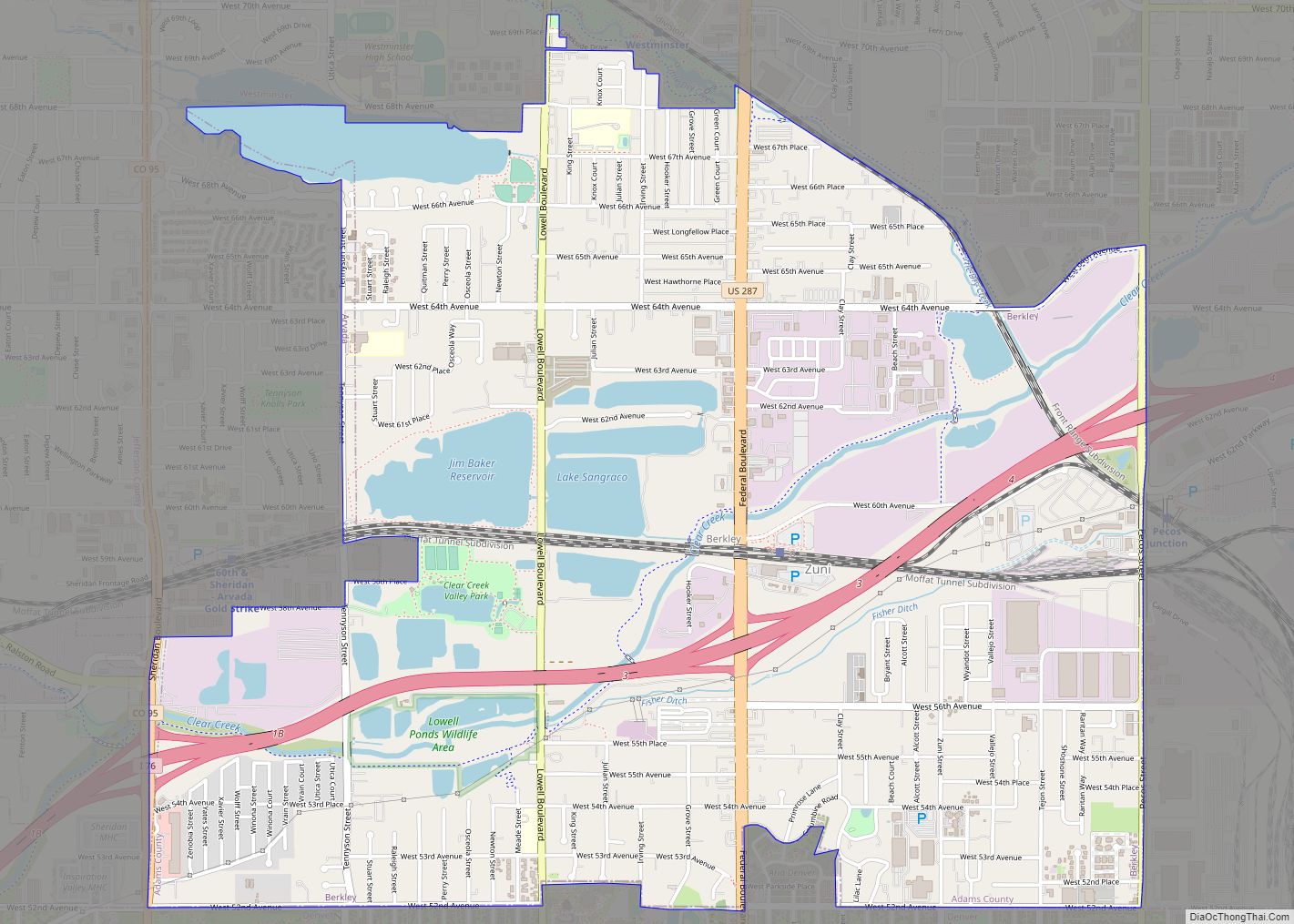
Online Interactive Map
Click on ![]() to view map in "full screen" mode.
to view map in "full screen" mode.
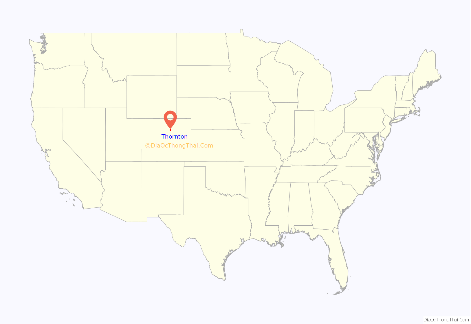
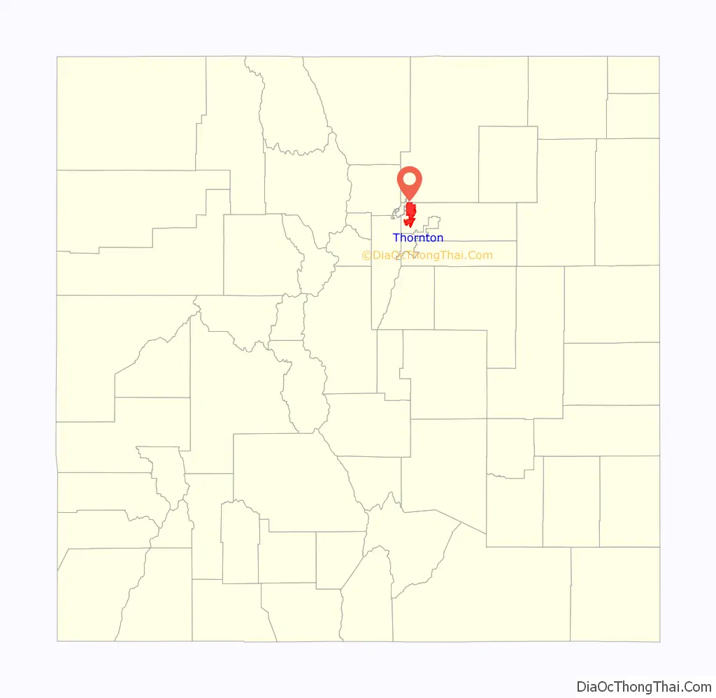
Thornton location map. Where is Thornton city?
History
Thornton consisted solely of farmland until 1953, when Sam Hoffman purchased a lot off Washington Street about seven miles (11 km) north of Denver. The town he laid out was the first fully planned community in Adams County, and the first to offer full municipal services from a single tax levy, including recreation services and free trash pickup. Thornton was named in honor of then-incumbent Colorado Governor Dan Thornton.
The Thornton Community Association (TCA) was formed in 1954 to help guide the new community’s development. By the end of 1955, Thornton had 5,500 residents in over 1,200 homes. The TCA was instrumental in Thornton’s 1956 incorporation as a city. Oyer G. Leary was elected the first mayor.
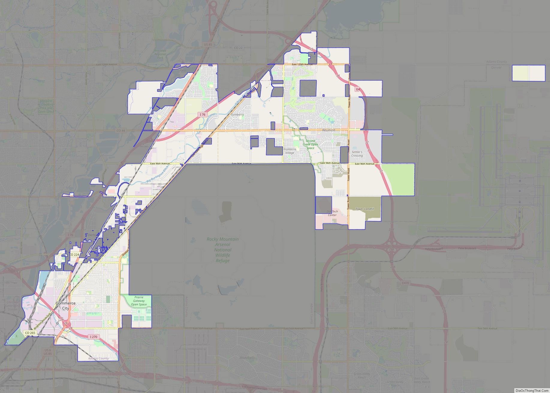
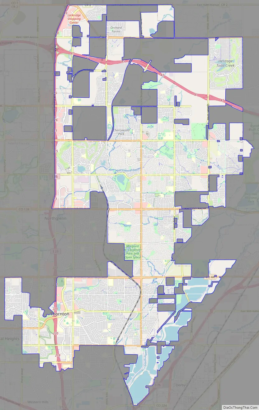
Thornton Road Map
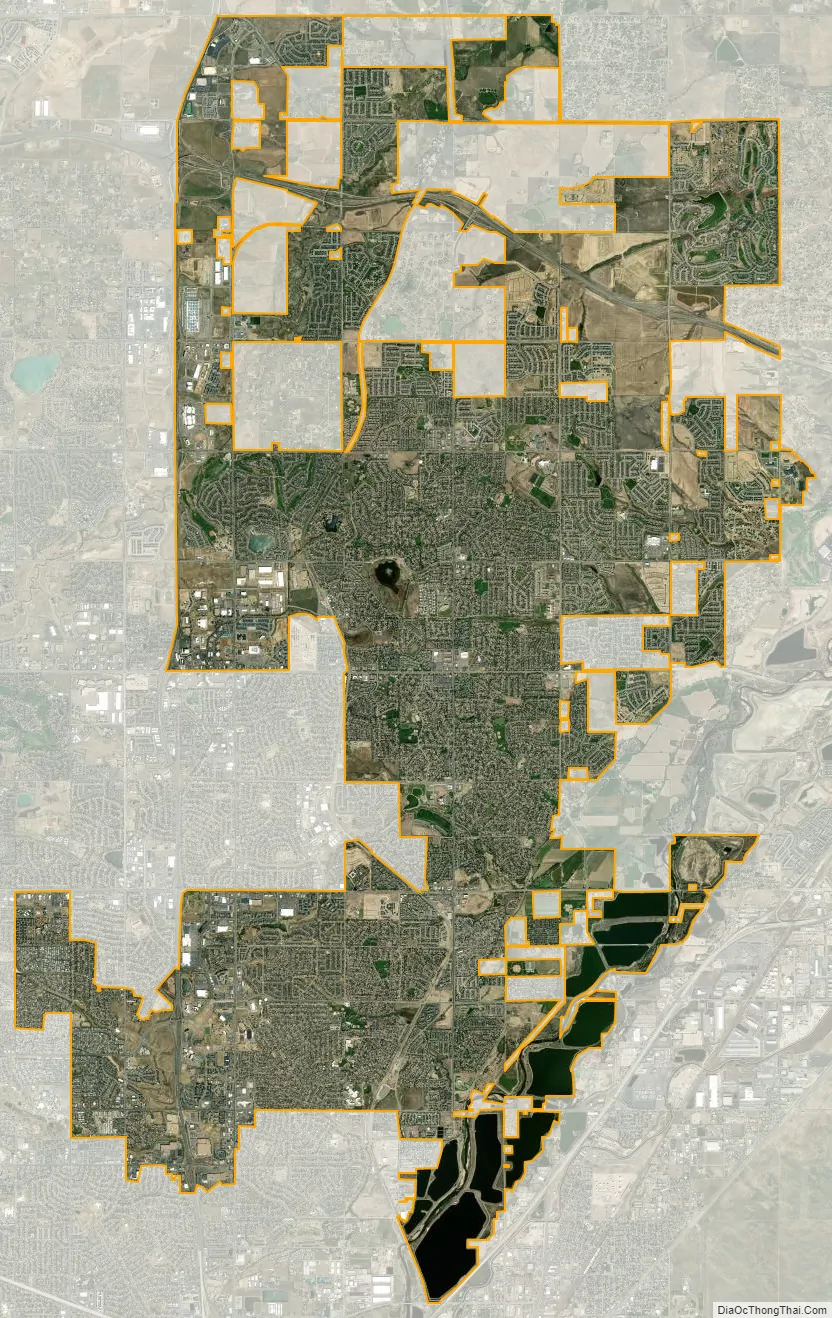
Thornton city Satellite Map
Geography
Thornton is located at 39°54′11″N 104°57′16″W / 39.90306°N 104.95444°W / 39.90306; -104.95444 (39.903043, -104.954406).
At the 2020 United States Census, the town had a total area of 24,286 acres (98.282 km) including 1,295 acres (5.239 km) of water.
See also
Map of Colorado State and its subdivision:- Adams
- Alamosa
- Arapahoe
- Archuleta
- Baca
- Bent
- Boulder
- Broomfield
- Chaffee
- Cheyenne
- Clear Creek
- Conejos
- Costilla
- Crowley
- Custer
- Delta
- Denver
- Dolores
- Douglas
- Eagle
- El Paso
- Elbert
- Fremont
- Garfield
- Gilpin
- Grand
- Gunnison
- Hinsdale
- Huerfano
- Jackson
- Jefferson
- Kiowa
- Kit Carson
- La Plata
- Lake
- Larimer
- Las Animas
- Lincoln
- Logan
- Mesa
- Mineral
- Moffat
- Montezuma
- Montrose
- Morgan
- Otero
- Ouray
- Park
- Phillips
- Pitkin
- Prowers
- Pueblo
- Rio Blanco
- Rio Grande
- Routt
- Saguache
- San Juan
- San Miguel
- Sedgwick
- Summit
- Teller
- Washington
- Weld
- Yuma
- Alabama
- Alaska
- Arizona
- Arkansas
- California
- Colorado
- Connecticut
- Delaware
- District of Columbia
- Florida
- Georgia
- Hawaii
- Idaho
- Illinois
- Indiana
- Iowa
- Kansas
- Kentucky
- Louisiana
- Maine
- Maryland
- Massachusetts
- Michigan
- Minnesota
- Mississippi
- Missouri
- Montana
- Nebraska
- Nevada
- New Hampshire
- New Jersey
- New Mexico
- New York
- North Carolina
- North Dakota
- Ohio
- Oklahoma
- Oregon
- Pennsylvania
- Rhode Island
- South Carolina
- South Dakota
- Tennessee
- Texas
- Utah
- Vermont
- Virginia
- Washington
- West Virginia
- Wisconsin
- Wyoming