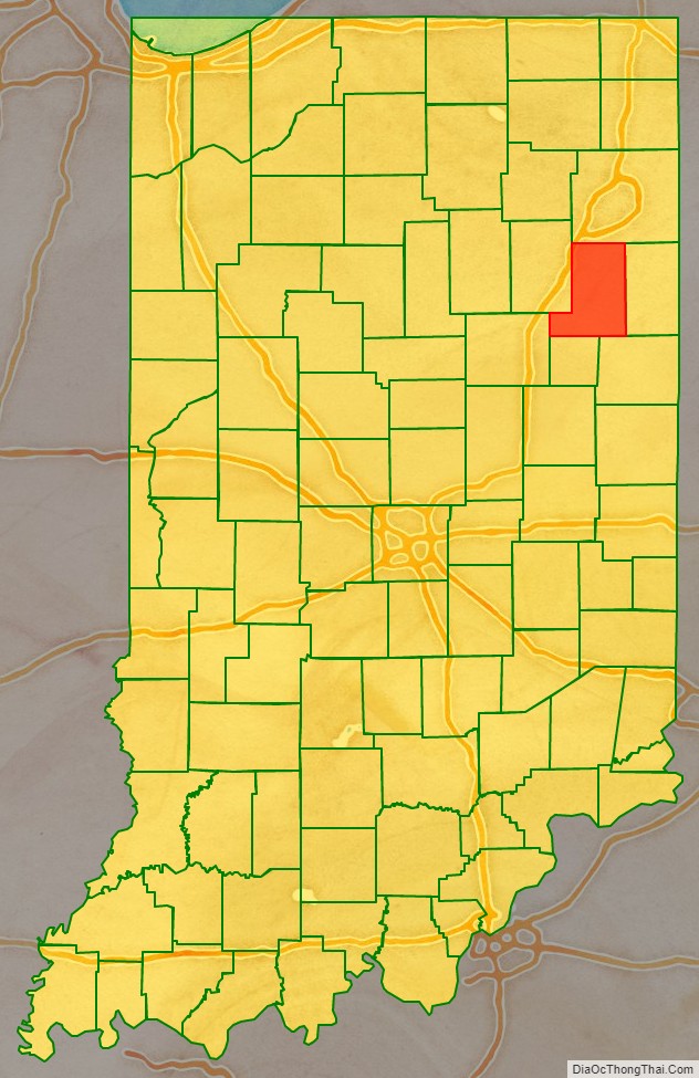
Wells County is a county in the U.S. state of Indiana. As of the 2020 United States Census, the population was 28,180. The county seat (and only incorporated city) is Bluffton.
Wells County is included in the Fort Wayne Metropolitan Statistical Area and the Fort Wayne–Huntington–Auburn Combined Statistical Area.
| Name: | Wells County |
|---|---|
| FIPS code: | 18-179 |
| State: | Indiana |
| Founded: | 1837 |
| Named for: | William A. Wells |
| Seat: | Bluffton |
| Largest city: | Bluffton |
| Total Area: | 370.25 sq mi (958.9 km²) |
| Land Area: | 368.09 sq mi (953.3 km²) |
| Total Population: | 28,180 |
| Population Density: | 76/sq mi (29/km²) |
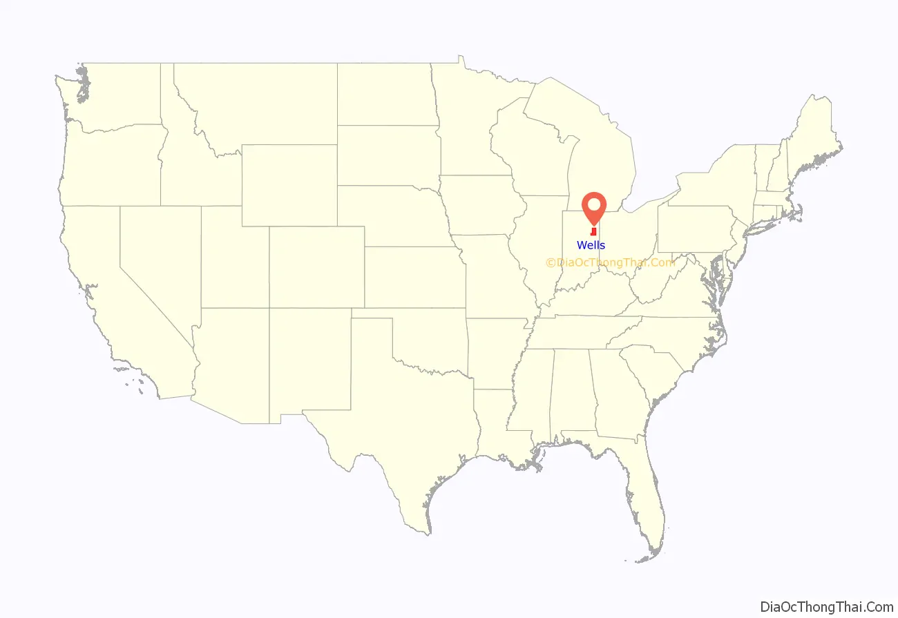
Wells County location map. Where is Wells County?
History
The future state of Indiana was first regulated by passage of the Northwest Ordinance in 1787. The governing structure created by this act created Wayne County as part of Indiana Territory in 1796. As the Territory’s lands began filling with settlers, other counties were organized, and in December 1816 the State of Indiana was admitted to the Union. The state legislature approved (on 7 February 1835) an omnibus bill which authorized the division of portions of Wayne County into thirteen counties. Wells was named for William A. Wells. It was assigned to Allen County for legislative and administrative affairs at first.
On 2 February 1837 an act was passed by the state, authorizing Wells County to be organized independent of Allen County, and specifying 1 May for the date of first meeting. However, that meeting did not take place, so an act dated 20 January 1838 further authorized the meeting of appointed commissioners to decide on a county seat. That vote was completed on 5 March 1838, selecting Bluffton.
Wells County Road Map
Geography
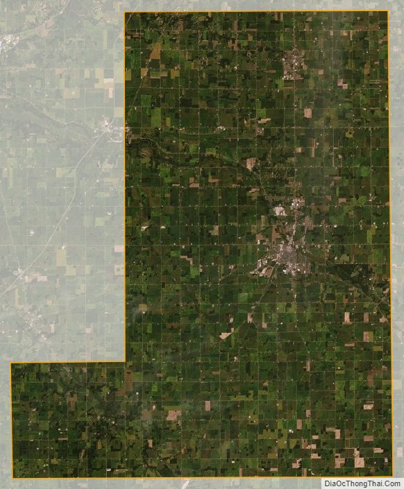
The low rolling hills of Wells County have been deforested and are now completely devoted to agriculture and urban development. The Wabash River flows to the northwest, draining the central and upper part of the county, while the lower part is drained by the Salamonie River, also flowing to the northwest. The highest point on the terrain (935 feet/285 meters ASL) is an isolated rise on the county’s south borderline with Jay County, one-half mile (0.8 km) east of the NE corner of Blackford County.
According to the 2010 census, the county has a total area of 370.25 square miles (958.9 km), of which 368.09 square miles (953.3 km) (or 99.42%) is land and 2.16 square miles (5.6 km) (or 0.58%) is water.
Adjacent counties
- Allen County – north
- Adams County – east
- Jay County – southeast
- Blackford County – south
- Grant County – west
- Huntington County – northwest
City and towns
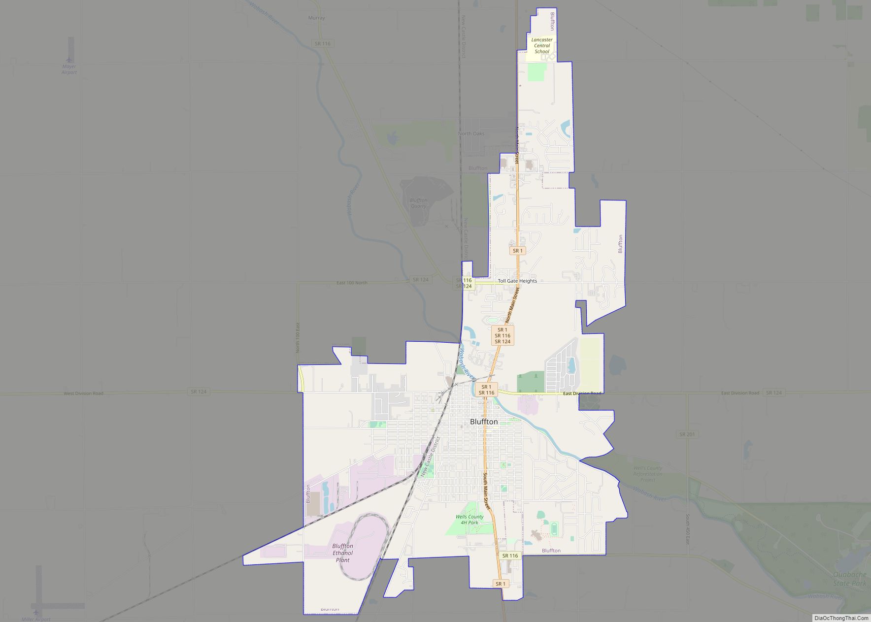
- Bluffton (city/county seat)
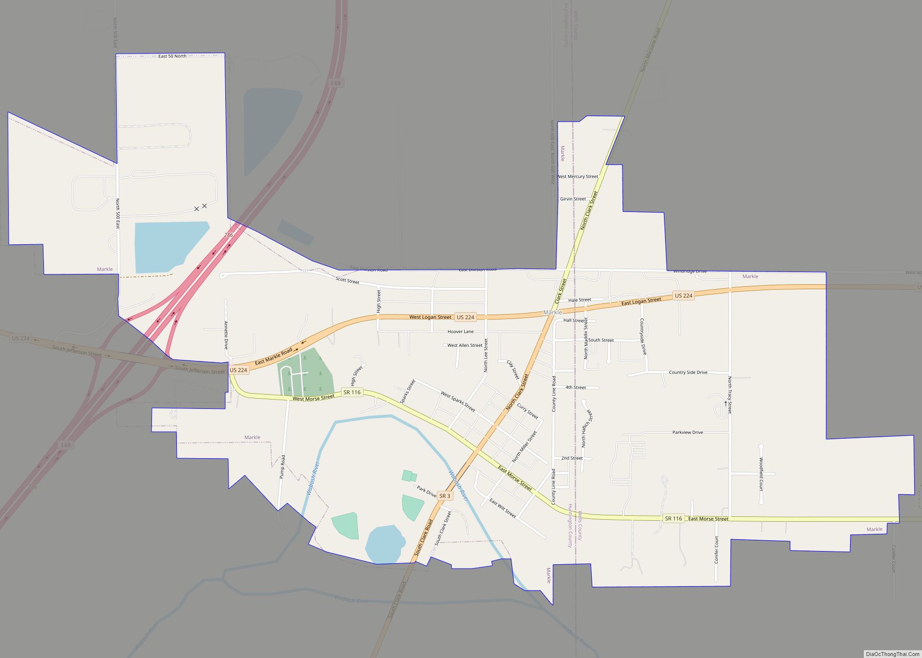
- Markle (town; partly in Huntington County)
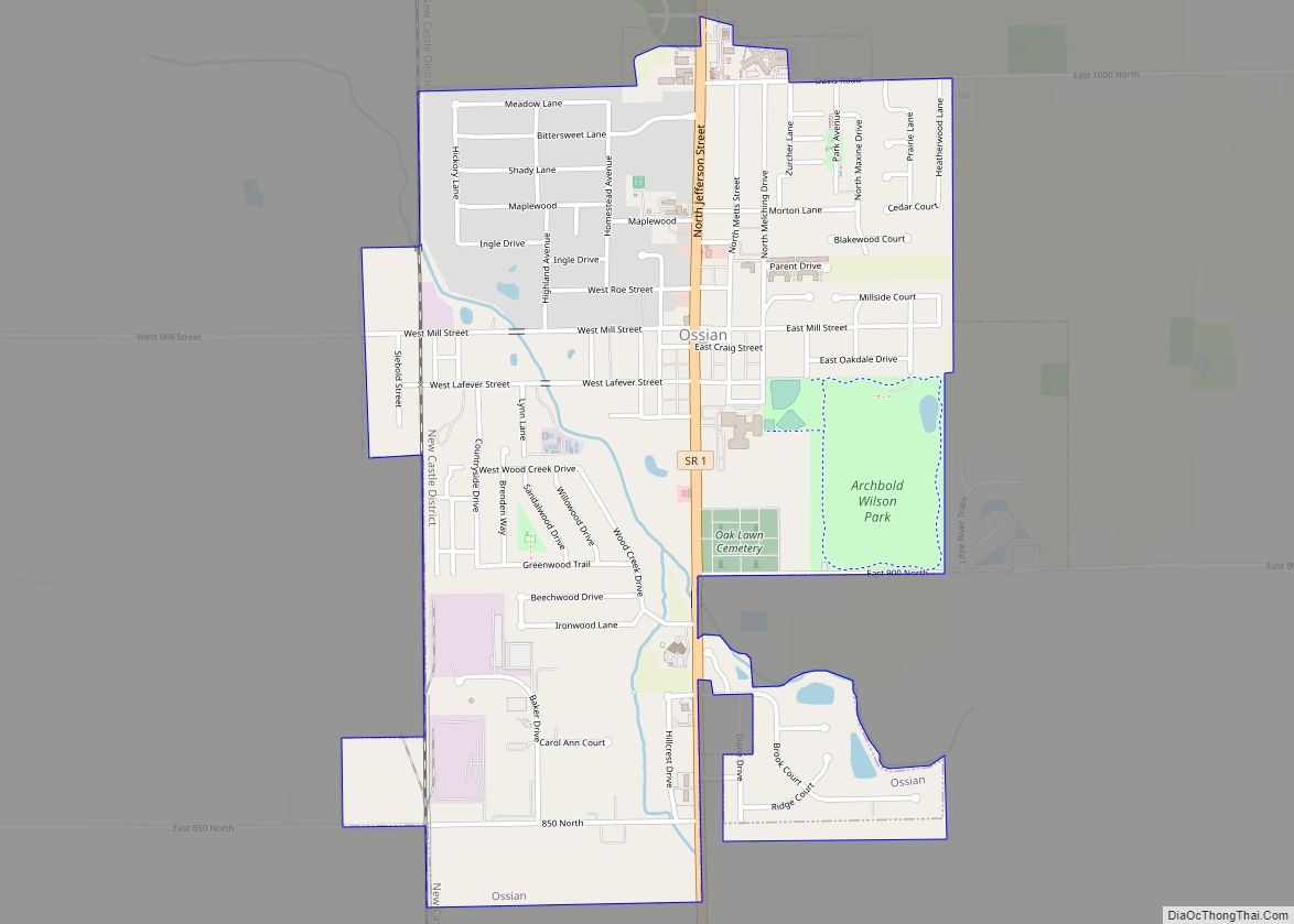
- Ossian (town)
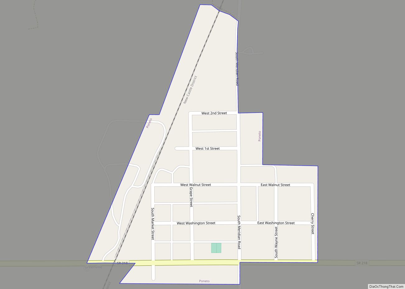
- Poneto (town – named Worthington from 1871 to 1881)
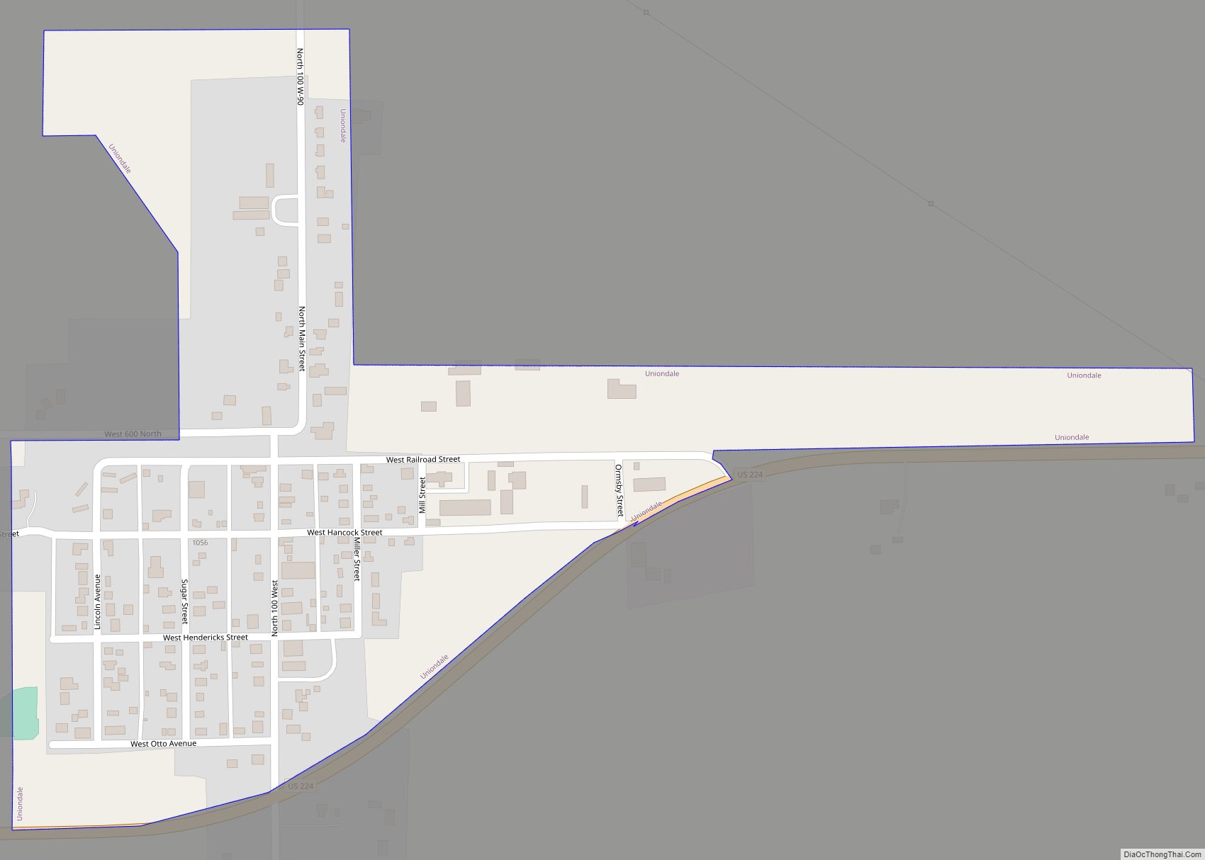
- Uniondale (town)
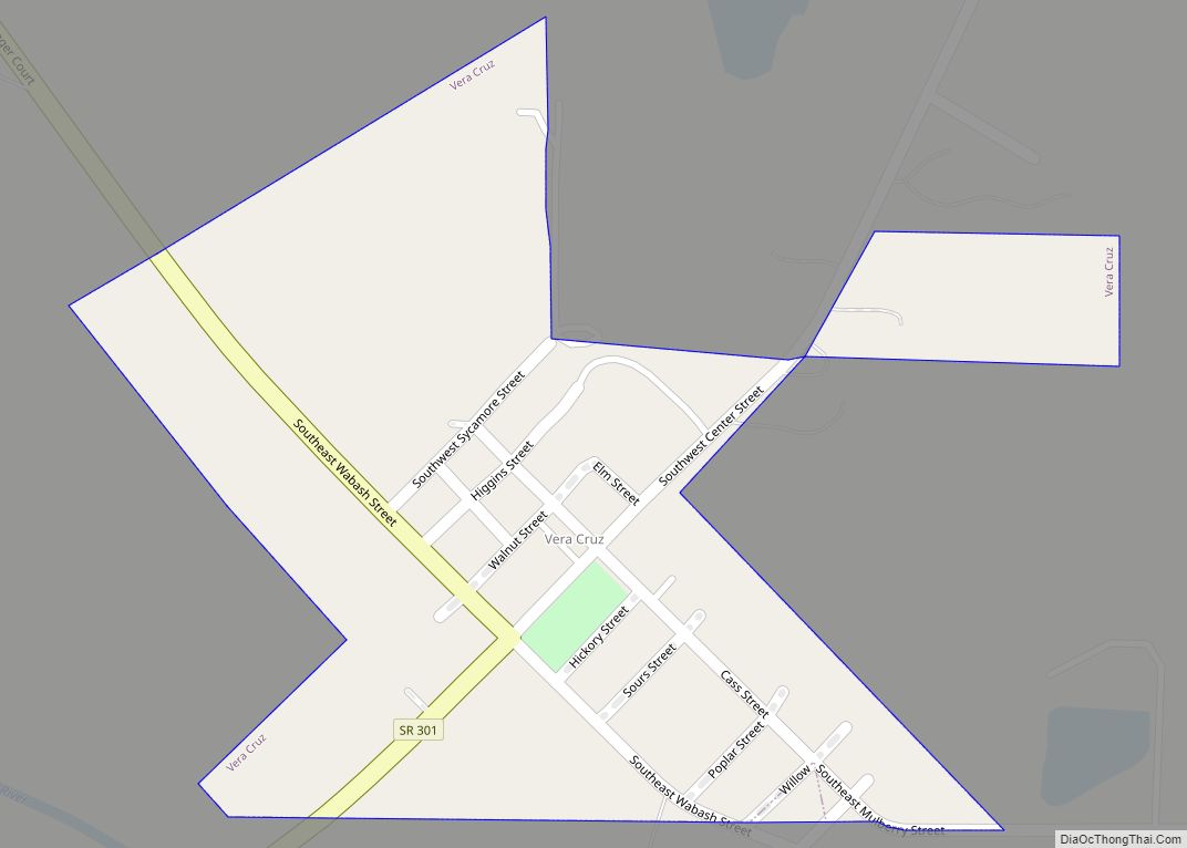
- Vera Cruz (town)
- Zanesville (town; partly in Allen County)
Unincorporated communities
- Craigville
- Curryville
- Dillman
- Domestic
- Five Points
- Greenville
- Greenwood
- Jeff
- Keystone
- Kingsland
- Liberty Center
- McNatts
- Mount Zion
- Murray
- North Oaks
- Nottingham
- Petroleum
- Phenix
- Reiffsburg
- Riverside
- Rockford
- Tocsin
- Toll Gate Heights
- Travisville
- Wellsburg
Townships
- Chester
- Harrison
- Jackson
- Jefferson
- Lancaster
- Liberty
- Nottingham
- Rockcreek
- Union
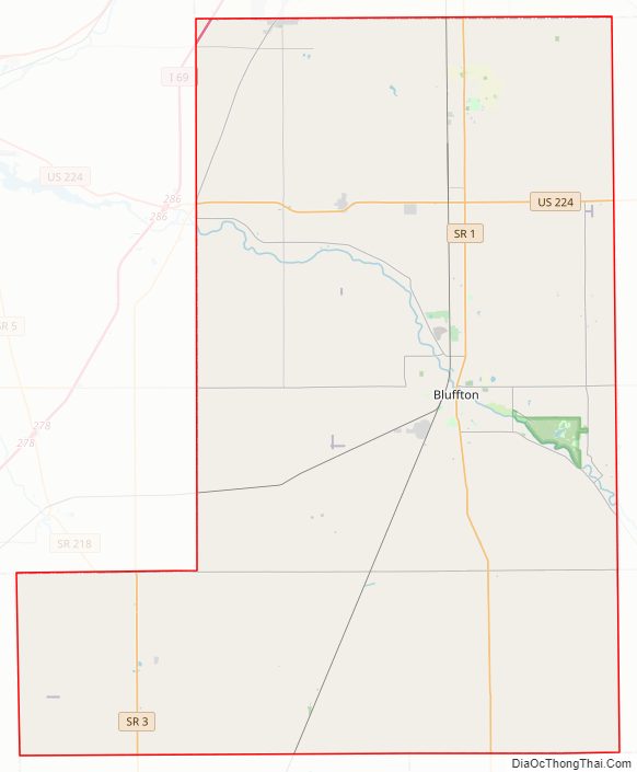
Major highways
- Interstate 69
- U.S. Route 224
- State Road 1
- State Road 3
- State Road 116
- State Road 124
- State Road 201
- State Road 218
- State Road 301
Wells County Topographic Map
Wells County Satellite Map
Wells County Outline Map