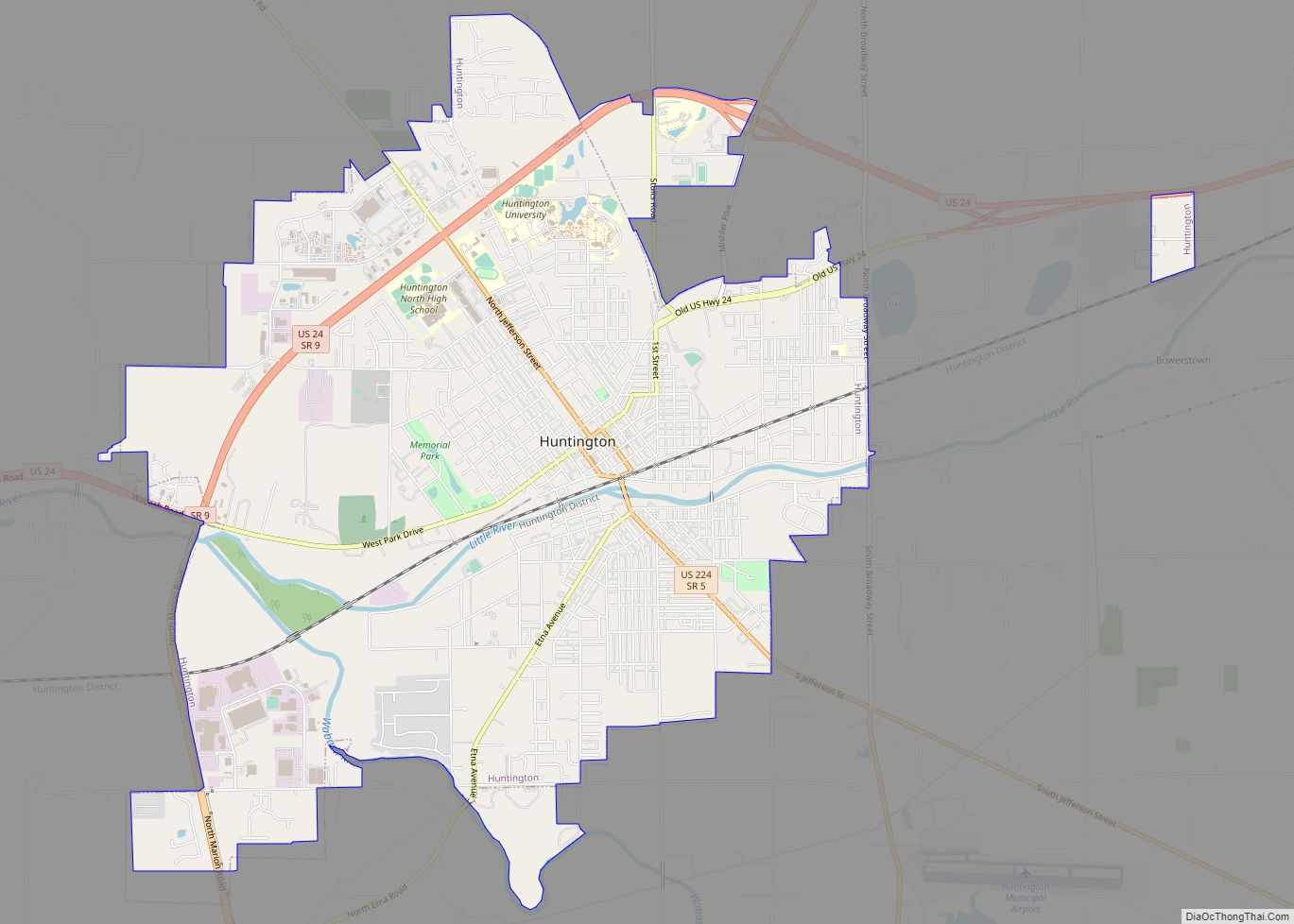
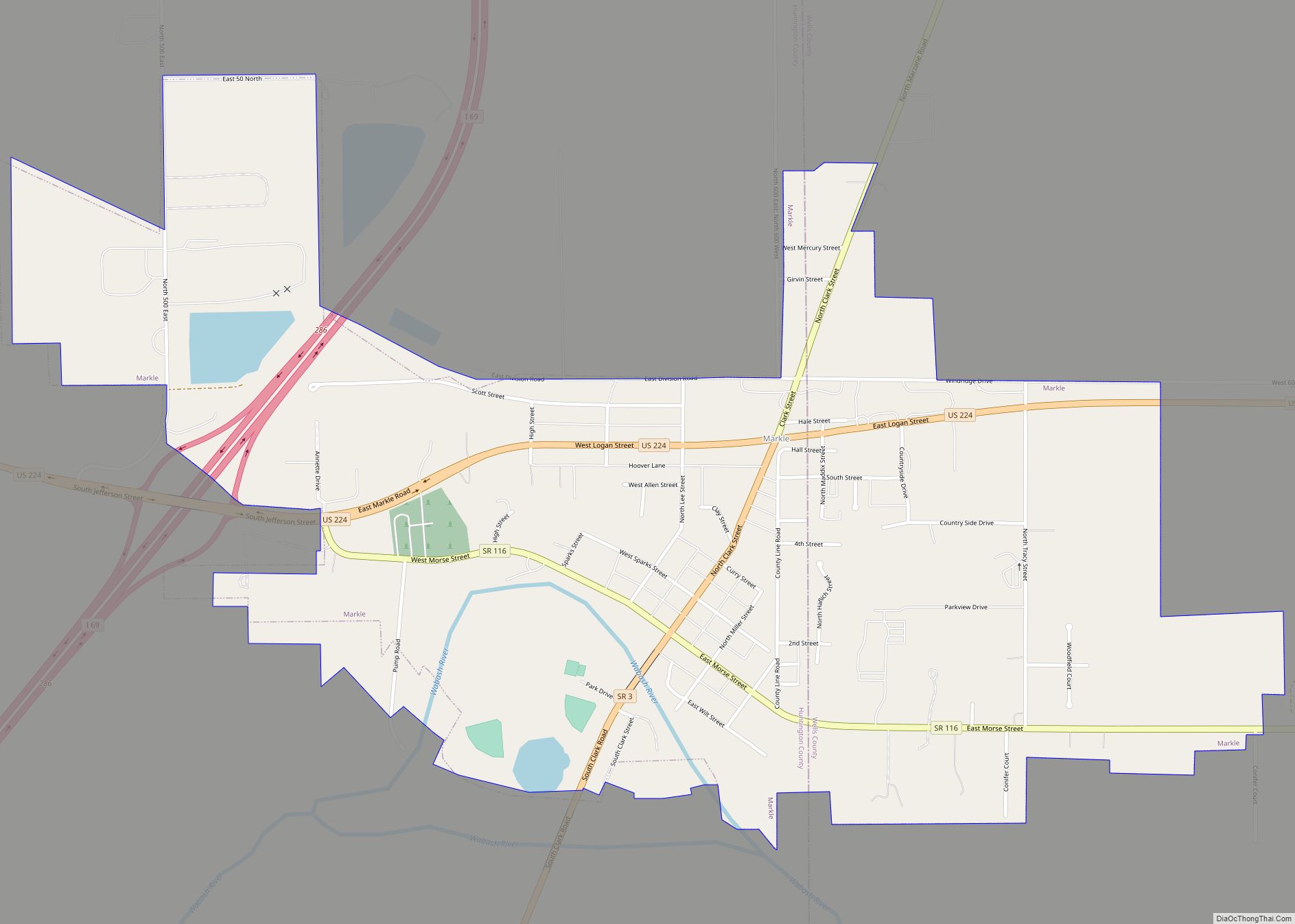
Markle is a town in Huntington and Wells counties, in the U.S. state of Indiana. The population was 1,071 at the 2020 census. It lies along Interstate 69, U.S. Route 224, State Road 116 and State Road 3.
| Name: | Markle town |
|---|---|
| LSAD Code: | 43 |
| LSAD Description: | town (suffix) |
| State: | Indiana |
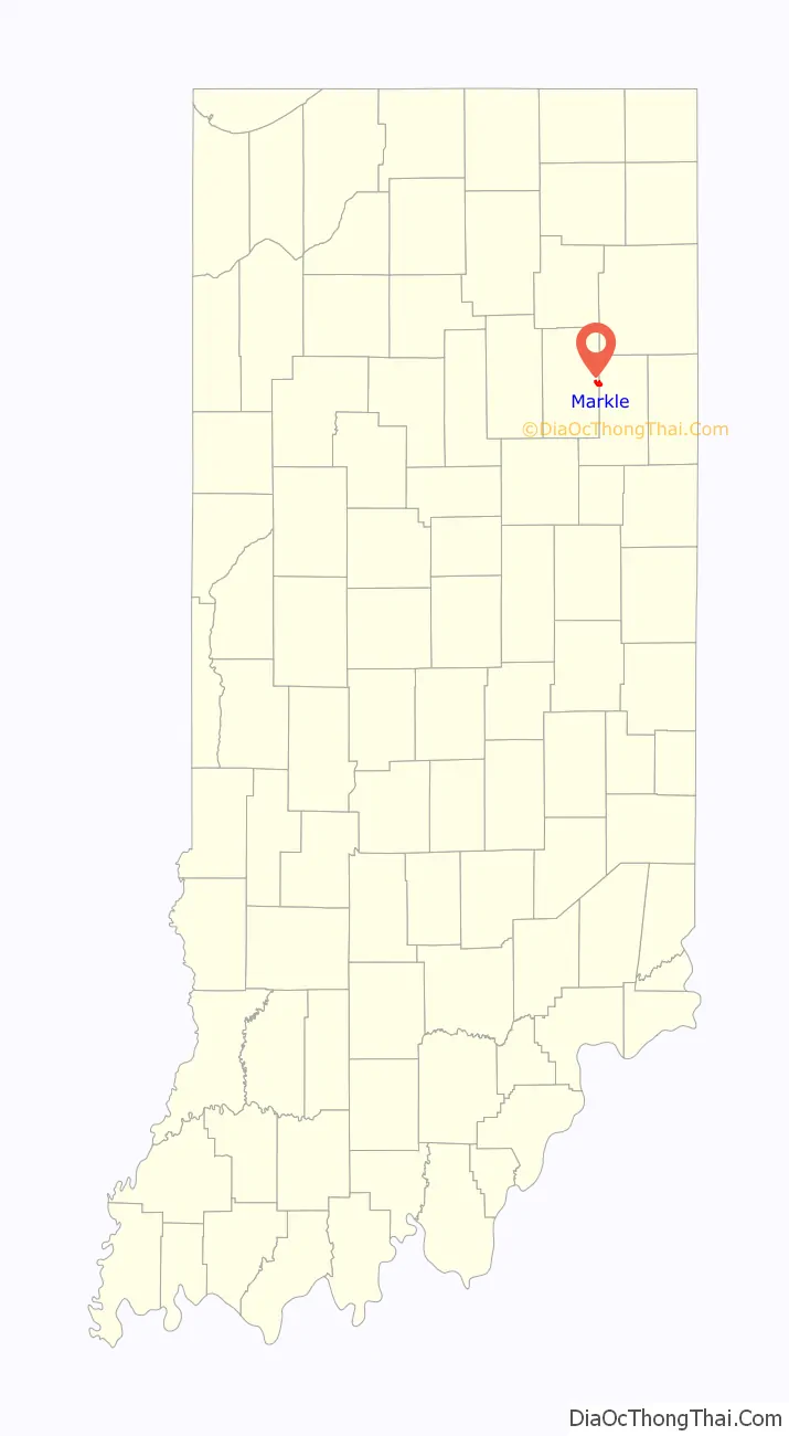
| County: | Huntington County, Wells County |
| Elevation: | 810 ft (247 m) |
| Total Area: | 1.43 sq mi (3.69 km²) |
| Land Area: | 1.37 sq mi (3.56 km²) |
| Water Area: | 0.05 sq mi (0.14 km²) |
| Total Population: | 1,071 |
| Population Density: | 780.04/sq mi (301.16/km²) |
| ZIP code: | 46770 |
| Area code: | 260 |
| FIPS code: | 1847160 |
| GNISfeature ID: | 438624 |
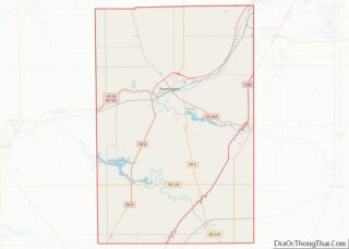
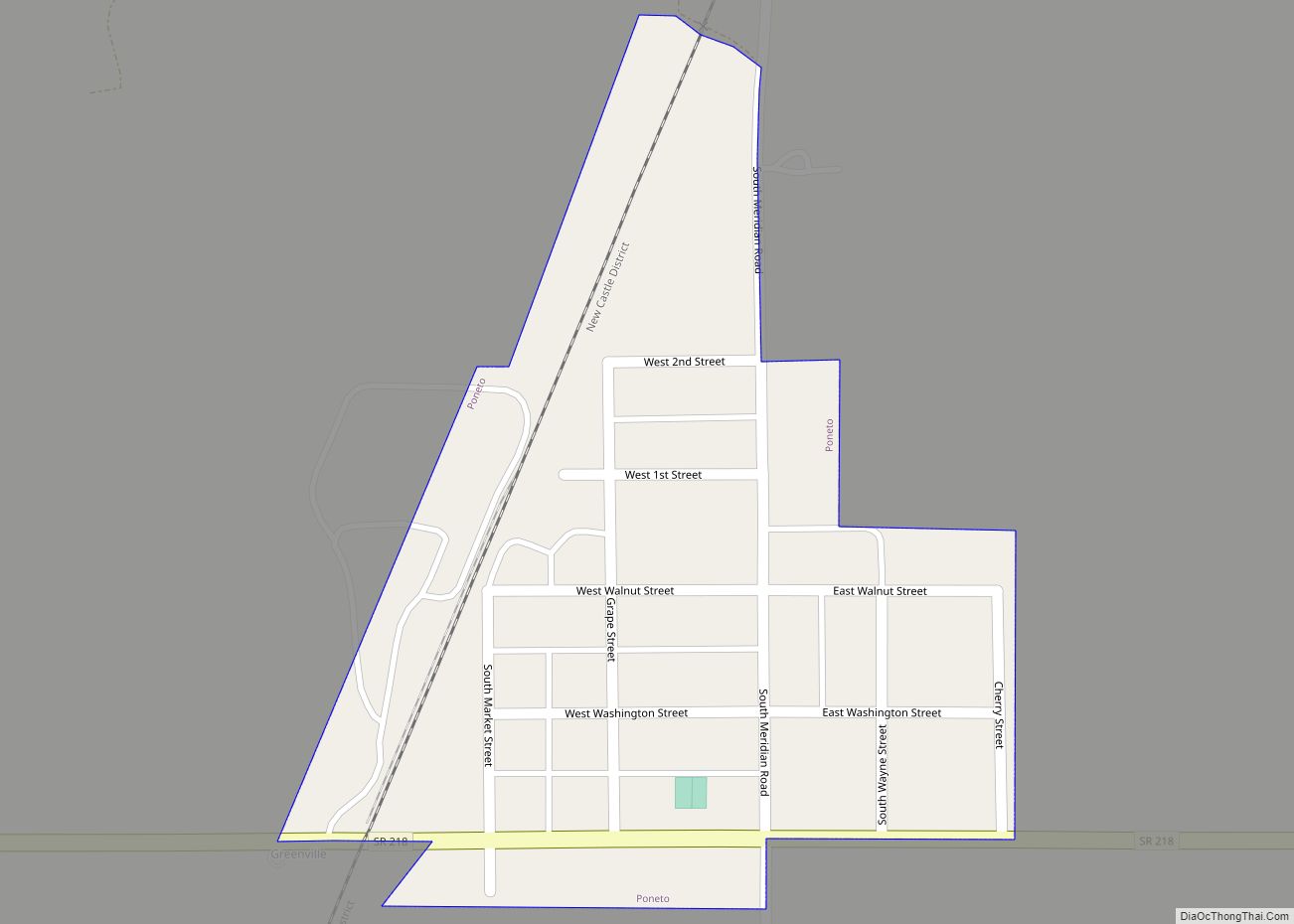
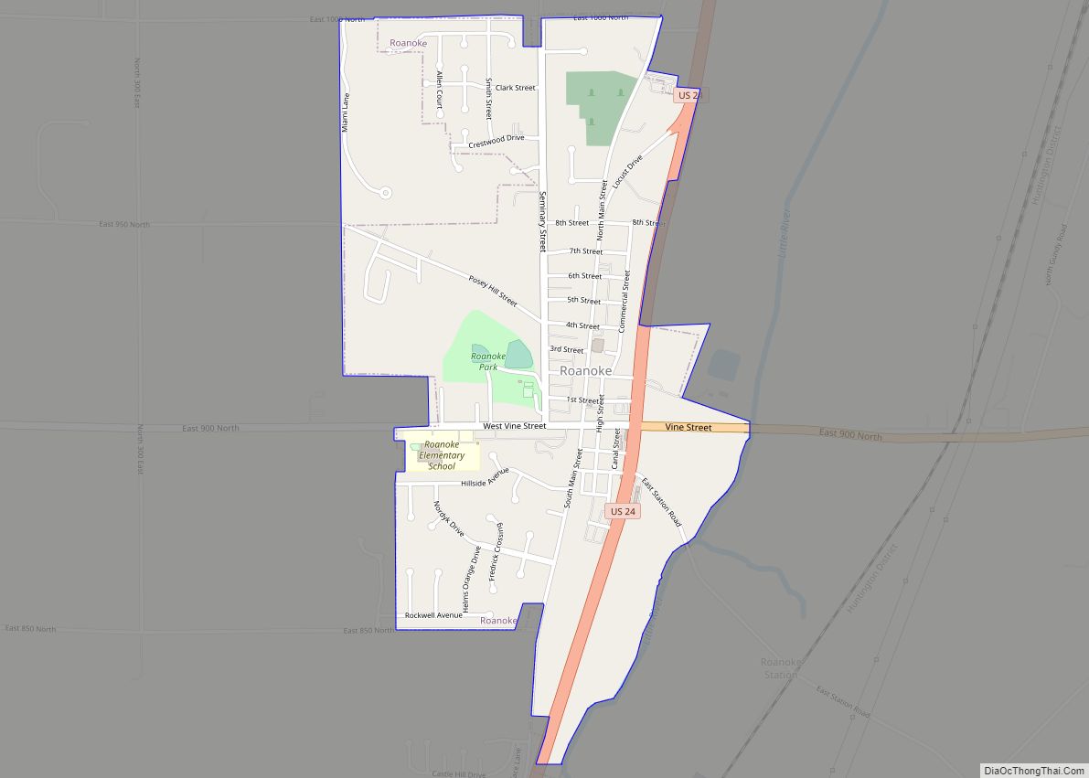
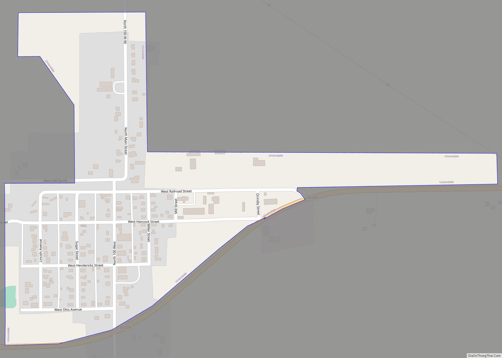
Online Interactive Map
Click on ![]() to view map in "full screen" mode.
to view map in "full screen" mode.
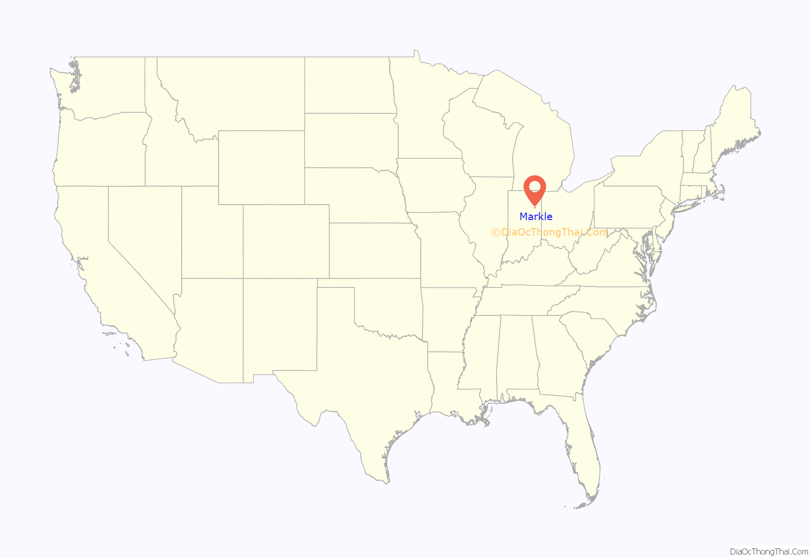
Markle location map. Where is Markle town?
History
Markle was laid out in 1836, but did not prosper until the railroad was extended to that point some time later.
The Markle post office has been in operation since 1852.
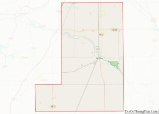
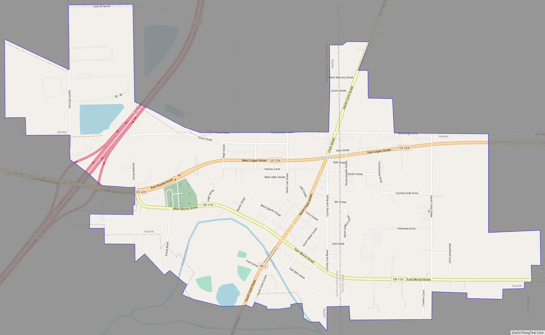
Markle Road Map
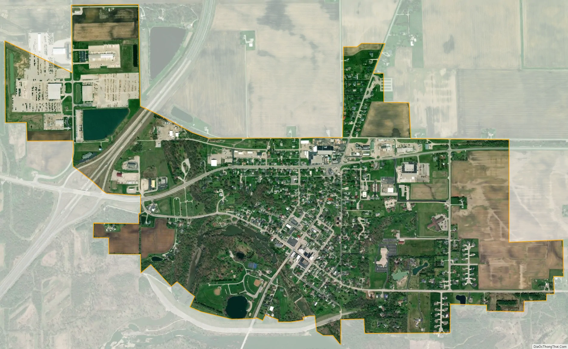
Markle city Satellite Map
Geography
Markle is located at 40°49′35″N 85°20′17″W / 40.82639°N 85.33806°W / 40.82639; -85.33806 (40.826477, -85.338076). The Wabash River flows through the south edge of the town.
According to the 2010 census, Markle has a total area of 1.27 square miles (3.29 km), of which 1.22 square miles (3.16 km) (or 96.06%) is land and 0.05 square miles (0.13 km) (or 3.94%) is water.
See also
Map of Indiana State and its subdivision:- Adams
- Allen
- Bartholomew
- Benton
- Blackford
- Boone
- Brown
- Carroll
- Cass
- Clark
- Clay
- Clinton
- Crawford
- Daviess
- De Kalb
- Dearborn
- Decatur
- Delaware
- Dubois
- Elkhart
- Fayette
- Floyd
- Fountain
- Franklin
- Fulton
- Gibson
- Grant
- Greene
- Hamilton
- Hancock
- Harrison
- Hendricks
- Henry
- Howard
- Huntington
- Jackson
- Jasper
- Jay
- Jefferson
- Jennings
- Johnson
- Knox
- Kosciusko
- LaGrange
- Lake
- Lake Michigan
- LaPorte
- Lawrence
- Madison
- Marion
- Marshall
- Martin
- Miami
- Monroe
- Montgomery
- Morgan
- Newton
- Noble
- Ohio
- Orange
- Owen
- Parke
- Perry
- Pike
- Porter
- Posey
- Pulaski
- Putnam
- Randolph
- Ripley
- Rush
- Saint Joseph
- Scott
- Shelby
- Spencer
- Starke
- Steuben
- Sullivan
- Switzerland
- Tippecanoe
- Tipton
- Union
- Vanderburgh
- Vermillion
- Vigo
- Wabash
- Warren
- Warrick
- Washington
- Wayne
- Wells
- White
- Whitley
- Alabama
- Alaska
- Arizona
- Arkansas
- California
- Colorado
- Connecticut
- Delaware
- District of Columbia
- Florida
- Georgia
- Hawaii
- Idaho
- Illinois
- Indiana
- Iowa
- Kansas
- Kentucky
- Louisiana
- Maine
- Maryland
- Massachusetts
- Michigan
- Minnesota
- Mississippi
- Missouri
- Montana
- Nebraska
- Nevada
- New Hampshire
- New Jersey
- New Mexico
- New York
- North Carolina
- North Dakota
- Ohio
- Oklahoma
- Oregon
- Pennsylvania
- Rhode Island
- South Carolina
- South Dakota
- Tennessee
- Texas
- Utah
- Vermont
- Virginia
- Washington
- West Virginia
- Wisconsin
- Wyoming