Wilkes-Barre (/ˈwɪlksbɛər/ WILKS-bair or /-bɛəri/ -bair-ee) is a city in and the county seat of Luzerne County, Pennsylvania, United States. Located at the center of the Wyoming Valley in Northeastern Pennsylvania, it had a population of 44,328 in the 2020 census. It is the second-largest city, after Scranton, in the Scranton–Wilkes-Barre–Hazleton, PA Metropolitan Statistical Area, which had a population of 567,559 as of the 2020 census, making it the fifth-largest metropolitan area in Pennsylvania (after the Delaware Valley, Greater Pittsburgh, the Lehigh Valley, and Greater Harrisburg).
Wilkes-Barre and the surrounding Wyoming Valley are framed by the Pocono Mountains to the east, the Endless Mountains to the north and west, and the Lehigh Valley to the south. The Susquehanna River flows through the center of the valley and defines the northwestern border of the city.
Wilkes-Barre was founded in 1769, incorporated as a borough in 1806, and formally re-incorporated as a city in 1869. The city grew rapidly in the 19th century after the discovery of nearby coal reserves and the arrival of hundreds of thousands of immigrants who provided a labor force for the local mines. The coal mining fueled industrialization in the city, which reached the height of its prosperity in the first half of the 20th century. Its population peaked at more than 86,000 in 1930. Following World War II, the city’s economy declined due to the collapse of industry. The Knox Mine disaster accelerated this trend after large portions of the area’s coal mines were flooded and could not be reopened. Today, the city has around half of its peak population of the 1930s, making it the largest city in Luzerne County and the 13th-largest city in Pennsylvania. The contiguous network of 5 cities and more than 40 boroughs all built in a straight line in Northeastern Pennsylvania’s urban area act culturally and logistically as one continuous city, so while the city of Wilkes-Barre itself is a smaller town, the larger unofficial city of Scranton/Wilkes-Barre contains nearly half a million residents in roughly 200 square miles.
Wilkes-Barre is located approximately 63 miles (101 km) northwest of Allentown, and 113 miles (182 km) northwest of Philadelphia.
| Name: | Wilkes-Barre city |
|---|---|
| LSAD Code: | 25 |
| LSAD Description: | city (suffix) |
| State: | Pennsylvania |
| County: | Luzerne County |
| Founded: | 1769 |
| Incorporated: | 1806: Borough |
| Elevation: | 525 ft (160 m) |
| Land Area: | 6.85 sq mi (17.74 km²) |
| Water Area: | 0.35 sq mi (0.90 km²) |
| Population Density: | 6,473.13/sq mi (2,499.19/km²) |
| Area code: | 570 and 272 |
| FIPS code: | 4285152 |
| Website: | www.wilkes-barre.city |
Online Interactive Map
Click on ![]() to view map in "full screen" mode.
to view map in "full screen" mode.
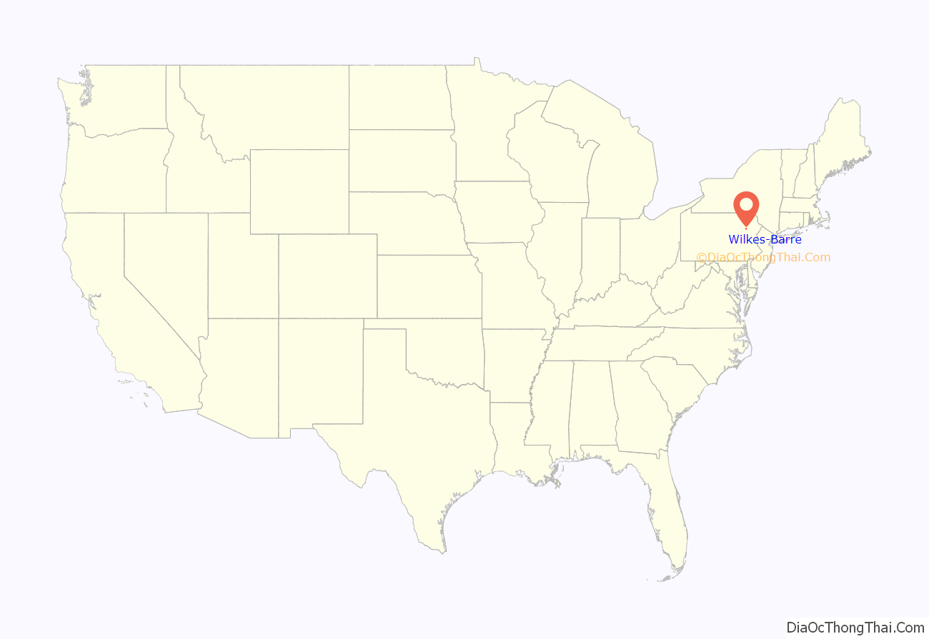
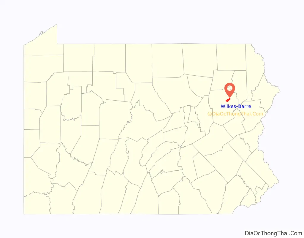
Wilkes-Barre location map. Where is Wilkes-Barre city?
History
18th century
By the 18th century, the Wyoming Valley was inhabited by the Shawnee and Lenape, also known as Delaware Indian tribes. In 1753, the Susquehanna Company was founded in Connecticut for settling the Wyoming Valley (in modern-day Pennsylvania). Connecticut succeeded in purchasing the land from the Native Americans; however, Pennsylvania already claimed the very same territory through a purchase they made in 1736. In 1762, roughly two hundred Connecticut settlers (Yankees) established a settlement near Mill Creek. They planted wheat and constructed log cabins. The Yankees returned to New England for the winter.
The Connecticut settlers returned in the spring of 1763 with their families and additional supplies. A party of Iroquois also visited the area with the dual purpose of turning the Delaware (Lenape) against the colonists and killing Teedyuscung, a local Delaware chief. On April 19, 1763, the residence of the chief, along with several others, was set ablaze. Chief Teedyuscung perished in the inferno. The Iroquois let the Delaware believe that this atrocity was committed by the settlers. As a result, the Delaware attacked the colonists on October 15, 1763. Thirty settlers were killed, and several others were taken prisoner. Those who managed to escape fled back to New England. The Delaware then burned what was left of the Yankee settlement.
In 1769, the Yankees returned to the Wyoming Valley. Five townships were established by Connecticut. Each one was five square miles and divided amongst forty settlers. Wilkes-Barre Township was one of the original townships; it was named in honor of John Wilkes and Isaac Barré—two British members of Parliament who supported colonial America. Pennsylvanians (Pennamites) also arrived in the valley that same year.
The Connecticut settlers established Fort Durkee, which was named in honor of their leader (Colonel Durkee). This was immediately followed by a series of skirmishes between the Pennsylvanians and Connecticut settlers. The land changed hands several times between the two groups. The Congress of the Confederation was asked to resolve the matter. With the Decree of Trenton, on December 30, 1782, the confederation government officially decided that the region belonged to Pennsylvania; the Wyoming Valley became part of Northumberland County.
Pennsylvania ruled that the Connecticut settlers (Yankees) were not citizens of the Commonwealth. Therefore, they could not vote and were ordered to give up their property claims. In May 1784, armed men from Pennsylvania force-marched the Connecticut settlers away from the valley. By November, the Yankees returned with a greater force. They captured and destroyed Fort Dickinson in Wilkes-Barre. With that victory, a new state (which was separate from both Connecticut and Pennsylvania) was proposed. The new state was to be named Westmoreland. To ensure that they didn’t lose the land, the Commonwealth of Pennsylvania worked out a compromise with the Connecticut (Yankee) settlers. The Yankee settlers would become citizens of Pennsylvania and their property claims would be restored (prior to the Decree of Trenton). As part of the compromise, Pennsylvania would establish a new county in Northeastern Pennsylvania. The Yankees agreed to the terms.
On September 25, 1786, the Pennsylvania General Assembly passed a resolution which created Luzerne County. It was formed from a section of Northumberland County and named after Chevalier de la Luzerne, a French soldier and diplomat during the 18th century. Wilkes-Barre became the seat of government for the new territory. This resolution ended the idea of creating a new state.
In 1797, several decades after the community’s founding, Louis Philippe, later the King of France from 1830 to 1840, stayed in Wilkes-Barre while traveling to the French Asylum settlement.
19th century
Wilkes-Barre’s population skyrocketed due to the discovery of anthracite coal in the 19th century. In 1808, Judge Jesse Fell of Wilkes-Barre discovered a solution to ignite anthracite with the usage of an iron grate; it allowed for the coal to light and burn more easily. This invention increased the popularity of anthracite as a fuel source. This led to the expansion of the coal industry in Northeastern Pennsylvania; Wilkes-Barre was nicknamed “The Diamond City” due to its high productivity of mining coal. The growing demand for coal as a domestic heat source resulted in changes to patterns of immigration to Wilkes-Barre in the 19th century. The Pennsylvania guide, compiled by the Writers’ Program of the Works Progress Administration in 1940, noted that:
Throughout the 1800s, canals and railroads were constructed to aid in the mining and transportation of coal. Hundreds of thousands of immigrants flocked to the city; they were seeking jobs in the numerous mines and collieries that sprang up throughout the region. In 1806, Wilkes-Barre Borough was formed from a segment of Wilkes-Barre Township; it was later incorporated as a city in 1871. This was the direct result of the population boom. At its peak, Wilkes-Barre had a population of over 86,000 in the 1930s and 40s.
New industries were established and the Vulcan Iron Works was a well-known manufacturer of railway locomotives from 1849 to 1954. During Wilkes-Barre’s reign as an industrial and economic force in America, several major companies and franchises became based in the city, such as Woolworth’s, Sterling Hotels, Miner’s Bank, Bell Telephone, Luzerne National Bank, and Stegmaier.
Even though the overall economy was doing very well, the city was still prone to natural disasters. Besides frequent flooding from the Susquehanna River, Wilkes-Barre also endured a devastating F3 tornado on August 19, 1890. The twister killed 16 people, injured 50, damaged or destroyed 260 buildings, and cost at least $240,000 (in 1890 money).
20th century
Wilkes-Barre is located within Pennsylvania’s Coal Region. The anthracite coal mining industry, and its extensive use of child labor in the early 20th century, was one of the industries targeted by the National Child Labor Committee and its hired photographer, Lewis Hine. Many of Hine’s subjects were photographed in the mines and coal fields near Wilkes-Barre. The impact of the Hine photographs led to the enactment of child labor laws across the country.
The coal industry continued despite several disasters, including an explosion at Wilkes-Barre’s Baltimore Colliery in 1919, which killed 92 miners. The industry declined when the United States switched to other energy sources, and most coal operations had left Wilkes-Barre by the end of World War II. The 1959 Knox Mine Disaster, resulting in the flooding of numerous mines, marked the end of large-scale coal mining in the area. Industrial restructuring also caused the city to lose jobs and begin a decades-long decline.
In 1926, Planters Peanuts Company was founded in Wilkes-Barre by two Italian immigrants. The company maintained its headquarters in the city until 1961. In 1929, baseball player Babe Ruth hit one of the longest home runs in history at Artillery Park in Wilkes-Barre.
On November 8, 1972, Wilkes-Barre became the birthplace of modern cable television programming, when Home Box Office (HBO) launched over the city’s Teleservice Cable system (now Service Electric Cable). Around 365 Teleservice subscribers were the first to receive the premium cable service when it commenced broadcasts. (As local ordinances prohibiting direct-to-cable telecasts of theatrical feature films prevented Time-Life from launching HBO over its New York City-based Sterling Manhattan cable franchise, the company initially sought an agreement with Teleservice to launch it on the provider’s Allentown system; possible television blackout conflicts for HBO-televised NBA games, as Allentown was located within the Philadelphia 76ers’s 75-mile [121 km] blackout radius, resulted in Teleservice electing to offer it on its Wilkes-Barre system instead.)
Wilkes-Barre became the site of a mass shooting on September 25, 1982. George Emil Banks killed 13 people and wounded one. Banks was deemed incompetent to be executed, yet currently resides on death row.
Manufacturing and retail remained Wilkes-Barre’s strongest industries, but the city’s economy took a major blow from Tropical Storm Agnes in 1972. The storm pushed the Susquehanna River to a height of nearly 41 feet (12 m), four feet above the city’s levees, flooding downtown with nine feet of water. A total of 128 deaths were attributed to the storm. Most drowning deaths were caused by people trapped in their cars. Almost 400,000 homes and businesses were destroyed and 220,000 Pennsylvanians were left homeless (as were hundreds of thousands in other states). Damage was estimated to be $2.1 billion in Pennsylvania alone. President Richard Nixon sent aid to the area, after flying over in his helicopter on his way to his Camp David retreat (on June 24, 1972).
Throughout the 1970s and 1980s, Wilkes-Barre attempted to prevent the damage from storms as intense as Agnes by building a levee system that rises 41 feet (12 m); completed in January 2003, the network of levees cost roughly $250 million. It has successfully resisted other threatening floods in 1996, 2004, and 2006. The Army Corps of Engineers has praised the quality of the levees. In 2006, the city made the front page of national newspapers when 200,000 residents were told to evacuate in the wake of flooding that was forecast to reach levels near that of 1972, though the flooding fell short of predictions.
In late August 2011, Hurricane Irene, centered off the New Jersey coast, caused the Susquehanna River to rise to flood level, but there was no cause for alarm. Then, from September 6 to 8, heavy rains from the inland remnants of Tropical Storm Lee and Hurricane Katia offshore funneled heavy rain over the Wyoming Valley and into the Susquehanna River watershed. The Susquehanna swelled to record levels across the state. In Wilkes-Barre, it crested on September 9 at an all-time record of 42.66 feet (13 m), nearly 2 feet (0.6 m) higher than water levels reached during Hurricane Agnes in 1972. The levees protected Wilkes-Barre, but nearby boroughs did not escape, as West Pittston, Plymouth, and parts of Plains Township were affected by extreme flooding.
21st century
On June 9, 2005, Mayor Thomas M. Leighton unveiled his “I believe…” campaign for Wilkes-Barre, which was intended to boost the city’s spirits. Construction began on a planned downtown theatre complex, which had a grand opening on June 30, 2006. Renovation of the landmark Hotel Sterling was being pursued by CityVest, a nonprofit developer. The expansion of Wilkes University and King’s College took place. Also, the canopy and matching street lights in Public Square and across downtown were removed; they were replaced by new green lampposts.
The city of Wilkes-Barre celebrated its 200th anniversary in 2006. Several events, including a Beach Boys concert, were planned but canceled due to extremely heavy rains. Most of the city’s population was ordered to evacuate on June 28, 2006, and the Bicentennial celebration was postponed to Labor Day weekend.
The Riverfront revitalization project (River Common), broke ground in 2007 and was completed in early 2010. It has made the riverfront accessible to the public. The area also has a new amphitheater for live performances and improved access through ramps and sidewalks. Fountains and color-changing lights have been added underneath two bridges which carry pedestrian traffic across the normally-open levee. The project stretches approximately four blocks from the Luzerne County Courthouse to the intersection of South River Street and West South Street. The River Common has since hosted concerts and charity events.
Since completion of the River Common, additional improvements to city infrastructure have been progressing. New crosswalks have been installed downtown, including signage emphasizing that pedestrians have the right-of-way. The completion of the James F. Conahan Intermodal Transportation Facility has added parking and relocated Luzerne County buses from their former Public Square staging sites. This has reduced traffic congestion around the square. Private carrier Martz offers coach bus service from the terminal as well.
The widening and realignment of Coal Street, a major road connecting Wilkes-Barre City with Wilkes-Barre Township, was completed in 2012. The new Coal Street provides four lanes over the original two lanes, making travel between the highly commercial Wilkes-Barre Township and the city much easier. In 2013, Hotel Sterling was demolished due to flood damage in the hotel’s basement (which compromised the building’s integrity). As of today, several buildings are in the process of being constructed on the site of the former hotel.
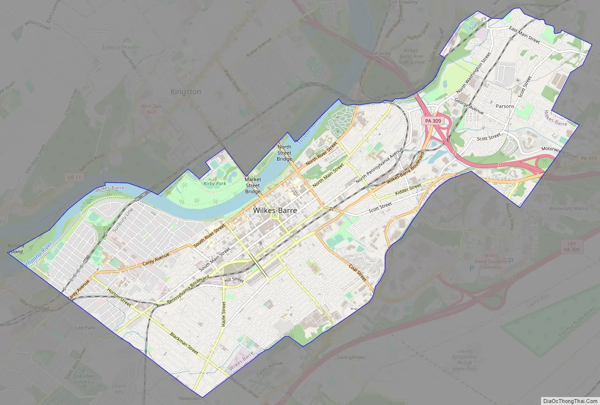
Wilkes-Barre Road Map
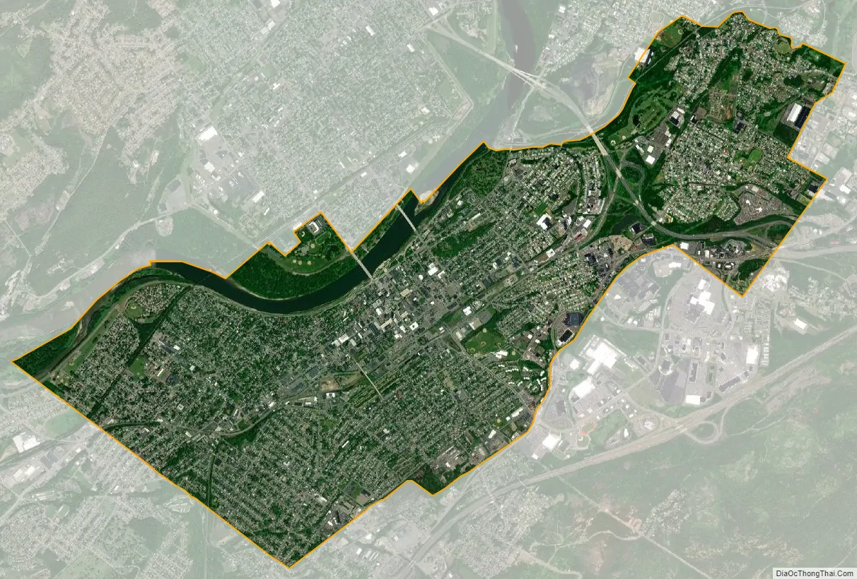
Wilkes-Barre city Satellite Map
Geography
According to the U.S. Census Bureau, the city has a total area of 7.2 square miles (19 km), of which 6.8 square miles (18 km) is land and 0.3 square miles (0.78 km), or 4.60%, is water. The city is bordered by the Susquehanna River to the west. Most of Downtown is located on a wide floodplain. Floodwalls were constructed to protect a large percentage of the city. The elevation of the downtown area is about 550 feet (170 m) above sea level. As you travel inland, away from the river, the elevation rises. Wilkes-Barre Mountain is a physical barrier southeast of the city.
Neighborhoods
Wilkes-Barre houses over one dozen neighborhoods:
- Central City: It is also referred to as “Downtown.” This section of the city is located between the Susquehanna River and Wilkes-Barre Boulevard, and between South and North Streets. It is the original foundation of Wilkes-Barre (the 16 blocks claimed by the Connecticut settlers who founded the city). The neighborhood is home to most of the city’s high-rises and its one Public Square. Throughout the city’s history, the area has remained a hub for all of Luzerne County. During the city’s boom, this small area was home to the headquarters of more than 100 national corporations. Today, it still houses the NEPA Headquarters for Verizon, Citizen’s Bank, Blue Cross, PNC Bank, Luzerne National Bank, Guard Insurance, and a number of other companies. Thousands of people live and/or work in Downtown Wilkes-Barre every day.
- North End: This is the area northeast of Downtown. It comprises a number of urban and suburban communities. North End is renowned for its architecture.
- Parsons: This neighborhood is also northeast of Downtown. This is a quiet part of the city (with a suburban atmosphere). It includes two city parks, a golf course, and a number of factories.
- Miners’ Mills: This community was named after a prominent local family (who lived in the area). Miners’ Mills is the last neighborhood on the northeastern border of the city.
- East End: This neighborhood is directly east of Downtown. East End, Heights, and Mayflower are fairly new areas compared to the rest of the city, having only been developed in the 20th century. Old pictures of the Stegmaier Building indicate that everything east of Downtown was undeveloped until the 1900s.
- Heights: This section of the city is located southeast of Downtown. It is centered between East End and Mayflower.
- Mayflower: This area is located south of Downtown. It was once home to numerous mansions owned by various “bigwigs.” Today it houses the OKT, Lincoln Plaza, and Park Avenue residential housing communities. The best view of Downtown can be seen from the high streets of Mayflower.
- South Wilkes-Barre: This neighborhood is located directly southwest of Downtown. It was home to the national headquarters of Planter’s Peanuts and the Bell Telephone Company (in the 20th century). One of the tallest churches in Luzerne County, St. Nicholas Roman Catholic Church, dominates the south end skyline (standing at nearly 200 feet).
- Goose Island: This area is located in the southwestern section of the city between South Wilkes-Barre and Rolling Mill Hill.
- Rolling Mill Hill: This neighborhood is also located in the southwestern part of the city.
- Iron Triangle: This is another community southwest of Downtown.
- Other neighborhoods and sub-neighborhoods: There are other smaller neighborhoods and sub-neighborhoods in Wilkes-Barre City (e.g., Brookside, Upper Miners’ Mills, Lower Miners’ Mills, and Barney Farms).
Adjacent municipalities
- Wilkes-Barre Township (southeast)
- Plains Township (east and northeast)
- Kingston (north)
- Edwardsville (northwest)
- Larksville (west)
- Hanover Township (southwest)
- Bear Creek Township (southwest)
Climate
Under the Köppen climate classification, Wilkes-Barre falls within either a hot-summer humid continental climate (Dfa) if the 0 °C (32 °F) isotherm is used or a humid subtropical climate (Cfa) if the −3 °C (27 °F) isotherm is used. Summers are hot and winters are moderately cold with wide variations in temperature. Winters are cold with a January average of 28.0 °F (−2.2 °C). The surrounding mountains have an influence on the climate (including both precipitation and temperatures), leading to wide variations within a short distance. On average, temperatures below 0 °F (−17.8 °C) are infrequent, occurring 2.5 days per year, and there are 34.9 days where the maximum temperature remains below 32 °F (0.0 °C). The average annual snowfall is 45.1 inches (115 cm) during the winter (in which severe snowstorms are rare). However, when snowstorms do occur, they can disrupt normal routines for several days.
Summers are warm with a July average of 73.7 °F (23.2 °C). In an average summer, temperatures exceeding 90 °F (32.2 °C) occur on 11.7 days and but rarely exceed 100 °F (37.8 °C). Spring and fall are unpredictable with temperatures ranging from cold to warm (although they are usually mild). On average, Wilkes-Barre receives 38.72 inches (983 mm) of precipitation each year, which is relatively evenly distributed throughout the year (though the summer months receive more precipitation). Extreme temperatures range from −21 °F (−29.4 °C) on January 21, 1994, to 103 °F (39.4 °C) on July 9, 1936. Wilkes-Barre averages 2,303 hours of sunshine per year, ranging from a low of 96 hours in December (or 33% of possible sunshine) to 286 hours in July (or 62% of possible sunshine).
See also
Map of Pennsylvania State and its subdivision:- Adams
- Allegheny
- Armstrong
- Beaver
- Bedford
- Berks
- Blair
- Bradford
- Bucks
- Butler
- Cambria
- Cameron
- Carbon
- Centre
- Chester
- Clarion
- Clearfield
- Clinton
- Columbia
- Crawford
- Cumberland
- Dauphin
- Delaware
- Elk
- Erie
- Fayette
- Forest
- Franklin
- Fulton
- Greene
- Huntingdon
- Indiana
- Jefferson
- Juniata
- Lackawanna
- Lancaster
- Lawrence
- Lebanon
- Lehigh
- Luzerne
- Lycoming
- Mc Kean
- Mercer
- Mifflin
- Monroe
- Montgomery
- Montour
- Northampton
- Northumberland
- Perry
- Philadelphia
- Pike
- Potter
- Schuylkill
- Snyder
- Somerset
- Sullivan
- Susquehanna
- Tioga
- Union
- Venango
- Warren
- Washington
- Wayne
- Westmoreland
- Wyoming
- York
- Alabama
- Alaska
- Arizona
- Arkansas
- California
- Colorado
- Connecticut
- Delaware
- District of Columbia
- Florida
- Georgia
- Hawaii
- Idaho
- Illinois
- Indiana
- Iowa
- Kansas
- Kentucky
- Louisiana
- Maine
- Maryland
- Massachusetts
- Michigan
- Minnesota
- Mississippi
- Missouri
- Montana
- Nebraska
- Nevada
- New Hampshire
- New Jersey
- New Mexico
- New York
- North Carolina
- North Dakota
- Ohio
- Oklahoma
- Oregon
- Pennsylvania
- Rhode Island
- South Carolina
- South Dakota
- Tennessee
- Texas
- Utah
- Vermont
- Virginia
- Washington
- West Virginia
- Wisconsin
- Wyoming


