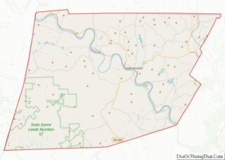
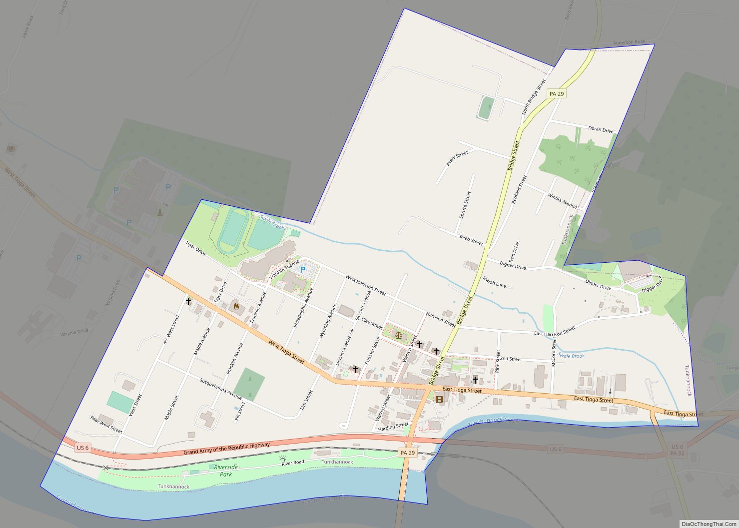
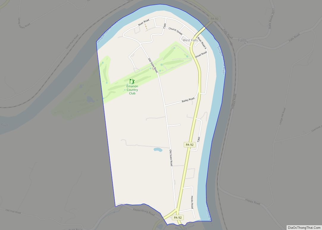
Tunkhannock is a borough in Wyoming County, Pennsylvania, 31 miles (50 km) northwest of Wilkes-Barre. In the past, lumbering was carried on extensively. Today, many residents are employed by the Procter & Gamble plant in nearby Washington Township. As of the 2020 census, the borough population was 1,766. It is the county seat of Wyoming County. Tunkhannock is in the Scranton–Wilkes-Barre–Hazleton, PA Metropolitan Statistical Area.
The name Tunkhannock is derived from the Minsi-Len’api term Ptuk’hanna’unk, which means “Bend-in-river-place,” especially to the town’s west, upstream at the radical bend called “The Neck.” Modern Tunkhannock, Wyoming County, The Tunkhannock Historic District, bounded by Tioga, Pine, and Harrison Streets, and Wyoming Avenue, were added to the National Register of Historic Places in August 2005.
Tunkhannock is 88 miles (142 km) northwest of Allentown and 141.7 miles (228.0 km) northwest of New York City.
| Name: | Tunkhannock borough |
|---|---|
| LSAD Code: | 21 |
| LSAD Description: | borough (suffix) |
| State: | Pennsylvania |
| County: | Wyoming County |
| Founded: | 1841 |
| Elevation: | 692 ft (211 m) |
| Total Area: | 0.94 sq mi (2.45 km²) |
| Land Area: | 0.89 sq mi (2.30 km²) |
| Water Area: | 0.06 sq mi (0.14 km²) |
| Total Population: | 1,766 |
| Population Density: | 1,908.89/sq mi (737.27/km²) |
| ZIP code: | 18657 |
| Area code: | 570 |
| FIPS code: | 4277784 |
Online Interactive Map
Click on ![]() to view map in "full screen" mode.
to view map in "full screen" mode.
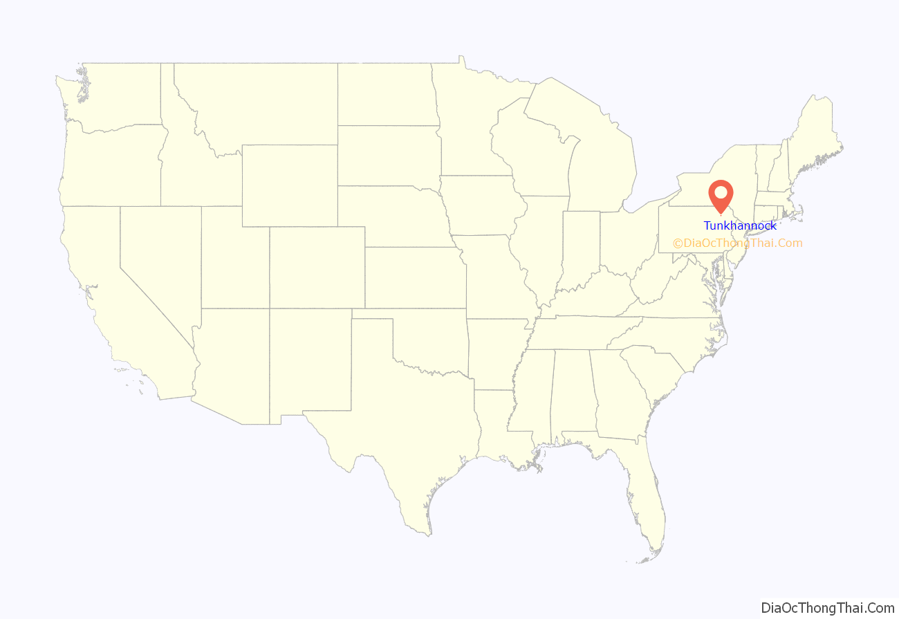
Tunkhannock location map. Where is Tunkhannock borough?
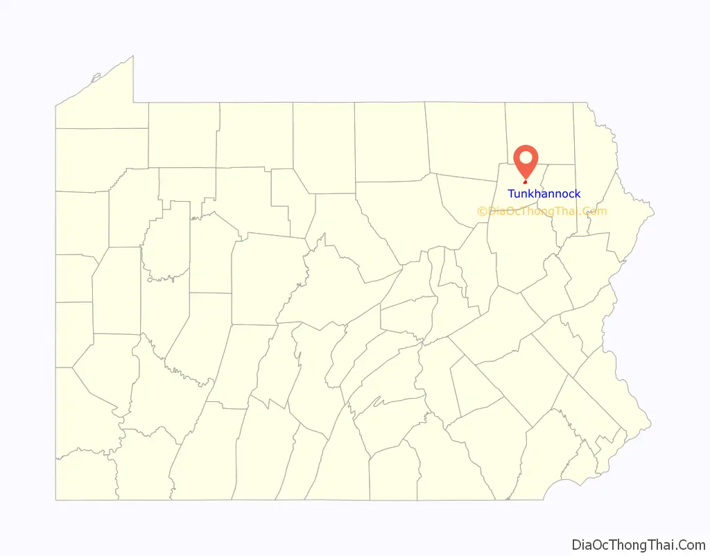
Tunkhannock Road Map
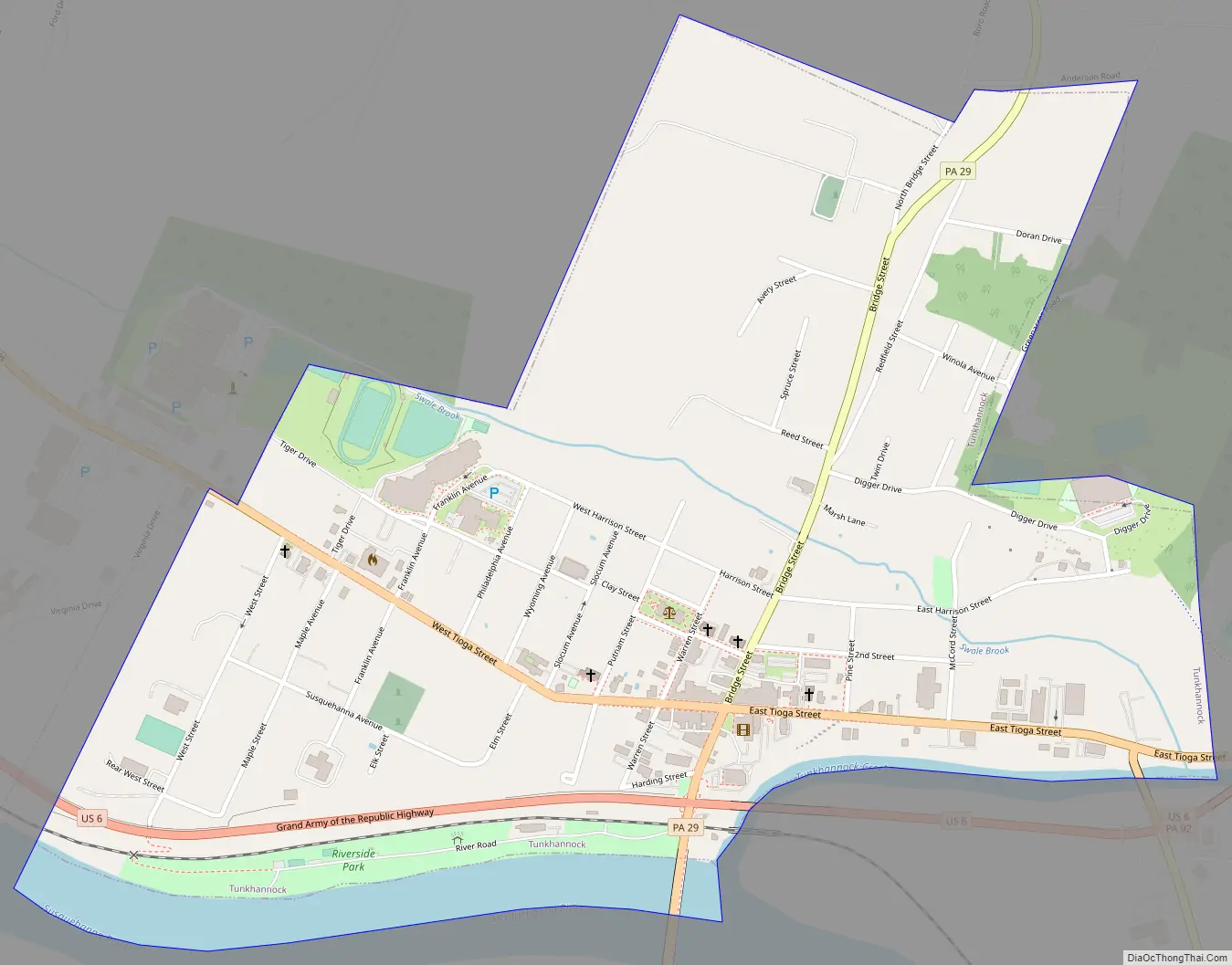
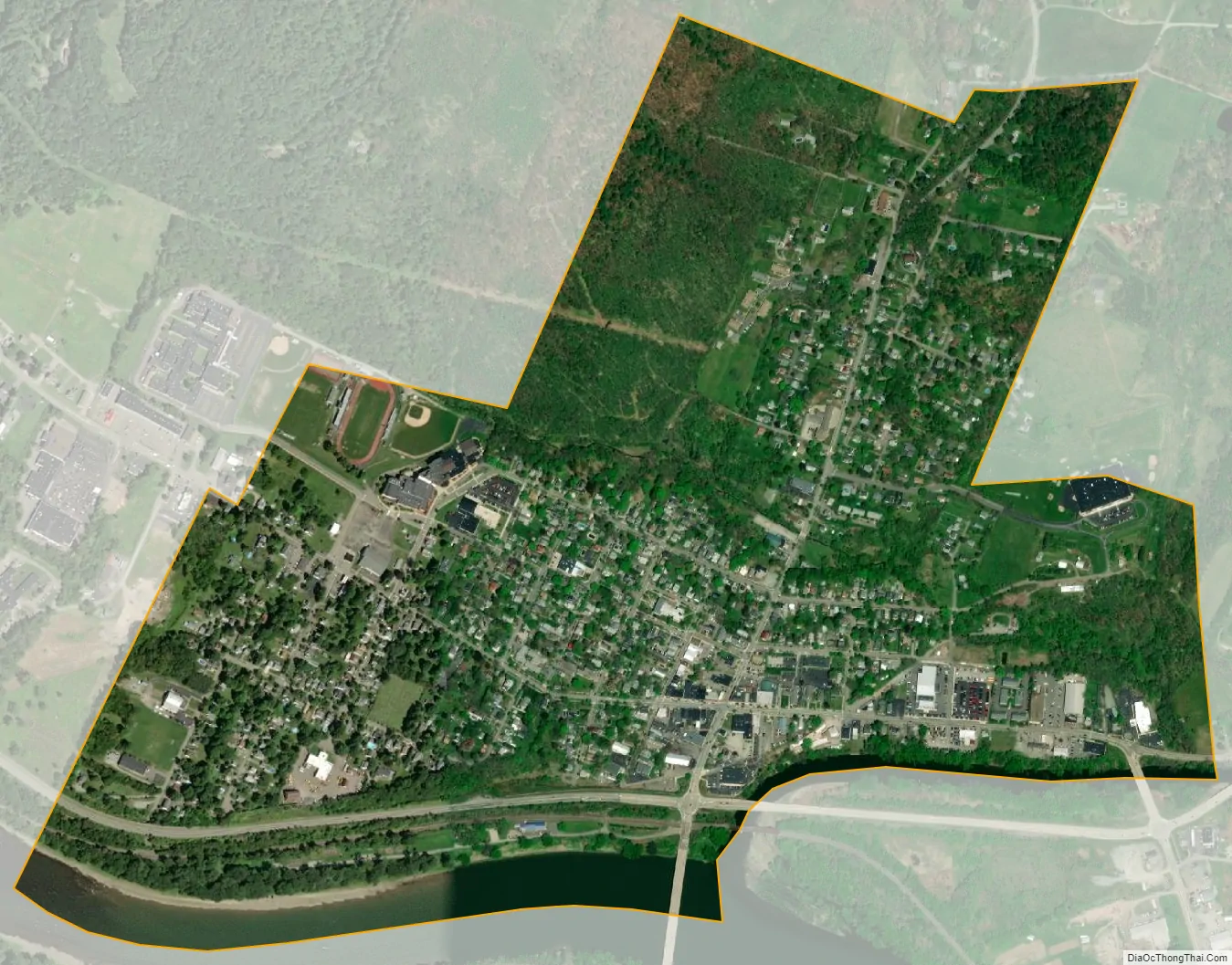
Tunkhannock city Satellite Map
Geography
Tunkhannock is located at 41°32′27″N 75°56′52″W / 41.54083°N 75.94778°W / 41.54083; -75.94778 (41.540836, -75.947703).
According to the U.S. Census Bureau, the borough has a total area of 0.9 square mile (2.3 km), all land.
See also
Map of Pennsylvania State and its subdivision:- Adams
- Allegheny
- Armstrong
- Beaver
- Bedford
- Berks
- Blair
- Bradford
- Bucks
- Butler
- Cambria
- Cameron
- Carbon
- Centre
- Chester
- Clarion
- Clearfield
- Clinton
- Columbia
- Crawford
- Cumberland
- Dauphin
- Delaware
- Elk
- Erie
- Fayette
- Forest
- Franklin
- Fulton
- Greene
- Huntingdon
- Indiana
- Jefferson
- Juniata
- Lackawanna
- Lancaster
- Lawrence
- Lebanon
- Lehigh
- Luzerne
- Lycoming
- Mc Kean
- Mercer
- Mifflin
- Monroe
- Montgomery
- Montour
- Northampton
- Northumberland
- Perry
- Philadelphia
- Pike
- Potter
- Schuylkill
- Snyder
- Somerset
- Sullivan
- Susquehanna
- Tioga
- Union
- Venango
- Warren
- Washington
- Wayne
- Westmoreland
- Wyoming
- York
- Alabama
- Alaska
- Arizona
- Arkansas
- California
- Colorado
- Connecticut
- Delaware
- District of Columbia
- Florida
- Georgia
- Hawaii
- Idaho
- Illinois
- Indiana
- Iowa
- Kansas
- Kentucky
- Louisiana
- Maine
- Maryland
- Massachusetts
- Michigan
- Minnesota
- Mississippi
- Missouri
- Montana
- Nebraska
- Nevada
- New Hampshire
- New Jersey
- New Mexico
- New York
- North Carolina
- North Dakota
- Ohio
- Oklahoma
- Oregon
- Pennsylvania
- Rhode Island
- South Carolina
- South Dakota
- Tennessee
- Texas
- Utah
- Vermont
- Virginia
- Washington
- West Virginia
- Wisconsin
- Wyoming