Allen County (county code AL) is a county located in the southeast portion of the U.S. state of Kansas. It is 504 square miles, or 322,560 acres in size. As of the 2020 census, the population was 12,526. Its county seat and most populous city is Iola.
| Name: | Allen County |
|---|---|
| FIPS code: | 20-001 |
| State: | Kansas |
| Founded: | August 25, 1855 |
| Named for: | William Allen |
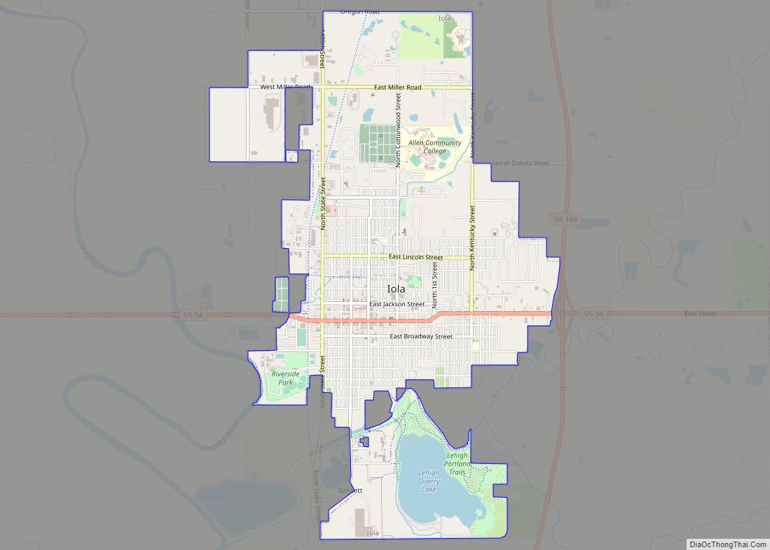
| Seat: | Iola |
| Largest city: | Iola |
| Total Area: | 505 sq mi (1,310 km²) |
| Land Area: | 500 sq mi (1,000 km²) |
| Total Population: | 12,526 |
| Population Density: | 25.1/sq mi (9.7/km²) |
| Time zone: | UTC−6 (Central) |
| Summer Time Zone (DST): | UTC−5 (CDT) |
| Website: | AllenCounty.org |
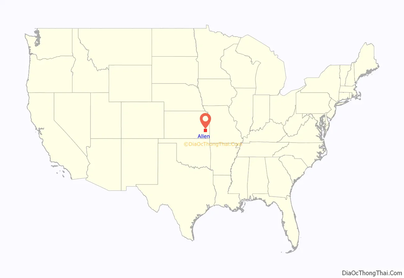
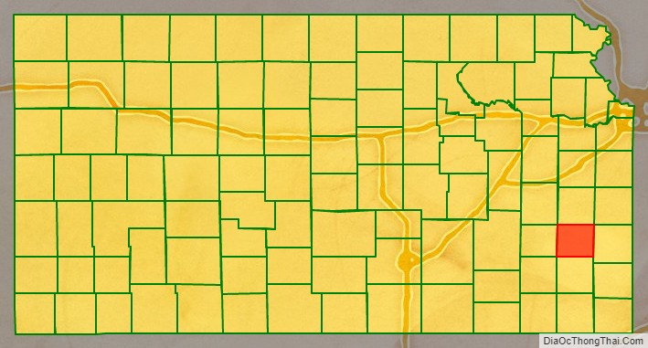
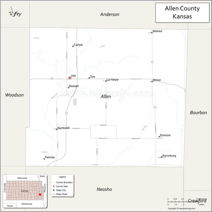
Allen County location map. Where is Allen County?
History
Early history
For many millennia, the Great Plains of North America was inhabited by nomadic Native Americans. From the 16th century to 18th century, the Kingdom of France claimed ownership of large parts of North America. In 1762, after the French and Indian War, France secretly ceded New France to Spain, per the Treaty of Fontainebleau.
19th century
In 1802, Spain returned most of the land to France, but keeping title to about 7,500 square miles. In 1803, most of the land for modern day Kansas was acquired by the United States from France as part of the 828,000 square mile Louisiana Purchase for 2.83 cents per acre.
In 1854, the Kansas Territory was organized. Allen County is one of the 33 counties established by the first territorial legislature in August 1855, six years before Kansas statehood in 1861. It was named in honor of William Allen, a United States senator from Ohio. At the time of its creation, Charles Passmore was appointed probate judge; B.W. Cowden and Barnett Owen were appointed county commissioners, and William Godfrey was appointed sheriff. The appointments were temporary until the general election in 1857. The four men were authorized to appoint the county clerk and treasurer thus completing the county organization.
Richard J. Fuqua and his family are considered the first white settlers in the county, arriving in the valley of the Neosho River January 1855. Fuqua established a post for trading with the neighboring Indian tribes which became quite popular with the Sac and Fox Indians. B.W. Cowden and H.D. Parsons arrived in March of the same year and selected claims in the valley of the Neosho River, near the mouth of Elm Creek. The next settlement was made near the mouth of Deer Creek (so named for the abundance of deer in the area) by Major James Parsons, and his two sons, Jesse and James, and a Mr. Duncan. The population grew rapidly through the spring and summer of 1855, most of it located on or near the Neosho River.
Many of the early settlers were pro-slavery, but few slaves were actually brought into the county. The anti-slavery population expressed such antipathy toward their pro-slavery neighbors that slaves within the county there were either freed or taken elsewhere in Kansas by their masters. Immigration continued during the summer and fall of 1856, though in reduced numbers.
The first town and county seat was Cofachique. In the spring of 1855 pro-slavery settlers from Fort Scott laid out the town in a hilly area east of the Neosho River and south of the mouth of Elm Creek. The territorial legislature passed an act in July 1855 incorporating the Cofachique Town Association. It was the only town in Allen County for nearly two years and as such was quite successful; but in 1857 other towns were constructed and Cofachique began to decline almost immediately. One of the reasons for decline was accessibility, the other was a lack of good well water. Another possible contribution to the town’s decline involved tensions between the pro and anti-slavery settlers. With the development of neighboring towns Humboldt and Iola the town of Cofachique all but disappeared by 1859. The county seat went briefly to Humboldt in 1857 where it remained until 1865, but with the election of that year Iola took the county seat and has retained this designation to the present.
After a series of disputes between residents in the county over where a county jail should be located, Allen County’s first jail was constructed in Iola in 1869 at a cost of $8,400. It operated until a replacement jail house was opened in 1959. Since that time the original jail has been run as a museum.
The last year of the territorial period (1860) was one of the most difficult years since the initial settlement of the county. Periods of drought beginning as early as 1854 had plagued all of Kansas and though 1859 had seen a reprieve, by the end of 1859 and into 1860 the drought worsened. The St. Laurence newspaper reported: “No rain, no snow, and much open, thawing, mild weather, alternated with sharp, though brief [cold] snaps. . . .” Most of the people who had moved to the county in the previous two years were still trying to establish their farms. With the prospect of starvation and hardship before them, many decided to return to the east.
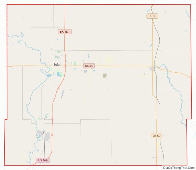
Allen County Road Map
Geography
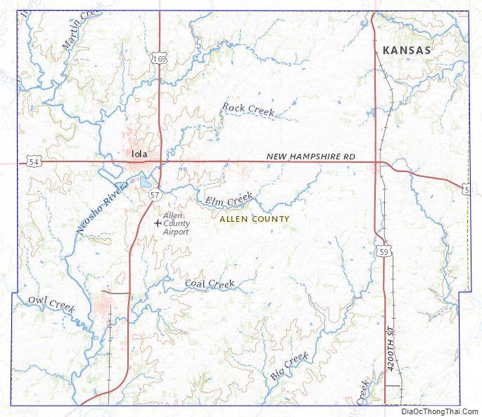
According to the U.S. Census Bureau, the county has a total area of 505 square miles (1,310 km), of which 500 square miles (1,300 km) is land and 5.0 square miles (13 km) (1.0%) is water. Allen County is located in the southeastern part of the state, in the second tier of counties west of Missouri, and about fifty miles north of Oklahoma. In extent it is twenty-one miles from north to south and twenty-four miles from east to west.
Geographic features
The general surface of the country is slightly rolling, though much more level than the greater portion of eastern Kansas. The soil is fertile and highly productive. The bottom lands along the streams average one and one-half miles in width, and comprise one-tenth the area of the county. The remainder is the gently rolling or level upland prairie. The principal varieties of trees native to the county are black walnut, hickory, cottonwood, oak, hackberry and elm.
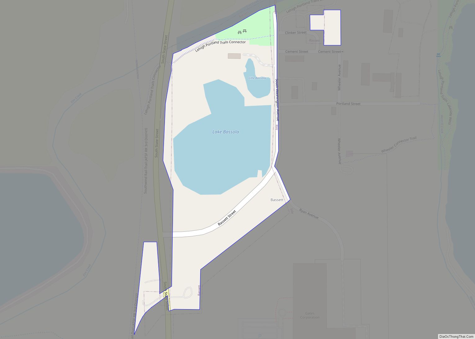
The main water course is the Neosho River, which flows through the western part of the county from north to south. Its tributaries are Indian, Martin’s, Deer, Elm, and other small creeks. The Marmaton River rises east of the center of the county, and flows through the southeastern part of the county. The Little Osage River rises not far from the head of the Marmaton and flows northeast. Its tributaries are Middle Creek on the north and the South Fork on the south.
Adjacent counties
- Anderson County (north)
- Linn County (northeast)
- Bourbon County (east)
- Neosho County (south)
- Wilson County (southwest)
- Woodson County (west)
- Coffey County (northwest)
Allen County Topographic Map
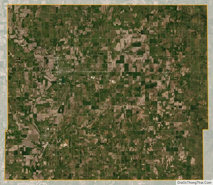
Allen County Satellite Map
Allen County Outline Map