La Harpe is a city in Allen County, Kansas, United States. As of the 2020 census, the population of the city was 480.
| Name: | La Harpe city |
|---|---|
| LSAD Code: | 25 |
| LSAD Description: | city (suffix) |
| State: | Kansas |
| County: | Allen County |
| Founded: | 1881 |
| Incorporated: | 1905 |
| Elevation: | 1,034 ft (315 m) |
| Total Area: | 0.80 sq mi (2.08 km²) |
| Land Area: | 0.80 sq mi (2.08 km²) |
| Water Area: | 0.00 sq mi (0.00 km²) |
| Total Population: | 480 |
| Population Density: | 600/sq mi (230/km²) |
| ZIP code: | 66751 |
| Area code: | 620 |
| FIPS code: | 2037725 |
| Website: | cityoflaharpe.org |
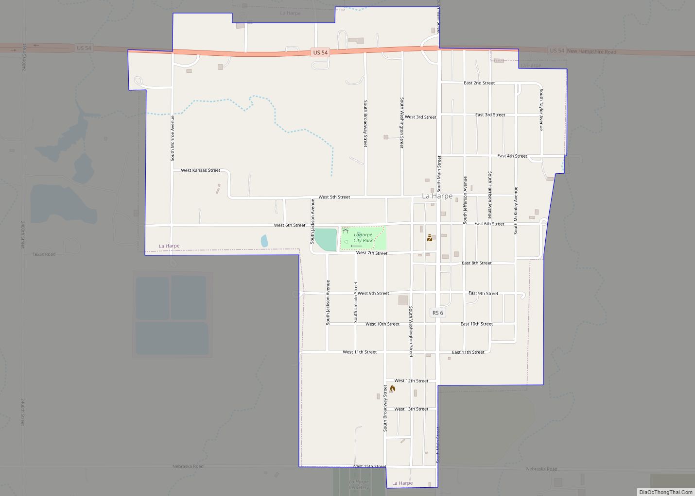
Online Interactive Map
Click on ![]() to view map in "full screen" mode.
to view map in "full screen" mode.
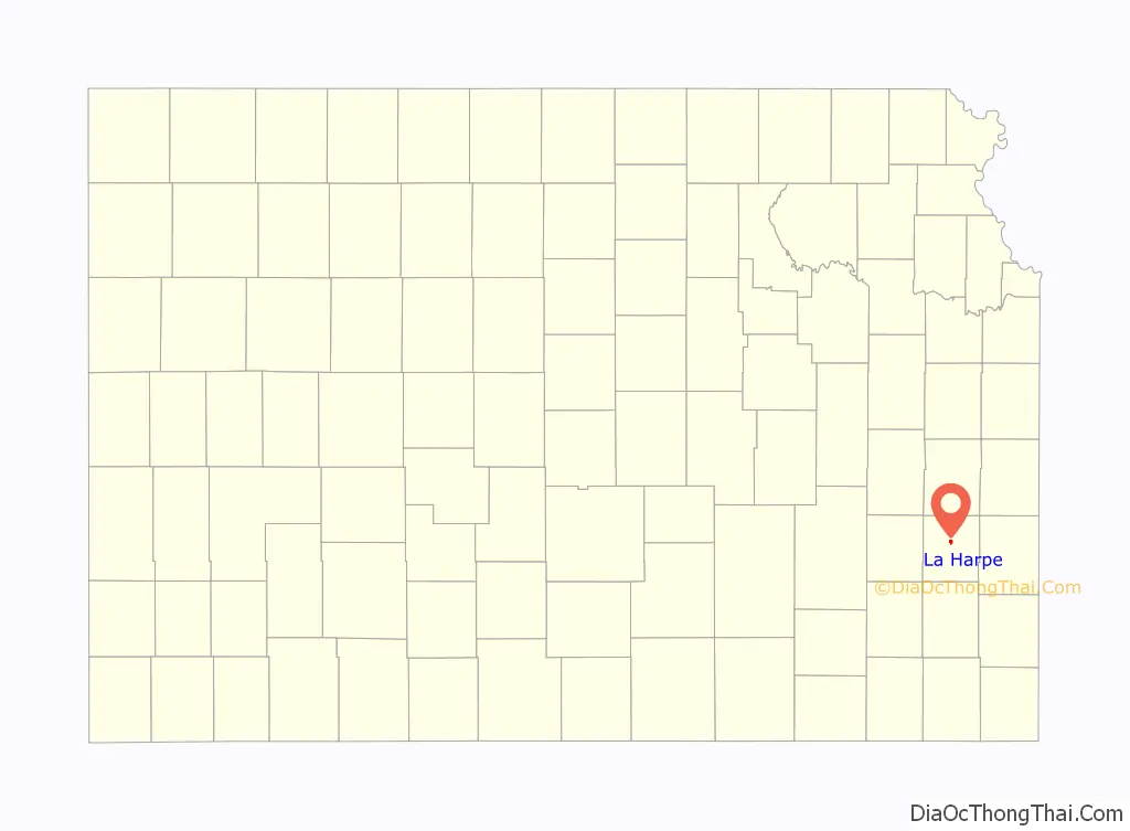
La Harpe location map. Where is La Harpe city?

History
La Harpe was founded by the Fort Scott, Wichita & Western Railroad company (later the Missouri Pacific), and was platted in 1881. It was named after La Harpe, Illinois and they both commemorate a prominent French explorer of the southern Great Plains of North America, Bernard de la Harpe
When natural gas was discovered in the immediate vicinity in 1899 the city began to grow more rapidly and soon rose to be a city of importance. It was incorporated as a city of the second class, and in 1910 had some of the largest zinc smelters in the world, two banks, an opera house, several good mercantile establishments, a newspaper, and all the municipal improvements usually found in cities of that class. The population that year was 2,080. Its post office, first opened in November 1881, was authorized to issue international money orders, and two rural routes supplied mail to the surrounding country.
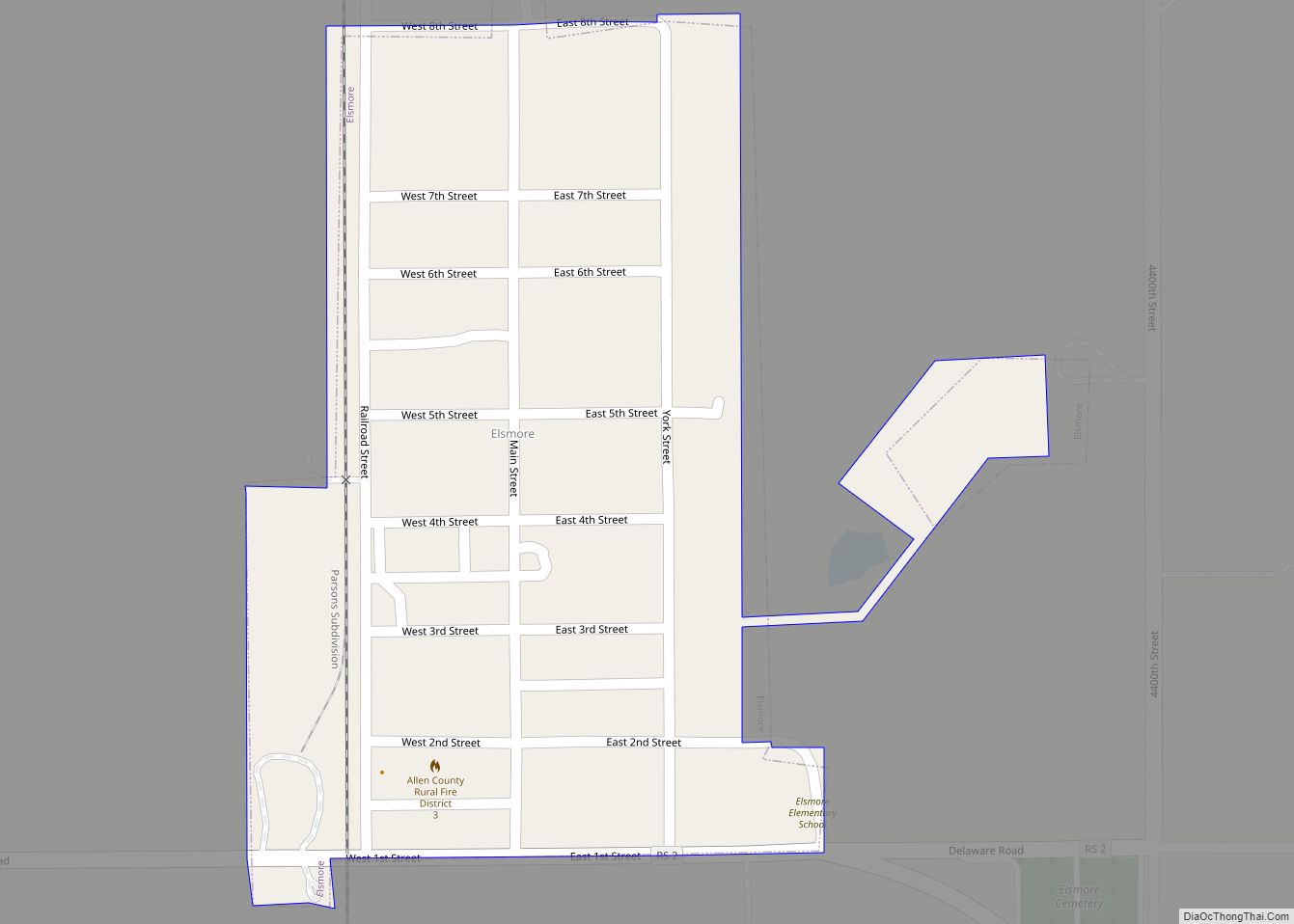
La Harpe Road Map
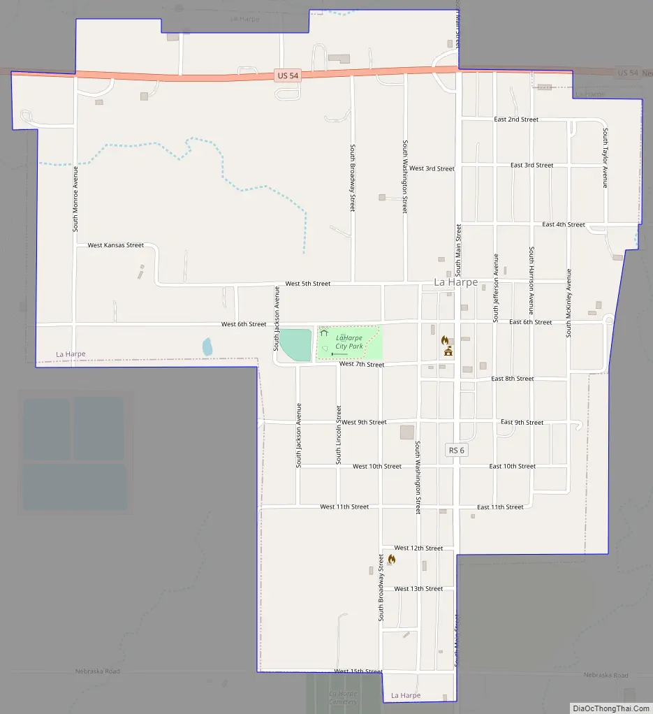
La Harpe city Satellite Map

Geography
La Harpe is located at 37°54′56″N 95°17′59″W / 37.91556°N 95.29972°W / 37.91556; -95.29972 (37.915631, -95.299729). Situated along U.S. Route 54 in the central part of Allen County, La Harpe is about 5+1⁄2 miles east of the city of Iola (the county seat), 2+1⁄2 miles east of Gas, and about seven miles west of the junction of U.S. Routes 54 and 59 and the city of Moran.
According to the United States Census Bureau, the city has a total area of 0.82 square miles (2.12 km), all of it land.
See also
Map of Kansas State and its subdivision:- Allen
- Anderson
- Atchison
- Barber
- Barton
- Bourbon
- Brown
- Butler
- Chase
- Chautauqua
- Cherokee
- Cheyenne
- Clark
- Clay
- Cloud
- Coffey
- Comanche
- Cowley
- Crawford
- Decatur
- Dickinson
- Doniphan
- Douglas
- Edwards
- Elk
- Ellis
- Ellsworth
- Finney
- Ford
- Franklin
- Geary
- Gove
- Graham
- Grant
- Gray
- Greeley
- Greenwood
- Hamilton
- Harper
- Harvey
- Haskell
- Hodgeman
- Jackson
- Jefferson
- Jewell
- Johnson
- Kearny
- Kingman
- Kiowa
- Labette
- Lane
- Leavenworth
- Lincoln
- Linn
- Logan
- Lyon
- Marion
- Marshall
- McPherson
- Meade
- Miami
- Mitchell
- Montgomery
- Morris
- Morton
- Nemaha
- Neosho
- Ness
- Norton
- Osage
- Osborne
- Ottawa
- Pawnee
- Phillips
- Pottawatomie
- Pratt
- Rawlins
- Reno
- Republic
- Rice
- Riley
- Rooks
- Rush
- Russell
- Saline
- Scott
- Sedgwick
- Seward
- Shawnee
- Sheridan
- Sherman
- Smith
- Stafford
- Stanton
- Stevens
- Sumner
- Thomas
- Trego
- Wabaunsee
- Wallace
- Washington
- Wichita
- Wilson
- Woodson
- Wyandotte
- Alabama
- Alaska
- Arizona
- Arkansas
- California
- Colorado
- Connecticut
- Delaware
- District of Columbia
- Florida
- Georgia
- Hawaii
- Idaho
- Illinois
- Indiana
- Iowa
- Kansas
- Kentucky
- Louisiana
- Maine
- Maryland
- Massachusetts
- Michigan
- Minnesota
- Mississippi
- Missouri
- Montana
- Nebraska
- Nevada
- New Hampshire
- New Jersey
- New Mexico
- New York
- North Carolina
- North Dakota
- Ohio
- Oklahoma
- Oregon
- Pennsylvania
- Rhode Island
- South Carolina
- South Dakota
- Tennessee
- Texas
- Utah
- Vermont
- Virginia
- Washington
- West Virginia
- Wisconsin
- Wyoming