| Name: | Burlington County |
|---|---|
| FIPS code: | 34-005 |
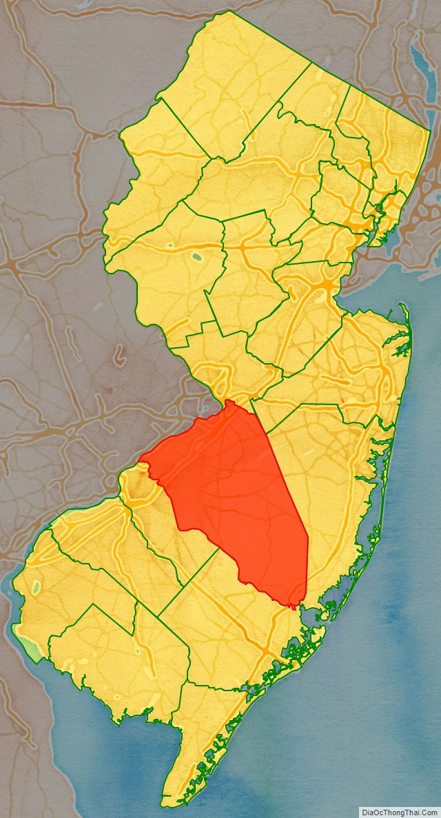
| State: | New Jersey |
| Founded: | May 17, 1694 |
| Named for: | Bridlington, England |
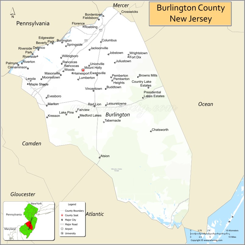
| Seat: | Mount Holly |
| Total Area: | 819.84 sq mi (2,123.4 km²) |
| Land Area: | 798.58 sq mi (2,068.3 km²) |
| Total Population: | 461,860 |
| Population Density: | 560/sq mi (220/km²) |
| Website: | www.co.burlington.nj.us |
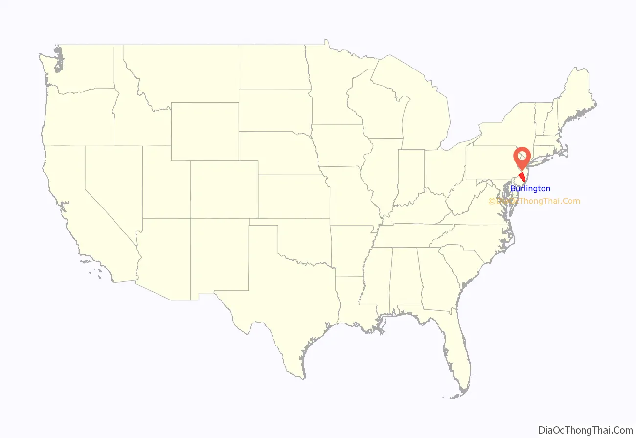
Burlington County location map. Where is Burlington County?
History
Etymology
Anglo-European records of Burlington County date to 1681, when its court was established in the Province of West Jersey. The county was formed on May 17, 1694, “by the union of the first and second Tenths.” The county was named for Bridlington, a town in England.
History
Burlington County was also the seat of government for the Province of West Jersey until its amalgamation with East Jersey in 1702, forming the Province of New Jersey. The county was much larger and was partitioned to form additional counties as the population increased. In 1714 one partition to the north became Hunterdon County, which itself was later partitioned to form three additional counties (Morris, Sussex and Warren). The county seat had been in Burlington but, as the population increased in the interior, away from the Delaware River, a more central location was needed, and the seat of government was moved to Mount Holly in 1793. Increasing industrialization led to improvements in transportation which increased the profitability of agriculture in the county. Population increases in the coastal communities due to successful international trade and ship repair led to road improvements throughout the county.
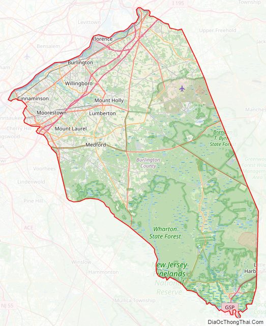
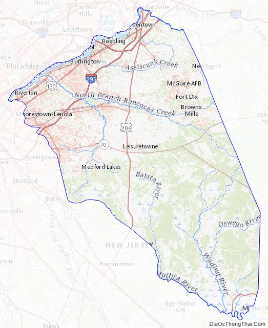
Burlington County Road Map
Geography
According to the 2010 Census, the county had an area of 819.84 square miles (2,123.4 km), including 798.58 square miles (2,068.3 km) of land (97.4%) and 21.26 square miles (55.1 km) of water (2.6%).
Most of the county’s land is coastal and alluvial plain with little relief. There are a few anomalous hills, such as Apple Pie Hill and Arney’s Mount, the highest of the county and among the highest in South Jersey at approximately 240 feet (73 m) above sea level. The low point is sea level along the Delaware and Mullica rivers.
Most of the land is dotted with rivers, streams, and wetlands. Some of the largest and most important rivers in Burlington County include Rancocas Creek, Assiscunk Creek, Pennsauken Creek, Mullica River, Batsto River, and Wading River.
Average temperatures in the county seat of Mount Holly have ranged from a low of 22 °F (−6 °C) in January to a high of 87 °F (31 °C) in July, although a record low of −25 °F (−32 °C) was recorded in February 1934 and a record high of 104 °F (40 °C) was recorded in July 1936. Average monthly precipitation ranged from 2.92 inches (74 mm) in February to 4.87 inches (124 mm) in August. According to the Köppen climate classification, Burlington County has a humid subtropical climate (Cfa), with relatively cool to cold winters and hot summers.
Severe weather is common in the warm months. Hurricanes have struck Burlington County on occasion, but tornadoes are uncommon. Severe thunderstorms, however, are common during the warm season. Snowfall is typical in the winter, with the snowfall averages in the county ranging from about 18 to 22 inches. The nearby Atlantic Ocean moderates Burlington County’s climate, and rain is common year-round. The county seat receives about 41 inches of rain per year.
Another interesting weather phenomenon that occurs in Burlington County is radiative cooling in the Pine Barrens, a large pine forest and reserve that takes up a good portion of Southern and Eastern Burlington County. Due to sandy soil, on clear and dry nights these areas might be 10 to 15 °F (−12 to −9 °C) colder than the surrounding areas, and there is a shorter frost-free season in these places. The sandy soil of the Pinelands loses heat much faster than the other soils or urban surfaces (concrete, asphalt) in the region, and so achieves a much lower temperature at night than the rest of the county. This effect is far less pronounced on moist, cloudy, or windy nights, as these three factors greatly reduce the radiative cooling of the sandy soil.
Burlington County Topographic Map
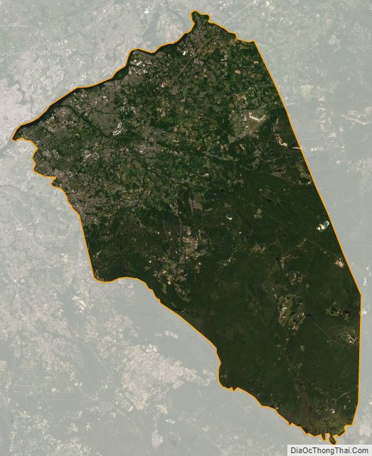
Burlington County Satellite Map
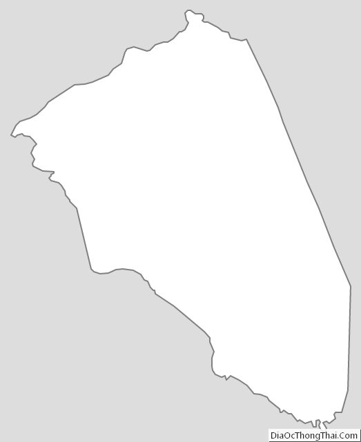
Burlington County Outline Map
See also
Map of New Jersey State and its subdivision: Map of other states:- Alabama
- Alaska
- Arizona
- Arkansas
- California
- Colorado
- Connecticut
- Delaware
- District of Columbia
- Florida
- Georgia
- Hawaii
- Idaho
- Illinois
- Indiana
- Iowa
- Kansas
- Kentucky
- Louisiana
- Maine
- Maryland
- Massachusetts
- Michigan
- Minnesota
- Mississippi
- Missouri
- Montana
- Nebraska
- Nevada
- New Hampshire
- New Jersey
- New Mexico
- New York
- North Carolina
- North Dakota
- Ohio
- Oklahoma
- Oregon
- Pennsylvania
- Rhode Island
- South Carolina
- South Dakota
- Tennessee
- Texas
- Utah
- Vermont
- Virginia
- Washington
- West Virginia
- Wisconsin
- Wyoming