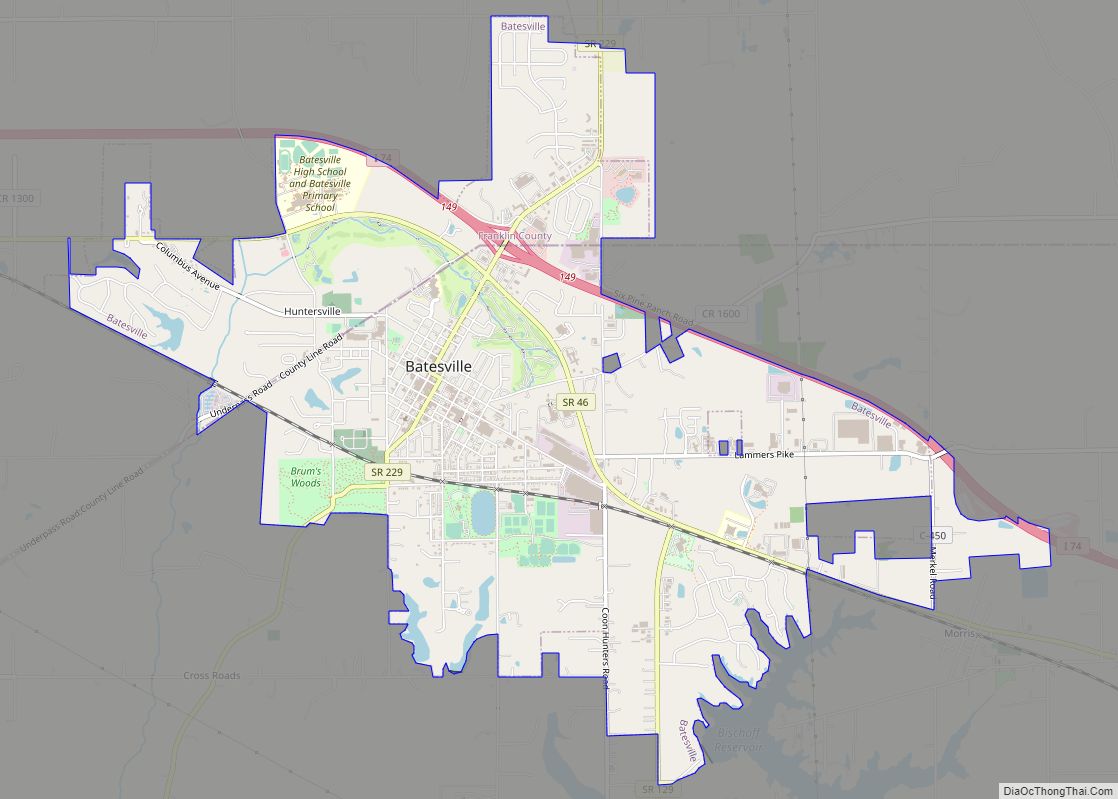
Franklin County is a county on the eastern border of the U.S. state of Indiana. In the 2020 United States Census, the county population was 22,785. The county seat is the town of Brookville. Franklin County is part of the Cincinnati, OH–KY–IN Metropolitan Statistical Area. The only incorporated city in Franklin County is Batesville, which lies mostly in adjoining Ripley County.
| Name: | Franklin County |
|---|---|
| FIPS code: | 18-047 |
| State: | Indiana |
| Founded: | 1 February 1811 (authorized) |
| Named for: | Benjamin Franklin |
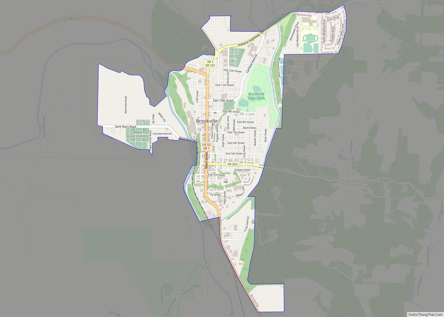
| Seat: | Brookville |
| Largest town: | Brookville (entirely within county) Batesville (partial) |
| Total Area: | 391.05 sq mi (1,012.8 km²) |
| Land Area: | 384.43 sq mi (995.7 km²) |
| Total Population: | 22,785 |
| Population Density: | 59.1/sq mi (22.8/km²) |
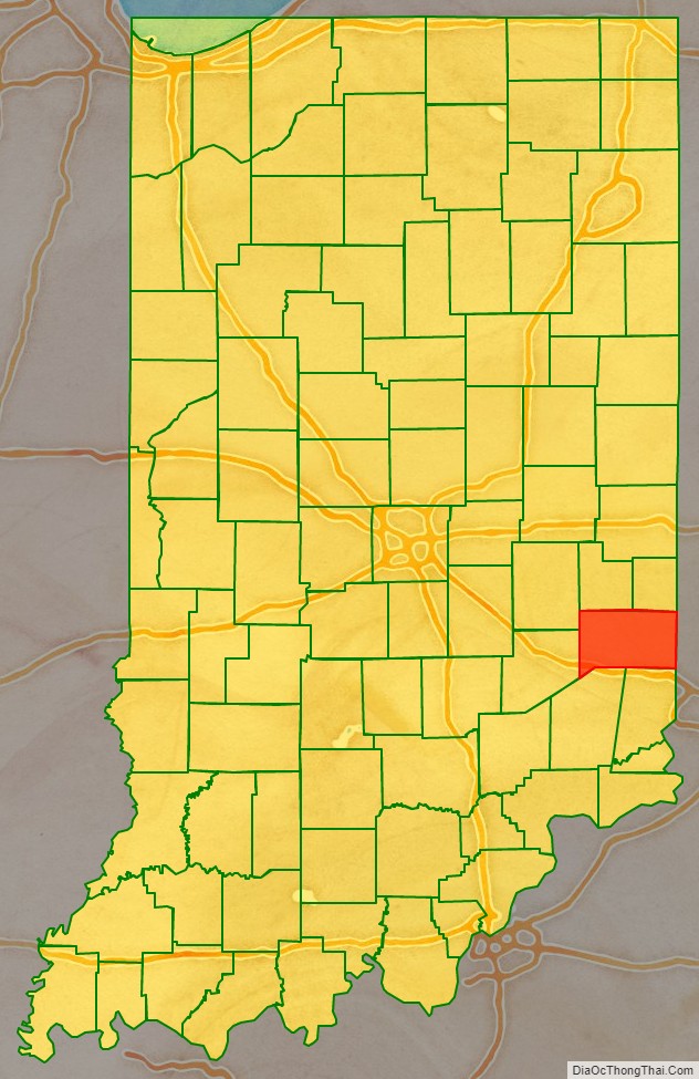
Franklin County location map. Where is Franklin County?
History
The future state of Indiana was first regulated by congressional passage of the Northwest Ordinance in 1787. In 1790 the Territory was divided into two counties, with Knox covering much of present-day Indiana. In 1810, a portion of Knox was partitioned to create Wayne County, and shortly thereafter a portion further south was partitioned to create Franklin; the authorizing act was dated 1 February 1811. It was named for statesman Benjamin Franklin.
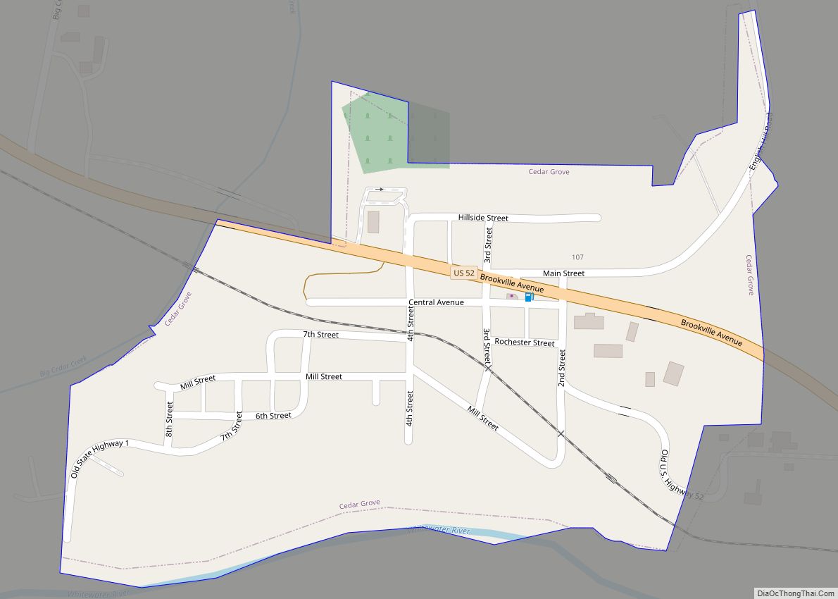
Some early settlers of Franklin County were Primitive Baptists who came with Elder William Tyner from Virginia in 1797, after the American Revolutionary War. They organized the first church congregation in the Whitewater Valley, the Little Cedar Grove Baptist Church. They raised a log chapel southeast of Brookville in 1805.
Another European-American landmark is the Big Cedar Baptist Church and Burying Ground on Big Cedar Creek Road, between the road to Reily and the Oxford Pike. The original church was established in 1817, as an arm of the Little Cedar Baptist church. The brick building was built in 1838. This church congregation, similar to many pioneer Baptist groups in the country, was originally Primitive Baptist or Hardshell. In the 1830s modernism reached the county, bringing innovations such as Sunday schools, Missionary Societies, and the playing of organs. Organs were particularly anathema to the Primitive Party, who considered it akin to Aaron’s golden calf.
The Big Cedar congregation divided into two over these issues, but the two groups arrived at an amicable settlement. Both congregations continued to use the same building: the Primitives, or Hardshells, had worship in the church on the first and third Sabbath of each month, and the Modernists or Missionary Baptists used the church on the second and fourth Sundays. Each congregation had a wood shed. The building is now maintained in connection with the Big Cedar Cemetery Association.
Governors James B. Ray, Noah Noble and David Wallace were known as the “Brookville Triumvirate.” They had each lived in Brookville and were elected to consecutive terms as Indiana governor. Noble and Ray were political adversaries.
James B. Goudie Jr. (1769-1836), Speaker of the Indiana House, was also from Franklin County.
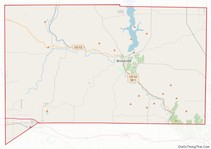
Franklin County Road Map
Geography
Franklin County lies on the eastern edge of Indiana; its eastern border abuts the western border of Ohio. Its low rolling hills, once completely wooded, have been partially cleared and leveled for agricultural use. The carved drainages are still largely brush-filled. According to the 2010 census, the county has a total area of 391.05 square miles (1,012.8 km), of which 384.43 square miles (995.7 km) (or 98.31%) is land and 6.62 square miles (17.1 km) (or 1.69%) is water.
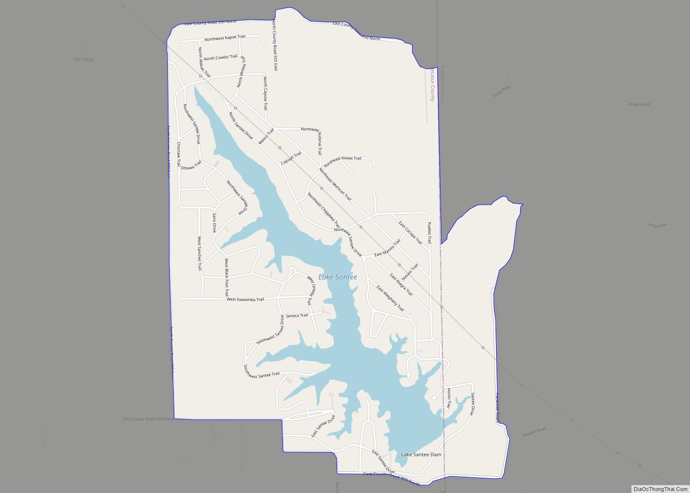
Brookville Lake extends into the county’s northern part, formed by a dam of the same name on the East Branch of the Whitewater River, a tributary of the Great Miami River. The West Branch of the Whitewater River enters the county’s northwestern part from Fayette County and joins the east branch at Brookville, to form the Whitewater River, flowing southeastward into Dearborn County. The southern and southwestern parts of Franklin County are drained by Salt Creek, Pipe Creek, and Blue Creek, which flow northeastward into Whitewater River. The highest point in the county (1,070 feet/330 meters ASL) is a small hill 1.0 mile (1.6 km) north of Andersonville.
Adjacent counties
- Fayette County – north
- Union County – northeast
- Butler County, Ohio – east
- Hamilton County, Ohio – southeast
- Dearborn County – south
- Ripley County – southwest
- Decatur County – west
- Rush County – northwest
Major highways
- Interstate 74
- U.S. Route 52
- Indiana State Road 1
- Indiana State Road 46
- Indiana State Road 101
- Indiana State Road 121
- Indiana State Road 229
- Indiana State Road 244
- Indiana State Road 252
Protected areas
- Mounds State Recreation Area
Lakes
- Brookville Lake (part)
Franklin County Topographic Map
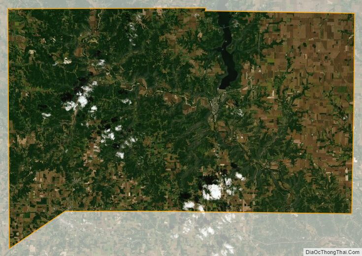
Franklin County Satellite Map
Franklin County Outline Map