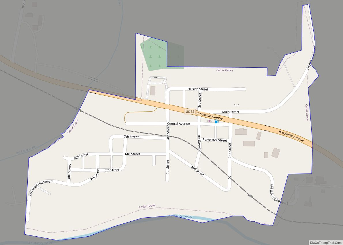
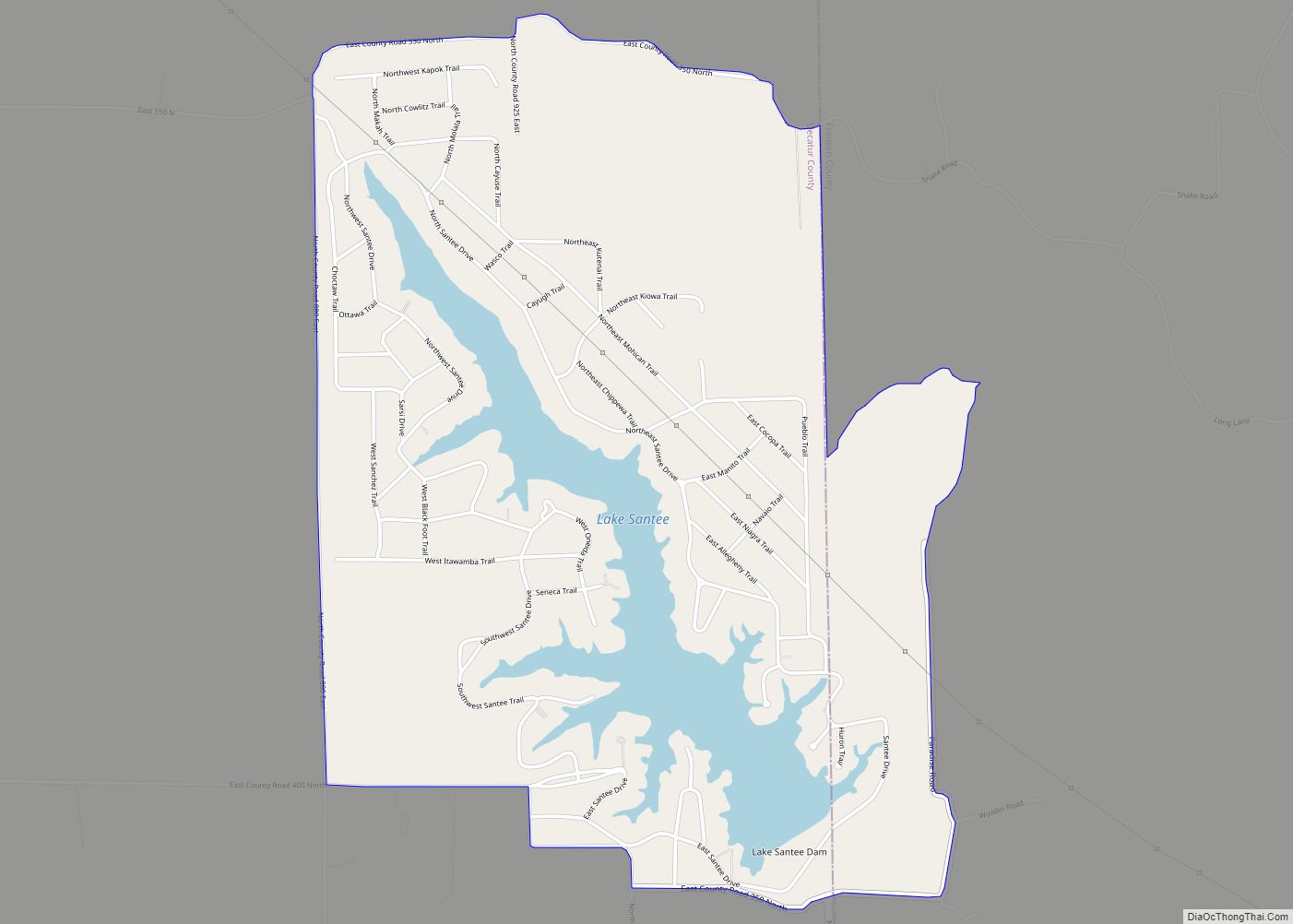
Lake Santee is an unincorporated town and census-designated place in Decatur and Franklin counties, Indiana, United States. As of the 2010 census, it had a population of 820.
| Name: | Lake Santee CDP |
|---|---|
| LSAD Code: | 57 |
| LSAD Description: | CDP (suffix) |
| State: | Indiana |
| County: | Decatur County, Franklin County |
| Elevation: | 1,015 ft (309 m) |
| Total Area: | 2.82 sq mi (7.30 km²) |
| Land Area: | 2.46 sq mi (6.38 km²) |
| Water Area: | 0.36 sq mi (0.92 km²) |
| Total Population: | 889 |
| Population Density: | 360.94/sq mi (139.34/km²) |
| ZIP code: | 47240 |
| FIPS code: | 1841444 |
Online Interactive Map
Click on ![]() to view map in "full screen" mode.
to view map in "full screen" mode.
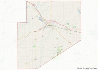
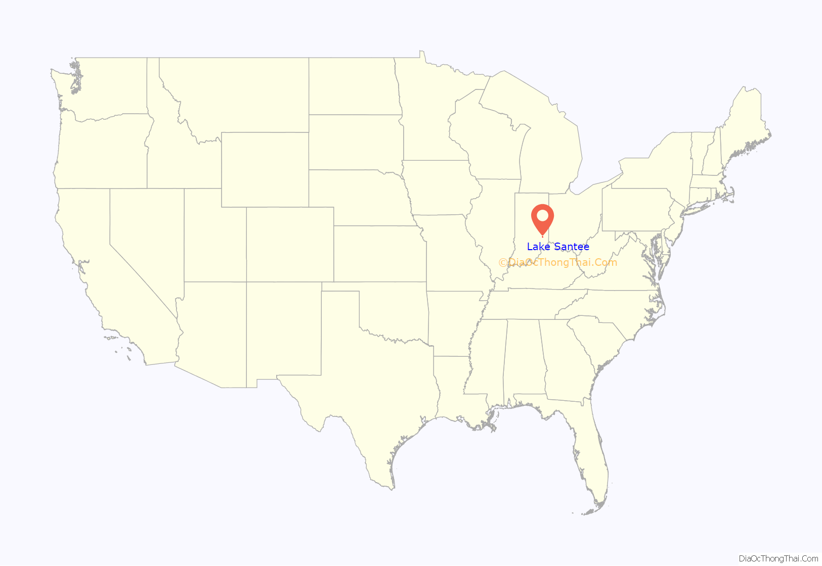
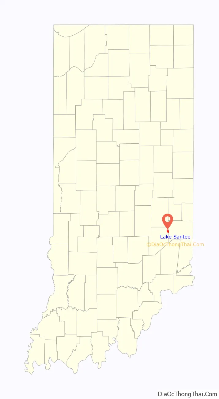
Lake Santee location map. Where is Lake Santee CDP?
History
Lake Santee was built up in the 1960s as a housing development centered on a reservoir of the same name.
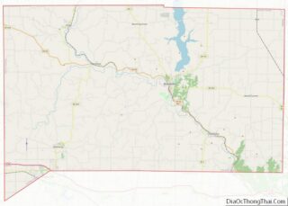
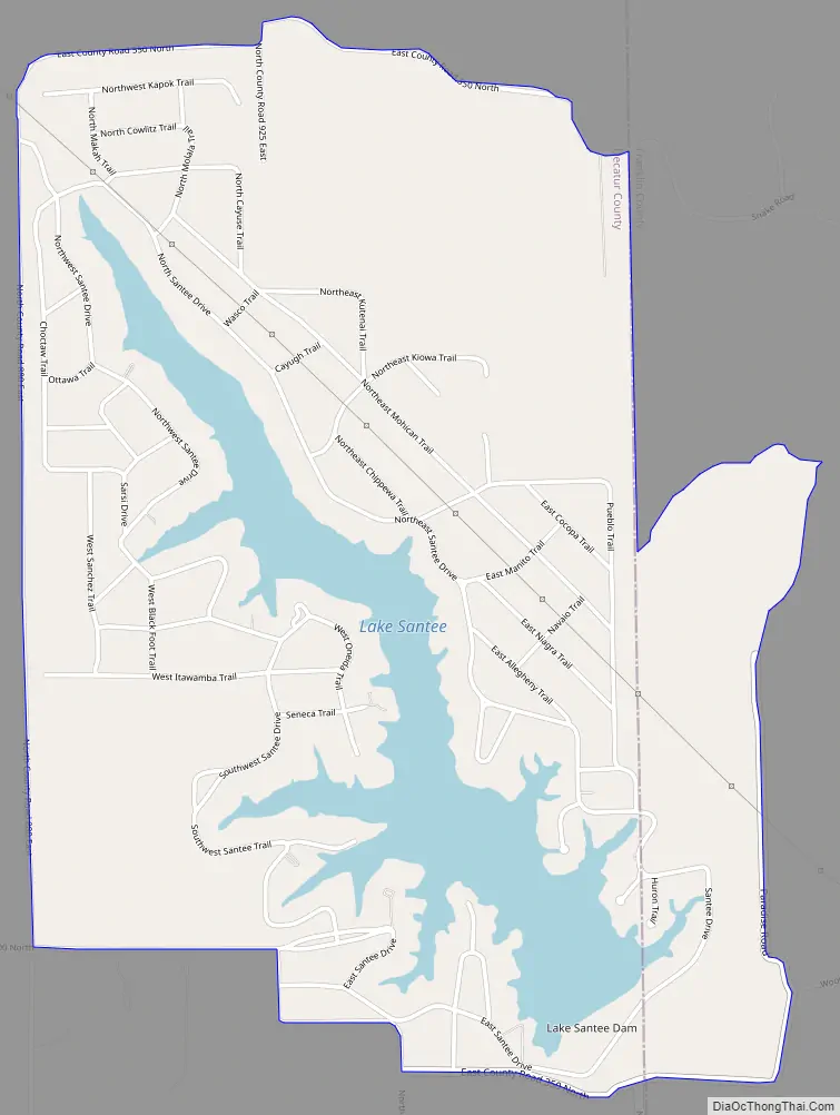
Lake Santee Road Map
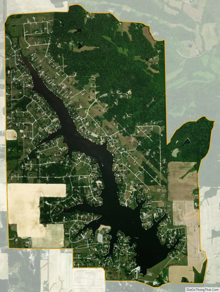
Lake Santee city Satellite Map
Geography
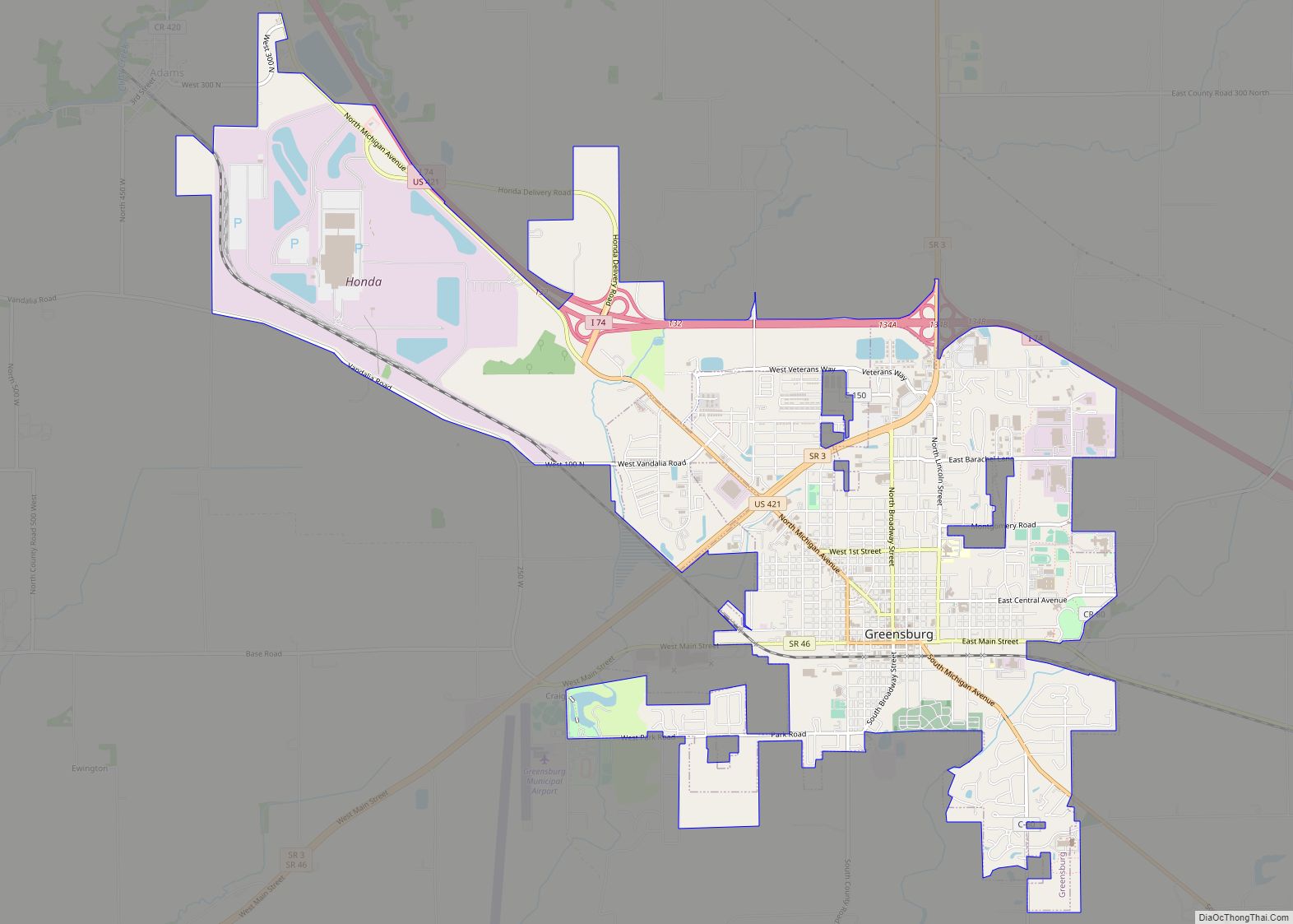
Lake Santee is located at 39°24′36″N 85°18′27″W / 39.41000°N 85.30750°W / 39.41000; -85.30750 in southeastern Indiana. It is situated 13 miles (21 km) northeast of Greensburg and 12 miles (19 km) northwest of Batesville.
According to the U.S. Census Bureau, the CDP has a total area of 2.8 square miles (7.3 km), of which 2.5 square miles (6.4 km) is land and 0.35 square miles (0.9 km), or 12.60%, is water. The water area consists entirely of Lake Santee, the reservoir.
See also
Map of Indiana State and its subdivision:- Adams
- Allen
- Bartholomew
- Benton
- Blackford
- Boone
- Brown
- Carroll
- Cass
- Clark
- Clay
- Clinton
- Crawford
- Daviess
- De Kalb
- Dearborn
- Decatur
- Delaware
- Dubois
- Elkhart
- Fayette
- Floyd
- Fountain
- Franklin
- Fulton
- Gibson
- Grant
- Greene
- Hamilton
- Hancock
- Harrison
- Hendricks
- Henry
- Howard
- Huntington
- Jackson
- Jasper
- Jay
- Jefferson
- Jennings
- Johnson
- Knox
- Kosciusko
- LaGrange
- Lake
- Lake Michigan
- LaPorte
- Lawrence
- Madison
- Marion
- Marshall
- Martin
- Miami
- Monroe
- Montgomery
- Morgan
- Newton
- Noble
- Ohio
- Orange
- Owen
- Parke
- Perry
- Pike
- Porter
- Posey
- Pulaski
- Putnam
- Randolph
- Ripley
- Rush
- Saint Joseph
- Scott
- Shelby
- Spencer
- Starke
- Steuben
- Sullivan
- Switzerland
- Tippecanoe
- Tipton
- Union
- Vanderburgh
- Vermillion
- Vigo
- Wabash
- Warren
- Warrick
- Washington
- Wayne
- Wells
- White
- Whitley
- Alabama
- Alaska
- Arizona
- Arkansas
- California
- Colorado
- Connecticut
- Delaware
- District of Columbia
- Florida
- Georgia
- Hawaii
- Idaho
- Illinois
- Indiana
- Iowa
- Kansas
- Kentucky
- Louisiana
- Maine
- Maryland
- Massachusetts
- Michigan
- Minnesota
- Mississippi
- Missouri
- Montana
- Nebraska
- Nevada
- New Hampshire
- New Jersey
- New Mexico
- New York
- North Carolina
- North Dakota
- Ohio
- Oklahoma
- Oregon
- Pennsylvania
- Rhode Island
- South Carolina
- South Dakota
- Tennessee
- Texas
- Utah
- Vermont
- Virginia
- Washington
- West Virginia
- Wisconsin
- Wyoming