Frederick County is located in the Commonwealth of Virginia. As of the 2020 census, the population was 91,419. Its county seat is Winchester. The county was formed in 1743 by the splitting of Orange County. It is Virginia’s northernmost county. Frederick County is included in the Winchester, VA-WV Metropolitan Statistical Area, which is also included in the Washington–Baltimore-Northern Virginia, DC-MD-VA-WV-PA Combined Statistical Area.
| Name: | Frederick County |
|---|---|
| FIPS code: | 51-069 |
| State: | Virginia |
| Founded: | 1743 |
| Named for: | Frederick, Prince of Wales |
| Seat: | Winchester |
| Largest town: | Winchester |
| Total Area: | 416 sq mi (1,080 km²) |
| Land Area: | 414 sq mi (1,070 km²) |
| Total Population: | 91,419 |
| Population Density: | 220/sq mi (85/km²) |
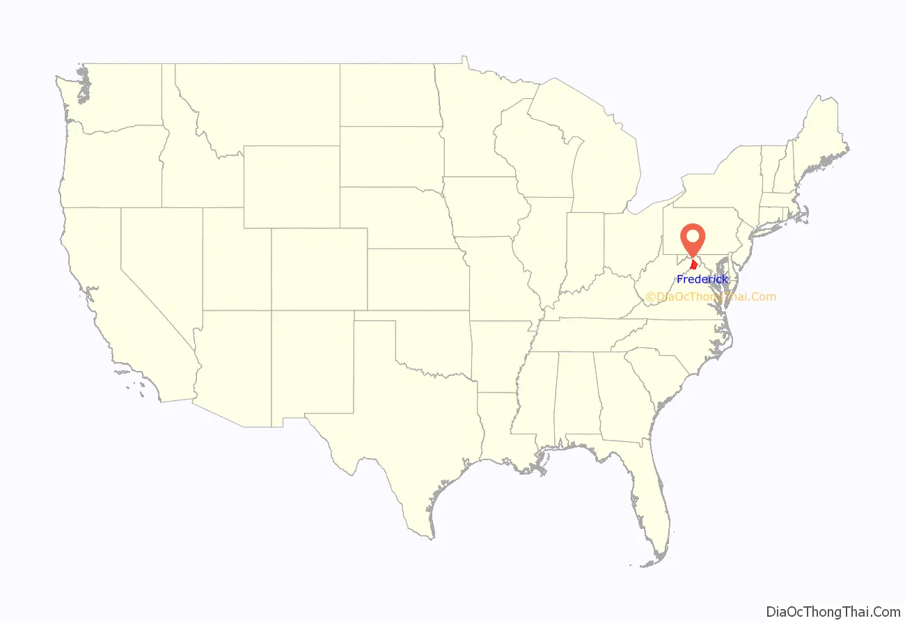
Frederick County location map. Where is Frederick County?

History
The area that would become Frederick County, Virginia, was inhabited and transited by various indigenous peoples for thousands of years before European colonization.
Colonization efforts began with the Virginia Company of London, but European settlement did not flourish until after the company lost its charter and Virginia became a royal colony in 1624. In order to stimulate migration to the colony, the headright system was used. Under this system, those who funded an emigrant’s transportation costs (not the actual colonizers) were compensated with land. In 1649 the exiled King Charles II granted several acres of colonial Virginia lands to “seven loyal supporters”, including Lord Fairfax. The Fairfax lands passed to Thomas Fairfax, 5th Lord Fairfax of Cameron (1657-1710), who married the daughter of Thomas Colepeper, who also owned several acres of land. After their son, Lord Thomas Fairfax, inherited the combined grants, he controlled over 5,000,000 acres of land in Virginia, including much of the land that became Frederick County.
Frederick County was created from Orange County in 1738, and was officially organized in 1743. The Virginia Assembly named the new county for Frederick Louis, Prince of Wales (1707–1751), the eldest son of King George II of Great Britain. At that time, “Old Frederick County” encompassed all or part of four counties in present-day Virginia and five in present-day West Virginia:
- Hampshire (West Virginia), created 1754
- Dunmore, created 1772 and renamed Shenandoah in 1778
- Berkeley (West Virginia), created 1772
- Hardy (West Virginia), created 1786
- Jefferson (West Virginia), created 1801
- Morgan (West Virginia), created 1820
- Page, created 1831
- Clarke, created 1836
- Warren, created 1836
Colonial era
As commanding officer of the new Colonial Virginia regiment in 1754, Colonel George Washington located his headquarters in Winchester before and during the French and Indian War. He resigned from military service in 1758. He represented Frederick County in his first elective office, having been elected to the House of Burgesses in 1758 and 1761.
Seventeen years later, on June 15, 1775, the Continental Congress “elected” George Washington as commander-in-chief of the yet-to-be-created Continental Army. He accepted the appointment the next day. This preceded the Congress’s declaration of independence and the outbreak of the American Revolutionary War.
War of 1812
American Civil War
Winchester was a site of volatile conditions during the Civil War of 1861-1865, with control shifting between the Confederate and Union armies on average once every three weeks during the war. Many battles were fought in Frederick County. Some of those battles included:
- First Battle of Kernstown, March 1862
- First Battle of Winchester, May 1862
- Second Battle of Winchester, June 1863
- Second Battle of Kernstown, July 1864
- Third Battle of Winchester (Battle of Opequon), September 1864
- Battle of Cedar Creek, October 1864
The first constitution of West Virginia provided for Frederick County to be added to the new state if approved by a local election. Unlike the residents of neighboring Berkeley and Jefferson counties, those in Frederick County voted to remain in Virginia, despite being occupied by the Confederate army at the time.
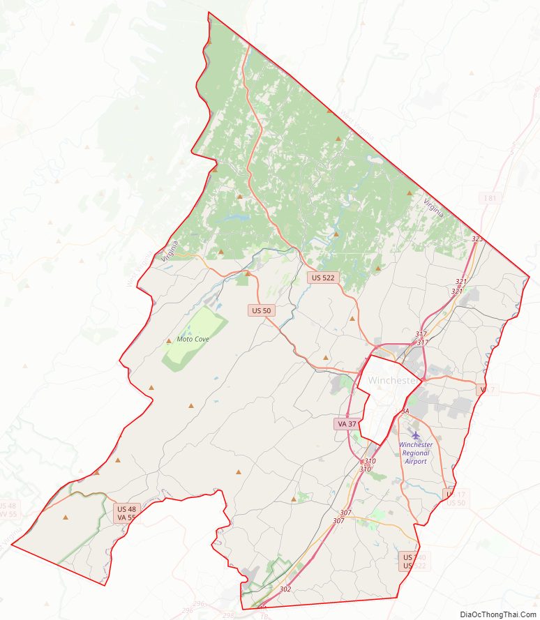
Frederick County Road Map
Geography
According to the U.S. Census Bureau, the county has a total area of 416 square miles (1,080 km), of which 414 square miles (1,070 km) is land and 2 square miles (5.2 km) (0.5%) is water. This is the northernmost county in the Commonwealth of Virginia.
Adjacent counties
National protected areas
- Cedar Creek and Belle Grove National Historical Park (part)
- George Washington National Forest (part)
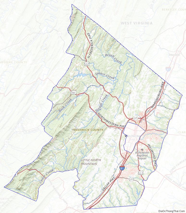
Frederick County Topographic Map
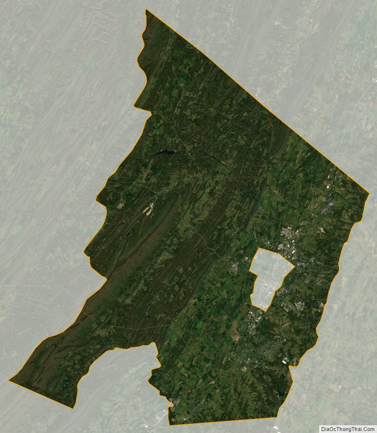
Frederick County Satellite Map
Frederick County Outline Map