Middletown is a town in Frederick County, Virginia, United States, in the northern Shenandoah Valley. The population was 1,265 at the 2010 census, up from 1,015 at the 2000 census.
| Name: | Middletown town |
|---|---|
| LSAD Code: | 43 |
| LSAD Description: | town (suffix) |
| State: | Virginia |
| County: | Frederick County |
| Elevation: | 715 ft (218 m) |
| Total Area: | 0.78 sq mi (2.01 km²) |
| Land Area: | 0.78 sq mi (2.01 km²) |
| Water Area: | 0.00 sq mi (0.00 km²) |
| Total Population: | 1,265 |
| Population Density: | 1,801.29/sq mi (695.44/km²) |
| ZIP code: | 22645 |
| Area code: | 540 |
| FIPS code: | 5151512 |
| GNISfeature ID: | 1495940 |
| Website: | www.middletownva.gov |
Online Interactive Map
Click on ![]() to view map in "full screen" mode.
to view map in "full screen" mode.
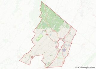
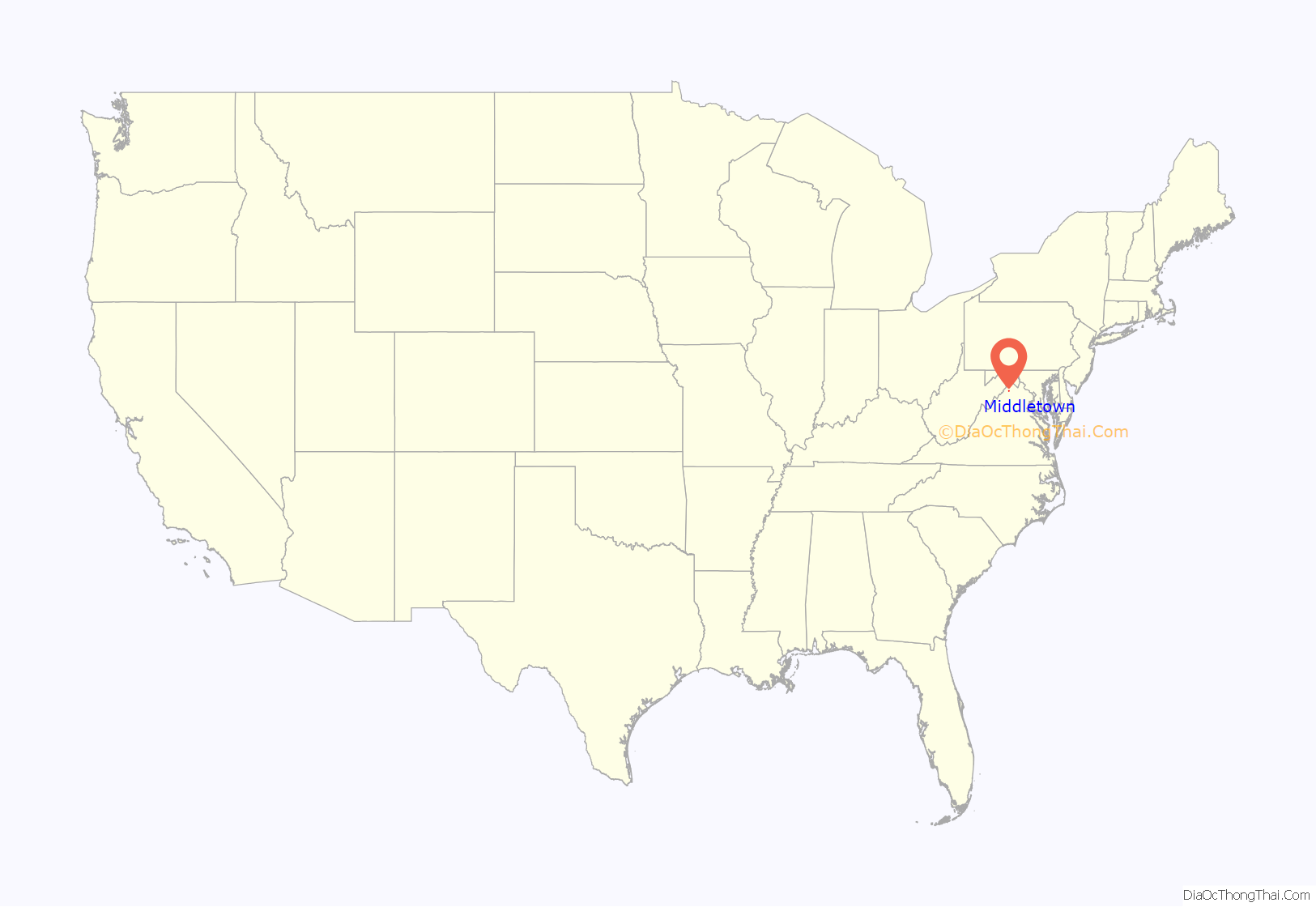
Middletown location map. Where is Middletown town?

History
Middletown was chartered on May 4, 1796. Some of the first documentation of early Middletown dates back to the late 18th century and is attributed to Dr. Peter Senseney and his wife Magdelen, two German settlers who had migrated from Pennsylvania. The town was originally known as “Senseney Town”, a piece of land within the 17th Century Fairfax Grant and gifted to the allies for siding with England during the civil war in the 1600s.
Belle Grove Plantation, about a mile southwest of Middletown, was first settled in about 1750, and its historic Federal-style manor house was completed in 1797. Middletown was the site of numerous military operations in the American Civil War including the Battle of Cedar Creek, fought just south of the town. The area where this battle occurred has been protected as part of the Cedar Creek and Belle Grove National Historical Park. Because the town was founded long before the Civil War, its antebellum history is extensive, as evidenced by the fact that Middletown’s Wayside Inn purports to be the longest continuously running inn in America. Wayside Theatre, also located in Middletown, was one of Virginia’s oldest professional live theaters (opened 1961, closed 2013). The town is home to Lord Fairfax Community College.
In addition to Belle Grove Plantation, Long Meadow, the Middletown Historic District, Fort Bowman, Monte Vista, Old Forge Farm, and St. Thomas Chapel are listed on the National Register of Historic Places. In 2012 the town of Middletown elected the youngest mayor in Virginia history at the age of 24, Charles Hamilton Harbaugh IV. He was reelected in 2016.
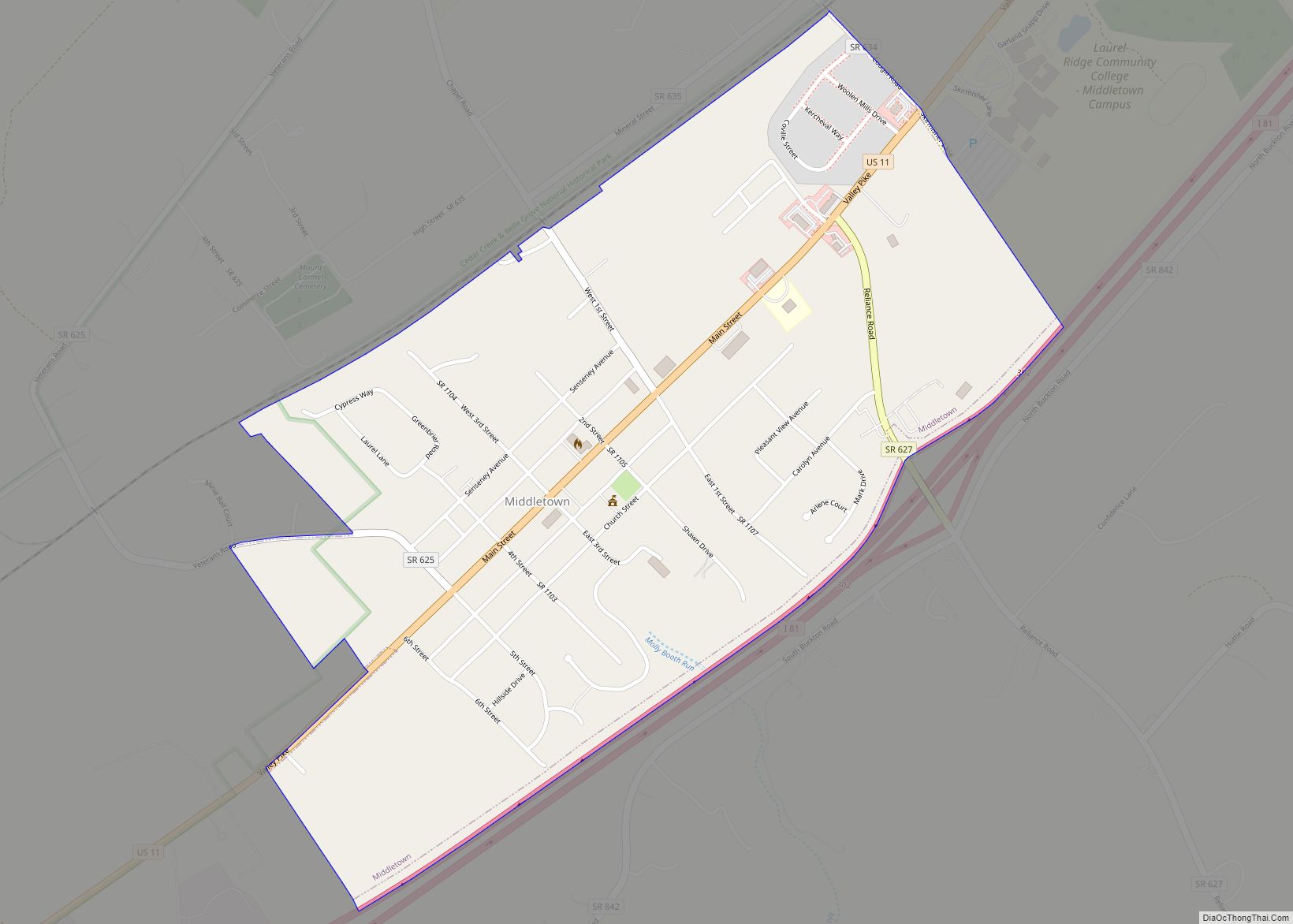
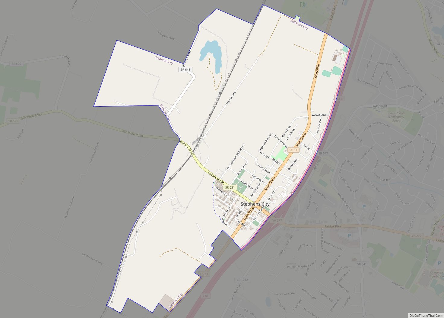
Middletown Road Map

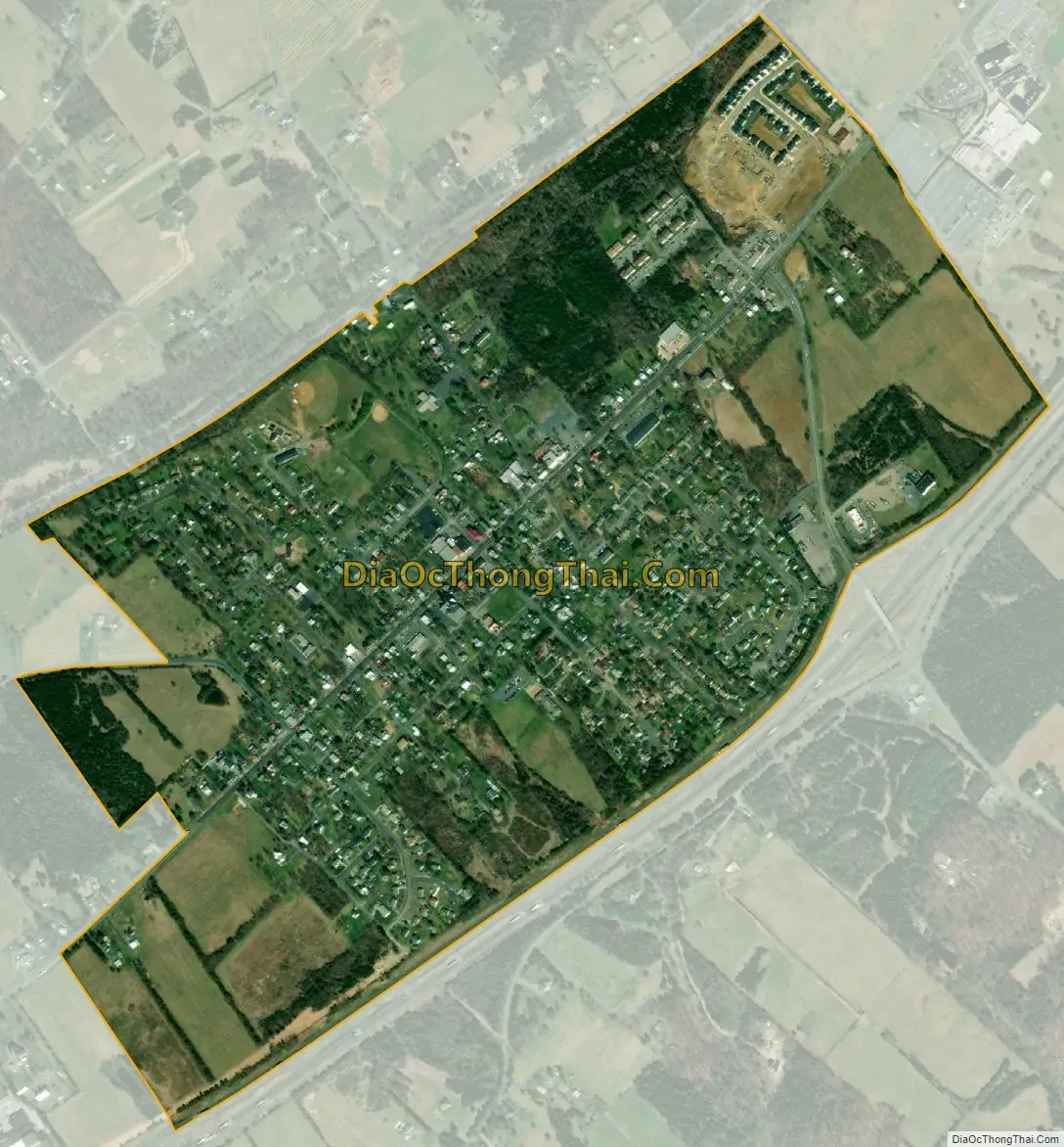
Middletown city Satellite Map
Geography
Middletown is located in southern Frederick County at 39°1′41″N 78°16′45″W / 39.02806°N 78.27917°W / 39.02806; -78.27917 (39.027989, −78.279273). It is in the Shenandoah Valley region and is 5 miles (8 km) southwest of Stephens City, 13 miles (21 km) southwest of Winchester, 5 miles (8 km) northeast of Strasburg, and 80 miles (129 km) west of Washington D.C.
According to the United States Census Bureau, the town has a total area of 0.77 square miles (2.0 km), of which 0.01 square miles (0.02 km), or 0.90%, are water. The town lies on a ridge between Meadow Brook to the northwest and tributaries of Molly Booth Run to the southeast. It is part of the watershed of the North Fork of the Shenandoah River.
Climate
Middletown has a Humid Subtropical climate, with hot, humid summers, and cool winters with moderate snowfall. January lows average 22.9F, while July highs average 86.9. Snowfall averages 23.2 inches per year and precipitation averages 40.2 inches per year.
See also
Map of Virginia State and its subdivision:- Accomack
- Albemarle
- Alexandria
- Alleghany
- Amelia
- Amherst
- Appomattox
- Arlington
- Augusta
- Bath
- Bedford
- Bedford City
- Bland
- Botetourt
- Bristol
- Brunswick
- Buchanan
- Buckingham
- Buena Vista
- Campbell
- Caroline
- Carroll
- Charles City
- Charlotte
- Charlottesville
- Chesapeake
- Chesterfield
- Clarke
- Clifton Forge City
- Colonial Heights
- Covington
- Craig
- Culpeper
- Cumberland
- Danville
- Dickenson
- Dinwiddie
- Emporia
- Essex
- Fairfax
- Fairfax City
- Falls Church
- Fauquier
- Floyd
- Fluvanna
- Franklin
- Frederick
- Fredericksburg
- Galax
- Giles
- Gloucester
- Goochland
- Grayson
- Greene
- Greensville
- Halifax
- Hampton
- Hanover
- Harrisonburg
- Henrico
- Henry
- Highland
- Hopewell
- Isle of Wight
- James City
- King and Queen
- King George
- King William
- Lancaster
- Lee
- Lexington
- Loudoun
- Louisa
- Lunenburg
- Lynchburg
- Madison
- Manassas
- Manassas Park
- Martinsville
- Mathews
- Mecklenburg
- Middlesex
- Montgomery
- Nelson
- New Kent
- Newport News
- Norfolk
- Northampton
- Northumberland
- Norton
- Nottoway
- Orange
- Page
- Patrick
- Petersburg
- Pittsylvania
- Poquoson
- Portsmouth
- Powhatan
- Prince Edward
- Prince George
- Prince William
- Pulaski
- Radford
- Rappahannock
- Richmond
- Roanoke
- Roanoke City
- Rockbridge
- Rockingham
- Russell
- Salem
- Scott
- Shenandoah
- Smyth
- Southampton
- Spotsylvania
- Stafford
- Staunton
- Suffolk
- Surry
- Sussex
- Tazewell
- Virginia Beach
- Warren
- Washington
- Waynesboro
- Westmoreland
- Williamsburg
- Winchester
- Wise
- Wythe
- York
- Alabama
- Alaska
- Arizona
- Arkansas
- California
- Colorado
- Connecticut
- Delaware
- District of Columbia
- Florida
- Georgia
- Hawaii
- Idaho
- Illinois
- Indiana
- Iowa
- Kansas
- Kentucky
- Louisiana
- Maine
- Maryland
- Massachusetts
- Michigan
- Minnesota
- Mississippi
- Missouri
- Montana
- Nebraska
- Nevada
- New Hampshire
- New Jersey
- New Mexico
- New York
- North Carolina
- North Dakota
- Ohio
- Oklahoma
- Oregon
- Pennsylvania
- Rhode Island
- South Carolina
- South Dakota
- Tennessee
- Texas
- Utah
- Vermont
- Virginia
- Washington
- West Virginia
- Wisconsin
- Wyoming