Kankakee County is a county located in the U.S. state of Illinois. According to the 2010 census, it has a population of 113,449. Its county seat is Kankakee. Kankakee County comprises the Kankakee, IL Metropolitan Statistical Area.
| Name: | Kankakee County |
|---|---|
| FIPS code: | 17-091 |
| State: | Illinois |
| Founded: | February 11, 1853 |
| Named for: | Kankakee River |
| Seat: | Kankakee |
| Largest city: | Kankakee |
| Total Area: | 681 sq mi (1,760 km²) |
| Land Area: | 677 sq mi (1,750 km²) |
| Total Population: | 113,449 |
| Population Density: | 170/sq mi (64/km²) |
| Time zone: | UTC−6 (Central) |
| Summer Time Zone (DST): | UTC−5 (CDT) |
| Website: | www.co.kankakee.il.us |
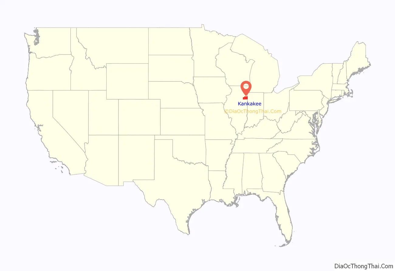
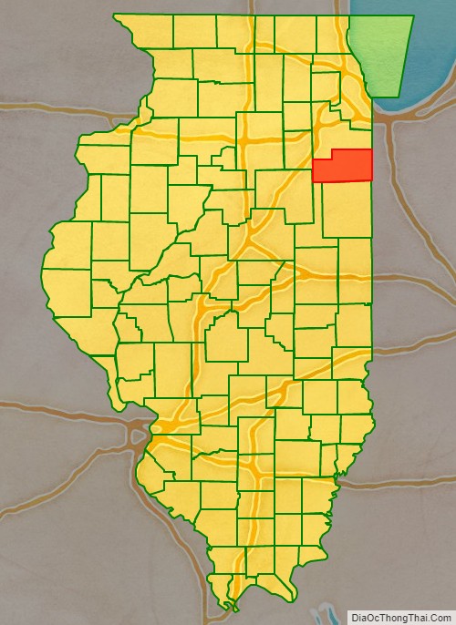
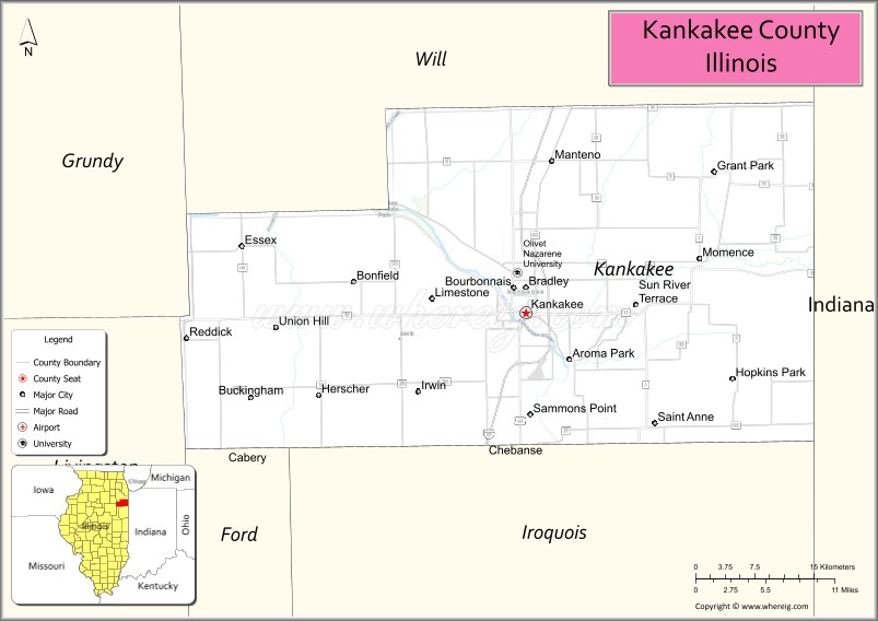
Kankakee County location map. Where is Kankakee County?
History
Starting in the 1770s, if not earlier, the area that is now Kankakee County was largely populated by the Pottawatami.
French Canadian Settlers came to Kankakee County in 1834, after the federal government signed the Treaty of Camp Tippecanoe in 1832. They were soon joined by migrants from New York and Vermont, mostly locating in Momence, Illinois. In the 1840s, most of the migrants were French Canadians or Metis and they settled in such places as Bourbonnais.
An act of the Illinois Legislature created Kankakee County out of the north part of Iroquois County and the south part of Will County in February 1853. The six original townships were Yellowhead, Rockville, Bourbonnais, Momence, Aroma Park, and Limestone. The population of the new county was about 8,000. In 1855 the two western townships (Norton and Essex) were taken from Vermilion County and added to Kankakee County. The county was named for the Kankakee River.
Kankakee County at the time of its creation in 1853
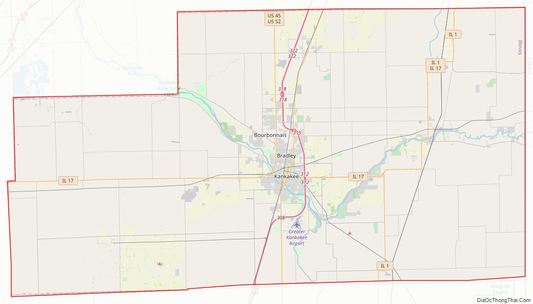
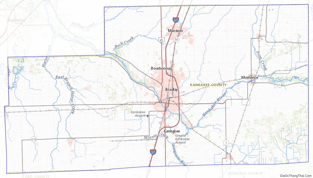
Kankakee County Road Map
Geography
According to the U.S. Census Bureau, the county has a total area of 681 square miles (1,760 km), of which 677 square miles (1,750 km) is land and 4.8 square miles (12 km) (0.7%) is water.
Climate and weather
In recent years, average temperatures in the county seat of Kankakee have ranged from a low of 12 °F (−11 °C) in January to a high of 86 °F (30 °C) in July, although a record low of −29 °F (−34 °C) was recorded in January 1985 and a record high of 107 °F (42 °C) was recorded in August 1988. Average monthly precipitation ranged from 1.62 inches (41 mm) in February to 4.54 inches (115 mm) in May.
Adjacent counties
- Will County – north
- Lake County, Indiana – northeast
- Newton County, Indiana – east
- Iroquois County – south
- Ford County – southwest
- Livingston County – west
- Grundy County – northwest
Kankakee County Topographic Map
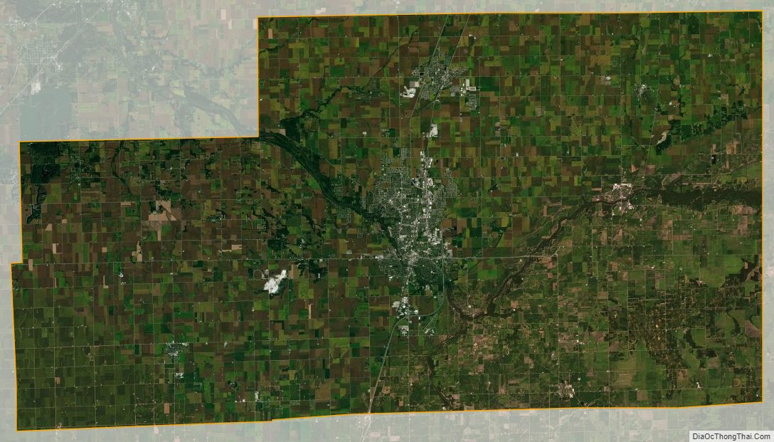
Kankakee County Satellite Map
Kankakee County Outline Map