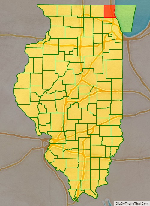
Lake County is situated in the northeastern corner of the U.S. state of Illinois, along the shores of Lake Michigan. As of the 2020 census, it has a population of 714,342, making it the third-most populous county in Illinois. Its county seat is Waukegan, the tenth-largest city in Illinois. The county is primarily suburban, with some urban areas and some rural areas. Due to its location, immediately north of Cook County, Lake County is one of the collar counties of the Chicago metropolitan area. Its northern boundary is the Wisconsin state line.
According to the 2010 census, Lake County is the second wealthiest county in the state by per capita income, after DuPage County. Additionally, Lake County ranks as the 27th wealthiest county in the nation. The county includes the affluent North Shore communities of Lake Forest, Lake Bluff, and Highland Park, and much of the county’s wealth is concentrated in this area, as well as in communities bordering Cook County to the south and McHenry County to the west. The north and northwest areas of the county, though historically rural and exurban, have experienced rapid suburbanization in the past three decades, while the lakefront communities of Waukegan, North Chicago, and Zion are post-industrial areas and majority non-white.
Naval Station Great Lakes is located in the city of North Chicago. It is the United States Navy’s Headquarters Command for training, and the Navy’s only recruit training center.
| Name: | Lake County |
|---|---|
| FIPS code: | 17-097 |
| State: | Illinois |
| Founded: | March 1, 1839 |
| Named for: | Lake Michigan |
| Seat: | Waukegan |
| Largest city: | Waukegan |
| Total Area: | 1,368 sq mi (3,540 km²) |
| Land Area: | 444 sq mi (1,150 km²) |
| Total Population: | 714,342 |
| Population Density: | 520/sq mi (200/km²) |
| Time zone: | UTC−6 (Central) |
| Summer Time Zone (DST): | UTC−5 (CDT) |
| Website: | www.lakecountyil.gov |
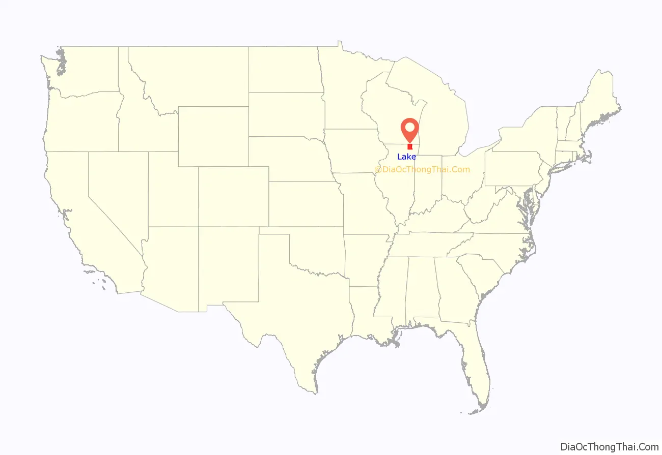
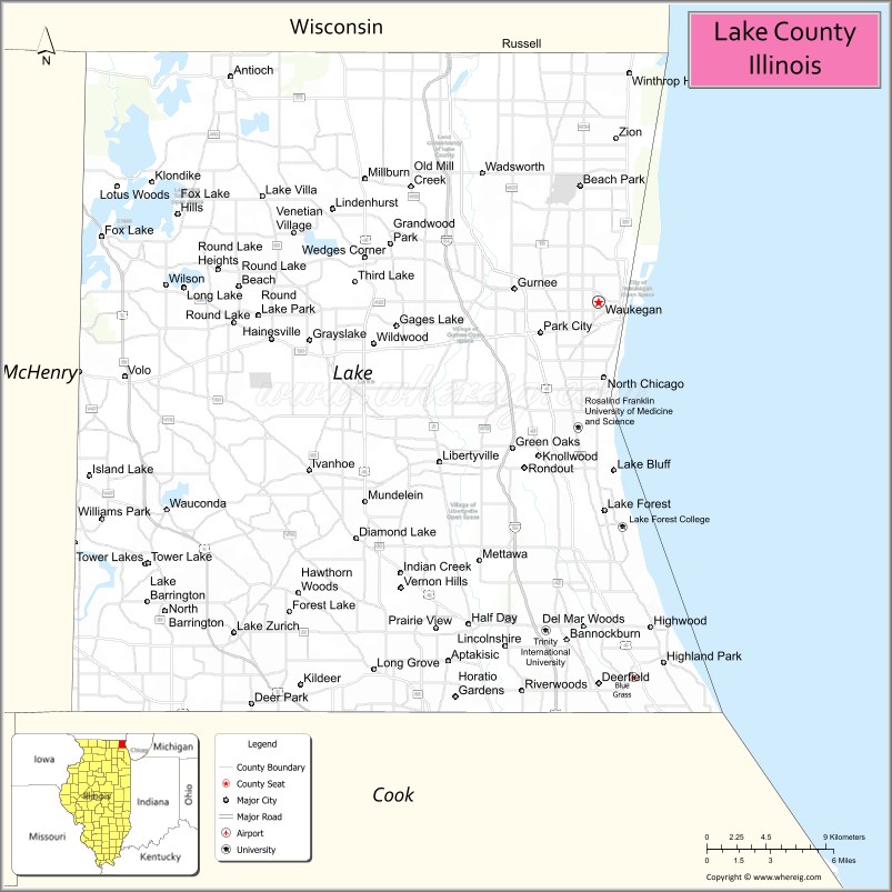
Lake County location map. Where is Lake County?
History
The county, which was primarily unsettled prairie and was still home to its native Potawatomi Indians, was created by the Illinois State Legislature in 1839. At that time, Libertyville, then known as Independence Grove, was the first county seat. In 1841, however, the county’s residents voted to move the county government to Little Fort, now Waukegan, where the commissioners had purchased a section of land from the state. Lake County’s first courthouse was built on part of that land in 1844 and the remainder was sold to pay for the $4,000 construction cost.
The county’s first courthouse was used solely for court sessions and the jail, but in 1853, commissioners constructed a building to accommodate county administration offices and house records. When fire damaged the courthouse on October 19, 1875, the county records were saved because they were in the adjacent building.
After the fire, proposals were made to move the county seat to Highland Park, Libertyville or another site in central Lake County. The county commissioners, however, decided to rebuild in Waukegan. The east half of the building was reconstructed at a cost of $45,000. In 1895, the first jail building was added to the government complex and a west addition was added to the courthouse in 1922. By 1938, county commissioners saw a need for additional space and approved the addition of a 5th Floor. This courthouse, however, was demolished in 1967 to make room for a new high-rise administration building, which was completed with the addition of the jail in 1969 and courts in 1970.
Shortly thereafter, the Lake County Board commissioned the construction of a multi-faceted justice facility and ground was broken in 1986 for the Robert H. Babcox Justice Center, named in memory of Sheriff Babcox, who served as Lake County Sheriff from 1982 to 1988. The justice center, which houses the county jail, work release program, sheriff’s administration offices and three courtrooms, was finished in 1989 at a cost of $29.6 million.
Additional county government facilities have been built or expanded throughout Lake County, including the Coroner’s Office, Health Department/Community Health Center facilities, Division of Transportation, Public Works and Winchester House. Lake County government services extend throughout the county’s 470 square miles (1,200 km).
The historic Half Day Inn, a tavern/restaurant, was constructed in 1843. This structure, once located at the corner of Milwaukee Avenue and Rte. 45/Old Half Day Road, was one of the oldest structures in Lake County until it was demolished in 2007 to make way for retail space, condominiums, and a retention pond.
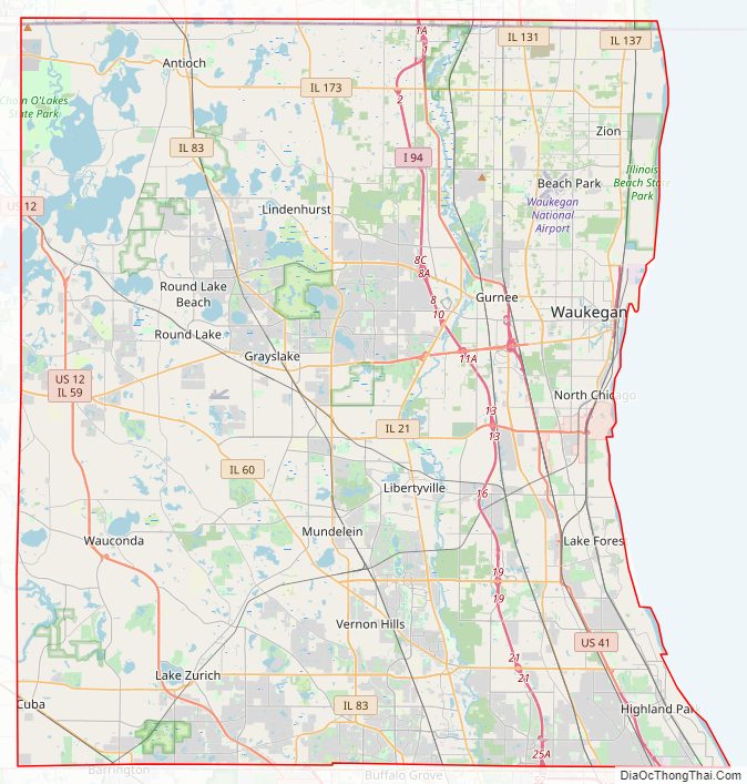
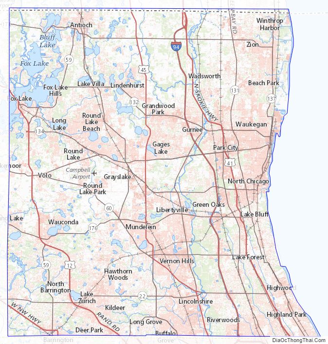
Lake County Road Map
Geography
According to the U.S. Census Bureau, the county has a total area of 1,368 square miles (3,540 km), of which 444 square miles (1,150 km) is land and 935 square miles (2,420 km) (67.6%) is water. It is the second-largest county in Illinois by total area and the only one that has more water area than land area. Most of the water is in Lake Michigan.
State parks
- Illinois Beach State Park
- North Point Marina
- Volo Bog State Natural Area
- Chain O’Lakes State Park
Lakes
Besides Lake Michigan, lakes in the county include:
- Bangs Lake
- Bluff Lake
- Butler Lake
- Channel Lake
- Lake Charles
- Countryside Lake
- Diamond Lake
- Druce Lake
- Dunns Lake
- East Loon Lake
- Fox Lake
- Gages Lake
- Grays Lake
- Highland Lake
- Island Lake
- Lake Linden
- Loch Lomond
- Loon Lake
- Lake Naomi
- Sterling Lake
- Valley Lake
- Wooster Lake
- Lake Zurich
Natural areas
Lake County’s forest preserves and natural areas are administered by the Lake County Forest Preserves district. These facilities include traditional nature preserves, such as the Ryerson Conservation Area, as well as golf courses and historic homes, such as the Adlai Stevenson historic home. A long north–south string of the preserves in Lake County, including Half Day Woods, Old School Forest Preserve, Independence Grove, and Van Patten Woods, form the Des Plaines River Greenway, which contains the Des Plaines River Trail, a popular place for walking, running, and biking. Lake County is also home to Illinois Beach State Park, featuring over six miles of Lake Michigan shoreline, as well as dune areas, wetlands, prairie, and black oak savanna. Several local environmental groups operate in Lake County, such as Conserve Lake County and Citizens for Conservation, working to improve habitat. Volunteer opportunities also exist with the Lake County Forest Preserve District.
Adjacent counties
- Kenosha County, Wisconsin – north
- Cook County – south
- McHenry County – west
Major highways
- Interstate 41
- Interstate 94
- U.S. Route 12
- U.S. Route 14
- U.S. Route 41
- U.S. Route 45
- Illinois Route 21
- Illinois Route 22
- Illinois Route 43
- Illinois Route 53
- Illinois Route 59
- Illinois Route 60
- Illinois Route 83
- Illinois Route 120
- Illinois Route 131
- Illinois Route 132
- Illinois Route 134
- Illinois Route 137
- Illinois Route 173
- Illinois Route 176
County Routes and County Highways
Lake County’s County Road system currently covers 300 miles of road. The county also employs two different numbering systems, a County Route system and a County Highway system. While both systems’ can be seen on official road maps only the County Route designations have been indicated with highway markers on traffic signals or dedicated poles.
The County Route system in use today by Lake County was purportedly intended to be the dominant system for all of Illinois’ counties and was proposed by the National Association of Counties (NACo), however their system was not chosen and instead each county was given the freedom to number their own county routes as well as choose whether or not to produce and display highway markers. Currently, only Lake County, Boone County, McHenry County, and Cook County use NACo’s proposed numbering system, and of the four only Lake and McHenry Counties chose to fully display the County Route designations on highway markers. Cook County began to roll out the production of highway markers near the beginning of 2009 however the seemingly arbitrary numbering system as well as the cost to produce the markers resulted in a lot of confusion and backlash, and ultimately only some of the markers were produced and mounted.
For Lake County, all North—South-bound County Routes begin with an “A”, while East—West-bound County Routes on the western half of the county begin with a “V”, and those located eastern half begin with a “W”.
Lake County Topographic Map
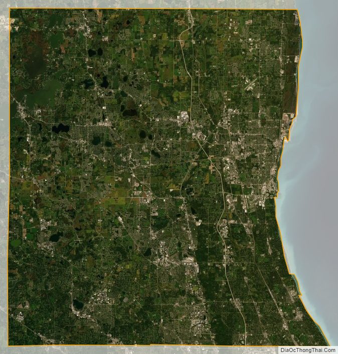
Lake County Satellite Map
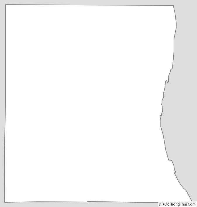
Lake County Outline Map