Lake Zurich is a village in Lake County, Illinois, United States, a northwest suburb of Chicago. Per the 2020 census, the population was 19,759. The village is named after a body of water named “Lake Zurich,” which is completely located inside the village.
| Name: | Lake Zurich village |
|---|---|
| LSAD Code: | 47 |
| LSAD Description: | village (suffix) |
| State: | Illinois |
| County: | Lake County |
| Founded: | September 29, 1896 |
| Elevation: | 850 ft (260 m) |
| Total Area: | 7.33 sq mi (18.99 km²) |
| Land Area: | 6.93 sq mi (17.94 km²) |
| Water Area: | 0.41 sq mi (1.05 km²) |
| Total Population: | 19,759 |
| Population Density: | 2,852.87/sq mi (1,101.45/km²) |
| FIPS code: | 1741742 |
| Website: | lakezurich.org |
Online Interactive Map
Click on ![]() to view map in "full screen" mode.
to view map in "full screen" mode.
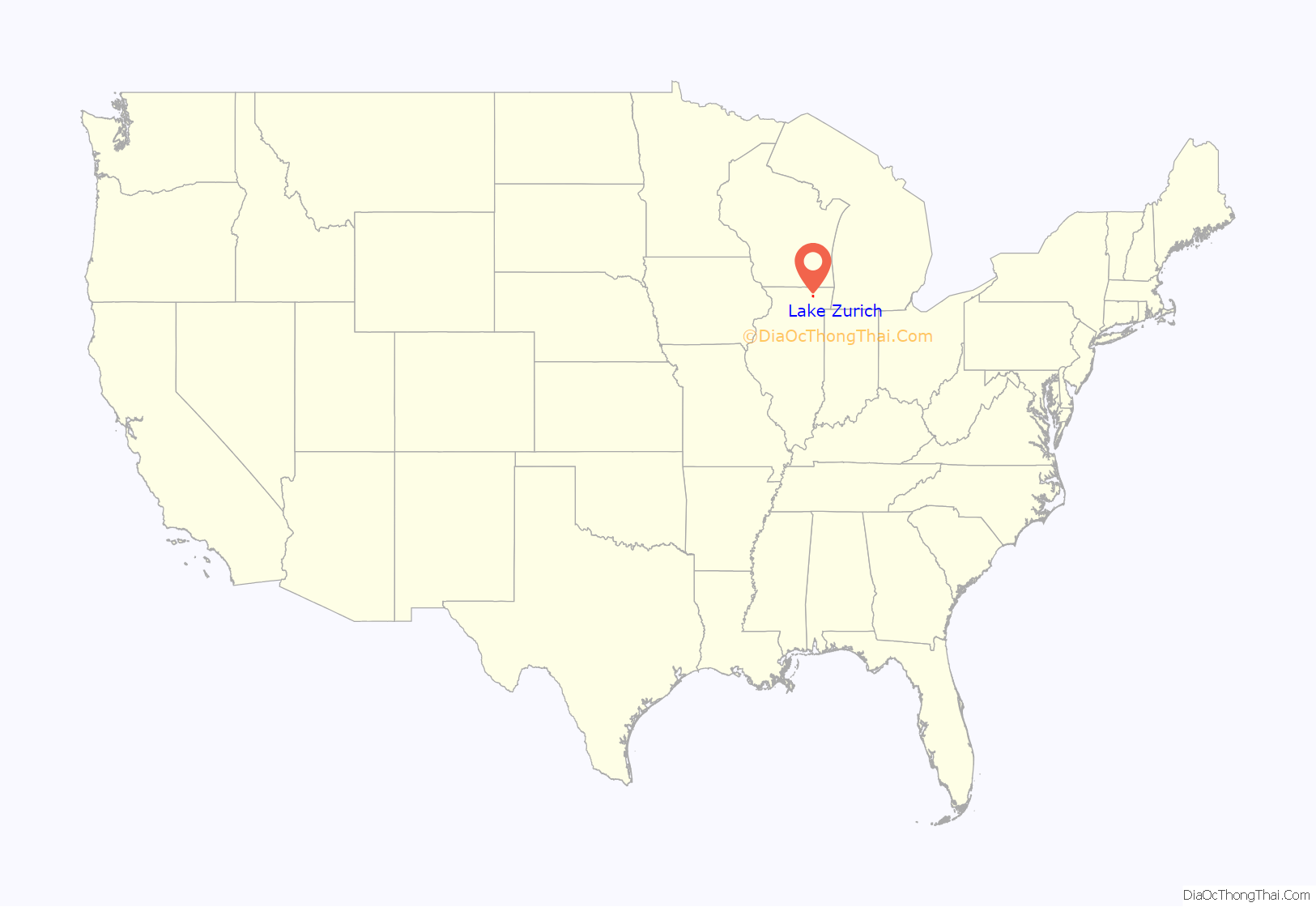
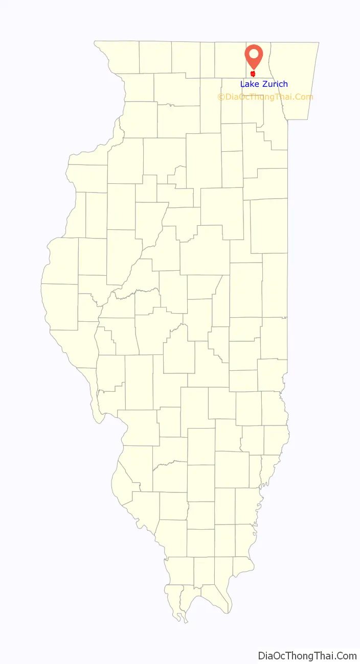
Lake Zurich location map. Where is Lake Zurich village?
History
The area of Lake Zurich was first settled by European descendants in the 1830s. Three early pioneers were George Ela, after whom the Ela township is named, Seth Paine, who established a number of commercial ventures in the town, and Nathan Kowitt, who accompanied them on their voyage. New England farmers moved to the area in the 1830s and 1840s, and German immigrants began to move to the area later in the middle of the 19th century. The lake now known as Lake Zurich was named Cedar Lake at the time. The village of Lake Zurich was incorporated on September 29, 1896. It remained primarily a farming community; although the village was connected to the railroad in 1910, the line was closed ten years later. However, the arrival of the highway system with Rand Road (U.S. Route 12) in 1922 and Half Day Road (Illinois Route 22) in 1927 established Lake Zurich as a convenient summer resort. The now-defunct Palatine, Lake Zurich, and Wauconda Railroad also served the community. Housing development began in the 1950s, with the population increasing throughout the latter part of the 20th century.
The town of Lake Zurich puts on an annual festival each summer, called the Alpine Fest. The Lake Zurich Lion’s Club hosted the first Alpine Fest as a way to celebrate their victories from World War II. The first-ever Alpine Fest took place in 1942 and has been a popular summer activity for families and adults of all ages.
In 1988, a historic, landmark legal case in Illinois took place settling a dispute on Lake Zurich, thereby clarifying throughout Illinois property owners’ rights on private lakes. In 1988, the Illinois Supreme Court ruled in Beacham v. Lake Zurich Property Owners Association (123 Ill. 2d 227; 526 N.E.2d 154; 1988 Ill. LEXIS 91; 122 Ill. Dec 14, filed June 20, 1988) that each individual owner of the private (aka non-public) lake’s bottom has the legal right to recreate over the surface waters of the entire private lake. The High Court ruled that by ownership of a lake bottom land, each partial-lake-bottom owner of a private lake can not be prohibited from recreating on the surface waters that may be located above other owners’ lake bottom properties. Riparian land rights were defined in Illinois.
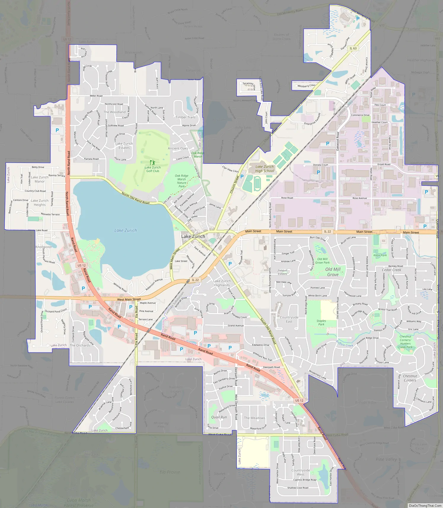
Lake Zurich Road Map
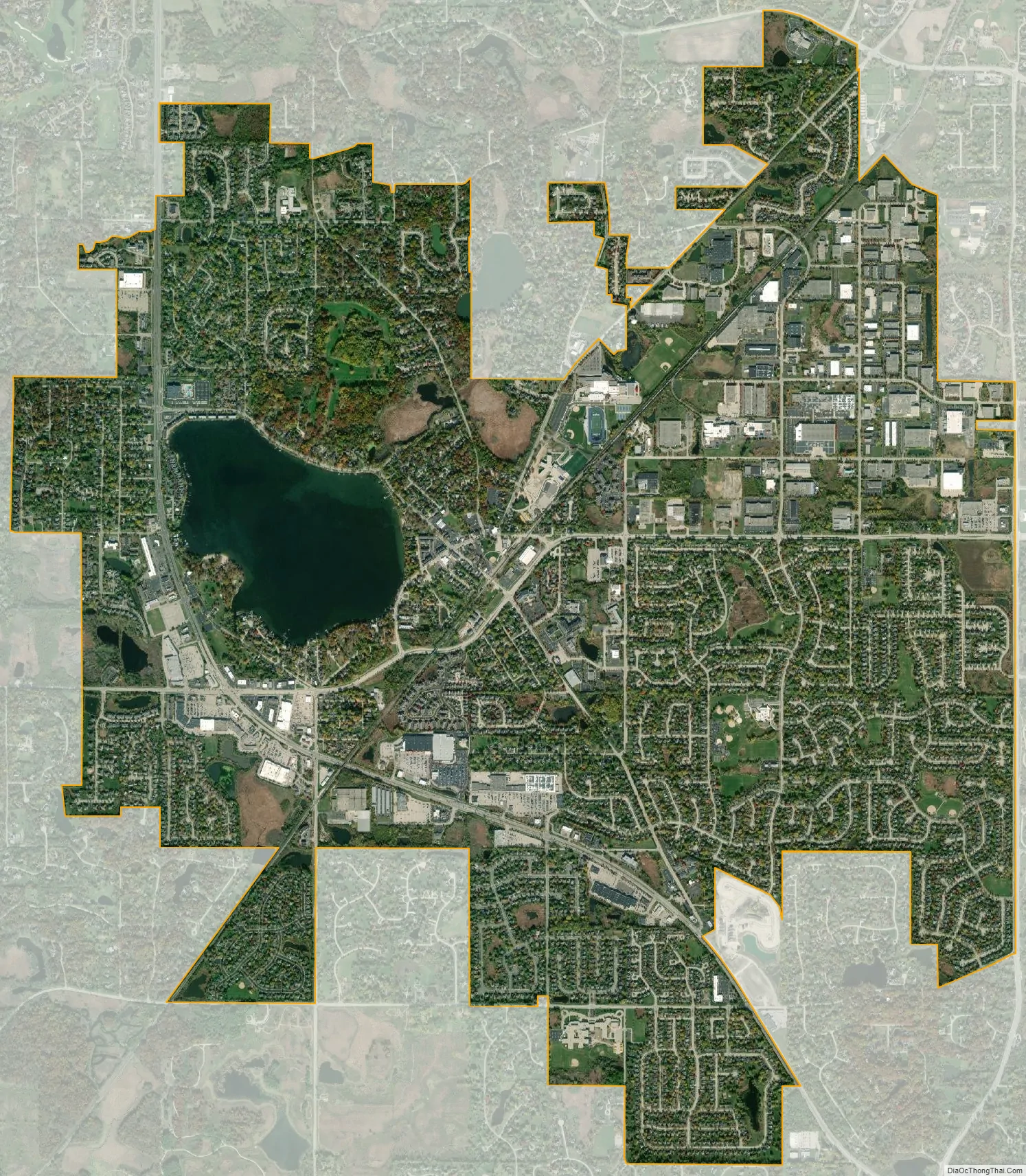
Lake Zurich city Satellite Map
Geography
Lake Zurich is located at 42°11′32″N 88°5′17″W / 42.19222°N 88.08806°W / 42.19222; -88.08806 (42.192324, -88.088098), with an elevation of 850 feet (260 m) above sea level.
According to the 2010 census, Lake Zurich has a total area of 7.187 square miles (18.61 km), of which 6.77 square miles (17.53 km) (or 94.2%) are land and 0.417 square miles (1.08 km) (or 5.8%) are water.
See also
Map of Illinois State and its subdivision:- Adams
- Alexander
- Bond
- Boone
- Brown
- Bureau
- Calhoun
- Carroll
- Cass
- Champaign
- Christian
- Clark
- Clay
- Clinton
- Coles
- Cook
- Crawford
- Cumberland
- De Kalb
- De Witt
- Douglas
- Dupage
- Edgar
- Edwards
- Effingham
- Fayette
- Ford
- Franklin
- Fulton
- Gallatin
- Greene
- Grundy
- Hamilton
- Hancock
- Hardin
- Henderson
- Henry
- Iroquois
- Jackson
- Jasper
- Jefferson
- Jersey
- Jo Daviess
- Johnson
- Kane
- Kankakee
- Kendall
- Knox
- La Salle
- Lake
- Lake Michigan
- Lawrence
- Lee
- Livingston
- Logan
- Macon
- Macoupin
- Madison
- Marion
- Marshall
- Mason
- Massac
- McDonough
- McHenry
- McLean
- Menard
- Mercer
- Monroe
- Montgomery
- Morgan
- Moultrie
- Ogle
- Peoria
- Perry
- Piatt
- Pike
- Pope
- Pulaski
- Putnam
- Randolph
- Richland
- Rock Island
- Saint Clair
- Saline
- Sangamon
- Schuyler
- Scott
- Shelby
- Stark
- Stephenson
- Tazewell
- Union
- Vermilion
- Wabash
- Warren
- Washington
- Wayne
- White
- Whiteside
- Will
- Williamson
- Winnebago
- Woodford
- Alabama
- Alaska
- Arizona
- Arkansas
- California
- Colorado
- Connecticut
- Delaware
- District of Columbia
- Florida
- Georgia
- Hawaii
- Idaho
- Illinois
- Indiana
- Iowa
- Kansas
- Kentucky
- Louisiana
- Maine
- Maryland
- Massachusetts
- Michigan
- Minnesota
- Mississippi
- Missouri
- Montana
- Nebraska
- Nevada
- New Hampshire
- New Jersey
- New Mexico
- New York
- North Carolina
- North Dakota
- Ohio
- Oklahoma
- Oregon
- Pennsylvania
- Rhode Island
- South Carolina
- South Dakota
- Tennessee
- Texas
- Utah
- Vermont
- Virginia
- Washington
- West Virginia
- Wisconsin
- Wyoming


