Lake Bluff (formerly Rockland) is a village in Lake County, Illinois, United States. Per the 2020 census, the population was 5,616.
| Name: | Lake Bluff village |
|---|---|
| LSAD Code: | 47 |
| LSAD Description: | village (suffix) |
| State: | Illinois |
| County: | Lake County |
| Incorporated: | September 21, 1895 |
| Land Area: | 4.08 sq mi (10.56 km²) |
| Water Area: | 0.01 sq mi (0.02 km²) |
| Population Density: | 1,377.82/sq mi (531.97/km²) |
| FIPS code: | 1740910 |
| Website: | www.lakebluff.org |
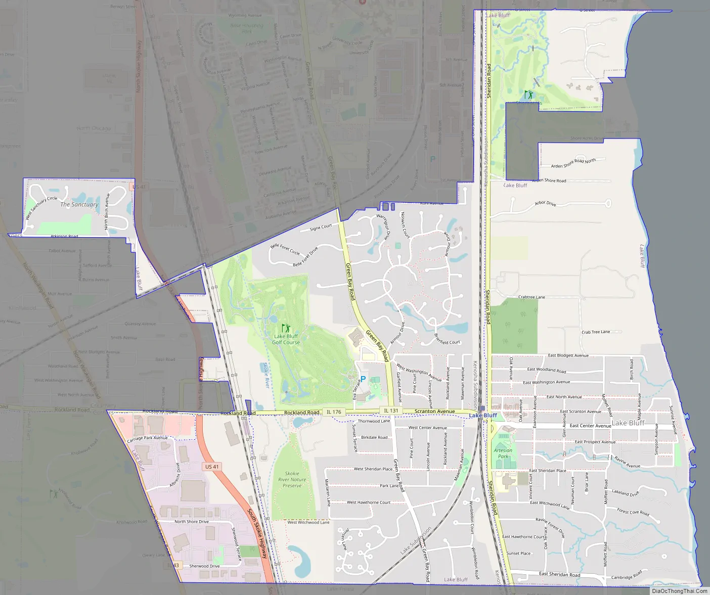
Online Interactive Map
Click on ![]() to view map in "full screen" mode.
to view map in "full screen" mode.
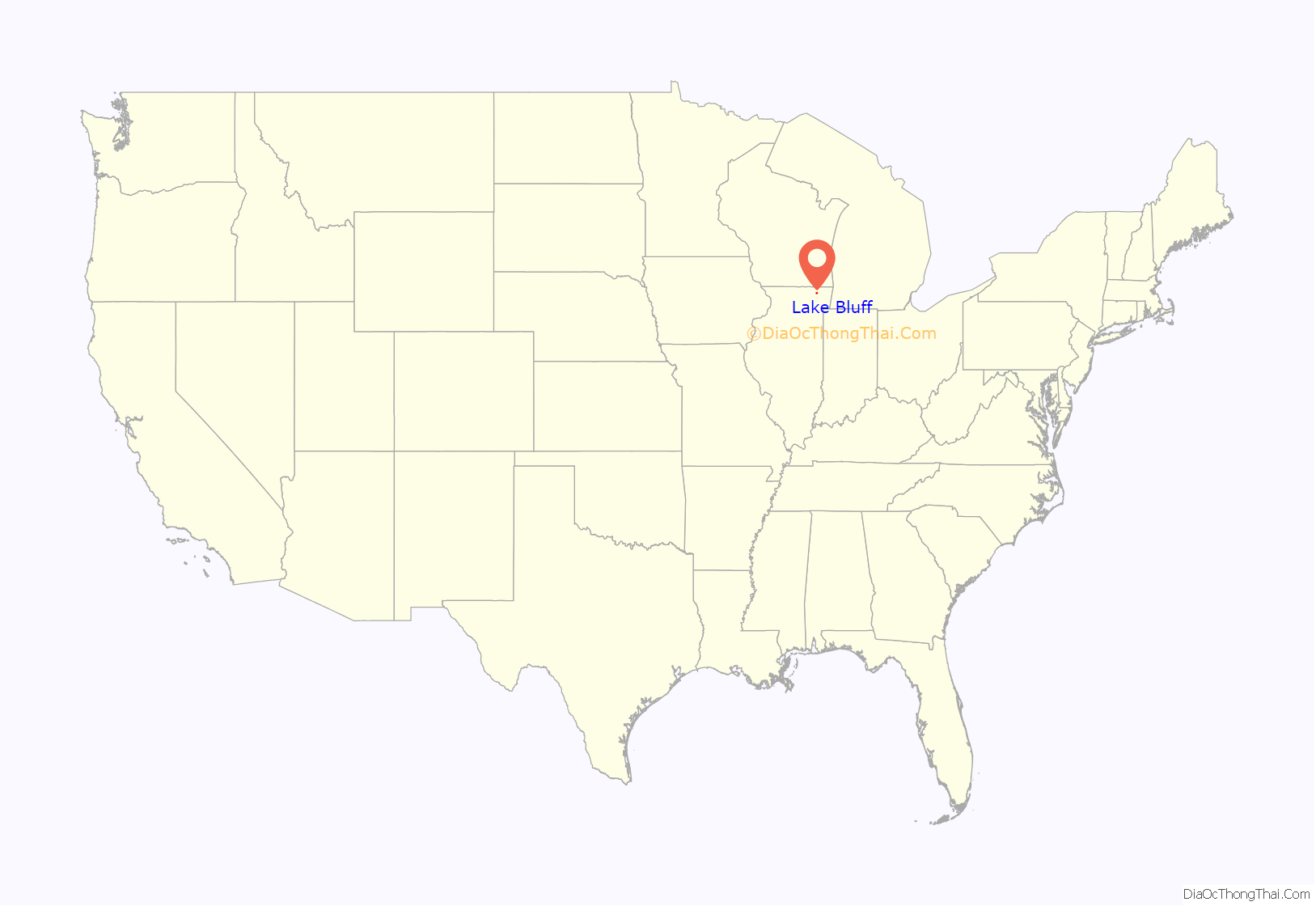
Lake Bluff location map. Where is Lake Bluff village?
History
The first settler family to claim land within the area now part of Lake Bluff arrived in 1836. They claimed 100 acres of land extending from the lake west to the Green Bay Trail. In 1849, a few residents left to seek their fortune in the California gold rush. In 1837, William and Mary Dwyer claimed the land just north of the former Central School. They opened and operated a stage coach stop and tavern along the Green Bay Trail. Some of the other early settlers were Henry and Angeline Ostrander, James Cole and William Whitnell.
In 1855, the first railroad through Lake County was completed, running from Chicago through the county line. Henry Ostrander owned the land where the depot was to be placed, and he agreed to donate the site if the depot were called “Rockland.” Therefore, this area, known previously as the Dwyer Settlement and Oak Hill, became Rockland, the only stop between Highland Park and Waukegan. Rockland had a post office and general store on Mawman Avenue with a small school and church located west of the tracks near Green Bay Road.
In 1875, a group of Methodist ministers led by Solomon Thatcher of River Forest purchased 100 acres of lakefront property from Ben Cloes, the youngest son of the first settlers. The Lake Bluff Camp Meeting Association was formed and Rockland was renamed “Lake Bluff.” The Association planned a resort that would provide not only religious activities but also social, cultural, educational and recreational programs. From the beginning, the Camp Meeting was successful at bringing in well-known personalities of the time, such as Frances Willard and Mrs. Rutherford B. Hayes. Summer visitors were attracted to Lake Bluff to enjoy the beach and ravines and participate in the Camp Meeting activities. A 10-acre lake in the center of town, Artesian Lake, provided additional recreational opportunities. Lake Bluff was a summer colony at the time, as most residents were seasonal.
Land was divided into 25-foot lots on which a cottage “could be erected within 20 days of purchase for $250.” The first hotel, the Bluff Lodge, was opened in 1876. By the mid 1880s there were more than 30 hotels and boarding houses and a large tabernacle with seating for more than 2,000 people.
Lake Bluff incorporated as a village in 1895. Charles Trusdell, the first Village President, built his home at 115 East Center Avenue. The East School opened in September 1895. In 1904, the railroad station was erected, and in 1905 the present Village Hall was built.
During the First World War, Lake Bluff was proclaimed the “most patriotic small town in America” for the efforts of the residents in supporting the Red Cross and purchasing an ambulance to send to France.
In the 1920s, Lake Bluff made plans to join the other North Shore suburbs in the race to attract new homes and growing families. New brick stores were added in the business block, and a large addition to East School was constructed. However, 1929 brought the Great Depression, and the plans for expansion never materialized.
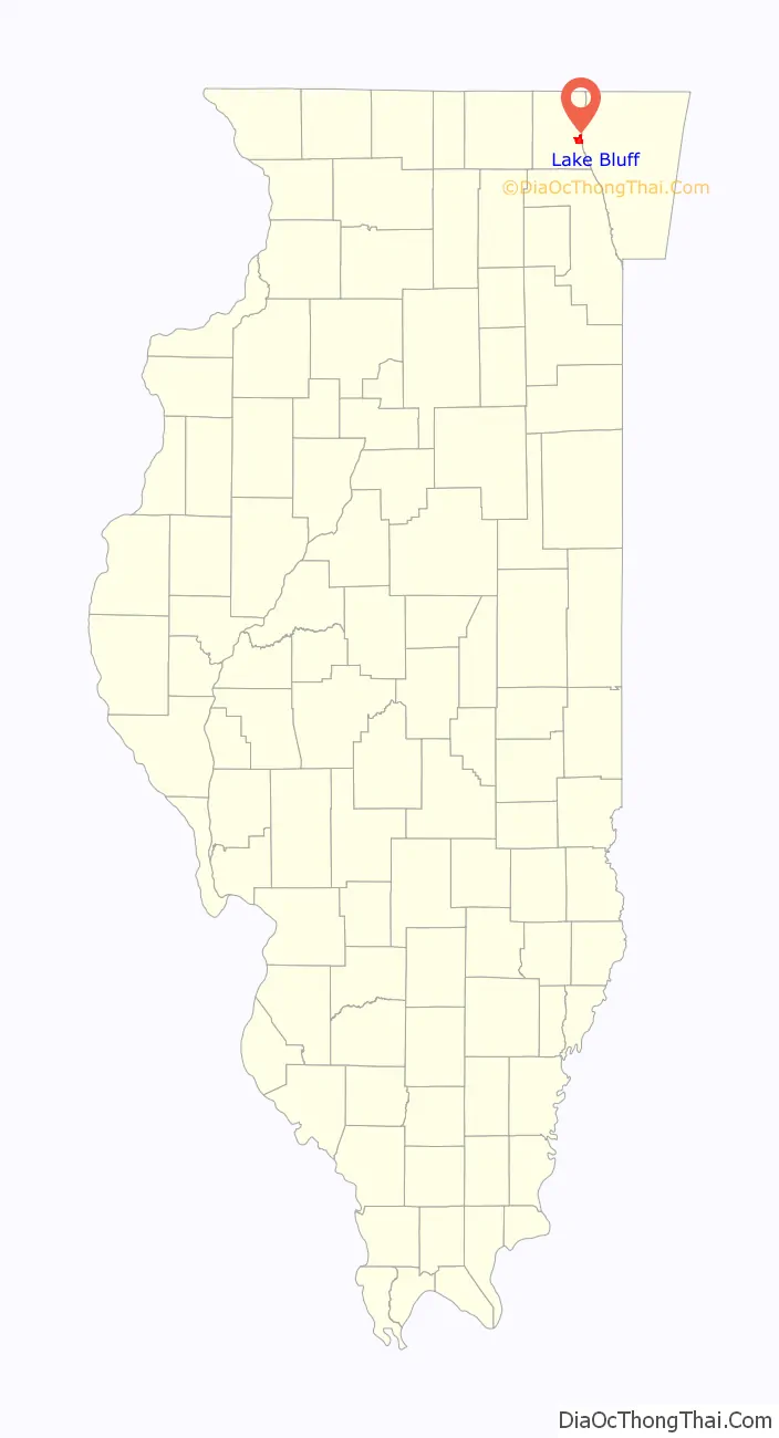
Lake Bluff Road Map
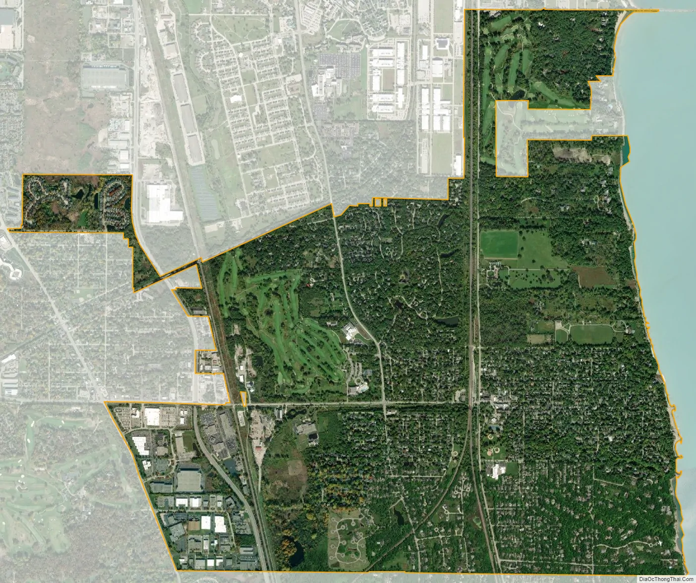
Lake Bluff city Satellite Map
Geography
Lake Bluff is located in the North Shore area at 42°17′N 87°51′W / 42.283°N 87.850°W / 42.283; -87.850 (42.281, -87.849).
According to the 2010 census, Lake Bluff has a total area of 4.057 square miles (10.51 km), of which 4.05 square miles (10.49 km) (or 99.83%) is land and 0.007 square miles (0.02 km) (or 0.17%) is water. It is bordered by Lake Michigan on the east, Naval Station Great Lakes to the north, Lake Forest to the south, and Libertyville to the west. The town is named for the prominent bluff overlooking Lake Michigan that extends across the eastern boundary.
Half of Lake Bluff’s land area is residential in nature, while the rest is mainly devoted to parks and recreation. Major parks include Blair Park, Ravine Park, Sunrise Park, and Artesian Park.
See also
Map of Illinois State and its subdivision:- Adams
- Alexander
- Bond
- Boone
- Brown
- Bureau
- Calhoun
- Carroll
- Cass
- Champaign
- Christian
- Clark
- Clay
- Clinton
- Coles
- Cook
- Crawford
- Cumberland
- De Kalb
- De Witt
- Douglas
- Dupage
- Edgar
- Edwards
- Effingham
- Fayette
- Ford
- Franklin
- Fulton
- Gallatin
- Greene
- Grundy
- Hamilton
- Hancock
- Hardin
- Henderson
- Henry
- Iroquois
- Jackson
- Jasper
- Jefferson
- Jersey
- Jo Daviess
- Johnson
- Kane
- Kankakee
- Kendall
- Knox
- La Salle
- Lake
- Lake Michigan
- Lawrence
- Lee
- Livingston
- Logan
- Macon
- Macoupin
- Madison
- Marion
- Marshall
- Mason
- Massac
- McDonough
- McHenry
- McLean
- Menard
- Mercer
- Monroe
- Montgomery
- Morgan
- Moultrie
- Ogle
- Peoria
- Perry
- Piatt
- Pike
- Pope
- Pulaski
- Putnam
- Randolph
- Richland
- Rock Island
- Saint Clair
- Saline
- Sangamon
- Schuyler
- Scott
- Shelby
- Stark
- Stephenson
- Tazewell
- Union
- Vermilion
- Wabash
- Warren
- Washington
- Wayne
- White
- Whiteside
- Will
- Williamson
- Winnebago
- Woodford
- Alabama
- Alaska
- Arizona
- Arkansas
- California
- Colorado
- Connecticut
- Delaware
- District of Columbia
- Florida
- Georgia
- Hawaii
- Idaho
- Illinois
- Indiana
- Iowa
- Kansas
- Kentucky
- Louisiana
- Maine
- Maryland
- Massachusetts
- Michigan
- Minnesota
- Mississippi
- Missouri
- Montana
- Nebraska
- Nevada
- New Hampshire
- New Jersey
- New Mexico
- New York
- North Carolina
- North Dakota
- Ohio
- Oklahoma
- Oregon
- Pennsylvania
- Rhode Island
- South Carolina
- South Dakota
- Tennessee
- Texas
- Utah
- Vermont
- Virginia
- Washington
- West Virginia
- Wisconsin
- Wyoming


